Deep River – Part Two

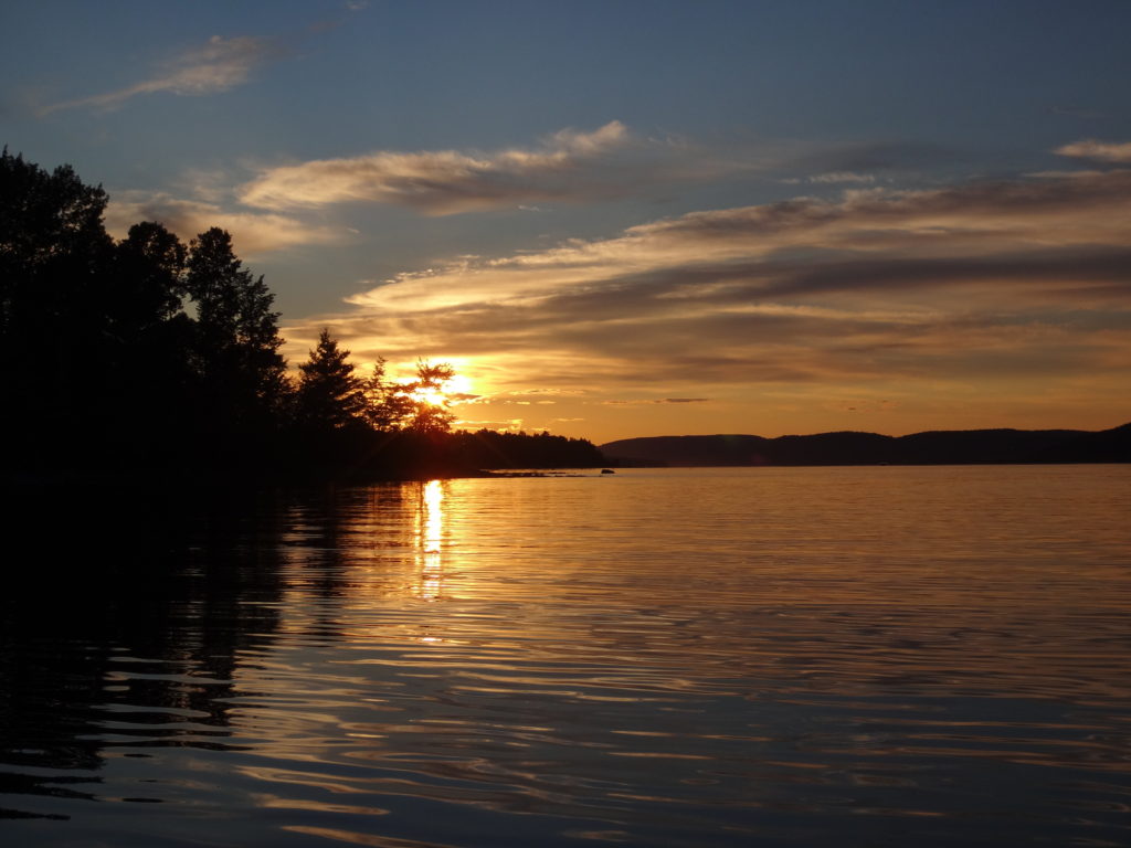
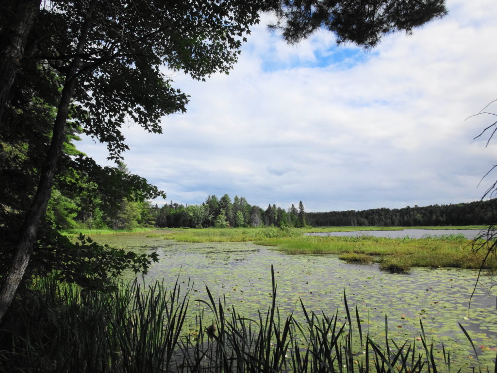
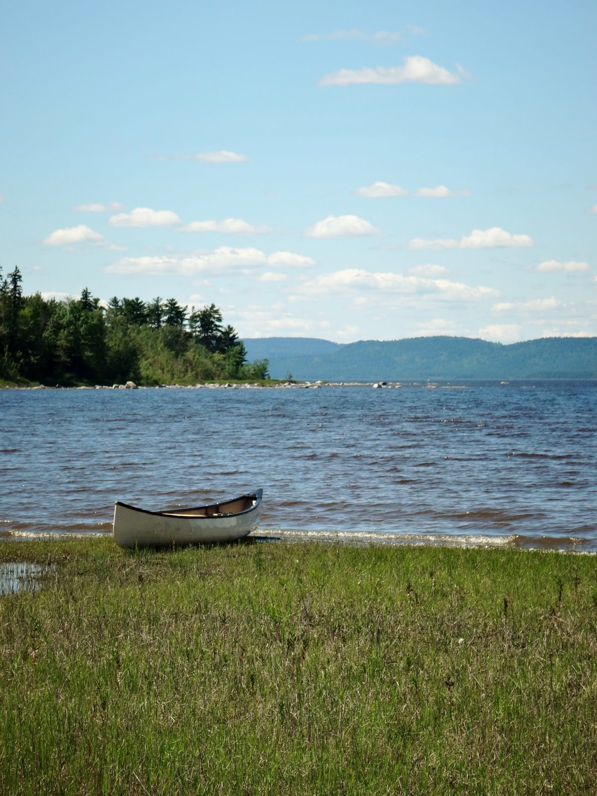
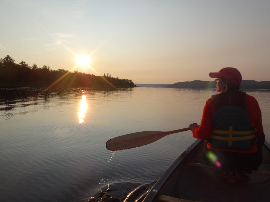
Deep River offers many lovely canoeing opportunities and destinations.  For a relaxed evening paddle, I frequently head downstream from the town along the Ontario shoreline, past Lamure Beach.  As the heat of the day dissipates, the wind dies down and the river often turns glassy and reflective.  I follow the outer edge of the sand flats, past two rocky points, and into Welsh Bay, where Kennedy Creek empties into the river.

Boulders emerge from the water of the Ottawa River on sunny, summer day.
Ottawa River Shoreline, Deep River

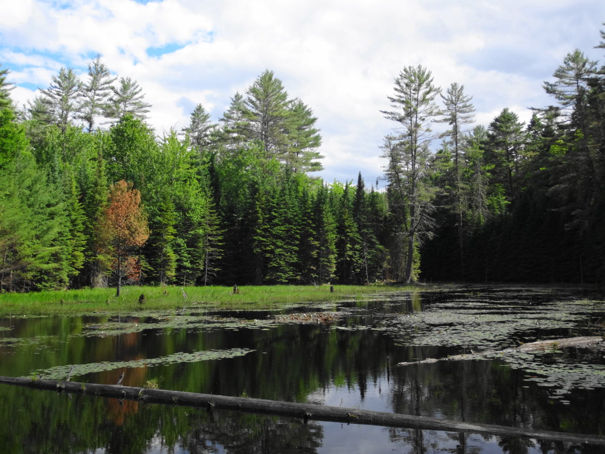
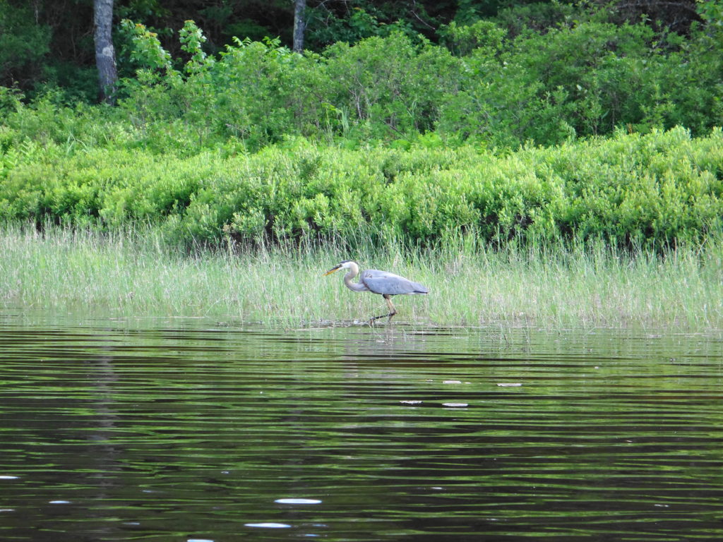
I frequently see young lake sturgeon and longnose gar finning in the shallow water of the bay, feeding on the bottom.  I’ve spied bald eagles sitting sentinel in the pines along the shore, and listened to the chiding of ospreys as I glide past.  Pulling my canoe on to the sandy shore, I like to cross the bar to the beaverpond behind the beach and watch for wildlife in the thickets.  The shoreline, here, remains largely unchanged.  I can imagine Samuel de Champlain and his Algonquin guides pulling their canoes on to shore 400 years ago to make camp for the night.

The setting sun silhouettes a woman in a canoe on the still, reflective waters of the Ottawa River.
Ottawa River Calm

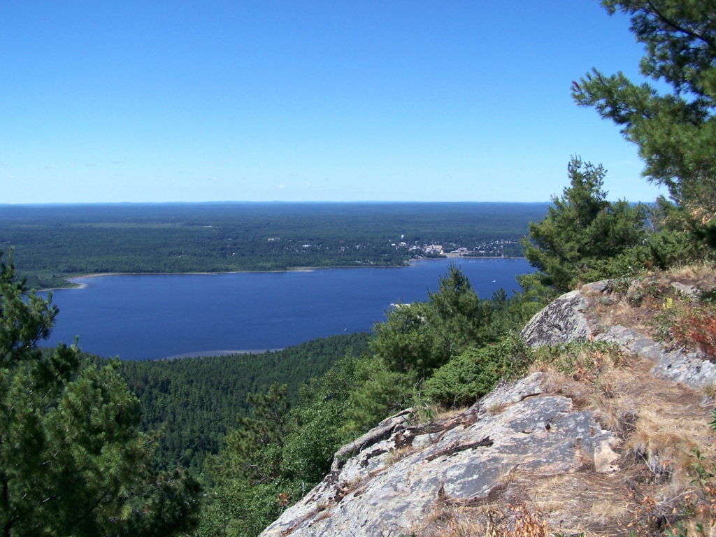
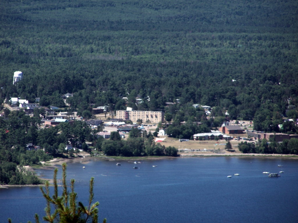
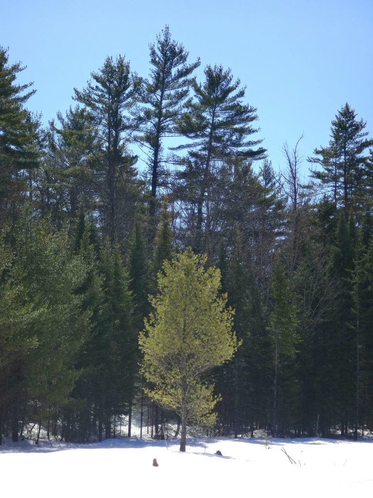
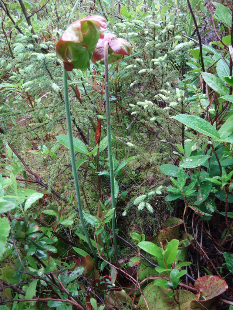
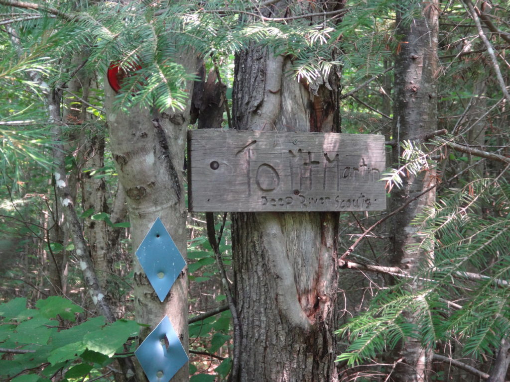
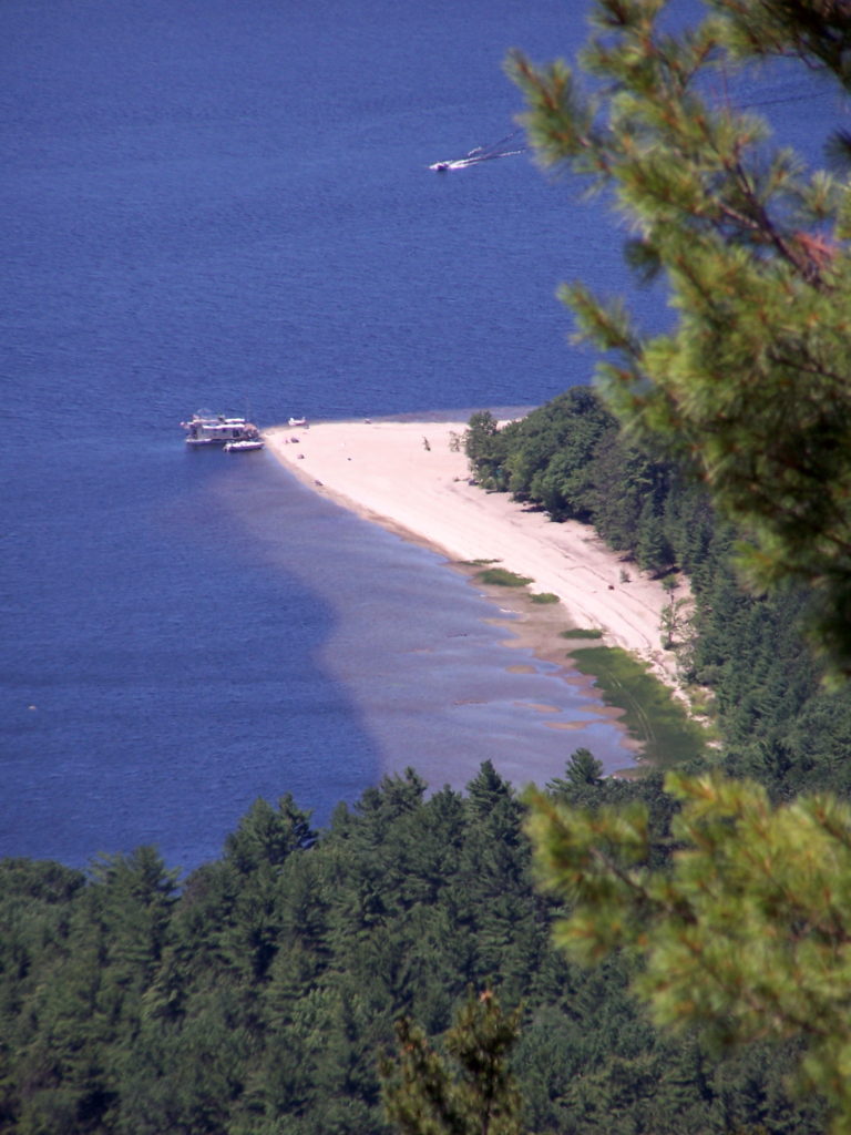
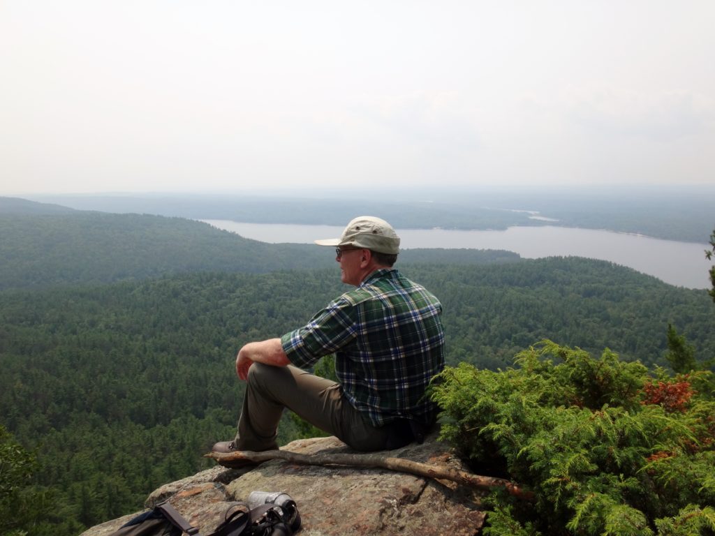
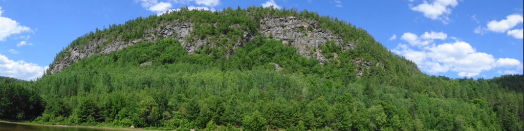
At least once during our annual visit to Deep River, I like to cross the river to the bay just inside Houseboat Point, where an overgrown logging trail heads up into the forest.  A 20 minute walk takes me to the path to Mount Martin, almost hidden on the north side of the trail.  An inconspicuous sign, placed by the Boy Scouts, marks the trailhead.  On a hot, summer day, the climb up through the forest provides a workout, and mosquitoes whine incessantly.  However, after a few false summits, the trail finally emerges on to an open, rocky lookout over the river and the town on the far side.  The sand flats and shoals show clearly along the shoreline.  Ravens and turkey vultures soar above and below, riding the breeze that rises over the escarpment.  Breaking out a lunch, I rest and recuperate on the rocks, even lying back and closing my eyes for warm nap.

A weathered, wood sign attached to a tree marks the trailhead to Mount Martin.
Mount Martin Trailhead
From far above on Mount Martin, the sandy beach and shoals of Houseboat Point can be seen reaching out into the blue Ottawa River
Houseboat Point Viewed from Mount Martin
The author rests on a rocky lookout at the top of Mount Martin, with forest and the Ottawa River in the background.
Resting at the Mount Martin Lookout

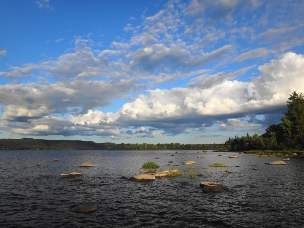
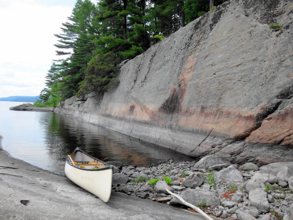
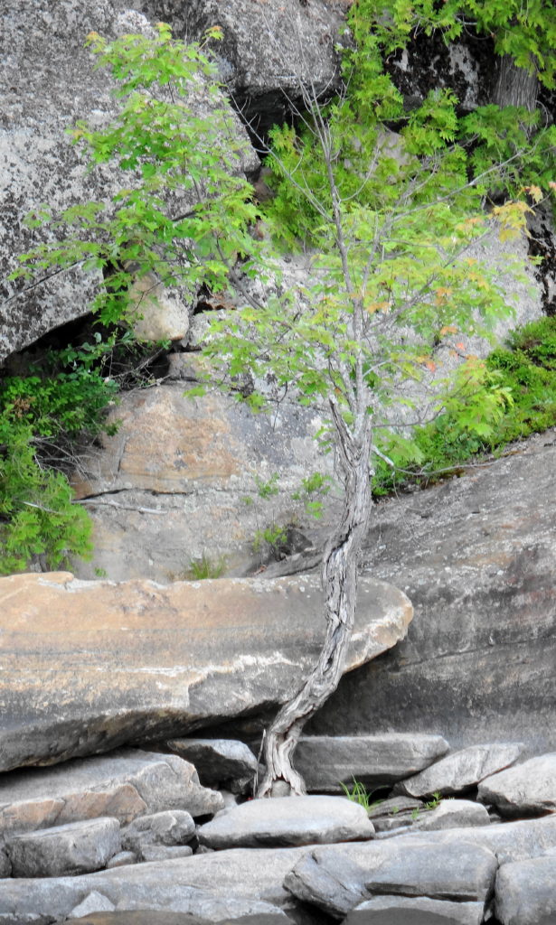
Another, more challenging paddle leads up the Ottawa River along the Quebec shoreline to Baie de la Presqu’ile d’en Bas and Lac a la Tortue.  This 20 km long trip follows the rocky east shore of the river, where the long seismic fault of the Ottawa – Bonnechere Graben (the geological feature that we call the Ottawa Valley) and repeated glaciation has laid bare the tortured roots of the Canadian Shield.  Broken only by a few short, sandy beaches, the old gneiss falls sharply into the deep waters.  Fissures and cracks spit the billion year-old rock, along with coarse veins of crystallized quartz and other minerals.  Sheered plates of stone form rocky walls and ledges.  A forest climbs back from the shoreline, while a few hardy, slow-growing trees find a tenuous foothold closer to the water.  The bay, itself, lies under a towering, shattered rock face, sheltered from the wide river by a long spit of sand deposited by an upstream tributary.  At the head of the bay, shallow Lac a la Tortue provides superb habitat for pike, gar, turtles and shorebirds.  Unfortunately, the bay has become very popular with campers and houseboats, who sometime line the beach in small flotillas.  Nonetheless, the scenery provides ample justification for a visit, as do the healthy pike that feed along the rocky, Ottawa shoreline.

A canoe rests on a rocky shore in a small cove under a flat wall of stone.
Quebec Shoreline Upstream of Deep River
A stunted red maple grows from bare stone on the Quebec shoreline of the Ottawa River.
Life Finds A Way
A great blue heron stalks along the shoreline at Lac a la Tortue.
Great Blue Heron, Lac a la Tortue
A wide angle photograph shows the towering rock face above Baie de la Presqu'ile d'en Bas.
Panorama of the Cliffs at Baie de la Presqu’ile d’en Bas

Of course, at the end of long day of hiking or paddling, nothing feels so good as plunging into the clean, clear river at Lamure Beach or Pine Point.  Many times, I’ve waded into the water to the drop-off, then dived under.  The distinct, wonderful scent of the water fills my nostrils.  The water washes over me.  I rise, turn on my back and float under the sunset sky, as the heat seeps from my skin along with sweat and weariness.  The quiet envelopes me like the river..  Somewhere inside me, an ancestral memory stirs.  I think about tomorrow’s adventure.


Deep River – Part One

An evening calm has settled over the Ottawa River as I paddle into a burnished, copper sunset.  I trail a fly behind the canoe, more from habit than hope.  If I really wanted to catch fish, I would trail a spinnerbait for pike, or rig a artificial minnow for walleye.  Mostly, I just enjoy the quiet, made more pronounced by the occasional powerboat thrumming in the distance.  On the Quebec side, I see lights begin to glimmer on the houseboats beached at the point.  Laughter carries across the water.  Nearer, on my left, I see a whitetail deer come shyly down to the beach in the deepening dusk, as a wood thrush begins to flute in the woods.  Abruptly, the sandy bottom rises below my canoe.  I ship my paddle and quickly wind in my fly.  Then I continue into the bay toward the boat launch, passing Lamure Beach and threading through the moored boats.  I pull out the canoe and drag it up to the trees with the others.  Then I stroll through the peaceful streets until I see home and the glow of warm, yellow light through the blinds of the large front window.

The setting sun turns the sky a burnished copper over the Ottawa River.
Sunset, Deep River

The town of Deep River lies an easy two hour drive northwest of Ottawa along Highway 17.  Sandwiched between the highway and the Ottawa River, it trails along the shoreline for a couple of kilometers.  The usual Tim Hortons, Canadian Tire, motel and small strip malls service the highway.  A busy grocery store, post office, shops, cafes, school, and town office anchor the small, downtown core, which sits just behind the waterfront, overlooking the river.  The marina and yacht club lie only a brisk two minute walk away.  Tidy residential neighbourhoods lie either side of downtown — a mix of small, renovated, post-war bungalows and more modern, multi-story houses.  The Deep River Regional Hospital marks the east side of town, while the Mount Martin Ski Club sits on the west side.

The Ottawa River and Ottawa Valley spread out below the lookout on Mount Martin, Quebec. In the distance, the town of Deep River lies along the far shore.
Deep River Viewed from Mount Martin, Quebec
The Deep River Waterfront as photographed from Mount Martin, Quebec.
Deep River Waterfront

I spend at least two weeks every summer in Deep River with my wife and our sons.  We make shorter visits throughout the year.  I spend most of that time outside, exploring the local forests and wetlands, or paddling the shoreline of the Ottawa River.  Deep River is a microcosm of whole Ottawa Valley, with almost every kind of ecosystem, habitat and wildlife species within easy reach.

Most trips to Deep River begin and end at the Four Seasons Forest Sanctuary, on the southeast side of the town.  This community-owned forest is part of an enormous, contiguous, protected natural area that includes the restricted lands surrounding the Canadian Nuclear Laboratories (formerly AECL) in Chalk River, the Petawawa Research Forest, the training areas of Canadian Forces Base Petawawa, and Algonquin Park.  A short hiking loop begins across from the hospital and leads to a pretty, covered shelter overlooking a wetland.  Even on the buggiest days, the squadrons of dragonflies hunting along the marsh edge succeed at keeping most mosquitoes at bay.  Common yellowthroats sing in the thickets, while swamp sparrows skulk in the reeds.  An American bittern grunts deep in the marsh.  A blue heron fishes along the meandering stream on the other side. Turtles and frogs bask in the small pond by the shelter, where an occasional beaver, muskrat or otter makes an appearance.  I’ll bring a lunch and meditate on the scene, read a book, or bring a guitar.  Almost always, I’m on my own.

A wooden archway spans an entrance to the Four Seasons Conservation Forest trail network.
Four Seasons Forest Sanctuary Entrance
Looking out from the shade of a covered observation shelter, a verdant marsh offers a pleasing view.
Marsh Shelter, Four Seasons Conservation Forest
A black-masked, common yellowthroat perches on the branches of an alder bush.
Common Yellowthroat, Four Seasons Conservation Forest
An otter plays on a log in a marshy pond at the Four Seasons Conservation Forest.
Otter, Four Seasons Conservation Forest

Longer trails lead deeper into the sanctuary, passing a variety of habitats:  upland forests of white pine, maple and beech; darker forests of spruce and balsam fir; pretty riparian marshes, and dark forest pools; bright, grassy clearings, and shadowed fern gardens.  One of my favourite destinations is Cranberry Lake, which stretches back into the AECL lands.  At the end of a half hour hike, a small bench looks out over the lake and a pretty, floating fen mat.  In late June and early July, white waterlilies carpet the water, and pink orchids (swamp pinks and rose pogonias) dot the fen.  I often skip the bench and stretch out under the white pine that graces the shoreline, closing my eyes for a nap in midday sunshine.  Occasionally I lift my head and look down the lake, hoping to see one of the moose that have found a haven on the AECL lands.

A verdant marsh is framed by overhanging trees.
Cranberry Lake, Deep River

During the winter, the trails of the Forest Sanctuary become an active cross-country ski and snowshoe network.  Trails are well marked and maintained by the Deep River Cross Country Ski Club, who put on an active recreational and social program through the winter.  The forest and wetlands take on a different kind of beauty and quiet in the winter, always reminding me of the Robert Frost lines, “the only other sound’s the sweep, of easy wind and downy flake.”

A young white pine sits at the edge of a snow-covered beaverpond, against a backdrop of older, darker pines.
Winter Beaverpond, Four Seasons Forest Sanctuary
A forest creek runs swiftly between snow and ice-covered banks on a warm, late-winter day.
Winter Creek, Four Seasons Forest Sanctuary

The Petawawa Research Forest, just outside nearby Chalk River, also provides wonderful opportunities for exploration.  The Research Forest Museum, now inactive and partly abandoned, still remains open to the public — albeit quickly deteriorating.  An interpretive trail still loops from the museum through the forest, and an old boardwalk still offers a short, but pretty walk along the shore of the Chalk River.  A maze of access and logging roads leads deep into the forest, past a myriad of different tree communities, streams and wetlands.  In particular, the research forest includes a large number of well-developed fens and bogs, some of which are very accessible and yet still virtually unknown and pristine.  They provide a unique opportunity for a careful, conscientious visitor to explore the flora and fauna of these marvelous ecosystems.  Unfortunately, summer visitors can expect to be trailed by a cloud of deer flies, which swarm from the sandy roads and trails in numbers that are hard to comprehend.  Once off the roads and into the forests and wetlands, however, the deer flies give way to the usual mosquitoes and blackflies, which respond much more readily to repellent.  Of course, sensitive individuals can always choose to wear bug hats or bug shirts.  Either way, the research forest is worth a visit.

A wide-angle photography of a raised bog in the Petawawa Research Forest.
Raised Bog, Petawawa Research Forest
A narrow stream runs through a sedge meadow, fed by the raised bog in the background.
Sedge Meadow and Raised Bog, Petawawa Research Forest
A type of rich fen, known as a "ring bog", surrounds a small pond in the Petawawa Research Forest.
Rich Fen, Petawawa Research Forest
A delicate pink orchid, called a rose pogonia, glistens with raindrops in a fen in the Petawawa Research Forest.
Rose Pogonia, Petawawa Research Forest
A swamp pink blooms on a fen mat in the Petawawa Research Forest.
Swamp Pink, Petawawa Research Forest
Pitcher plants bloom on a fen mat in the Petawawa Research Forest.
Northern Pitcher Plant, Petawawa Research Forest
A gartner snake curls atop a sphagnum hummock in a bog in the Petawawa Research Forest
Garter Snake on Bog Hummock, Petawawa Research Forest
Tufts of red and green sphagnum moss form a mound in a bog in the Petawawa Research Forest.
Sphagnum Moss in a Bog, Petawawa Research Forest
Orange-tipped lichen grows on a sphagnum mound in the Petawawa Research Forest.
Lichen in Bog, Petawawa Research Forest