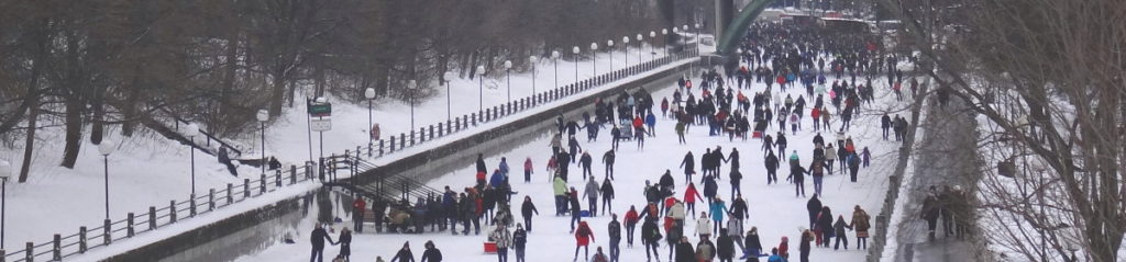
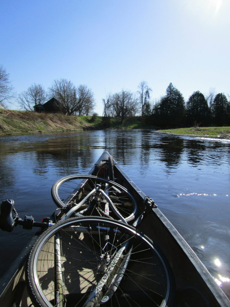
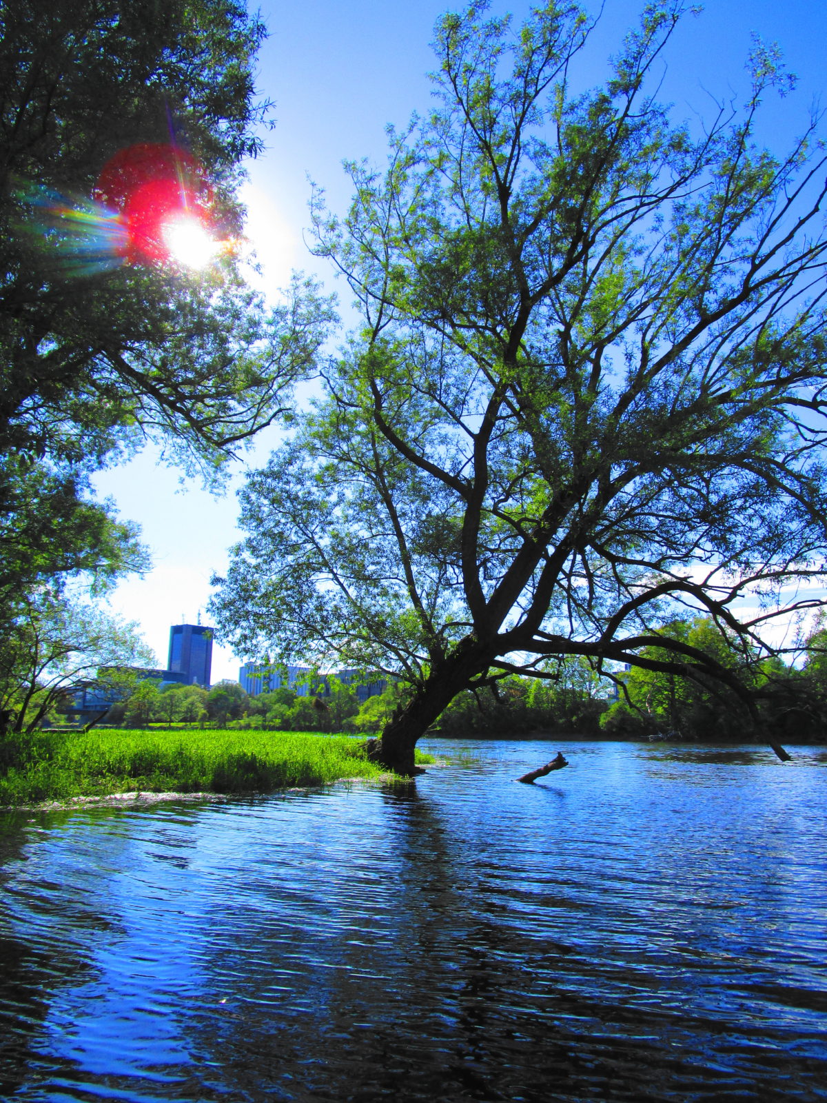
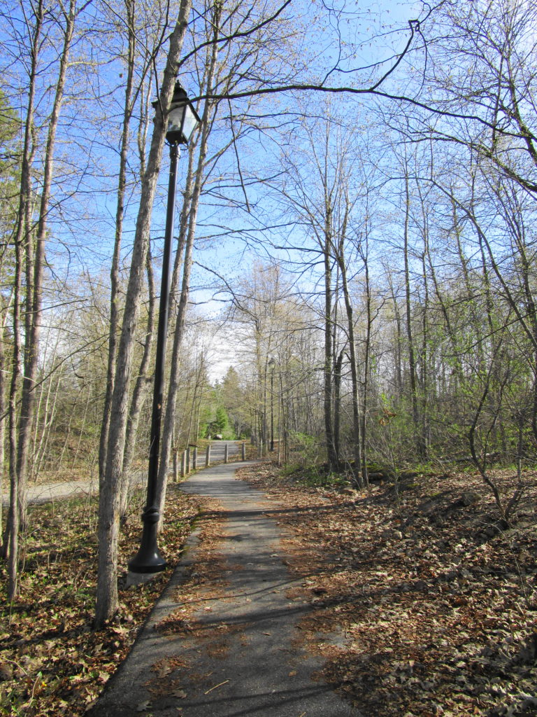
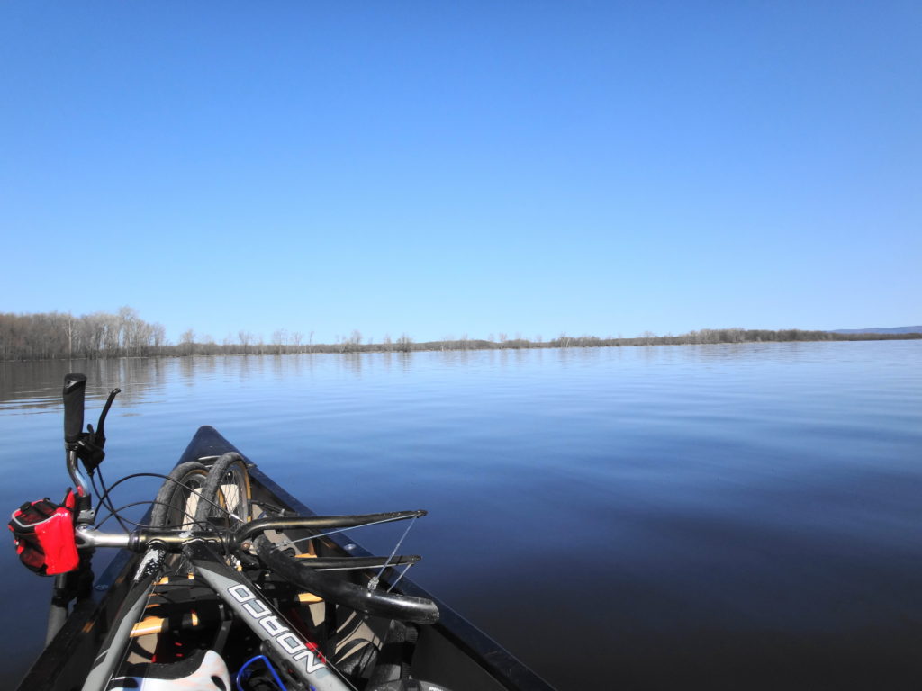
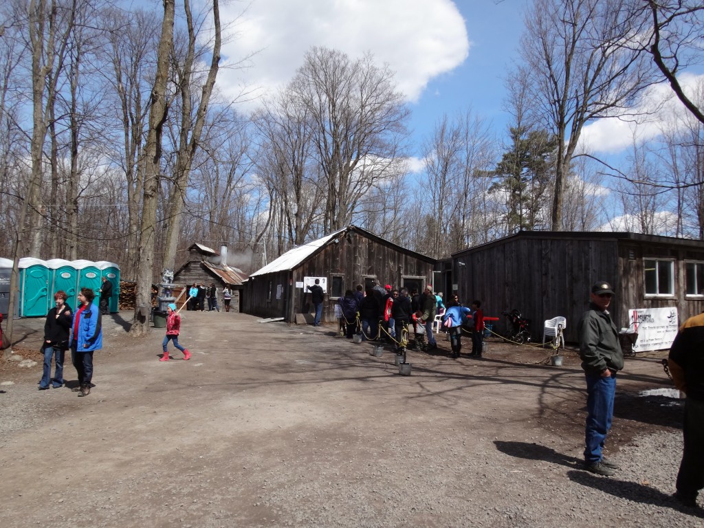
On one of the first warm weekends of spring, I loaded a Vrtucar with my canoe, bicycle, and canoe trailer, and I headed to the Jock River. Leaving the car at Jock River Park in Richmond, I hooked the trailer and canoe on the bike and cycled into a stiff breeze out of the Village along Franktown Road. The gravel shoulder provided plenty of room for comfort, although sections remained soft from the previous day’s rains. A left turn on to Green’s Road and a right on to Jock Trail Road eventually took me to Munster Road, just a few meters from where it crosses the Jock River, 12 km by canoe from the Village. I hauled the canoe off the trailer and down the embankment, packed the bike and trailer in front, and set off down river.
The Jock River at the Munster Road BridgeCanoe Packed with a Bicycle and Canoe Trailer
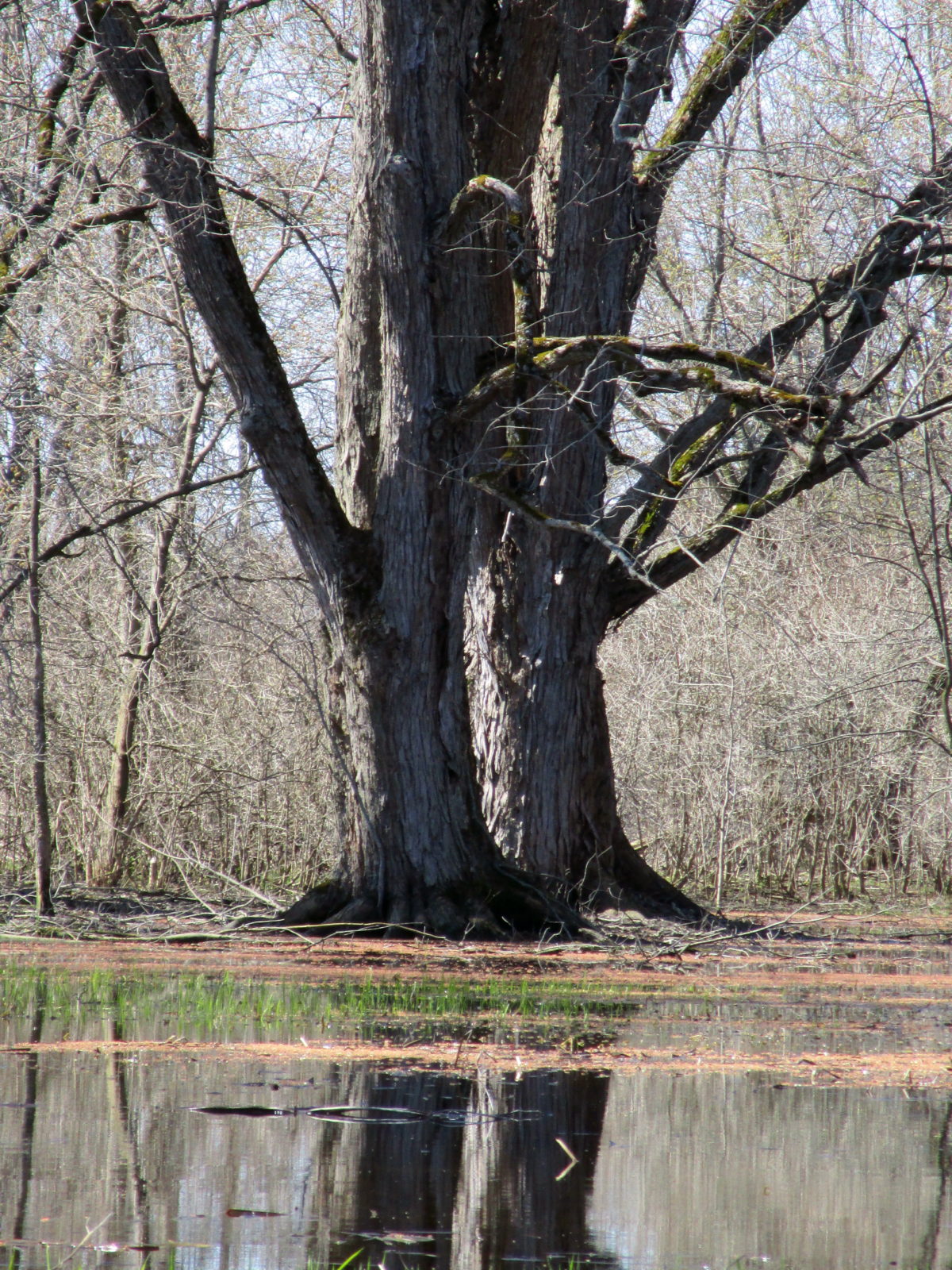
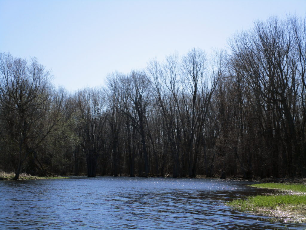
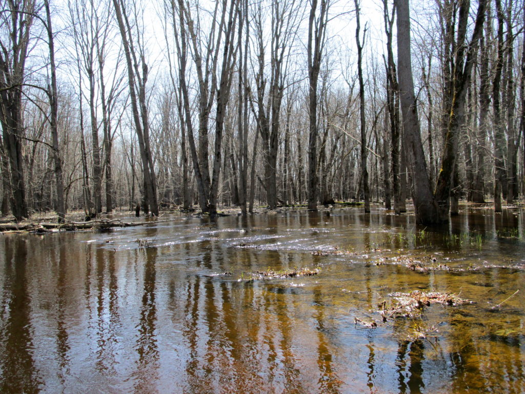
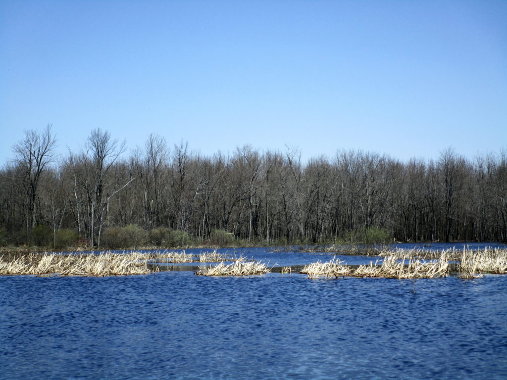
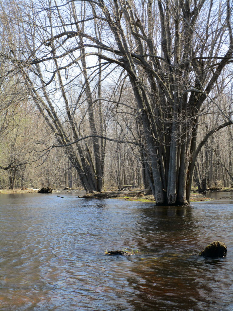
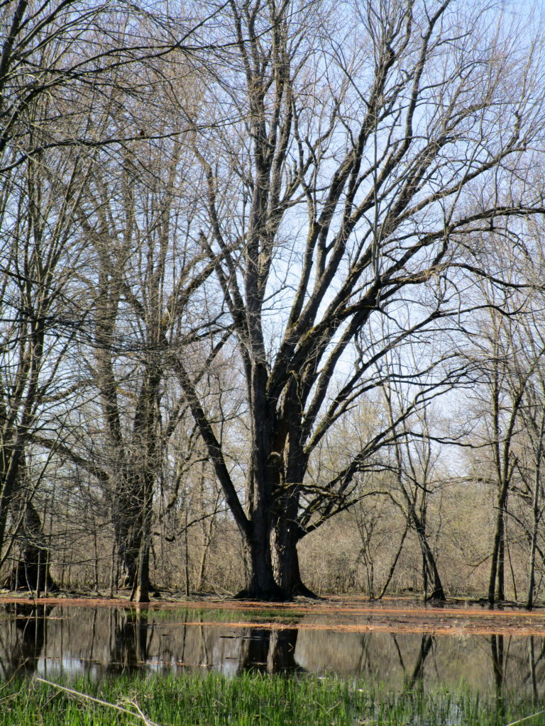
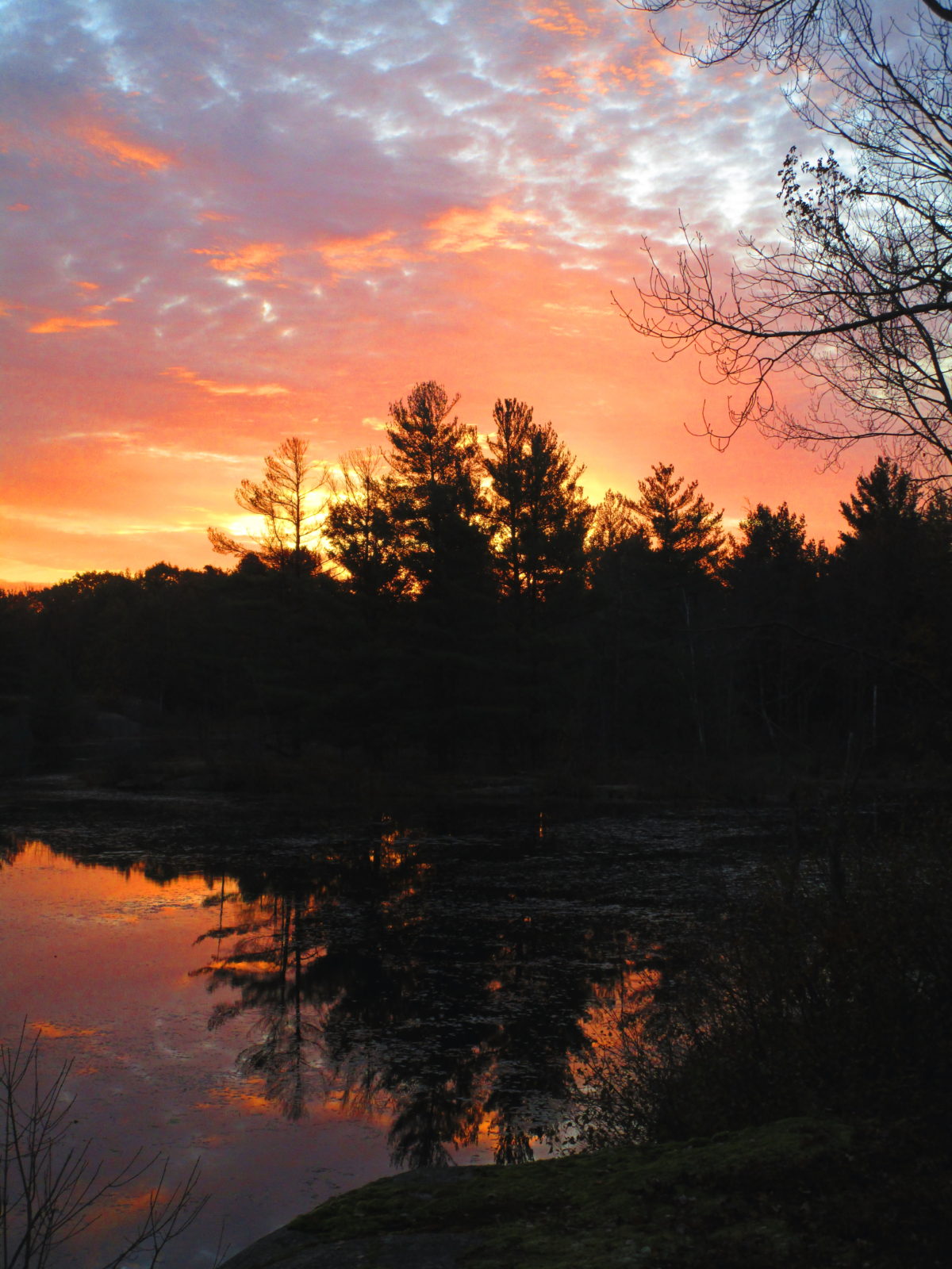
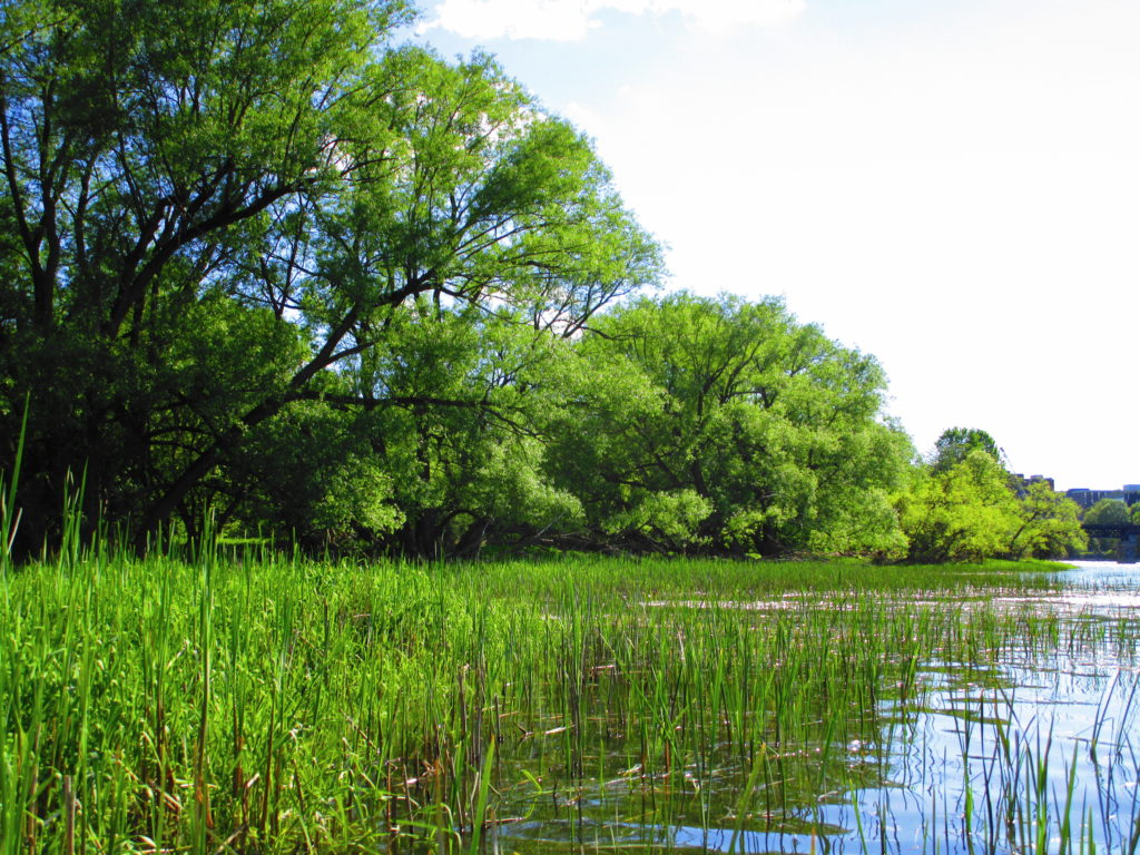
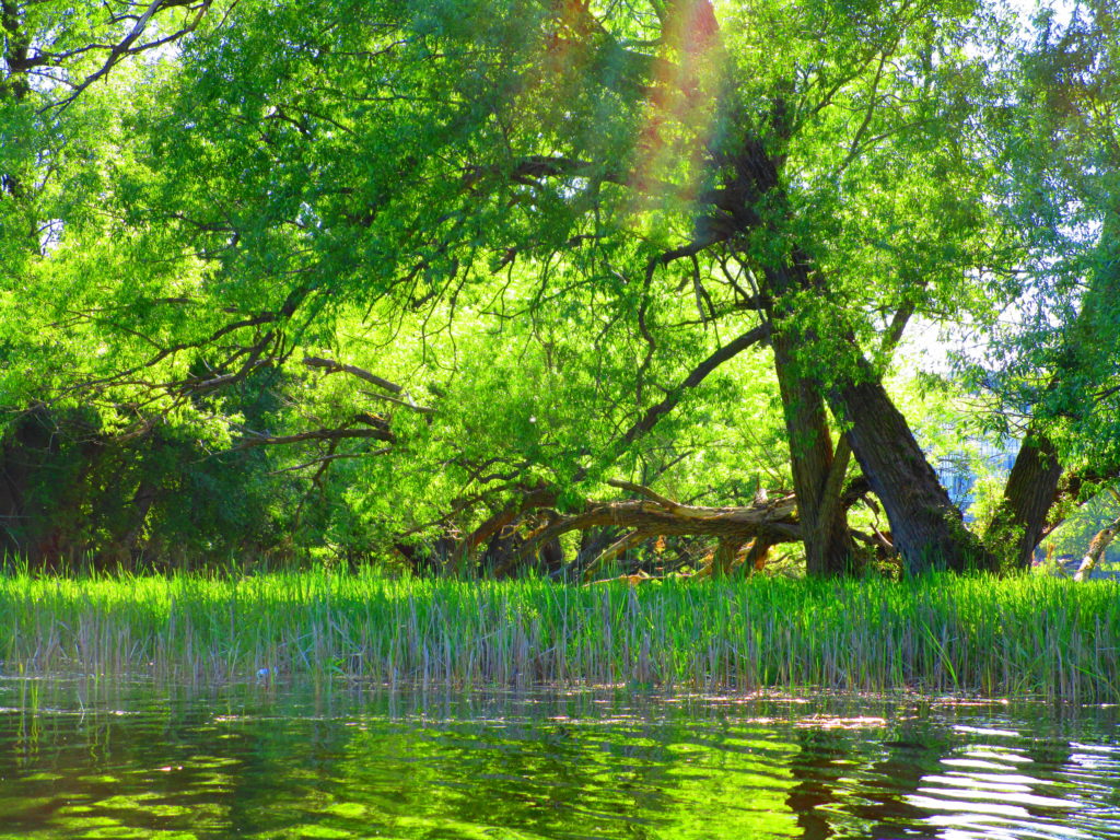
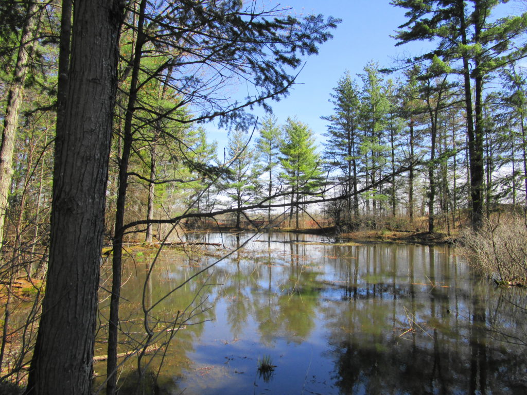
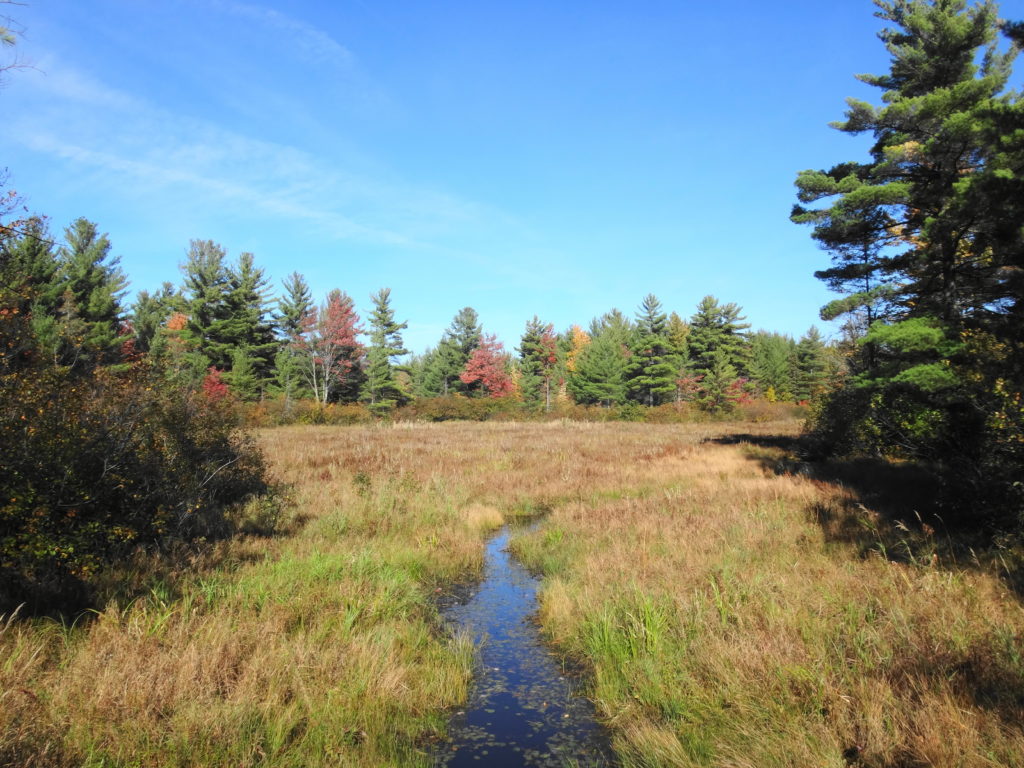
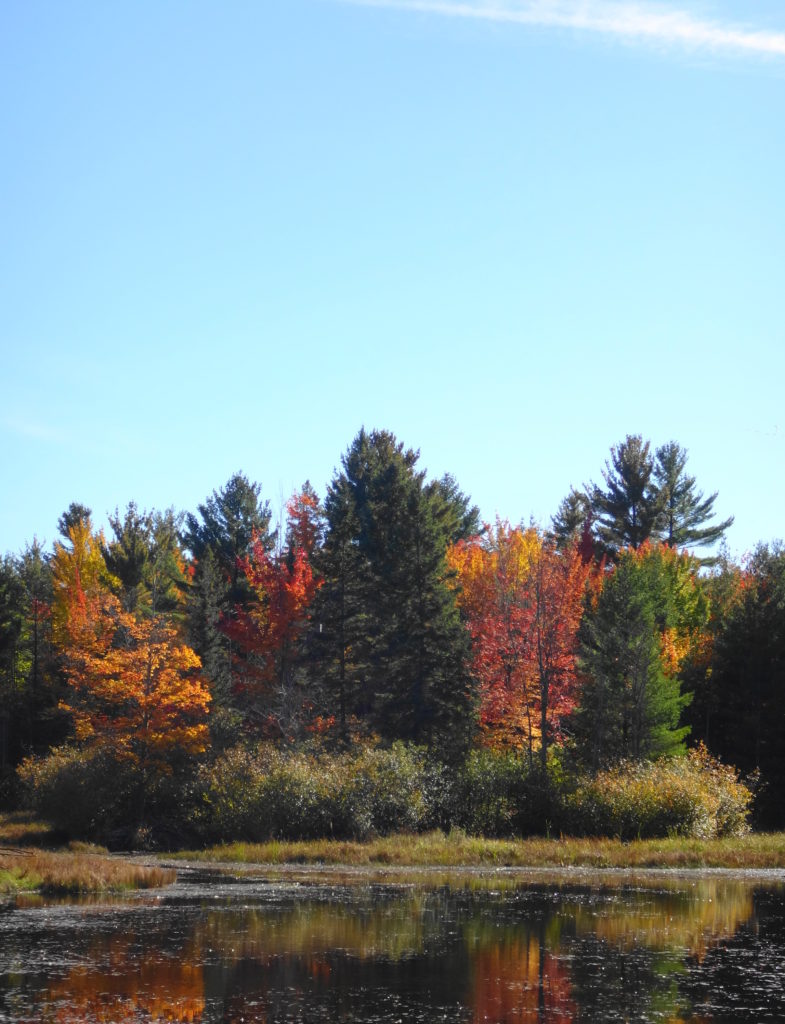
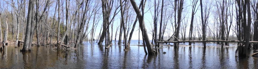
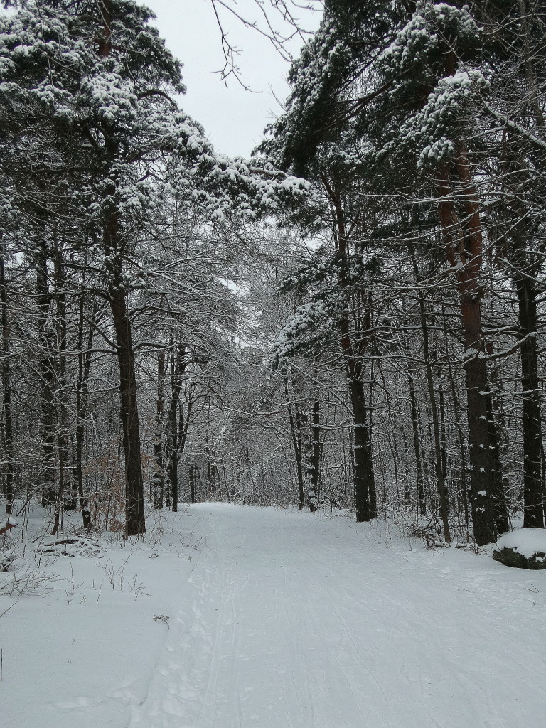
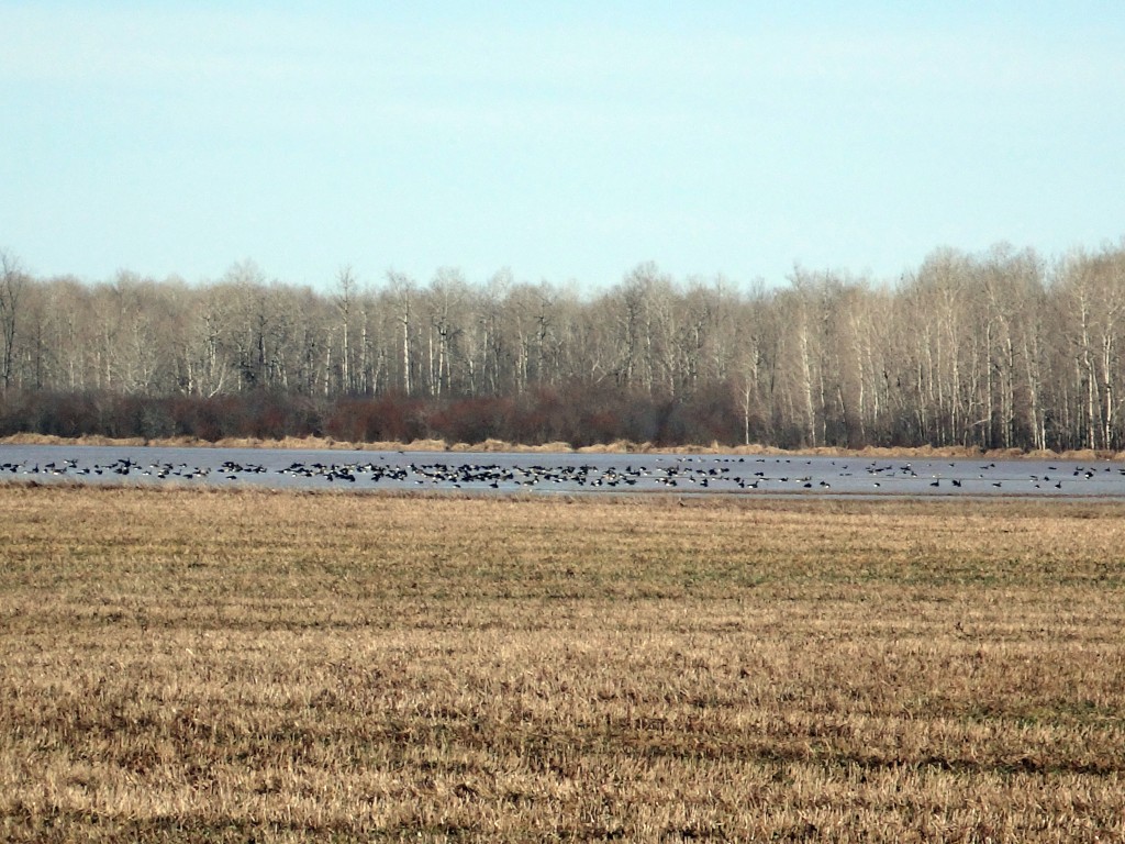
Some people, perhaps, might not consider the Marlborough Forest to extend as far north as the Jock River. For several kilometres, however, the river winds through the swampy north end of the Richmond Fen — the large, provincially-significant peatland that occupies much of the north half of the forest. In the spring, when the creek spills its banks, the swamp appears like some southern bayou, with huge red and silver maples rising from the water to spread overhead like the arches of a cathedral. Blackbirds and grackles call incessently and flit overhead. Wood ducks, mallards, and even a few a teal shelter in back bays and sunlight-dappled pools. Flocks of Canada geese rise noisily from the channel ahead of the canoe as I come around a bend. The scene is both ancient and timeless.
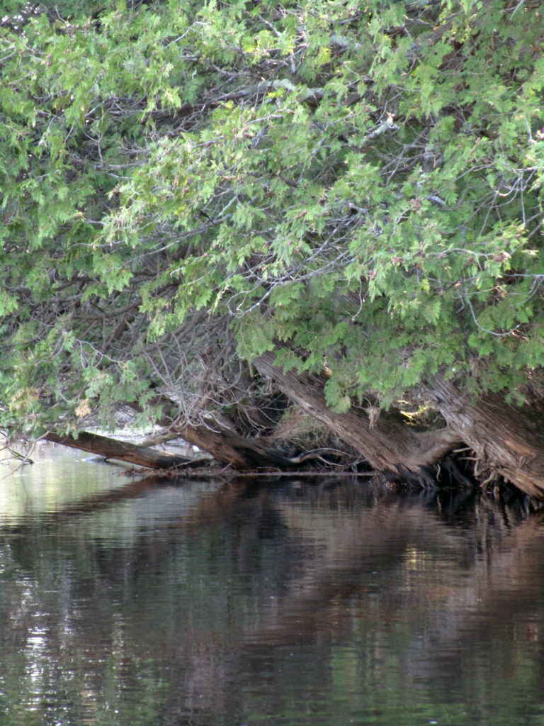
The Jock River Entering the Richmond Fen SwampCedars Beside the Jock River
I can hardly imagine the hardships faced by the early settlers of Richmond and its surroundings in the early 19th century. Initially settled in 1818 by demobilized British and Irish soldiers of the 99th Regiment, the village languished for a long time, with little construction or settlement. According to histories of the area, the well-known settler Hamnett Pinhey said of Richmond in 1832, “if you get into it in the Spring, you can’t get out till Summer; and if you get into it in the Fall, you must wait till the Winter…”. The difficulties rose in large part, no doubt, because of the low, boggy land through which the Jock River runs. Much of that land has since been effectively drained for agriculture. However, even today, the swamps bordering the Richmond Fen extend far north of Franktown Road, and new developments on the low, west side of the village rely on sump pumps for dry basements.
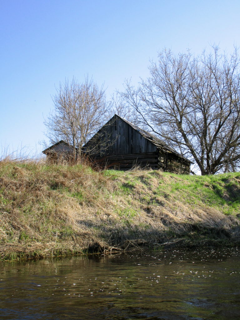
Farm BuildingRichmond Fen Peatland
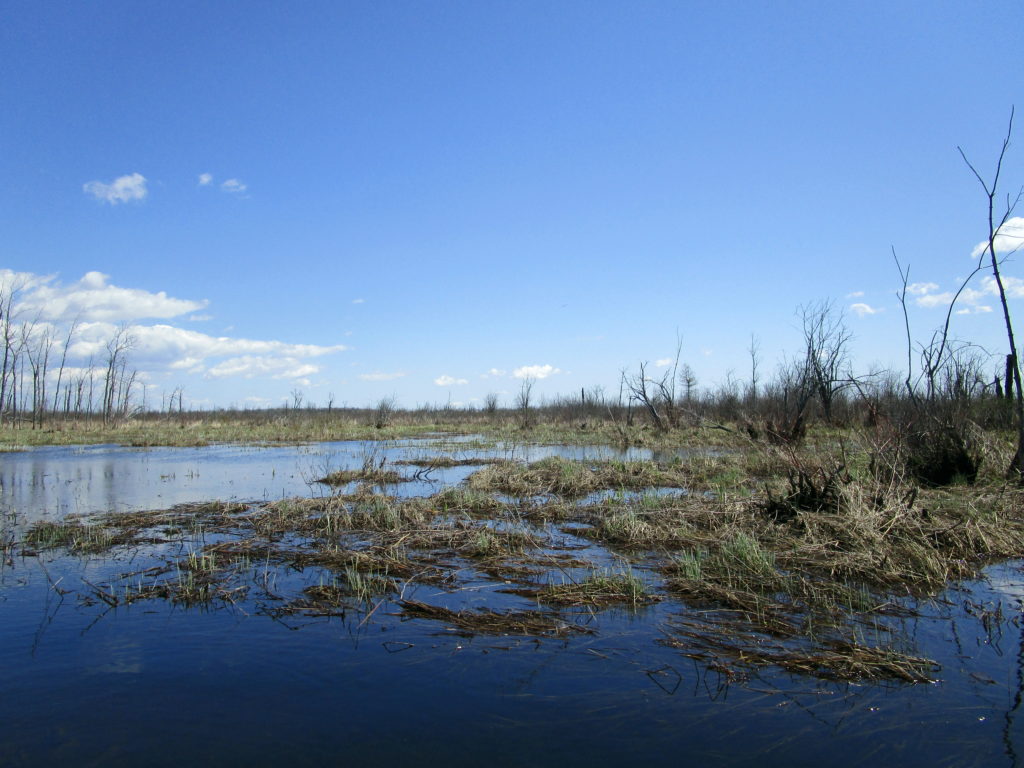
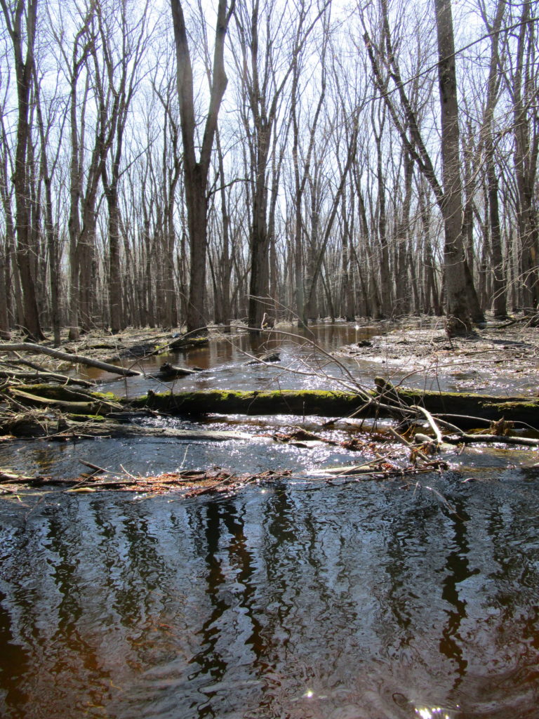
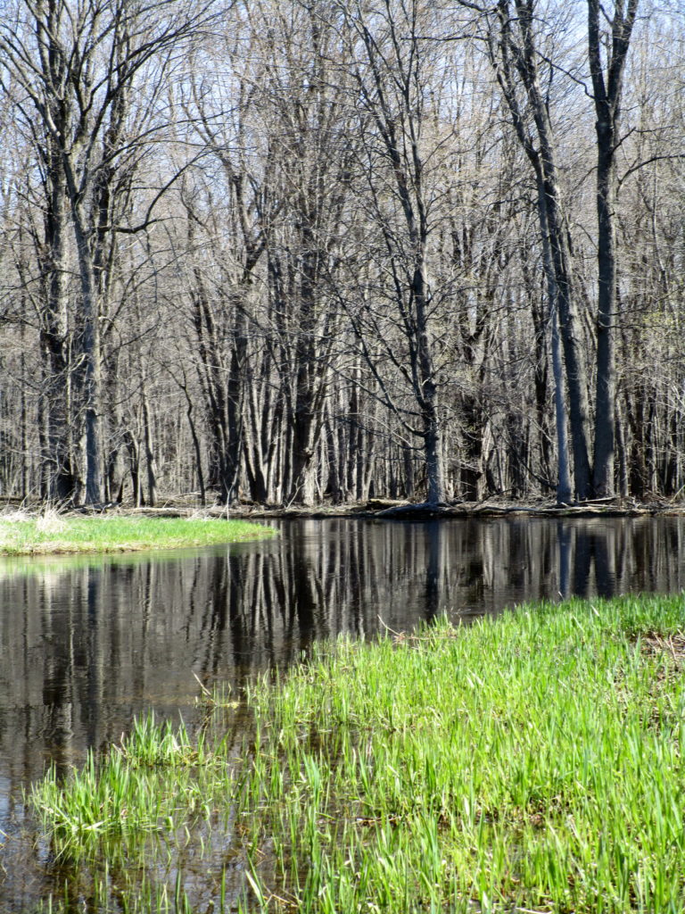
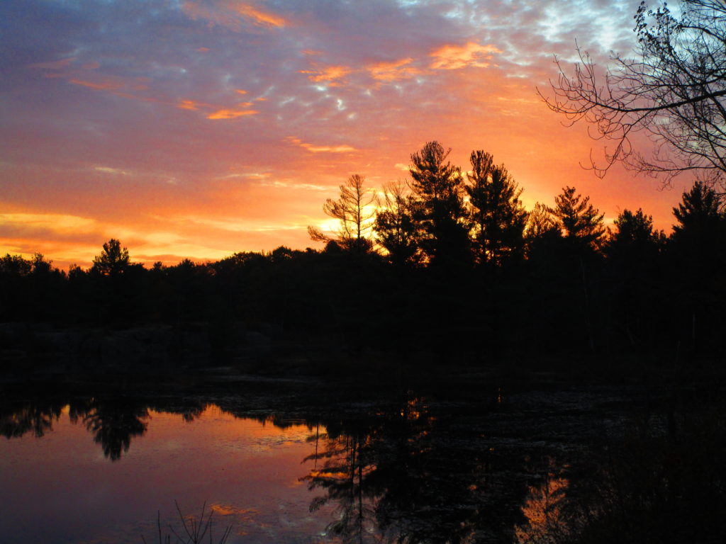
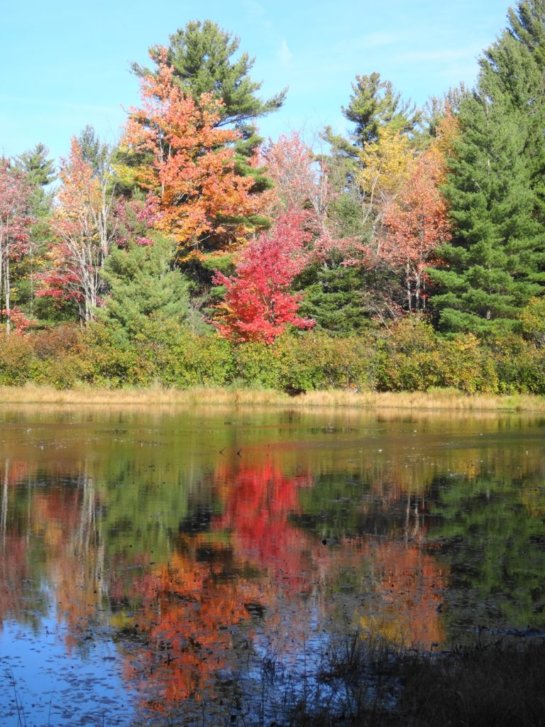
All of that swamp, however, plays a critical role in protecting the Village of Richmond, the suburb of Barrhaven, and much of the intervening farmland from serious flooding. On this particular spring morning, with the river running high, the main channel almost vanished in the swamp as the water flowed outwards into the forest, backwaters, and old oxbows. Spreading placidly over hundreds of hectares, the water slowed and calmed, like a charging bull finding itsef suddenly in a grassy meadow. Why the hurry? Further downstream, at the bottom end of the swamp, the water lazily eased back into the channel again, before running down some last riffles into the village.
Floodwaters Spilling from the Jock River into the Richmond Fen SwampFloodwaters Spilling from the Jock River into the Richmond Fen Swamp
The Rideau Valley Conservation Authority has calculated that the wetlands in its watershed reduce peak flood levels by at least 10% by the time they reach Ottawa. More recent work by the Credit River Conservation Authority and Ducks Unlimited shows that local benefits — such as the influence of the Richmond Fen on the Village of Richmond — can be much greater. In fact, the influence goes much further downstream. Many of the new neighbourhoods and homes bordering the Jock River in Barrhaven simply could not be built safely without the protection provided by the Richmond Fen.
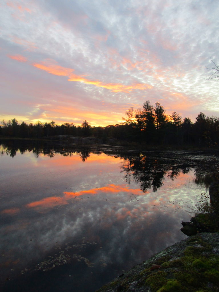
Floodplain of the Jock River in the Richmond FenFloodplain of the Jock River in the Richmond Fen
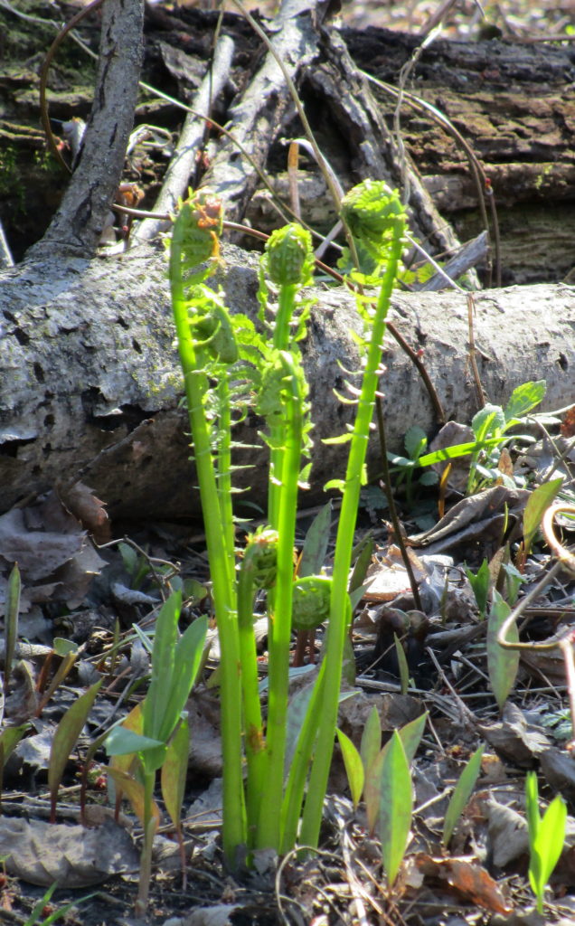
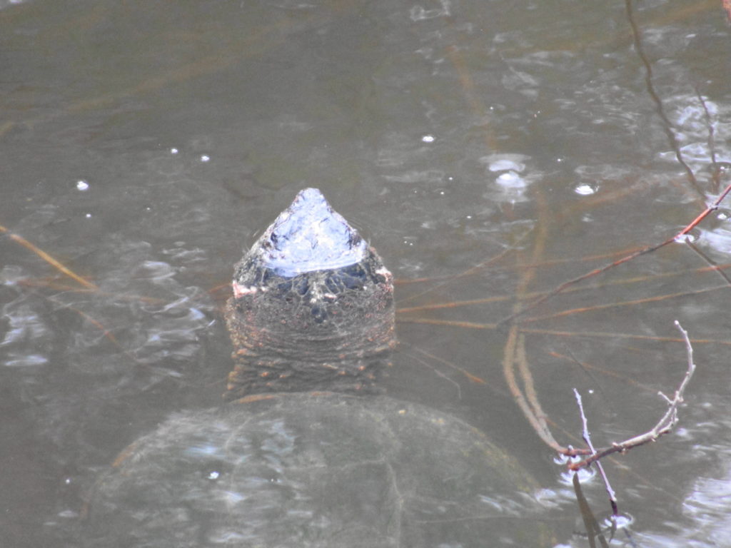
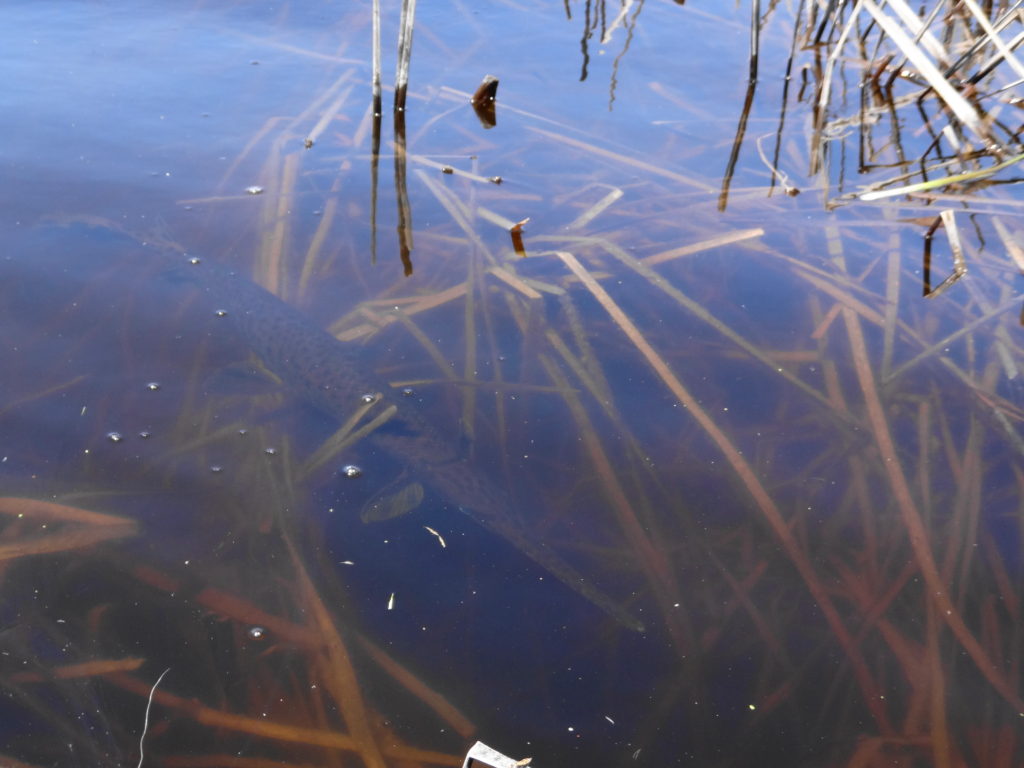
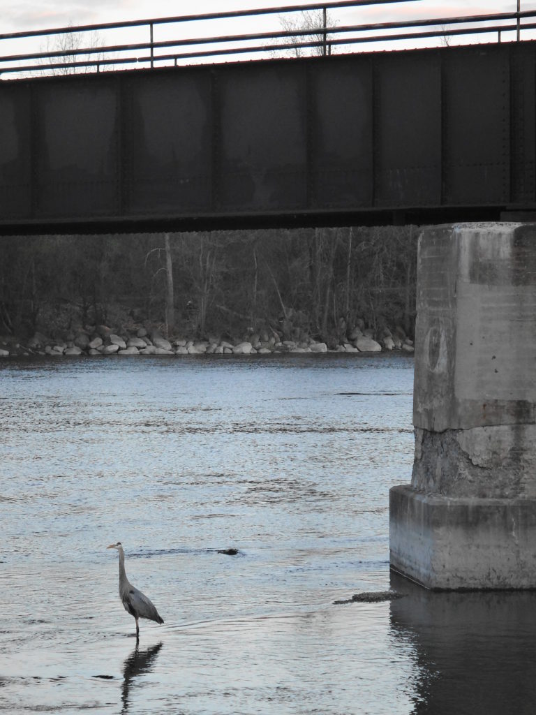
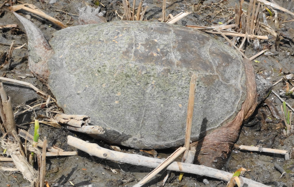
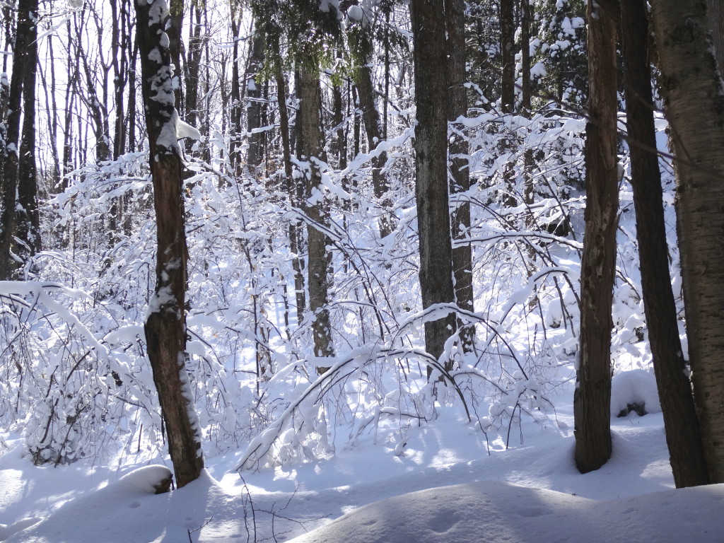
After a long winter, however, the poetic virtues of the swamp have more immediate appeal than the practical benefits: the warmth of the sun through the bare trees, the squak of a blue heron rising ahead, the dance of tree swallows over the water, the reflection of a silver maple in a glassy pool, the unfurling of a fern, the bright green of new grass and sedges on the shore. I dawdled down the river, detouring up side creeks and under the railway bridge into the moat (the “lagg”) surrounding the open fen. Whenever possible, I set down my paddle and leaned back with my elbows on the thwarts drifting with with the current and watching for turtles. A Cooper’s hawk passed overhead. A snapping turtle slid reluctantly into the stream. A carp swirled from the weedy shallows into the deeper water. The river carried me along.
Silver Maple, Richmond Fen SwampTree Swallows, Richmond FenOstrich Fern and Trout Lily, Richmond Fen SwampJock River, Richmond Fen Swamp
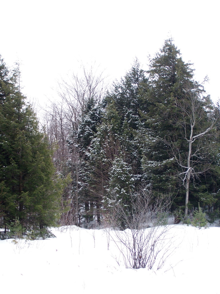
I revisit the Carp Hills several times each year. Spring, of course, when the white-throated sparrows sing, the morning dew beads on the spider webs, and the snakes and turtles come out to bask. Summer for the scent of pines. And autumn for the colours.
Dawn at Lovers Pond, Carp Hills
I turned out early this morning, driving west across Ottawa with the sky paling slowly behind me. A short hike across the barrens took me to Lovers Pond, where I sat on grey gneiss and watched the sun rise peach and turquoise behind the pines.
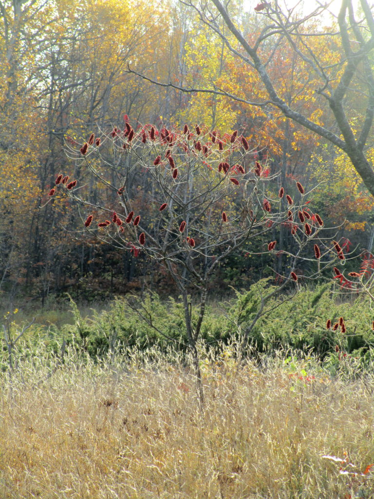
Dawn Reflections, Carp HillsLovers Pond at Sunrise, Carp HillsRed Maple, Carp HillsYoung Staghorn Sumac, Carp Hills
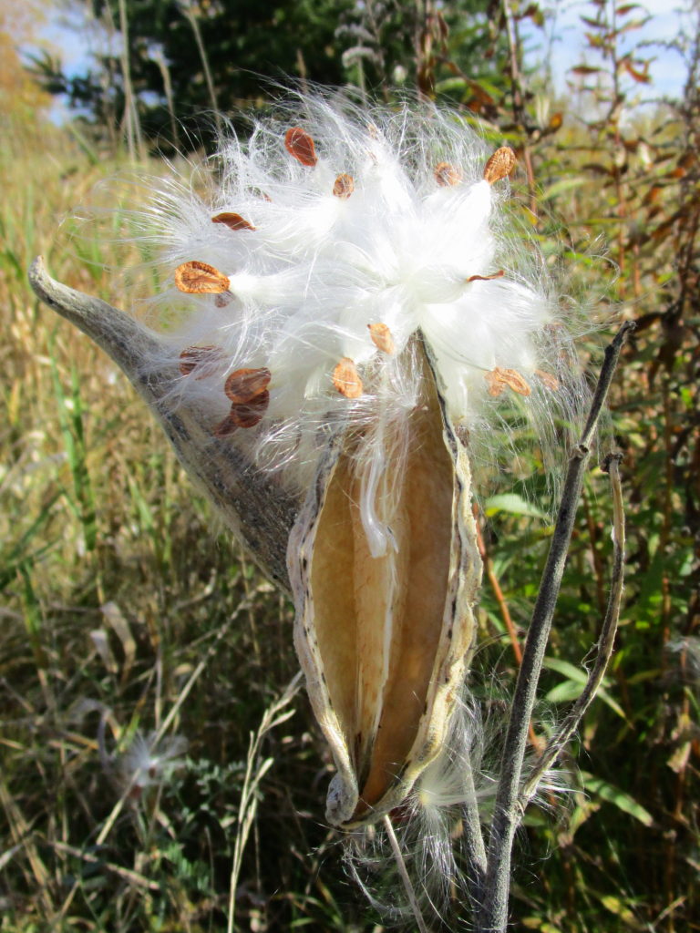
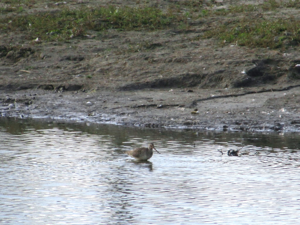
On the return home, I stopped at the Carp River restoration area, where I watched a northern harrier hunting over the marsh, and added a Hudsonian Godwit to my life list.
Milkweed, Carp River Restoration AreaHudsonian Godwit, Carp River Restoration Area
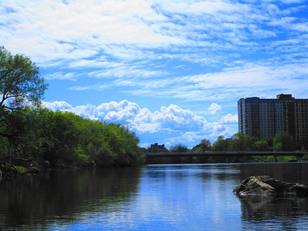
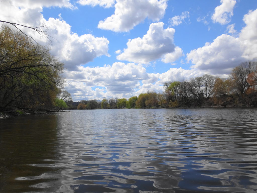
I never tire of paddling the Rideau River, especially the familiar section between Sandy Hill and Carleton University. I always find something to admire. I always reflect upon the human experience of the River, which still evolves, and which goes back at least 4000 years.
On a gorgeous Saturday afternoon, while many of my friends participated in the Ottawa Race Weekend, I launched my canoe for the season’s first paddle on the Rideau. I usually make this excursion earlier in the spring, but this year’s high flows kept me off the river. Loading my canoe on the bike trailer, I rode down to Robinson Park, launched from the beach, and turned upstream.
Wike Canoe Trailer
The paddling proved relatively easy, despite the strong current. I passed under the Queensway and the footbridge, skirting the shoreline and reeds in search of wildlife. My new cherrywood paddle (a birthday gift from Sue) felt good in my hands, and the tensions of the past work week eased out of my shoulders.
Rideau River Downstream of the Hurdman Bridge
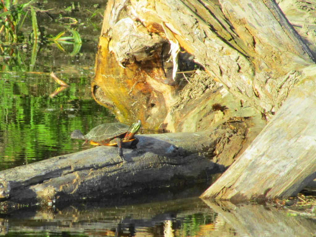
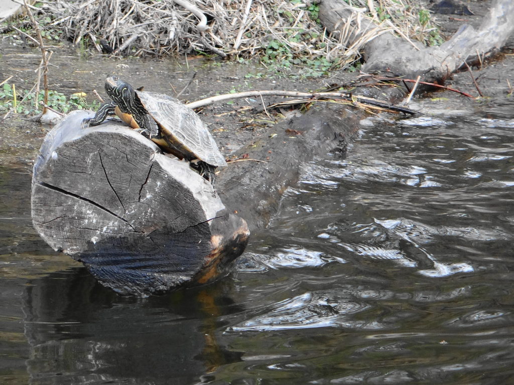
Given the warmth of the day, I expected to see a lot of basking turtles. In the past, I’ve spotted large numbers of painted turtles, plus large snappers and even map turtles along the shore. Surprisingly, in almost six hours on the river, I only found two painted turtles up on logs, along with three snappers idling in the shallows amidst the reeds. The Ministry of Natural Resources and Forestry has several old records of Blanding’s turtle along the river, and despite a decade of disappointment, I still live in hope of finding one sometime on this stretch.
Painted Turtle, Rideau River
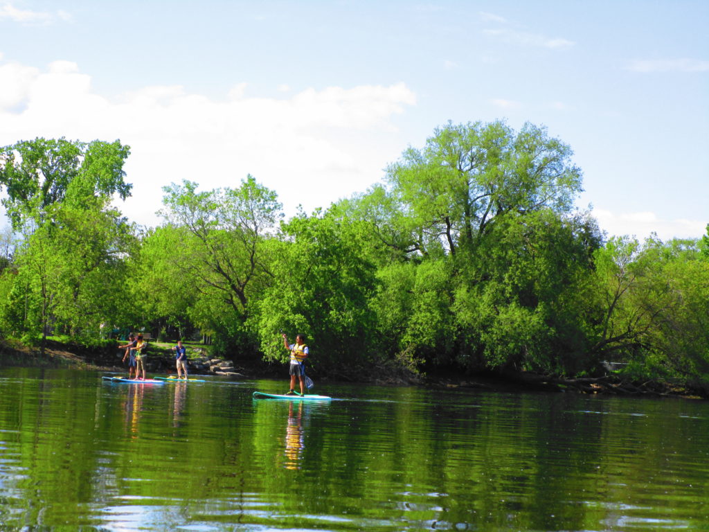
The hardest paddling of the day came at Billing’s Bridge, where the river flowed fast through the piers. Passing a small group of stand-up paddleboarders, I tried first for the central span, paddling hard in the eddy behind a pier and then shooting into the current. For a minute a two I held my own, but without making headway. Finally, I dropped back and moved to the next span south, where the current proved a little less challenging. One of the paddleboarders tried to follow me, but couldn’t muster enough speed. Just upstream of the bridge, several more stand-up paddleboarders practiced in the calmer pool. One of them, a very pretty young woman, struck yoga poses on her board, as her girlfriend snapped photographs.
Stand-up Paddleboarders, Rideau River
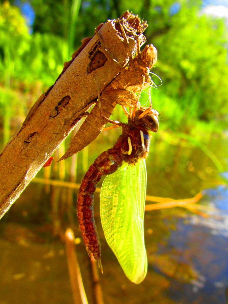
After working slowly through the riffles above Billings Bridge, I slid my canoe into the reeds at Clifford Allen Island, so that I could renew my sunscreen. As I slathered on the cream, with a pair of geese eyeing me warily, I noticed a newly molted dragonfly drying its wings at the tip of broken, brown reed, still hanging from its discarded nymph skin. It’s colors had not yet fully developed, but the stripes on the thorax suggested some kind of darner. I had seen pretty, green darners dancing over the reeds during my paddle upstream, but they lacked the thorax stripes.
Unknown Darner, Rideau River
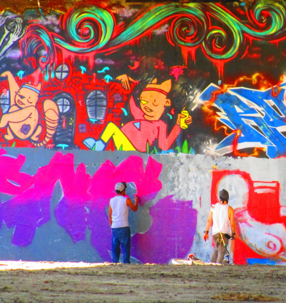
Carrying on from the island, I paddled past Brewer Park to the Dunbar Bridge. This part of the Rideau River hosts the most fascinating juxtaposition of culture in the City: literally 4000 years of history separated by barely 300 metres of river. On the north shore, nestled under the Dunbar Bridge, the House of PainT provides a venue for Ottawa’s hip-hop community, featuring its first legal graffiti wall and regular street dance festivals. Just upstream and across the river, on the south shore at Vincent Massey Park, lies a 4000 year-old, indigenous archaeology site. Excavated by the National Capital Commission over several years, the site marks the bottom end of an old portage around the Hogsback Falls. Paddling up the south shore in late afternoon, just below the rapids under the O-Train line, one can easily imagine those Early Woodland people pulling their canoes into shore to set camp for the night, perhaps casting their nets into the river, where fishermen cast their lines today. I suspect that they chose the spot as much for its beauty as for its convenience.
House of PainT, Dunbar Bridge, Rideau RiverEarly Woodland Archaeology Site, Rideau RiverShoreline, Vincent Massey Park, Rideau River
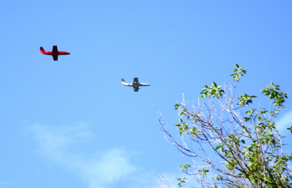
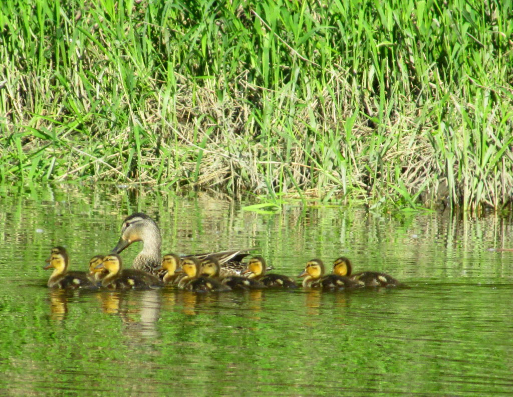
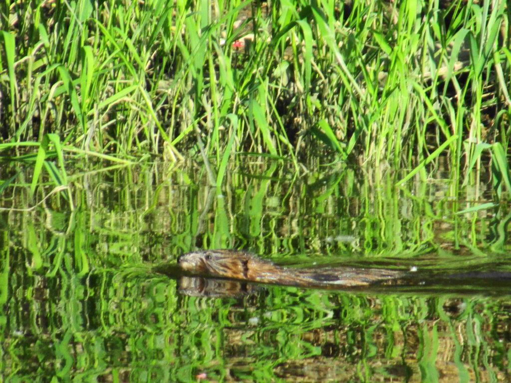
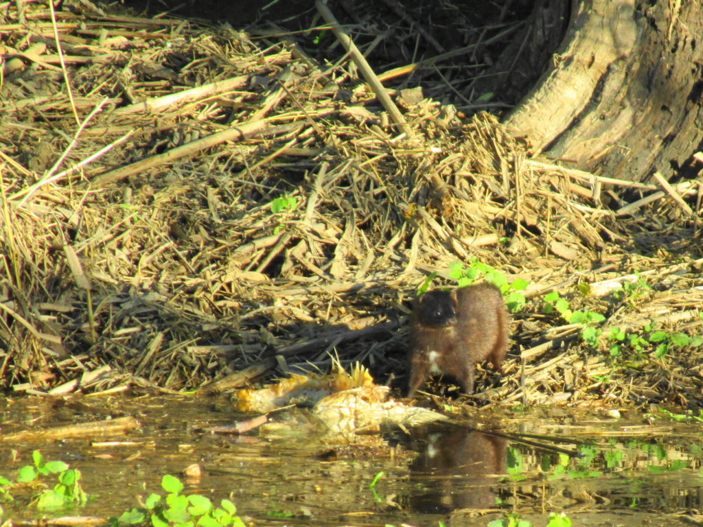
I turned back downstream in late afternoon, alternating drifting and paddling gently. For awhile, I watched two jets circling over the City in formation as part of the race weekend celebrations. Gradually, as the light mellowed, the wildlife became a bit more active. Just above Billings Bridge, a female mallard shepherded her large brood of ducklings. I could not help but think of the large muskellunge known from the area, and wonder how many ducklings would survive the summer. Further downstream, a muskrat plied the shoreline in the shadows of the trees. Finally, near the end of the paddle, I came upon a mink feeding on the carcass of a carp at the edge of the shore. I shot a few, quick photographs, then circled back to take a few more, only to see the mink slip back into the shadow of the trees.
L29 Delfins, AMC WarbirdsMallard and Ducklings, Rideau RiverMuskrat, Rideau RiverMink, Rideau River
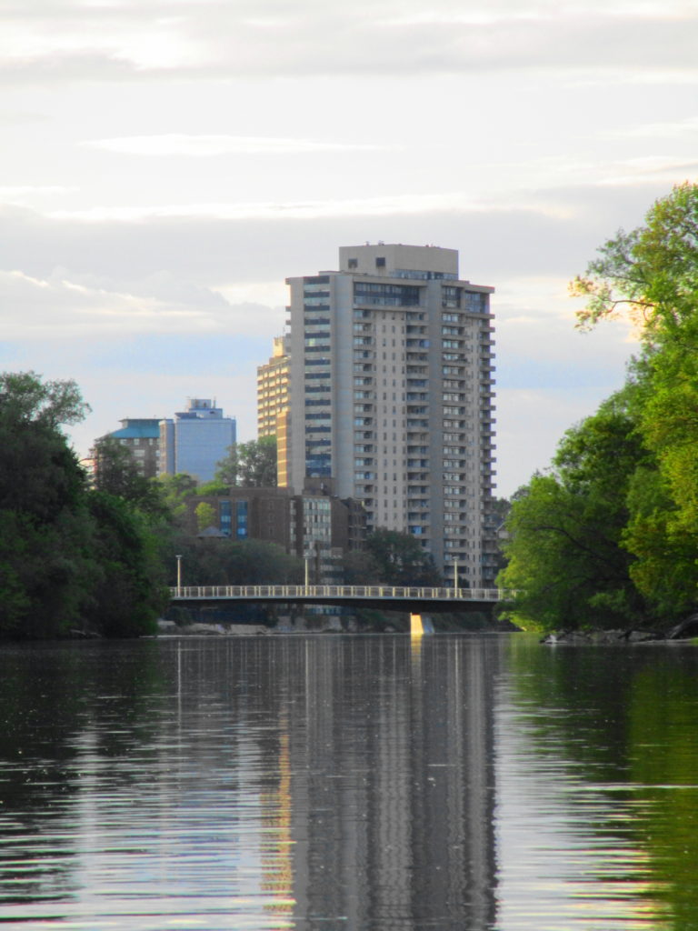
I pulled back into Robinson Park, just as the evening sun was dropping behind the City. I looked down the peaceful waterway to the Adawe Crossing at Strathcona Park. The serenity of the scene encapsulated the beautiful dichotomy of this wonderful urban river.
With a brief, sunny break in Ottawa’s wet spring weather, I headed out early on an April Saturday morning for a bird watching trip to the west end of the City. I set out just before dawn on my bike, crossed downtown along the Laurier bike lane, then cut down to the Ottawa River bike path by the War Museum. Almost immediately I stopped to watch several rough-winged swallows feeding over the channel by Albert Island, darting occasionally into the drainage holes in the concrete channel walls.
Carrying on, I quickly arrived at Lemieux Island, where I stopped to check out the colonies of ring-billed gulls on the smaller islands. A brown thrasher chattered in a copse of trees at the entrance of the causeway, and white-throated sparrows moved through the underbrush. Robins foraged in the grass. A cardinal sang in the sumac on the other side of the lane, and red-winged blackbirds piped all along the shoreline. Out at the lookout, I spotted a black-crowned night heron perched amidst the gulls, and the black spikes of cormorants on the furthest island. A large flock of tree swallows hunted over the swift, roiling river.
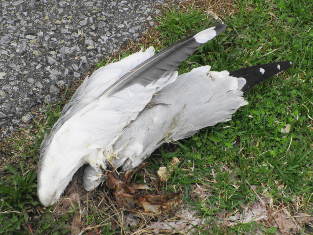
Leaving the island, I continued west along the river, checking off puddle ducks and diving ducks, until just before Mud Lake at Britannia, where a gull carcass caught my eye. Lying beside the path, all that remained of it were the two wings and a scraps of bones. I immediately thought of a description from J.A. Baker’s beautiful masterpiece of natural history, The Peregrine.
“A peregine kill can be easily recognized. The framework of a bird is left on its back, with the wings untouched and still attached to the body by the shoulder-girdles. The breastbone and all the main bones of the body may be quite fleshless. If the head has been left, the neck vertebrae will usually be fleshless also. The legs and back are frequently left untouched. If the breast-bone is still intact, small triangular pieces will have nipped out it by the peregrine’s bill.”
Peregrine Kill
Okay… not the most poetic extract of
Baker’s book, but based on this observation and others over the years, a pretty fair description.
I arrived at Mud Lake early, while only a few keen wildlife photographers were prowling the paths. I went looking first for Blanding’s turtles in the well-screened east swamp, where I’d seen them basking in previous years. But the light was still too thin and the air too cold for basking. Pushing my bike along the path toward the boardwalk and the main pond, I spotted a pair of black-crowned night herons pass overhead. Chickadees flitted along beside me on the trail, until they realized that I had no sunflower seeds to feed to them. A pair of crows chased a raven.
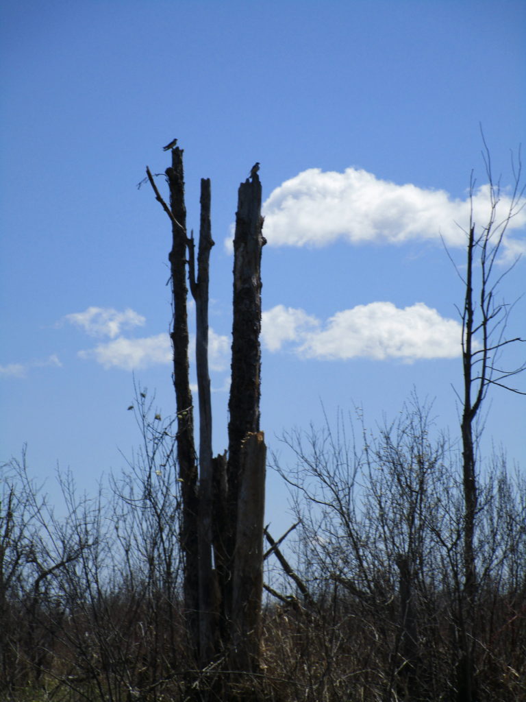
At the boardwalk, I hoped again to see some early basking turtles. But no luck. Several pairs of wood ducks swam amidst the maze of logs, broken branches and downed trees in the swamp on the inside of the boardwalk, while raucous geese squabbled over nesting sites along the shore of the pond. As I prepared to move on, a pair of northern flickers flew up to a snag beside the swamp, checking out the cavities. I had just resolved to leave them in peace, when I noticed a stir in the water and a tell-tale trail of bubbles. A few minutes of patient waiting was rewarded with the sight of large snapping turtle rising from the bottom of the pond for a breath.
Mud Lake Snapping Turtle
I slowly worked my way clockwise along the shore of Mud Lake, listening to the morning chorus. Goldfinches chittered overhead. A pine warbler buzzed in a tall pine. Yellow-rumped warblers flitted and sang in the high branches. Nuthatches and downy woodpeckers methodically moved from tree to tree, searching the trunk of each for insect morsels. To my disappointment, I found no trace of the screech owl that had made its home in the woods the past two years. Perhaps a little later in the spring?
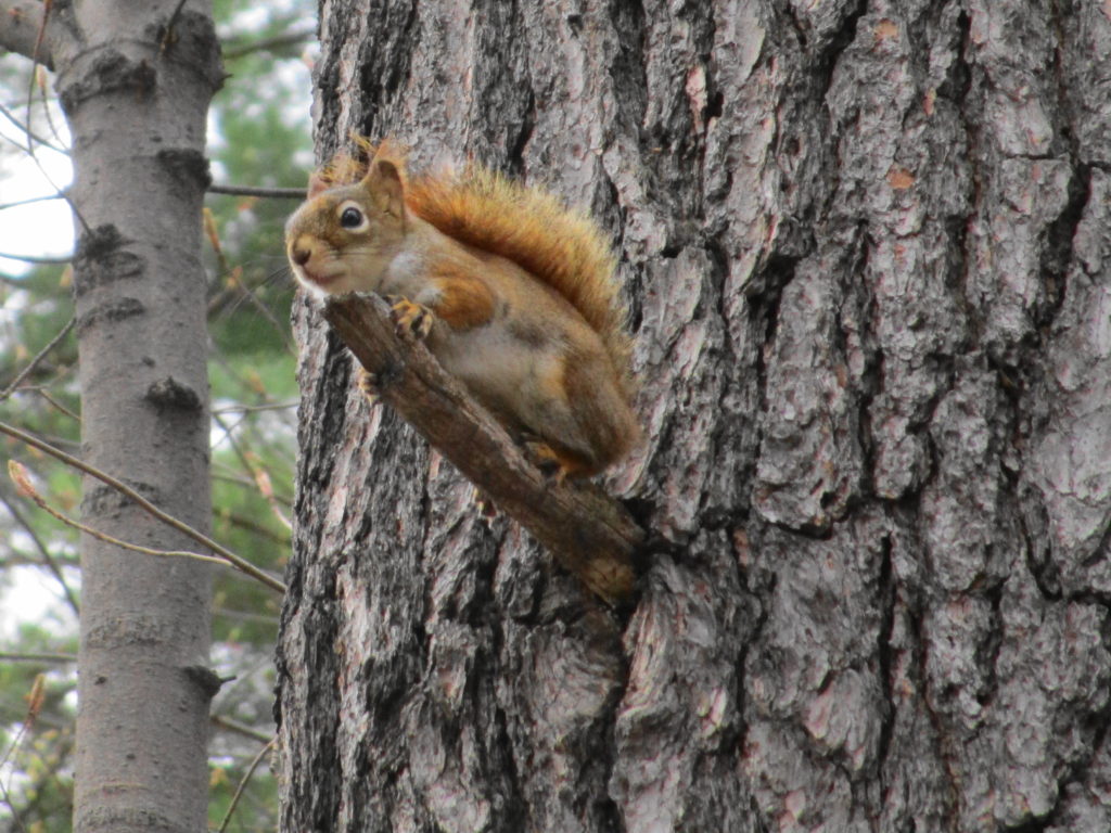
Red Squirrel
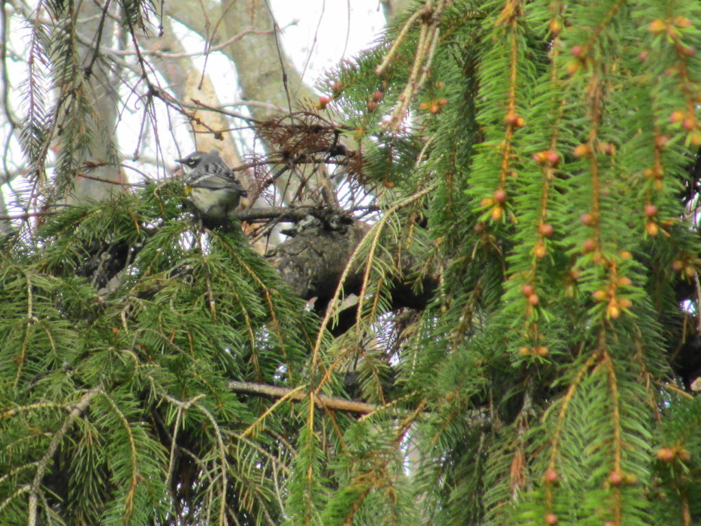
Leaving my bike locked at the trailhead at Cassels Street, I walked the ridge along the river shoreline. From one of the lookouts, I could see across Deschenes Rapids to the large gull colony at the old mill site on the far shore. With my binoculars, I made out the larger, white silhouettes of several great egrets perched amidst the gulls. At the south end of the ridge, I spent almost half an hour lingering around the conifers in hopes of getting some good photographs of the enthusiastic yellow-rumped warblers feeding in their branches with a solitary palm warbler. While a small crowd of [other] grey-haired photographers fired off clusters of shots from a fortune of tripod-mounted, digital SLRs and long lenses, I waited for birds to come close enough for my pocket compact.
Yellow-rumped Warbler
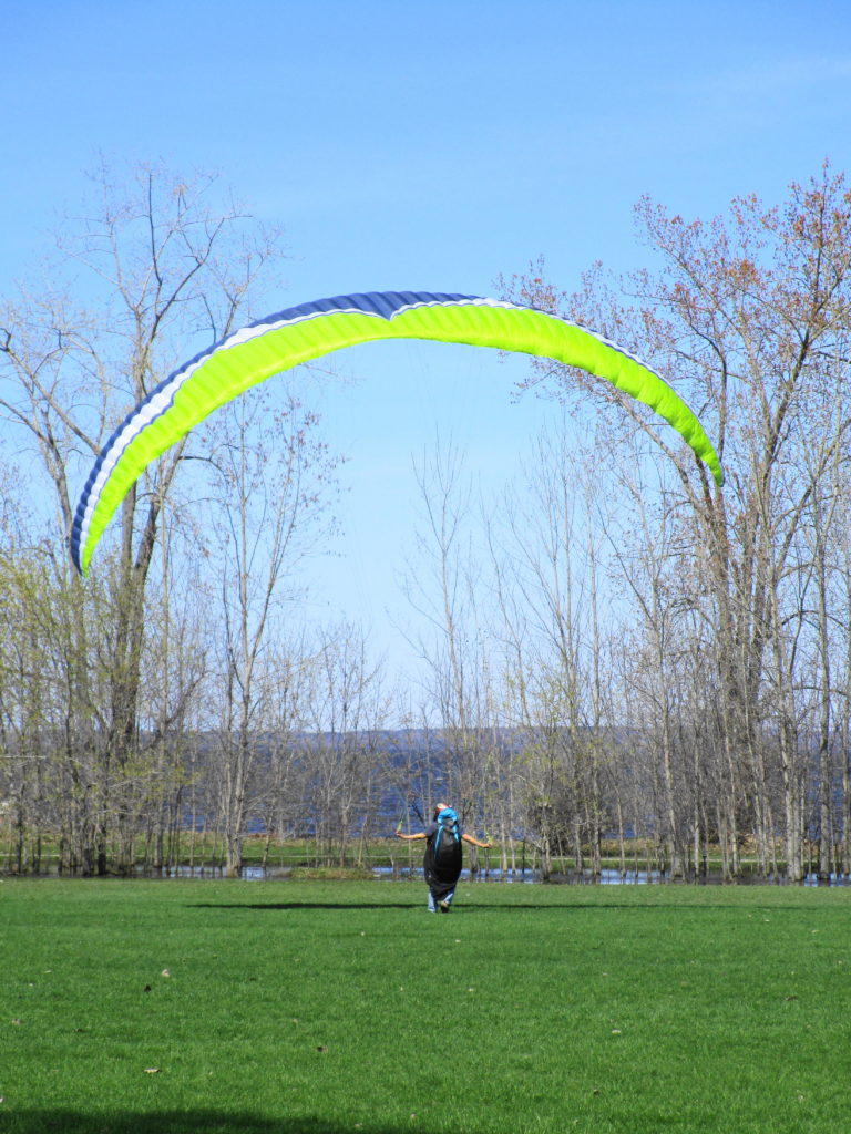
As usually happens, I’d lost track of time in the woods. Feeling hungry, I rode up to Richmond Road to grab some lunch, after which I returned to the Ottawa River trail and continued west. On one of the lawns at Britannia Park, someone was testing a parasail in the stiff wind. I passed Andrew Haydon Park and followed Watt’s Creek pathway to Moodie Drive, where I crossed into the National Capital Greenbelt. I continued following the Watt’s Creek pathway west to March Road, where I turned north to Herzberg Road and March Valley Road.
Parasail Practice at Britannia Park
When I first came to Ottawa, more than 25 years ago, March Valley Road provided some of the best bird-watching in Ottawa, especially for hawks and owls. It may be the last place in the City where I saw a short-eared owl, and I still catch glimpes of northern harriers over the Department of National Defence lands. Over the years, however, development has crept ever closer. Suburban subdivisions now lie only a few hundred meters distant, kept at bay only by the restrictions placed around the Department of National Defence firing range. However, it still offers a few good vistas across the fields of the base toward the silver maple swamps shielding Shirley’s Bay and the Ottawa Duck Club properties, including a distant view of Ottawa’s only active bald eagle nest. On this day, tree swallows filled the air above Shirley’s Brook, and the clean white head of an adult bald eagle rose above the rim of its nest.
Having ridden to within a few minutes of the South March Highlands and the Carp River Valley, I decided to mix pleasure with a bit of work. I headed up Terry Fox Drive, past Old Second Line Road, and then turned my bike on to the construction access road into the KNL development property to inspect some of the perimeter fencing.
Even having witnessed the transformation of the landscape on the KNL property during this winter’s cutting, I still find the view quite stark and shocking. Where a mature forest once stood, a expanse of stumps and scarred earth now remains. I find little consolation in the knowledge that the destruction of this forest was ordained more than twenty years ago, and that I played my role in protecting what remains. Perhaps when homes fill the landscape, families fill the homes, and neighborhood children ride the surrounding nature trails, I’ll feel better about the outcome.
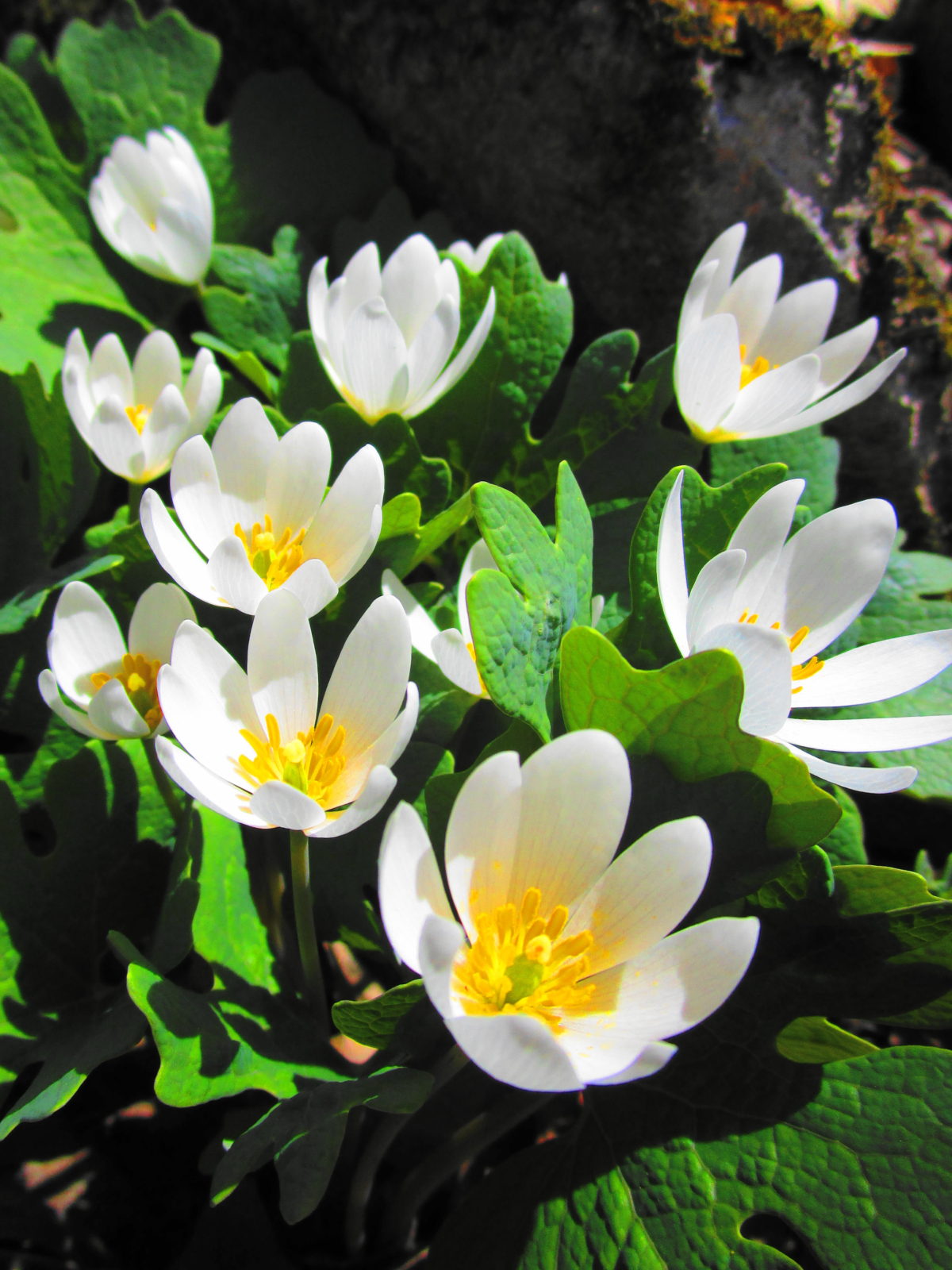
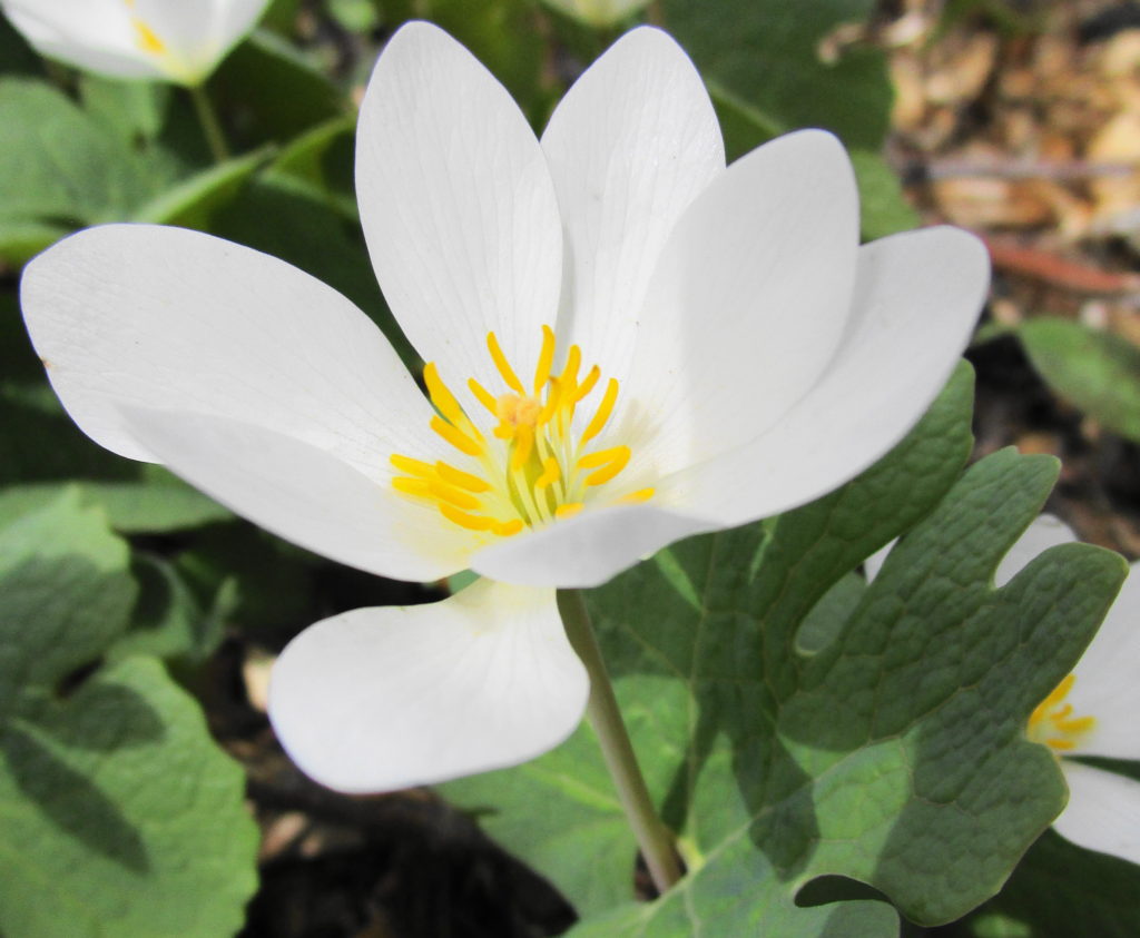
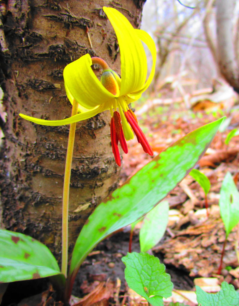
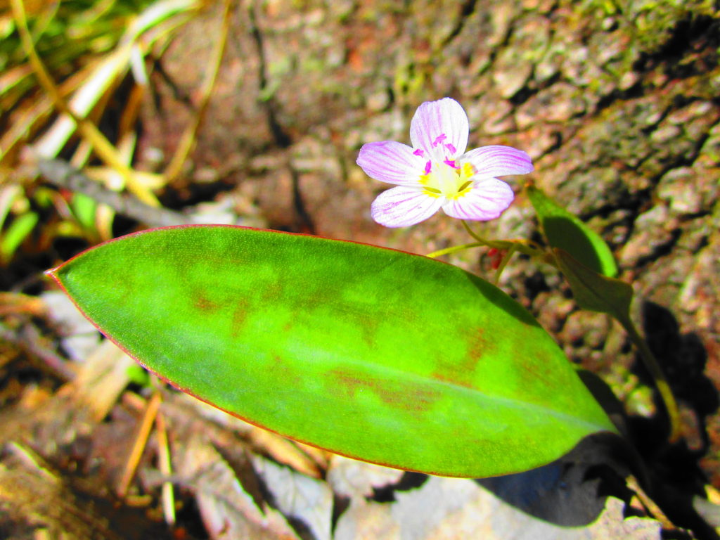
Retained Pond on KNL PropertyBloodroot in KNL Natural AreaTrout Lily in KNL Natural AreaSpring Beauty in KNL Natural Area
After checking out the fencing and scouting a retained pond for turtles (two painted, no Blanding’s), I continued along Terry Fox Drive to the Carp River Restoration Area. Like the KNL lands, the Carp River Restoration Area has a controversial development history. Notwithstanding its history, the restoration looks terrific. One of the pathways still needs completion, but the Carp has been returned to a more natural, sinuous form, and the new wetlands have been landscaped. With the spring flood only just having dropped (now returned!), the restoration area consisted mainly of bare, brown earth and mud. But in my mind’s eye, I could see it in the future, with the shrubs, cattails, and reeds in full growth and a cacophany of waterfowl side-slipping into the ponds.
As I was contemplating this sight, I had my best moment of the day. While I looked out over one of the muddy ponds, a flock of six lesser yellow-legs flew across the water to land on shore at its edge. A instant later they scattered upward as a brown, blurred shape swept through, knocking one of them down. A peregine! The falcon whirled tightly back around, but its first strike had not been clean; the yellow-legs was back in the air. The peregine jinked quickly after it, but again the yellow-legs evaded, striking the water in the process. The prospect of a possible dunking seemed to deter the peregrine, which quickly gave up the chase, and climbed away to the west and out of sight. The whole encounter lasted only a few seconds. In my excitement, I hadn’t even thought of reaching for my camera — not that I could have captured anything at that range.
I waited awhile to see if either the yellow-legs or the peregrine would return. But apart from some mallards and geese, my only sighting of interest was a white-tailed deer in a thicket swamp on the far side of the river.
With the sun now sliding steadily downward, I reluctantly turned my bicycle back towards home. Heading along Campeau Drive, I detoured quickly into the Kanata Centre Woods, where a short pathway winds over a pretty rock knoll and past a lovely, hidden pond. The pond seemed very quiet in the late afternoon, made more so by the song of a solitary Cardinal in the trees across the water.
Kanata Centre Woods
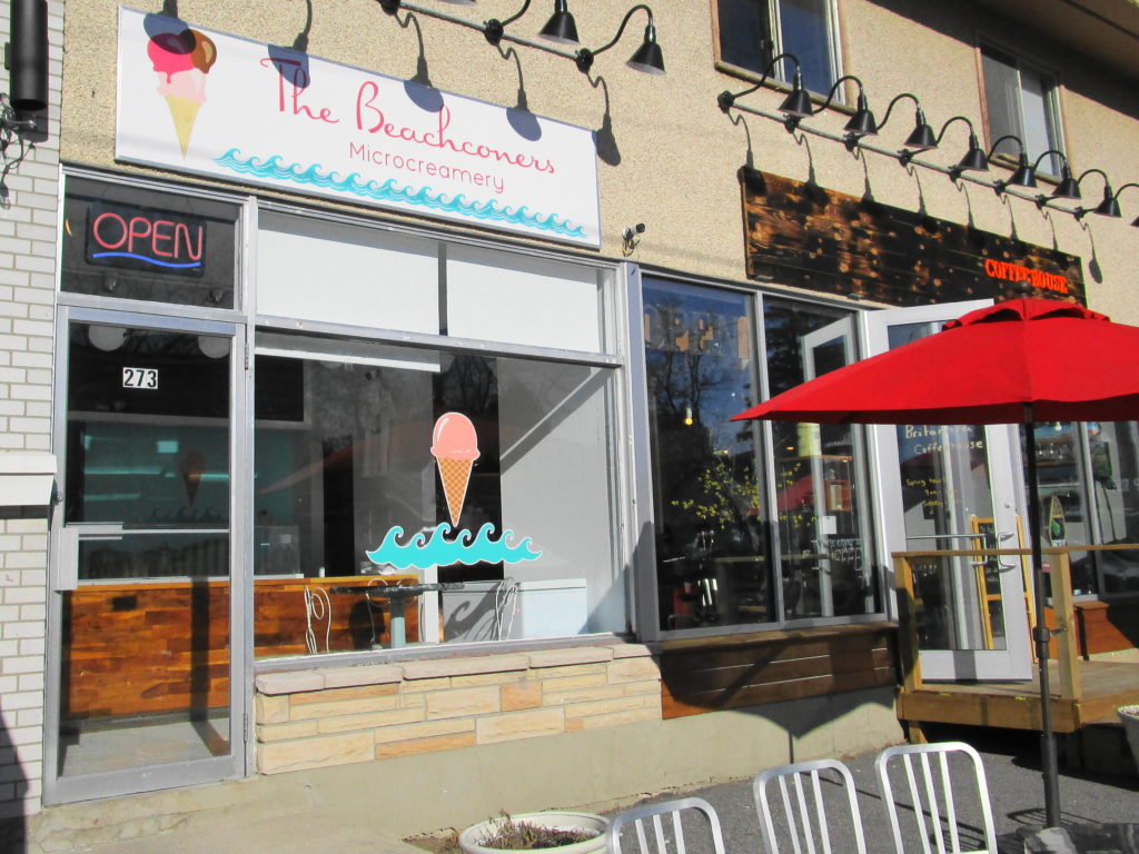
Reaching March Road, I cycled back to the Watts Creek pathway and retraced my route toward downtown. By the time that I reached Britannia, however, I was ready for a refreshment. I’d spotted the “Beachconers Microcremery” in the morning, beside the cycle path. Stopping now, with my muscles weary and my throat dry, I enjoyed what must be Ottawa’s best vanilla bean ice cream — or so it seemed at that moment.
Beachconers Microcremery
I arrived home just after sunset, wheeling up to the back door to see Sue through the window, sitting at the kitchen table. After a welcome supper, I then soothed my muscles and joints with a hot bath. Altogether, a very satisfying day.
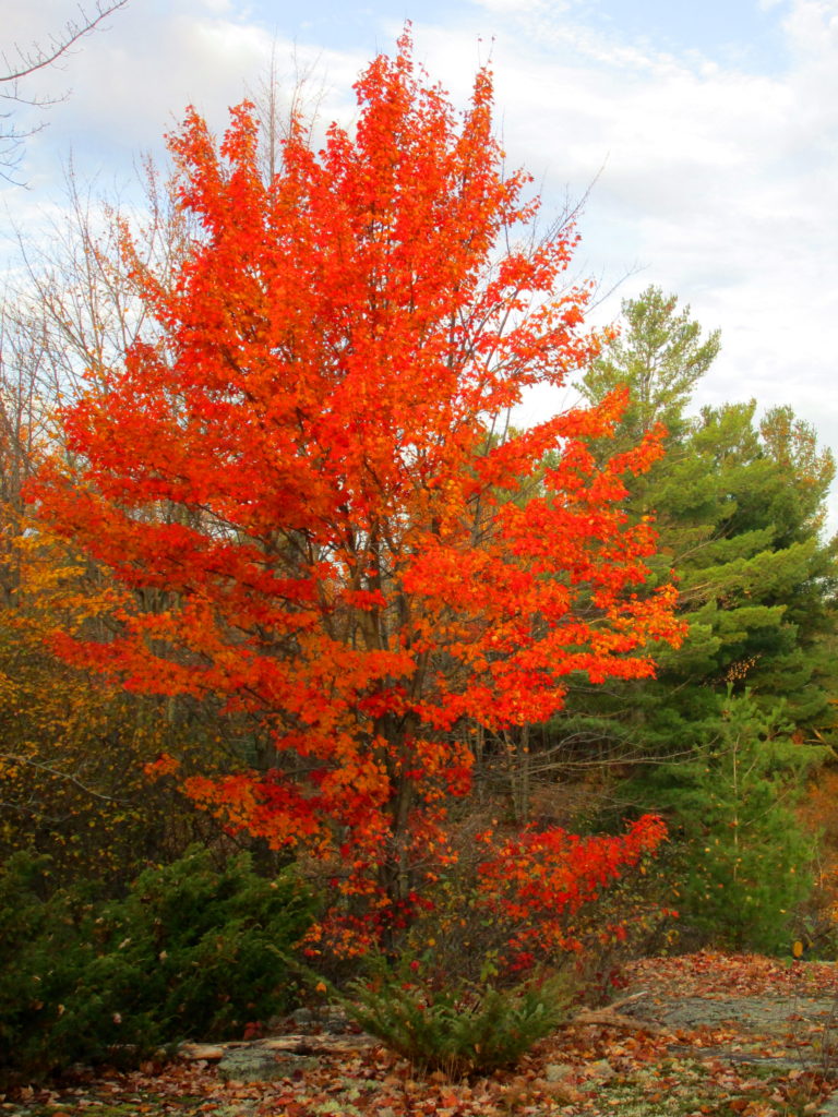
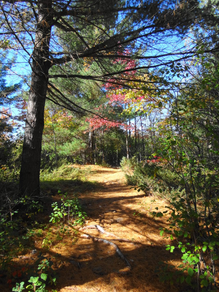
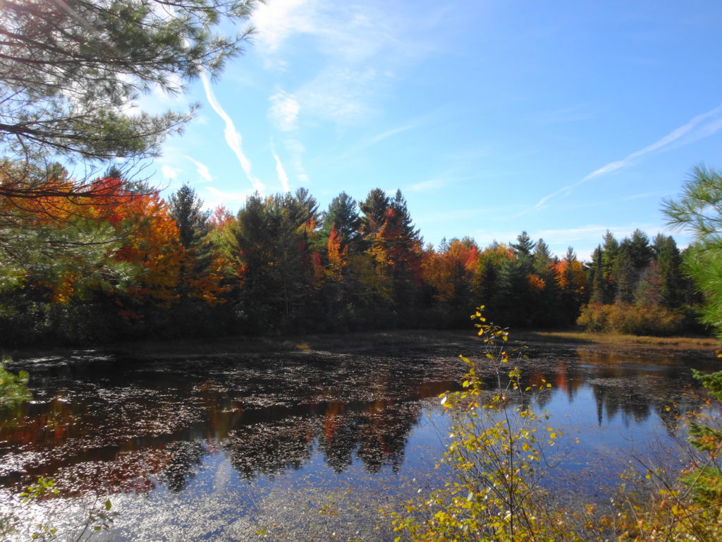
With a clear, blue sky, the autumn foliage at its peak, and rain forecast for the next few days, I decided to check out the work of the Friends of the Carp Hills on the Crazy Horse Trail. Parking my car at the trailhead on March Road, where it intersects Huntmar Drive, I tucked my pants into my socks (tick prevention) and strolled into the forest. The trees closed around me, and the sounds of traffic gradually faded.
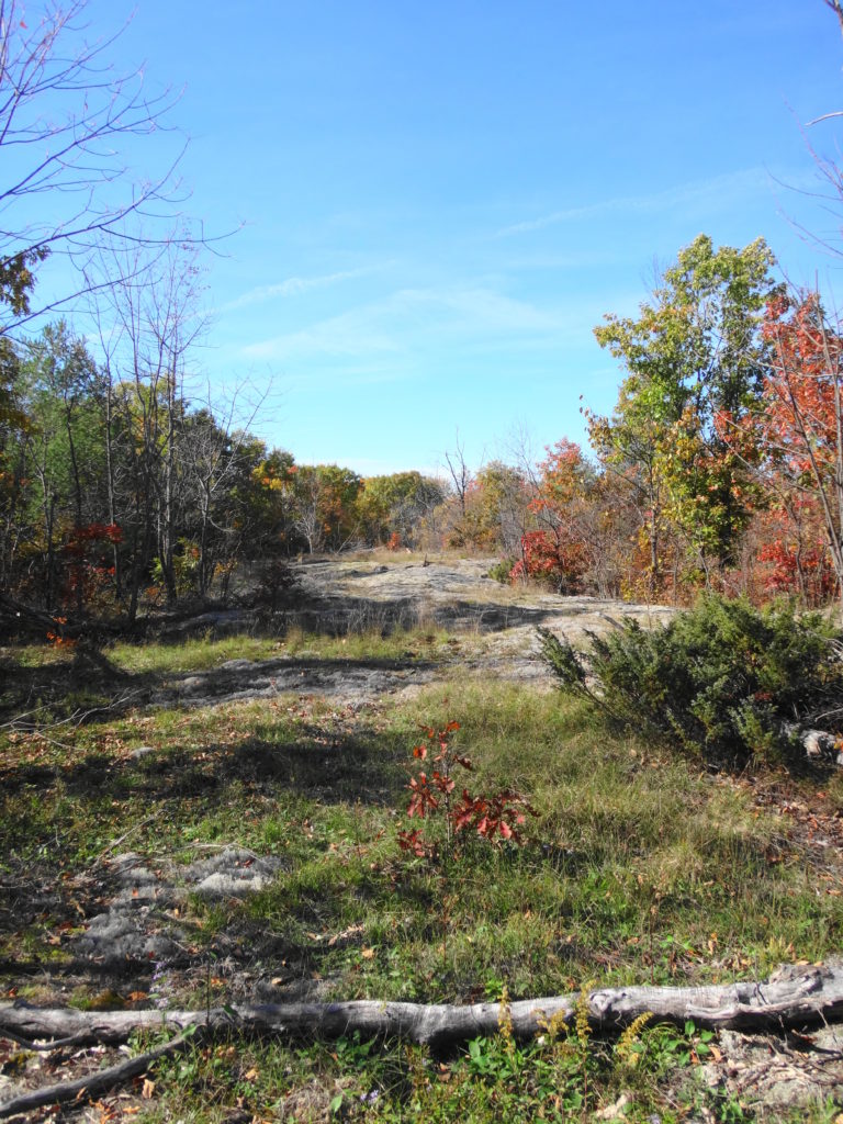
The Precambrian bedrock of the Carp Hills rises from the clay-covered limestone of Ottawa’s west end. Historically, the thin soils and rock barrens resisted settlement, leaving the hills as one of Ottawa’s most beautiful natural areas. The City of Ottawa already owns and protects large portions of the Hills. Other landowners have protected additional areas through voluntary conservation easements. At the heart of these efforts, the Friends of the Carp Hills have committed themselves to seeing the area preserved for the enjoyment of current and future generations.
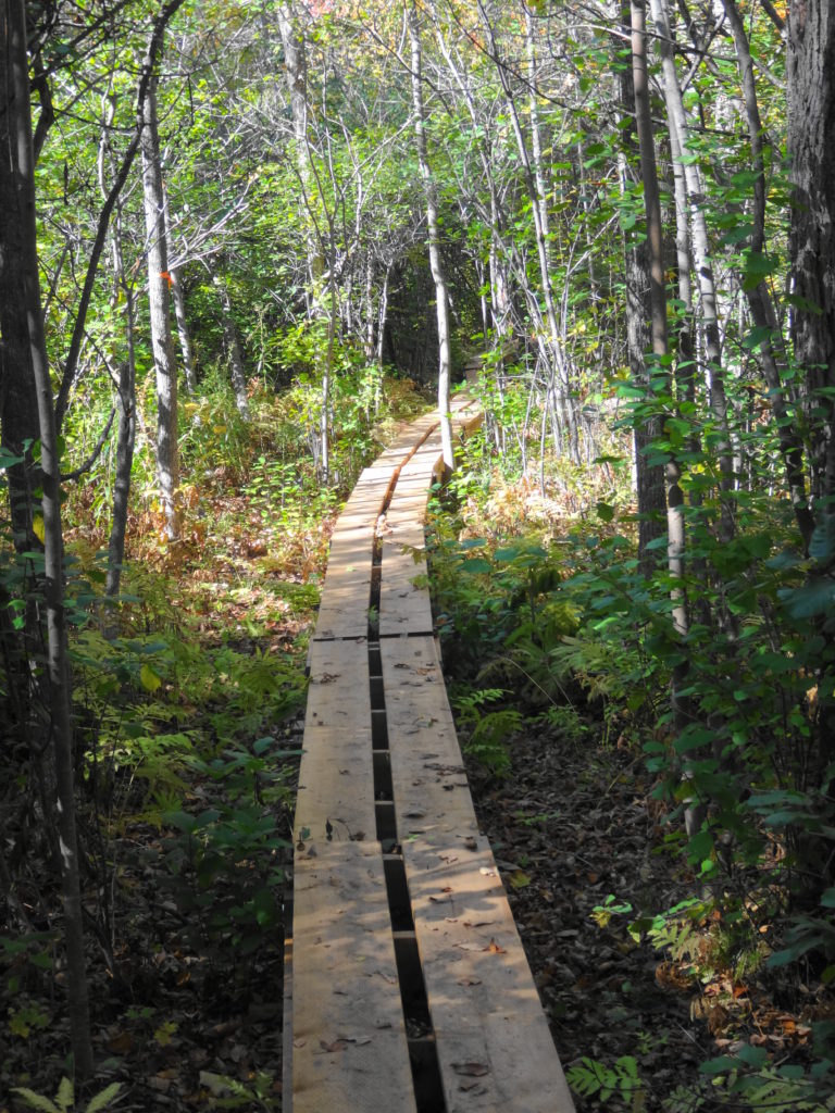
Crazy Horse Trail Boardwalk
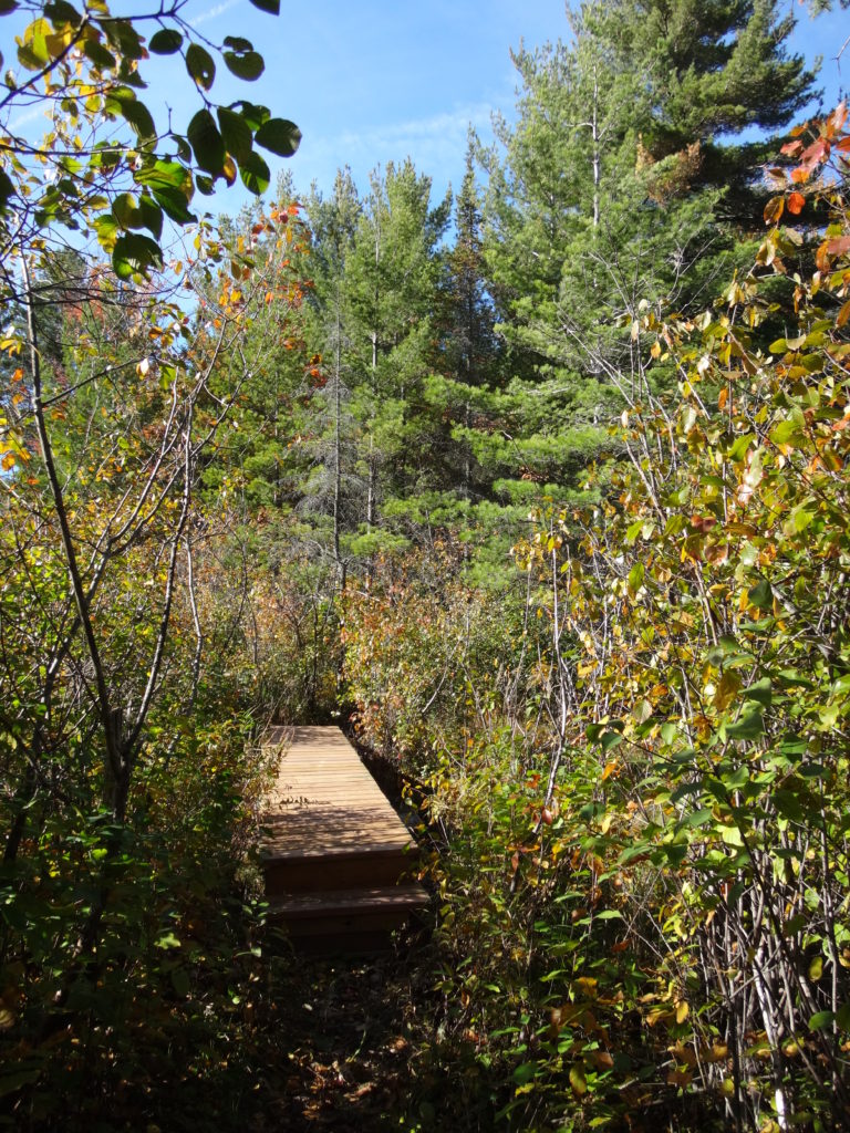
Under the guidance of their Trail Foreman, Bernard, the Friends of the Carp Hills have created an 8 km long hiking trail on City-owned property. Much of the trail follows an informal network of cross-country ski trails. With the help of City staff from the Parks and Natural Systems branches, the Friends have blazed a route that visits shady forests, sunny glades, and luscious wetlands. While avoiding the most delicate and sensitive features, the trail winds past maples and pines, crosses beaver dams, and curls around boulders. Short spur trails lead to lookouts over wetlands and lichen-encrusted rock barrens. Where a short bridge spans a narrow watercourse, a rich fen lies to one side, gorgeously clad with sedges and other wetland plants. Markers guide hikers along the way, and the Friends provide a map on their website.
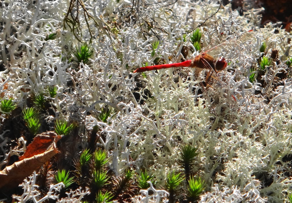
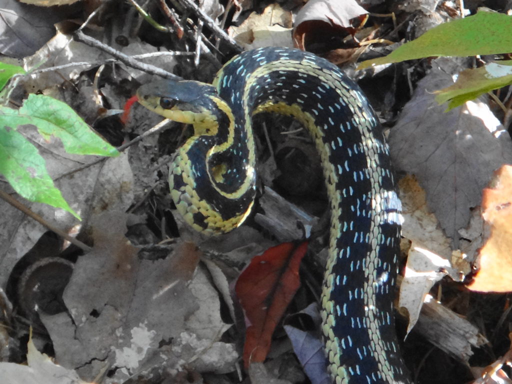
On this day, the woods seem quiet. Here and there a downy woodpecker taps on a tree, a blue jay rustles in the underbrush, and small, foraging flocks of chickadees and tardy kinglets pass through the forest. A few scarlet, autumn meadowhawks dart here and there over the barrens. A red squirrel scurries across the trail, carrying a mushroom almost as large as itself. A garter snake curls up in mock aggression as I pass. A small flock of geese honk on the Big Pond. Mostly, though, I wander alone along the trail, simply enjoying the beauty of the day.
The largest living thing on earth lies within the floor of a forest in Oregon. A honey mushroom, Armillaria solidipes, it has spread over thousands of years through the soil and litter to parasitize the roots of trees over a four square mile area. Tests have showed that the entire mycelial network consists of a single, fungal colony — a single, almost immortal organism.
And it’s edible.
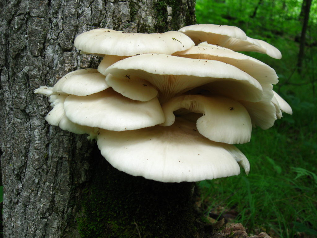
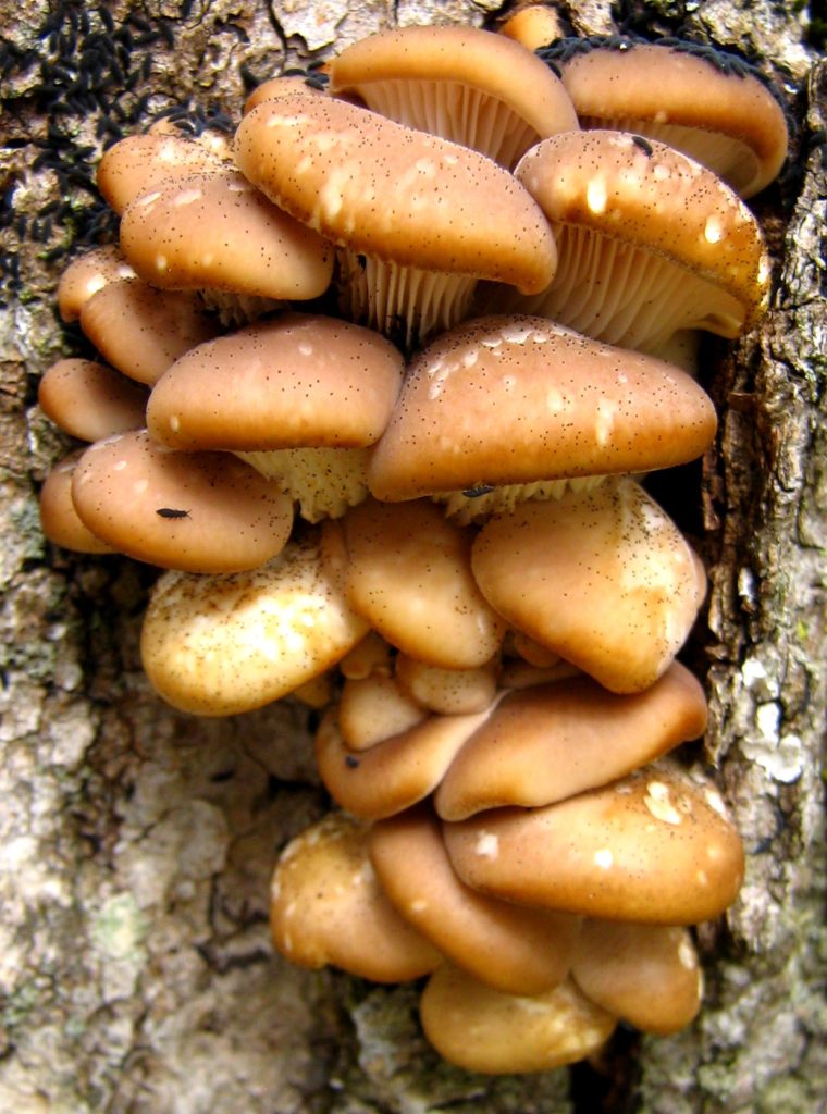
Oyster Mushrooms
I sometimes think about bringing brown paper bags with me into the forest. Unfortunately, that thought usually comes when I’m standing before a feast of oyster mushrooms sprouting from a log or tree, with no way to carry them home. By the time that I return, the slugs will have found them. Generally, however, I have little interest in picking mushrooms. My reluctance comes, in large part, from my lack of confidence in distinguishing edible mushrooms from the many inedible or poisonous species that grow side-by-side with them. It also comes from my appreciation of the beauty of mushrooms and the fascinating, critical role that they have played in life on Earth.
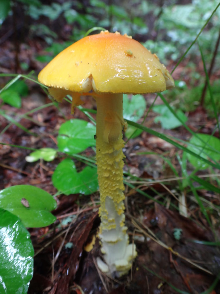
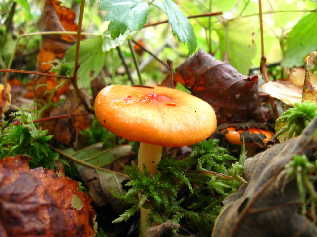
A beautiful but deadly Amanita frostiana, Frost’s Amanita.
By some estimates, almost 90% of the Earth’s plants form a symbiotic relationship with soil fungi. These mycorrhizae colonize plant roots, feeding on the sugars produced by the plants. In return, the fine mycelial threads of the fungi penetrate into soil pores and other spaces where plant roots cannot reach, giving the plants greater access to water and nutrients. They break down leaf litter and other detritus, improving the efficiency of nutrient cycling. They may even use organic acids and enzymes to dissolve rock, releasing phosphorous that would otherwise be unavailable to the plants. Not just individual species or plant families, but entire ecosystems like the northern boreal forest depend upon mycorrhizal fungi for their existence.
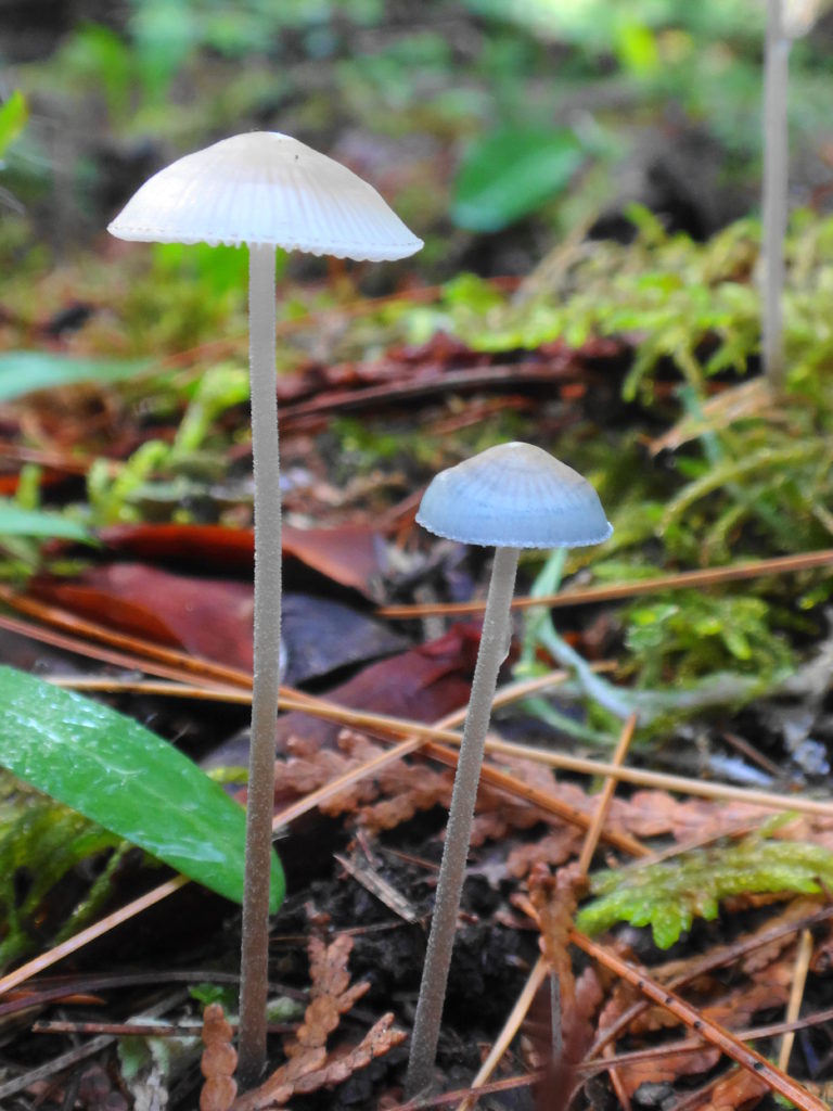
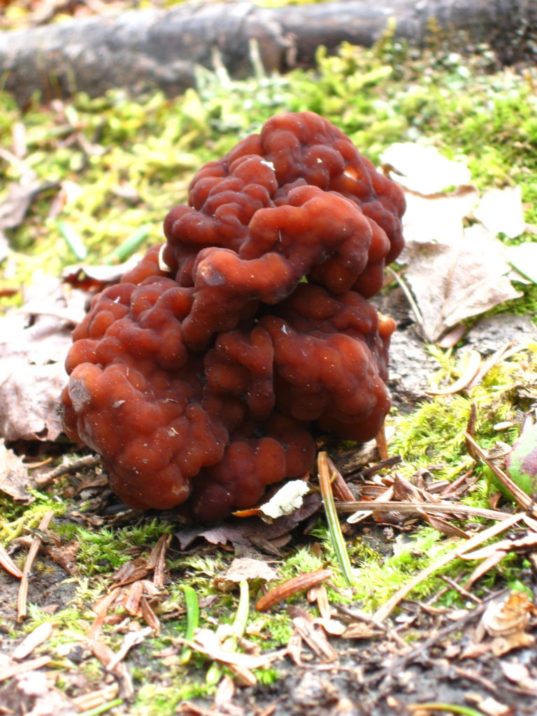
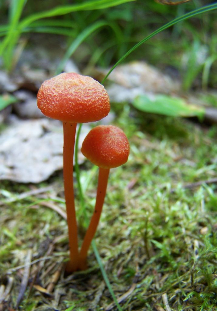
Hydrocybe acutoconica, Waxcap
Genetic studies suggest that the relationship between fungi and plants goes back to the very first colonization of dry land by plants. DNA analyses show that mycorrhizal fungi diverged from a group of parasitic aquatic fungi called “chytrids” approximately 700 million years ago — just about the time that the first land plants appear in the geological record. It seems very likely that these mycorrhizae not only accompanied plants on to the land, but that they actually made colonization of land possible through their superior ability to scavenge for water and nutrients in the barren landscape.
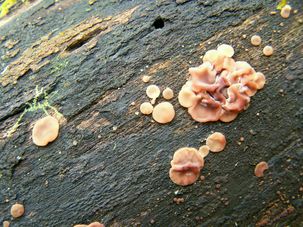
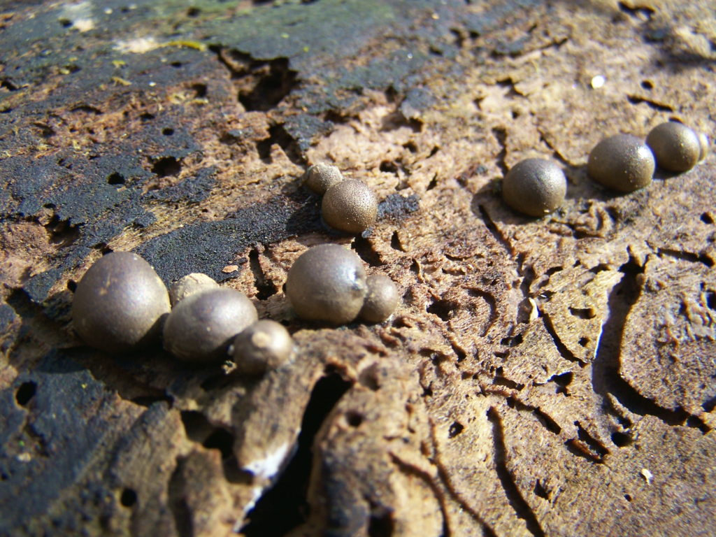
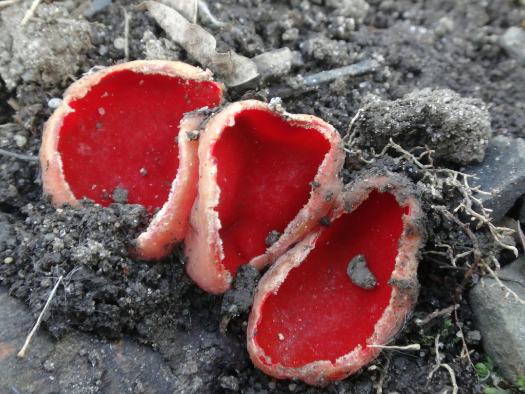
Ascocoryne cylichnium, a Sac or Cup FungusLasiosphaeria spermoides, a Sac or Cup FungusSarcoscypha austriaca, Scarlet Cups
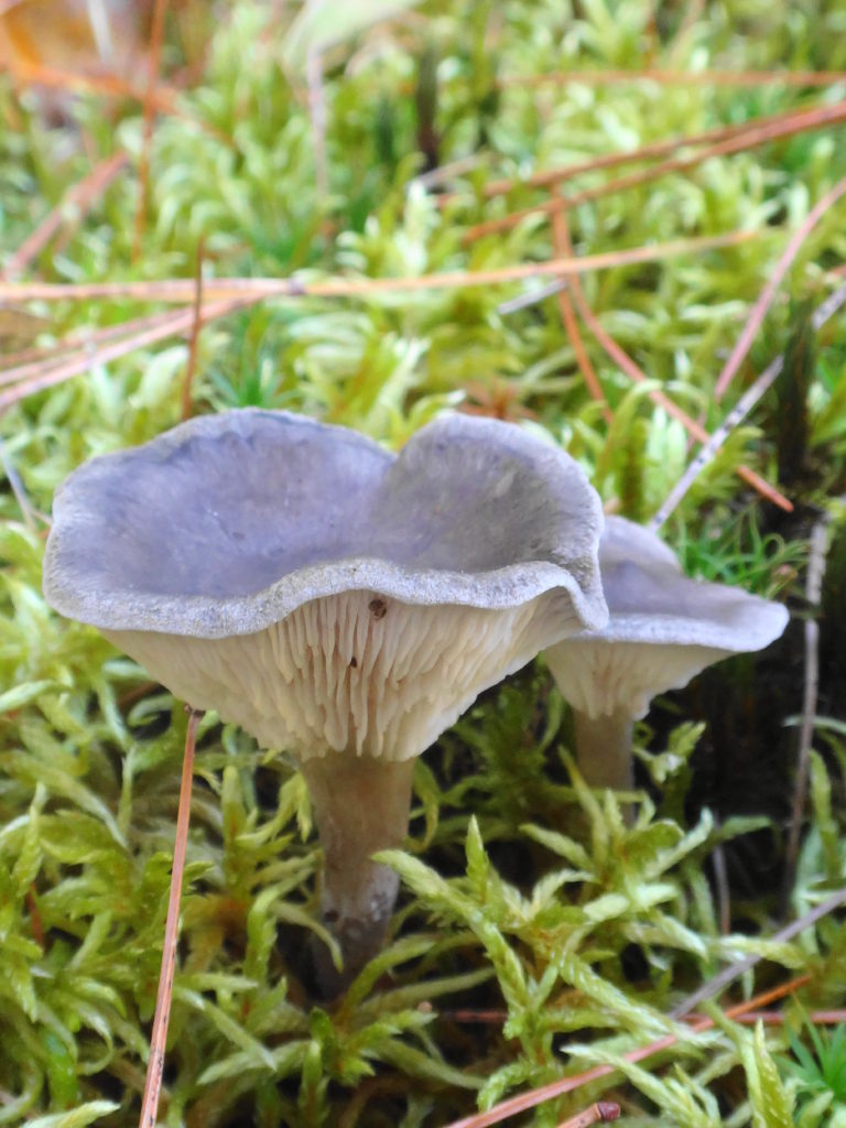
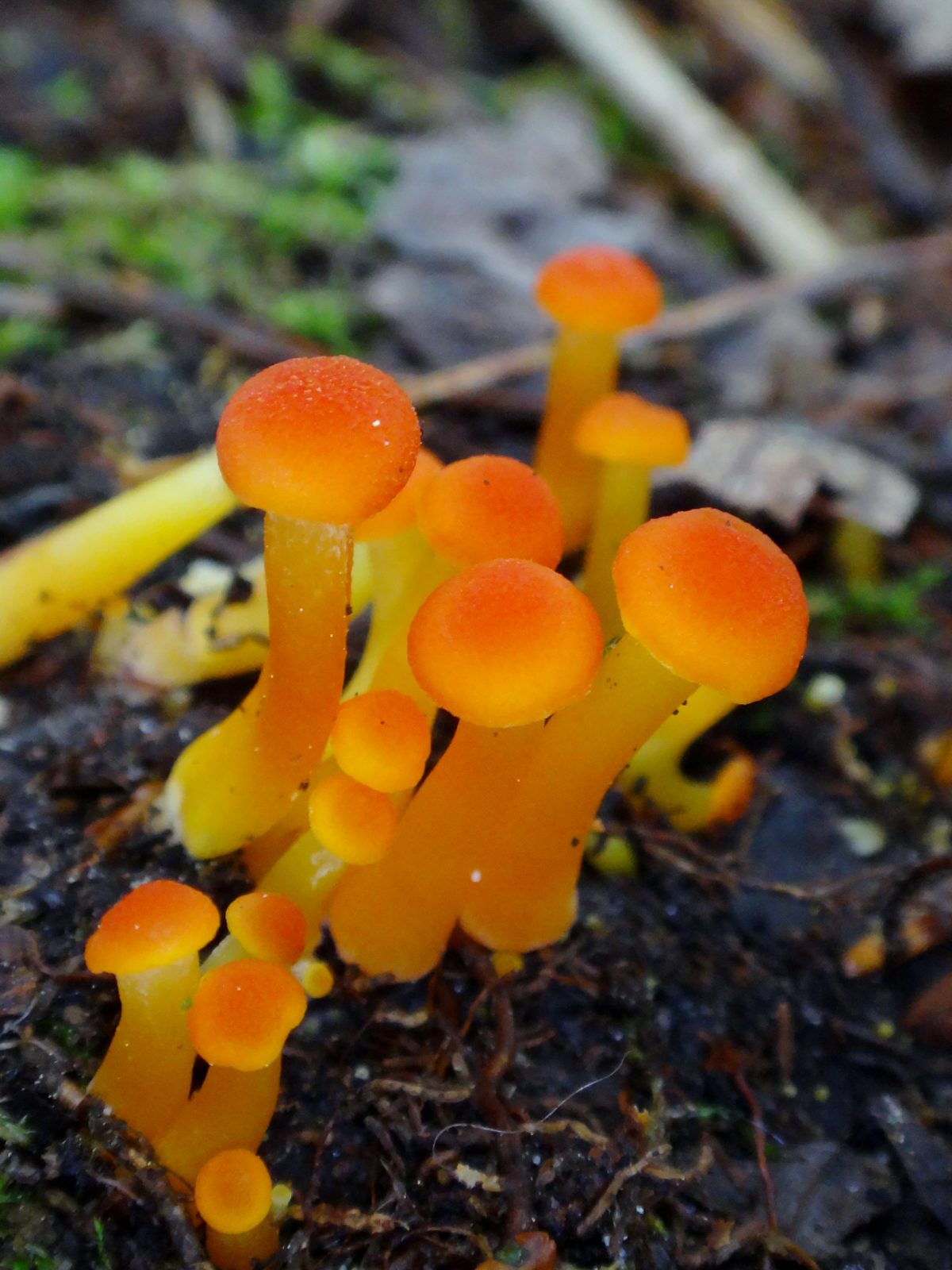
As a photographic subject, mushrooms seem sadly underappreciated. In the dog days of summer, when the spring chorus of birds has faded and the other forest animals hide from sight with their young, when the trees cast the forest floor in shade and the trilliums have withered and dropped, many of the most colourful mushrooms begin their slow eruption from the humus. Purest white, brilliant yellow, earthy browns and tans, luminescent orange, pale translucent blue… they turn dried leaves, moss and twigs into minature landscapes. One appreciates them most from close up, lying carefully amidst the ferns, tree seedlings, and forest litter: the different varieties and substrates, the forms and textures, the subtle details of cap and stem when viewed from the side or below. Other features of the forest floor also come into focus. Slugs enjoying a meal, tendrils of moss, skeletal scaffolds of decaying leaves. The first coral fungus that I ever examined held a red spotted salamander hidden amidst its spires. Sadly, on that day, I didn’t have a camera with me.
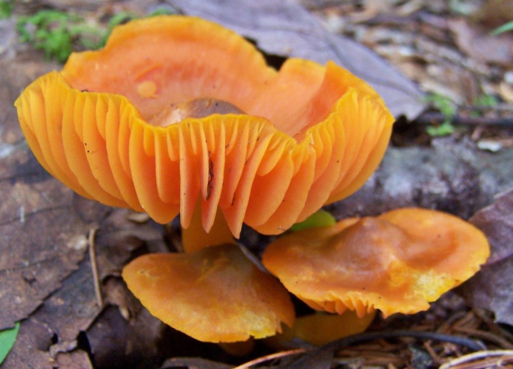
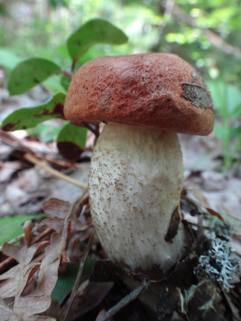
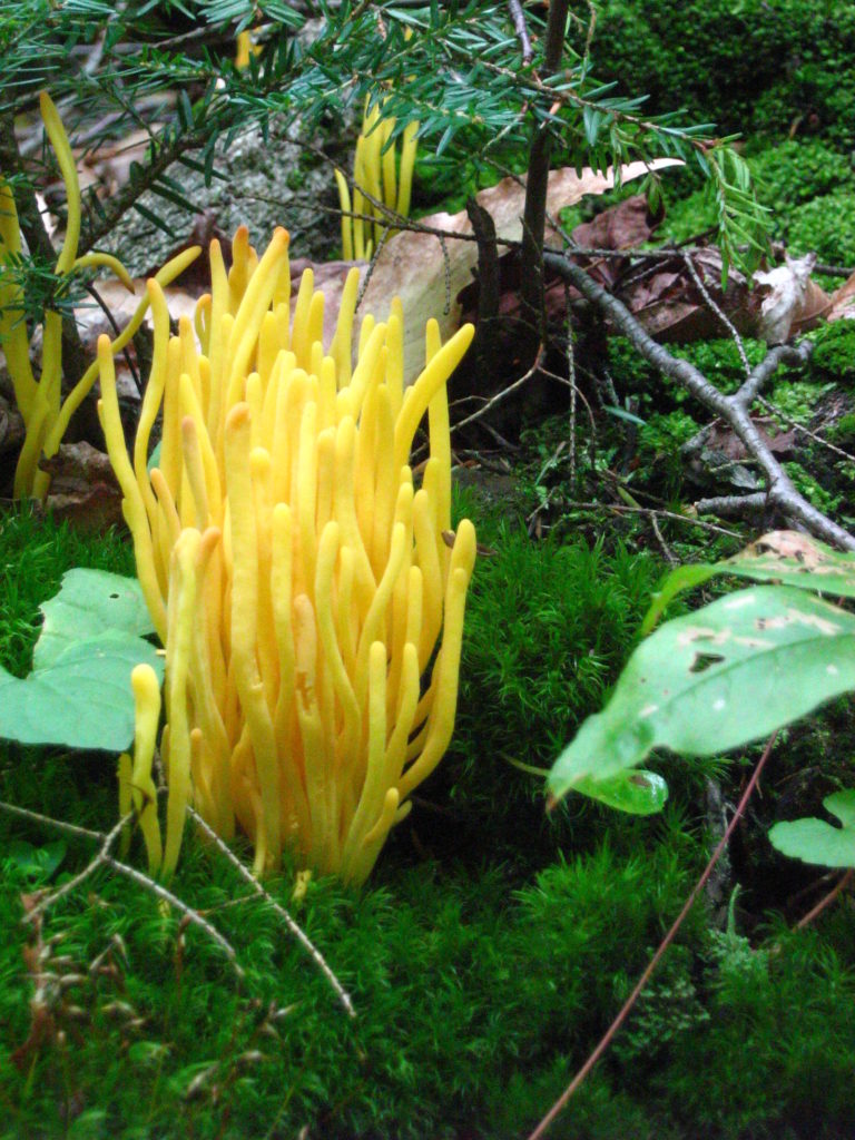
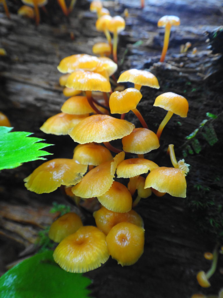
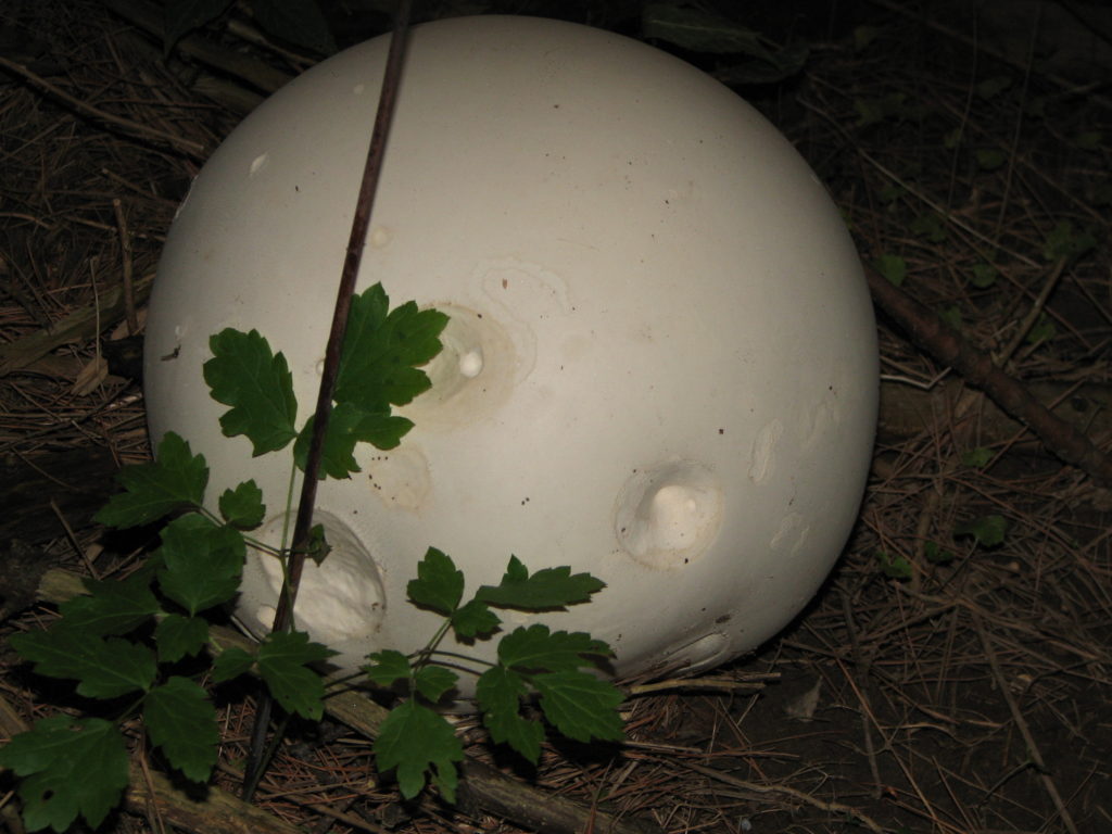
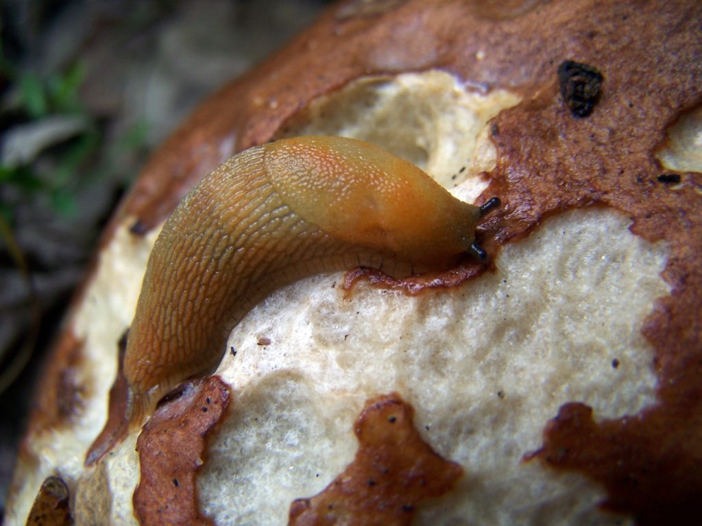
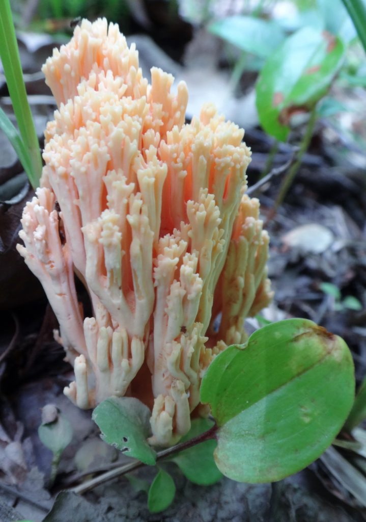
Leccinum aurantiacum, Orange BoleteClaculinopsis fusiformis, Spindle-shaped CoralXeromphalina campanellaCalvatia gigantea, Giant PuffballSlug Feeding on an Orange BoleteMycena subcaerulea
Every woodlot will have its share of mushrooms. My favourite places to search for them are the Four Seasons Forest Preserve in Deep River, where I spend two weeks each summer with my family, and Gatineau Park, where I often cycle and hike on weekends. Both areas offer a wide range of habitats, from dry pine and oak forests, through cool coves of maple and beech, to dank cedar swamps and wetlands. Please refrain from collecting mushrooms on protected lands and conservation areas: thousands of hectares of crown land lie available for collecting. And please refrain from collecting altogether unless you can confidently identify the edible varieties. Most mushroom guide books will list four or five unmistakable, “safe” species, such as oyster mushroom or black and yellow morels. Outside of those species, the chance of accidental poisoning or adverse effects increases dramatically for non-experts. Picking mushrooms for their hallucinogenic properties is especially risky, not just because the hallucinogenic species are almost indistinguishable from more poisonous species, but also because the reaction to such mushrooms can vary greatly between individuals. It simply isn’t worth the risk.
Omphalotus olearius, Jack O’Lantern. Deadly poisonous.
Do, however, get down on your stomach to admire and photograph mushrooms. And while you are there, in contact with the living forest floor, think about how the life in the forest is linked and interwoven. How the trees around you are connected by the hidden network below you; how the living and the dead are connected in the circle of life, and how the miracle of evolution has produced the wonder of it all.
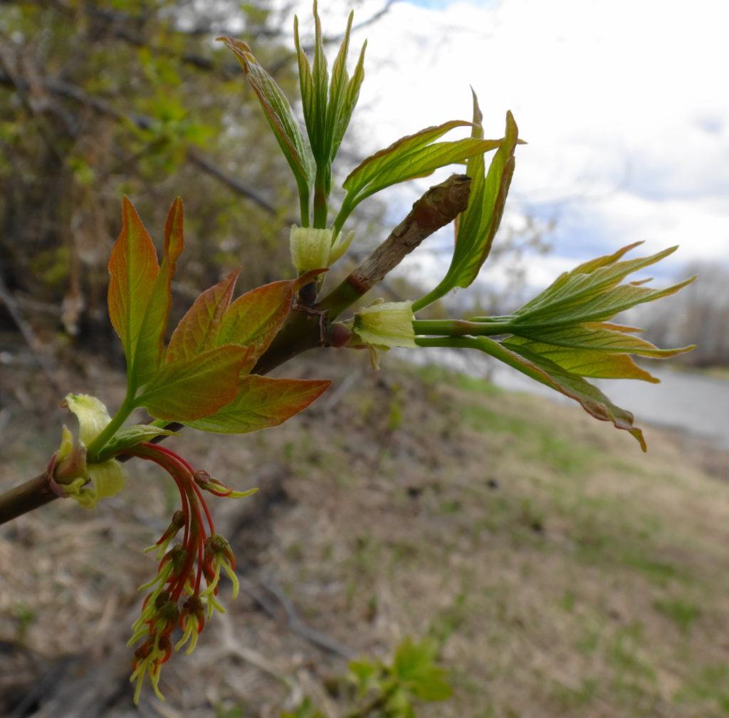
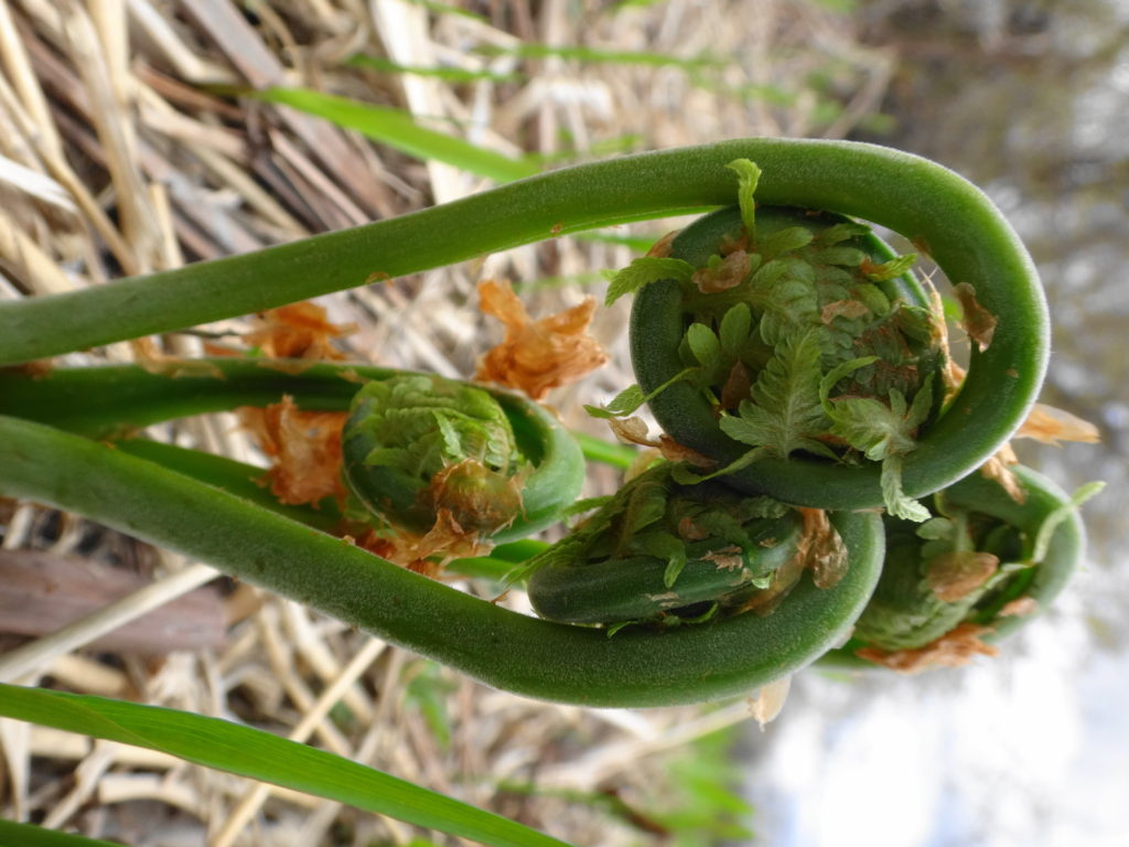
Sometime around the second week of May, a magical event happens in Ottawa: the buds begin to burst on the trees. For weeks, they have swollen with the lengthening days, drawing sustenance from their roots and the moist, spring earth. Some smaller trees and shrubs have already sprouted leaves, and some canopy trees will wait a while longer. But the vanguard of the northern hardwood forest — the maples, beeches, birches, ash, basswoods, oaks — erupt with new leaves. As they unfold, the grey forest turns a delicate, pale green. Still translucent, the young leaves glow in the morning sunlight, each like a little flower. The forest has a momentary gaiety, like a young girl twirling in her first dress.
Spring foliagePink Lake Shoreline
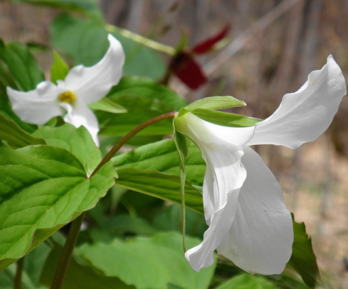
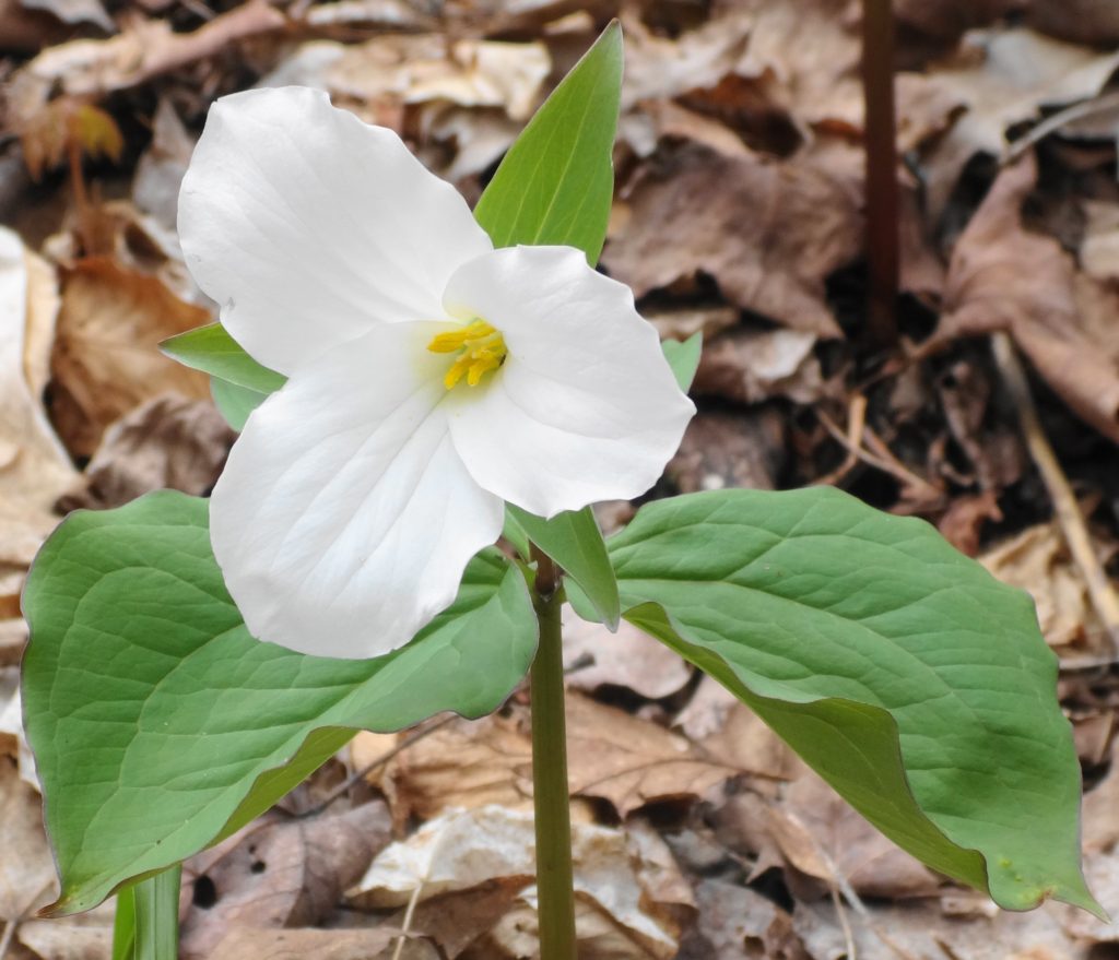
For several years, I have taken vacation during the second week of May. Sometimes I go camping. Sometimes I stay in town. Either way, I spend my free days indulging in the exuberant rebirth that spring brings. The migratory songbirds arrive: warblers, vireos, thrushes, flycatchers, swallows, sparrows. They flit through the tree-tops and scurry in the underbrush, still easily visible in the young foliage. Their early-morning chorus begins before dawn and ends only with the heat of midday. Spring wildflowers speckle the forest slopes: pointillist dreams of white trilliums; lilies, violets and dutchman’s britches; honeysuckle and elder. A few spring peepers still call, along with the croak of leopard frogs and the trill of american toads. Reptiles emerge into the sun, still half torpid from winter. Turtles bask on logs, more reluctant to re-enter the cold water than later in the summer. Snakes sun themselves on warm, grey rocks or under old boards. Even fish seek the shallows to warm themselves in the welcome rays.
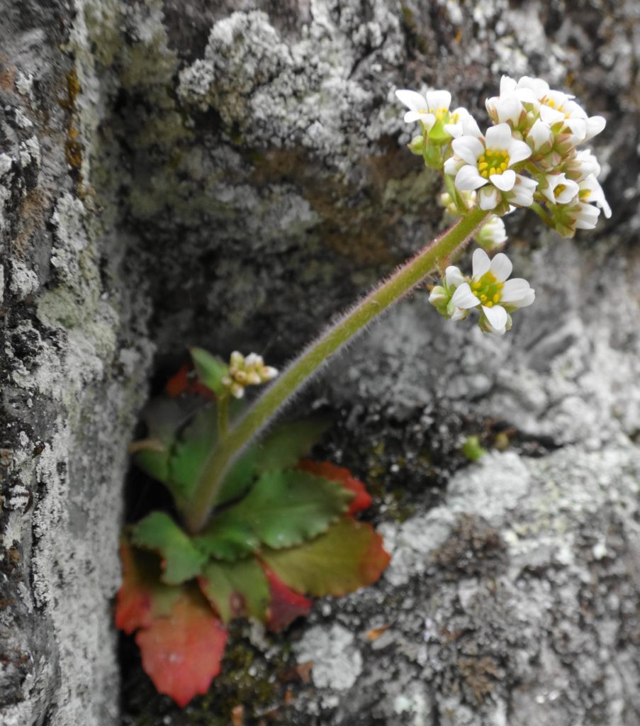
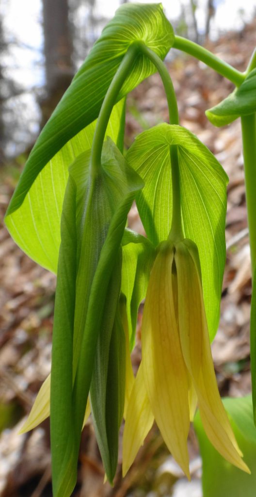
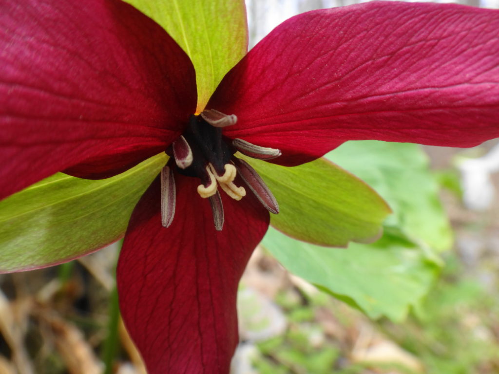
White Trillium at Pink LakeEarly Saxifrage at Pink LakeLarge Flowered Bellwort at Pink LakeRed Trillium
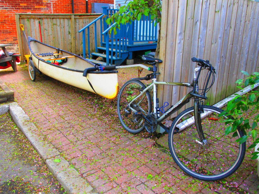
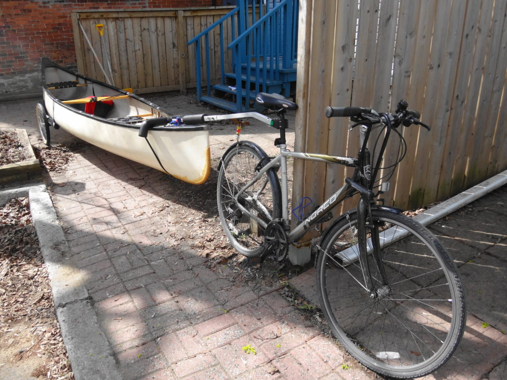
I’ve spent this past week exploring some old and new haunts by bicycle and canoe: the Rideau River, Pink Lake, Baie McLaurin, Shirley’s Bay, Poole Creek. I’ve ridden about 250 km, sometimes with canoe in tow behind my bike. I recently purchased a canoe trailer for my bike from Wike, mainly to eliminate the need to book a VrtuCar (a local car-sharing business) any time that I wanted to go canoeing. Already, the combination of my two favourite activities has given me incredible satisfaction… as well as some intense exercise.
Canoe Trailer by WikeCanoeing at Shirley’s BaySilver Maple Swamp at Shirley’s BayLongnose Gar at Shirley’s BayRideau River MorningGreat Blue HeronSleepy Snapping Turtle on the Rideau RiverMap Turtle on the Rideau RiverOstrich Fern on the Rideau River
I look forward to my summer vacation — those full, glorious two weeks in late June and early July. I can feel the warmth, see the dragonflies dancing over the ponds, feel my fly rod in my hands. The time will pass slower and more restfully. But the days won’t bring the same sense of excitement and wonder as my May sabbatical, when all the world’s anew.
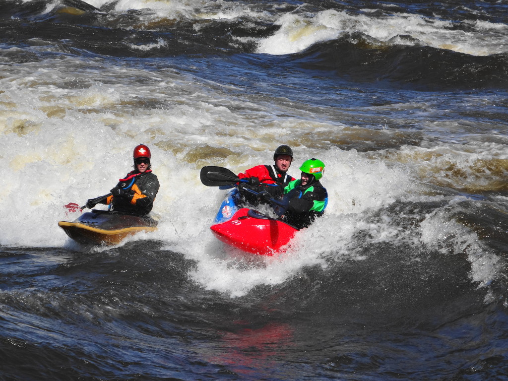
I sometimes wonder if I could still learn to paddle whitewater. Then I remember how much my knees complain simply climbing into my open canoe. Could I really fit myself into a whitewater canoe or kayak? Could I get out? Nonetheless, whenever I watch the paddlers on the waves at Bate Island, the hankering strikes again.
With temperatures climbing into the low teens, I’d set out to cycle along the Ottawa River, up Pinecrest Creek, back to the Experimental Farm and Arboretum, and then home along the Rideau Canal. I didn’t make it. Enough snow lingered along the pathway beside the river to convince me that Pinecrest Creek would be impassable except on a fat bike. Instead, seeing the cars parked at Bate Island, I decided to detour for a look at “The Wave”.
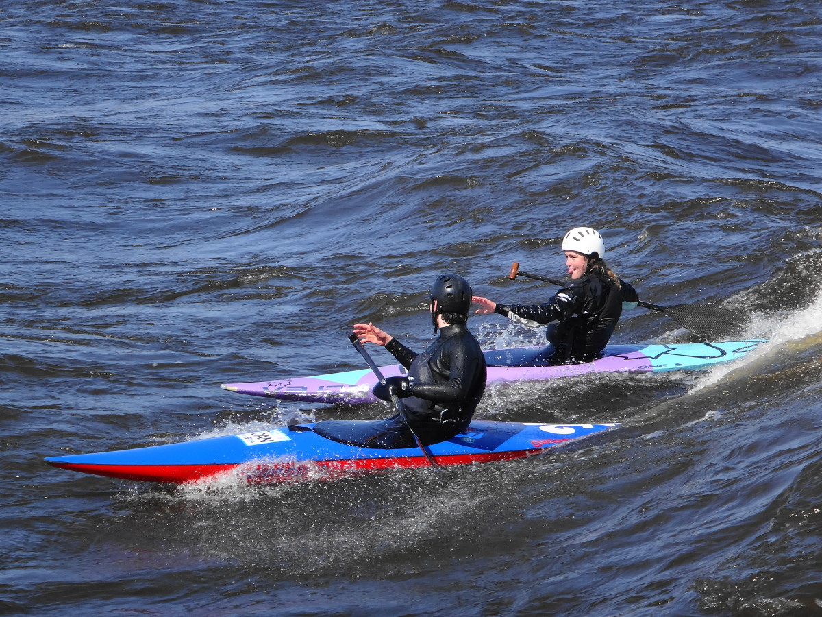
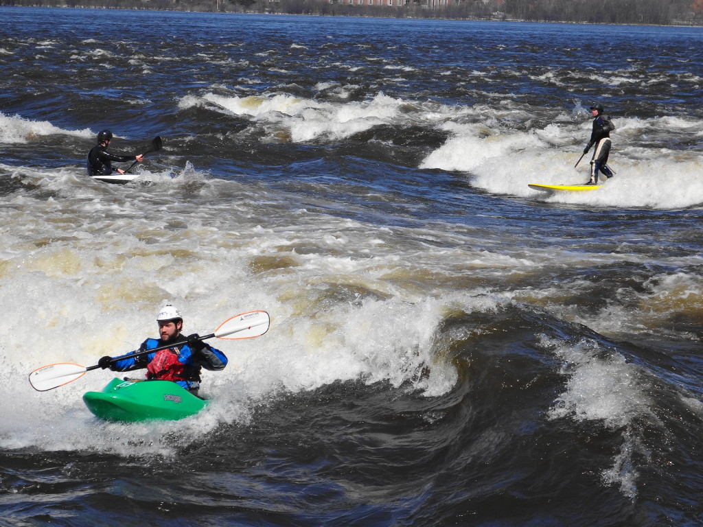
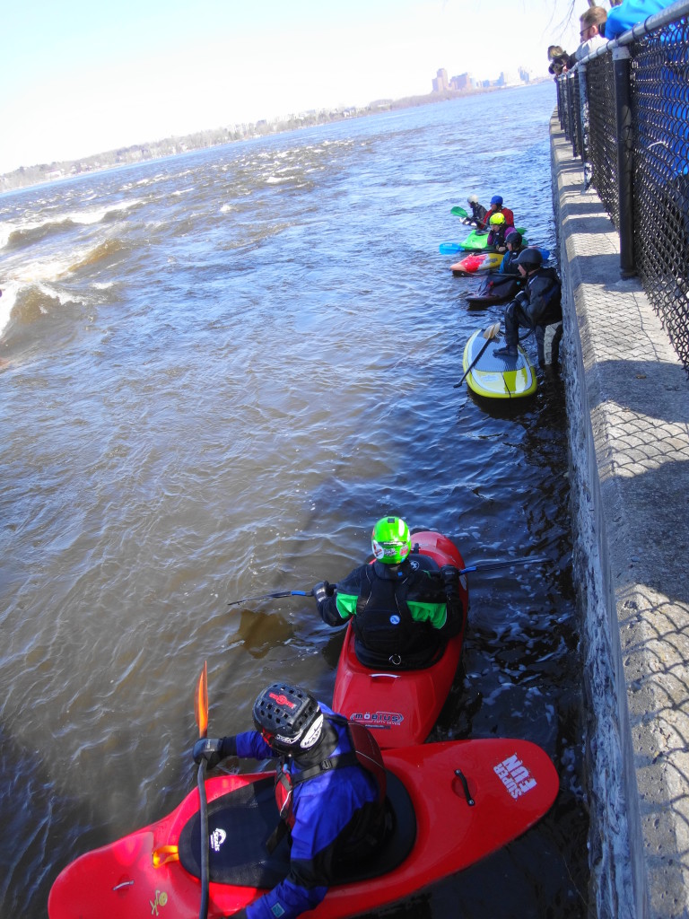
It lies just below the Champlain Bridge, on the west side of Bate Island: a standing wave, only a few metres offshore, curling perpetually in the swift current. Actually, in Spring conditions, several waves stand out from the shore. However, “The Wave”, as it is known, has just the right curl to cradle a paddler, while the adjacent boil provides the perfect conditions for tricks. Canoeists, kayakers, stand-up paddlers and surfers line up along the retaining wall to take turns lancing into the current. More experienced paddlers advise the novices on which line to take and how hard to paddle. Each paddler takes a couple of minutes carving the water, and then bails out for the next person to slide into place.
Action on The WaveLining up for “The Wave”
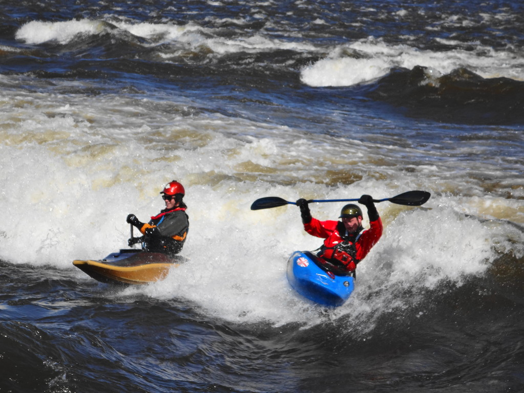
Sometimes several paddlers will launch together in a competition to see who can hold their place amid the bumping of the kayaks. The losers roll over the wave and bob away down the short chain of rapids into the lee of the island, while the winner celebrates with a few spins.
Competition Among FriendsThrowing in a Few Tricks
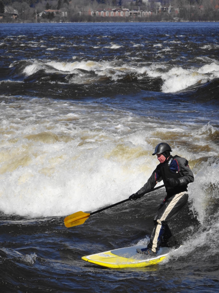
The stand-up paddleboarders impress me the most. Although they seem relatively tame in comparison to the kayakers, I admire their skill in manoeuvring their long boards through the whitewater, with only a paddle and the feel of the river through their feet to guide them.
Surfing “The Wave”
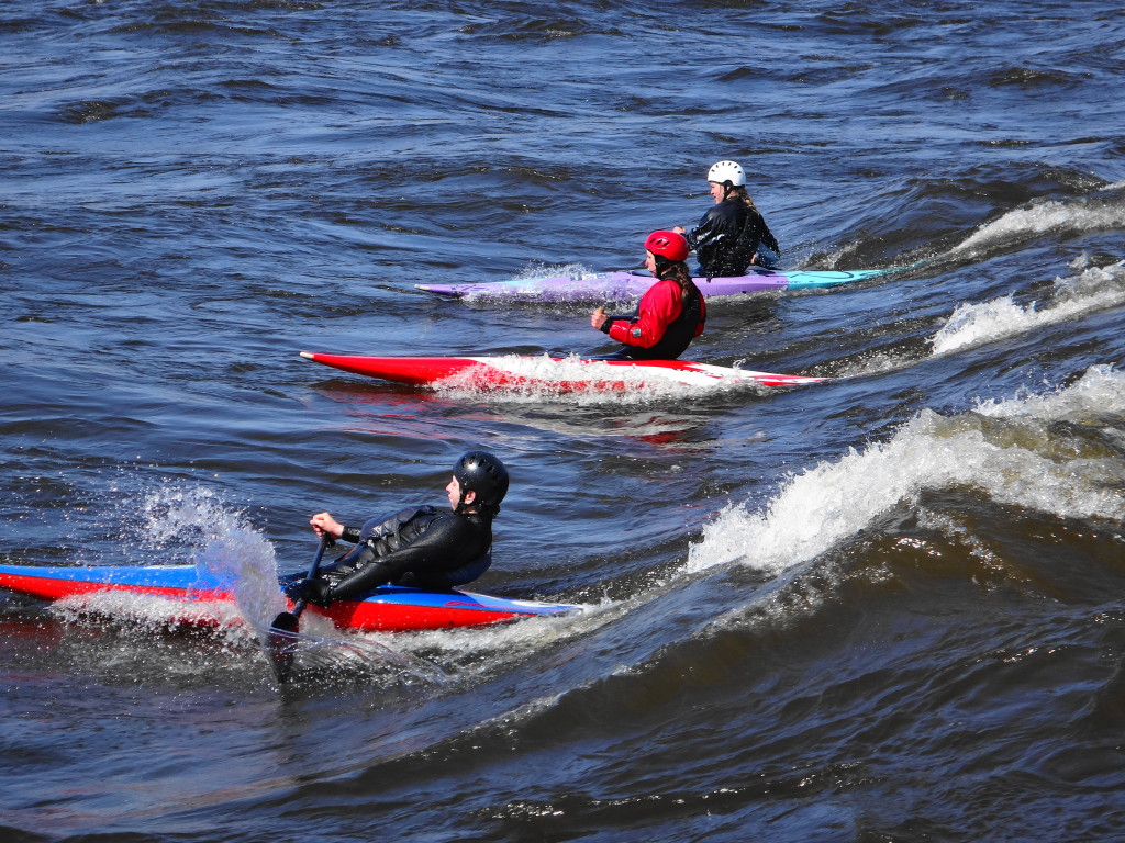
My heart, though, lies with the canoeists. Leaning into their single-bladed paddles, and rocketing their streamlined craft into the surf, they seem like the greyhounds of the waves. I love to watch the spray knifing from their hulls and blades as they hiss across the face of the wave. Perhaps one of these days, I’ll join them.
Whitewater Canoes at Bate Island
Bate Island can be accessed from the Champlain Bridge, heading west toward Quebec. Parking is abundant. Whitewater paddling is inherently risky, and the Ottawa River is cold, even in Summer. Never paddle alone, and always wear a wetsuit, flotation device and helmet.
Every ski in Gatineau Park seems to begin with a long hill. You snap into the bindings, slip your gloved hands through the poll straps, and push off. If you have started from one of the more exposed trailheads on a windy day, then the chilled air bites at your face. But only for moment. Within a few hundred metres you enter the woods, where the wind lifts into the treetops, leaving you climbing comfortably up the trail. You reach the top and slide into the tracks. As you recover from the first, short exertion, you settle into a rhythm and pace. The sun glints on snow crystals, or maybe you ski through a snowglobe fantasy of big, soft flakes. The kilometres flow away.
Fresh Snow
Admittedly, not every day of skiing in Gatineau Park meets this idyllic description. On the coldest days, one may struggle to find just the right balance of layers: enough to stay warm on the descents, without perspiring on the climbs. An early spring may turn trails icy. A heavy snowfall may bend the trees low over the narrower trails, until the groomers have had time to visit them all. Most of the time, though, the only hard choice is deciding at which cabin to eat lunch.
Most trails in the park are shared: one or two groomed tracks on the outside, with a broad skating track in the middle. The wide parkways offer easy skiing along gentle grades, with long views across lakes and wetlands. The winding, wooded trails offer a range of challenges, from beginner to advanced, with a few, particularly narrow trails reserved for classic skiers. I’m a classic skier. I learned that way, and my stiff, old body just doesn’t take well to skate skiing. I sometimes envy the speed and grace of the skaters, as they weave past me along the trail — especially the competitive skiers, which includes national team members. But I also feel that my slower pace connects me more closely to the landscape. I have time to notice the foraging flock of chickadees, nuthatches and downy woodpeckers flitting and chirping through the trees. I appreciate the fine sifting of snow down through the canopy, as the wind drags its fingers along the treetops.
Gatineau Park Scenery
I have two favourite routes. Trail 50 begins at Parking Lot 16, in the Meech Creek Valley, on the north side of the park and rolls through easy terrain for about 15 km to the campground at Lac Philippe (where you can find both winter camping and reserve winterized yurts). En route, you pass both the Healey and Herridge shelters — large cabins with indoor picnic tables and wood burning stoves. But I prefer to carry on another 7 km or so past Lac Philippe on Trails 55 and 54 to eat my lunch at the shelter overlooking Lusk Lake. Trail 54 to Lusk Lake features three long climbs. But the view across the lake justifies the effort, and the descent back down the trail is just difficult enough to provide a novice or intermediate skier with a thrill. Altogether, it’s a 45 km round trip on easy, well-groomed trails.
Lusk Lake
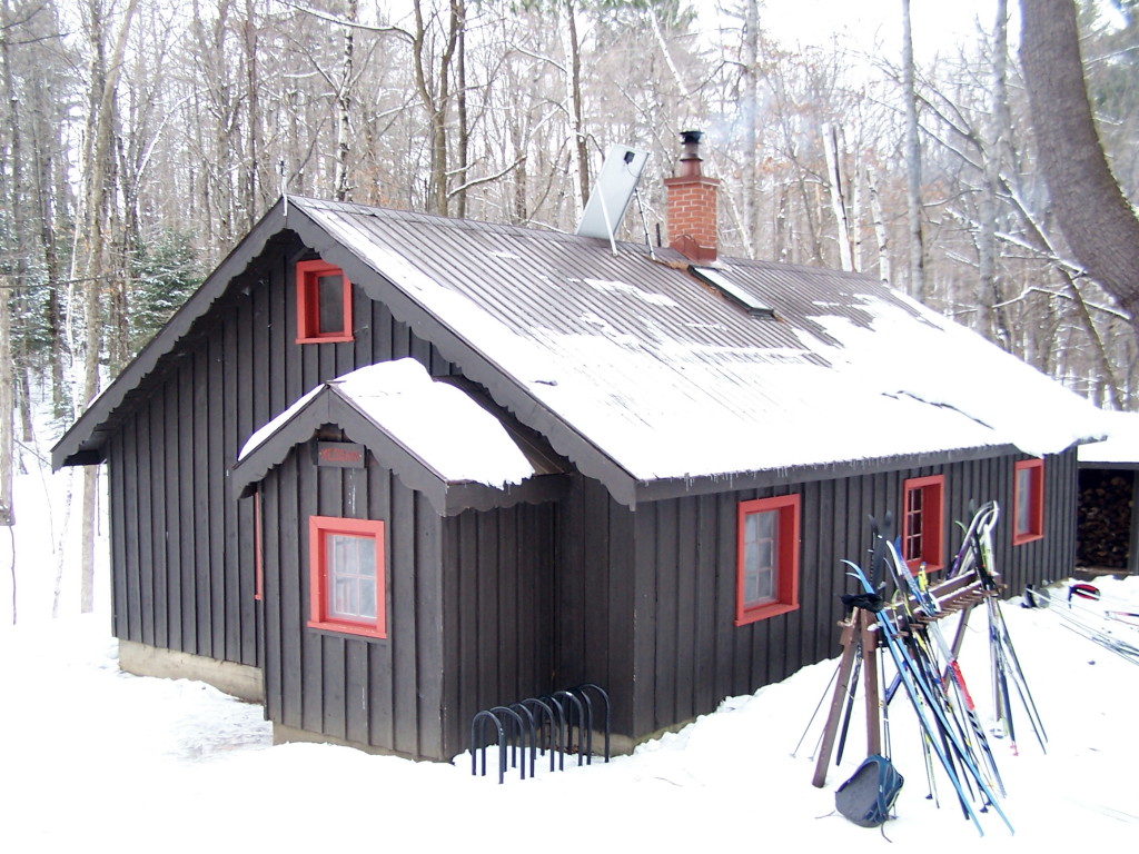
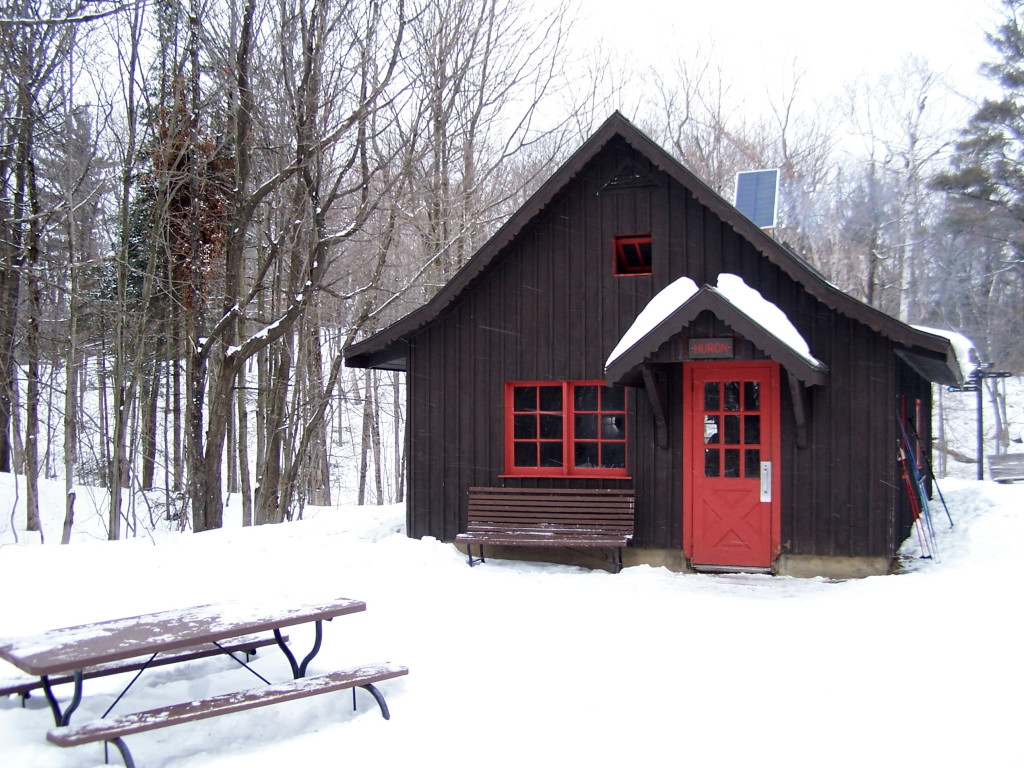
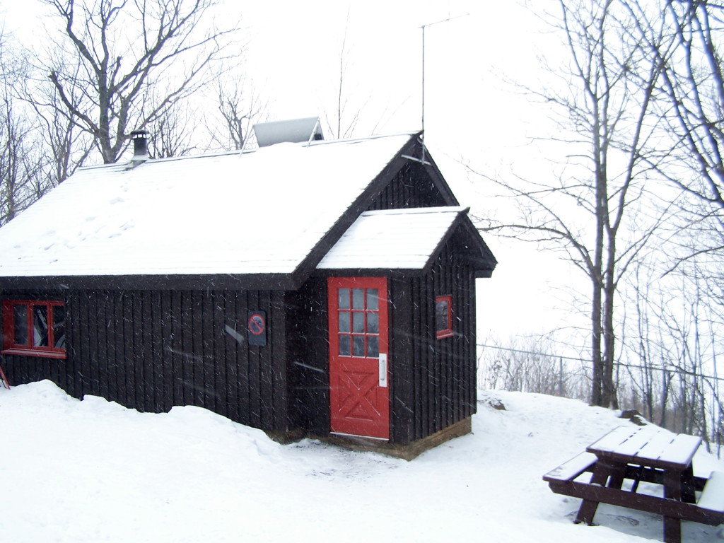
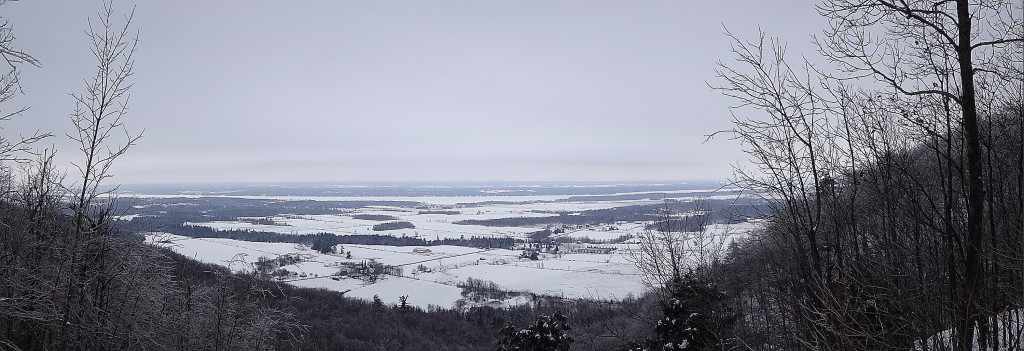
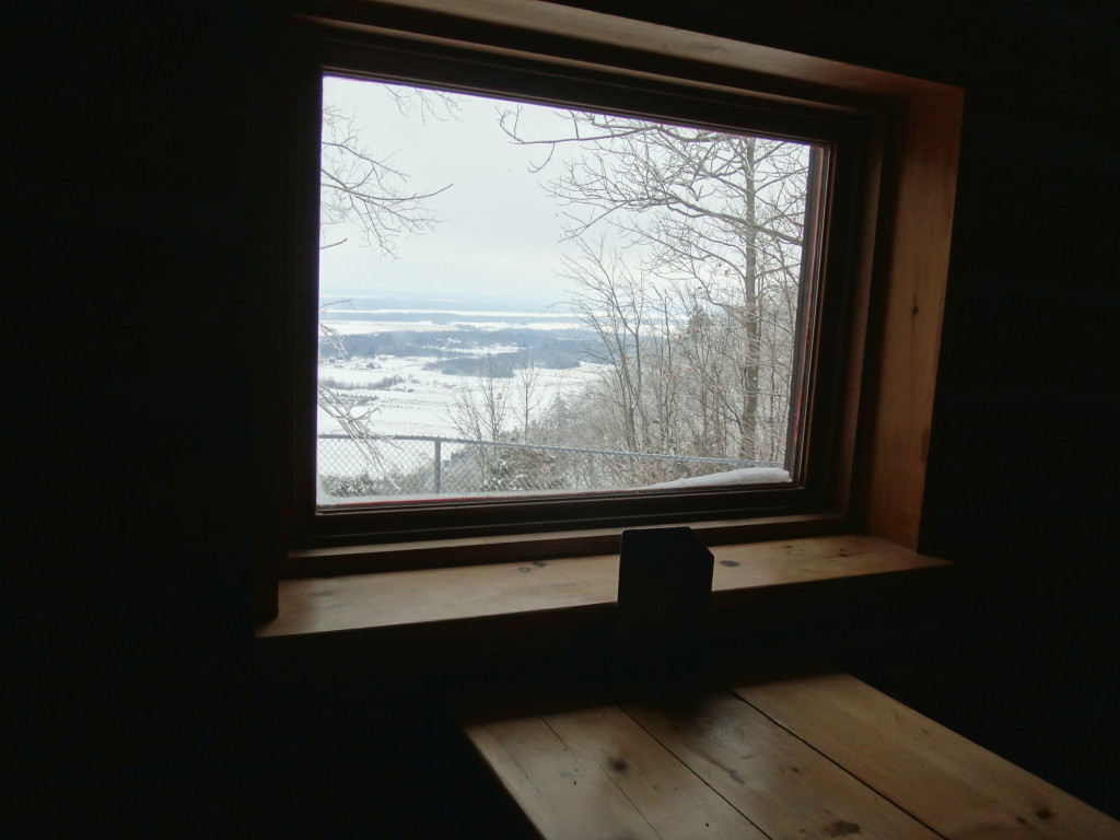
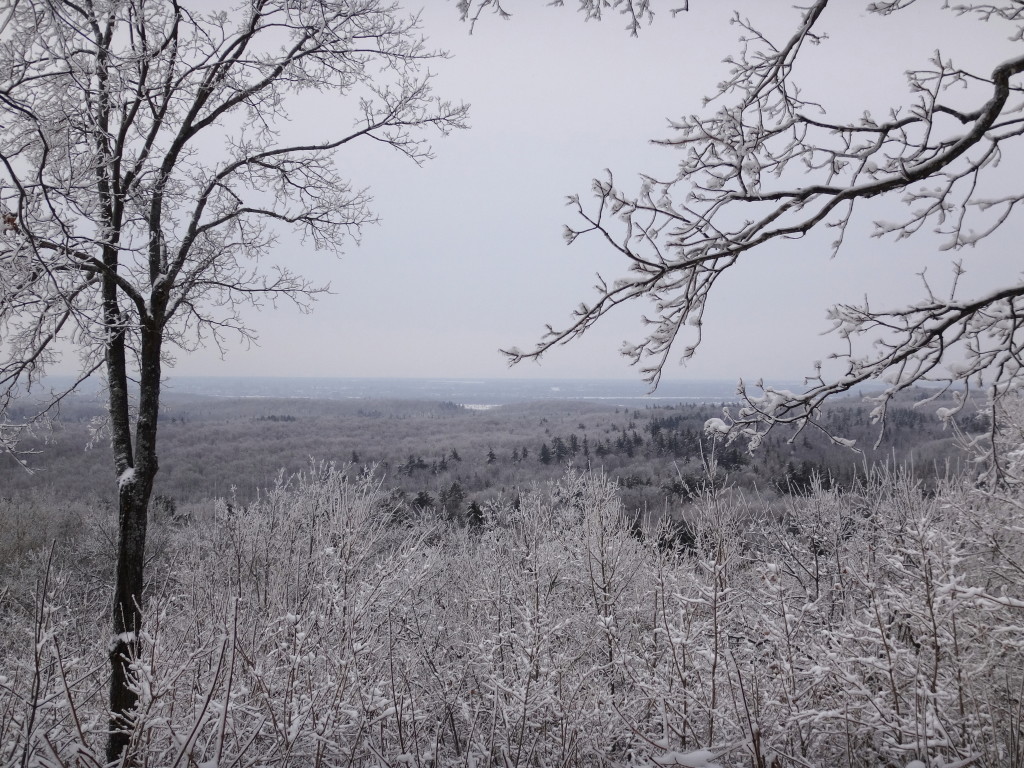
My other favourite route starts at the Kingsmere Parking Lot, Number 7, near MacKenzie King Estate. It begins with a steep, winding climb up Trail, Number 30, a blue trail, but then transitions to the Trans-Canada Trail, Trail 1. Trail 1 runs for more than 20 km through the southern edge of Gatineau Park, with frequent spurs and connections to other routes. Along the way, it visits four shelters, Keogan, Shilly Shally, Huron and, near the far end, McKinstry. Keogan and Huron may be the busiest shelters in the park, and Huron features a particularly active bird feeder. I normally carry on past Keogan and Huron to Trail 2, a relatively easy blue trail that ends at the Western Shelter, overlooking the Ottawa Valley. On a sunny, late-winter afternoon, one can sometimes sit comfortably on the outside bench beside the shelter, enjoying the view across to the Ottawa River and beyond. On colder days, the stove offers warmth and a place to toast a sandwich. It is a shorter ski, about 25 km round trip.
Keogan ShelterHuron ShelterWestern Shelter
Overlooking the Ottawa ValleyWood-burning StoveWindow Seat – Western Shelter
Gatineau Park lies only fifteen minutes north of Ottawa, across the Ottawa River in Quebec, along Highway 5. The exit for Old Chelsea is well-marked. Pass through Old Chelsea and take the turnoff for Chemin de Kingsmere to reach the Kingsmere Parking Lot and Trail 1. To reach the Meech Valley Parking Lot 16 and Trail 50, continue along Highway 5 past Old Chelsea for about 10 km, to the first turnoff for Highway 105. Turn left (west) on Highway 105 for less than 1 km, then turn left again on to Chemin Pine. A well-plowed, gravel road will carry you back under Highway 5 to Meech Creek Valley and Parking Lot 16.
Day passes for skiing can be purchased at all of the trailheads, based on the honour system. Cash is simply dropped into a locked box. Day passes and season passes, along with trail maps, can be purchased at the Gatineau Park Main Office, in the Village of Old Chelsea. The village also offers ski rentals and a great selection of restaurants. I’ve enjoyed L’Orêe Du Bois, which offers gourmet dining featuring a regional cuisine. The Old Chelsea Pub offers great food with wide selection of local and brand name beers. However, I usually stop at Luigi’s Pizza. Family-owned and run, it offers very little in the way of decor or amenities. But the Magici Mushroom pizza, with portabello, king and oyster mushrooms, drizzled with truffle oil and parmesan cheese, comes as close as one can get to culinary heaven after a long day of skiing.
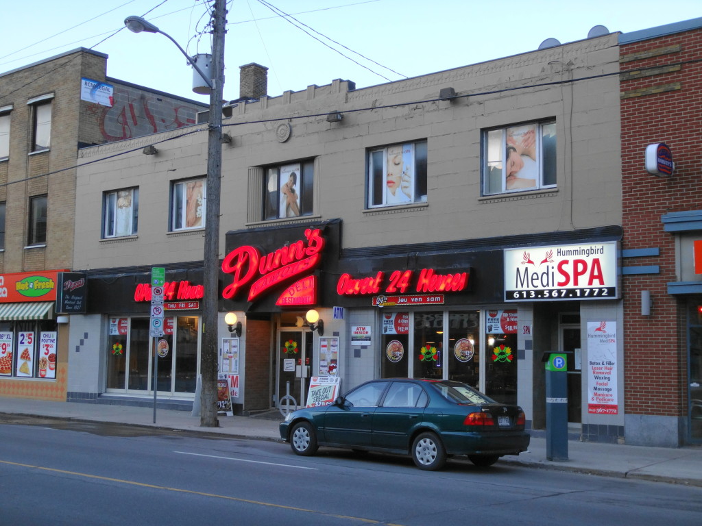
With a week of warmer weather behind us, I had a feeling that today would be good for the first expedition of the Spring. I rose at 5 AM, careful not to wake Sue, dressed quietly, packed my binoculars and camera, and pulled my bike from the basement. I then cycled over to Elgin Street and ate breakfast at Dunn’s. After breakfast, I carried my bike on to a 95 bus to Orleans, in the east end of the City.
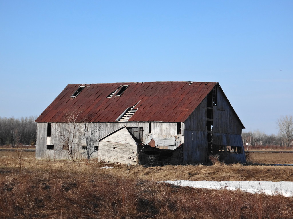
From the Place D’Orleans Shopping Centre, I headed south on Tenth Line Road. I passed out of the urban area, into the farm fields, where I stopped to admire two eastern phoebes flitting around a derelict barn. It looks like a good place for barn swallows. Dropping down into the lowlands around the Mer Bleue bog (a globally significant wetland), I almost immediately came across a beautiful northern harrier, which drifted away across a damp, grassy field.
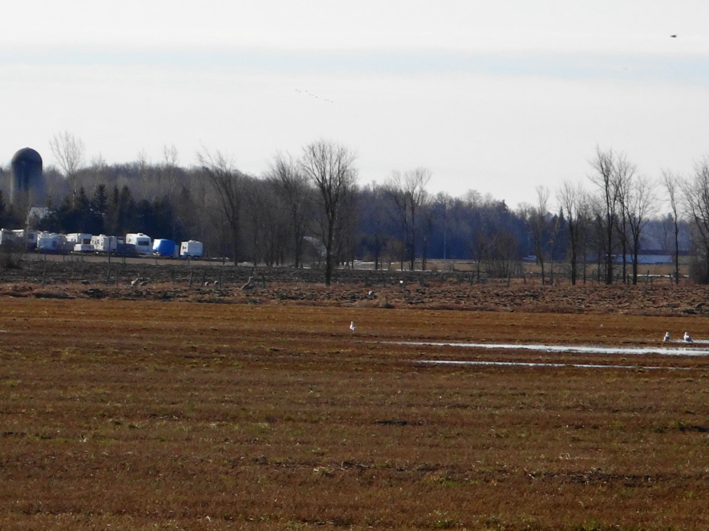
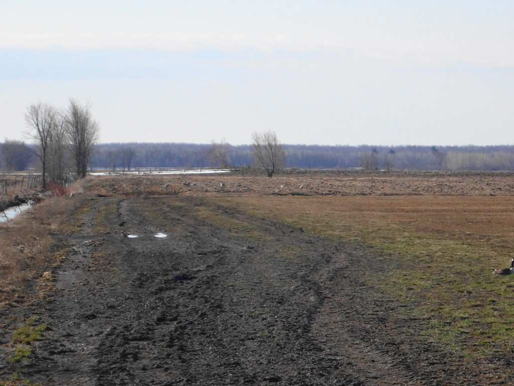
I turned on to Smith Road and climbed a low rise, getting my first glimpse of the fields and floodplain east of Mer Bleue. A flock of geese cackled in the pasture beside the road. In the scraggly hayfield behind them, a dozen sandhill cranes gleaned through the hummocks. Unfortunately, my camera is limited to optical 5x zoom and digital 10x zoom. But you can just make them out the photos.
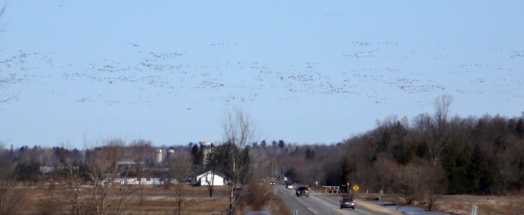
From Smith Road, I turned south on Milton toward Bearbrook. During most of the year, it meanders through a broad floodplain of corn and hayfields. In the spring, though, it spreads into a wide, shallow lake. Canada geese gather by the tens of thousands, fattening themselves on the leftover grain. They are joined by mallards, pintails and teal. Sometimes flocks of snow geese stray a bit west of their usual migration route to them. Today, though, I saw only geese and pintail. But I was fortunate to see the arrival of the largest flock of geese that I’ve seen in many years: perhaps five thousand, straggling in from the southeast, probably from the Ottawa River.
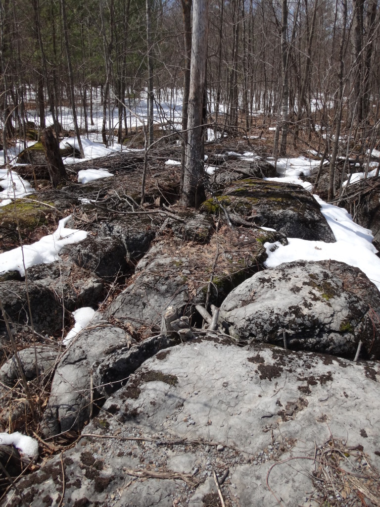
From Bearbrook, I headed a little east and then north into the Cardinal Creek area. I cruised the roads for several hours, exploring some of the places that I’d featured in a recent planning study (the Greater Cardinal Creek Subwatershed Study): woodlots, karst pavements, the Proulx sugarbush.
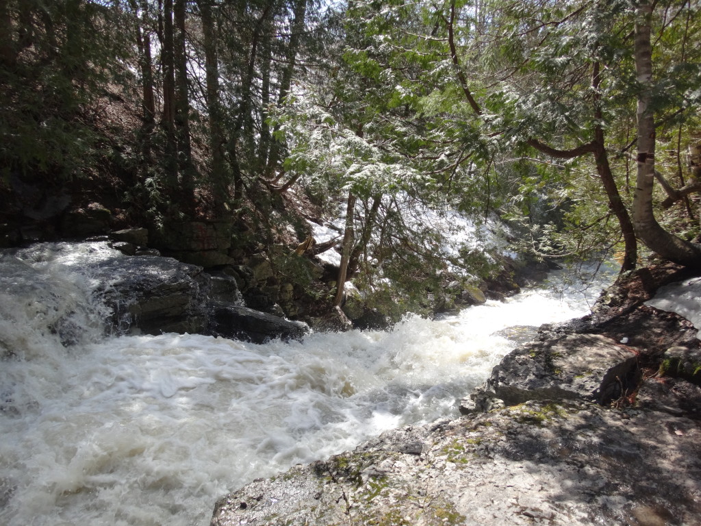
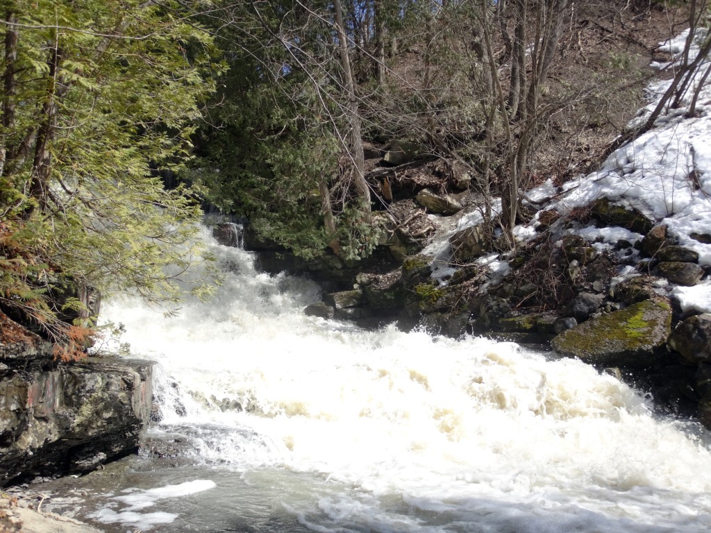
I ended my explorations at the Cardinal Creek karst: a cave and ravine system, formed where the creek tumbles over a steep escarpment. For most of the year, the creek by-passes the ravine, travelling underground through the cave (which is blocked off to protect the public). During the spring run-off, however, or in summer storms, it fills the ravine with a torrent.
All things considered, the day could hardly have been more successful. I cycled 86 km, saw almost every bird that I hoped to find, and arrived home safe and sound for good supper, a hot bath, and relaxed evening.