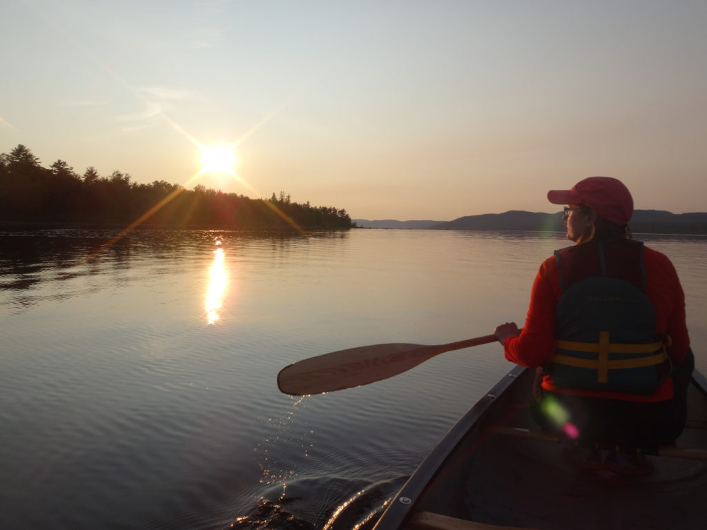
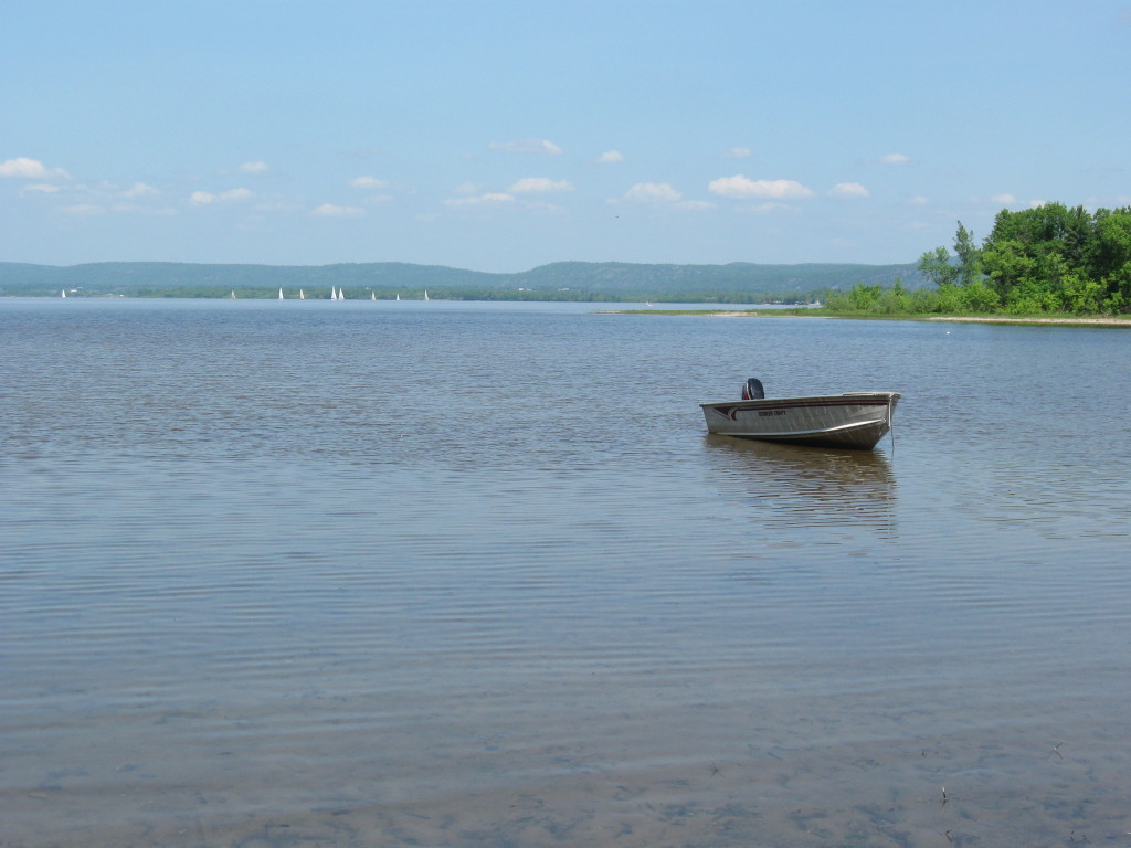
Deep River offers many lovely canoeing opportunities and destinations. For a relaxed evening paddle, I frequently head downstream from the town along the Ontario shoreline, past Lamure Beach. As the heat of the day dissipates, the wind dies down and the river often turns glassy and reflective. I follow the outer edge of the sand flats, past two rocky points, and into Welsh Bay, where Kennedy Creek empties into the river.
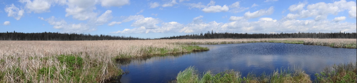
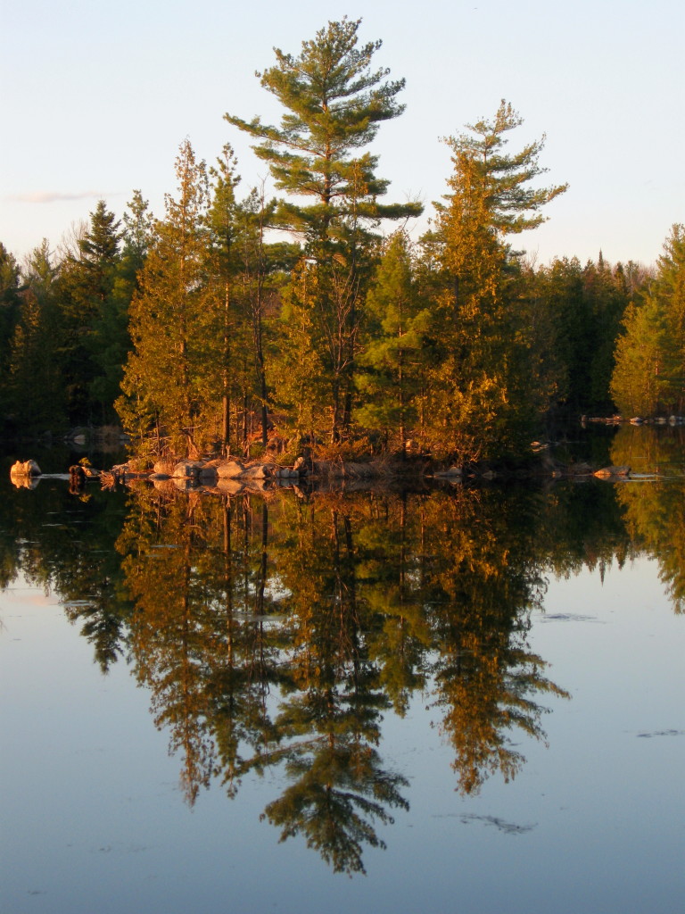
Ottawa River Shoreline, Deep River
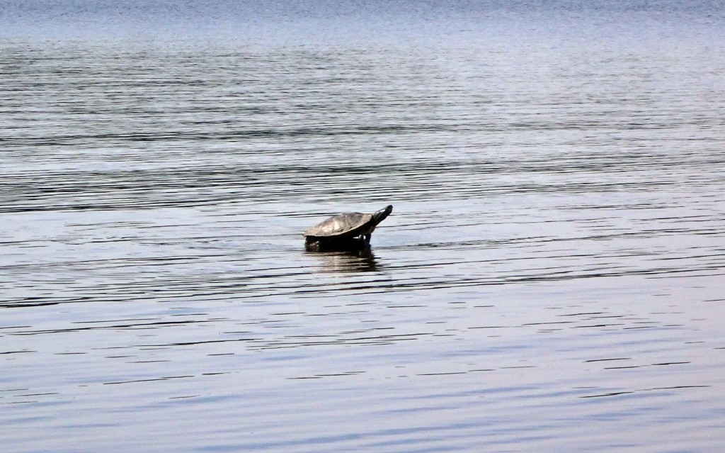
I frequently see young lake sturgeon and longnose gar finning in the shallow water of the bay, feeding on the bottom. I’ve spied bald eagles sitting sentinel in the pines along the shore, and listened to the chiding of ospreys as I glide past. Pulling my canoe on to the sandy shore, I like to cross the bar to the beaverpond behind the beach and watch for wildlife in the thickets. The shoreline, here, remains largely unchanged. I can imagine Samuel de Champlain and his Algonquin guides pulling their canoes on to shore 400 years ago to make camp for the night.
Ottawa River Calm
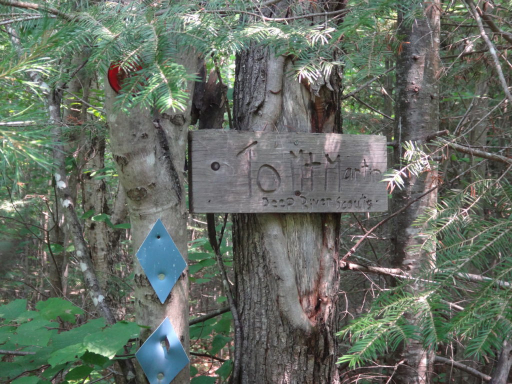
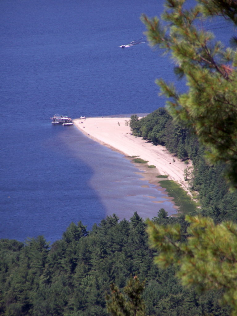
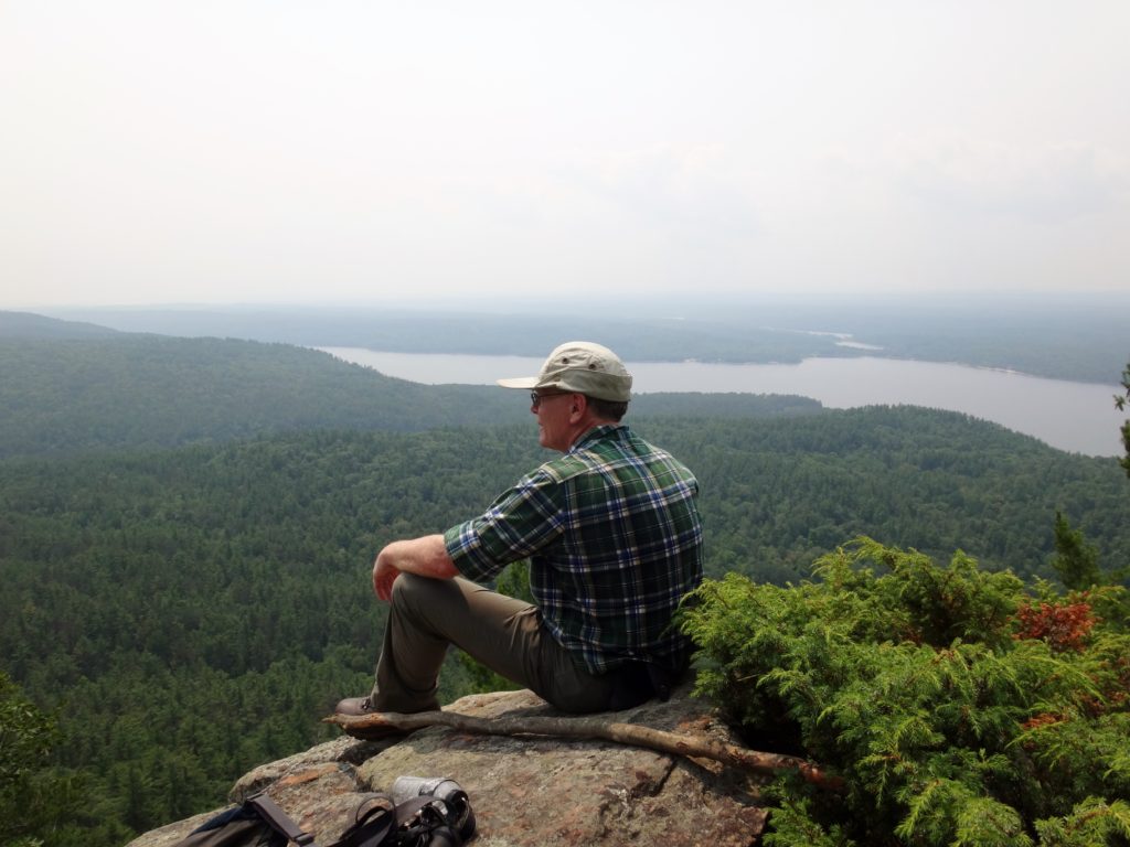
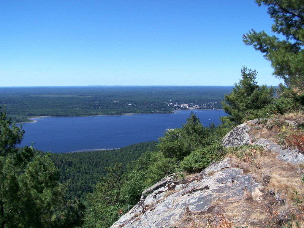
At least once during our annual visit to Deep River, I like to cross the river to the bay just inside Houseboat Point, where an overgrown logging trail heads up into the forest. A 20 minute walk takes me to the path to Mount Martin, almost hidden on the north side of the trail. An inconspicuous sign, placed by the Boy Scouts, marks the trailhead. On a hot, summer day, the climb up through the forest provides a workout, and mosquitoes whine incessantly. However, after a few false summits, the trail finally emerges on to an open, rocky lookout over the river and the town on the far side. The sand flats and shoals show clearly along the shoreline. Ravens and turkey vultures soar above and below, riding the breeze that rises over the escarpment. Breaking out a lunch, I rest and recuperate on the rocks, even lying back and closing my eyes for warm nap.
Mount Martin TrailheadHouseboat Point Viewed from Mount MartinResting at the Mount Martin Lookout
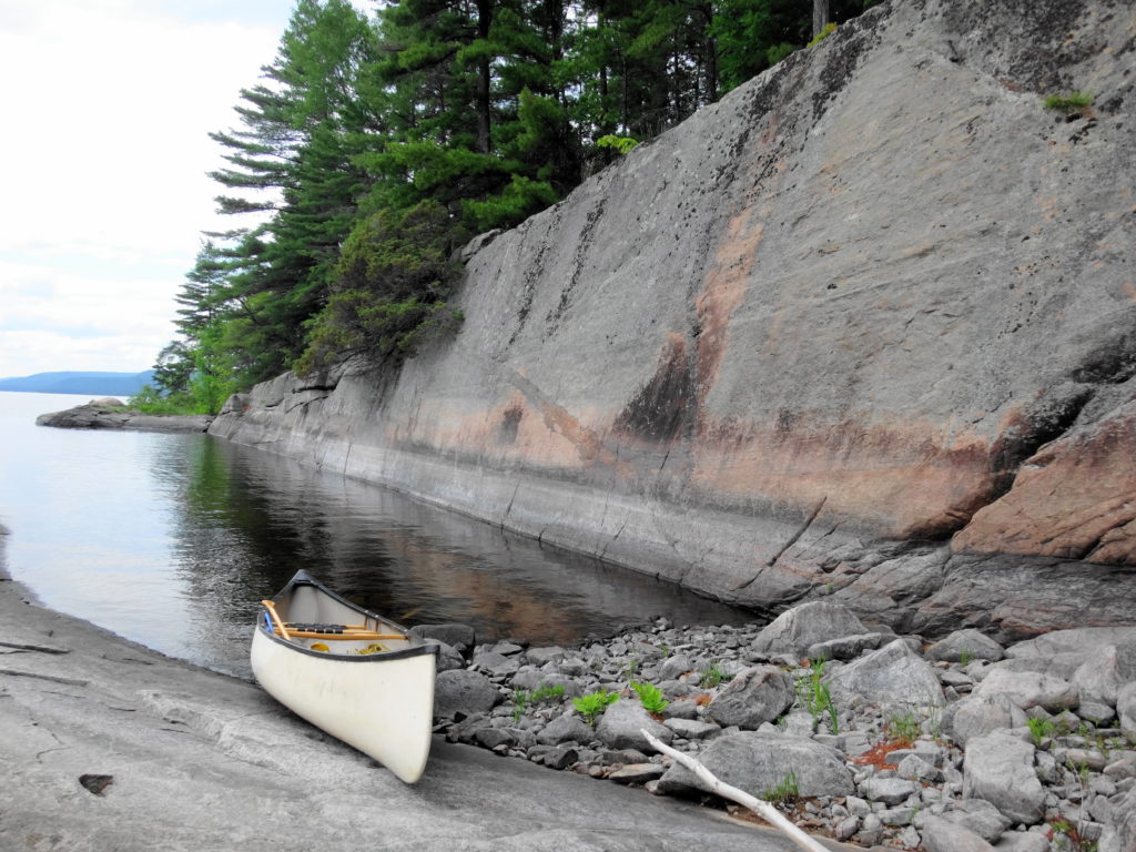
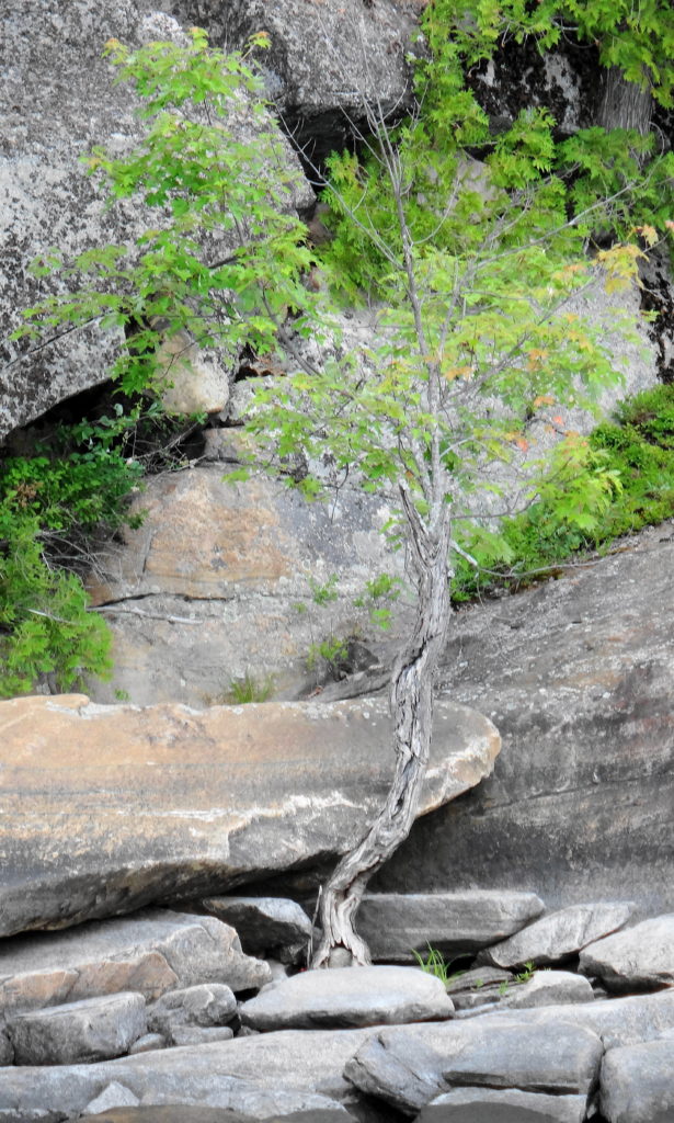
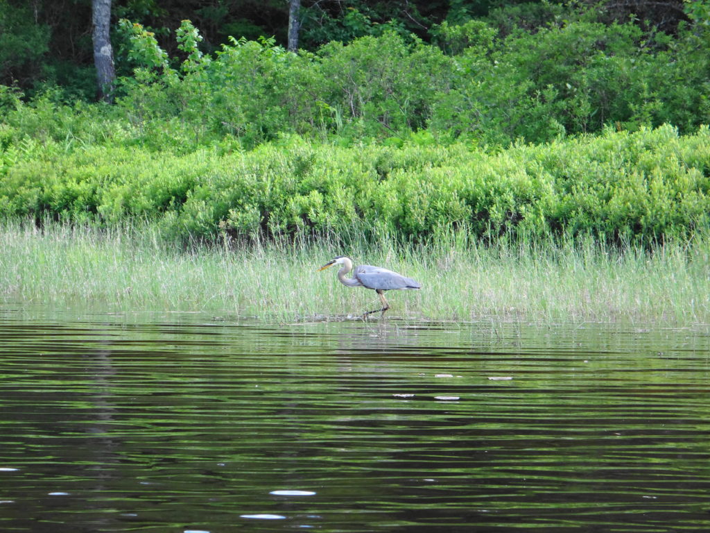
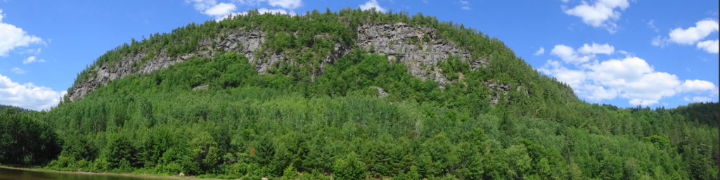
Another, more challenging paddle leads up the Ottawa River along the Quebec shoreline to Baie de la Presqu’ile d’en Bas and Lac a la Tortue. This 20 km long trip follows the rocky east shore of the river, where the long seismic fault of the Ottawa – Bonnechere Graben (the geological feature that we call the Ottawa Valley) and repeated glaciation has laid bare the tortured roots of the Canadian Shield. Broken only by a few short, sandy beaches, the old gneiss falls sharply into the deep waters. Fissures and cracks spit the billion year-old rock, along with coarse veins of crystallized quartz and other minerals. Sheered plates of stone form rocky walls and ledges. A forest climbs back from the shoreline, while a few hardy, slow-growing trees find a tenuous foothold closer to the water. The bay, itself, lies under a towering, shattered rock face, sheltered from the wide river by a long spit of sand deposited by an upstream tributary. At the head of the bay, shallow Lac a la Tortue provides superb habitat for pike, gar, turtles and shorebirds. Unfortunately, the bay has become very popular with campers and houseboats, who sometime line the beach in small flotillas. Nonetheless, the scenery provides ample justification for a visit, as do the healthy pike that feed along the rocky, Ottawa shoreline.
Quebec Shoreline Upstream of Deep RiverLife Finds A WayGreat Blue Heron, Lac a la TortuePanorama of the Cliffs at Baie de la Presqu’ile d’en Bas
Of course, at the end of long day of hiking or paddling, nothing feels so good as plunging into the clean, clear river at Lamure Beach or Pine Point. Many times, I’ve waded into the water to the drop-off, then dived under. The distinct, wonderful scent of the water fills my nostrils. The water washes over me. I rise, turn on my back and float under the sunset sky, as the heat seeps from my skin along with sweat and weariness. The quiet envelopes me like the river.. Somewhere inside me, an ancestral memory stirs. I think about tomorrow’s adventure.
With a brief, sunny break in Ottawa’s wet spring weather, I headed out early on an April Saturday morning for a bird watching trip to the west end of the City. I set out just before dawn on my bike, crossed downtown along the Laurier bike lane, then cut down to the Ottawa River bike path by the War Museum. Almost immediately I stopped to watch several rough-winged swallows feeding over the channel by Albert Island, darting occasionally into the drainage holes in the concrete channel walls.
Carrying on, I quickly arrived at Lemieux Island, where I stopped to check out the colonies of ring-billed gulls on the smaller islands. A brown thrasher chattered in a copse of trees at the entrance of the causeway, and white-throated sparrows moved through the underbrush. Robins foraged in the grass. A cardinal sang in the sumac on the other side of the lane, and red-winged blackbirds piped all along the shoreline. Out at the lookout, I spotted a black-crowned night heron perched amidst the gulls, and the black spikes of cormorants on the furthest island. A large flock of tree swallows hunted over the swift, roiling river.
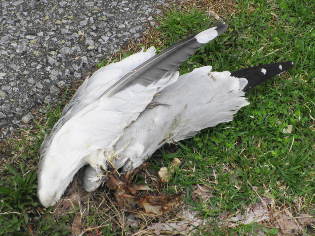
Leaving the island, I continued west along the river, checking off puddle ducks and diving ducks, until just before Mud Lake at Britannia, where a gull carcass caught my eye. Lying beside the path, all that remained of it were the two wings and a scraps of bones. I immediately thought of a description from J.A. Baker’s beautiful masterpiece of natural history, The Peregrine.
“A peregine kill can be easily recognized. The framework of a bird is left on its back, with the wings untouched and still attached to the body by the shoulder-girdles. The breastbone and all the main bones of the body may be quite fleshless. If the head has been left, the neck vertebrae will usually be fleshless also. The legs and back are frequently left untouched. If the breast-bone is still intact, small triangular pieces will have nipped out it by the peregrine’s bill.”
Peregrine Kill
Okay… not the most poetic extract of
Baker’s book, but based on this observation and others over the years, a pretty fair description.
I arrived at Mud Lake early, while only a few keen wildlife photographers were prowling the paths. I went looking first for Blanding’s turtles in the well-screened east swamp, where I’d seen them basking in previous years. But the light was still too thin and the air too cold for basking. Pushing my bike along the path toward the boardwalk and the main pond, I spotted a pair of black-crowned night herons pass overhead. Chickadees flitted along beside me on the trail, until they realized that I had no sunflower seeds to feed to them. A pair of crows chased a raven.
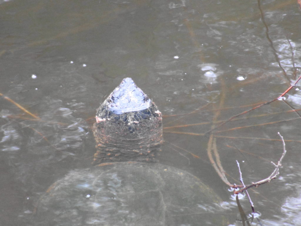
At the boardwalk, I hoped again to see some early basking turtles. But no luck. Several pairs of wood ducks swam amidst the maze of logs, broken branches and downed trees in the swamp on the inside of the boardwalk, while raucous geese squabbled over nesting sites along the shore of the pond. As I prepared to move on, a pair of northern flickers flew up to a snag beside the swamp, checking out the cavities. I had just resolved to leave them in peace, when I noticed a stir in the water and a tell-tale trail of bubbles. A few minutes of patient waiting was rewarded with the sight of large snapping turtle rising from the bottom of the pond for a breath.
Mud Lake Snapping Turtle
I slowly worked my way clockwise along the shore of Mud Lake, listening to the morning chorus. Goldfinches chittered overhead. A pine warbler buzzed in a tall pine. Yellow-rumped warblers flitted and sang in the high branches. Nuthatches and downy woodpeckers methodically moved from tree to tree, searching the trunk of each for insect morsels. To my disappointment, I found no trace of the screech owl that had made its home in the woods the past two years. Perhaps a little later in the spring?
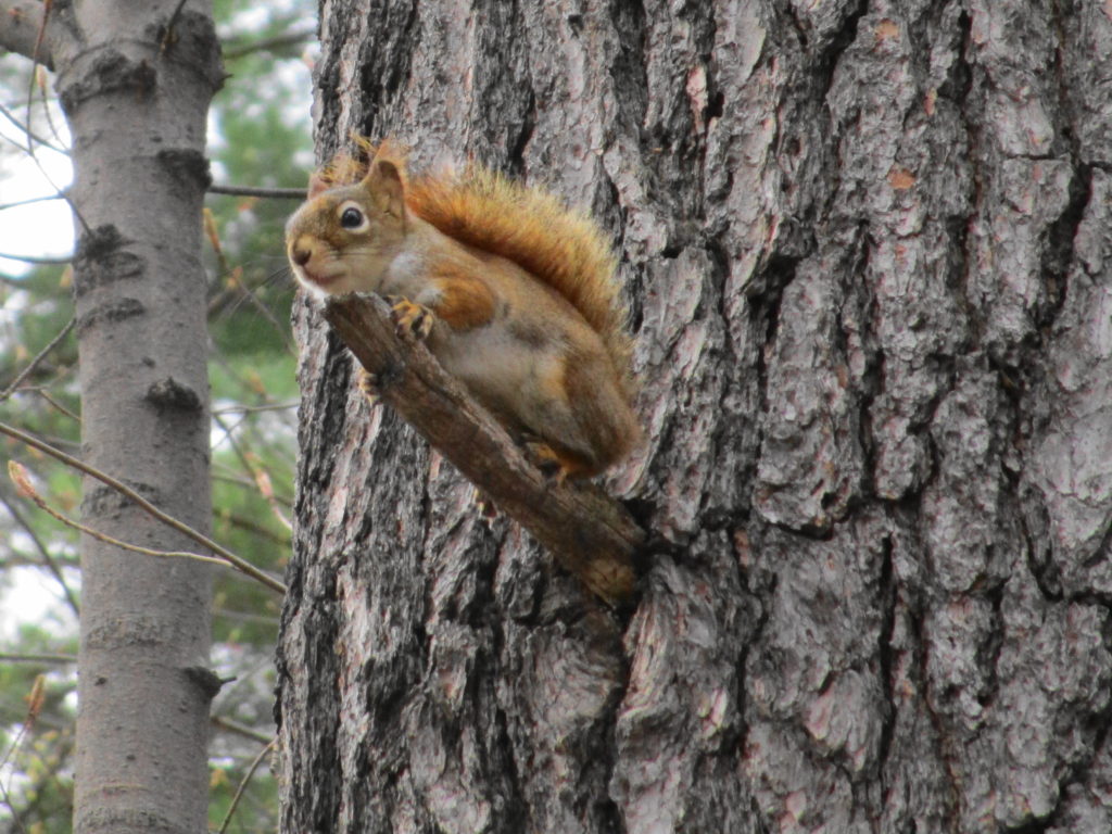
Red Squirrel
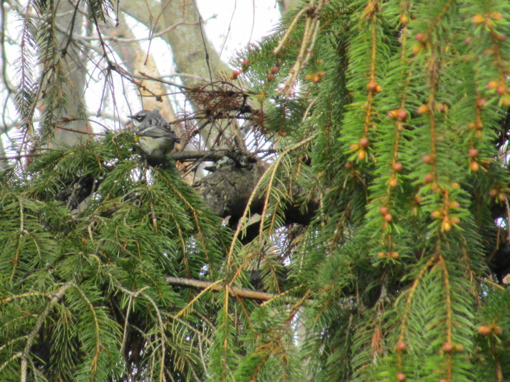
Leaving my bike locked at the trailhead at Cassels Street, I walked the ridge along the river shoreline. From one of the lookouts, I could see across Deschenes Rapids to the large gull colony at the old mill site on the far shore. With my binoculars, I made out the larger, white silhouettes of several great egrets perched amidst the gulls. At the south end of the ridge, I spent almost half an hour lingering around the conifers in hopes of getting some good photographs of the enthusiastic yellow-rumped warblers feeding in their branches with a solitary palm warbler. While a small crowd of [other] grey-haired photographers fired off clusters of shots from a fortune of tripod-mounted, digital SLRs and long lenses, I waited for birds to come close enough for my pocket compact.
Yellow-rumped Warbler
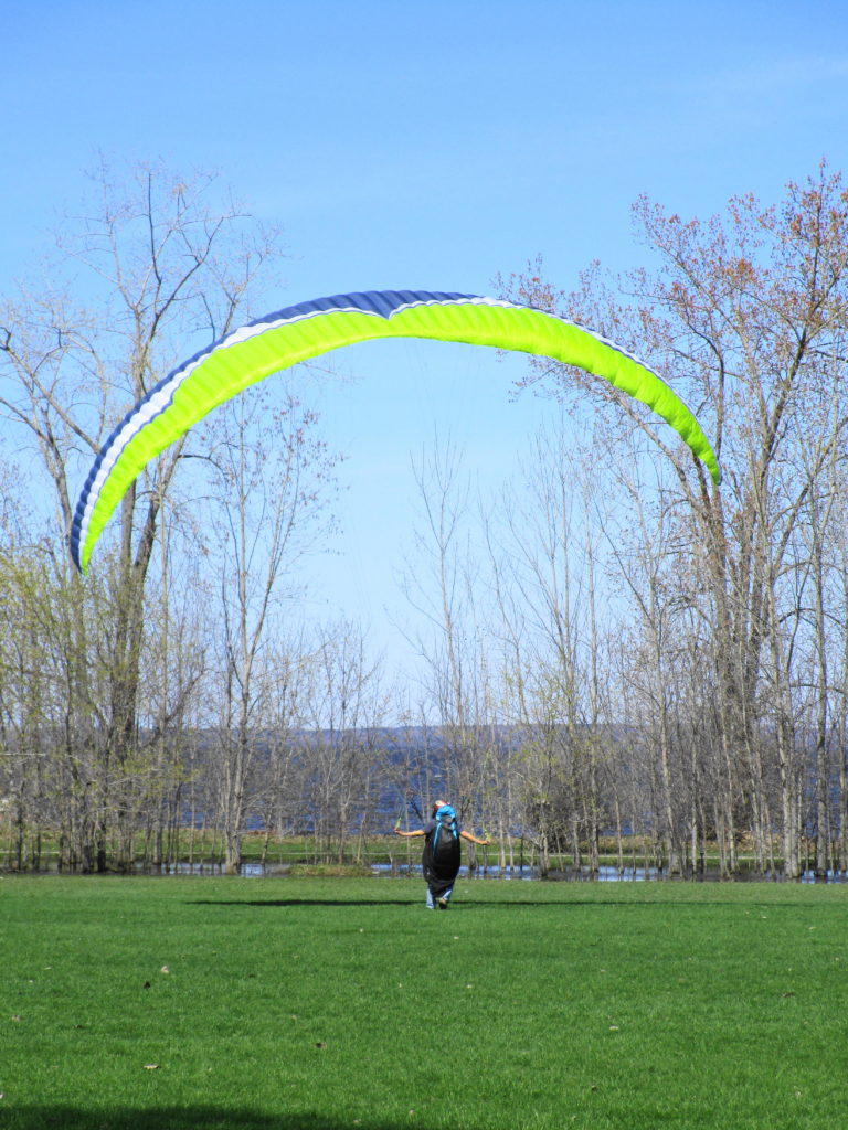
As usually happens, I’d lost track of time in the woods. Feeling hungry, I rode up to Richmond Road to grab some lunch, after which I returned to the Ottawa River trail and continued west. On one of the lawns at Britannia Park, someone was testing a parasail in the stiff wind. I passed Andrew Haydon Park and followed Watt’s Creek pathway to Moodie Drive, where I crossed into the National Capital Greenbelt. I continued following the Watt’s Creek pathway west to March Road, where I turned north to Herzberg Road and March Valley Road.
Parasail Practice at Britannia Park
When I first came to Ottawa, more than 25 years ago, March Valley Road provided some of the best bird-watching in Ottawa, especially for hawks and owls. It may be the last place in the City where I saw a short-eared owl, and I still catch glimpes of northern harriers over the Department of National Defence lands. Over the years, however, development has crept ever closer. Suburban subdivisions now lie only a few hundred meters distant, kept at bay only by the restrictions placed around the Department of National Defence firing range. However, it still offers a few good vistas across the fields of the base toward the silver maple swamps shielding Shirley’s Bay and the Ottawa Duck Club properties, including a distant view of Ottawa’s only active bald eagle nest. On this day, tree swallows filled the air above Shirley’s Brook, and the clean white head of an adult bald eagle rose above the rim of its nest.
Having ridden to within a few minutes of the South March Highlands and the Carp River Valley, I decided to mix pleasure with a bit of work. I headed up Terry Fox Drive, past Old Second Line Road, and then turned my bike on to the construction access road into the KNL development property to inspect some of the perimeter fencing.
Even having witnessed the transformation of the landscape on the KNL property during this winter’s cutting, I still find the view quite stark and shocking. Where a mature forest once stood, a expanse of stumps and scarred earth now remains. I find little consolation in the knowledge that the destruction of this forest was ordained more than twenty years ago, and that I played my role in protecting what remains. Perhaps when homes fill the landscape, families fill the homes, and neighborhood children ride the surrounding nature trails, I’ll feel better about the outcome.
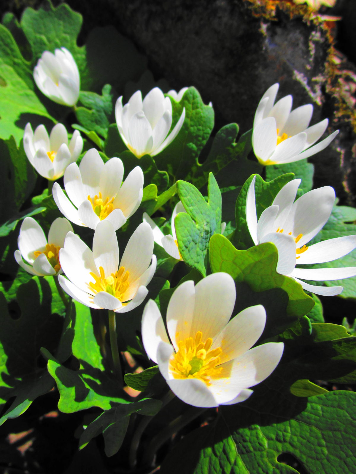
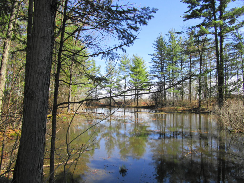
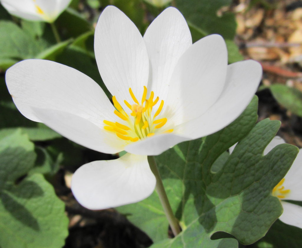
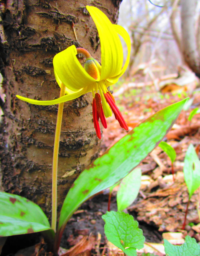
Retained Pond on KNL PropertyBloodroot in KNL Natural AreaTrout Lily in KNL Natural AreaSpring Beauty in KNL Natural Area
After checking out the fencing and scouting a retained pond for turtles (two painted, no Blanding’s), I continued along Terry Fox Drive to the Carp River Restoration Area. Like the KNL lands, the Carp River Restoration Area has a controversial development history. Notwithstanding its history, the restoration looks terrific. One of the pathways still needs completion, but the Carp has been returned to a more natural, sinuous form, and the new wetlands have been landscaped. With the spring flood only just having dropped (now returned!), the restoration area consisted mainly of bare, brown earth and mud. But in my mind’s eye, I could see it in the future, with the shrubs, cattails, and reeds in full growth and a cacophany of waterfowl side-slipping into the ponds.
As I was contemplating this sight, I had my best moment of the day. While I looked out over one of the muddy ponds, a flock of six lesser yellow-legs flew across the water to land on shore at its edge. A instant later they scattered upward as a brown, blurred shape swept through, knocking one of them down. A peregine! The falcon whirled tightly back around, but its first strike had not been clean; the yellow-legs was back in the air. The peregine jinked quickly after it, but again the yellow-legs evaded, striking the water in the process. The prospect of a possible dunking seemed to deter the peregrine, which quickly gave up the chase, and climbed away to the west and out of sight. The whole encounter lasted only a few seconds. In my excitement, I hadn’t even thought of reaching for my camera — not that I could have captured anything at that range.
I waited awhile to see if either the yellow-legs or the peregrine would return. But apart from some mallards and geese, my only sighting of interest was a white-tailed deer in a thicket swamp on the far side of the river.
With the sun now sliding steadily downward, I reluctantly turned my bicycle back towards home. Heading along Campeau Drive, I detoured quickly into the Kanata Centre Woods, where a short pathway winds over a pretty rock knoll and past a lovely, hidden pond. The pond seemed very quiet in the late afternoon, made more so by the song of a solitary Cardinal in the trees across the water.
Kanata Centre Woods
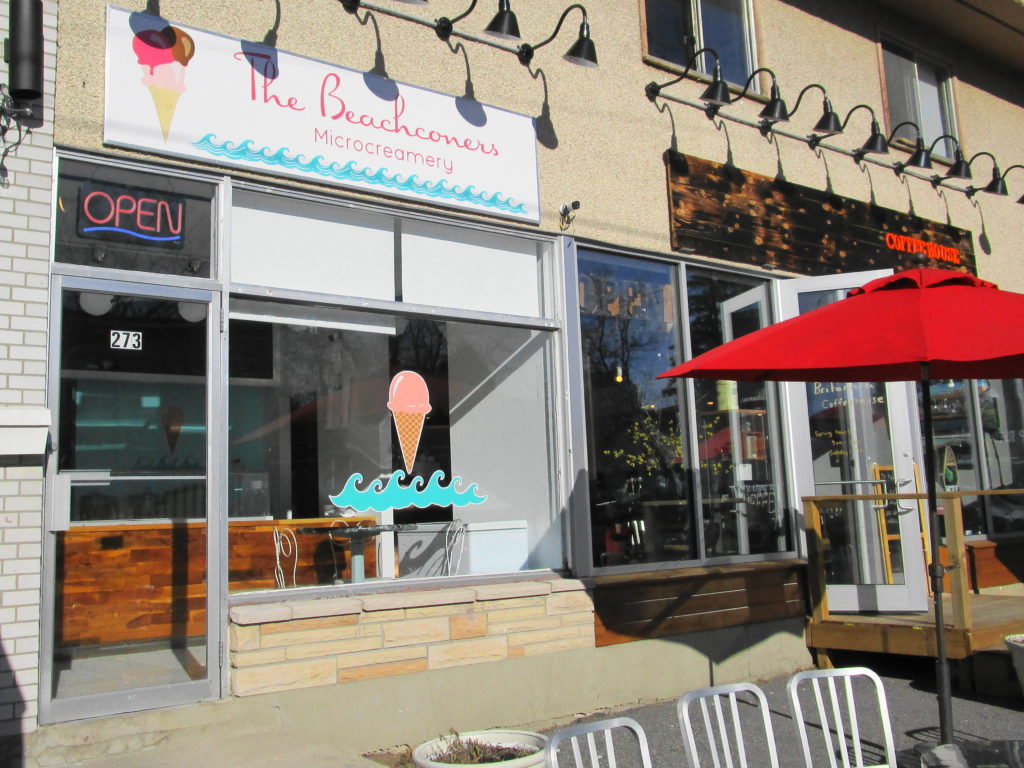
Reaching March Road, I cycled back to the Watts Creek pathway and retraced my route toward downtown. By the time that I reached Britannia, however, I was ready for a refreshment. I’d spotted the “Beachconers Microcremery” in the morning, beside the cycle path. Stopping now, with my muscles weary and my throat dry, I enjoyed what must be Ottawa’s best vanilla bean ice cream — or so it seemed at that moment.
Beachconers Microcremery
I arrived home just after sunset, wheeling up to the back door to see Sue through the window, sitting at the kitchen table. After a welcome supper, I then soothed my muscles and joints with a hot bath. Altogether, a very satisfying day.
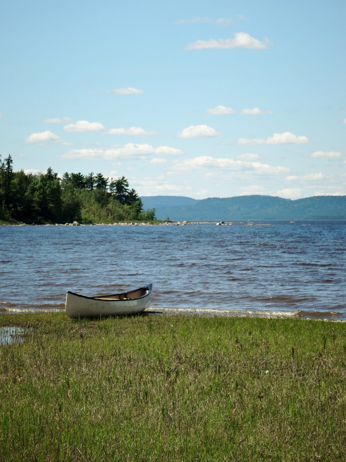
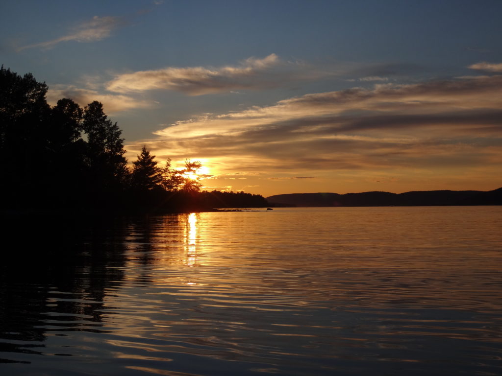
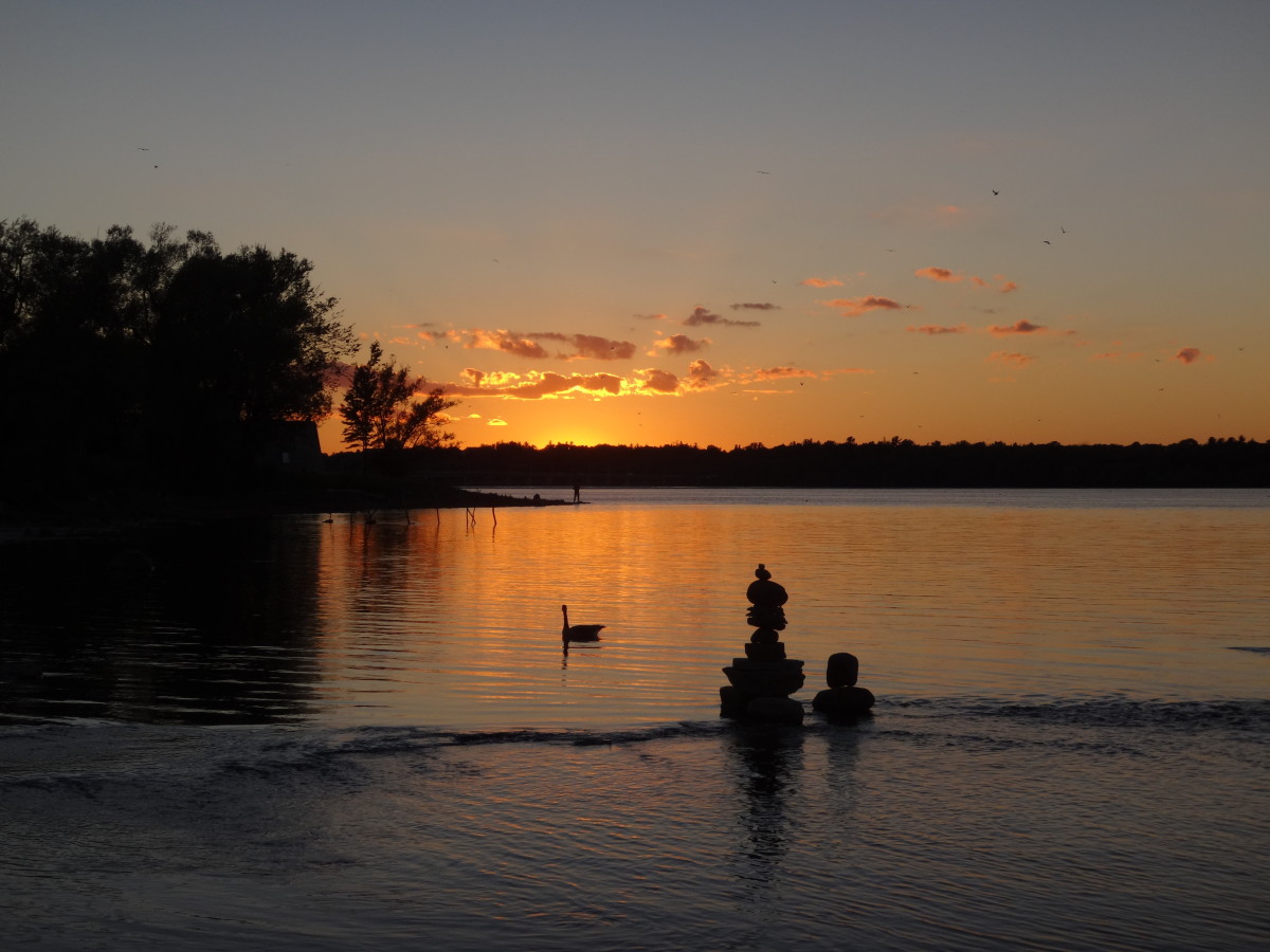
An evening calm has settled over the Ottawa River as I paddle into a burnished, copper sunset. I trail a fly behind the canoe, more from habit than hope. If I really wanted to catch fish, I would trail a spinnerbait for pike, or rig a artificial minnow for walleye. Mostly, I just enjoy the quiet, made more pronounced by the occasional powerboat thrumming in the distance. On the Quebec side, I see lights begin to glimmer on the houseboats beached at the point. Laughter carries across the water. Nearer, on my left, I see a whitetail deer come shyly down to the beach in the deepening dusk, as a wood thrush begins to flute in the woods. Abruptly, the sandy bottom rises below my canoe. I ship my paddle and quickly wind in my fly. Then I continue into the bay toward the boat launch, passing Lamure Beach and threading through the moored boats. I pull out the canoe and drag it up to the trees with the others. Then I stroll through the peaceful streets until I see home and the glow of warm, yellow light through the blinds of the large front window.
Sunset, Deep River
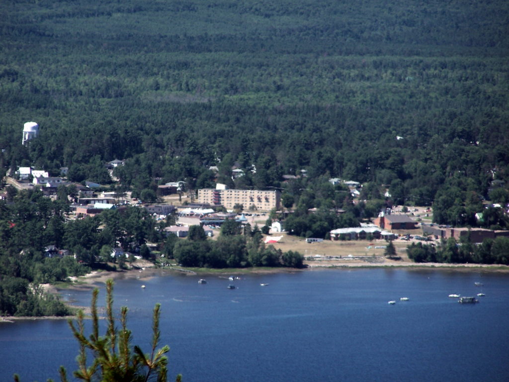
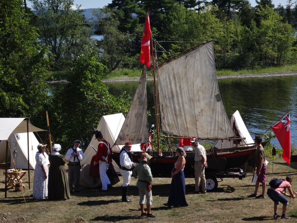
The town of Deep River lies an easy two hour drive northwest of Ottawa along Highway 17. Sandwiched between the highway and the Ottawa River, it trails along the shoreline for a couple of kilometers. The usual Tim Hortons, Canadian Tire, motel and small strip malls service the highway. A busy grocery store, post office, shops, cafes, school, and town office anchor the small, downtown core, which sits just behind the waterfront, overlooking the river. The marina and yacht club lie only a brisk two minute walk away. Tidy residential neighbourhoods lie either side of downtown — a mix of small, renovated, post-war bungalows and more modern, multi-story houses. The Deep River Regional Hospital marks the east side of town, while the Mount Martin Ski Club sits on the west side.
Deep River Viewed from Mount Martin, QuebecDeep River Waterfront
I spend at least two weeks every summer in Deep River with my wife and our sons. We make shorter visits throughout the year. I spend most of that time outside, exploring the local forests and wetlands, or paddling the shoreline of the Ottawa River. Deep River is a microcosm of whole Ottawa Valley, with almost every kind of ecosystem, habitat and wildlife species within easy reach.
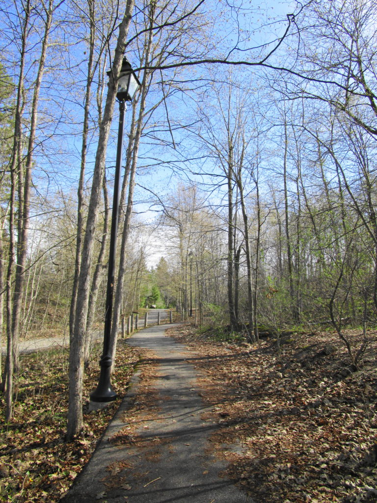
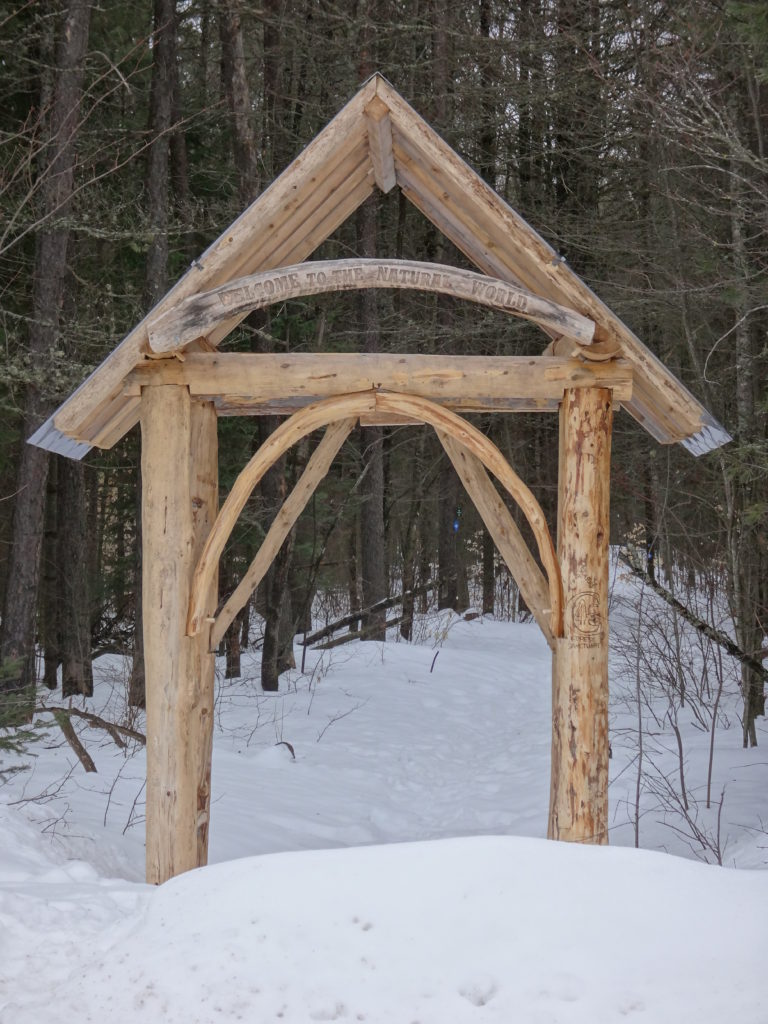
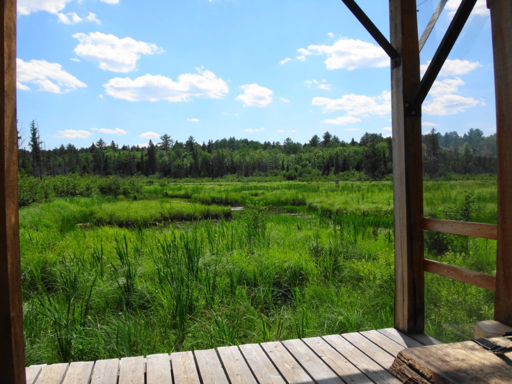
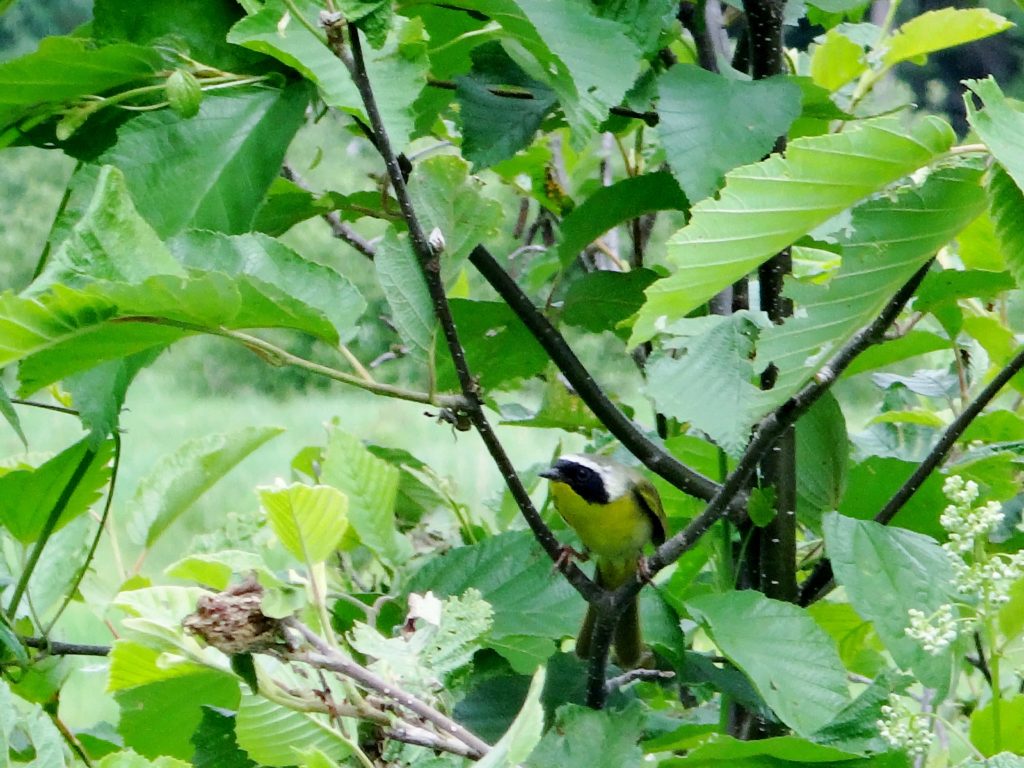
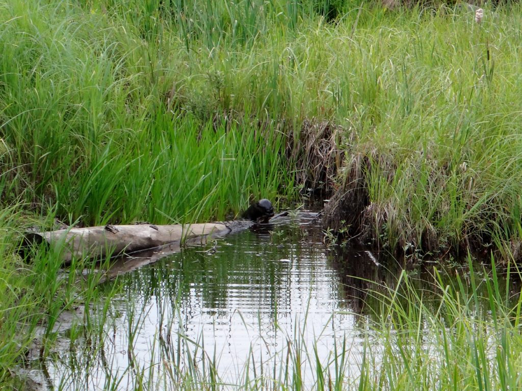
Most trips to Deep River begin and end at the Four Seasons Forest Sanctuary, on the southeast side of the town. This community-owned forest is part of an enormous, contiguous, protected natural area that includes the restricted lands surrounding the Canadian Nuclear Laboratories (formerly AECL) in Chalk River, the Petawawa Research Forest, the training areas of Canadian Forces Base Petawawa, and Algonquin Park. A short hiking loop begins across from the hospital and leads to a pretty, covered shelter overlooking a wetland. Even on the buggiest days, the squadrons of dragonflies hunting along the marsh edge succeed at keeping most mosquitoes at bay. Common yellowthroats sing in the thickets, while swamp sparrows skulk in the reeds. An American bittern grunts deep in the marsh. A blue heron fishes along the meandering stream on the other side. Turtles and frogs bask in the small pond by the shelter, where an occasional beaver, muskrat or otter makes an appearance. I’ll bring a lunch and meditate on the scene, read a book, or bring a guitar. Almost always, I’m on my own.
Four Seasons Forest Sanctuary EntranceMarsh Shelter, Four Seasons Conservation ForestCommon Yellowthroat, Four Seasons Conservation ForestOtter, Four Seasons Conservation Forest
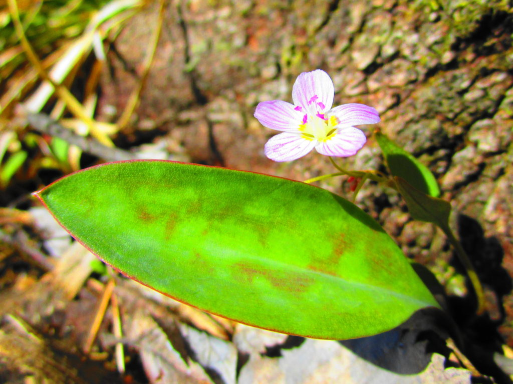
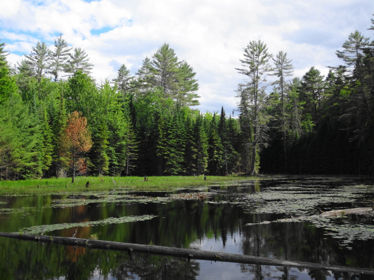
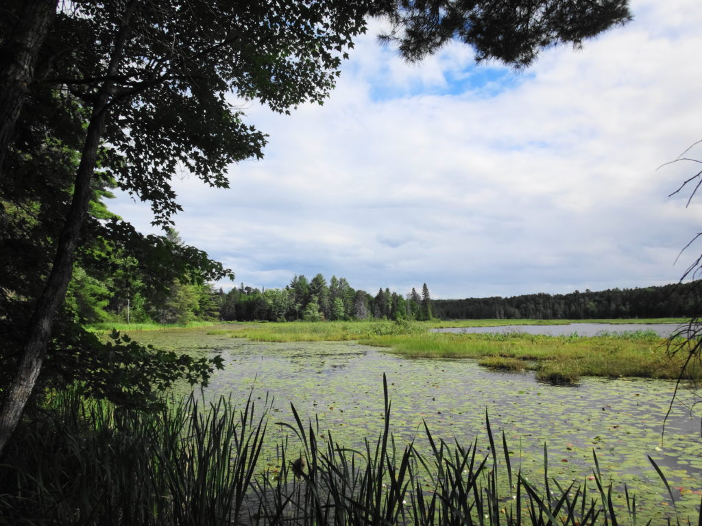
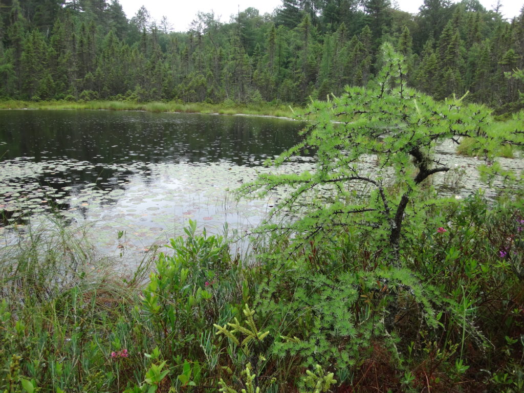
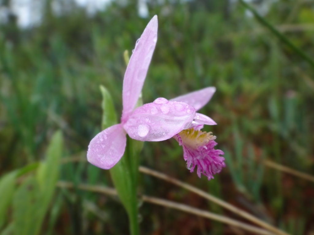
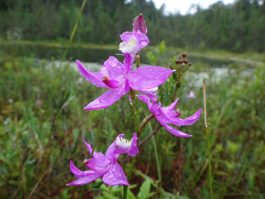
Longer trails lead deeper into the sanctuary, passing a variety of habitats: upland forests of white pine, maple and beech; darker forests of spruce and balsam fir; pretty riparian marshes, and dark forest pools; bright, grassy clearings, and shadowed fern gardens. One of my favourite destinations is Cranberry Lake, which stretches back into the AECL lands. At the end of a half hour hike, a small bench looks out over the lake and a pretty, floating fen mat. In late June and early July, white waterlilies carpet the water, and pink orchids (swamp pinks and rose pogonias) dot the fen. I often skip the bench and stretch out under the white pine that graces the shoreline, closing my eyes for a nap in midday sunshine. Occasionally I lift my head and look down the lake, hoping to see one of the moose that have found a haven on the AECL lands.
Cranberry Lake, Deep River
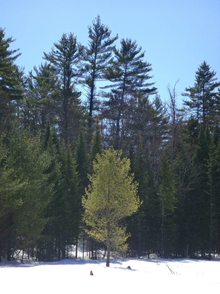
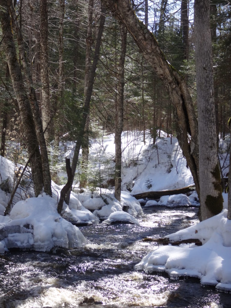
During the winter, the trails of the Forest Sanctuary become an active cross-country ski and snowshoe network. Trails are well marked and maintained by the Deep River Cross Country Ski Club, who put on an active recreational and social program through the winter. The forest and wetlands take on a different kind of beauty and quiet in the winter, always reminding me of the Robert Frost lines, “the only other sound’s the sweep, of easy wind and downy flake.”
Winter Beaverpond, Four Seasons Forest SanctuaryWinter Creek, Four Seasons Forest Sanctuary
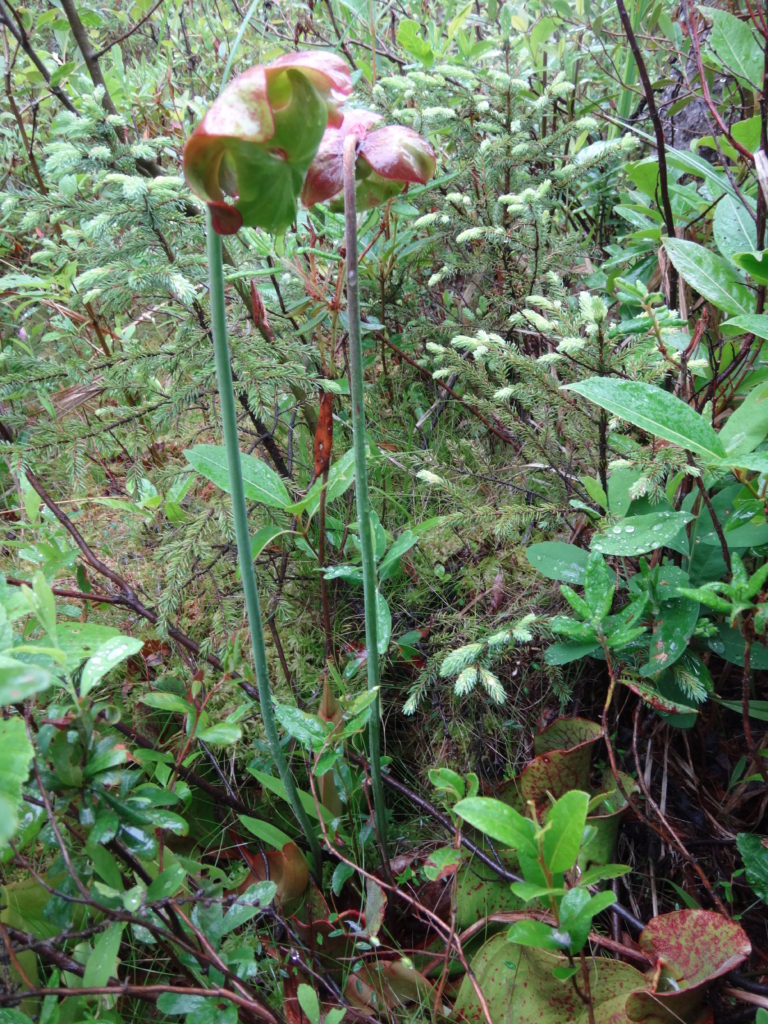
The Petawawa Research Forest, just outside nearby Chalk River, also provides wonderful opportunities for exploration. The Research Forest Museum, now inactive and partly abandoned, still remains open to the public — albeit quickly deteriorating. An interpretive trail still loops from the museum through the forest, and an old boardwalk still offers a short, but pretty walk along the shore of the Chalk River. A maze of access and logging roads leads deep into the forest, past a myriad of different tree communities, streams and wetlands. In particular, the research forest includes a large number of well-developed fens and bogs, some of which are very accessible and yet still virtually unknown and pristine. They provide a unique opportunity for a careful, conscientious visitor to explore the flora and fauna of these marvelous ecosystems. Unfortunately, summer visitors can expect to be trailed by a cloud of deer flies, which swarm from the sandy roads and trails in numbers that are hard to comprehend. Once off the roads and into the forests and wetlands, however, the deer flies give way to the usual mosquitoes and blackflies, which respond much more readily to repellent. Of course, sensitive individuals can always choose to wear bug hats or bug shirts. Either way, the research forest is worth a visit.
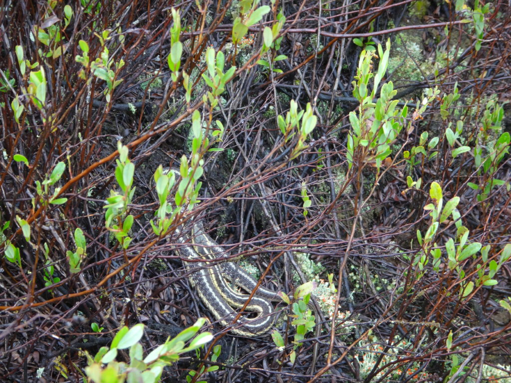
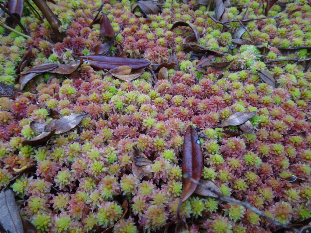
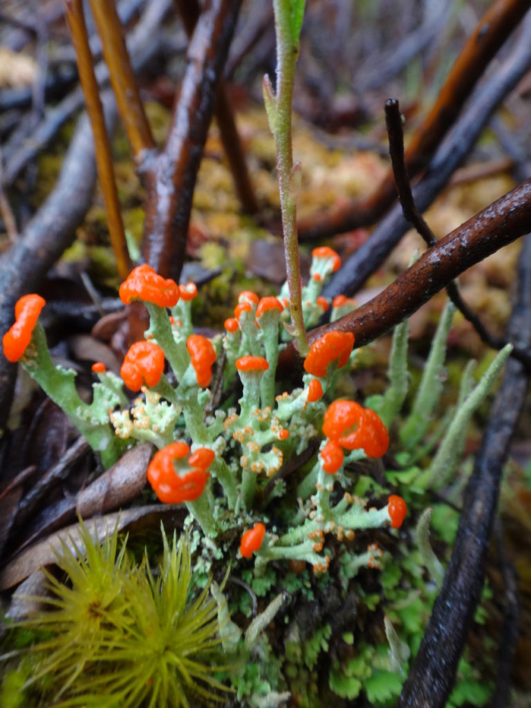
Raised Bog, Petawawa Research ForestSedge Meadow and Raised Bog, Petawawa Research ForestRich Fen, Petawawa Research ForestRose Pogonia, Petawawa Research ForestSwamp Pink, Petawawa Research ForestNorthern Pitcher Plant, Petawawa Research ForestGarter Snake on Bog Hummock, Petawawa Research ForestSphagnum Moss in a Bog, Petawawa Research ForestLichen in Bog, Petawawa Research Forest
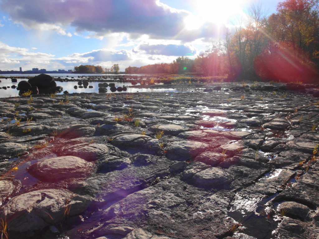
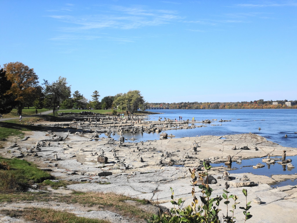
In late summer, when water levels drop in the Ottawa River, a fascinating glimpse into ancient history emerges into view. The Ottawa River stromatolites lie below the Quebec side of the Champlain Bridge. 460 million years ago, in a shallow, salty embayment of a tropical sea, colonies of blue-green algae cemented together sediments and calcium carbonate into low mounds of limestone (http://www.ottawagatineaugeoheritage.ca/subsites/4). They survived the geological cataclysms of next half billion years to be scoured clean by the river and exposed on the pretty, wooded shoreline. Perhaps nowhere else in the world can one leave a damp footprint on such tangible evidence of ancient life.
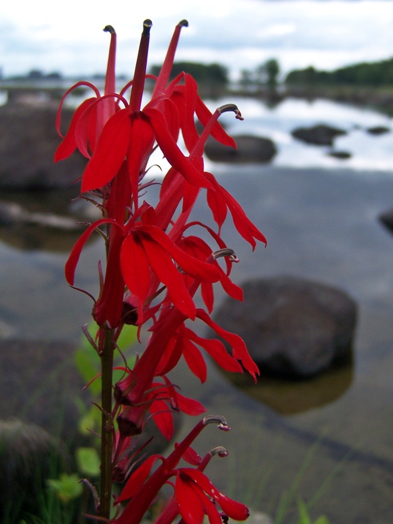
Cardinal Flower
No river figures so strongly in Canada’s history as the Ottawa. For Aboriginal peoples, for early European explorers, for fur-traders and for pioneer loggers, the Ottawa River provided the most direct route into the heart of Canada. The first Aboriginal sites along the Ottawa River date back 6000 years. Samuel de Champlain’s Aboriginal guides led him up the Ottawa River in 1613. The last timber raft floated under Parliament Hill in 1908, and log drives continued on the Ottawa River until 1990. During the last half of the 19th Century and well into the 20th Century, power from the Chaudiere Falls supported thriving industries along the Gatineau and Ottawa shorelines. The river gave birth to Canada’s atomic industry, at the Atomic Energy Commission Laboratories in Chalk River. Hydro-electric dams continue to operate along the river, while the lakes behind them provide recreational boating and fishing that help to support thriving communities up the Ottawa Valley. A paddle along the Ottawa River is literally a paddle through the history of the country.
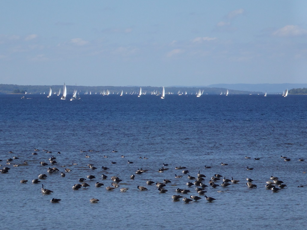
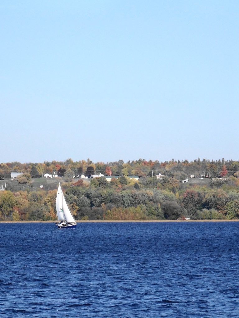
Regatta on Lac Deschenes, Ottawa River
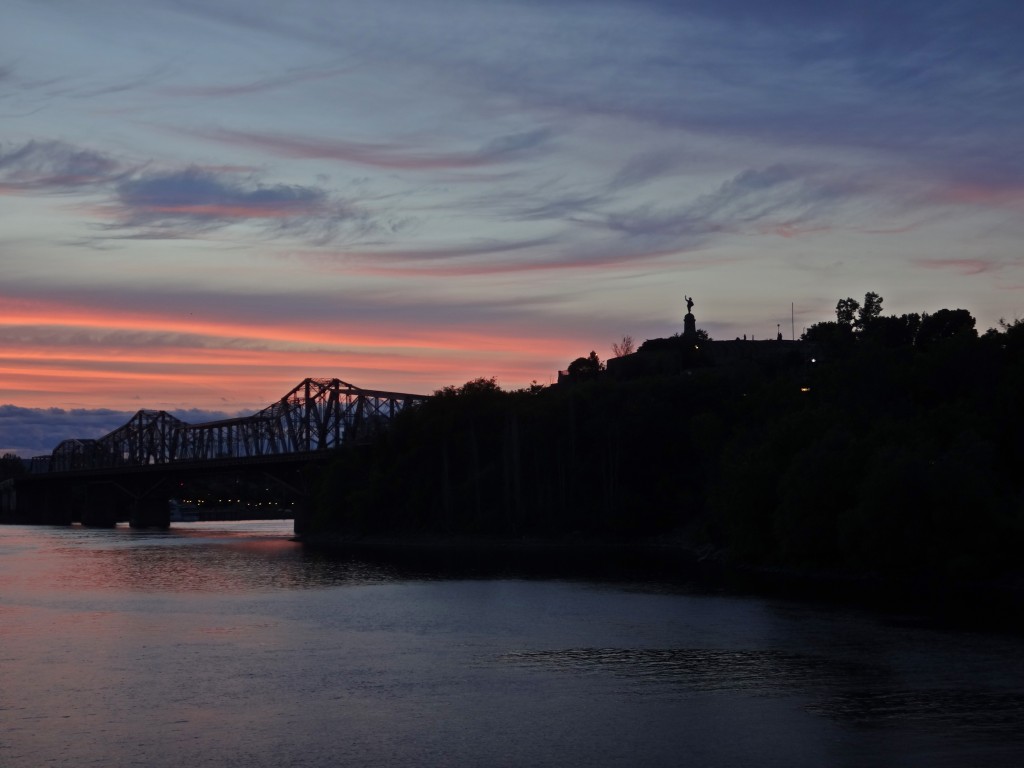
Fortunately, almost all of the Ottawa River lies open to pedestrians, cyclists and paddlers. Multi-use pathways line both shorelines through the urban core, with numerous lookouts and beaches providing access to the water. Most of my favourite cycling routes begin beside the Ottawa River Locks, on the Rideau Canal, sandwiched between the Parliament Buildings and the Chateau Laurier hotel. From there, a National Capital Commission cycling path travels beside the river, under the bluffs of Parliament Hill, below the Supreme Court of Canada and past the historical Aboriginal site of Victoria Island. At the Portage Bridge, the trails begin to branch, some continuing along the Ontario shoreline upriver past the Chaudiere Falls and the Canadian War Museum, some crossing over the Portage and Chaudiere bridges to the Quebec shoreline. The National Capital Commission publishes a map of its trail system, showing the available destinations and routes (http://www.ncc-ccn.gc.ca/places-to-visit/parks-paths/things-to-do/cycling-capital-pathways).
My favourite ride makes a loop through Gatineau, on the Quebec side. From the Chaudiere Bridge, it heads briefly upriver, then turns north into Gatineau Park, makes a quick detour to Pink Lake, heads east to the Gatineau River, goes back down through Lac Leamy Parc to the Ottawa River, and then crosses the Alexandra Bridge at the Canadian Museum of History. It’s a challenging ride through beautiful scenery: steep climbs and descents along forest trails and roads, winding pathways past wetlands, boardwalks and bridges over creeks and along shorelines.
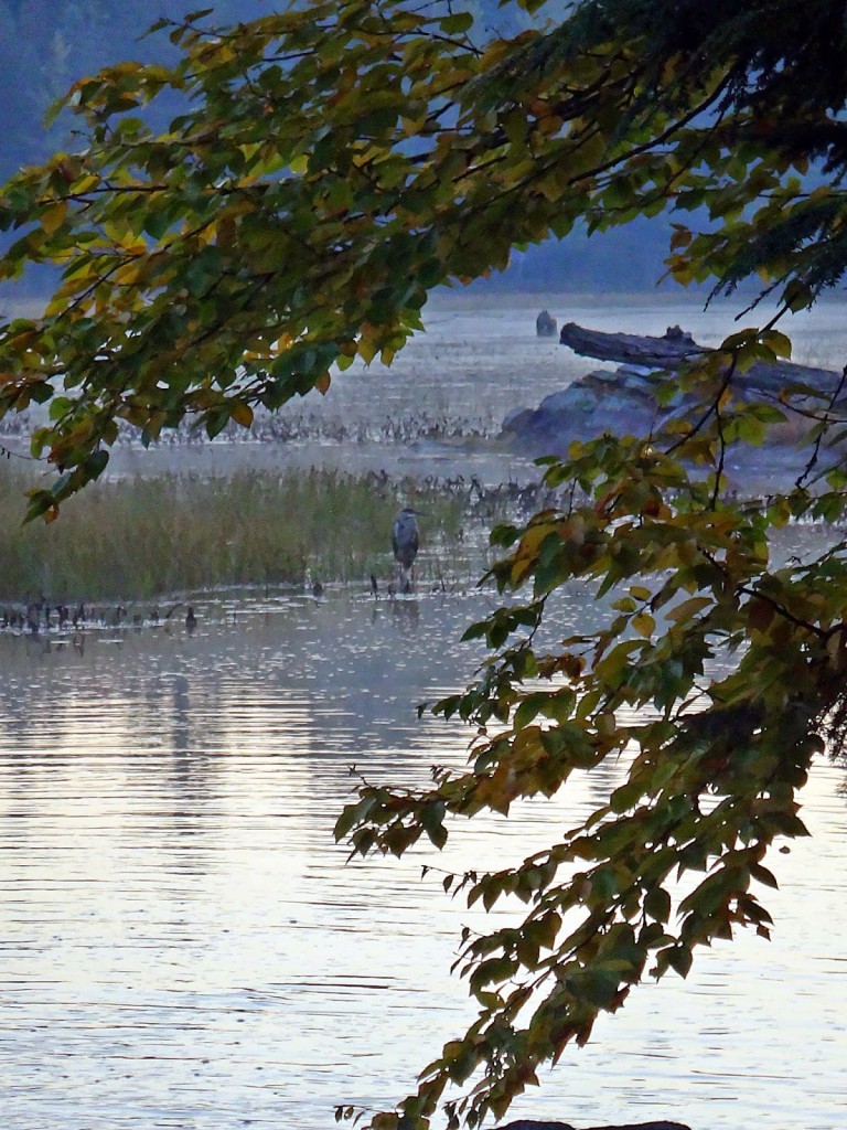
Gatineau Park Wetland
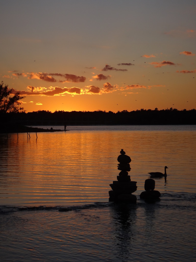
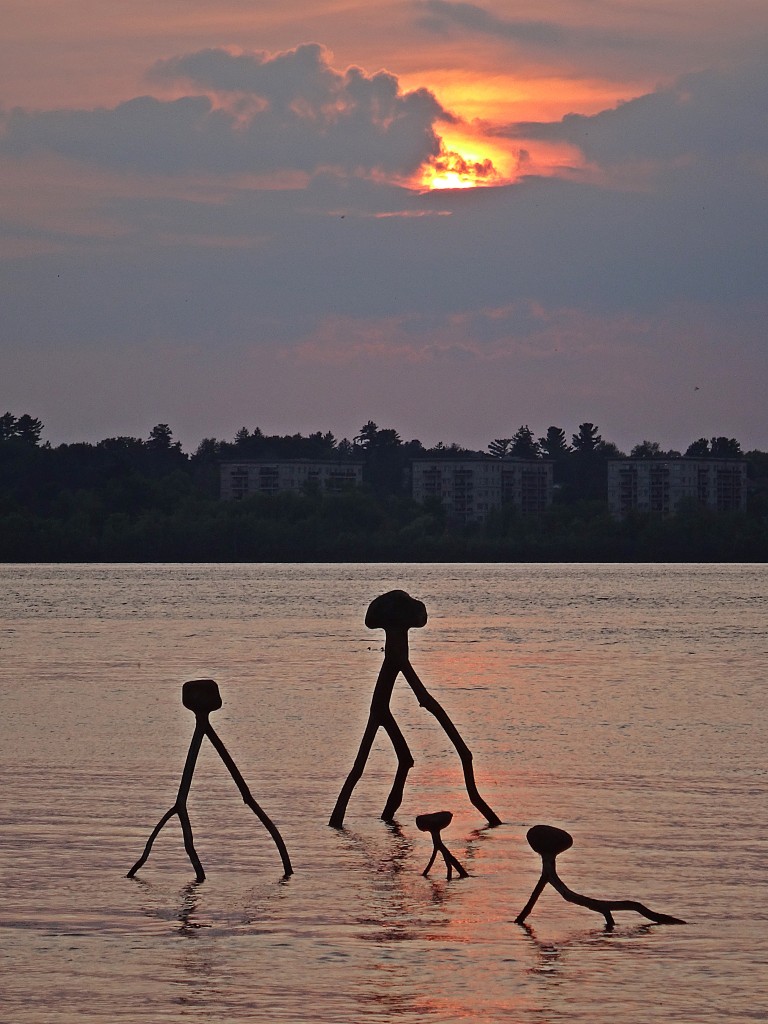
For a shorter, easier trip, I like to ride upriver along the Ontario shoreline to Mud Lake and Britannia Park. Along the way, I sometimes stop at Lemiuex Island to view the colonies of gulls, cormorants and night herons on the adjacent, smaller islands. I stop at Remic Rapids to admire the balanced rock sculptures in the shallows of the river. Near Westboro Beach, I often take a detour into Westboro Village for coffee at Bridgehead, a browse through Mountain Equipment Co-op, or a meal at one of the cafes and restaurants. Reaching Mud Lake, I may dismount for a walk through the natural area or carry on to Brittania Beach or Andrew Hayden Park. I usually time my ride back home for the evening, when the sun sets behind the Quebec shoreline, sending its apricot glow across the river.
Remic RapidsRock BalancingRiver SculpturesAlexandra Bridge and Statue of Samuel de Champlain
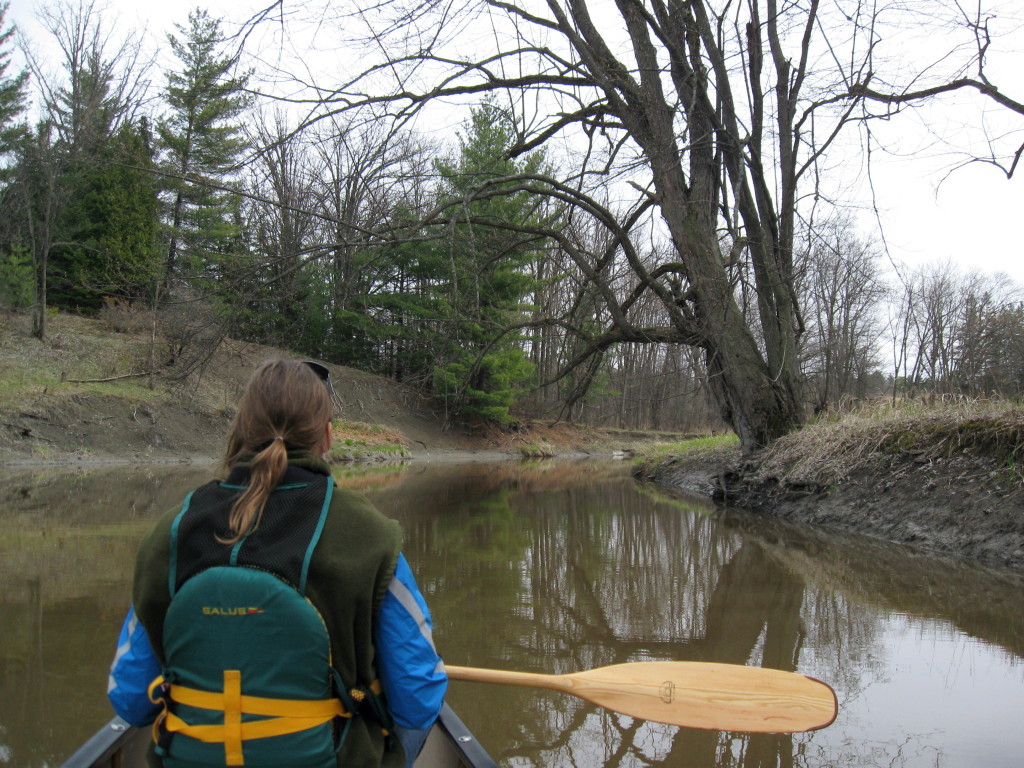
On calm mornings, I will often load my canoe on to a Vrtucar (a local car-sharing business) and head off to one the river’s quieter areas. Petrie Island, in the east end of the City, is a wonderful destination. The provincially significant wetland inshore of the island provides sheltered canoeing, with opportunities to photograph the area’s many birds, turtles (including the threatened map turtle), and beautiful swamp forest. Downstream of the island, the mouth of Cardinal Creek provides one of the river’s most important fish habitats. A low squeeze under the Highway 174 bridge takes one into the lower reach of Cardinal Creek: a marvellous, meandering paddle through a superb floodplain wetland entrenched in a deep valley.
Map Turtle at Petrie Island
At the opposite end of the City lies Constance Bay, which deserves a full blog post of its own. Lying at the upper end of a relict, post-glacial flow channel paralleling the Ottawa River, Constance bay forms a wide, shallow, sandy-bottomed crescent at the mouth of Constance Creek. Cottages and homes line the shore, but access to the Bay is possible from City road allowances at the end of Greenland Road on the east side of the bay and Lane Street on the west side of the bay in the Village of Constance Bay. The shallow, sandy bay is delightful for wading, warm in the summer and easy on bare feet. In the spring, just east of the creek mouth, longnose gar spawn and hunt in mere centimetres of water, “finning” in the shallows. Pike lie in ambush in the reed beds. Catfish wait in the channel of the creek, and walleye hunt along the dropoffs. Waterfowl abound. Herons hunt frogs. Gulls and terns patrol the shallows, waiting to plunge onto schools of small minnows. Within the mouth of creek, along the edge of the silver maple swamp, songbirds flit and sing. It may be the prettiest spot on the river.
Constance Bay from Greenland RoadFishing at the Mouth of Constance CreekSmall Pike on a Spinnerbait
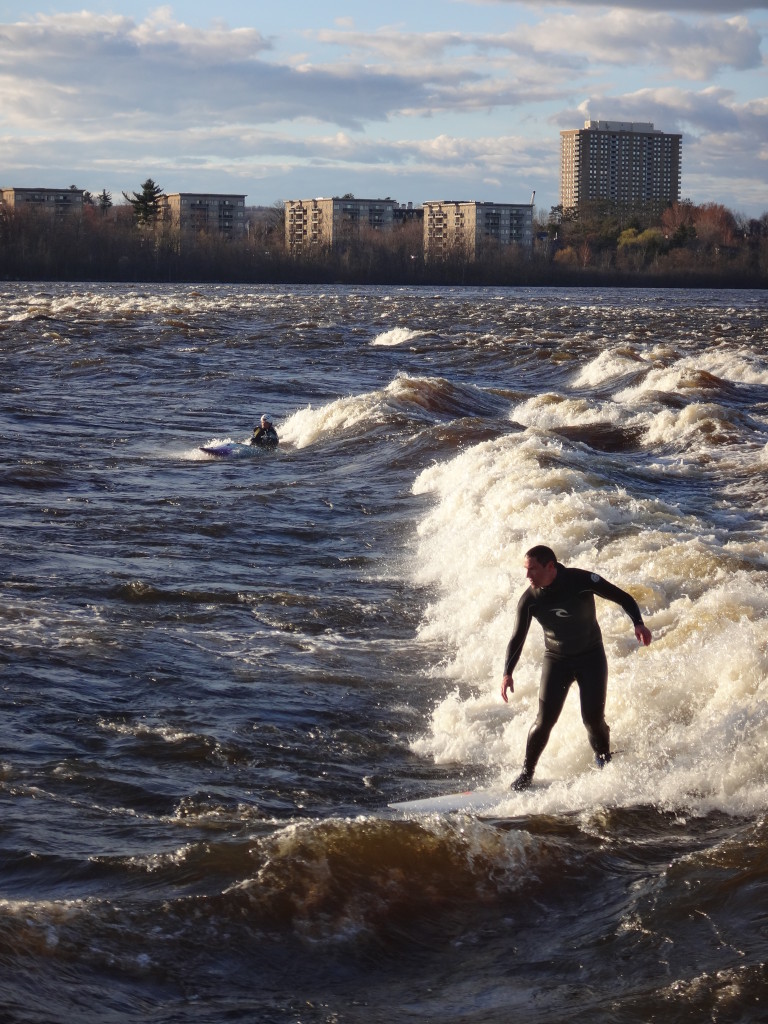
The Ottawa River simply offers too many places to visit and things to do to describe in one short post. Just within the boundaries of Ottawa and Gatineau, one can find places enough to fill a summer with exploration: Morris Island Conservation Area, Fitzroy Harbour Provincial Park, The Quyon Ferry, Piney’s Point Historical Site, Sheila McKee Park, Shirley’s Bay, Andrew Hayden Park, Bate Island, Lemieux Island, Victoria Island, Rideau River Falls, Rockcliffe Park, Green’s Creek, Upper and Lower Duck Islands, Lac Leamy Park, Baie McLaurin, Baie Lafontaine. Beyond Ottawa, even more opportunities abound, such as whitewater rafting in Beachburg, only 90 minutes north of the City, camping in Voyageur Provincial Park or Driftwood Provincial Park, an hour downriver and two and half hours upriver respectively, or houseboat cruising on the Upper Ottawa River. Somewhere, there’s a deserted beach waiting.
For more information on enjoying and protecting the Ottawa River, please visit the Ottawa Riverkeeper website at: http://www.ottawariverkeeper.ca/
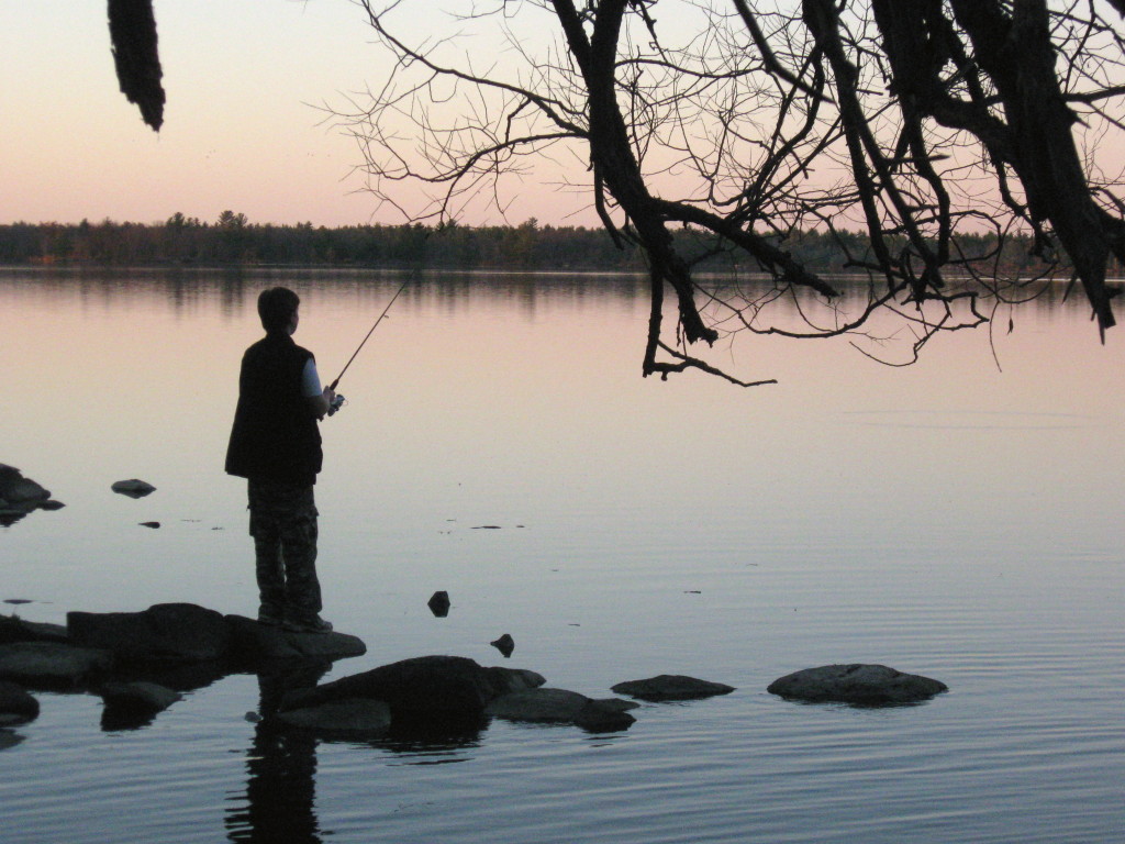
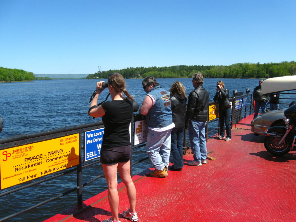
Morris Island ReflectionsEvening FishingQuyon FerryView from Sheila McKee ParkRiverfest at Pinhey’s Point Historical SiteRiding “The Wave” at Bate IslandGreen’s Creek