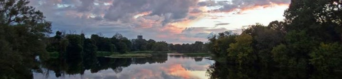
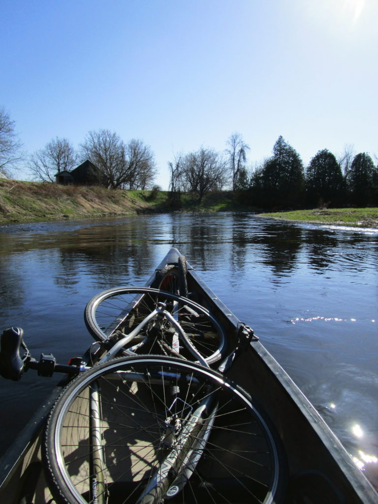
On one of the first warm weekends of spring, I loaded a Vrtucar with my canoe, bicycle, and canoe trailer, and I headed to the Jock River. Leaving the car at Jock River Park in Richmond, I hooked the trailer and canoe on the bike and cycled into a stiff breeze out of the Village along Franktown Road. The gravel shoulder provided plenty of room for comfort, although sections remained soft from the previous day’s rains. A left turn on to Green’s Road and a right on to Jock Trail Road eventually took me to Munster Road, just a few meters from where it crosses the Jock River, 12 km by canoe from the Village. I hauled the canoe off the trailer and down the embankment, packed the bike and trailer in front, and set off down river.
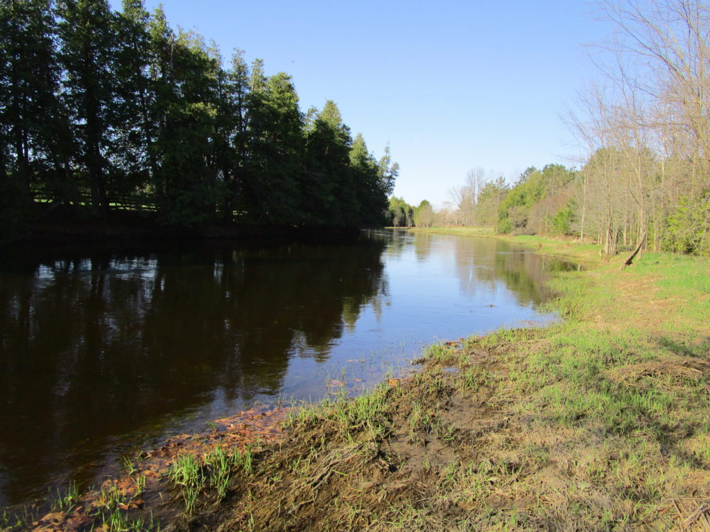
The Jock River at the Munster Road BridgeCanoe Packed with a Bicycle and Canoe Trailer
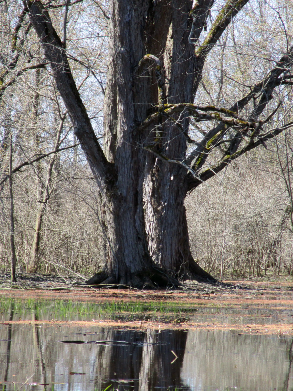
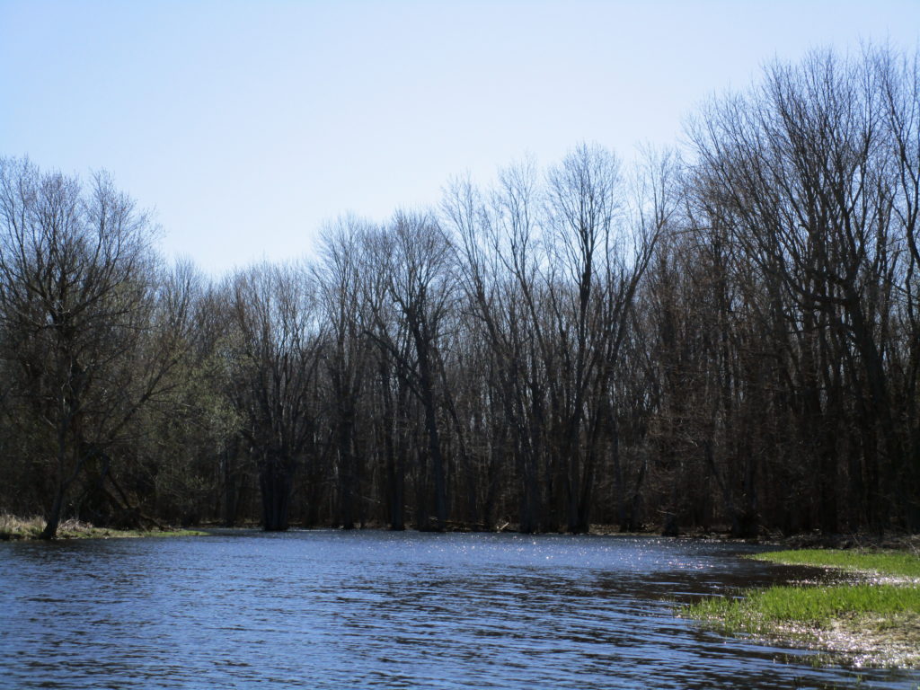
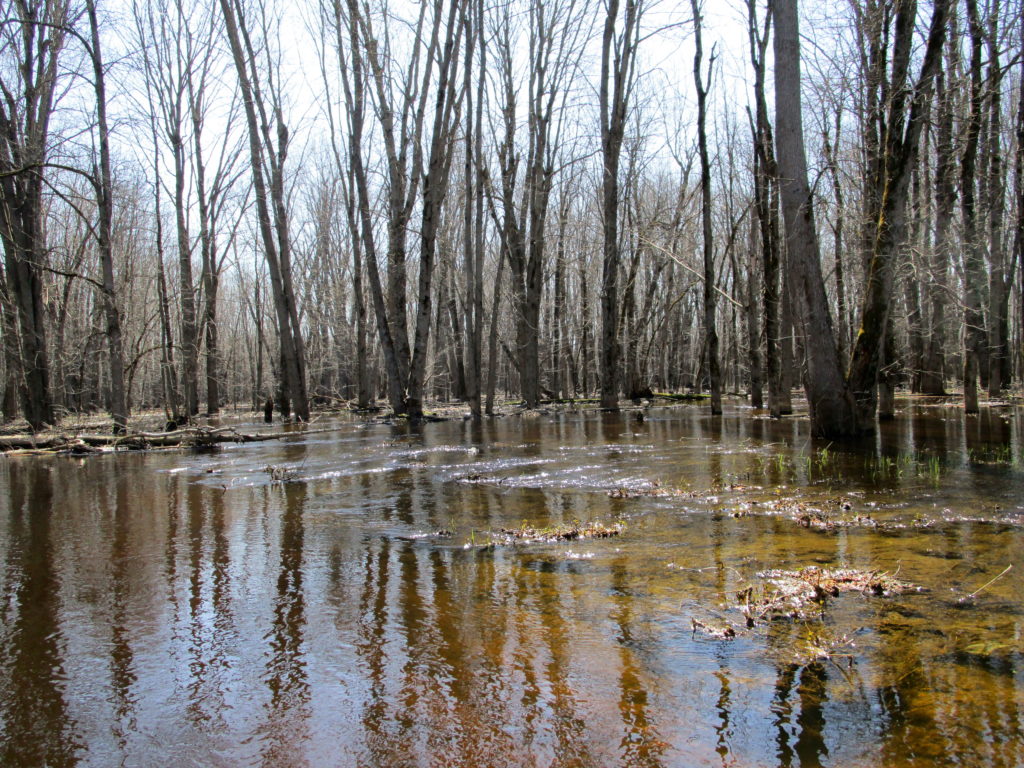
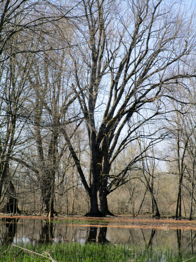
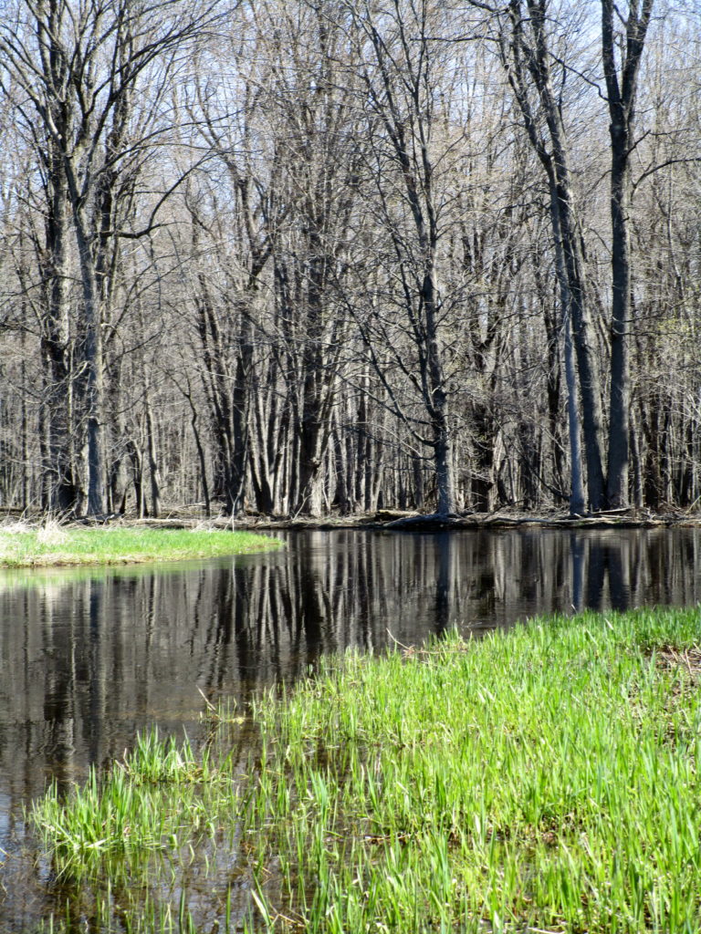
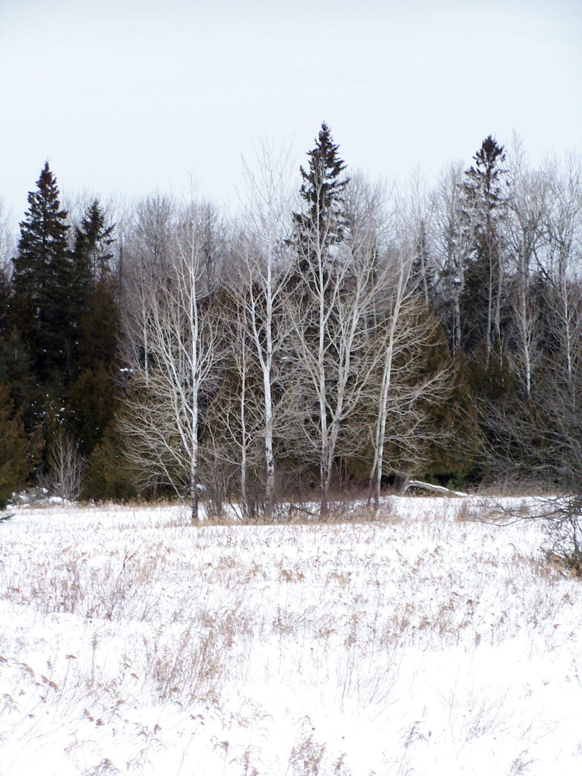
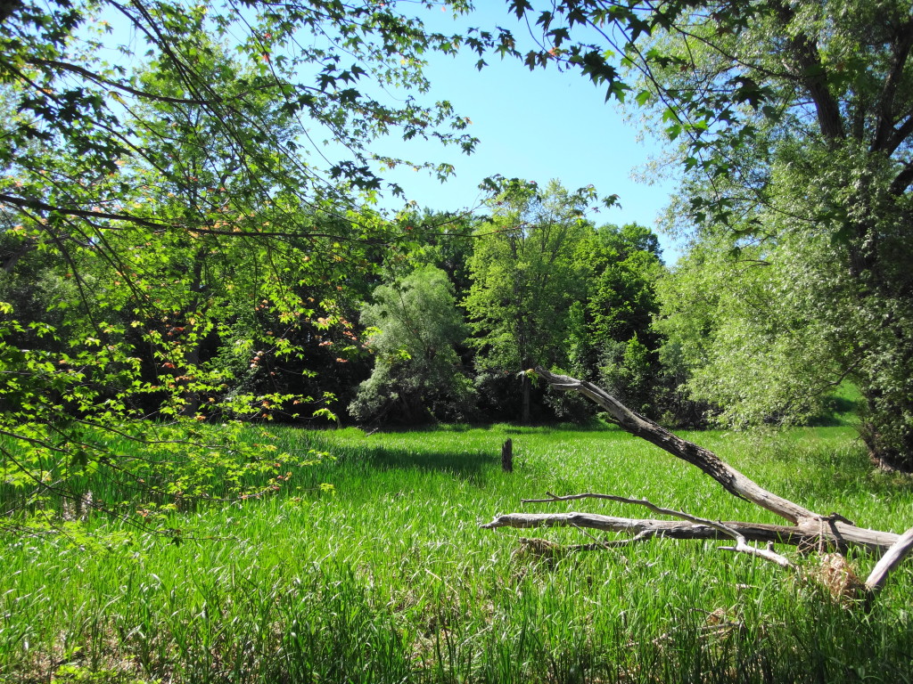
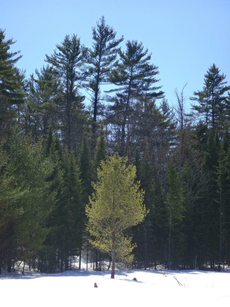
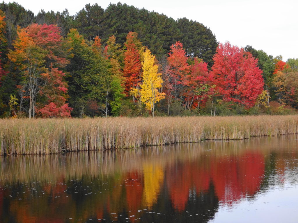
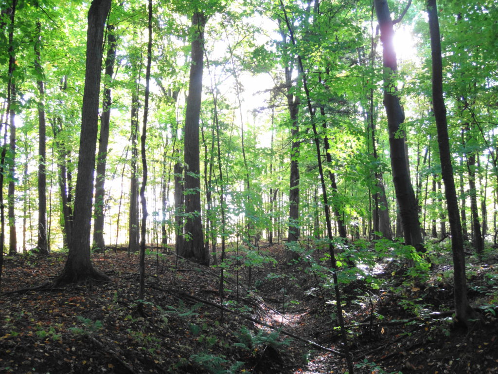
Some people, perhaps, might not consider the Marlborough Forest to extend as far north as the Jock River. For several kilometres, however, the river winds through the swampy north end of the Richmond Fen — the large, provincially-significant peatland that occupies much of the north half of the forest. In the spring, when the creek spills its banks, the swamp appears like some southern bayou, with huge red and silver maples rising from the water to spread overhead like the arches of a cathedral. Blackbirds and grackles call incessently and flit overhead. Wood ducks, mallards, and even a few a teal shelter in back bays and sunlight-dappled pools. Flocks of Canada geese rise noisily from the channel ahead of the canoe as I come around a bend. The scene is both ancient and timeless.
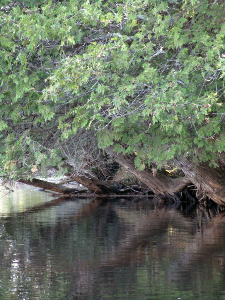
The Jock River Entering the Richmond Fen SwampCedars Beside the Jock River
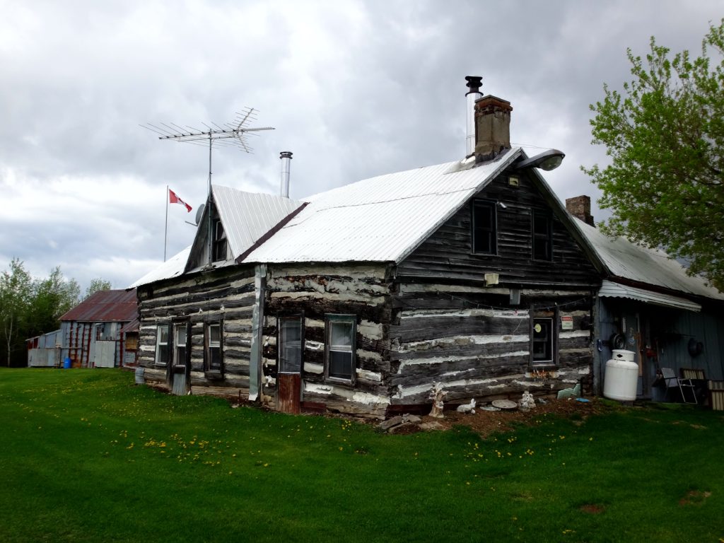
I can hardly imagine the hardships faced by the early settlers of Richmond and its surroundings in the early 19th century. Initially settled in 1818 by demobilized British and Irish soldiers of the 99th Regiment, the village languished for a long time, with little construction or settlement. According to histories of the area, the well-known settler Hamnett Pinhey said of Richmond in 1832, “if you get into it in the Spring, you can’t get out till Summer; and if you get into it in the Fall, you must wait till the Winter…”. The difficulties rose in large part, no doubt, because of the low, boggy land through which the Jock River runs. Much of that land has since been effectively drained for agriculture. However, even today, the swamps bordering the Richmond Fen extend far north of Franktown Road, and new developments on the low, west side of the village rely on sump pumps for dry basements.
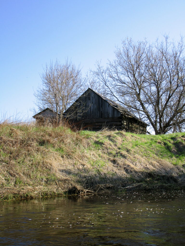
Farm BuildingRichmond Fen Peatland
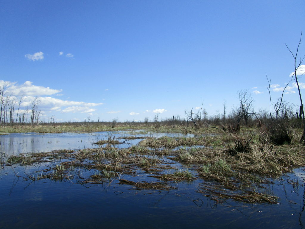
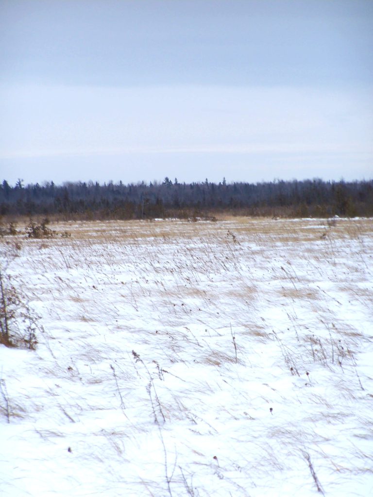
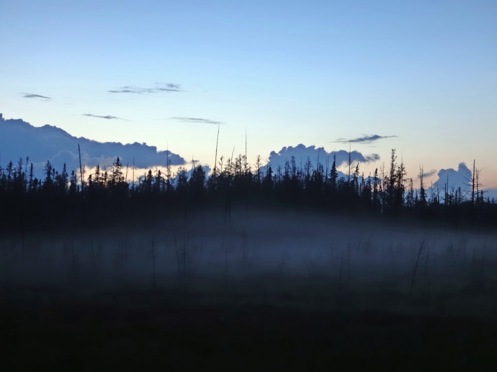
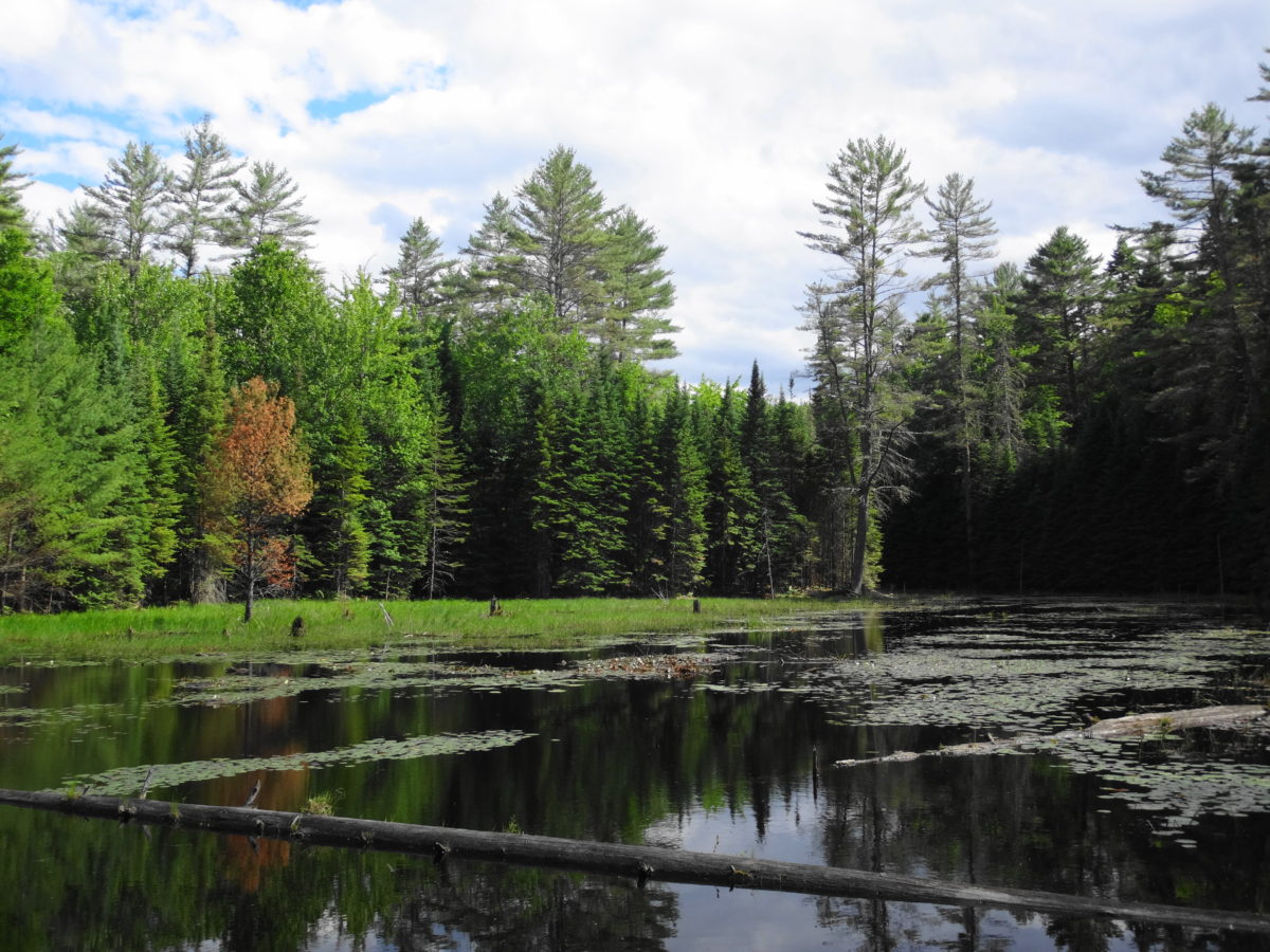
All of that swamp, however, plays a critical role in protecting the Village of Richmond, the suburb of Barrhaven, and much of the intervening farmland from serious flooding. On this particular spring morning, with the river running high, the main channel almost vanished in the swamp as the water flowed outwards into the forest, backwaters, and old oxbows. Spreading placidly over hundreds of hectares, the water slowed and calmed, like a charging bull finding itsef suddenly in a grassy meadow. Why the hurry? Further downstream, at the bottom end of the swamp, the water lazily eased back into the channel again, before running down some last riffles into the village.
Floodwaters Spilling from the Jock River into the Richmond Fen SwampFloodwaters Spilling from the Jock River into the Richmond Fen Swamp
The Rideau Valley Conservation Authority has calculated that the wetlands in its watershed reduce peak flood levels by at least 10% by the time they reach Ottawa. More recent work by the Credit River Conservation Authority and Ducks Unlimited shows that local benefits — such as the influence of the Richmond Fen on the Village of Richmond — can be much greater. In fact, the influence goes much further downstream. Many of the new neighbourhoods and homes bordering the Jock River in Barrhaven simply could not be built safely without the protection provided by the Richmond Fen.
Floodplain of the Jock River in the Richmond FenFloodplain of the Jock River in the Richmond Fen
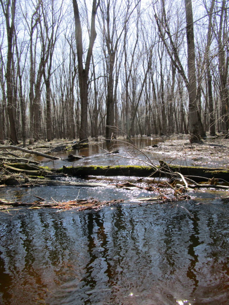
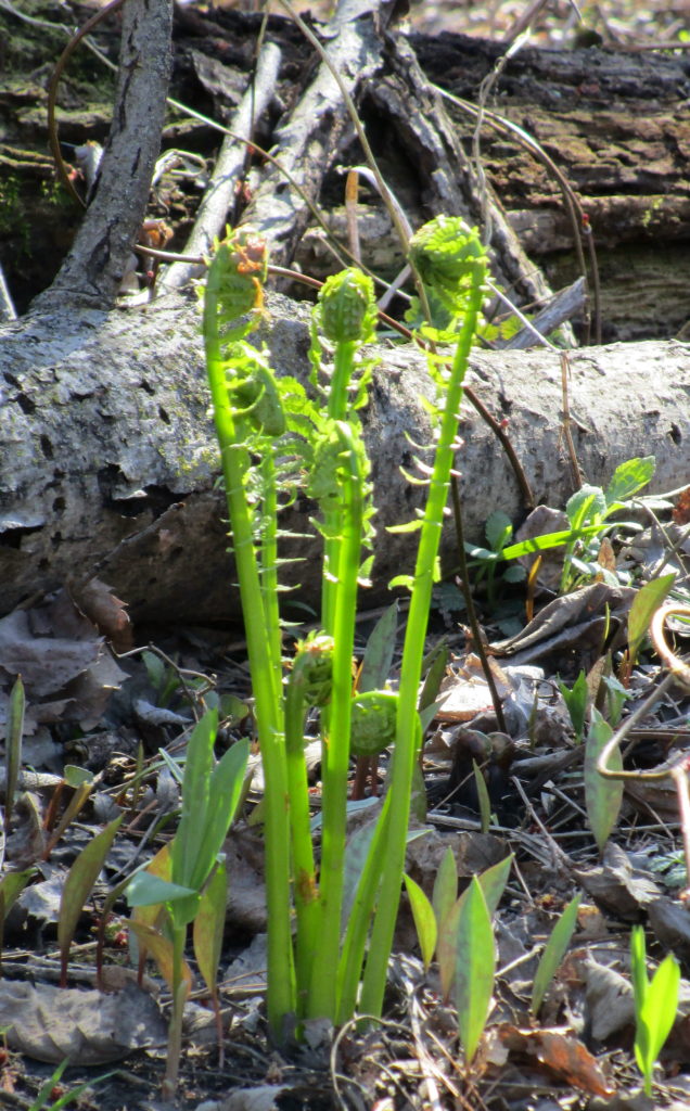
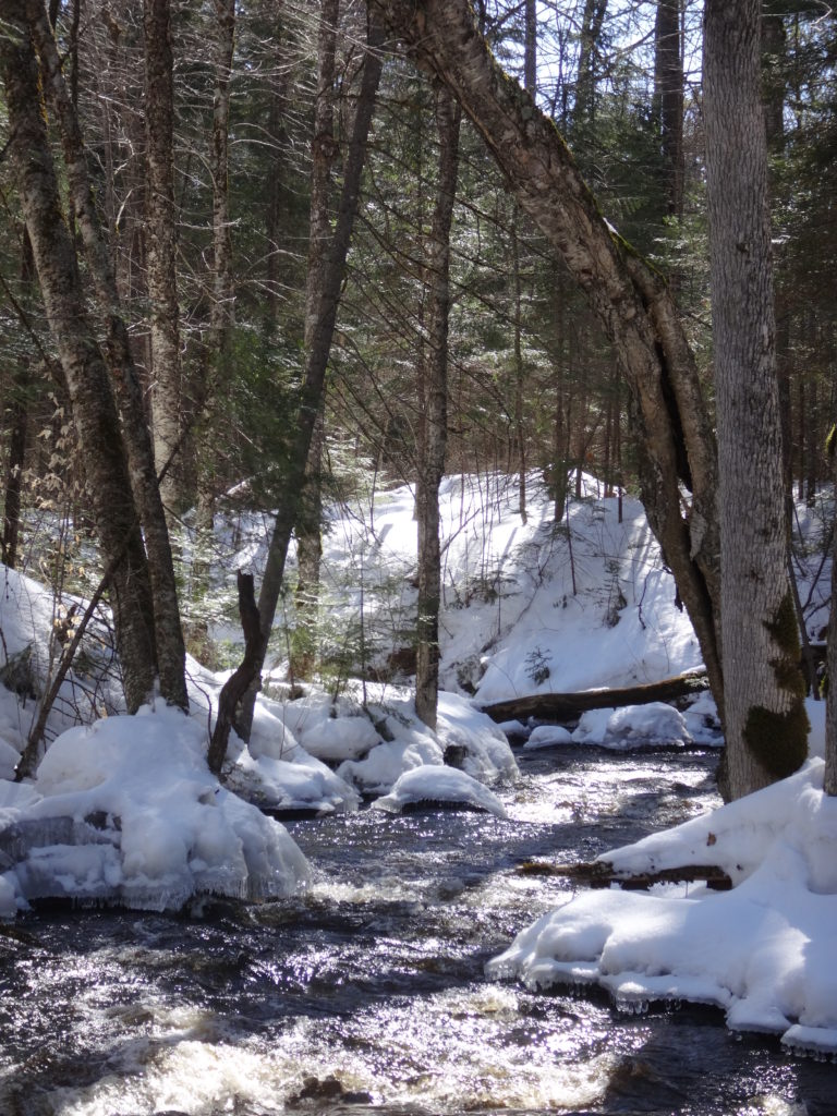
After a long winter, however, the poetic virtues of the swamp have more immediate appeal than the practical benefits: the warmth of the sun through the bare trees, the squak of a blue heron rising ahead, the dance of tree swallows over the water, the reflection of a silver maple in a glassy pool, the unfurling of a fern, the bright green of new grass and sedges on the shore. I dawdled down the river, detouring up side creeks and under the railway bridge into the moat (the “lagg”) surrounding the open fen. Whenever possible, I set down my paddle and leaned back with my elbows on the thwarts drifting with with the current and watching for turtles. A Cooper’s hawk passed overhead. A snapping turtle slid reluctantly into the stream. A carp swirled from the weedy shallows into the deeper water. The river carried me along.
Silver Maple, Richmond Fen SwampTree Swallows, Richmond FenOstrich Fern and Trout Lily, Richmond Fen SwampJock River, Richmond Fen Swamp
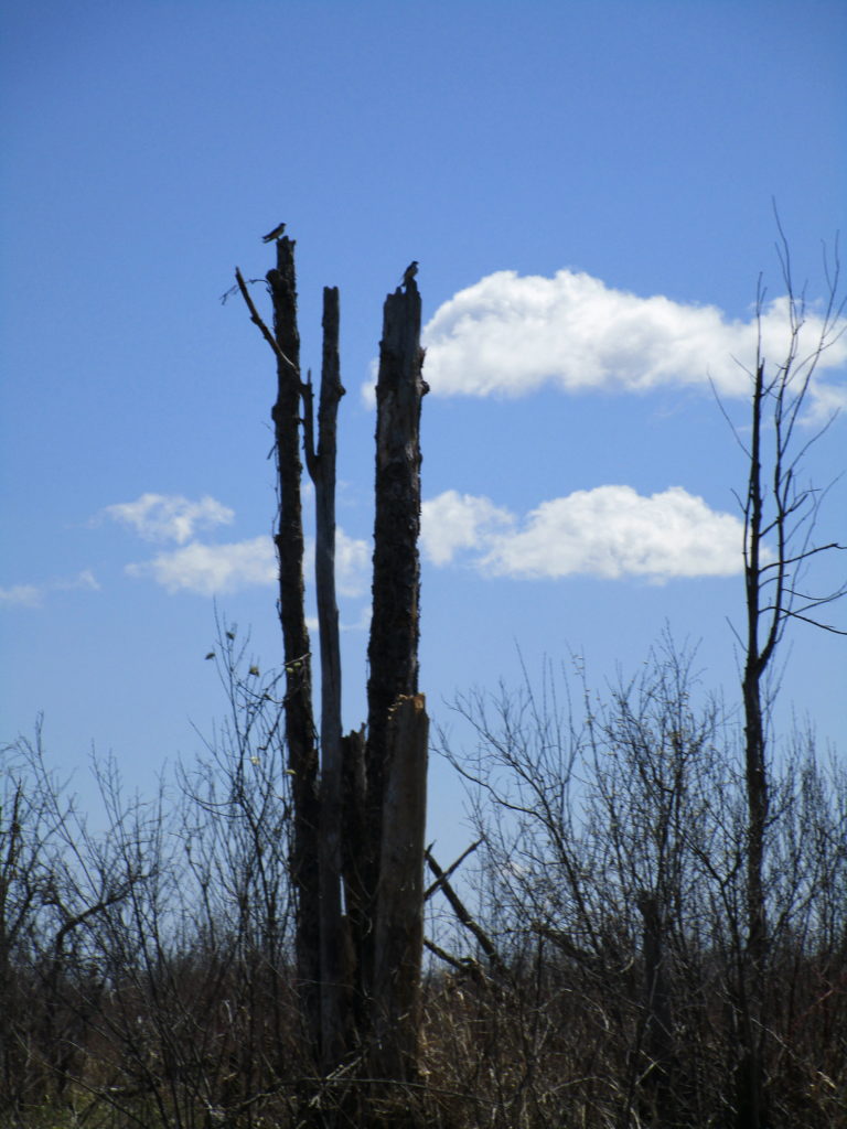
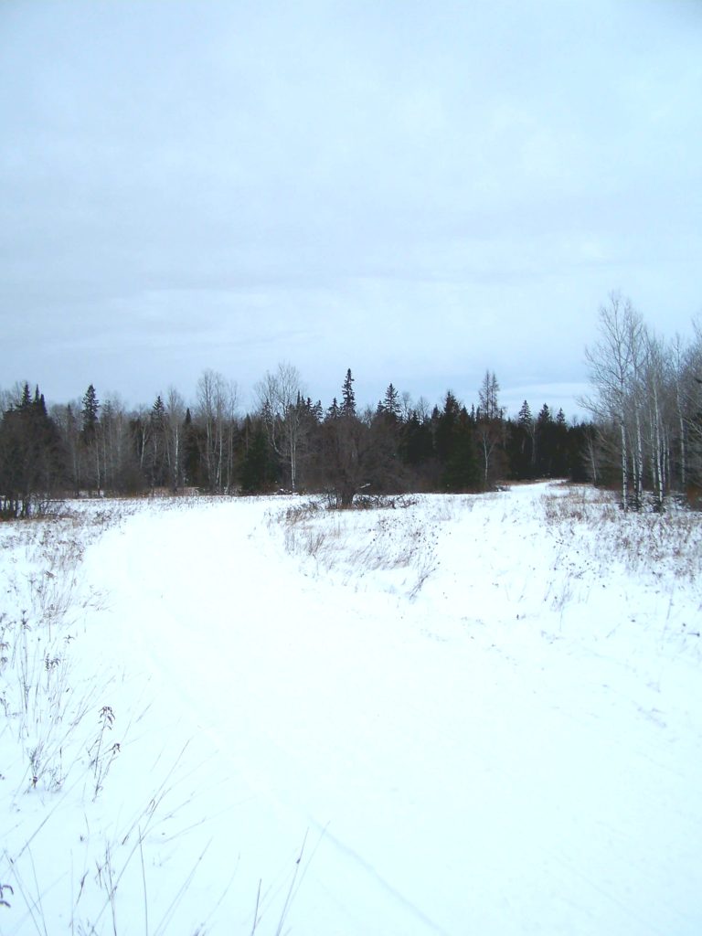
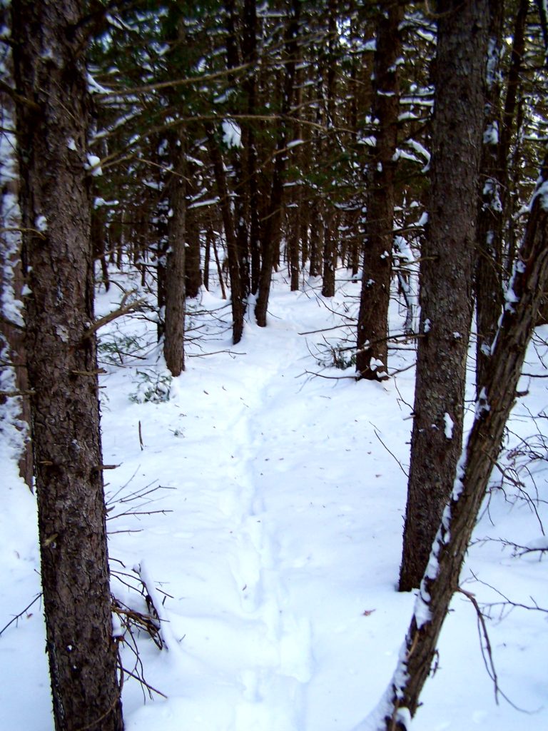
Ottawa’s largest natural area lies in the south end of the City, largely unknown to most residents. A 200 km2 patchwork of forest and abandoned homesteads, swamps and fens, dusty forestry roads and claustrophic thickets — it hides off the beaten path, protecting its secrets. Only one road crosses it, Roger Stevens Drive, which bisects it from east to west. Dwyer Hill Road skirts in and out along its west side. A few other public roads probe the edges, ending either in cattails or locked gates. One doesn’t stumble upon the Marlborough Forest; a visit requires purpose and intent.
Cedar Rail Fence — Marlborough ForestHeritage Farmhouse – Marlborough Forest
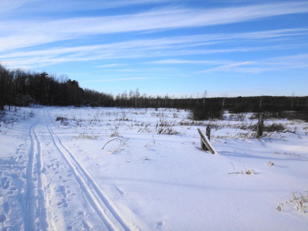
For much of the year, the Marlborough discourages exploration. In winter, winds stream bitterly across flat peatlands and old fields, sculpting snow into ripples and waves, and piling it deep under bare hardwoods, while deer seek shelter in dark groves of cedar and spruce. In spring, meltwaters pool behind beaver dams, submerge roads and trails, and turn tracks into clay quagmires. In summer, plagues of mosquitoes and deer flies swarm in the hot, dry air to torment both human and beast. In autumn, the crack of hunters’ rifles warns against casual hiking.
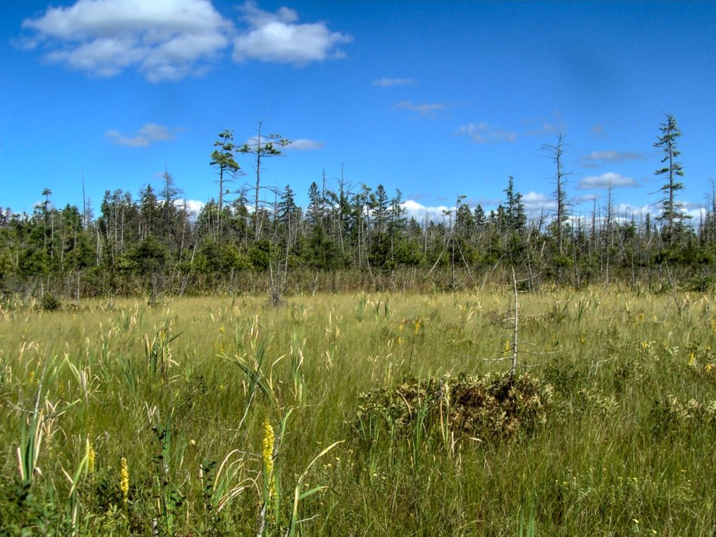
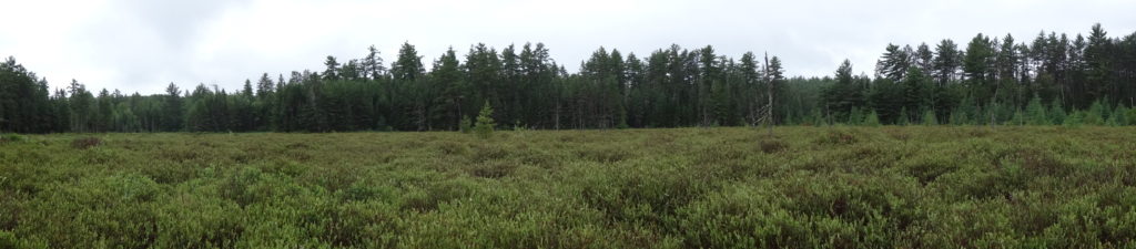
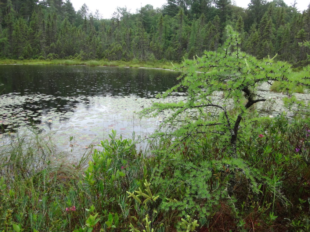
Phragmites Fen – Marlborough Forest
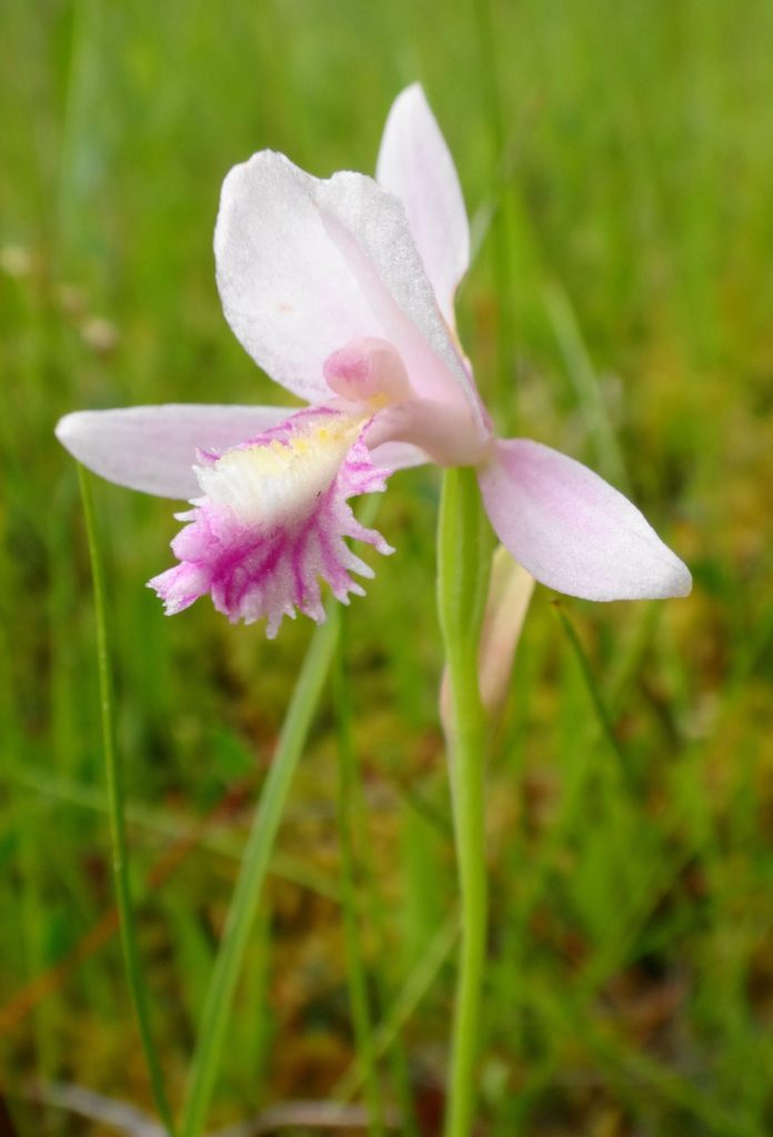
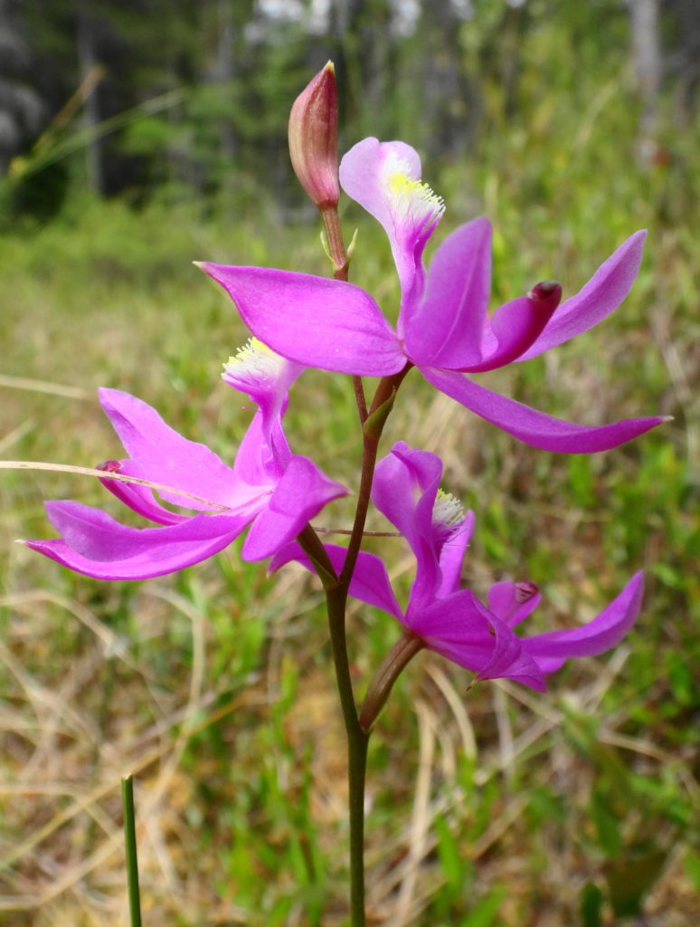
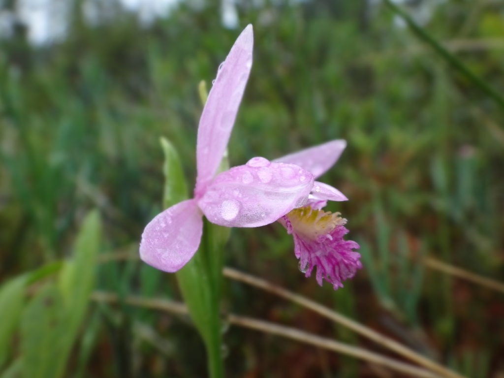
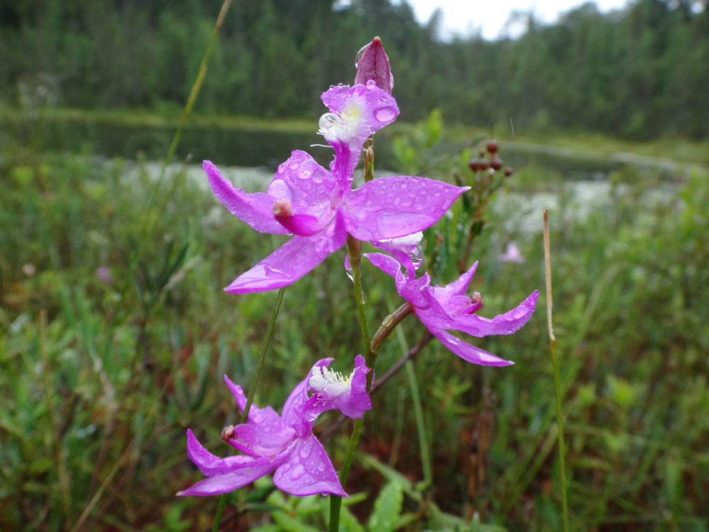
And yet, the Marlborough offers moments sublime and increasingly rare. The low, winter sun glinting off deep snow may highlight the tracks of a fisher crossing between trees or an otter crossing between creeks. A humid and buggy trek through a swamp may lead to the open, fresh air of a fen, where orchids rise from pale green sphagnum like small, purple flags. In the stillness of a darkening, plum sky, bats may flitter along the edge of a clearing, while whip-poor-wills call plaintively.
Perhaps because of its isolation, any intrusion on the quiet of the Marlborough feels more agregious. In the sharp winter air, the whine of snowmobiles announces their presence minutes in advance. In the murmur and buzz of a summer afternoon, the grumble of ATVs stalks the forest like a disgruntled bear. Nonetheless, the Marlborough has survived because of its history of public use. More than half of the forest lies in public ownership, a legacy of Ontario’s Agreement Forest Program.
Snowmobile Trail, Marlborough Forest
The Agreement Forest Program ran from the 1920s until 1998. The program aimed to repair the damage done by the previous 150 years of deforestation in Ontario. On abandoned lands — lands stripped by poor logging practices, scratch farms, and wildfires — the Province began a program of reclamation and rehabilition. Many of Ottawa’s protected natural lands date from this time: places like the Cumberland and Larose Forests in the east, the Marlborough Forest in the south, and the Torbolton Forest in the west.
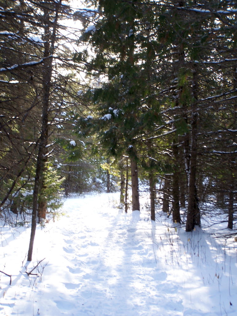
Cedar Grove Trail, Marlborough Forest
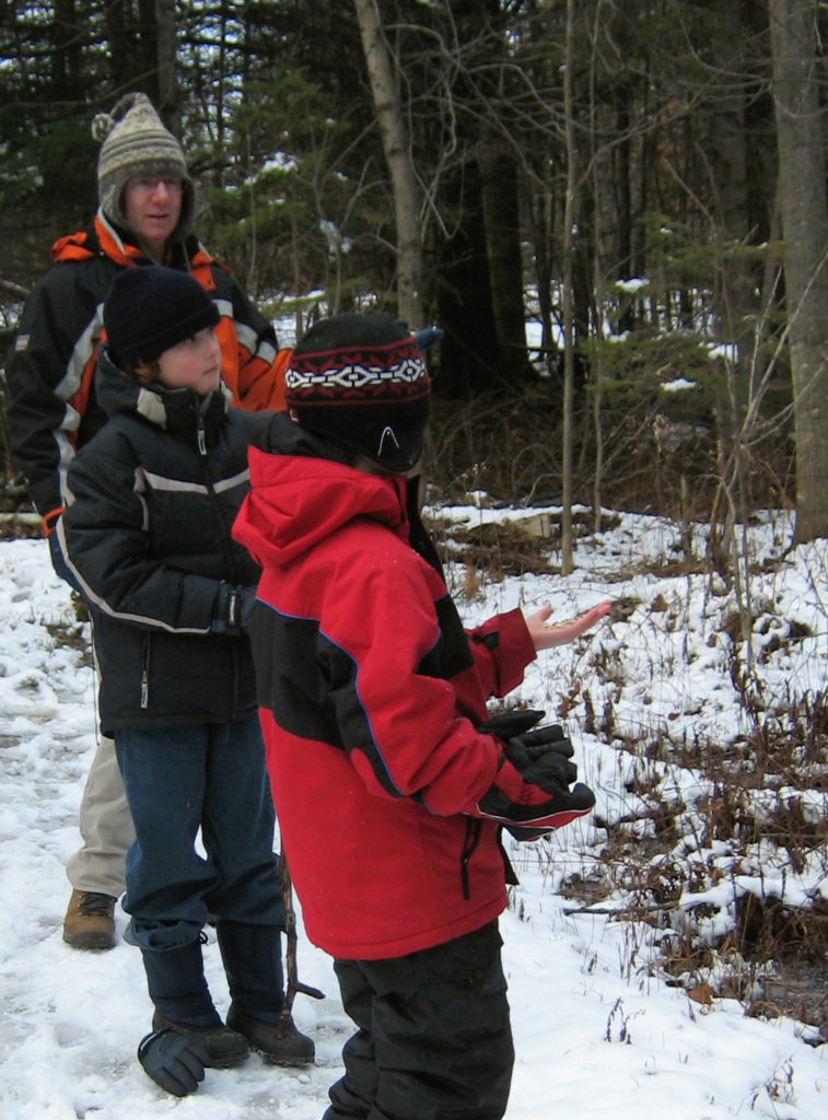
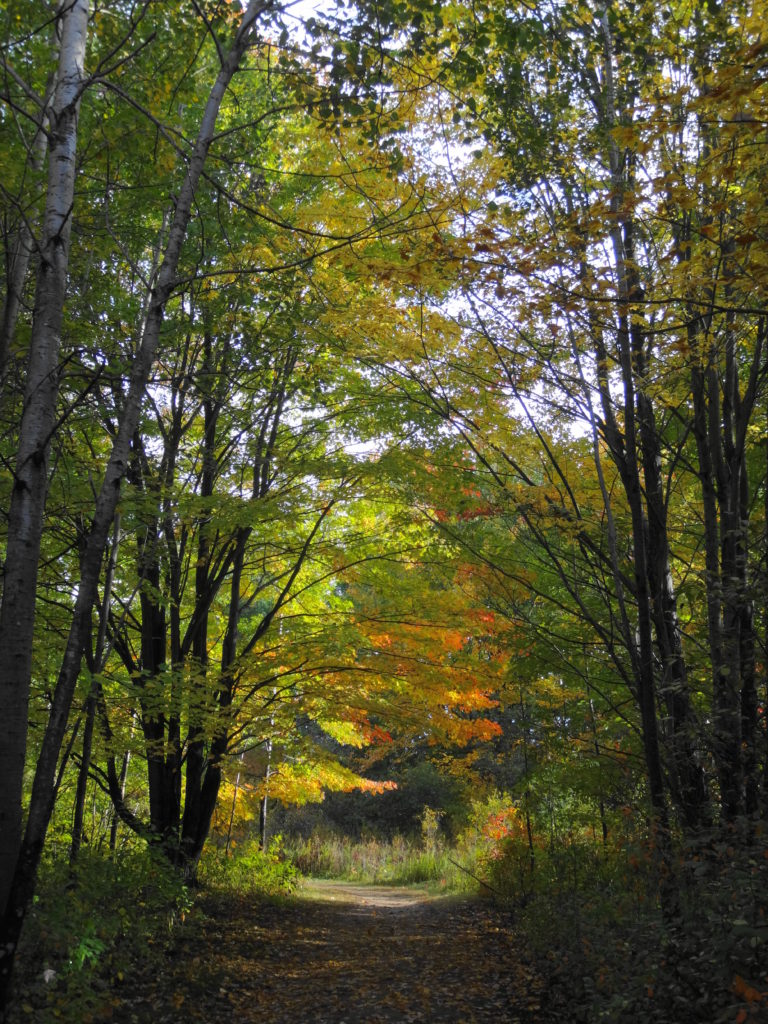
The Cedar Grove Trail, off Roger Steven’s Drive, provides a pretty introduction to the Marlborough Forest, ideal for a sunny winter day of snowshoeing or skiing (https://ottawa.ca/en/residents/water-and-environment/air-land-and-water/greenspace#south). This short trail circles a small lake and takes about 1 – 2 hours to complete at an easy pace. En route, it passes over a short weir, crosses a meadow, and threads through hardwood and cedar forests. At first, the forest seems quiet, except perhaps for the distant buzzing of snowmobiles. But a few minutes of walking and listening soon corrects that perception. Chickadees and nuthatches twitter and flit among the trees, always ready to alight on an outstretched hand for peanuts and sunflowers seeds. Downy and hairy woodpeckers tap in the treetops. Pileated woodpeckers hammer deeper in the woods. With a deep “croak” and the susurration of wings, a raven passes overhead.
Feeding Chickadees – Marlborough ForestRoger’s Pond, Cedar Grove Trail, Marlborough Forest.
Other life remains hidden behind the cedars or sheltered under the snow. The tracks of white-tailed deer, squirrels, and hares cross the trail. The delicate footprints of a white-footed mouse emerge from a tunnel beside a log and end at a small pile of seeds. Under the pond ice, beavers venture from their lodge to retrieve twigs from their food pile. Under the clearer ice by the weir, a close eye may find water beetles still hunting in the gently flowing stream.
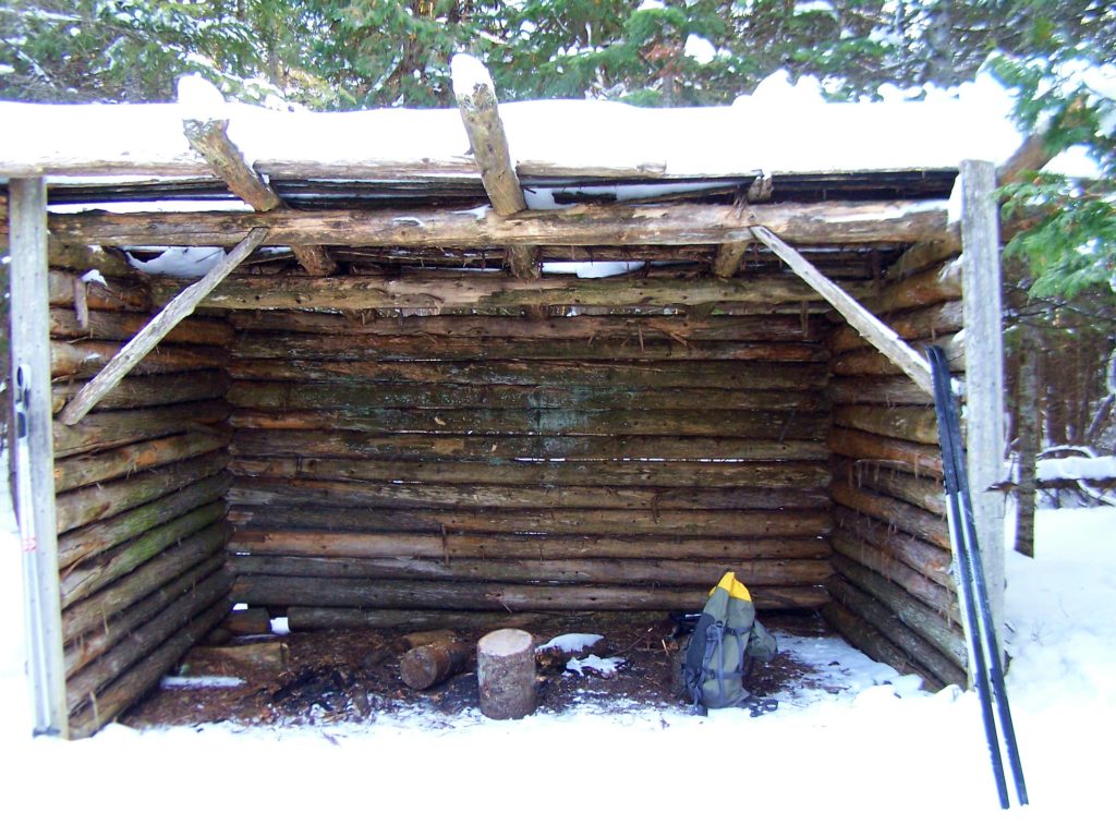
Deer Tracks – Cedar Pond Trail, Marlborough ForestHiking Shelter – Cedar Grove Trail, Marlborough Forest
I haven’t visited the Cedar Grove Trail outside of winter, but I imagine it equally as lovely. I’d opt for autumn, after the mosquitoes and deer flies, when the golden foliage along the pond should glow against the darker conifers. I can picture a frosty early morning walk, with the sun just touching the down of milkweeds in the meadow, perhaps a delicate rime on the leaves and grasses, and a beaver silently creasing the pond toward home. A faint mist might lie on the water. Along the forest edge, the sun might catch the flash of a white tail, as a deer vanishes into the wood.
Wetlands receive very little respect in literature. J.R.R. Tolkien, in particular, seems to have had low regard for them.
“The ground now became damp, and in places boggy, and here and there they came upon pools, and wide stretches of reeds and rushes filled with the warbling of little hidden birds. They had to pick their way carefully to keep both dry-footed and on their proper course. At first they made fair progress, but as they went on, their passage became slower and more dangerous. The marshes were bewildering and treacherous, and there was no permanent trail even for Rangers to find through their shifting quagmires. The flies began to torment them, and the air was full of clouds of tiny midges that crept up their sleeves and breeches and into their hair…. They spent a miserable day in this lonely and unpleasant country. Their camping-place was damp, cold, and uncomfortable; and the biting insects would not let them sleep. There were also abominable creatures haunting the reeds and tussocks that from the sound of them were evil relatives of the cricket. There were thousands of them, and they squeaked all round, neek-breek, breek-neek, unceasingly all the night, until the hobbits were nearly frantic.” — The Fellowship of the Ring.
Tolkien later takes Frodo, Sam, and Gollum into the Dead Marshes, an even more unpleasant place by his description — where bog gasses flicker like will-o-wisps and corpses lie preserved in fetid pools.
Tolkien, that tweedy professor, clearly had never stood in a deer track in an open, sunny fen with a breeze stirring the drooping reeds, dragonflies and damselflies dancing overhead, sedge wrens rattling in the rushes, and dense spikes of orchids rising from the spongy, peat mat. He’d never paddled a canoe at dawn through a flooded cathedral of maples or bald cypress, watched by a wary heron. He’d never sat beside a marsh at dusk, flipping a plug toward the lily-pads and watching a beaver crease the copper reflection of sunset on the water.
Wetland, Four Seasons Conservation Forest, Deep RiverUpper Poole Creek Wetland
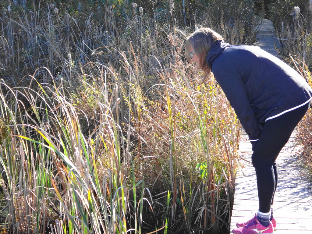
I spend more time in wetlands than most people, both for work and pleasure. Unlike Tolkien’s poor hobbits, I have accepted the two inevitabilities of happy wetland exploration: water and bugs. I embrace the first. Unless hypothermia threatens, boots and hip-waders are better left at home. A pair of old runners — “bog shoes” — and long pants tucked into socks make for easier and more enjoyable wading. I tolerate the second, helped by slatherings of picaridin or DEET. With walking stick or paddle in hand, I follow the windings of marshy channels, clamber and slog through alder and ash swamps looking for fens, or pierce dense spruce thickets and ford moat-like laggs to stand upon a bog.
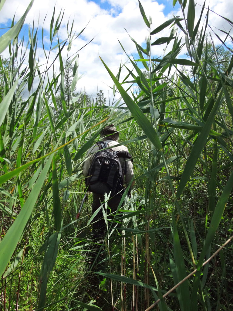
Entering the Phragmites Fen with Michael Runtz
Wetlands, much like coral reefs or rainforests, display life at its most exuberant. They literally overflow with the most precious substance in the universe, water: H2O, that wondrous, bipolar, lipophobic molecule; miraculous solvent; force of nature; cradle of creation. From the smallest plants on earth to some of the largest, life rises upwards from wetlands. Scoop a handful of marsh water from a canoe and see life swimming and writhing in your palm. Stand within a circle of reeds, close your eyes, and hear hidden life rustle, hum, buzz, and sing about you. Raise your face to the emerald canopy of a red maple swamp and watch life transform sunlight into substance.
Maple Swamp and Marsh Meadow, Stony Swamp
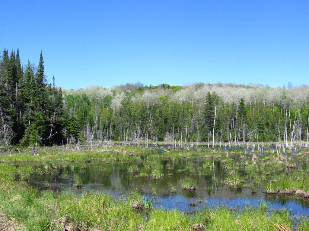
Ottawa and the Ottawa Valley differ from much of Southern Ontario in that they retain most of their original, pre-European wetlands. Other areas south of the Canadian Shield have experienced the loss of up to 95% of their wetlands to urbanization and agriculture. In addition to the direct loss of wetland habitat and biodiversity, these losses have robbed the landscape of much of its ability to retain water, nutrients, and pollutants — contributing to a array of environmental problems, including toxic algal blooms in Lake Erie. In Ottawa, where about 60% of our original wetlands remain, the Rideau Valley Conservation Authority has calculated that they reduce peak floodwater elevations by about 10%. In doing so, they protect property and homes in both the rural and urban area.
Restored Wetland, Carp River Floodplain
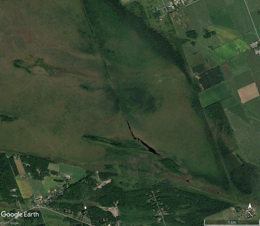
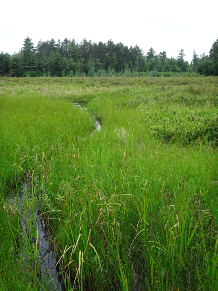
Circumstance rather than foresight has protected Ottawa’s wetlands. Although protections now exist for much of the City’s wetlands, all of the larger wetlands bear the scars of previous attempts at drainage. Even in Mer Bleue, an internationally significant RAMSAR wetland, abandoned drainage ditches and channels cut knife-like through the 10,000 year-old bog, easily visible on Google Earth. Many of these attempts failed simply because the land proved too flat to drain efficiently. Flat or near-flat plains of shallow limestone bedrock and clay cover about 2/3 of the City’s landscape, often pockmarked by shallow depressions. Even where larger creeks and rivers, like Bearbrook or the Carp, have carved channels, they often flow slowly through wide floodplains lined by old oxbows, backwaters, and marshy swales.
Mer Bleue DitchingMississippi River Wetland
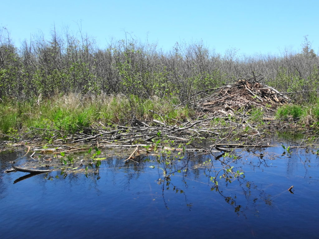
Since the mid-20th century, in fact, Ottawa’s wetlands have made a come-back, in large part thanks to the resurgence of beavers. For nearly 200 years, beavers had become rare in the Ottawa Valley, eliminated in the 17th and 18th centuries by the combination of the fur trade, uncontrolled logging, and agricultural land clearing. By the end of the fur trade in the mid-19th century, the focus of trapping had shifted far west and north. Around the 1950s, however, beaver populations began to recover and to rec0l0nize their old ranges. At the same time, marginal farmlands had been abandoned across eastern North America and forests began to regrow, providing food for returning animals. In Ottawa, historical aerial photography shows beavers re-settling the area through the 1970s and 1980s, with populations reaching a peak in the mid-1990s.
Beaver Lodge and Food Pile
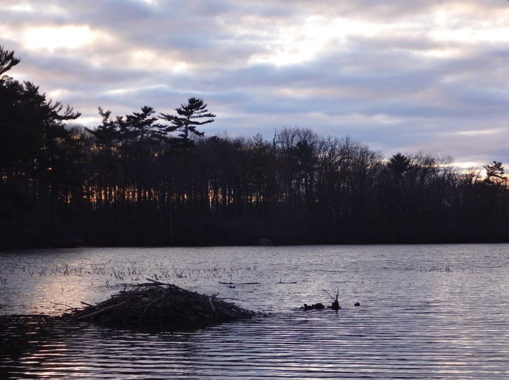
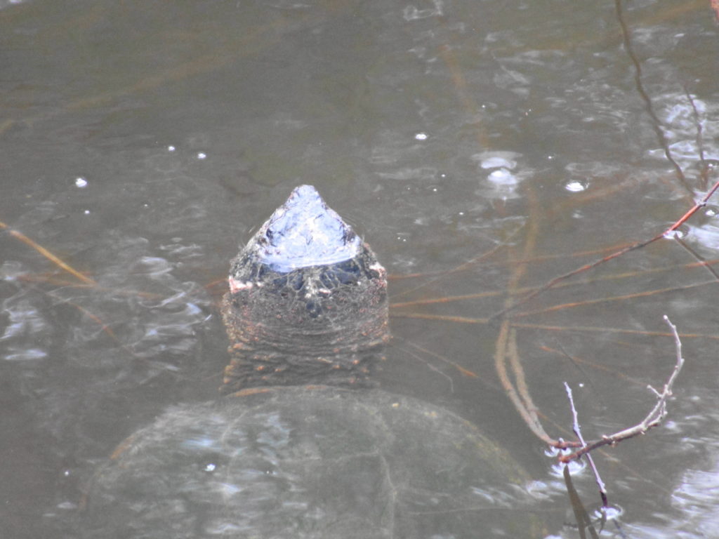
Signs of beavers appear everywhere, even in the heart of Ottawa. A walk along any one of the City’s larger urban creeks is liable to reveal a dam or a lodge tucked into a quieter reach. Stony Swamp, in the National Capital Greenbelt, contains the popular Beaver Trail, and Mud Lake, in Britannia, provides a favourite location for photographers seeking that iconic image of a beaver at dusk.
Mud Lake Beaver Lodge at DuskMud Lake Snapping Turtle
The real impact of beavers, however, has been felt in the rural area — both for good and ill. That long-time chronicler of Ottawa’s natural history, Dr. Fred Schueler, has suggested that the return of beavers may be responsible for an apparent resurgence of threatened Blanding’s turtles in the region. In fact, many scientific studies have demonstrated the immense benefits of beaver ponds and beaver meadows for biodiversity: for everything from bugs and bats to moose and wolves. However, those benefits seem poor consolation to a farmer who has seen acres of his grandfather’s fields and woodlots turned to marsh and swamp. Sometimes the costs of those societal benefits come at the expense of individual landowners, with no compensation. Given the robust health of Ottawa’s beaver population, I cannot fault a farmer who feels the need to trap a beaver — although I might suggest some more effective solutions.
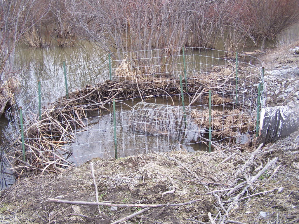
Beaver Deceiver Protecting a Road Culvert
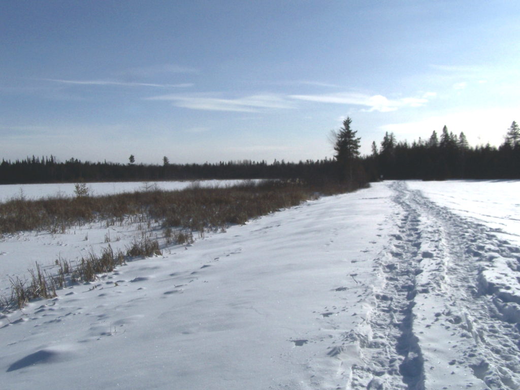
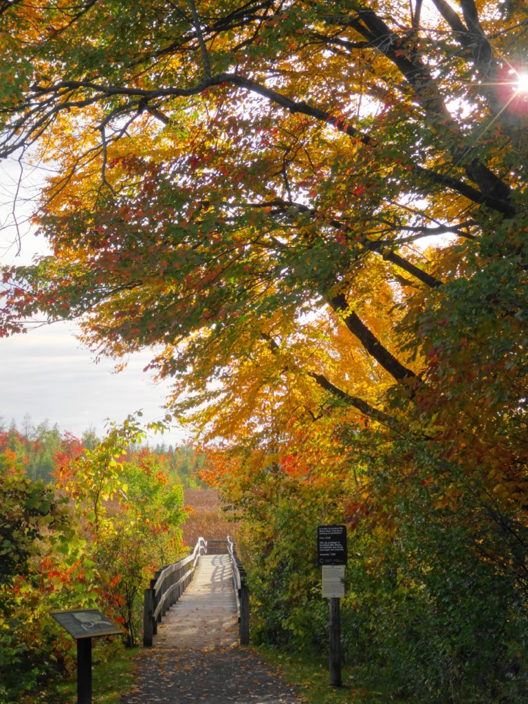
Ottawa’s residents enjoy access to every type of wetland: marshes, swamps, bogs, fens. The City of Ottawa has left some more sensitive areas, like the Phragmites Fen deep in the Marlborough Forest, protected by its own natural barriers. But other features can be reached by trail, boardwalk, or path. Mer Bleue and Stony Swamp, in the National Capital Greenbelt, receive the most visitors. But the Trans-Canada Trail, west of Stittsville, offers lovely views over marshlands. Petrie Island, in Kanata, provides a popular destination for photographers and birdwatchers. The Crazy Horse Trail, in the Carp Hills, winds between beaver ponds, swamps, and small fens.
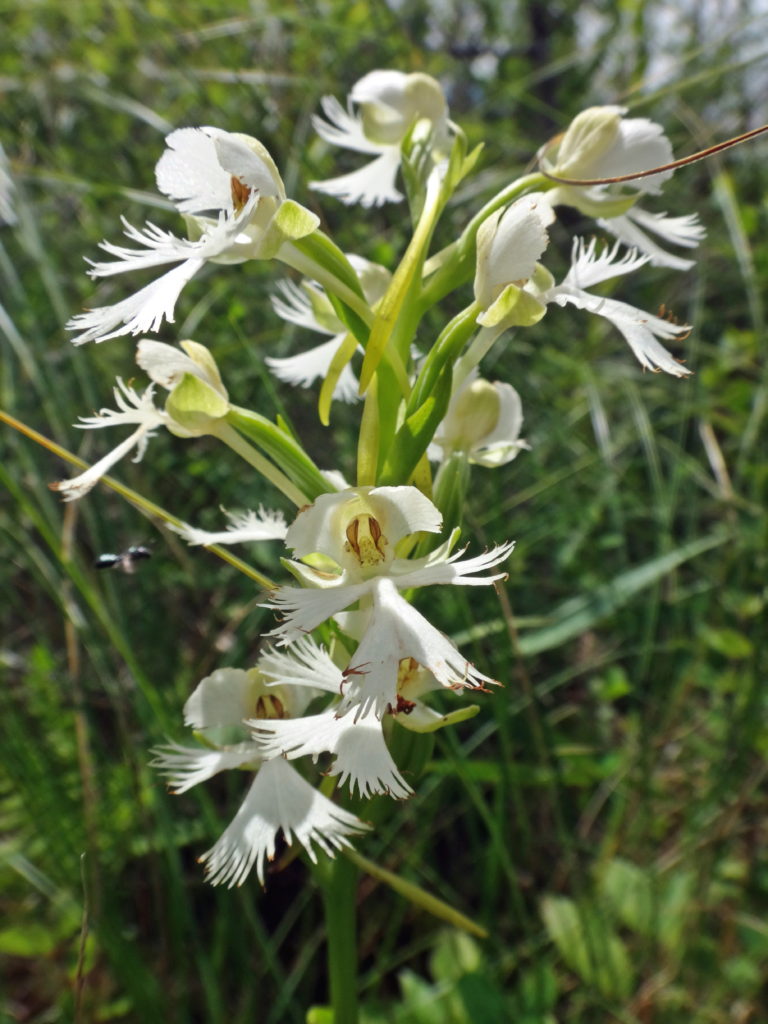
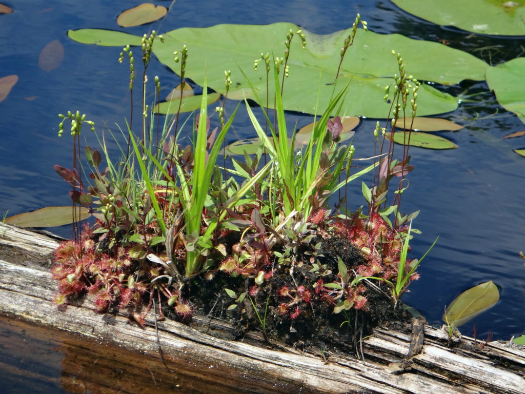
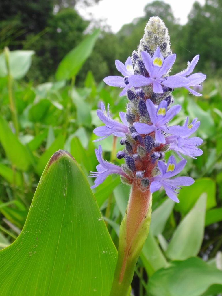
Endangered Eastern Prairie Fringed OrchidFloating FenSundewsPickerelweedMisty SwampRose PogoniaGatineau Park Wetland
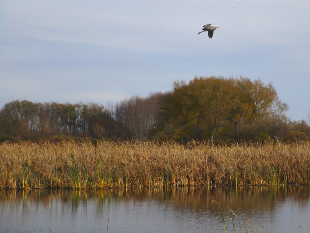
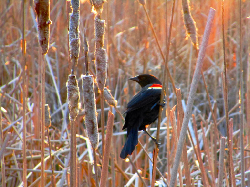
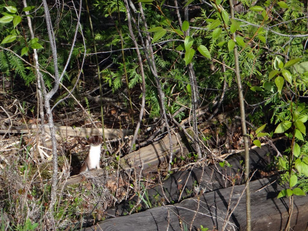
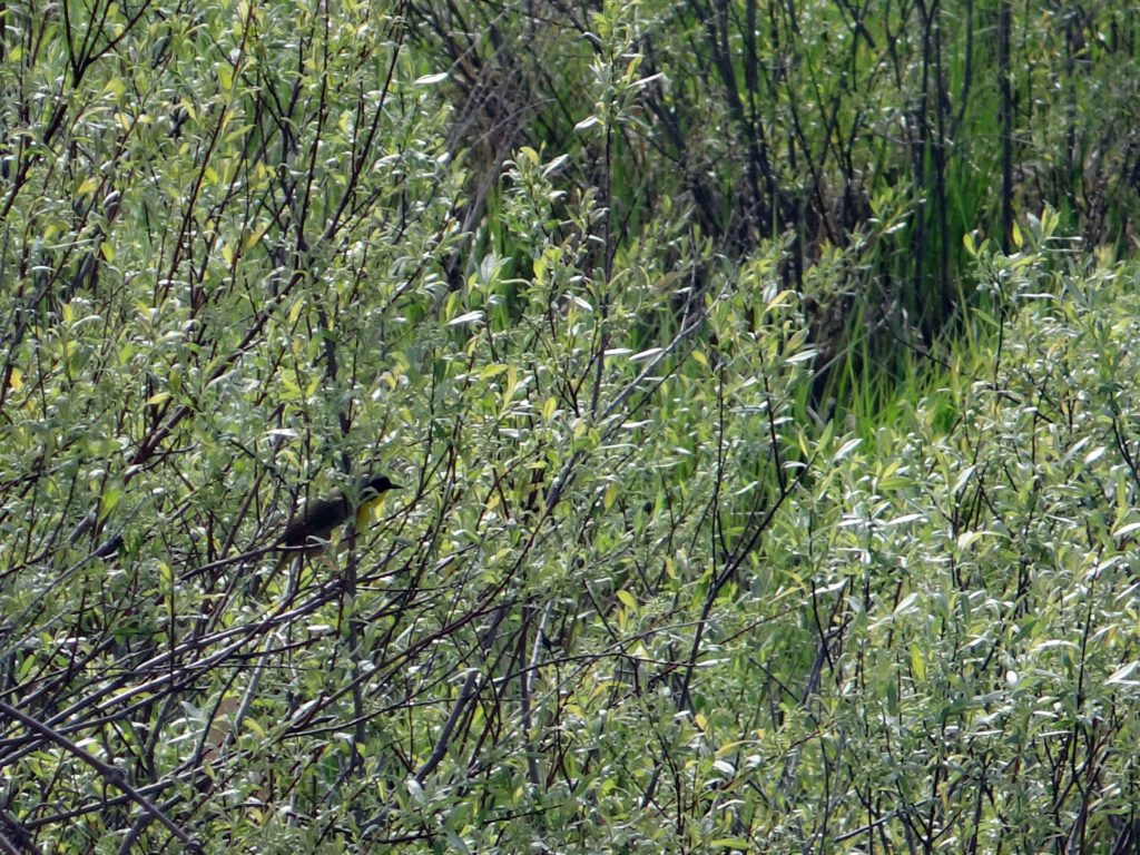
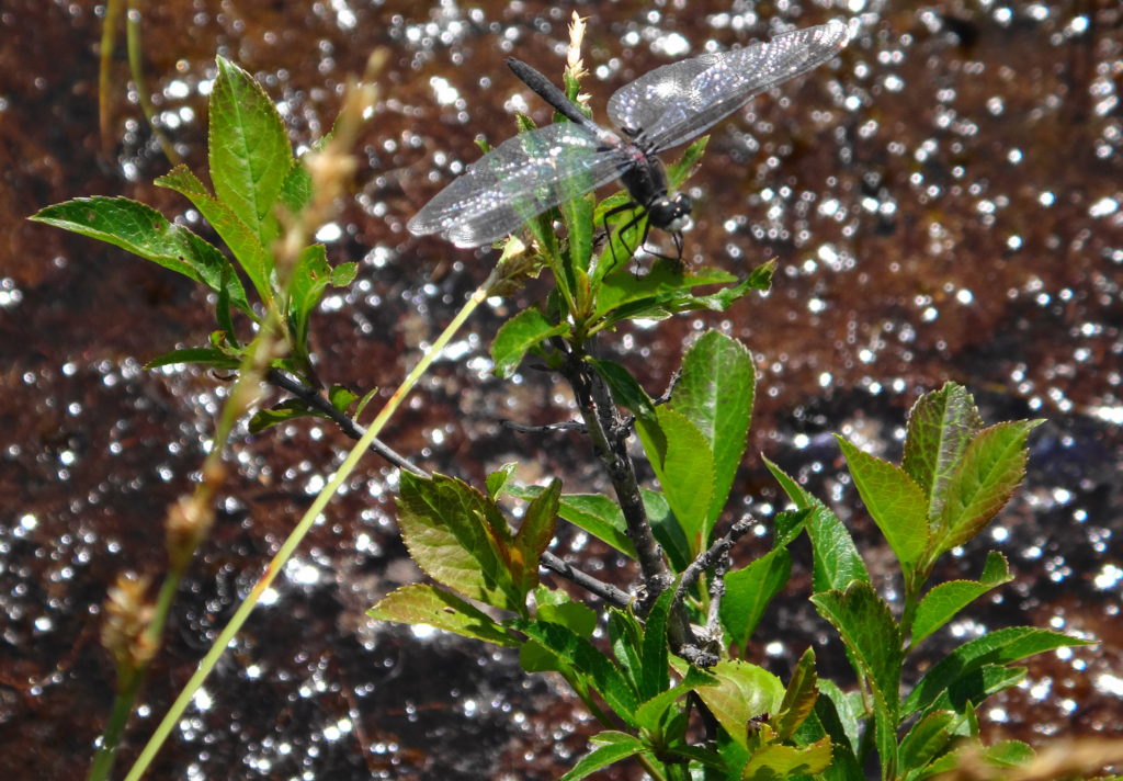
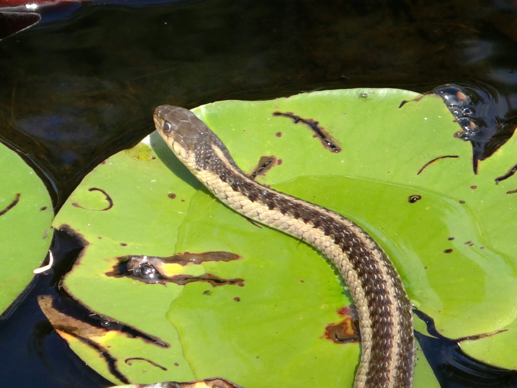
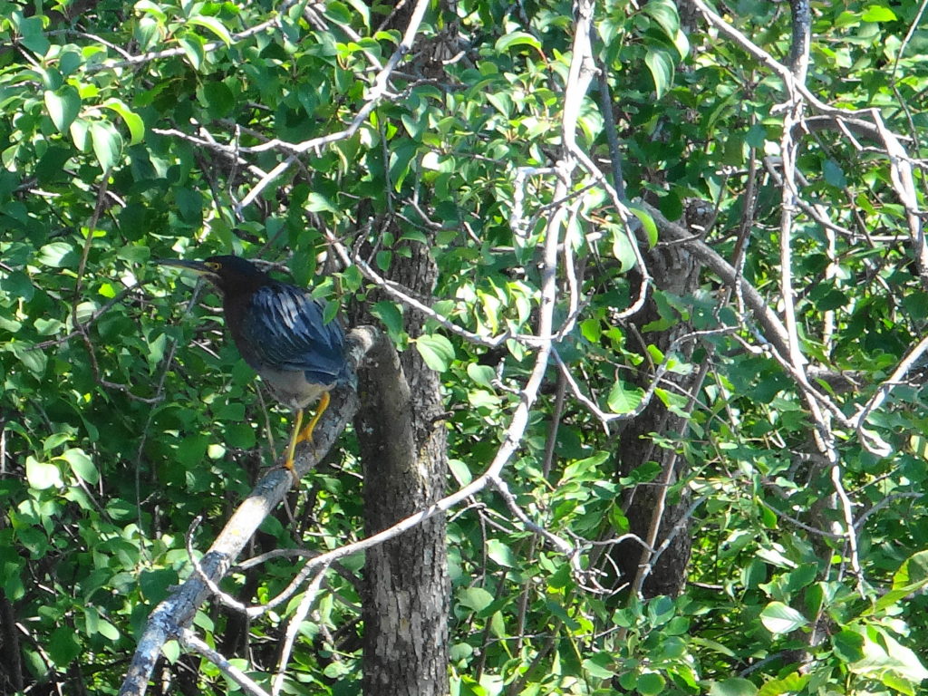
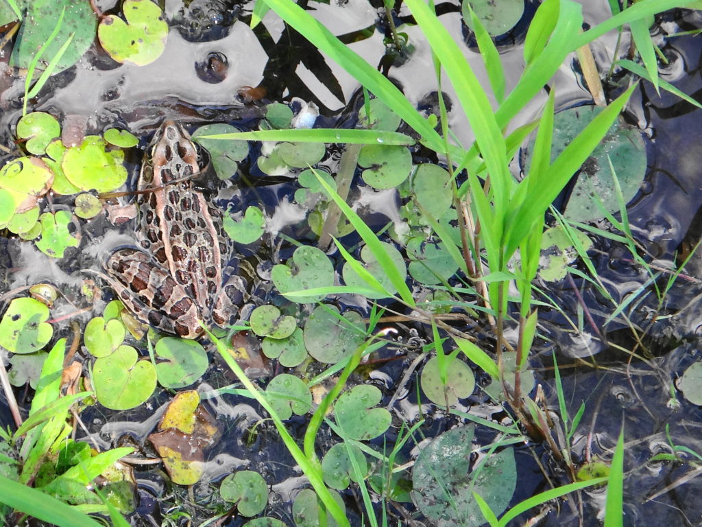
Unlike forests and grasslands, which tend to grow quieter as the sun rises higher, wetlands carry on through the day, as one group of animals replaces another. Just as the dawn frog and songbird chorus begins to ebb, the turtles emerge cautiously on to basking rocks and logs. Soon dragonflies and damselflies dart amongst the reeds. A muskrat preens itself, while an ermine hunts along the shoreline. Tree swallows chatter and sweep over the pond. The afternoon hums with the sound of bees visiting pickerweed and joe pye weed. A great blue heron freezes in the shallows, then spears a green frog. The evening sun closes with the horizon and the fringing willows and alders cast long shadows across the marsh. As the sun sets, a woodc0ck begins to buzz somewhere close by, while an American bittern starts to grunt deeper in the cattails. With a ripple, a beaver breaks the surface and glides into the darkness.
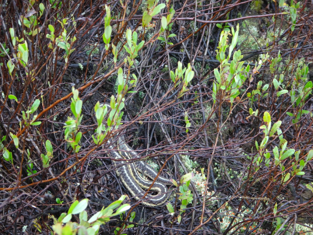
Red-winged Blackbird, Dows LakeErmine, Upper Poole Creek WetlandCommon YellowthroatWhite Water LilyDragonfly in a FenGarter SnakeGreen Heron, Beaver Pond, KanataLeopard Frog, Snye WetlandSwamp Pink
An evening calm has settled over the Ottawa River as I paddle into a burnished, copper sunset. I trail a fly behind the canoe, more from habit than hope. If I really wanted to catch fish, I would trail a spinnerbait for pike, or rig a artificial minnow for walleye. Mostly, I just enjoy the quiet, made more pronounced by the occasional powerboat thrumming in the distance. On the Quebec side, I see lights begin to glimmer on the houseboats beached at the point. Laughter carries across the water. Nearer, on my left, I see a whitetail deer come shyly down to the beach in the deepening dusk, as a wood thrush begins to flute in the woods. Abruptly, the sandy bottom rises below my canoe. I ship my paddle and quickly wind in my fly. Then I continue into the bay toward the boat launch, passing Lamure Beach and threading through the moored boats. I pull out the canoe and drag it up to the trees with the others. Then I stroll through the peaceful streets until I see home and the glow of warm, yellow light through the blinds of the large front window.
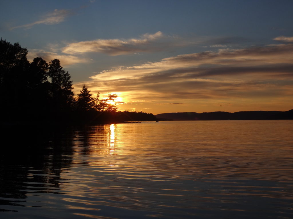
Sunset, Deep River
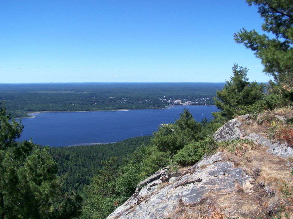
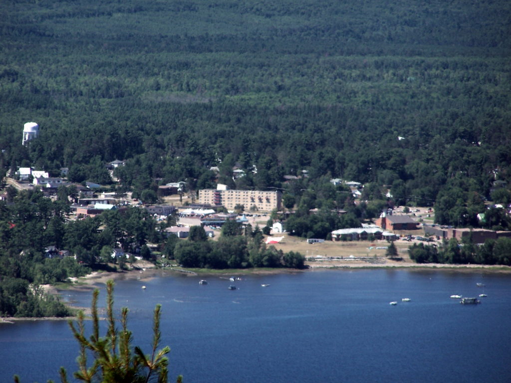
The town of Deep River lies an easy two hour drive northwest of Ottawa along Highway 17. Sandwiched between the highway and the Ottawa River, it trails along the shoreline for a couple of kilometers. The usual Tim Hortons, Canadian Tire, motel and small strip malls service the highway. A busy grocery store, post office, shops, cafes, school, and town office anchor the small, downtown core, which sits just behind the waterfront, overlooking the river. The marina and yacht club lie only a brisk two minute walk away. Tidy residential neighbourhoods lie either side of downtown — a mix of small, renovated, post-war bungalows and more modern, multi-story houses. The Deep River Regional Hospital marks the east side of town, while the Mount Martin Ski Club sits on the west side.
Deep River Viewed from Mount Martin, QuebecDeep River Waterfront
I spend at least two weeks every summer in Deep River with my wife and our sons. We make shorter visits throughout the year. I spend most of that time outside, exploring the local forests and wetlands, or paddling the shoreline of the Ottawa River. Deep River is a microcosm of whole Ottawa Valley, with almost every kind of ecosystem, habitat and wildlife species within easy reach.
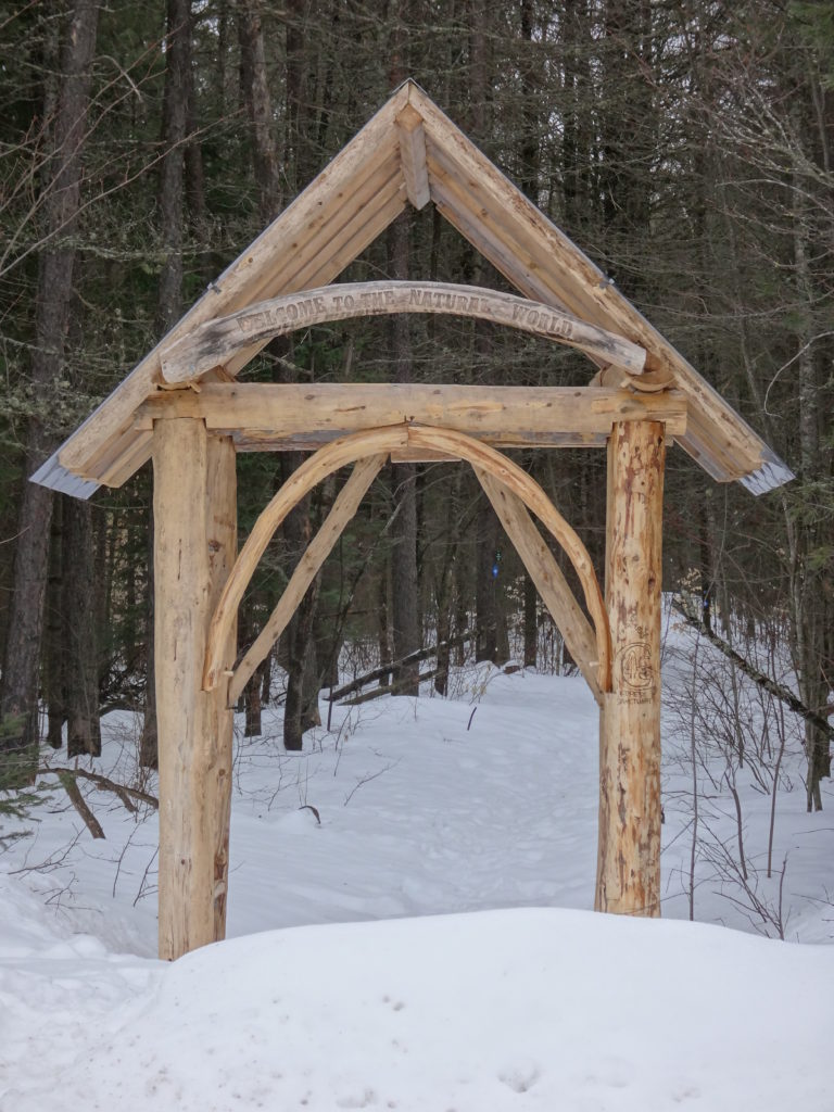
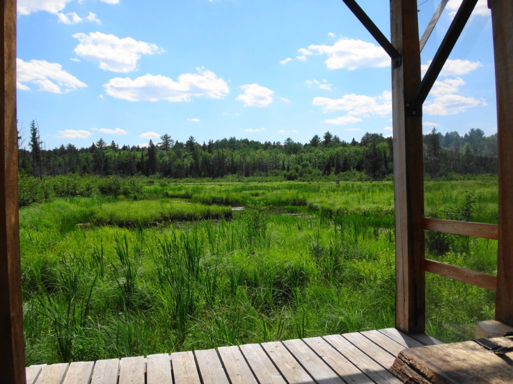
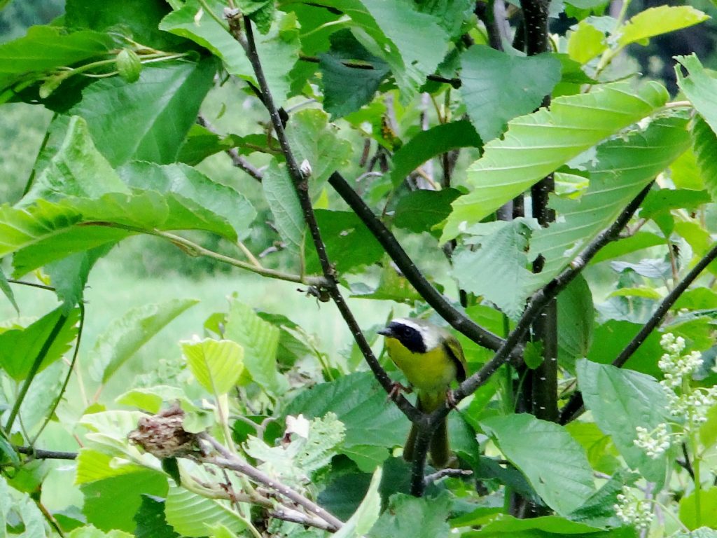
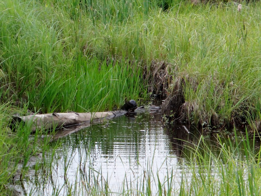
Most trips to Deep River begin and end at the Four Seasons Forest Sanctuary, on the southeast side of the town. This community-owned forest is part of an enormous, contiguous, protected natural area that includes the restricted lands surrounding the Canadian Nuclear Laboratories (formerly AECL) in Chalk River, the Petawawa Research Forest, the training areas of Canadian Forces Base Petawawa, and Algonquin Park. A short hiking loop begins across from the hospital and leads to a pretty, covered shelter overlooking a wetland. Even on the buggiest days, the squadrons of dragonflies hunting along the marsh edge succeed at keeping most mosquitoes at bay. Common yellowthroats sing in the thickets, while swamp sparrows skulk in the reeds. An American bittern grunts deep in the marsh. A blue heron fishes along the meandering stream on the other side. Turtles and frogs bask in the small pond by the shelter, where an occasional beaver, muskrat or otter makes an appearance. I’ll bring a lunch and meditate on the scene, read a book, or bring a guitar. Almost always, I’m on my own.
Four Seasons Forest Sanctuary EntranceMarsh Shelter, Four Seasons Conservation ForestCommon Yellowthroat, Four Seasons Conservation ForestOtter, Four Seasons Conservation Forest
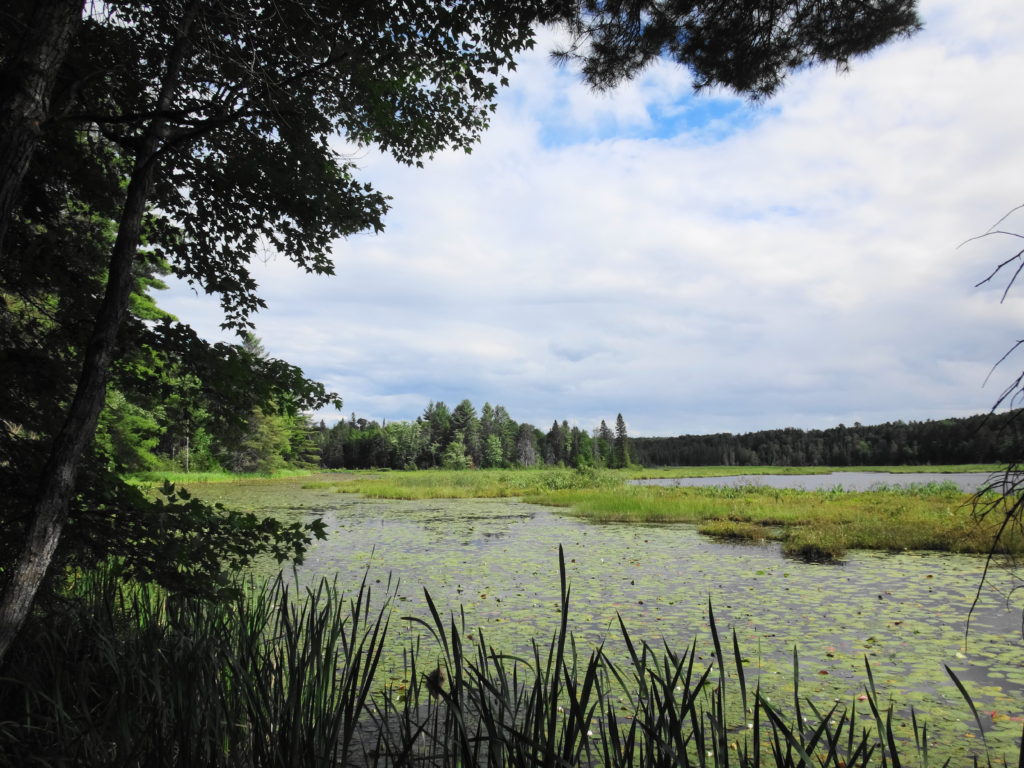
Longer trails lead deeper into the sanctuary, passing a variety of habitats: upland forests of white pine, maple and beech; darker forests of spruce and balsam fir; pretty riparian marshes, and dark forest pools; bright, grassy clearings, and shadowed fern gardens. One of my favourite destinations is Cranberry Lake, which stretches back into the AECL lands. At the end of a half hour hike, a small bench looks out over the lake and a pretty, floating fen mat. In late June and early July, white waterlilies carpet the water, and pink orchids (swamp pinks and rose pogonias) dot the fen. I often skip the bench and stretch out under the white pine that graces the shoreline, closing my eyes for a nap in midday sunshine. Occasionally I lift my head and look down the lake, hoping to see one of the moose that have found a haven on the AECL lands.
Cranberry Lake, Deep River
During the winter, the trails of the Forest Sanctuary become an active cross-country ski and snowshoe network. Trails are well marked and maintained by the Deep River Cross Country Ski Club, who put on an active recreational and social program through the winter. The forest and wetlands take on a different kind of beauty and quiet in the winter, always reminding me of the Robert Frost lines, “the only other sound’s the sweep, of easy wind and downy flake.”
Winter Beaverpond, Four Seasons Forest SanctuaryWinter Creek, Four Seasons Forest Sanctuary
The Petawawa Research Forest, just outside nearby Chalk River, also provides wonderful opportunities for exploration. The Research Forest Museum, now inactive and partly abandoned, still remains open to the public — albeit quickly deteriorating. An interpretive trail still loops from the museum through the forest, and an old boardwalk still offers a short, but pretty walk along the shore of the Chalk River. A maze of access and logging roads leads deep into the forest, past a myriad of different tree communities, streams and wetlands. In particular, the research forest includes a large number of well-developed fens and bogs, some of which are very accessible and yet still virtually unknown and pristine. They provide a unique opportunity for a careful, conscientious visitor to explore the flora and fauna of these marvelous ecosystems. Unfortunately, summer visitors can expect to be trailed by a cloud of deer flies, which swarm from the sandy roads and trails in numbers that are hard to comprehend. Once off the roads and into the forests and wetlands, however, the deer flies give way to the usual mosquitoes and blackflies, which respond much more readily to repellent. Of course, sensitive individuals can always choose to wear bug hats or bug shirts. Either way, the research forest is worth a visit.
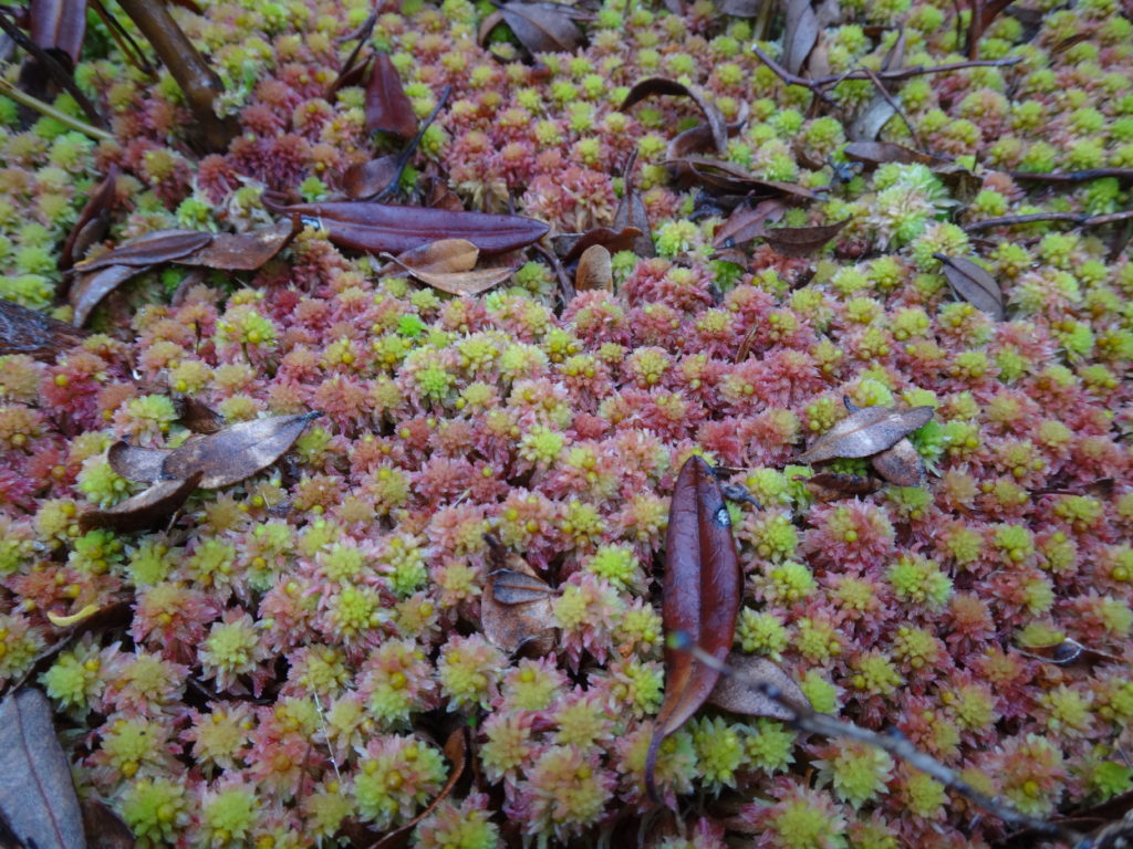
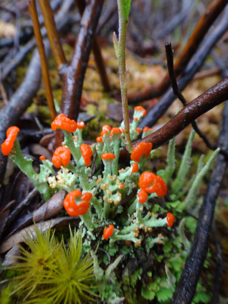
Raised Bog, Petawawa Research ForestSedge Meadow and Raised Bog, Petawawa Research ForestRich Fen, Petawawa Research ForestRose Pogonia, Petawawa Research ForestSwamp Pink, Petawawa Research ForestNorthern Pitcher Plant, Petawawa Research ForestGarter Snake on Bog Hummock, Petawawa Research ForestSphagnum Moss in a Bog, Petawawa Research ForestLichen in Bog, Petawawa Research Forest
South of the Canadian Shield, Ontario has very few true bogs. The two largest occur in Eastern Ontario, anchoring both ends of a 60 km long, regionally-significant, natural landscape corridor known as the Bog-to-Bog Link. At the east end of this link lies the Alfred Bog — Southern Ontario’s largest. At the west end of the link lies Mer Bleue — Southern Ontario’s second largest and, arguably, most accessible and famous.
Mer Bleue Beaverpond
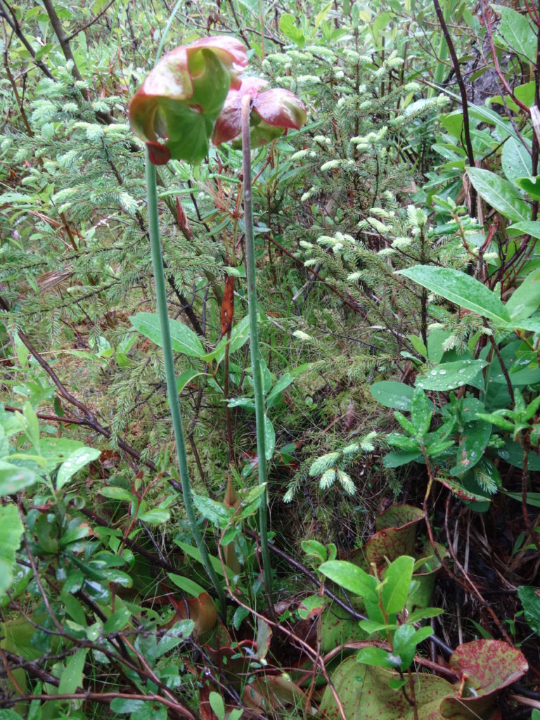
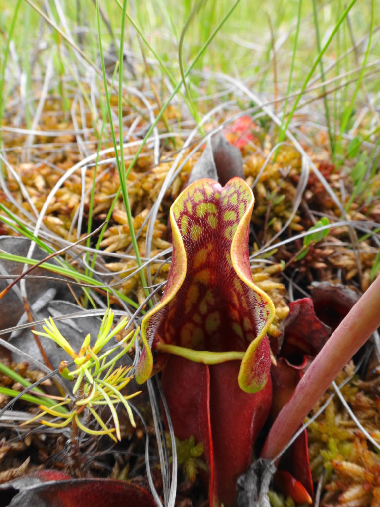
Mer Bleue occupies an old, post-glacial flow channel of the Ottawa River. Two forested ridges — immense, old river sandbars — thrust into the heart of the flat, peaty wetland. Cold, nutrient-poor groundwater seeping through the sandy ridges, along with the poor drainage of the old clay channel, creates the perfect conditions for the formation of peat, which lies almost 10 metres deep in places. Toward the centre of the wetland, the peat has built up into an almost imperceptible, low dome. Out of contact with the underlying water, most of few, hardy plant species growing in the centre of the raised peat must survive entirely on trace nutrients deposited by rain, snow and dust. One or two carnivorous species, like the pitcher plant, supplement that diet with captured insects. This reliance on aerial deposition of nutrients is what makes Mer Bleue a true bog.
Mer Bleue BogPitcher Plant
Mer Bleue welcomes visitors in any season. In the spring, the ridges attract migrating songbirds, while the watery moat along the edge of the peat mat (technically known as a “lagg”) attracts migrating waterfowl. Hawks hunt high over the ridges or low over the wetland. A dozen or so sandhill cranes stop in the area annually on their way north, with a few perhaps nesting somewhere deep within the bog. Beavers and muskrats ply the waters in the morning and evening to a chorus of frogs.
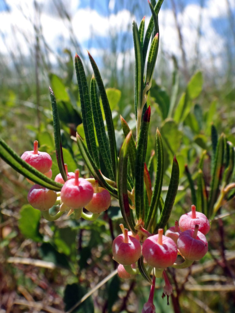
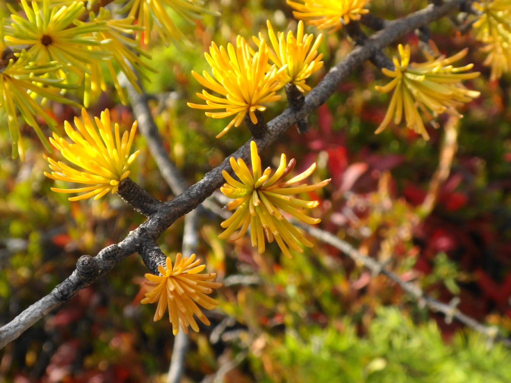
Through the summer, the shady, ridge trails provide a cool, relaxing hike. Vireos and pewees sing overhead. Ferns push up through the underbrush. Where a trail skirts the edge of a field, grey catbirds mew in a hedgerow, while a brown thrasher scolds from the treetops. Along the boardwalk, the heat of afternoon fills the air with the perfume of Labrador tea, bog rosemary, bog laurel, and leatherleaf. The scent of a few tamarack needles rubbed between the palms calls forth old memories.
Walking Trail, Mer BleueMature Forest, Mer BleueStart of the Mer Bleue BoardwalkTamarack Needles – Autumn
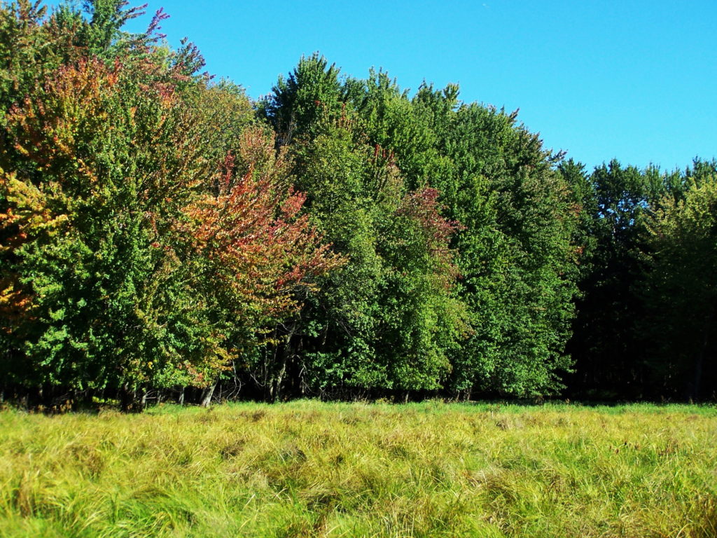
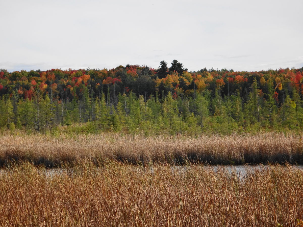
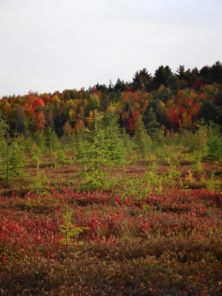
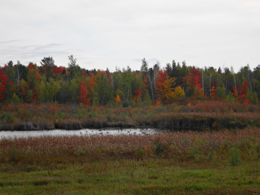
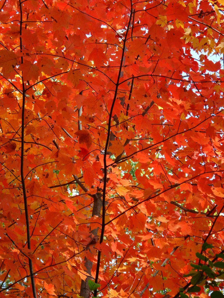
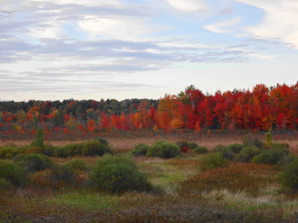
In autumn, the contrast of vegetation communities makes Mer Bleue one of the best places at which to enjoy the fall colours. The bog turns a deep red, accented by the paling tamarack. Red and gold maples line the edge of the ridges, brilliant against backgrounds of pine and spruce. Variegated thickets of young birch stems support an awning of yellow leaves. The forest floor rustles with life, as squirrels, thrushes, sparrows and other creatures prepare for the long winter. Flocks of blackbirds and starlings pass noisily overhead, while strings of geese call plaintively in the distance.
Canada GeeseRed MapleAfternoon Light on Maples
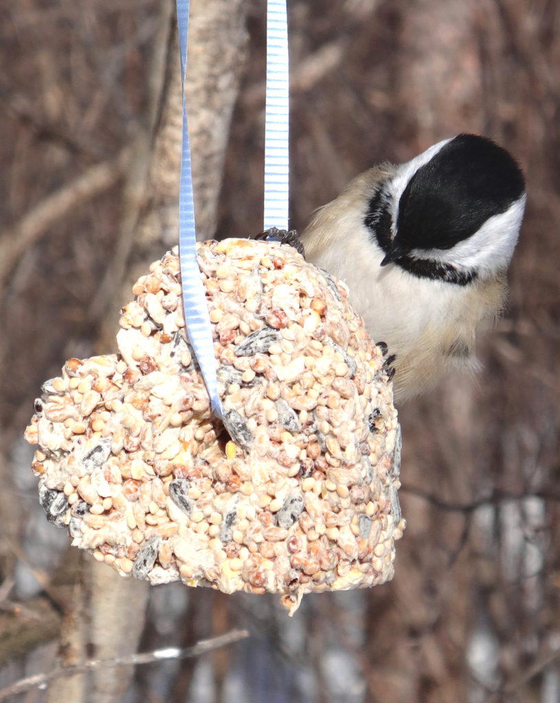
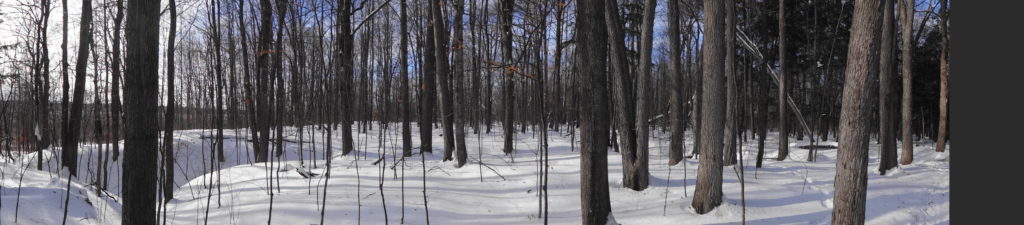
In winter, well-stocked bird feeders guarantee that the bright chatter of chickadees, nuthatches, woodpeckers and finches will greet visitors at every trailhead. Animal tracks criss-cross the trails: squirrels, snowshoe hares, mice and voles, coyotes, weasels, deer, and even moose. Those hoping to lay down their own tracks in fresh snow will need to rise early. Later in the day, when the parking lots begin to fill with visitors, the compacted trails provide an easy walk in the woods or out onto the boardwalk.
The NCC does not provide heated shelters or warm-up huts at Mer Bleue, so winter visitors should dress appropriately. The boardwalk, in particular, lies exposed to the wind, which blows unhindered across the bog. At those times, frostbite becomes a real risk. On calm days, however, particularly those brilliant blue days of January and February, when a frigid Arctic high sits over the City and the snow squeaks underfoot, the moisture rising from the peat will sometimes crystallize in a delicate, morning hoarfrost on the bog, sparkling in the sunlight. On those mornings, one hardly feels the cold.
Black-capped ChickadeeWinter Forest PanoramaNCC Trail 53 A, Mer Bleue
Mer Bleue lies only fifteen minutes from Parliament Hill and just five minutes off Highway 417 — the Trans-Canada Highway (http://www.ncc-ccn.gc.ca/places-to-visit/greenbelt/mer-bleue). Every trailhead has a small parking area, where visitors will find basic outhouses. There is no charge for parking or use of the area.
Visitors should remember that the international community has recognized Mer Bleue as a globally significant wetland under the Ramsar Convention (www.ramsar.org). Please stay on the trails and the boardwalk. The bog may look inviting, but it is both delicate and hazardous. A stray footstep can destroy decades of painstakingly slow plant growth or lead to a fatal plunge through the mat into the tannic waters below. Such a plunge would lead to an immortality of sorts, as the tannins of the bog preserved and slowly transformed the unwary soul into a leathery mummy. However, such immortality would be unappreciated both by the victim, the victim’s family, and posterity. Take a photograph instead.