The Marlborough Forest – Part One

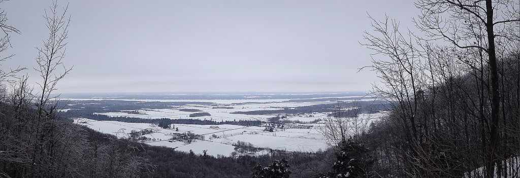
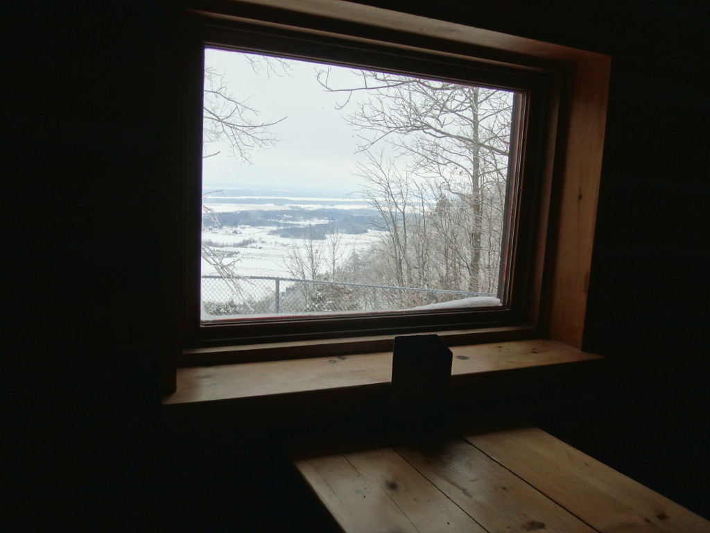
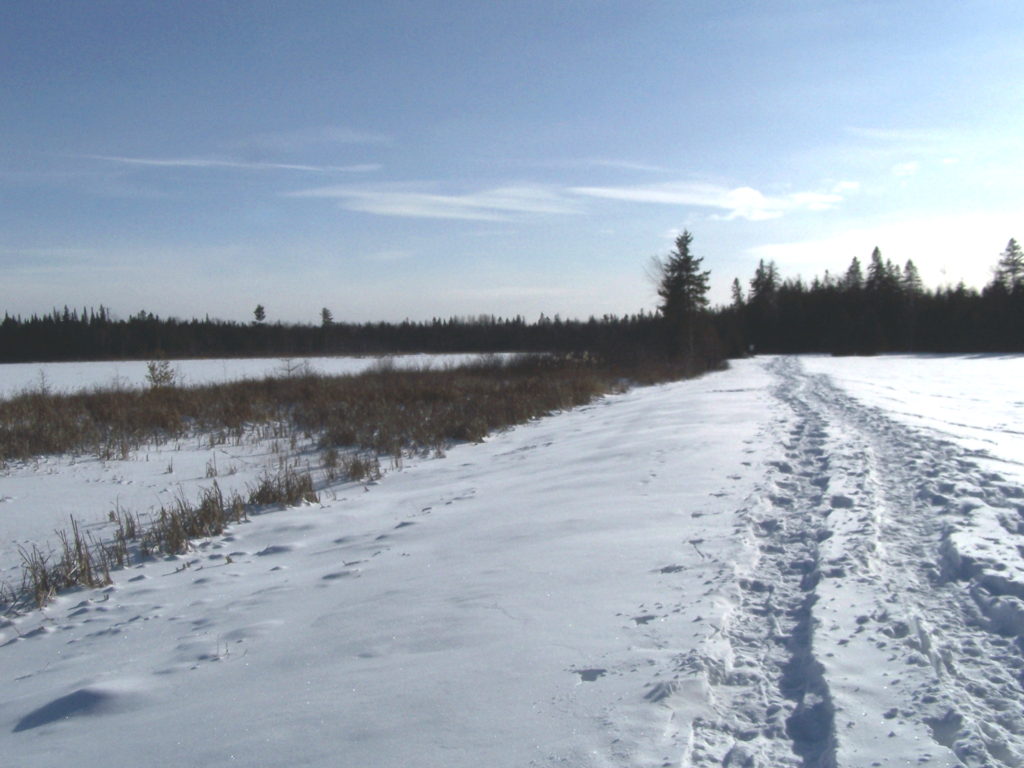
Ottawa’s largest natural area lies in the south end of the City, largely unknown to most residents.  A 200 km2 patchwork of forest and abandoned homesteads, swamps and fens, dusty forestry roads and claustrophic thickets — it hides off the beaten path, protecting its secrets.  Only one road crosses it, Roger Stevens Drive, which bisects it from east to west.  Dwyer Hill Road skirts in and out along its west side.  A few other public roads probe the edges, ending either in cattails or locked gates.  One doesn’t stumble upon the Marlborough Forest; a visit requires purpose and intent.

A moss-covered, cedar rail fence decays on an fieldstone wall along a trail in the Marlborough Forest.
Cedar Rail Fence — Marlborough Forest
A city-owned, heritage log farmhouse lies under a grey sky on a farm in the Marlborough Forest.
Heritage Farmhouse – Marlborough Forest

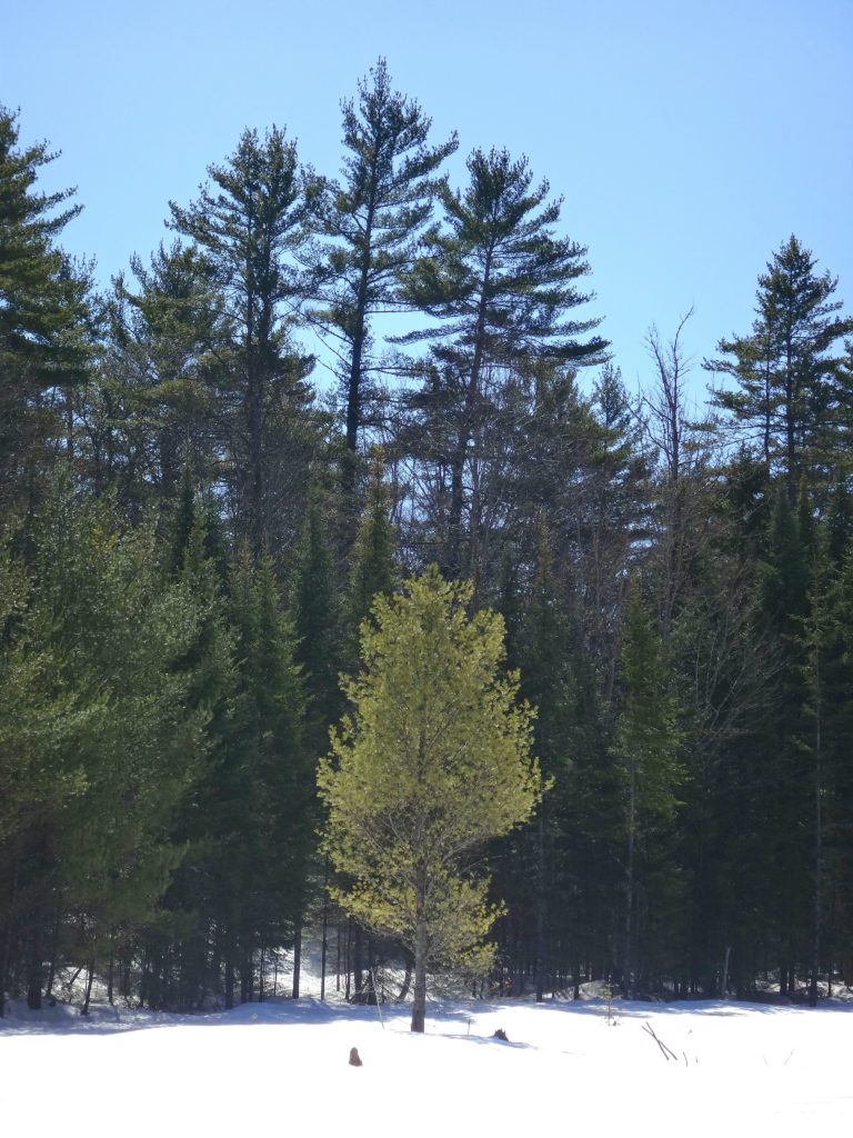
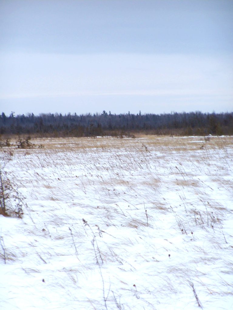
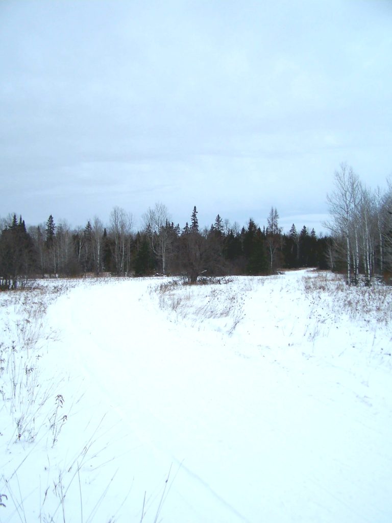
For much of the year, the Marlborough discourages exploration.  In winter, winds stream bitterly across flat peatlands and old fields, sculpting snow into ripples and waves, and piling it deep under bare hardwoods, while deer seek shelter in dark groves of cedar and spruce.  In spring, meltwaters pool behind beaver dams, submerge roads and trails, and turn tracks into clay quagmires.  In summer, plagues of mosquitoes and deer flies swarm in the hot, dry air to torment both human and beast.  In autumn, the crack of hunters’ rifles warns against casual hiking.

The wind sweeps across the snowy expanse of the Phragmites Fen.
Phragmites Fen – Marlborough Forest

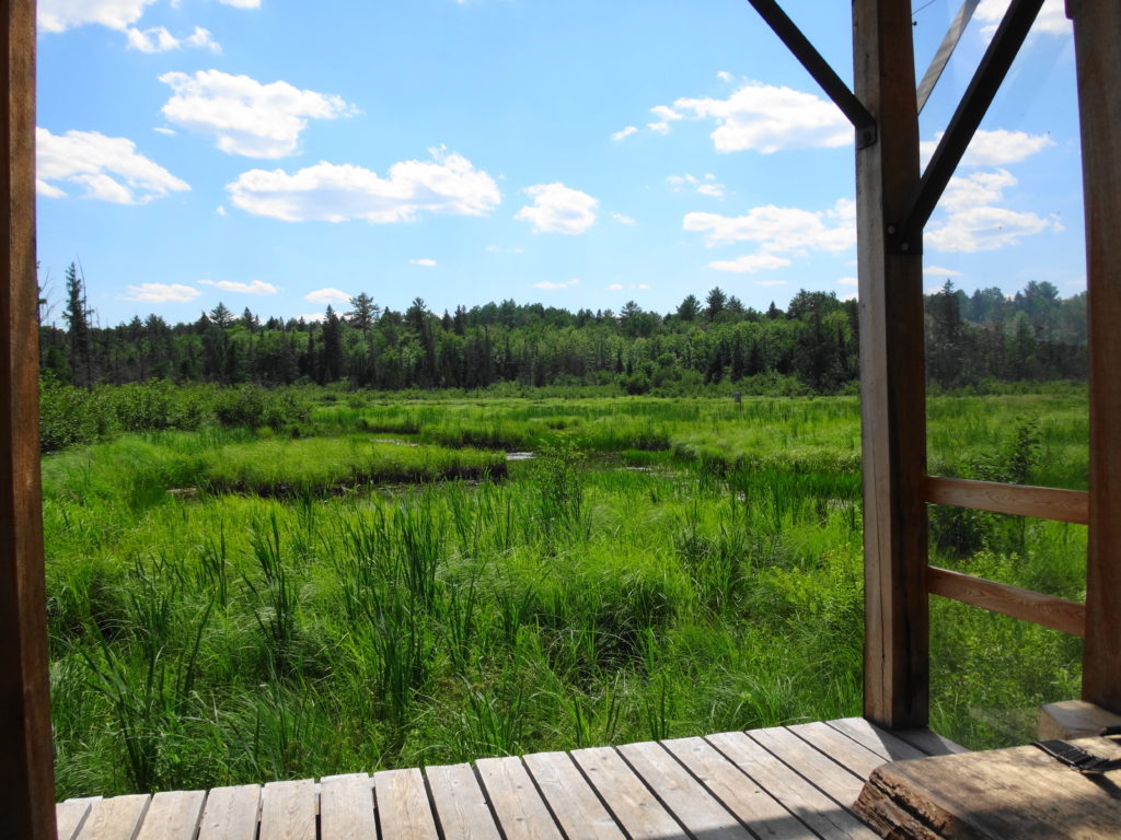
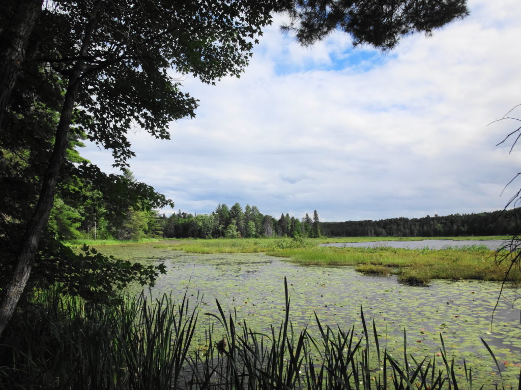
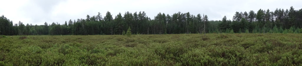
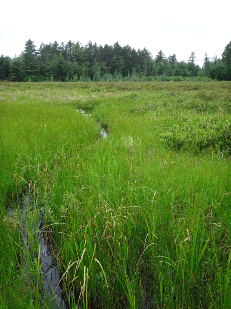
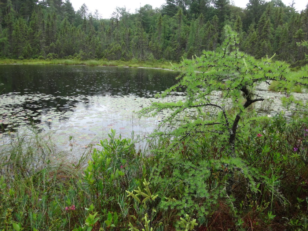
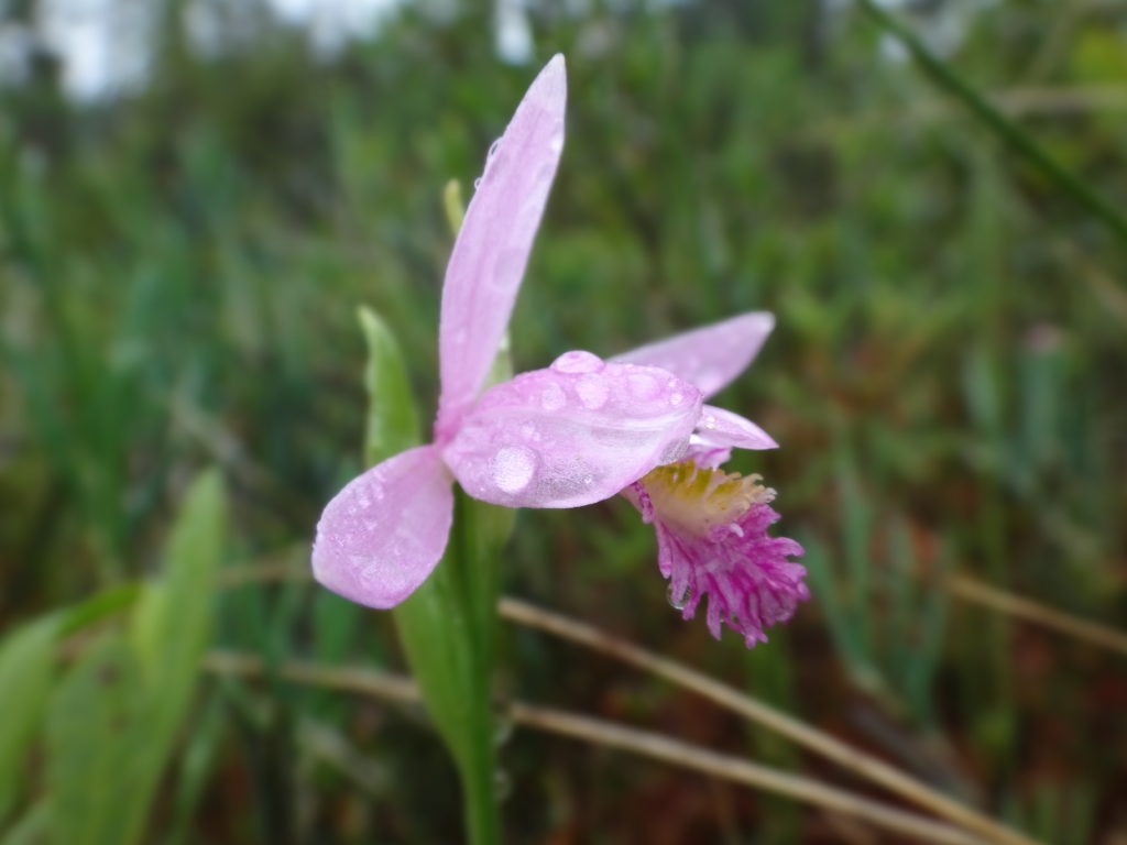
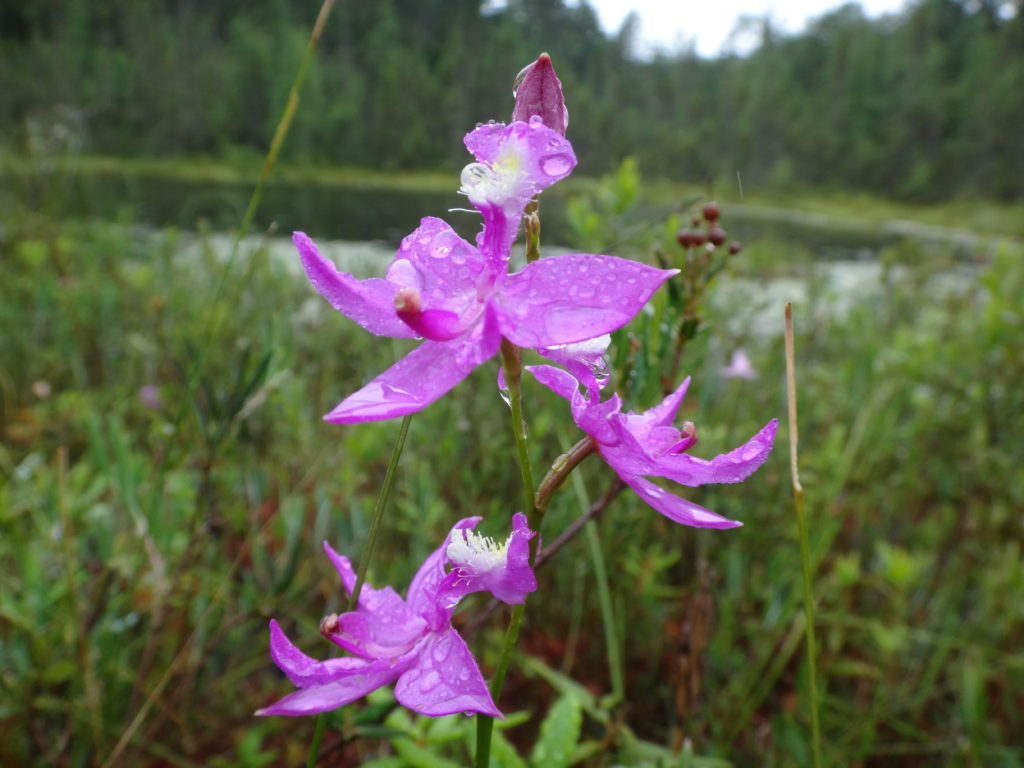
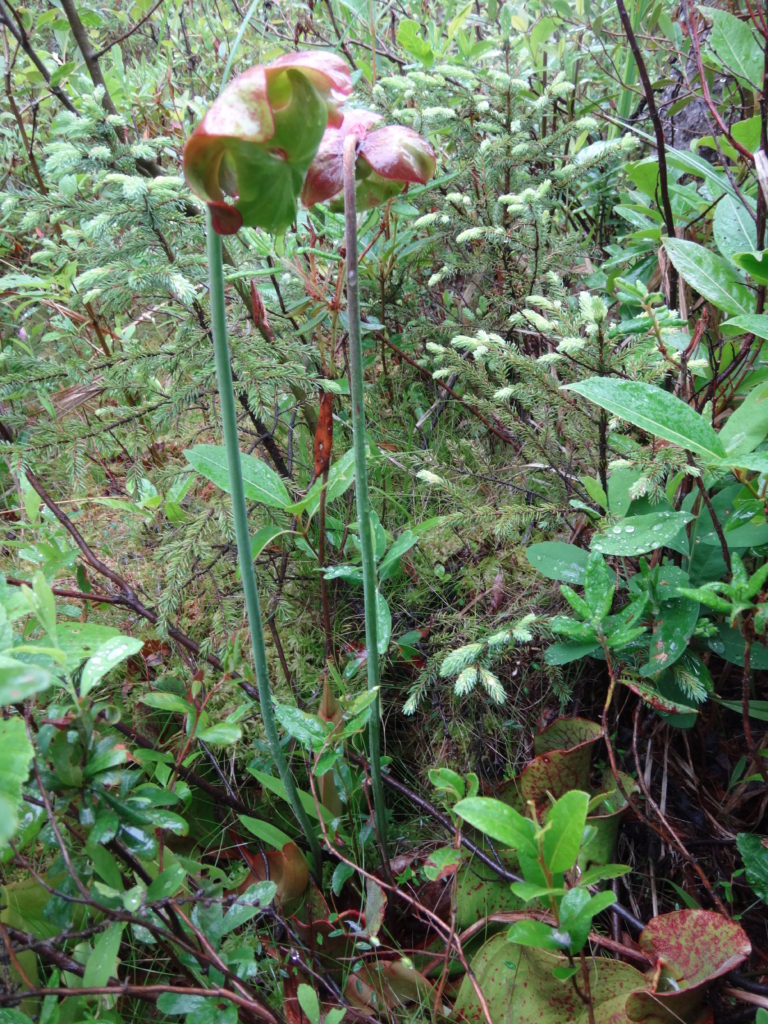
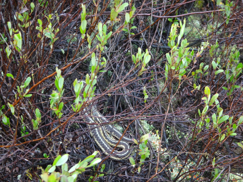
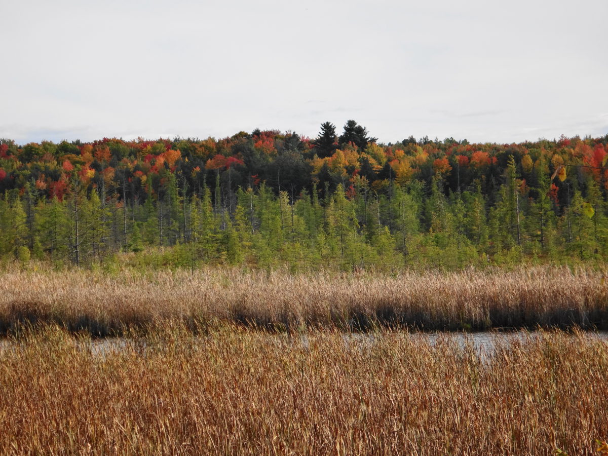
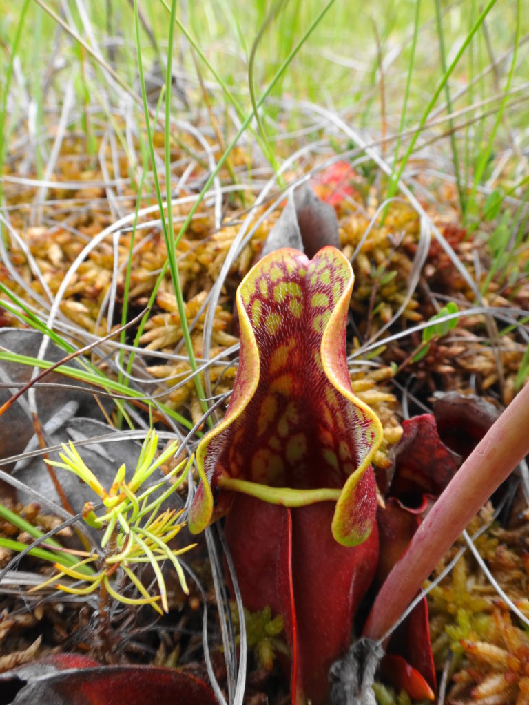
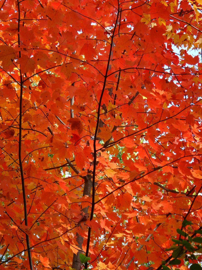
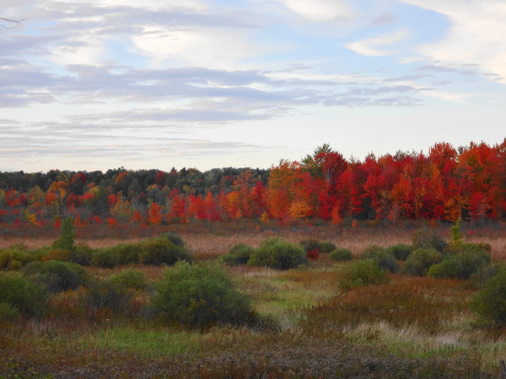
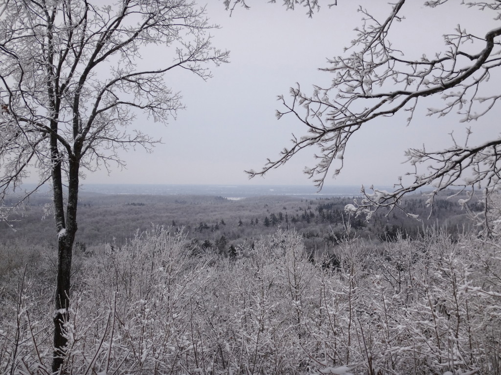
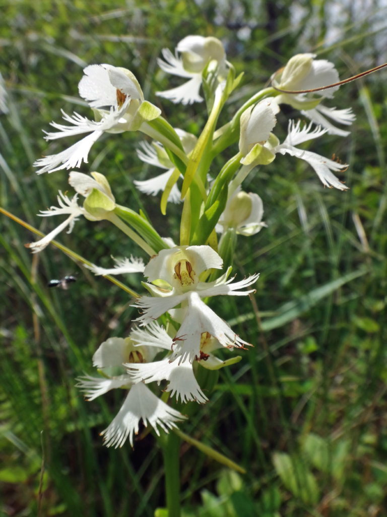
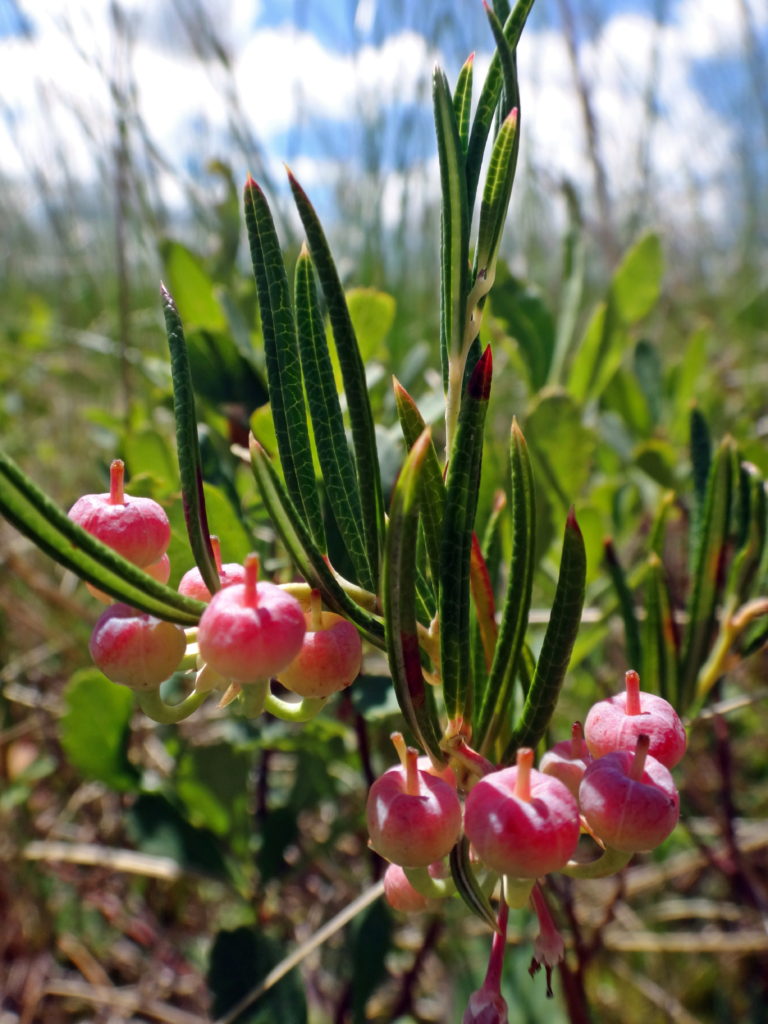
And yet, the Marlborough offers moments sublime and increasingly rare.  The low, winter sun glinting off deep snow may highlight the tracks of a fisher crossing between trees or an otter crossing between creeks.  A humid and buggy trek through a swamp may lead to the open, fresh air of a fen, where orchids rise from pale green sphagnum like small, purple flags.  In the stillness of a darkening, plum sky, bats may flitter along the edge of a clearing, while whip-poor-wills call plaintively.

An endangered eastern prairie fringed orchid grows in a fen.
Eastern Prairie Fringed Orchid – Marlborough Forest
A close-up photograph of bog rosemary in the Phragmites Fen, Marlborough Forest.
Bog Rosemary – Marlborough Forest
A common nighthawk hides in plain sight in a rocky clearing in the Marlborough Forest.
Common Nighthawk – Marlborough Forest
An enlarged and cropped version of the previous photograph shows the common nighthawk blending into the rocky clearing.
Common NIghthawk – Enlarged

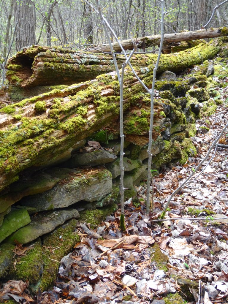
Perhaps because of its isolation, any intrusion on the quiet of the Marlborough feels more agregious.  In the sharp winter air, the whine of snowmobiles announces their presence minutes in advance.  In the murmur and buzz of a summer afternoon, the grumble of ATVs stalks the forest like a disgruntled bear.  Nonetheless, the Marlborough has survived because of its history of public use.   More than half of the forest lies in public ownership, a legacy of Ontario’s Agreement Forest Program.

A snowmobile trail crosses a field in the Marlborough Forest.
Snowmobile Trail, Marlborough Forest

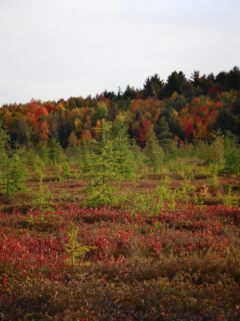
The Agreement Forest Program ran from the 1920s until 1998.  The program aimed to repair the damage done by the previous 150 years of deforestation in Ontario.  On abandoned lands — lands stripped by poor logging practices, scratch farms, and wildfires — the Province began a program of reclamation and rehabilition.  Many of Ottawa’s protected natural lands date from this time:  places like the Cumberland and Larose Forests in the east, the Marlborough Forest in the south, and the Torbolton Forest in the west.

Sunlight lluminates a pathway through conifers along the Cedar Grove Trail.
Cedar Grove Trail, Marlborough Forest

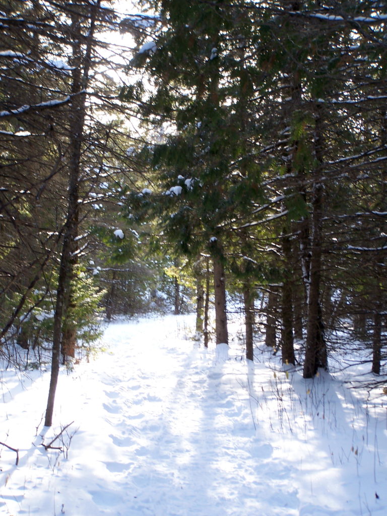
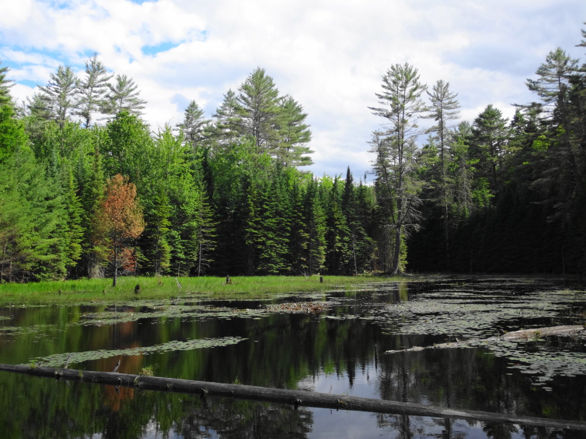
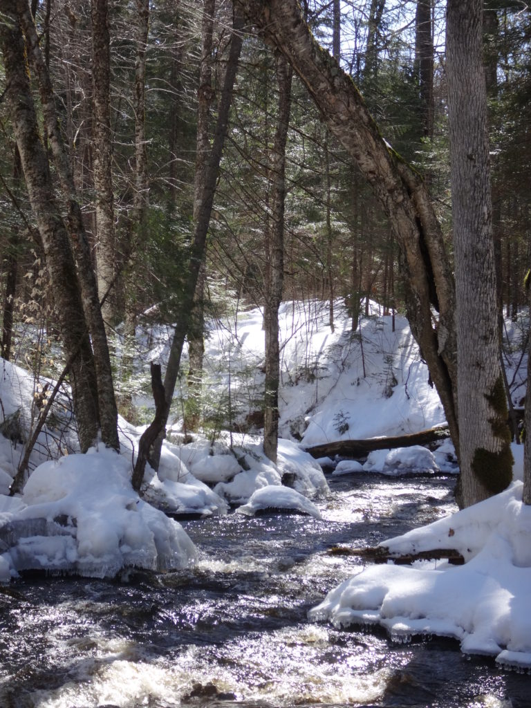
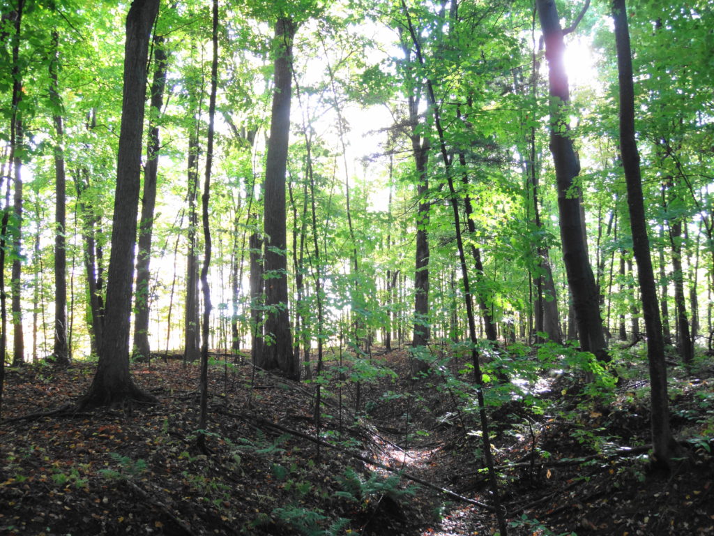
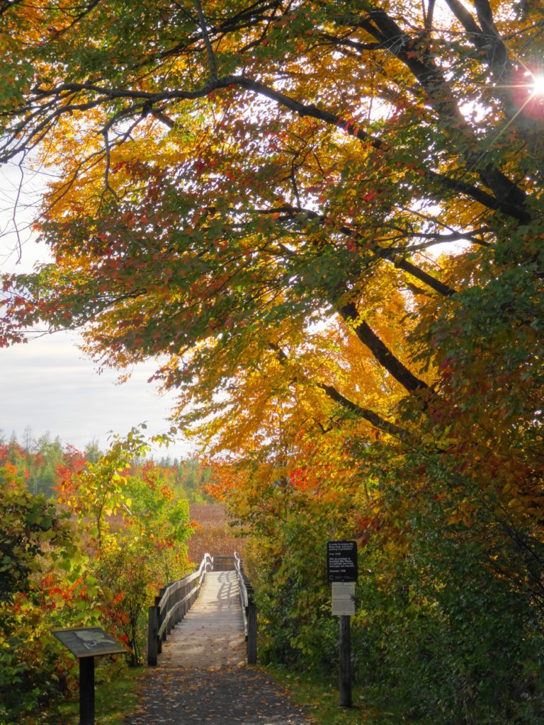
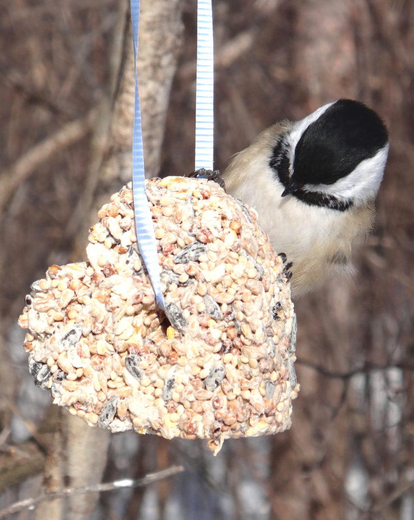
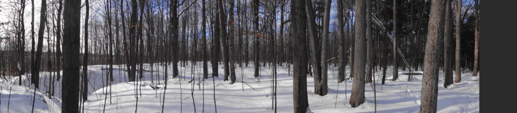
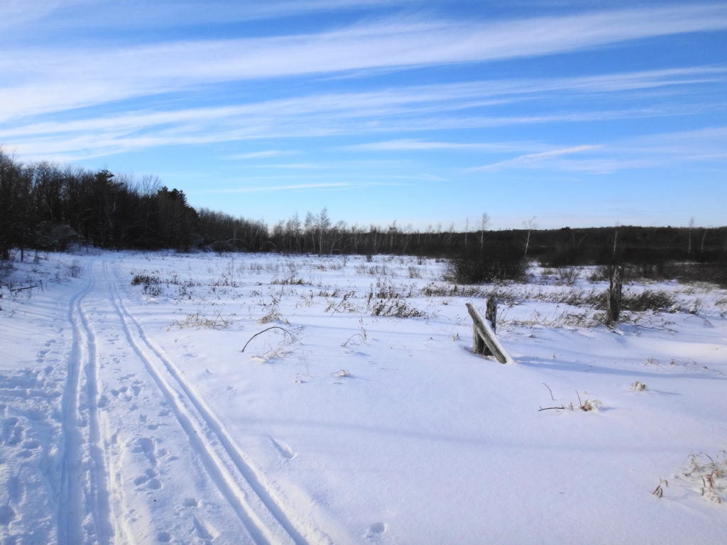
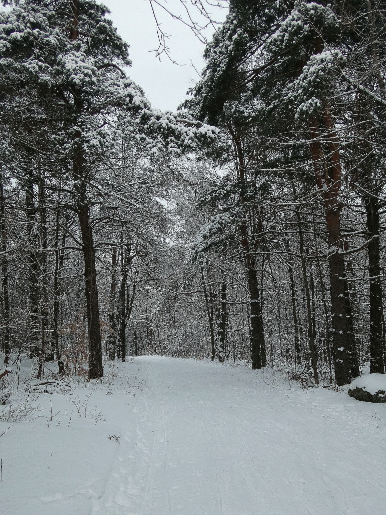
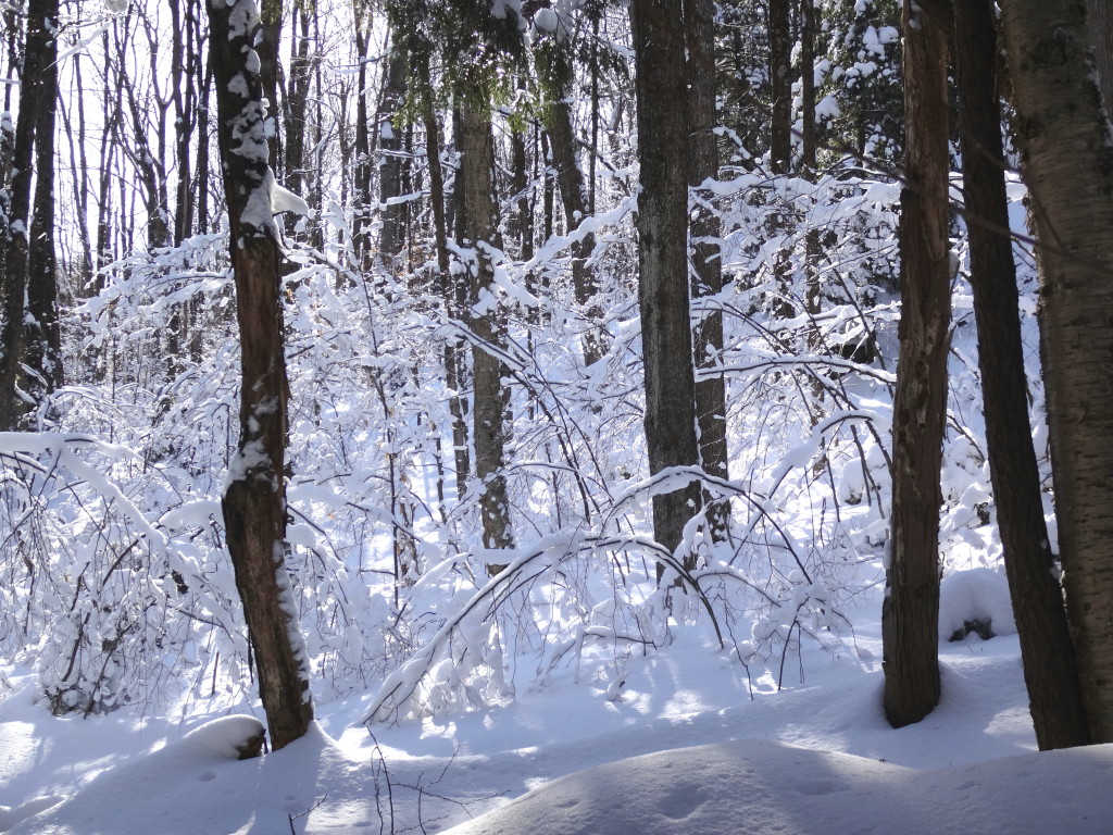
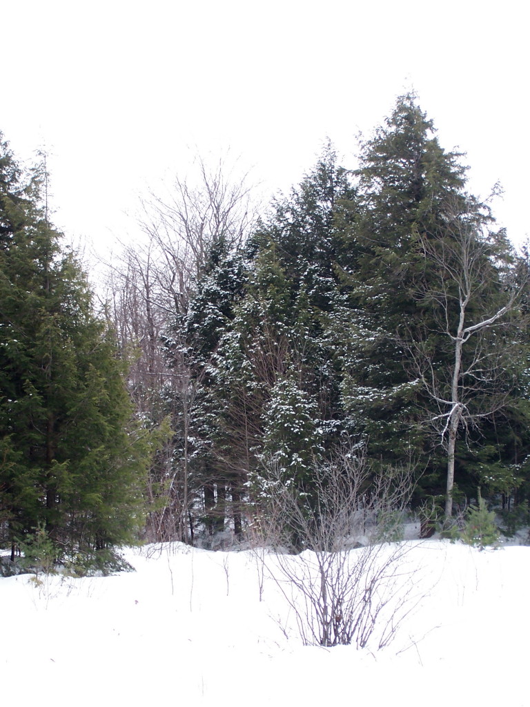
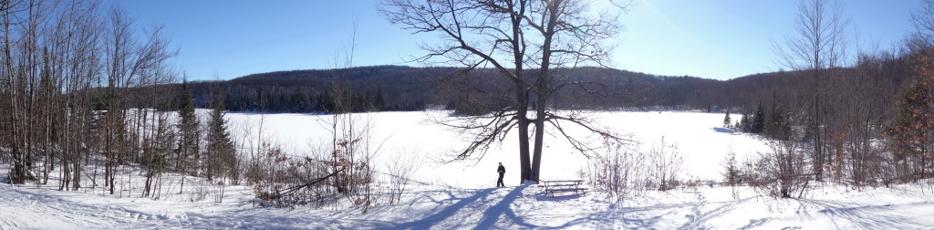
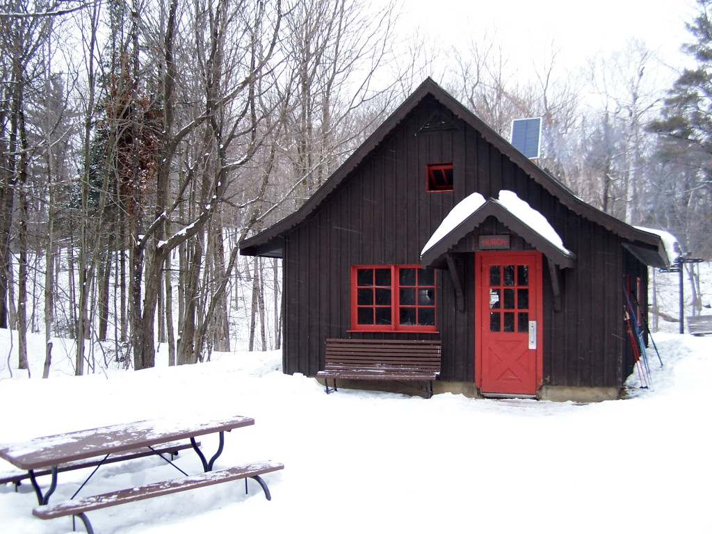
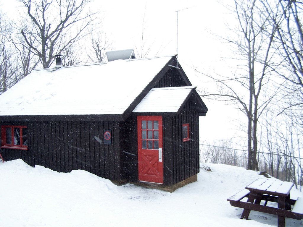
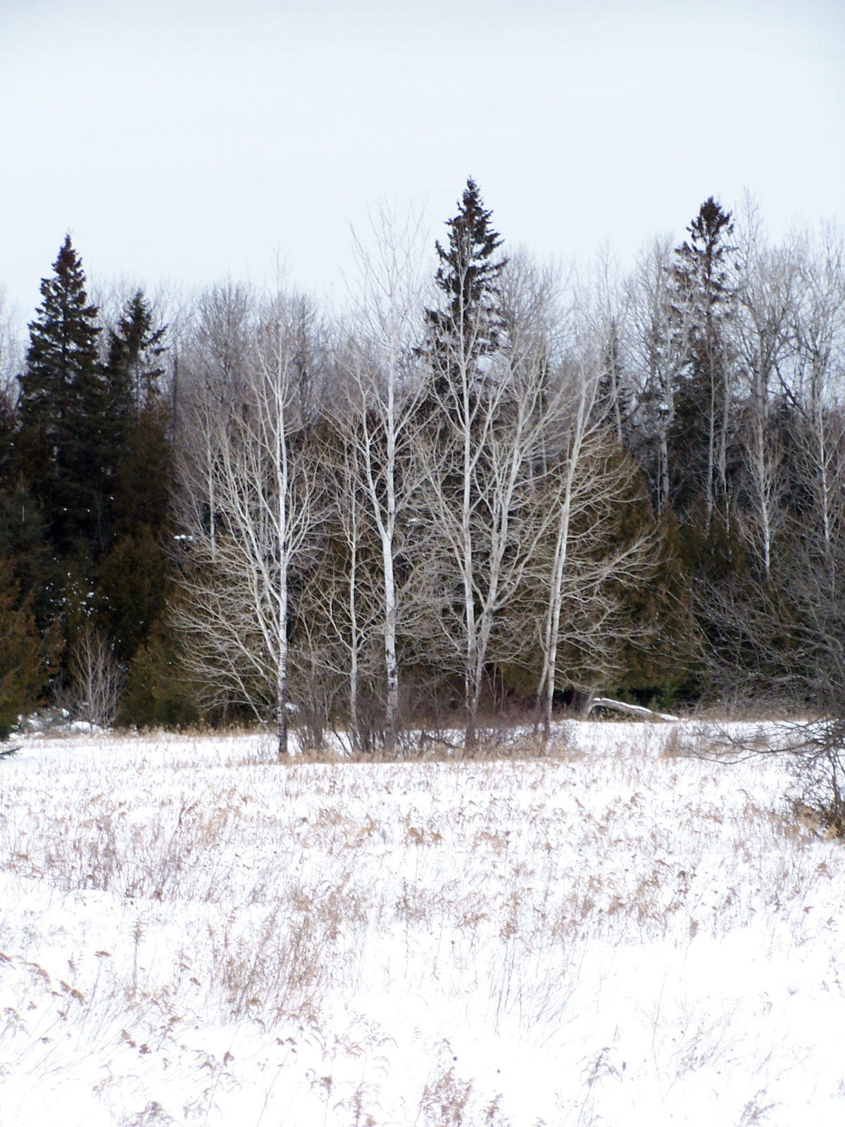
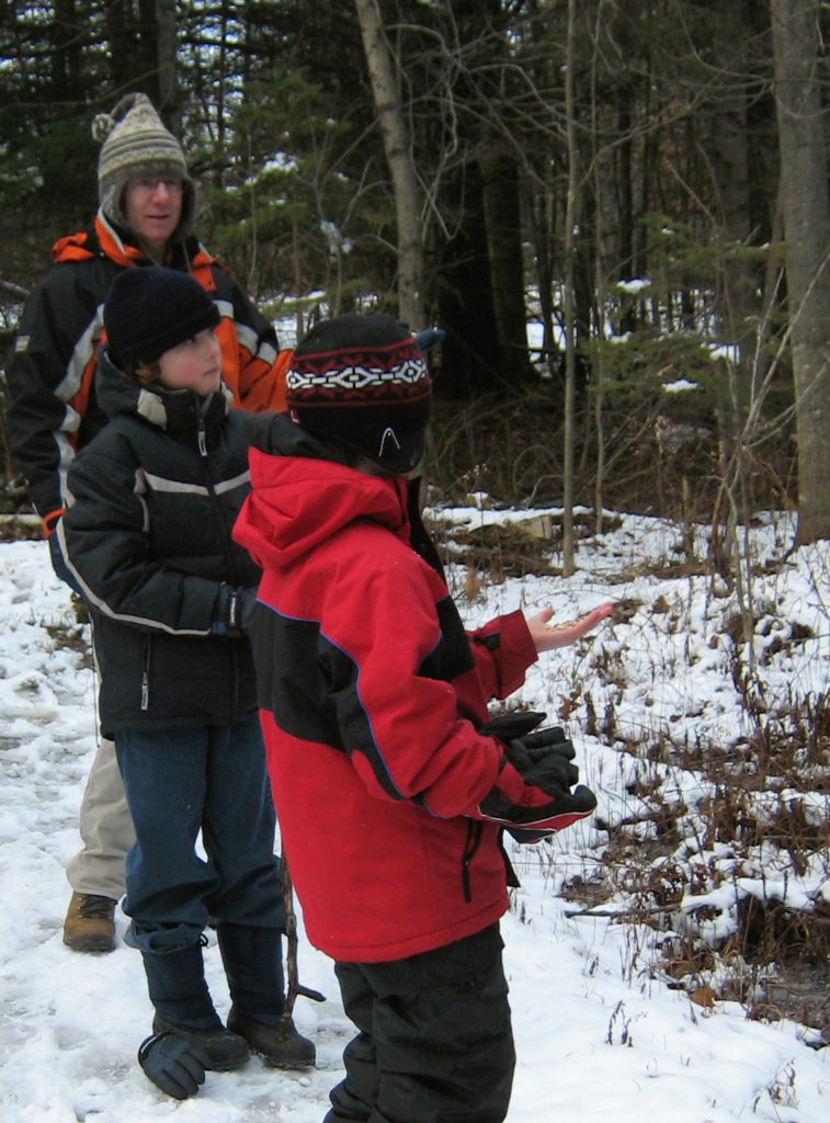
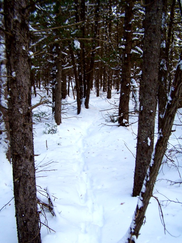
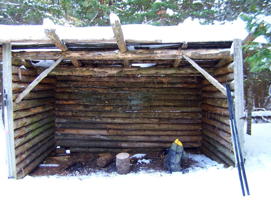
The Cedar Grove Trail, off Roger Steven’s Drive, provides a pretty introduction to the Marlborough Forest, ideal for a sunny winter day of snowshoeing or skiing (https://ottawa.ca/en/residents/water-and-environment/air-land-and-water/greenspace#south).  This short trail circles a small lake and takes about 1 – 2 hours to complete at an easy pace.  En route, it passes over a short weir, crosses a meadow, and threads through hardwood and cedar forests.  At first, the forest seems quiet, except perhaps for the distant buzzing of snowmobiles.  But a few minutes of walking and listening soon corrects that perception.  Chickadees and nuthatches twitter and flit among the trees, always ready to alight on an outstretched hand for peanuts and sunflowers seeds.  Downy and hairy woodpeckers tap in the treetops.  Pileated woodpeckers hammer deeper in the woods.  With a deep “croak” and the susurration of wings, a raven passes overhead.

Two boys hold out seeds for chickadees in the Marlborough Forest.
Feeding Chickadees – Marlborough Forest
Roger’s Pond, Cedar Grove Trail, Marlborough Forest.

Other life remains hidden behind the cedars or sheltered under the snow.  The tracks of white-tailed deer, squirrels, and hares cross the trail.  The delicate footprints of a white-footed mouse emerge from a tunnel beside a log and end at a small pile of seeds. Under the pond ice, beavers venture from their lodge to retrieve twigs from their food pile.  Under the clearer ice by the weir, a close eye may find water beetles still hunting in the gently flowing stream.

A line of deer tracks runs back into a stand of small conifers.
Deer Tracks – Cedar Pond Trail, Marlborough Forest
An rough shelter provides a resting place along the Cedar Grove Trail.
Hiking Shelter – Cedar Grove Trail, Marlborough Forest

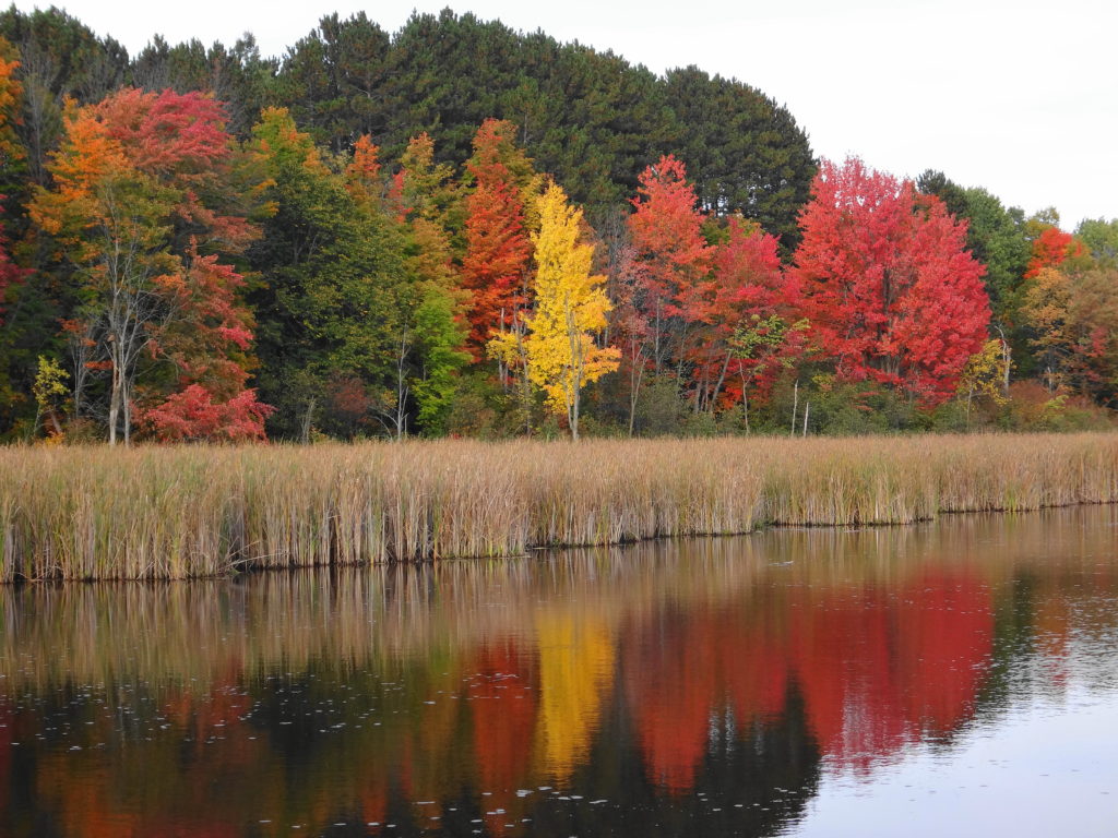
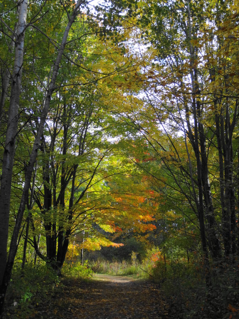
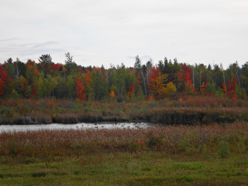
I haven’t visited the Cedar Grove Trail outside of winter, but I imagine it equally as lovely.  I’d opt for autumn, after the mosquitoes and deer flies, when the golden foliage along the pond should glow against the darker conifers.  I can picture a frosty early morning walk, with the sun just touching the down of milkweeds in the meadow, perhaps a delicate rime on the leaves and grasses, and a beaver silently creasing the pond toward home.  A faint mist might lie on the water.  Along the forest edge, the sun might catch the flash of a white tail, as a deer vanishes into the wood.

Deep River – Part One

An evening calm has settled over the Ottawa River as I paddle into a burnished, copper sunset.  I trail a fly behind the canoe, more from habit than hope.  If I really wanted to catch fish, I would trail a spinnerbait for pike, or rig a artificial minnow for walleye.  Mostly, I just enjoy the quiet, made more pronounced by the occasional powerboat thrumming in the distance.  On the Quebec side, I see lights begin to glimmer on the houseboats beached at the point.  Laughter carries across the water.  Nearer, on my left, I see a whitetail deer come shyly down to the beach in the deepening dusk, as a wood thrush begins to flute in the woods.  Abruptly, the sandy bottom rises below my canoe.  I ship my paddle and quickly wind in my fly.  Then I continue into the bay toward the boat launch, passing Lamure Beach and threading through the moored boats.  I pull out the canoe and drag it up to the trees with the others.  Then I stroll through the peaceful streets until I see home and the glow of warm, yellow light through the blinds of the large front window.

The setting sun turns the sky a burnished copper over the Ottawa River.
Sunset, Deep River

The town of Deep River lies an easy two hour drive northwest of Ottawa along Highway 17.  Sandwiched between the highway and the Ottawa River, it trails along the shoreline for a couple of kilometers.  The usual Tim Hortons, Canadian Tire, motel and small strip malls service the highway.  A busy grocery store, post office, shops, cafes, school, and town office anchor the small, downtown core, which sits just behind the waterfront, overlooking the river.  The marina and yacht club lie only a brisk two minute walk away.  Tidy residential neighbourhoods lie either side of downtown — a mix of small, renovated, post-war bungalows and more modern, multi-story houses.  The Deep River Regional Hospital marks the east side of town, while the Mount Martin Ski Club sits on the west side.

The Ottawa River and Ottawa Valley spread out below the lookout on Mount Martin, Quebec. In the distance, the town of Deep River lies along the far shore.
Deep River Viewed from Mount Martin, Quebec
The Deep River Waterfront as photographed from Mount Martin, Quebec.
Deep River Waterfront

I spend at least two weeks every summer in Deep River with my wife and our sons.  We make shorter visits throughout the year.  I spend most of that time outside, exploring the local forests and wetlands, or paddling the shoreline of the Ottawa River.  Deep River is a microcosm of whole Ottawa Valley, with almost every kind of ecosystem, habitat and wildlife species within easy reach.

Most trips to Deep River begin and end at the Four Seasons Forest Sanctuary, on the southeast side of the town.  This community-owned forest is part of an enormous, contiguous, protected natural area that includes the restricted lands surrounding the Canadian Nuclear Laboratories (formerly AECL) in Chalk River, the Petawawa Research Forest, the training areas of Canadian Forces Base Petawawa, and Algonquin Park.  A short hiking loop begins across from the hospital and leads to a pretty, covered shelter overlooking a wetland.  Even on the buggiest days, the squadrons of dragonflies hunting along the marsh edge succeed at keeping most mosquitoes at bay.  Common yellowthroats sing in the thickets, while swamp sparrows skulk in the reeds.  An American bittern grunts deep in the marsh.  A blue heron fishes along the meandering stream on the other side. Turtles and frogs bask in the small pond by the shelter, where an occasional beaver, muskrat or otter makes an appearance.  I’ll bring a lunch and meditate on the scene, read a book, or bring a guitar.  Almost always, I’m on my own.

A wooden archway spans an entrance to the Four Seasons Conservation Forest trail network.
Four Seasons Forest Sanctuary Entrance
Looking out from the shade of a covered observation shelter, a verdant marsh offers a pleasing view.
Marsh Shelter, Four Seasons Conservation Forest
A black-masked, common yellowthroat perches on the branches of an alder bush.
Common Yellowthroat, Four Seasons Conservation Forest
An otter plays on a log in a marshy pond at the Four Seasons Conservation Forest.
Otter, Four Seasons Conservation Forest

Longer trails lead deeper into the sanctuary, passing a variety of habitats:  upland forests of white pine, maple and beech; darker forests of spruce and balsam fir; pretty riparian marshes, and dark forest pools; bright, grassy clearings, and shadowed fern gardens.  One of my favourite destinations is Cranberry Lake, which stretches back into the AECL lands.  At the end of a half hour hike, a small bench looks out over the lake and a pretty, floating fen mat.  In late June and early July, white waterlilies carpet the water, and pink orchids (swamp pinks and rose pogonias) dot the fen.  I often skip the bench and stretch out under the white pine that graces the shoreline, closing my eyes for a nap in midday sunshine.  Occasionally I lift my head and look down the lake, hoping to see one of the moose that have found a haven on the AECL lands.

A verdant marsh is framed by overhanging trees.
Cranberry Lake, Deep River

During the winter, the trails of the Forest Sanctuary become an active cross-country ski and snowshoe network.  Trails are well marked and maintained by the Deep River Cross Country Ski Club, who put on an active recreational and social program through the winter.  The forest and wetlands take on a different kind of beauty and quiet in the winter, always reminding me of the Robert Frost lines, “the only other sound’s the sweep, of easy wind and downy flake.”

A young white pine sits at the edge of a snow-covered beaverpond, against a backdrop of older, darker pines.
Winter Beaverpond, Four Seasons Forest Sanctuary
A forest creek runs swiftly between snow and ice-covered banks on a warm, late-winter day.
Winter Creek, Four Seasons Forest Sanctuary

The Petawawa Research Forest, just outside nearby Chalk River, also provides wonderful opportunities for exploration.  The Research Forest Museum, now inactive and partly abandoned, still remains open to the public — albeit quickly deteriorating.  An interpretive trail still loops from the museum through the forest, and an old boardwalk still offers a short, but pretty walk along the shore of the Chalk River.  A maze of access and logging roads leads deep into the forest, past a myriad of different tree communities, streams and wetlands.  In particular, the research forest includes a large number of well-developed fens and bogs, some of which are very accessible and yet still virtually unknown and pristine.  They provide a unique opportunity for a careful, conscientious visitor to explore the flora and fauna of these marvelous ecosystems.  Unfortunately, summer visitors can expect to be trailed by a cloud of deer flies, which swarm from the sandy roads and trails in numbers that are hard to comprehend.  Once off the roads and into the forests and wetlands, however, the deer flies give way to the usual mosquitoes and blackflies, which respond much more readily to repellent.  Of course, sensitive individuals can always choose to wear bug hats or bug shirts.  Either way, the research forest is worth a visit.

A wide-angle photography of a raised bog in the Petawawa Research Forest.
Raised Bog, Petawawa Research Forest
A narrow stream runs through a sedge meadow, fed by the raised bog in the background.
Sedge Meadow and Raised Bog, Petawawa Research Forest
A type of rich fen, known as a "ring bog", surrounds a small pond in the Petawawa Research Forest.
Rich Fen, Petawawa Research Forest
A delicate pink orchid, called a rose pogonia, glistens with raindrops in a fen in the Petawawa Research Forest.
Rose Pogonia, Petawawa Research Forest
A swamp pink blooms on a fen mat in the Petawawa Research Forest.
Swamp Pink, Petawawa Research Forest
Pitcher plants bloom on a fen mat in the Petawawa Research Forest.
Northern Pitcher Plant, Petawawa Research Forest
A gartner snake curls atop a sphagnum hummock in a bog in the Petawawa Research Forest
Garter Snake on Bog Hummock, Petawawa Research Forest
Tufts of red and green sphagnum moss form a mound in a bog in the Petawawa Research Forest.
Sphagnum Moss in a Bog, Petawawa Research Forest
Orange-tipped lichen grows on a sphagnum mound in the Petawawa Research Forest.
Lichen in Bog, Petawawa Research Forest

Mer Bleue

South of the Canadian Shield, Ontario has very few true bogs.  The two largest occur in Eastern Ontario, anchoring both ends of a 60 km long, regionally-significant, natural landscape corridor known as the Bog-to-Bog Link.  At the east end of this link lies the Alfred Bog — Southern Ontario’s largest.  At the west end of the link lies Mer Bleue — Southern Ontario’s second largest and, arguably, most accessible and famous.

Red and gold trees reflect in the pond beside the Mer Bleue Boardwalk
Mer Bleue Beaverpond

Mer Bleue occupies an old, post-glacial flow channel of the Ottawa River.  Two forested ridges — immense, old river sandbars — thrust into the heart of the flat, peaty wetland.  Cold, nutrient-poor groundwater seeping through the sandy ridges, along with the poor drainage of the old clay channel, creates the perfect conditions for the formation of peat, which lies almost 10 metres deep in places.  Toward the centre of the wetland, the peat has built up into an almost imperceptible, low dome.  Out of contact with the underlying water, most of few, hardy plant species growing in the centre of the raised peat must survive entirely on trace nutrients deposited by rain, snow and dust.  One or two carnivorous species, like the pitcher plant, supplement that diet with captured insects.  This reliance on aerial deposition of nutrients is what makes Mer Bleue a true bog.

Stunted trees are scattered across the flat surface of the Mer Bleue bog, with a forested ridge in the background.
Mer Bleue Bog
A pitcher plant grows amidst the mosses on a peat mat.
Pitcher Plant

Mer Bleue welcomes visitors in any season.  In the spring, the ridges attract migrating songbirds, while the watery moat along the edge of the peat mat (technically known as a “lagg”) attracts migrating waterfowl.  Hawks hunt high over the ridges or low over the wetland.  A dozen or so sandhill cranes stop in the area annually on their way north, with a few perhaps nesting somewhere deep within the bog.  Beavers and muskrats ply the waters in the morning and evening to a chorus of frogs.

Through the summer, the shady, ridge trails provide a cool, relaxing hike.  Vireos and pewees sing overhead.  Ferns push up through the underbrush.  Where a trail skirts the edge of a field, grey catbirds mew in a hedgerow, while a brown thrasher scolds from the treetops.  Along the boardwalk, the heat of afternoon fills the air with the perfume of Labrador tea, bog rosemary, bog laurel, and leatherleaf.  The scent of a few tamarack needles rubbed between the palms calls forth old memories.

A wide walking trail passes under a canopy of shady trees.
Walking Trail, Mer Bleue
A canopy of large maples trees lies beside a hiking trail at Mer Bleue.
Mature Forest, Mer Bleue
A path leads under a colourful autumn tree to the start of the Mer Bleue Boardwalk
Start of the Mer Bleue Boardwalk
Small clusters of yellow tamarack needles grow from a twig.
Tamarack Needles – Autumn

In autumn, the contrast of vegetation communities makes Mer Bleue one of the best places at which to enjoy the fall colours.  The bog turns a deep red, accented by the paling tamarack.  Red and gold maples line the edge of the ridges, brilliant against backgrounds of pine and spruce.  Variegated thickets of young birch stems support an awning of yellow leaves.  The forest floor rustles with life, as squirrels, thrushes, sparrows and other creatures prepare for the long winter.  Flocks of blackbirds and starlings pass noisily overhead, while strings of geese call plaintively in the distance.

A small flock of Canada geese rest in a pond at Mer Bleue.
Canada Geese
Brilliant red maple leaves fill the photograph.
Red Maple
Across the wetland, a backdrop of maple trees glows red in the late afternoon light.
Afternoon Light on Maples

In winter, well-stocked bird feeders guarantee that the bright chatter of chickadees, nuthatches, woodpeckers and finches will greet visitors at every trailhead.  Animal tracks criss-cross the trails:  squirrels, snowshoe hares, mice and voles, coyotes, weasels, deer, and even moose.  Those hoping to lay down their own tracks in fresh snow will need to rise early.  Later in the day, when the parking lots begin to fill with visitors, the compacted trails provide an easy walk in the woods or out onto the boardwalk.

The NCC does not provide heated shelters or warm-up huts at Mer Bleue, so winter visitors should dress appropriately.  The boardwalk, in particular, lies exposed to the wind, which blows unhindered across the bog.  At those times, frostbite becomes a real risk.  On calm days, however, particularly those brilliant blue days of January and February, when a frigid Arctic high sits over the City and the snow squeaks underfoot, the moisture rising from the peat will sometimes crystallize in a delicate, morning hoarfrost on the bog, sparkling in the sunlight.  On those mornings, one hardly feels the cold.

A black-capped chickadee feeds on a heart-shaped suet block.
Black-capped Chickadee
A blanket of snow covers the floor of a mature deciduous forest.
Winter Forest Panorama
Parallel cross-country ski tracks skirt the edge of a thicket swamp at Mer Bleue.
NCC Trail 53 A, Mer Bleue

Mer Bleue lies only fifteen minutes from Parliament Hill and just five minutes off Highway 417 — the Trans-Canada Highway (http://www.ncc-ccn.gc.ca/places-to-visit/greenbelt/mer-bleue).  Every trailhead has a small parking area, where visitors will find basic outhouses.  There is no charge for parking or use of the area.

Visitors should remember that the international community has recognized Mer Bleue as a globally significant wetland under the Ramsar Convention (www.ramsar.org).  Please stay on the trails and the boardwalk.  The bog may look inviting, but it is both delicate and hazardous.  A stray footstep can destroy decades of painstakingly slow plant growth or lead to a fatal plunge through the mat into the tannic waters below.  Such a plunge would lead to an immortality of sorts, as the tannins of the bog preserved and slowly transformed the unwary soul into a leathery mummy.  However, such immortality would be unappreciated both by the victim, the victim’s family, and posterity.  Take a photograph instead.

A woman leans over to admire the wetland from the boardwalk.
Admiring the Wetland

Skiing in Gatineau Park

Trail 1 Gatineau Park

Every ski in Gatineau Park seems to begin with a long hill.  You snap into the bindings, slip your gloved hands through the poll straps, and push off.  If you have started from one of the more exposed trailheads on a windy day, then the chilled air bites at your face.  But only for moment.  Within a few hundred metres you enter the woods, where the wind lifts into the treetops, leaving you climbing comfortably up the trail.  You reach the top and slide into the tracks.  As you recover from the first, short exertion, you settle into a rhythm and pace.  The sun glints on snow crystals, or maybe you ski through a snowglobe fantasy of big, soft flakes.  The kilometres flow away.

Fresh Snow
Fresh Snow

Admittedly, not every day of skiing in Gatineau Park meets this idyllic description.  On the coldest days, one may struggle to find just the right balance of layers:  enough to stay warm on the descents, without perspiring on the climbs.  An early spring may turn trails icy.  A heavy snowfall may bend the trees low over the narrower trails, until the groomers have had time to visit them all.  Most of the time, though, the only hard choice is deciding at which cabin to eat lunch.

Most trails in the park are shared:  one or two groomed tracks on the outside, with a broad skating track in the middle.  The wide parkways offer easy skiing along gentle grades, with long views across lakes and wetlands.  The winding, wooded trails offer a range of challenges, from beginner to advanced, with a few, particularly narrow trails reserved for classic skiers.  I’m a classic skier.  I learned that way, and my stiff, old body just doesn’t take well to skate skiing.  I sometimes envy the speed and grace of the skaters, as they weave past me along the trail — especially the competitive skiers, which includes national team members.  But I also feel that my slower pace connects me more closely to the landscape.  I have time to notice the foraging flock of chickadees, nuthatches and downy woodpeckers flitting and chirping through the trees.  I appreciate the fine sifting of snow down through the canopy, as the wind drags its fingers along the treetops.

Gatineau Park Scenery

I have two favourite routes.  Trail 50 begins at Parking Lot 16, in the Meech Creek Valley, on the north side of the park and rolls through easy terrain for about 15 km to the campground at Lac Philippe (where you can find both winter camping and reserve winterized yurts).  En route, you pass both the Healey and Herridge shelters — large cabins with indoor picnic tables and wood burning stoves.  But I prefer to carry on another 7 km or so past Lac Philippe on Trails 55 and 54 to eat my lunch at the shelter overlooking Lusk Lake.  Trail 54 to Lusk Lake features three long climbs.  But the view across the lake justifies the effort, and the descent back down the trail is just difficult enough to provide a novice or intermediate skier with a thrill.  Altogether, it’s a 45 km round trip on easy, well-groomed trails.

Lusk Lake
Lusk Lake

My other favourite route starts at the Kingsmere Parking Lot, Number 7, near MacKenzie King Estate.  It begins with a steep, winding climb up Trail, Number 30, a blue trail, but then transitions to the Trans-Canada Trail, Trail 1.  Trail 1 runs for more than 20 km through the southern edge of Gatineau Park, with frequent spurs and connections to other routes.  Along the way, it visits four shelters, Keogan, Shilly Shally, Huron and, near the far end, McKinstry.  Keogan and Huron may be the busiest shelters in the park, and Huron features a particularly active bird feeder.  I normally carry on past Keogan and Huron to Trail 2, a relatively easy blue trail that ends at the Western Shelter, overlooking the Ottawa Valley.  On a sunny, late-winter afternoon, one can sometimes sit comfortably on the outside bench beside the shelter, enjoying the view across to the Ottawa River and beyond.  On colder days, the stove offers warmth and a place to toast a sandwich.  It is a shorter ski, about 25 km round trip.

Keogan Shelter
Keogan Shelter
Huron Shelter
Huron Shelter
Western
Western Shelter
Overlooking the Ottawa Valley
Wood-burning Stove
Wood-burning Stove
Window Seat - Western Shelter
Window Seat – Western Shelter

Gatineau Park lies only fifteen minutes north of Ottawa, across the Ottawa River in Quebec, along Highway 5.  The exit for Old Chelsea is well-marked.  Pass through Old Chelsea and take the turnoff for Chemin de Kingsmere to reach the Kingsmere Parking Lot and Trail 1.  To reach the Meech Valley Parking Lot 16 and Trail 50, continue along Highway 5 past Old Chelsea for about 10 km, to the first turnoff for Highway 105.  Turn left (west) on Highway 105 for less than 1 km, then turn left again on to Chemin Pine.  A well-plowed, gravel road will carry you back under Highway 5 to Meech Creek Valley and Parking Lot 16.

Maps of Gatineau Park’s ski trails can be downloaded from the Gatineau Park website at http://www.ncc-ccn.gc.ca/places-to-visit/gatineau-park/things-to-do/cross-country-skiing-gatineau-park.

Day passes for skiing can be purchased at all of the trailheads, based on the honour system.  Cash is simply dropped into a locked box.  Day passes and season passes, along with trail maps, can be purchased at the Gatineau Park Main Office, in the Village of Old Chelsea.  The village also offers ski rentals and a great selection of restaurants.  I’ve enjoyed L’Orêe Du Bois, which offers gourmet dining featuring a regional cuisine.  The Old Chelsea Pub offers great food with wide selection of local and brand name beers.  However, I usually stop at Luigi’s Pizza.  Family-owned and run, it offers very little in the way of decor or amenities.  But the Magici Mushroom pizza,  with portabello, king and oyster mushrooms, drizzled with truffle oil and parmesan cheese, comes as close as one can get to culinary heaven after a long day of skiing.

View along Trail 1
View along Trail 1