Constance Creek

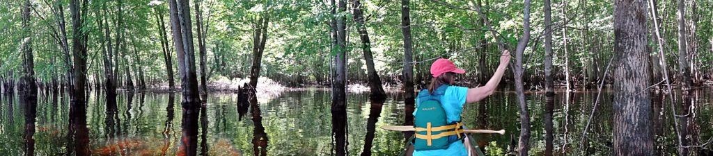
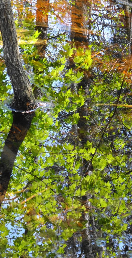
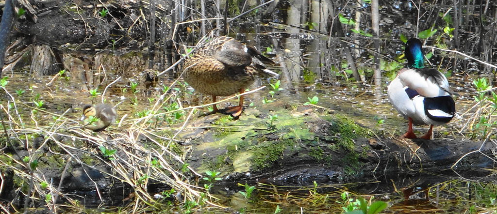
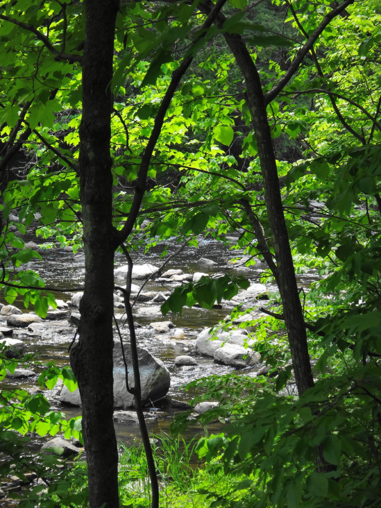
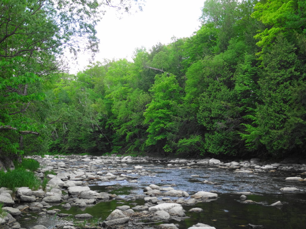
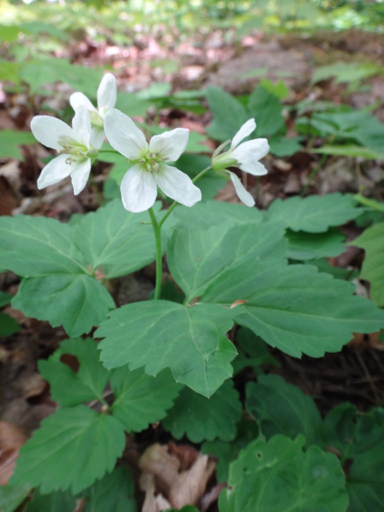
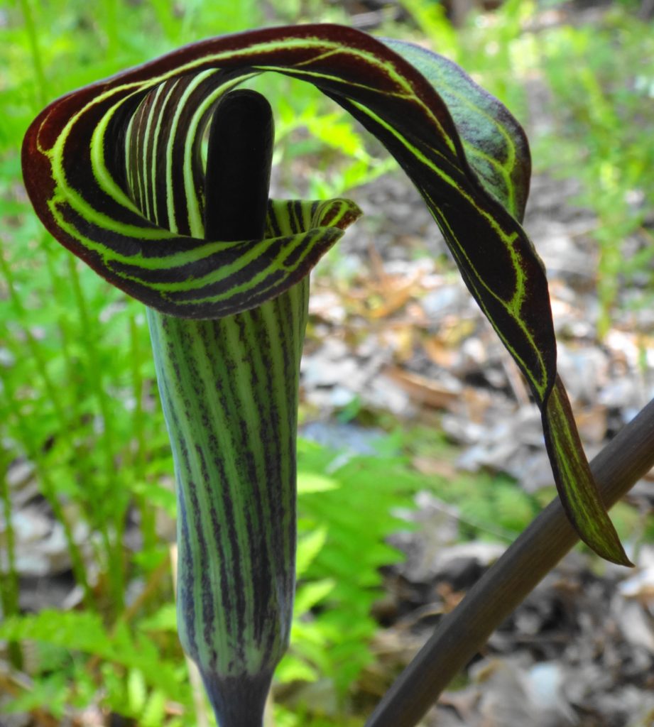
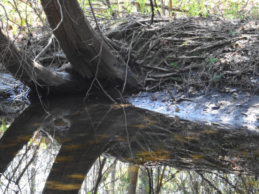
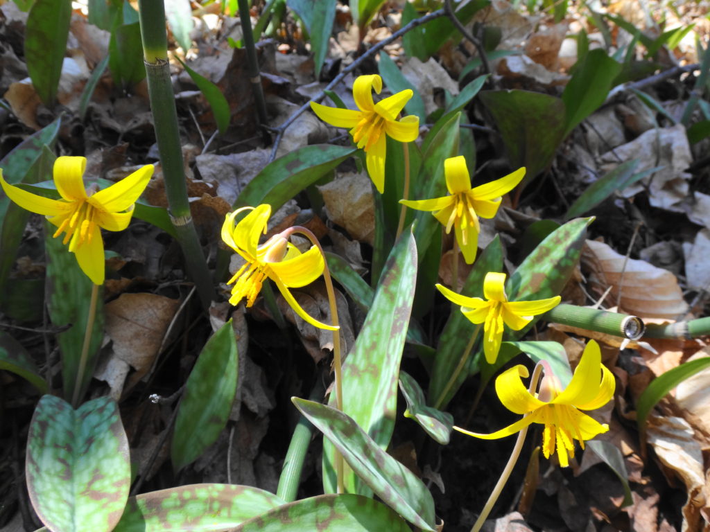
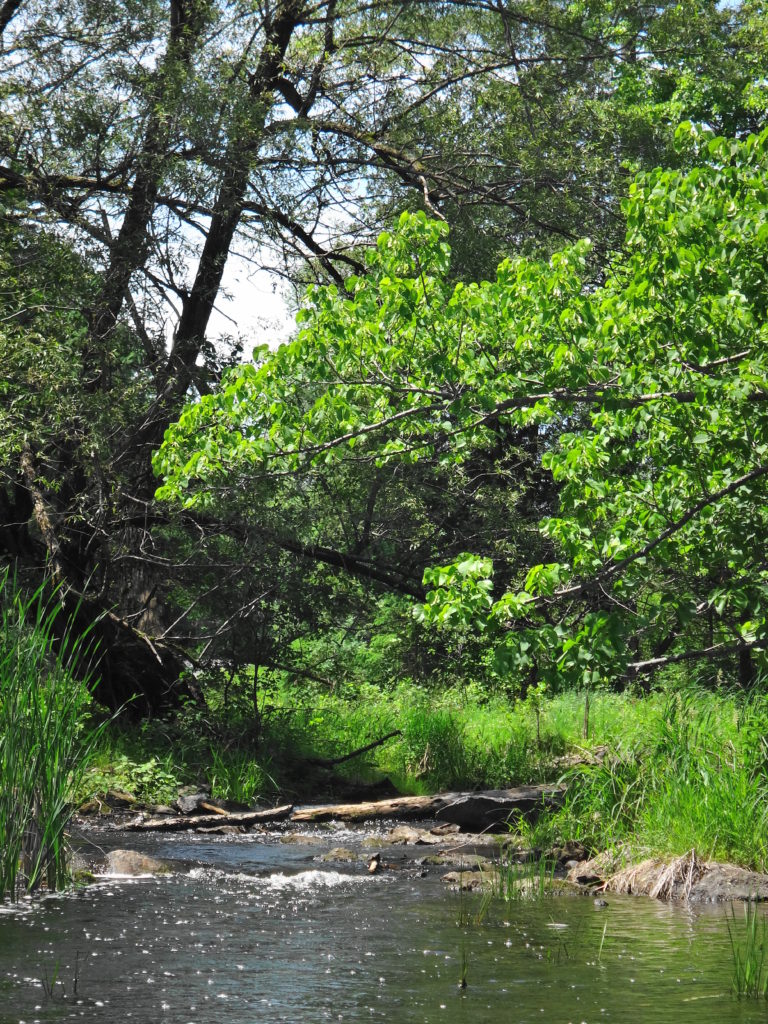
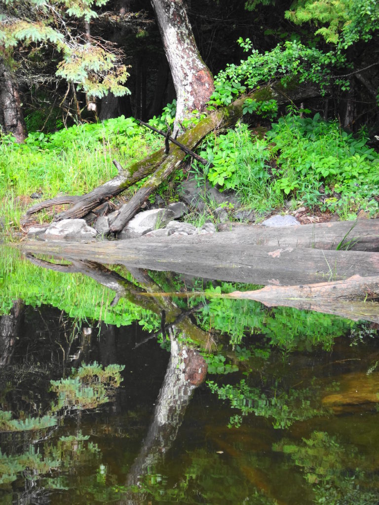
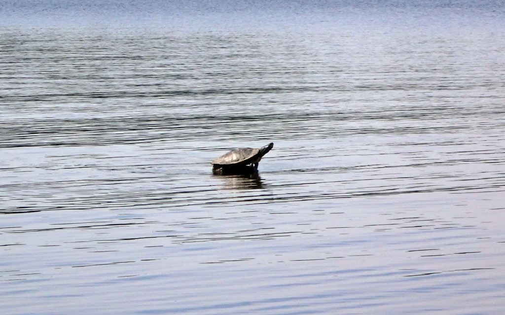
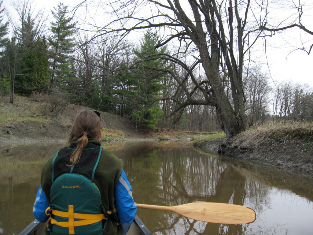
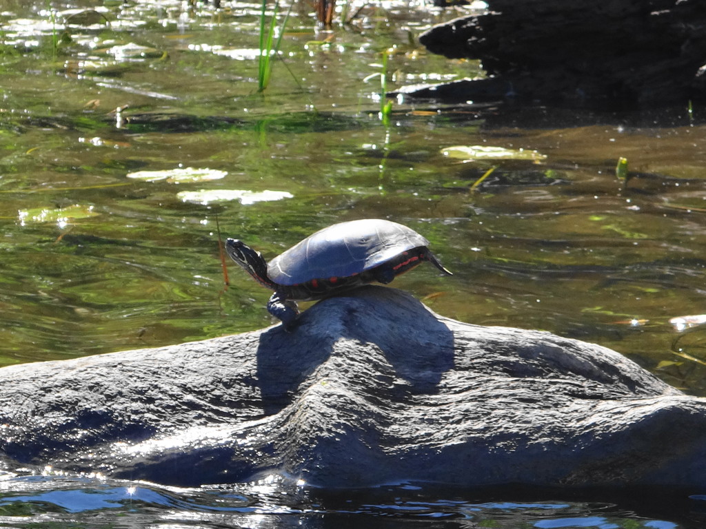
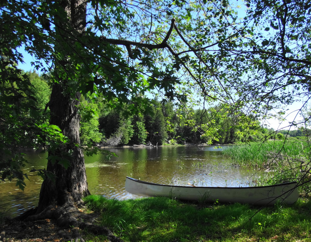
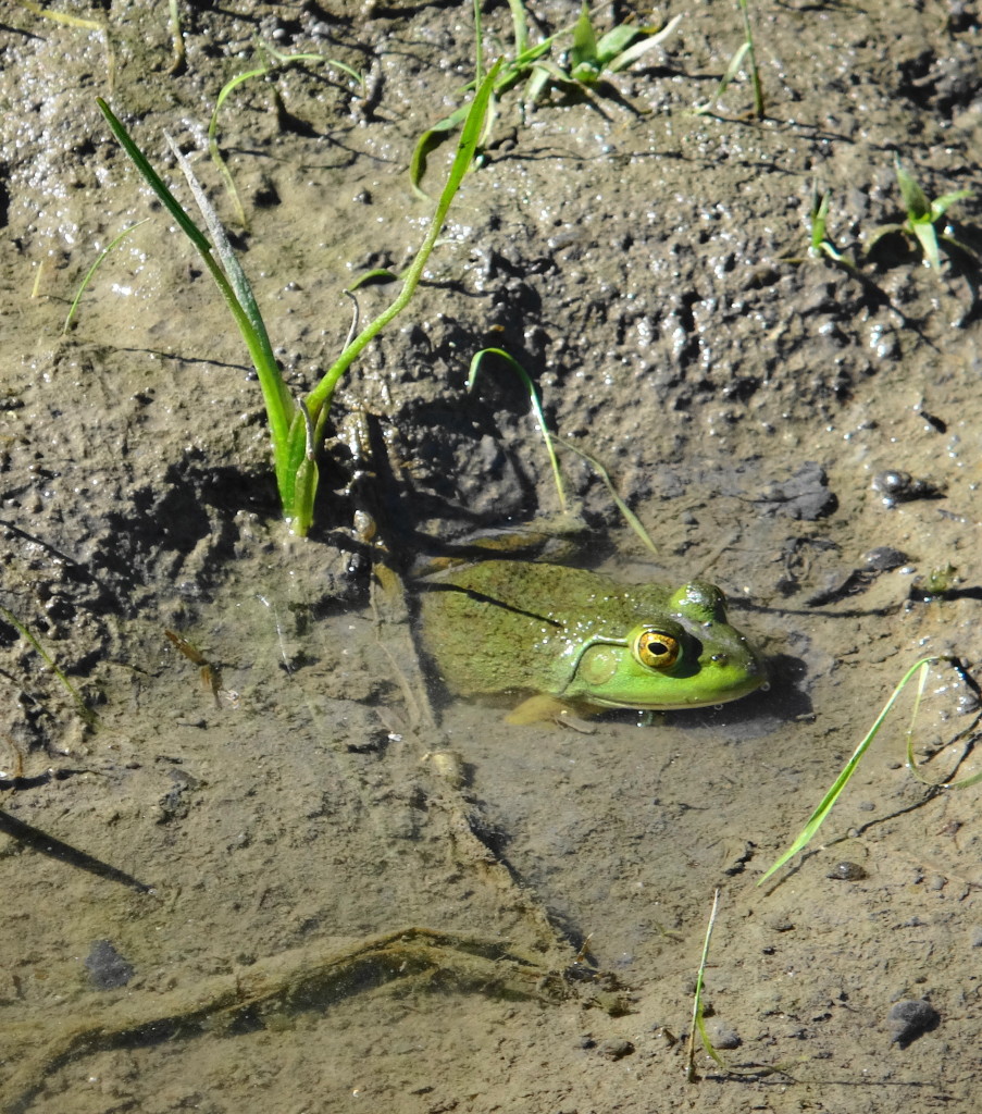
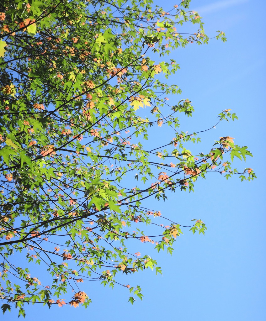
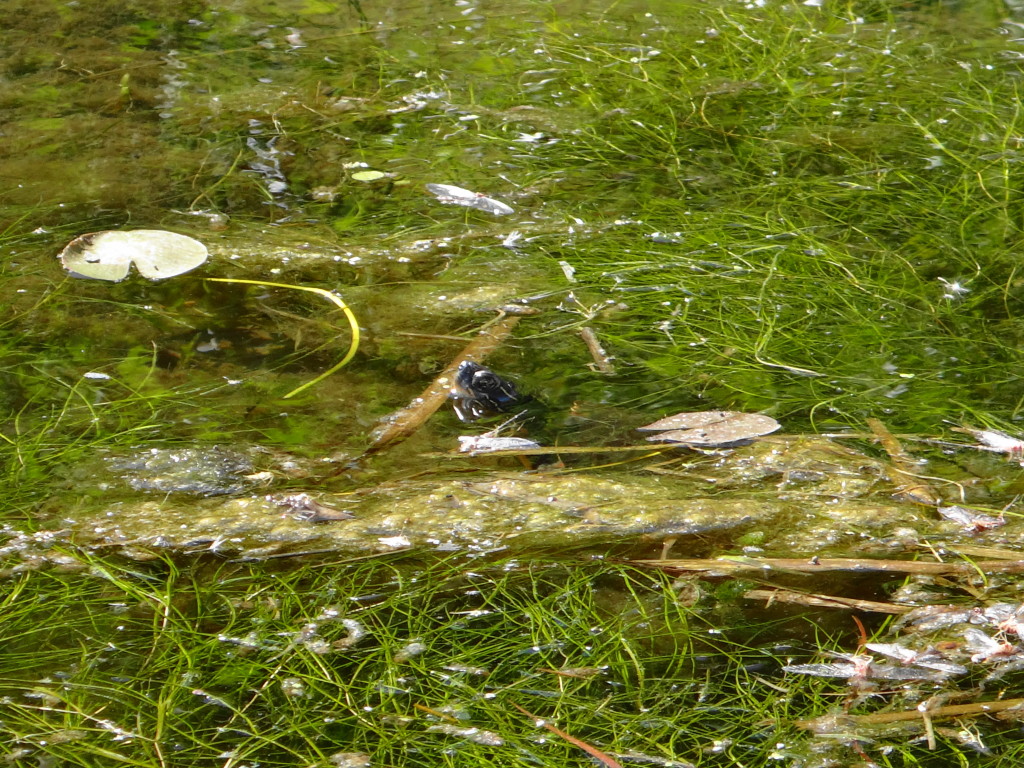
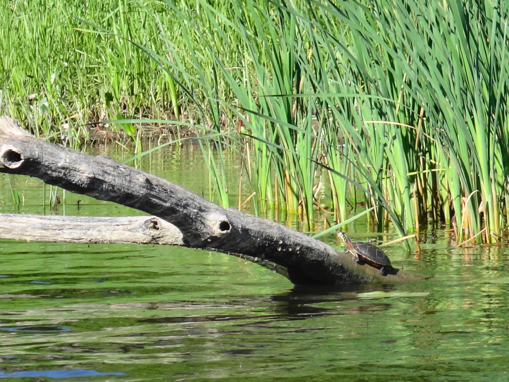
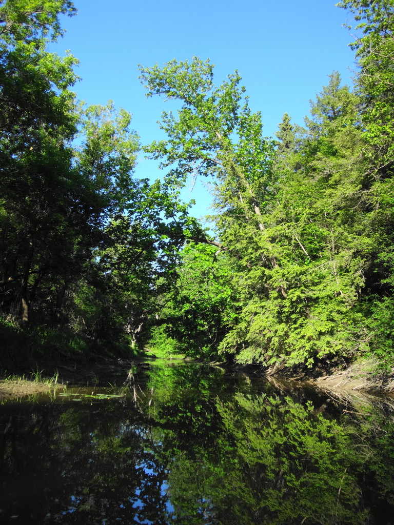
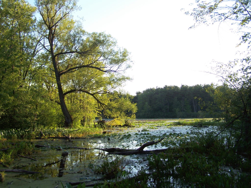
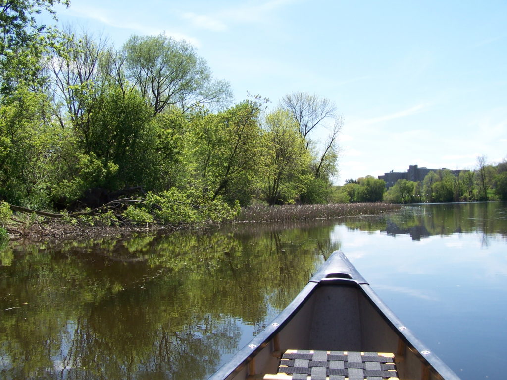
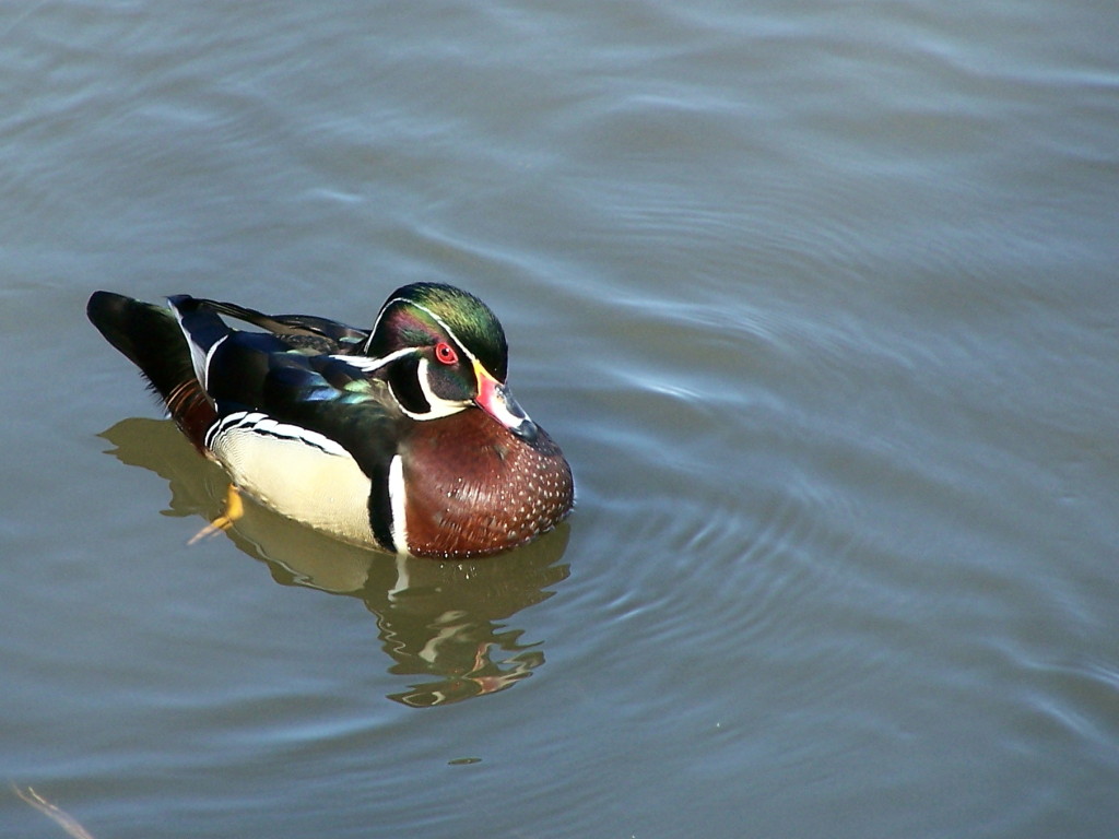
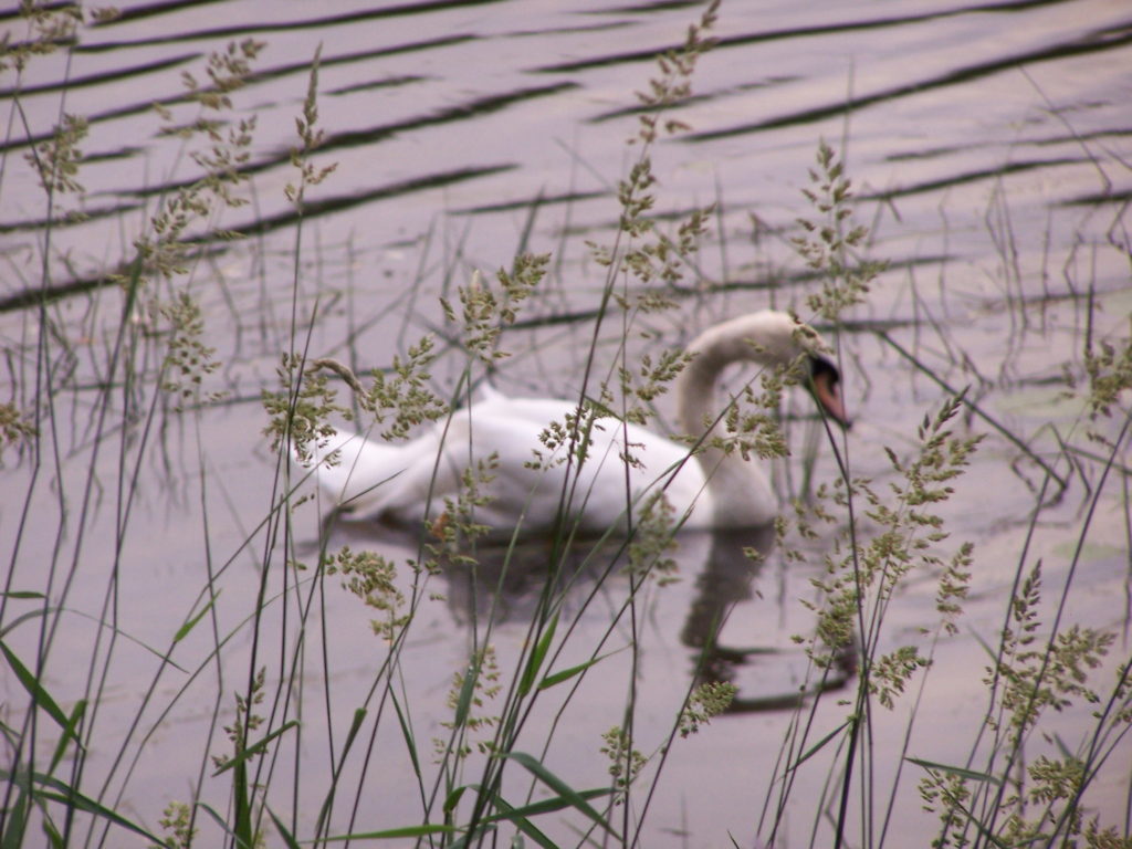
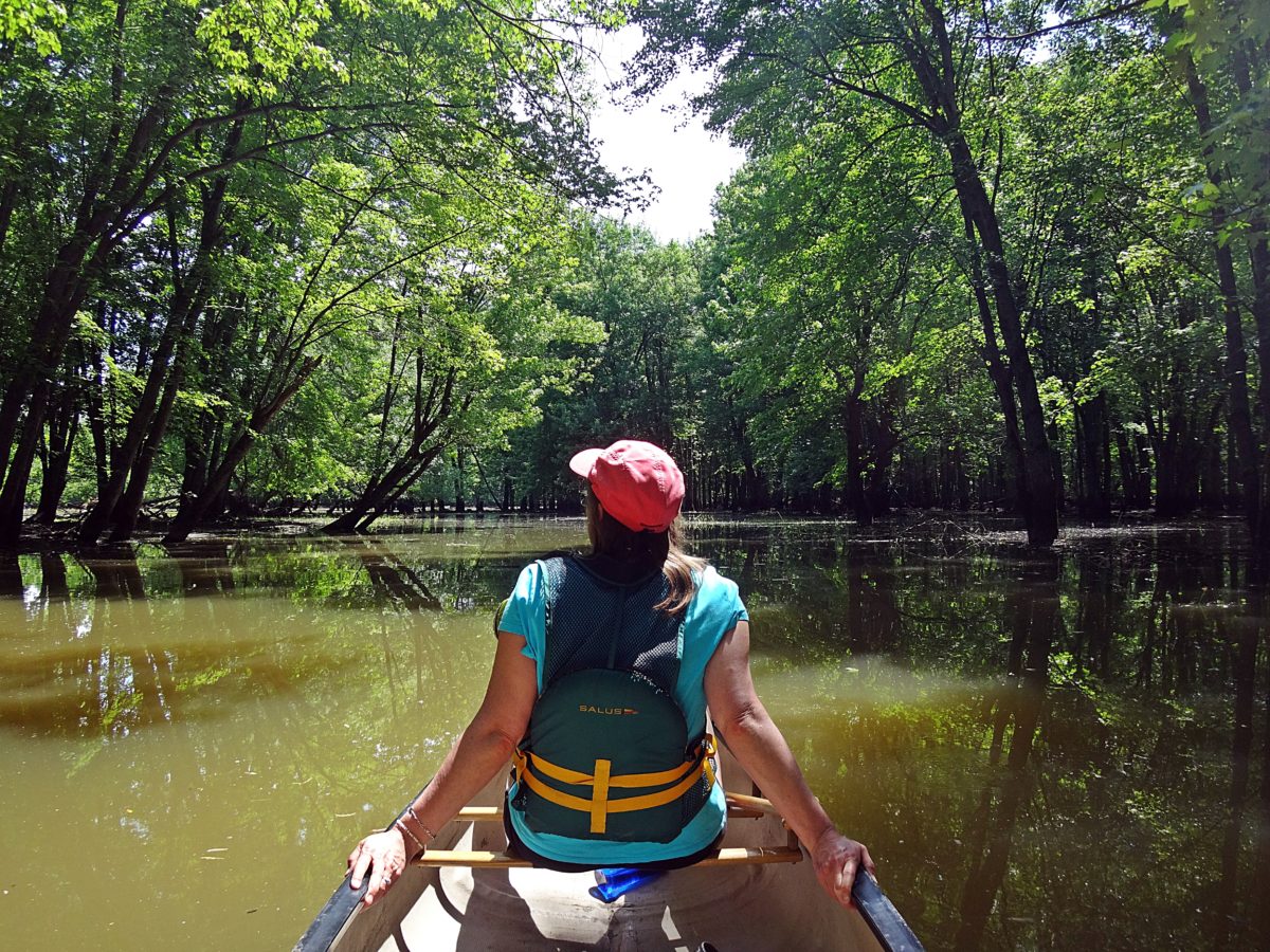
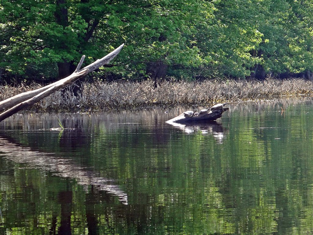
We glide on dirty, brown water under a green, sunlit canopy of silver maple trees.  Spring run-off on the Ottawa River has pushed nutrient-rich floodwaters back into the forests along lower Constance Creek.  Warblers sing brightly in the tree-tops and multi-hued wood ducks peek shyly from the shady depths of the swamp.  The nighttime chorus of spring peepers and tree frogs has dwindled in the warming day to a few desultory chirps and clucks.  We pass between the spreading, fluted tree trunks in quiet awe, like visitors to some southern, bald cypress bayou.  But instead of alligators basking along the channel, map turtles and painted turtles crawl on to logs to sun themselves, while pike and gar lie up in the shallow reed beds.

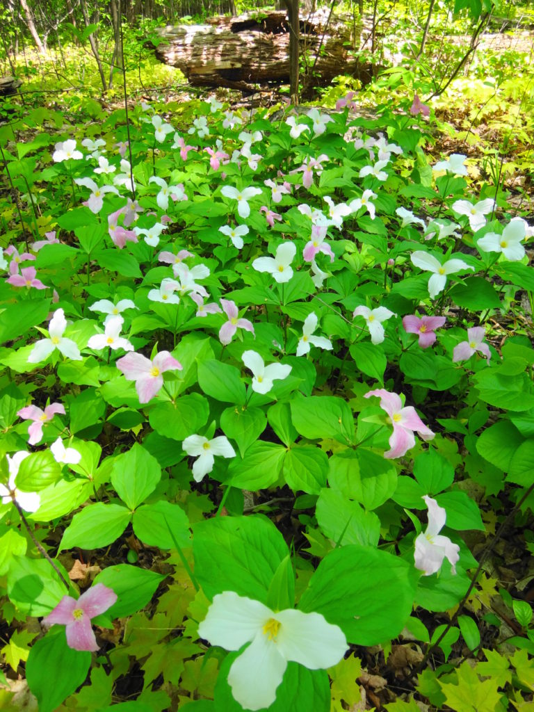
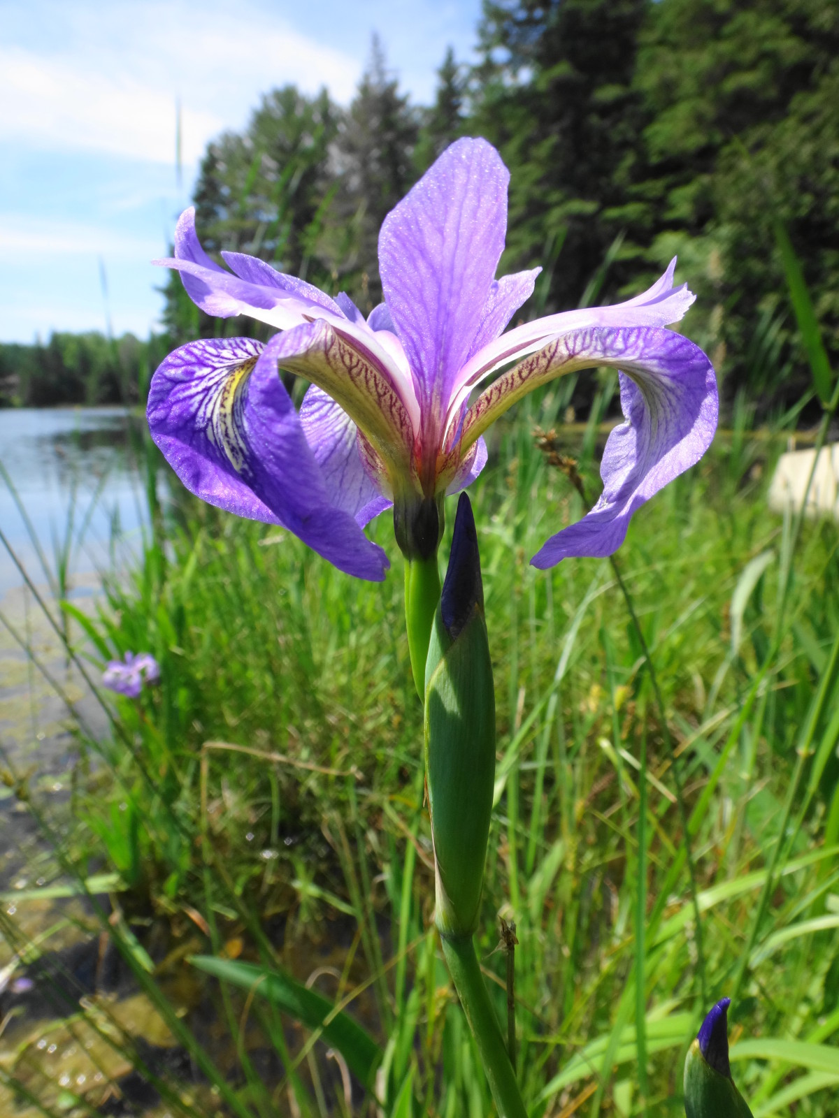
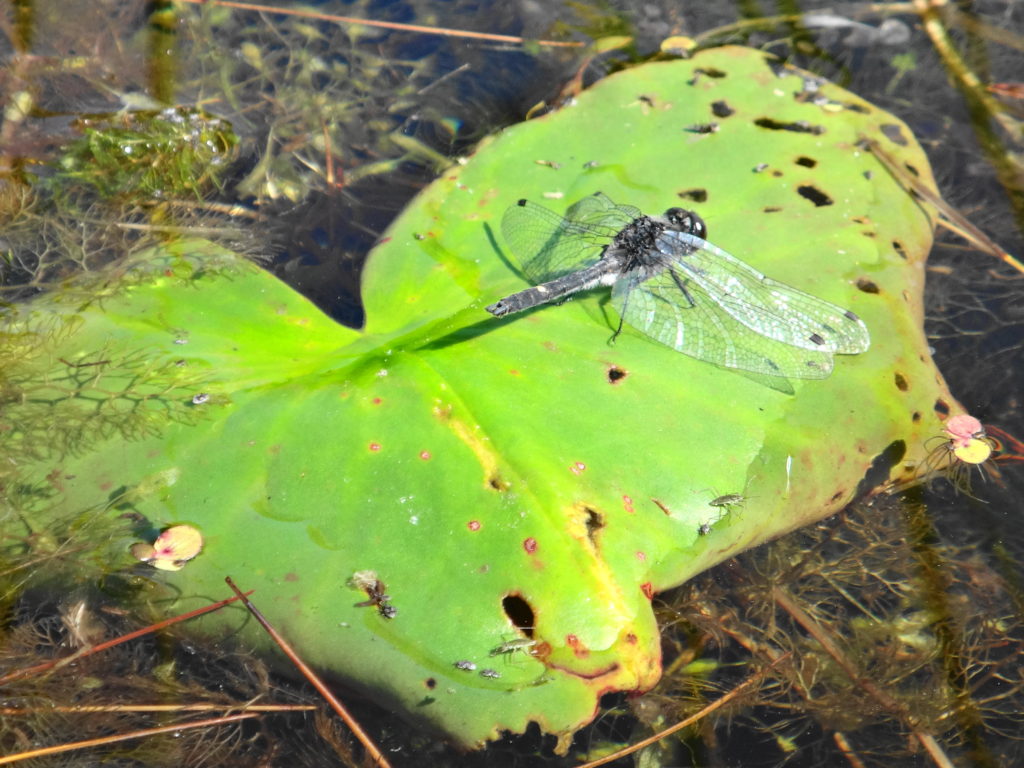
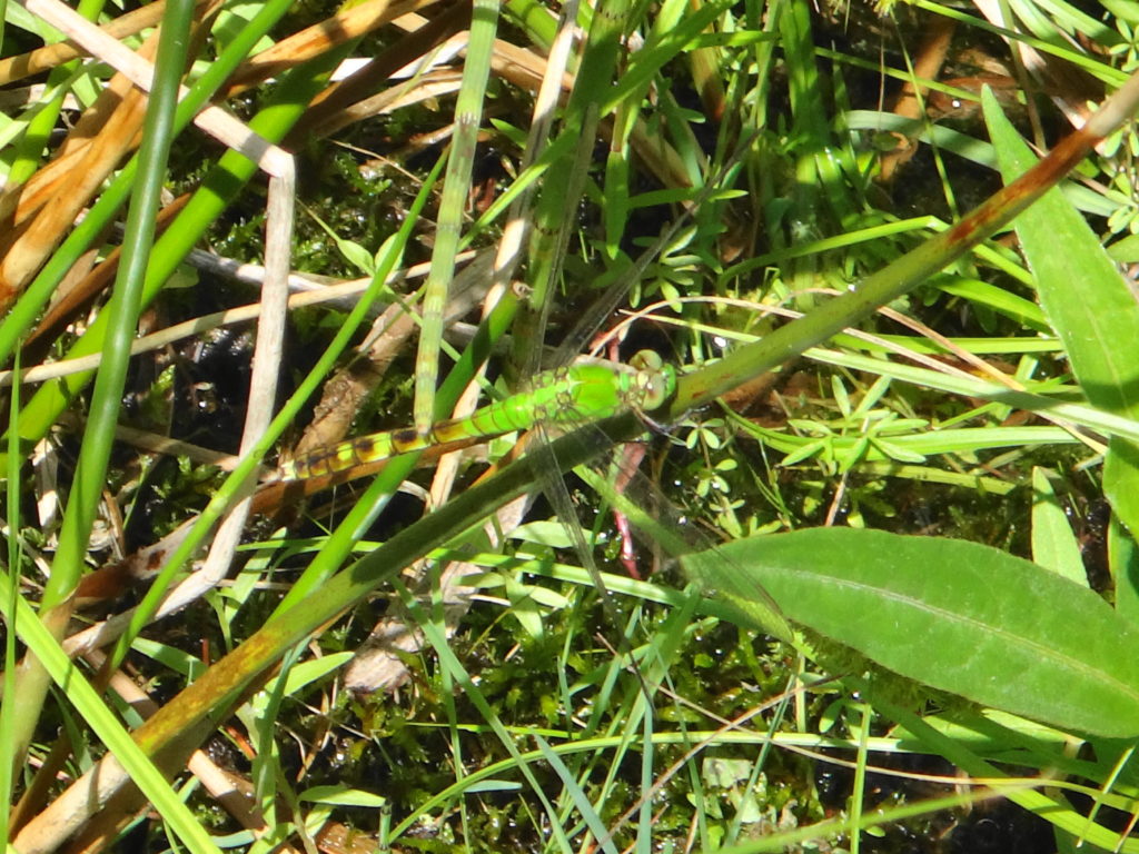
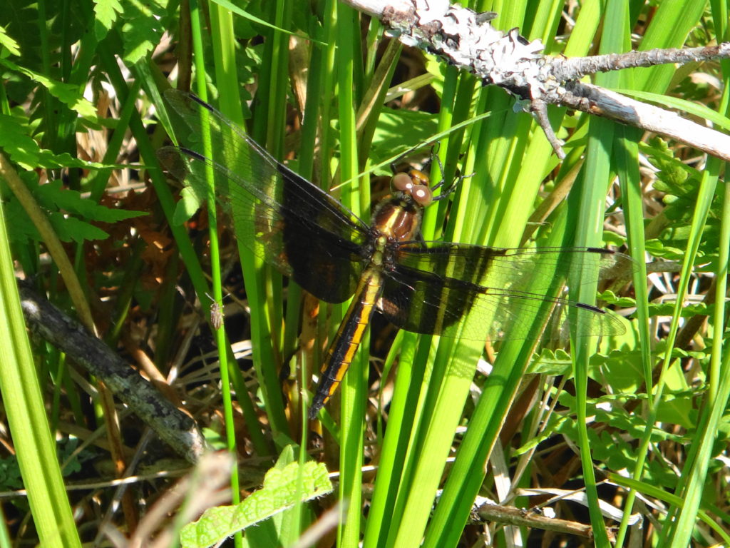
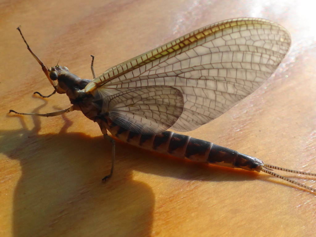
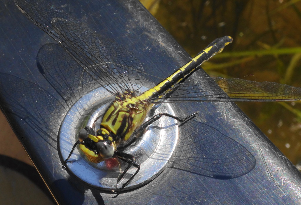
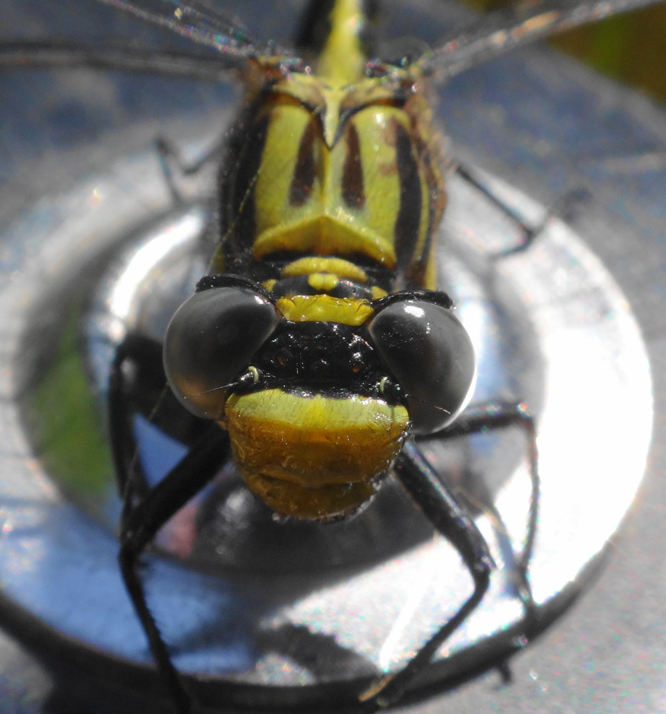
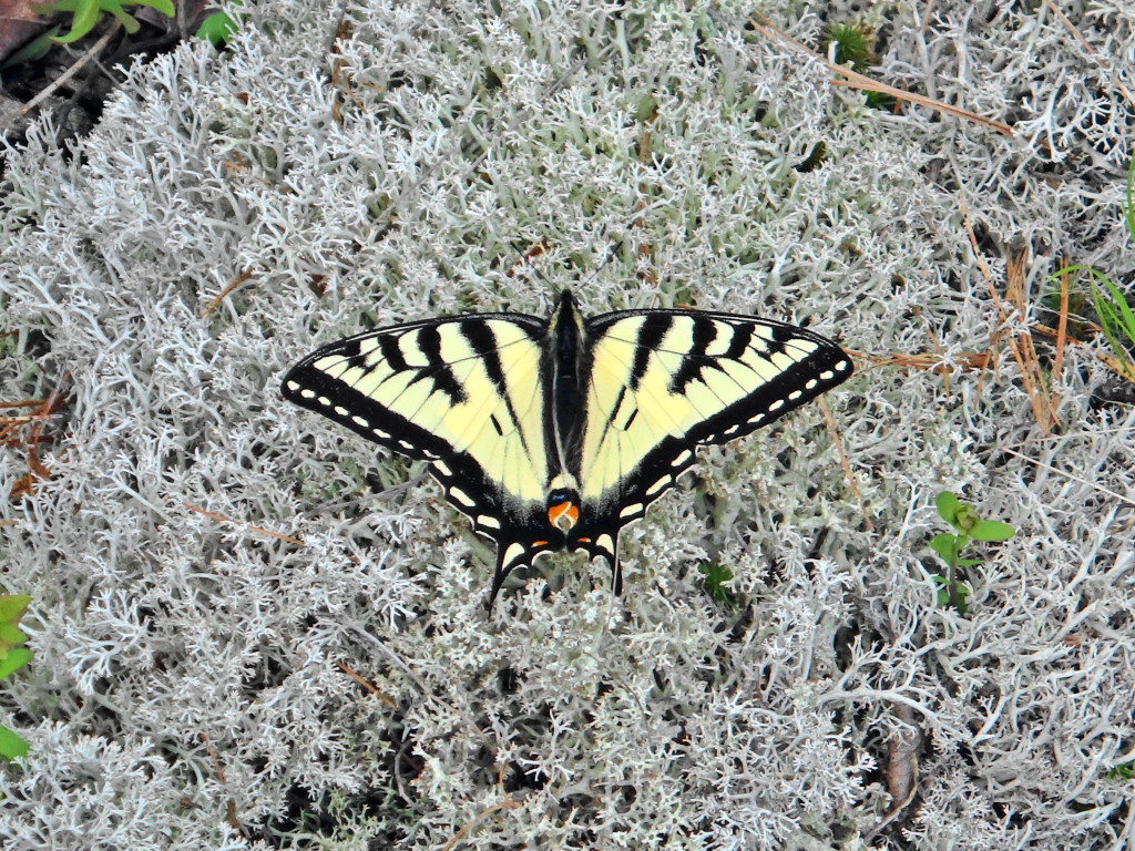
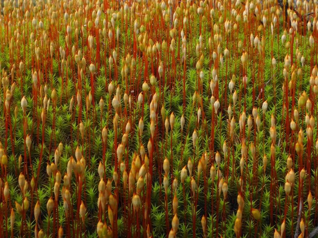
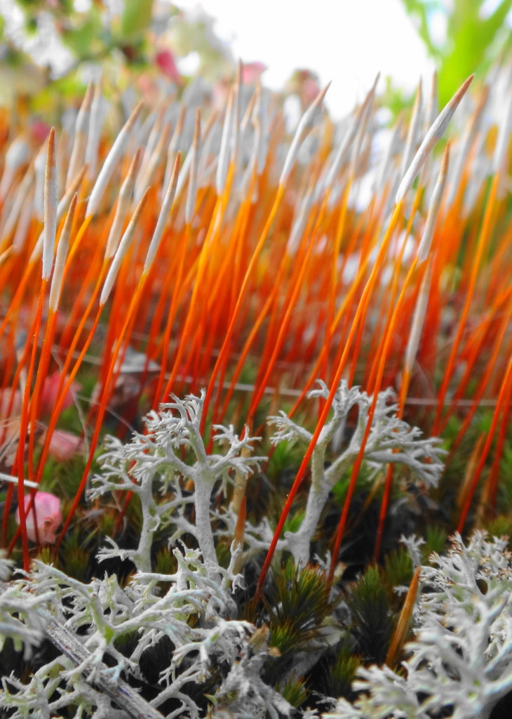
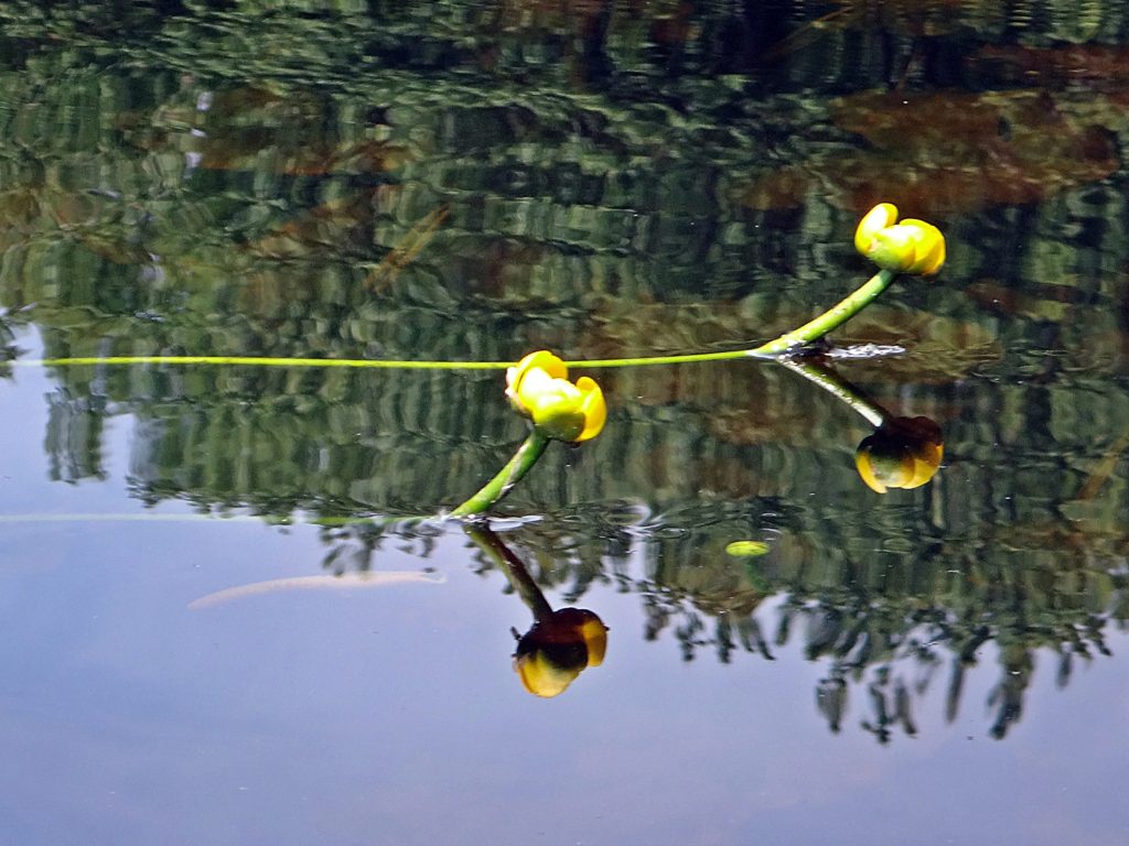
When biologists speak of the diversity and productivity of wetlands, they have places like Constance Creek in mind, where life overspills its banks.  Scoop the creek water into your cupped hands, and you hold a galaxy of microscopic, living things.  Look up to the trees to see life thrust by the laws of thermodynamics toward its origin in the dust and energy of stars.  Energy flows through a tangled web of matter, seeking stability, building in complexity, expressed in a fractal lattice in which dragonflies hang like jewels.  A wetland brings together the elements of life like no other place.  Perhaps in no other place does a biologist feel more like a priest.

Three turtles bask on the projecting end of a log near the bank of Constance Creek. The treed shoreline reflects in the calm water.
Turtle Basking on Constance Creek

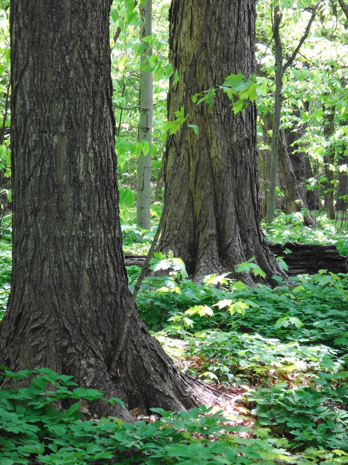
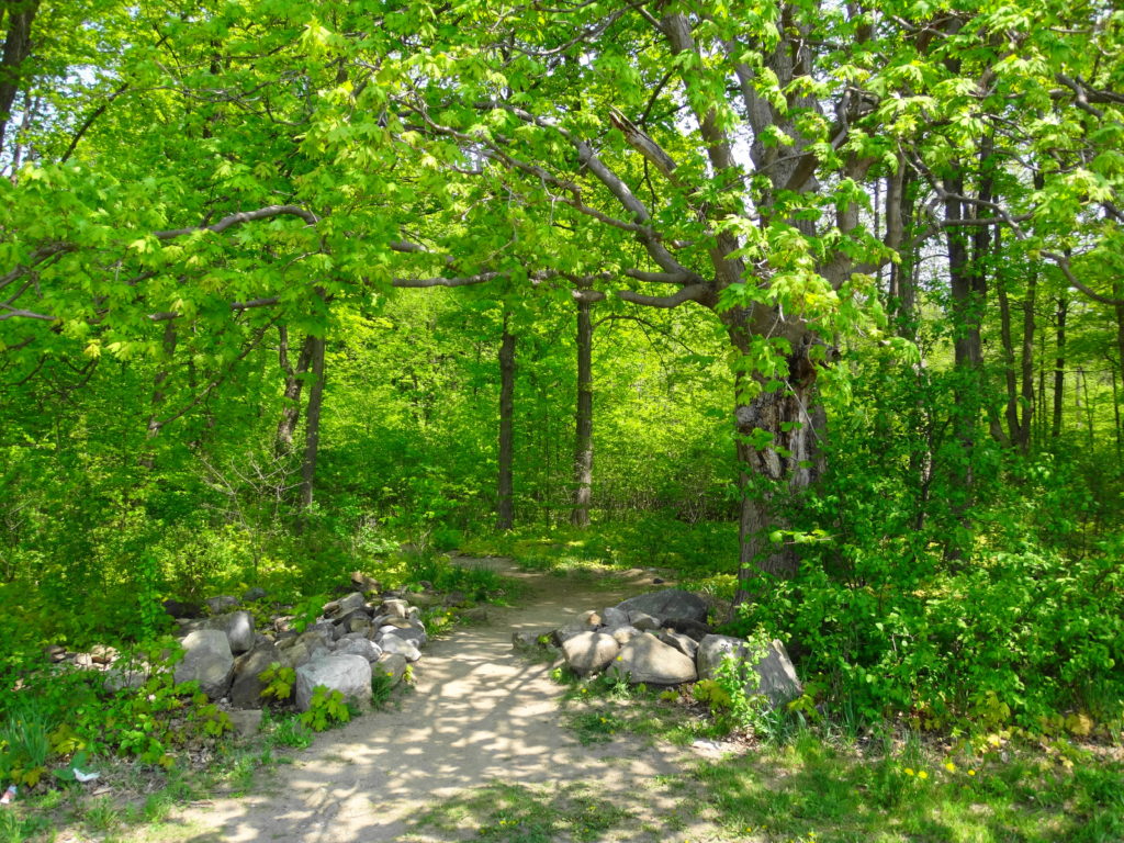
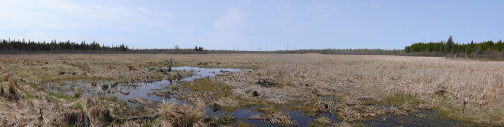
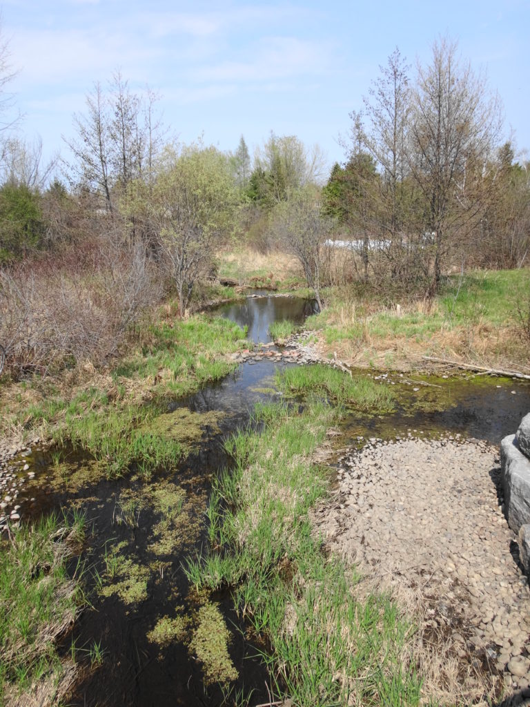
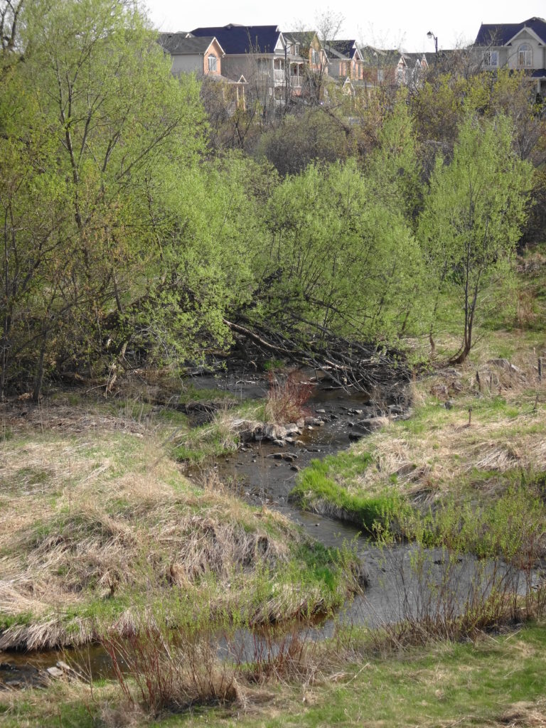
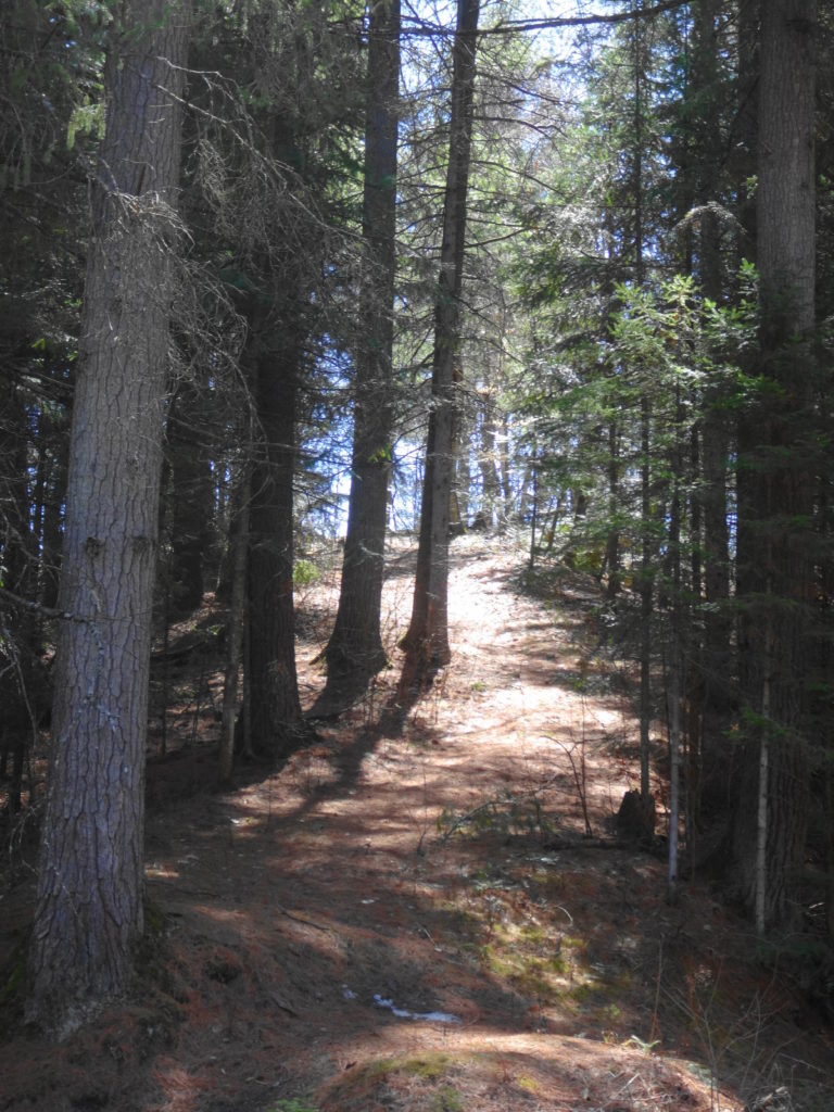
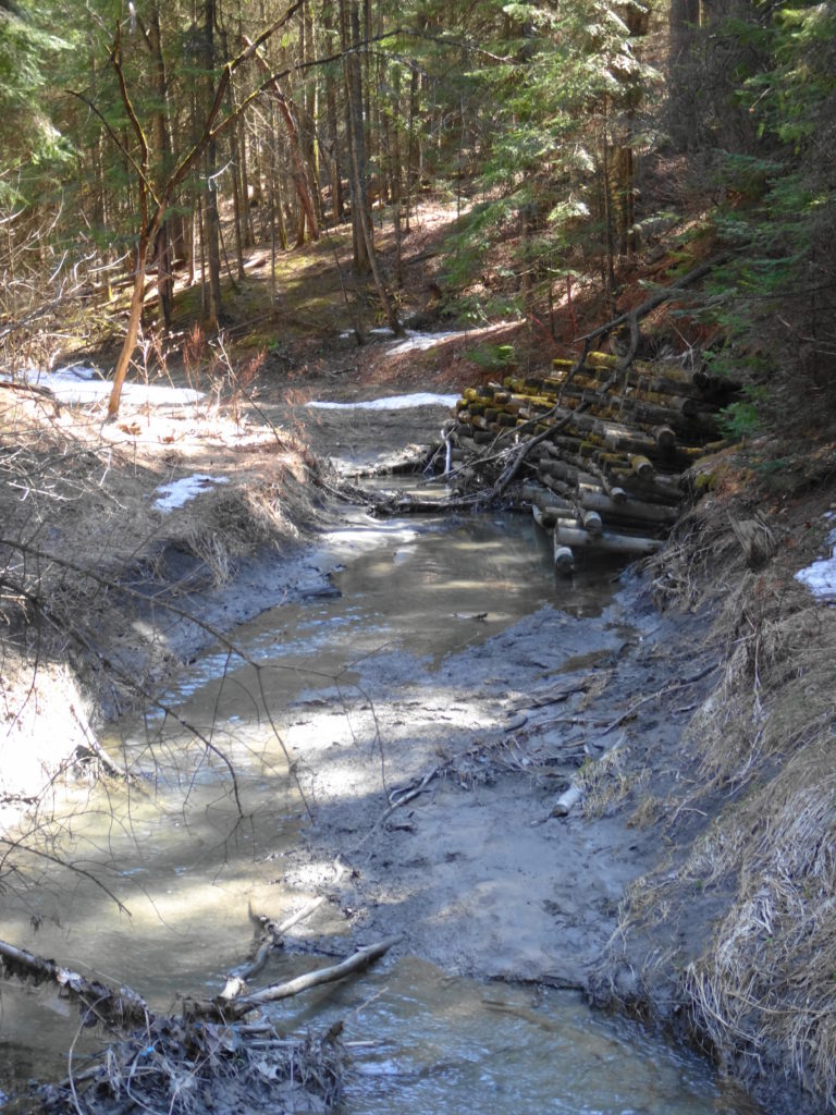
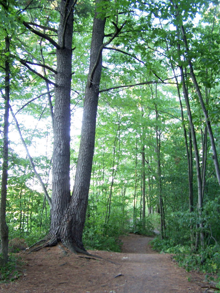
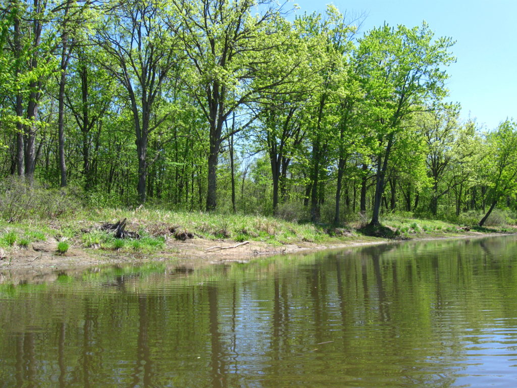
A confluence of fortuitous circumstances has preserved Constance Creek as a uniquely healthy riverine wetland.  About 10,000 years ago, when meltwaters of the retreating glaciers swelled the Ottawa River, part of it flowed along a side channel from Constance Bay in the north to Shirley’s Bay in the south.  Along the banks of this channel, it deposited large sandbars over the flat clays left by the retreating Champlain Sea.  Over time, as the Ottawa River shrank to its current size, flows along the channel reversed direction, draining the adjacent Carp Ridge and Dunrobin Ridge north through a meadering stream and wide, swampy floodplain.  Annual flooding limited farming and permanent settlement along the creek, while the deep, sandy soils supported the growth of a rich riparian forest to further screen and protect the creek.  Some unauthorized filling of the Constance Creek wetland occurred in 1989 with the construction of the Eagle Creek Golf Club.  Sand pits have also opened at places along the creek, although they remain hidden from the main channel.  For the most part, though, the creek remains well buffered from surrounding land uses.

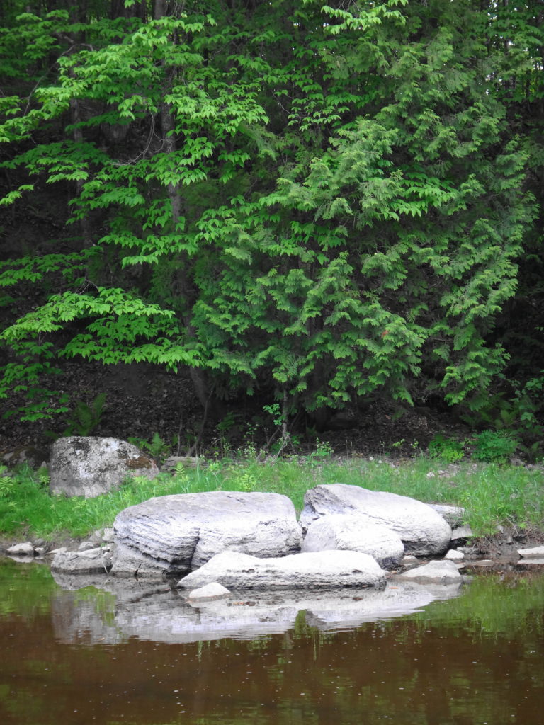
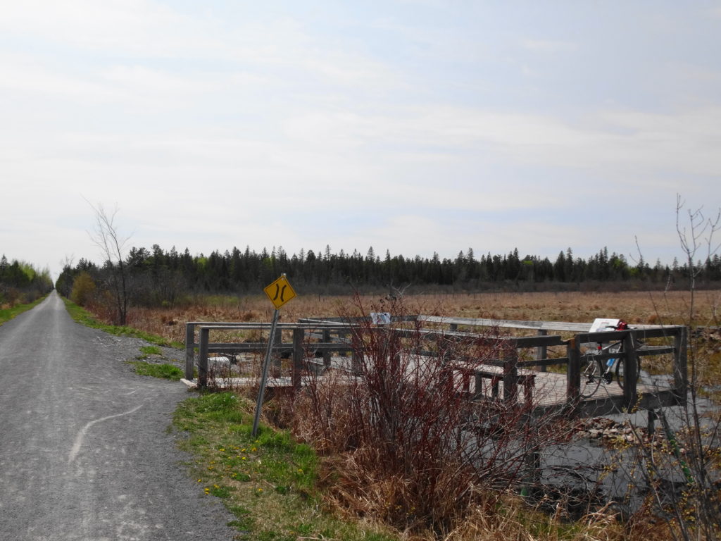
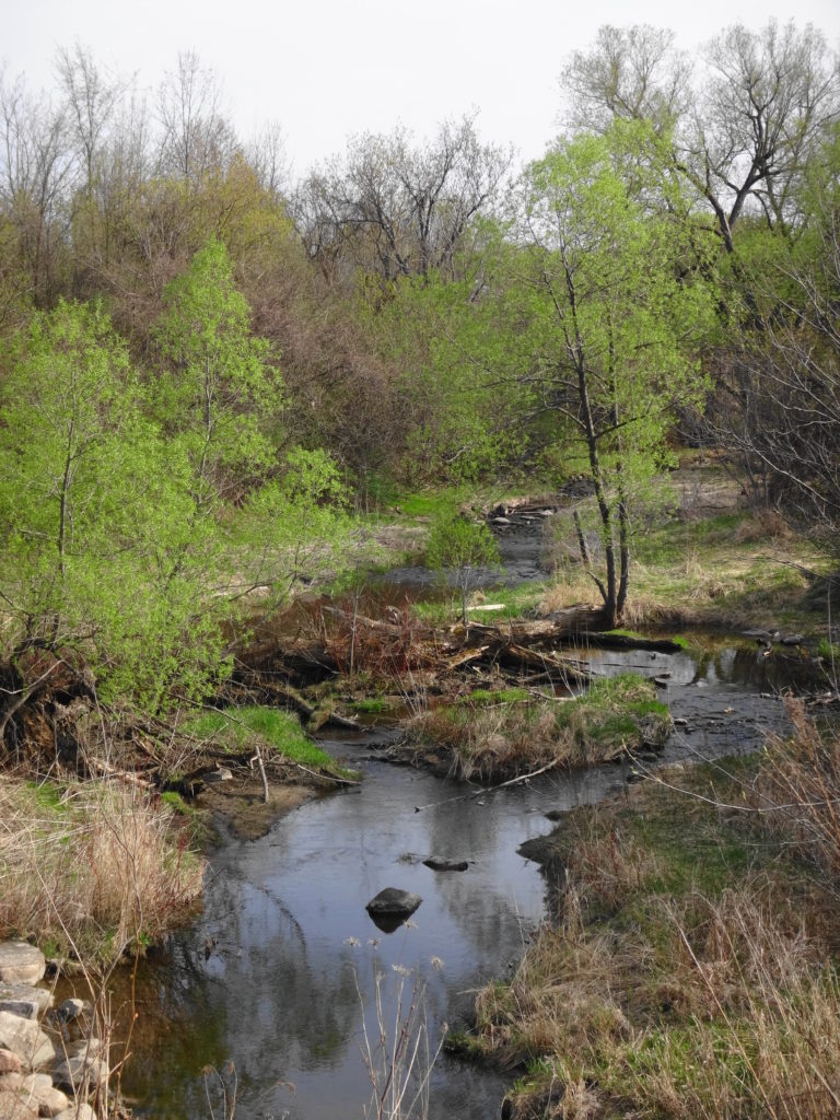
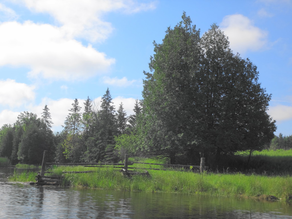
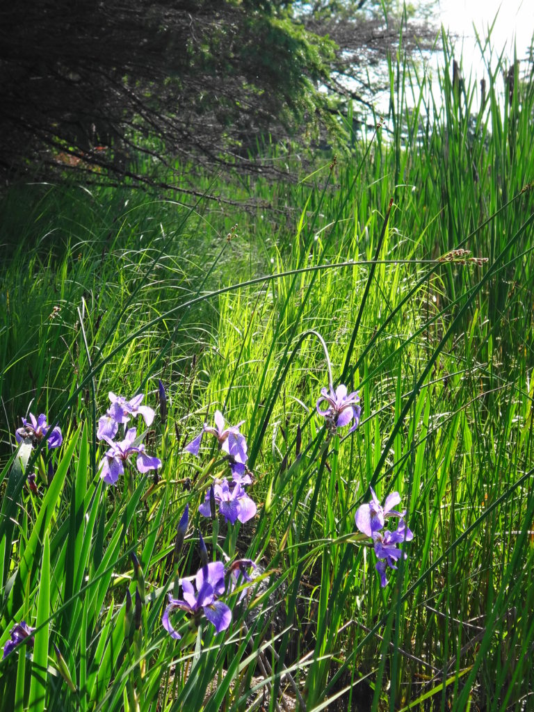
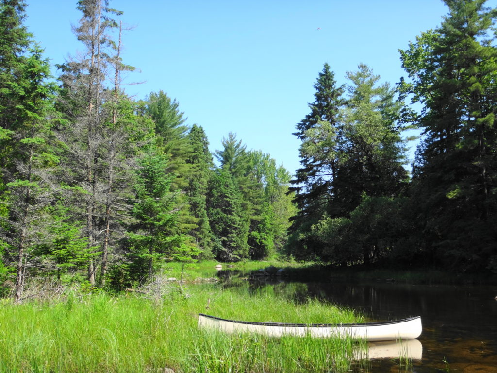
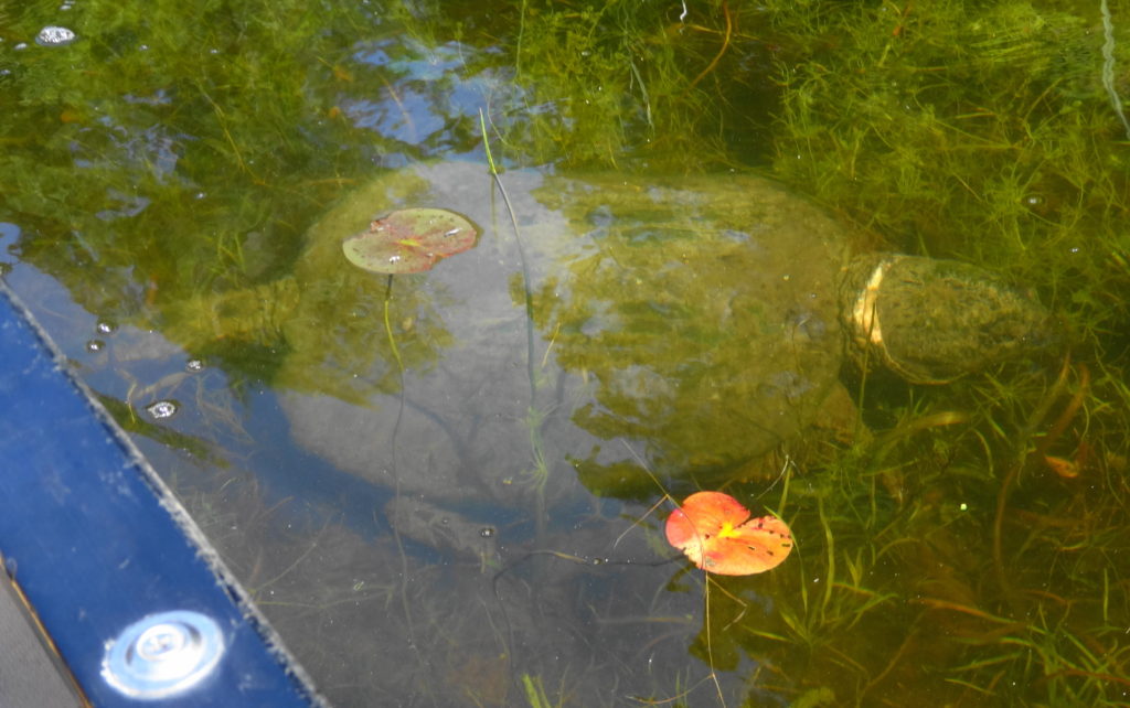
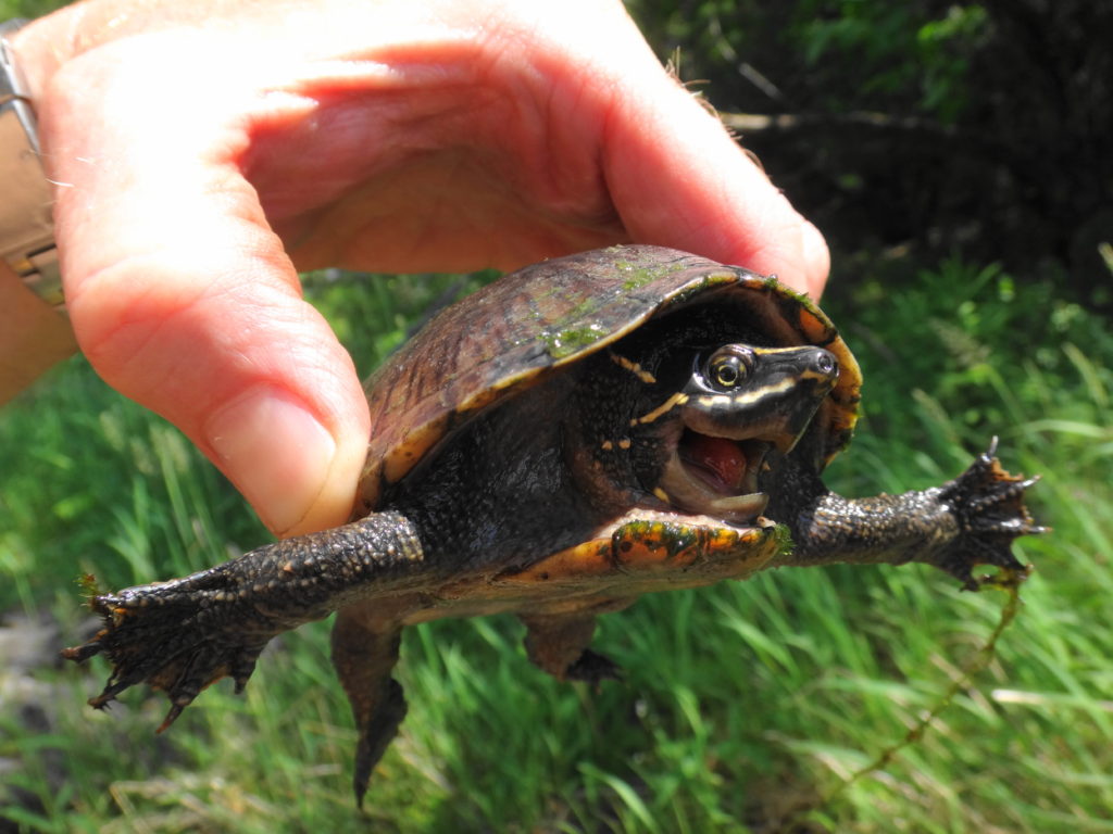
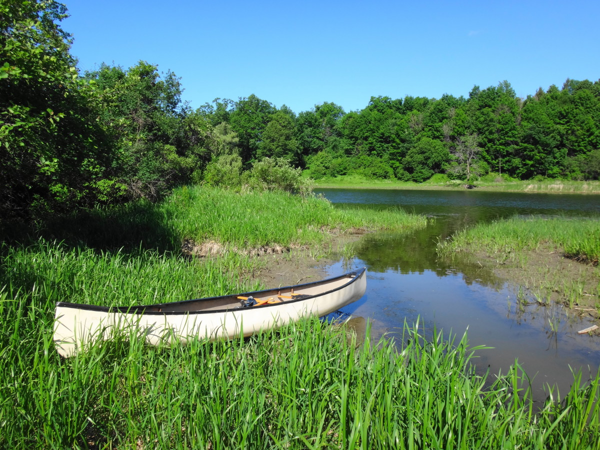
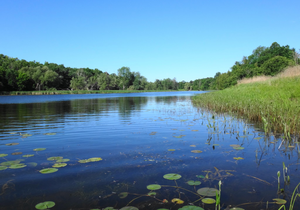
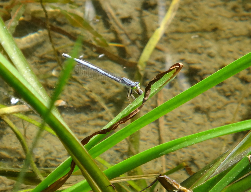
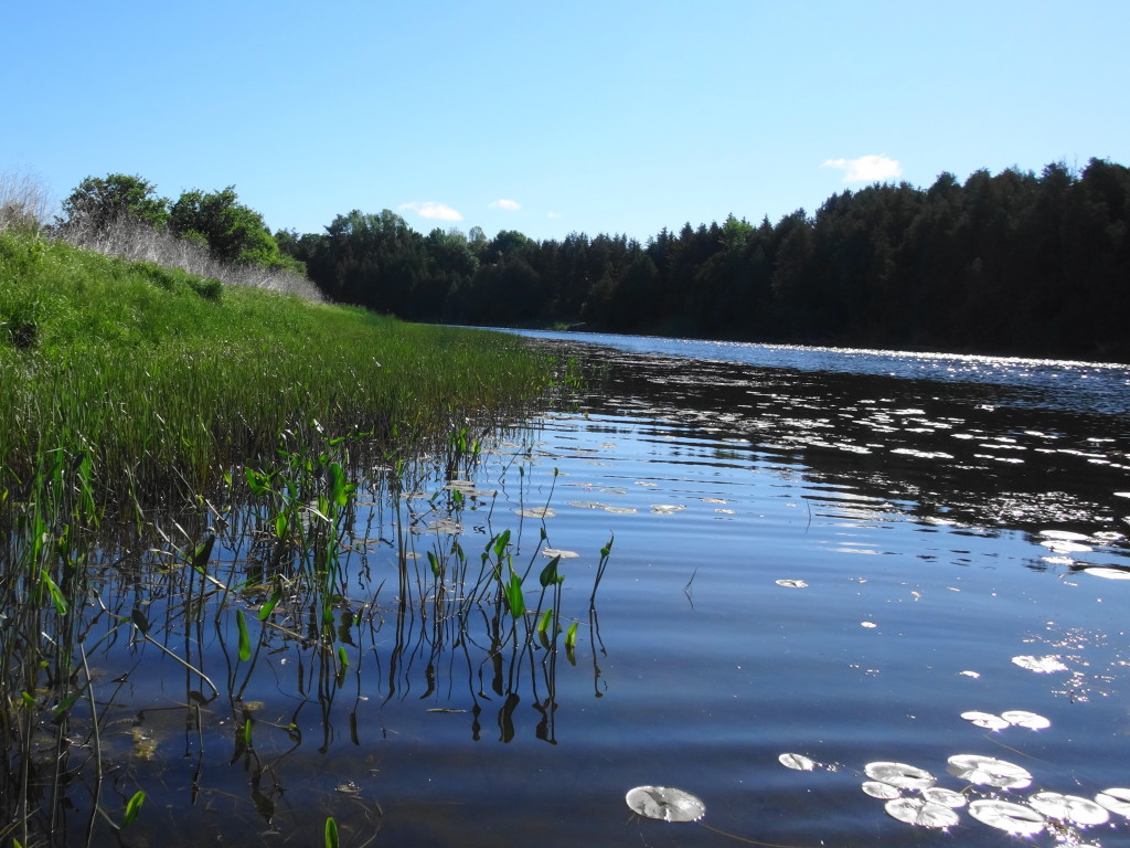
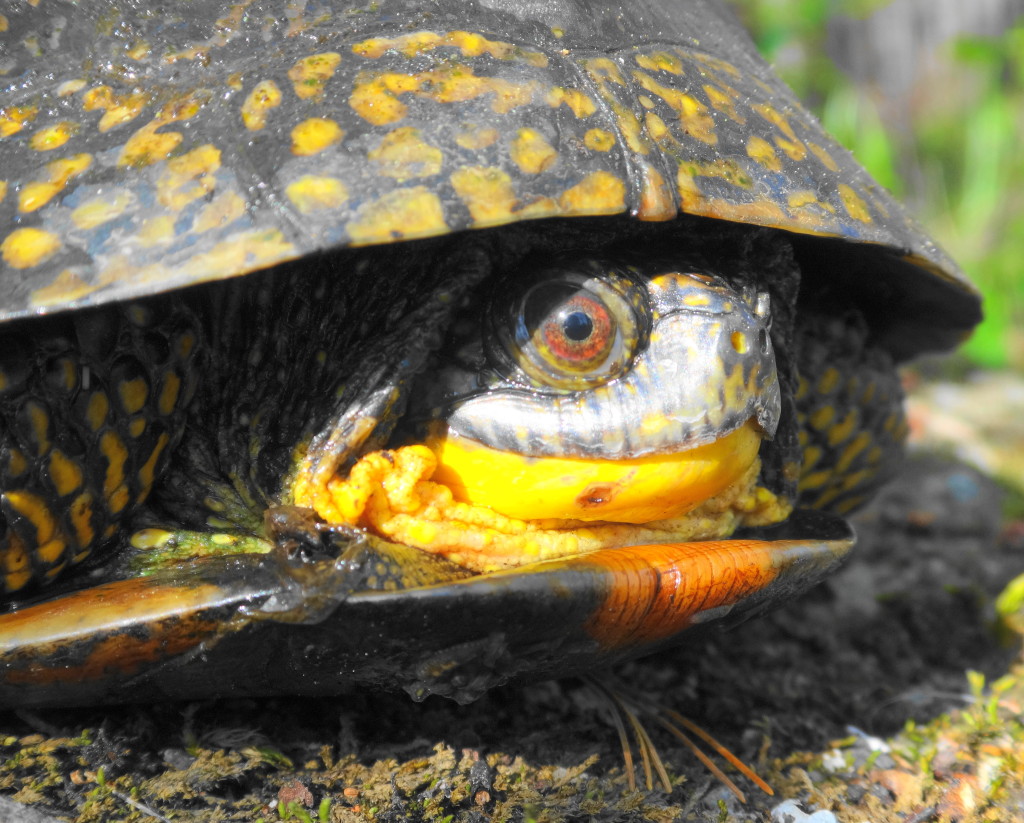
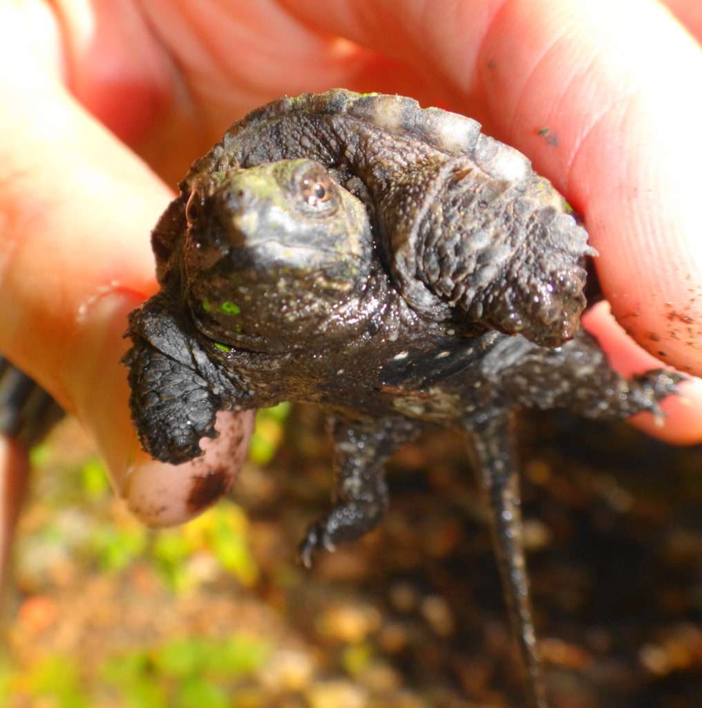
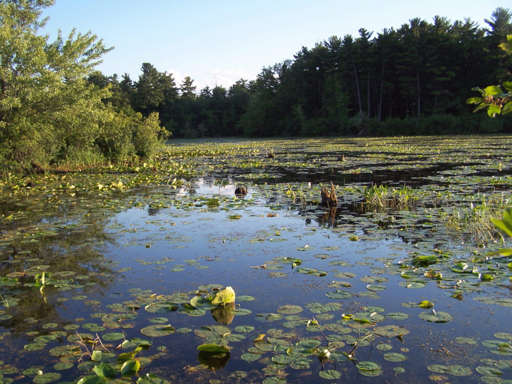
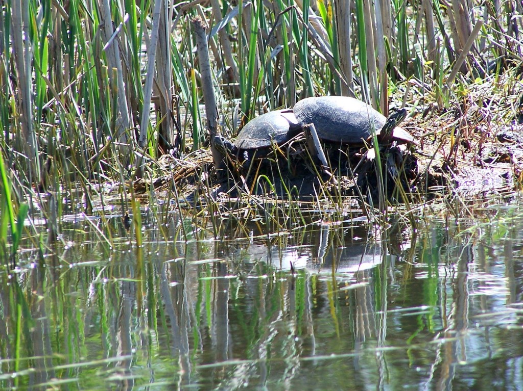
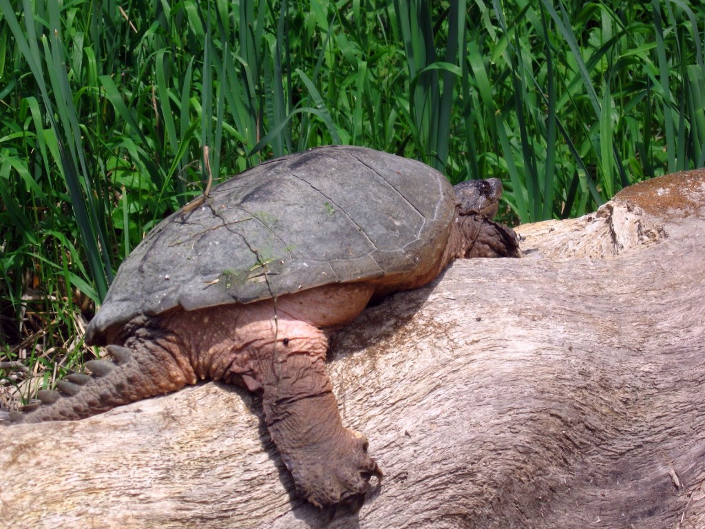
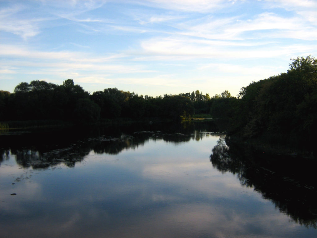
Several locations give access to the creek, but thick cattails often limit paddling.  At the upper end, an alm0st impenetrable marsh blocks access from Constance Lake.  The reach downstream of the bridge at Thomas Dolan Parkway provides a short, easy paddle through a lovely riverine marsh.  Painted turtles, snapping turtles and Blanding’s turtles bask along the channel in the midday sun, and a colony of black-crowned night herons hides back in the reeds.  Damselflies and dragonflies hunt over the water.  The bridge at Vance’s Side Road provides a pretty view over marsh and swamp, but the channel quickly chokes off both upstream and downstream.  In contrast, the mouth of the creek on Constance Bay offers one of the most beautiful, flat water paddles in Ottawa.

Two yellow pond lilies reflect in the calm water of Constance Creek.
Yellow Pond Lilies

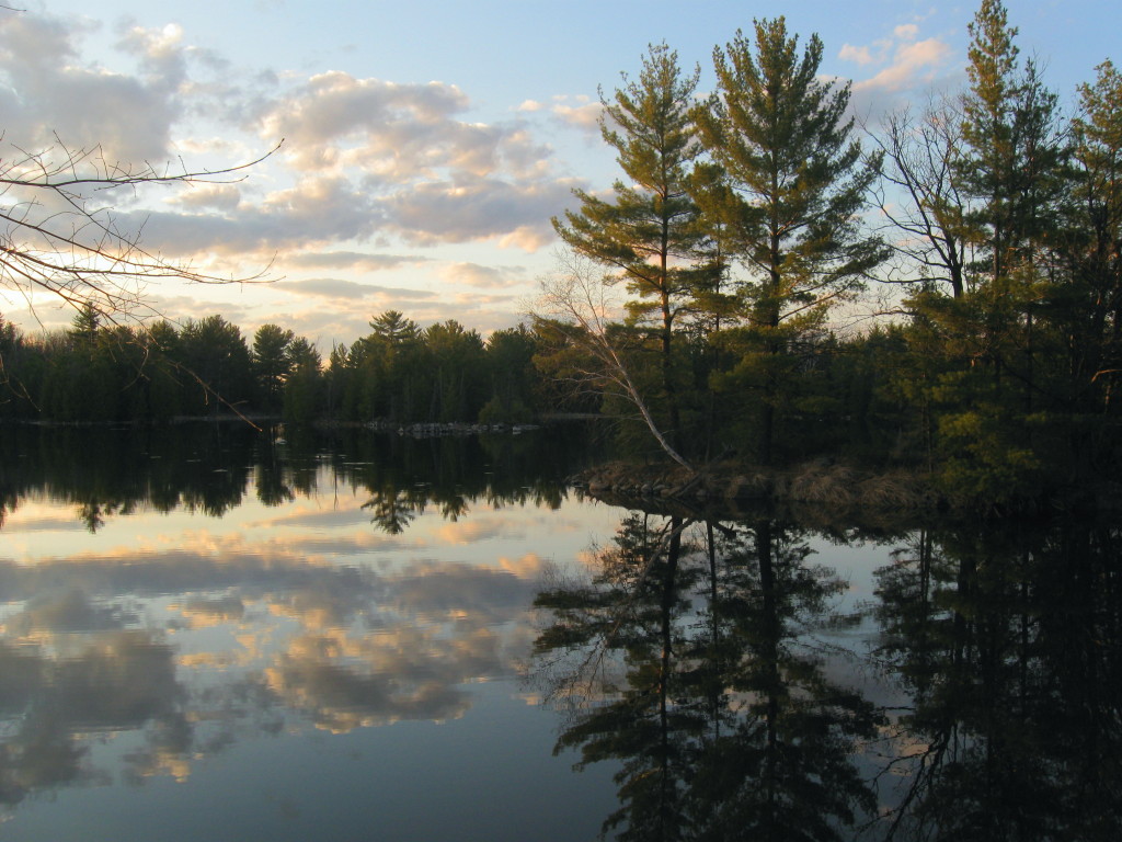
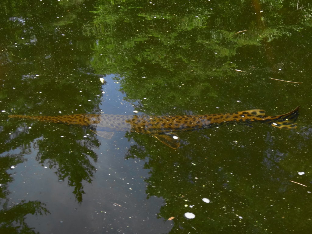
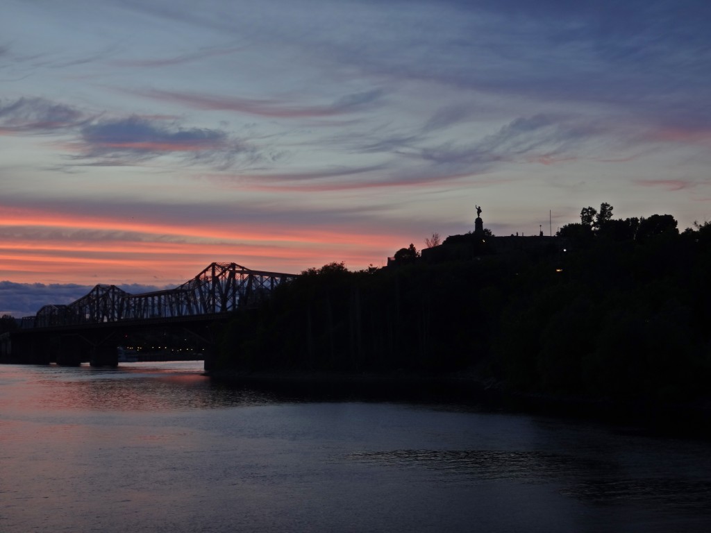
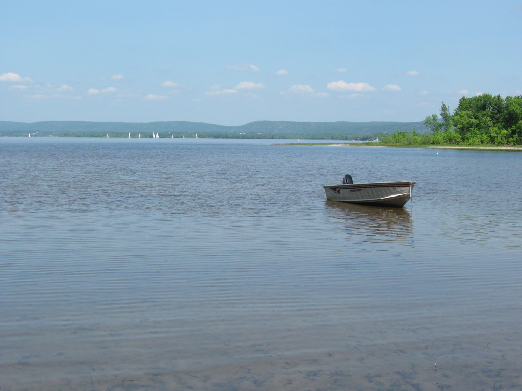
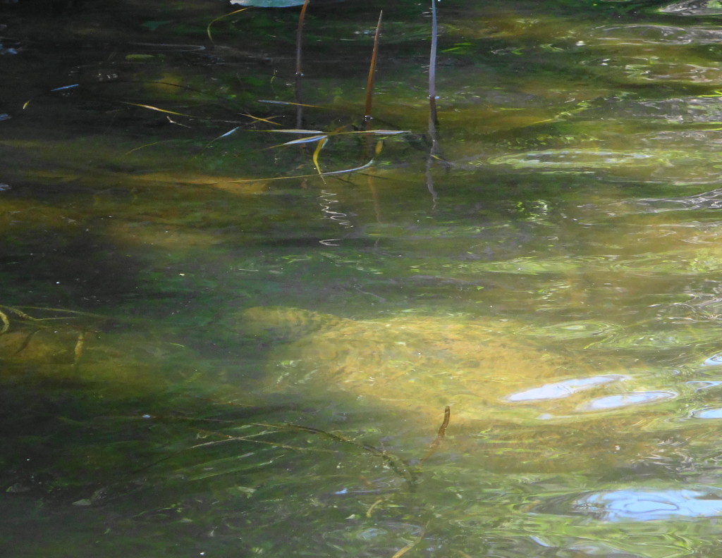
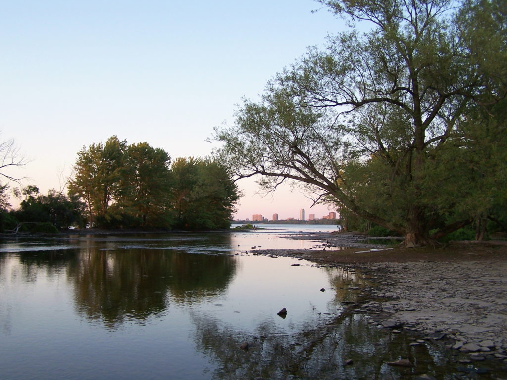
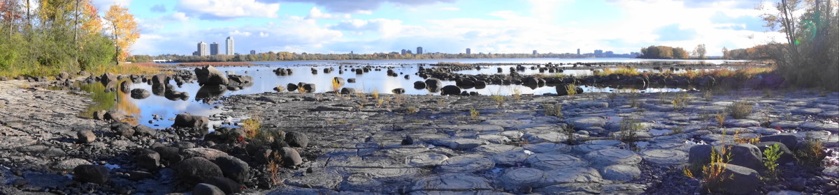
I like to start my trips up Constance Creek at the far, north end of Greenland Road, where the City-owned road allowance runs up to the water at tiny Horseshoe Bay.  I paddle through the sandy shallows, tracked by freshwater clams and mussels, into the wider expanse of Constance Bay.  I don’t recommend it for breezy days, when the wind driving across the wide river can raise substantial waves.  But on calm days, the glassy water parts smoothy to either side of the bow, as I round the point to the west.  Sometimes I paddle straight across Constance Bay to the mouth of the creek.  More often, though, I skirt the shoreline, looking for turtles and scanning the flats for longnose gar finning in the shallow water.

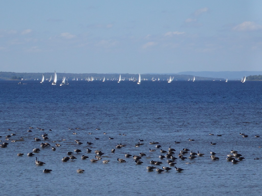
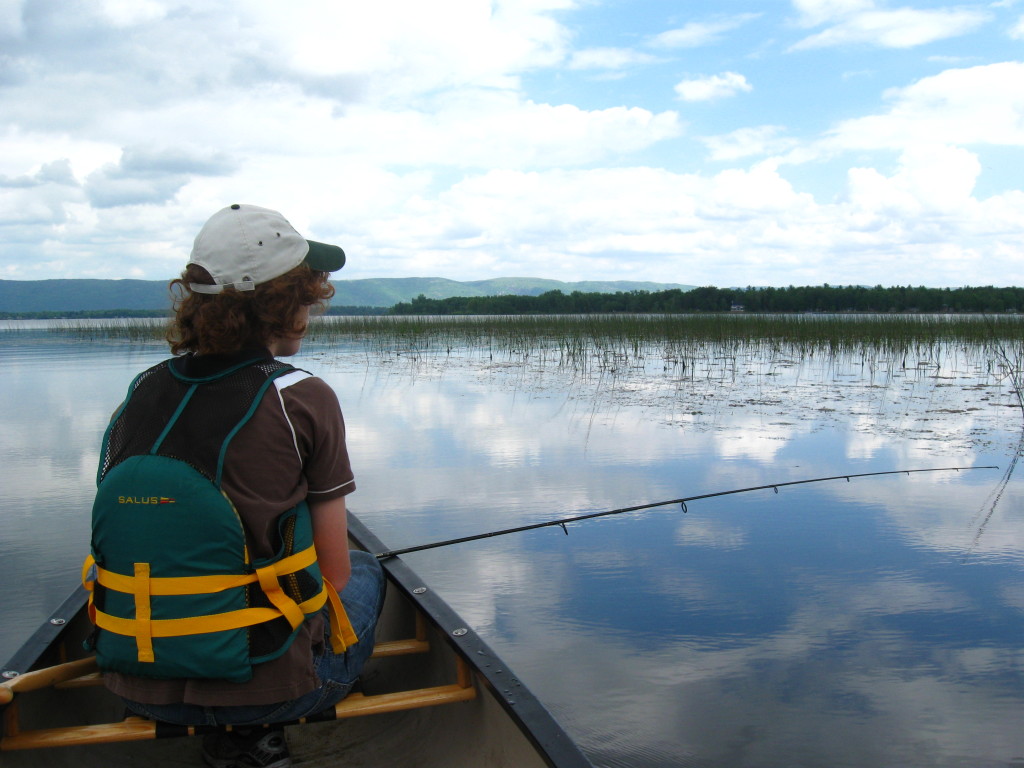
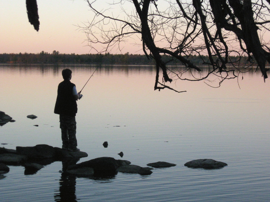
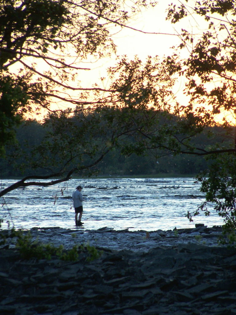
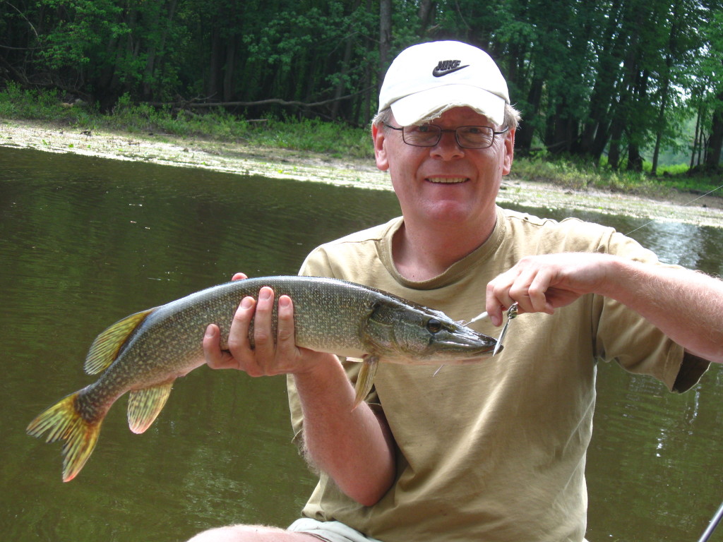
Constance Bay provides some of the best fishing along the Ottawa River shoreline.  The clean, Ottawa River, the shallow reed and weed beds, and the steady influx of nutrients from Constance Creek create a perfect mix of spawning, nursery and adult habitats.  Although I haven’t yet tried flyfishing for longnose gar, I’ve heard that they rival bonefish for fun.  The technique seems roughly the same, and one can find lots of instruction online.  Usually, however, I troll a streamer fly or a spinnerbait behind the canoe and pick up some of the pike for which Constance Bay is famous.  Musky also lurk in the weeds, although for the sake of my light tackle (and their health), I don’t try for them.  Closer to the mouth of the creek, though, I’ve caught catfish and bass.  Walleye forage in deeper water, along the outer edge of the bay.  At times, in fact, fish have struck so frequently as I’ve paddled across the bay, that I’ve had to bring in my line to make any real progress toward the creek.

The author holds a small pike that he's caught on a spinnerbait on Constance Bay.
Small Pike on a Spinnerbait

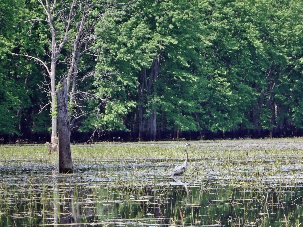
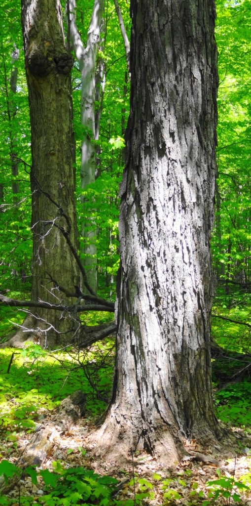
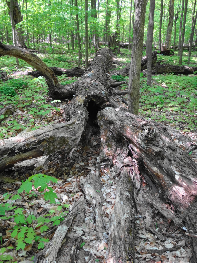
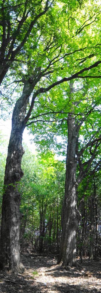
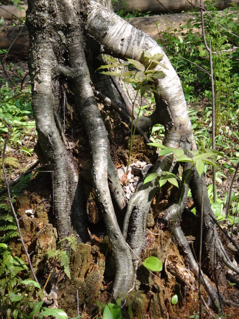
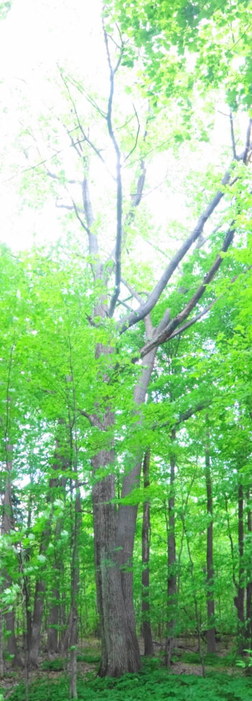
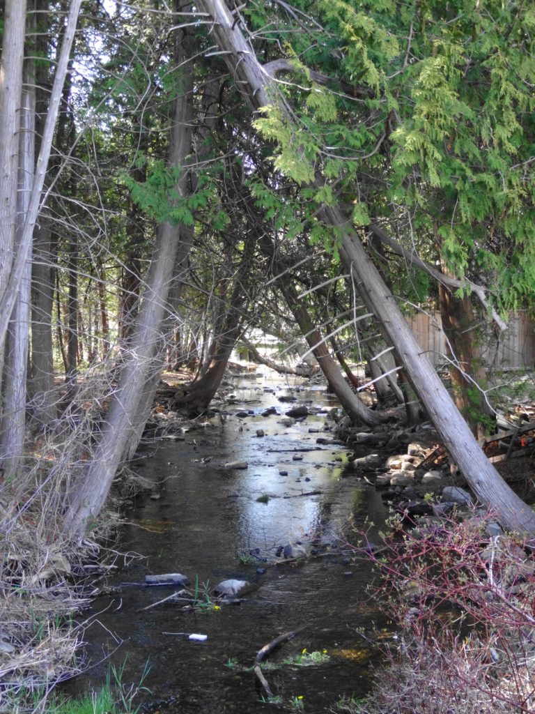
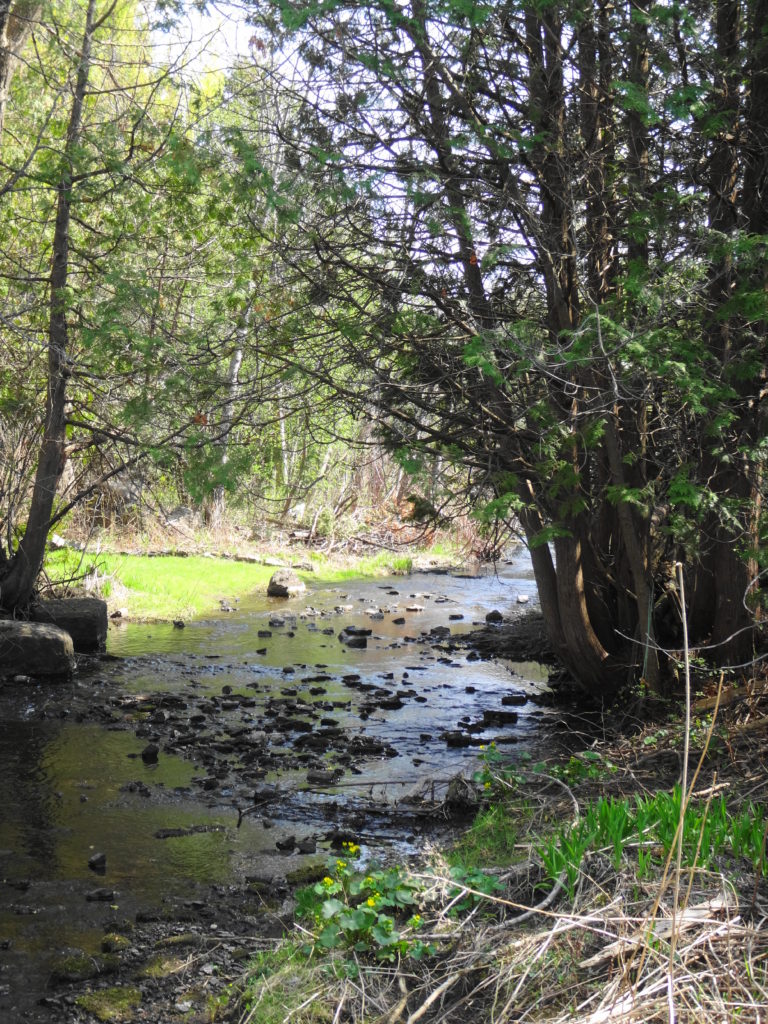
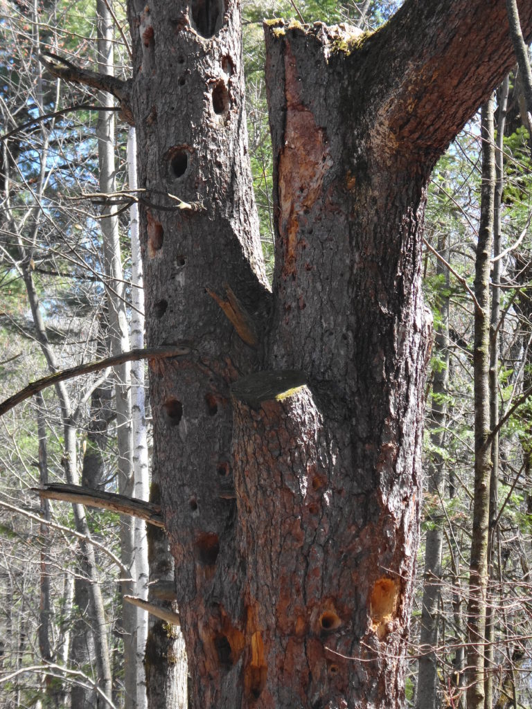
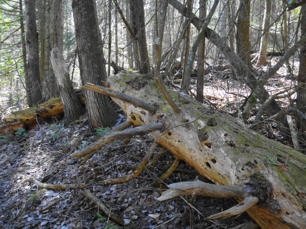
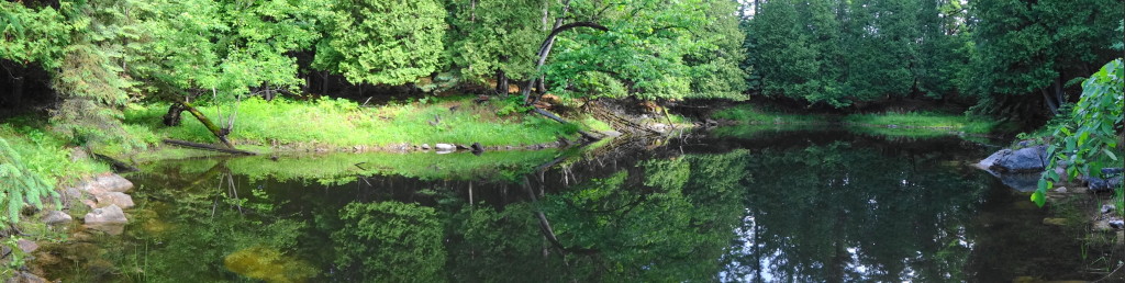
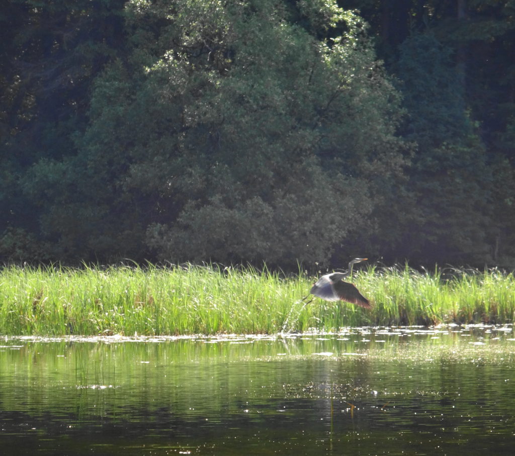
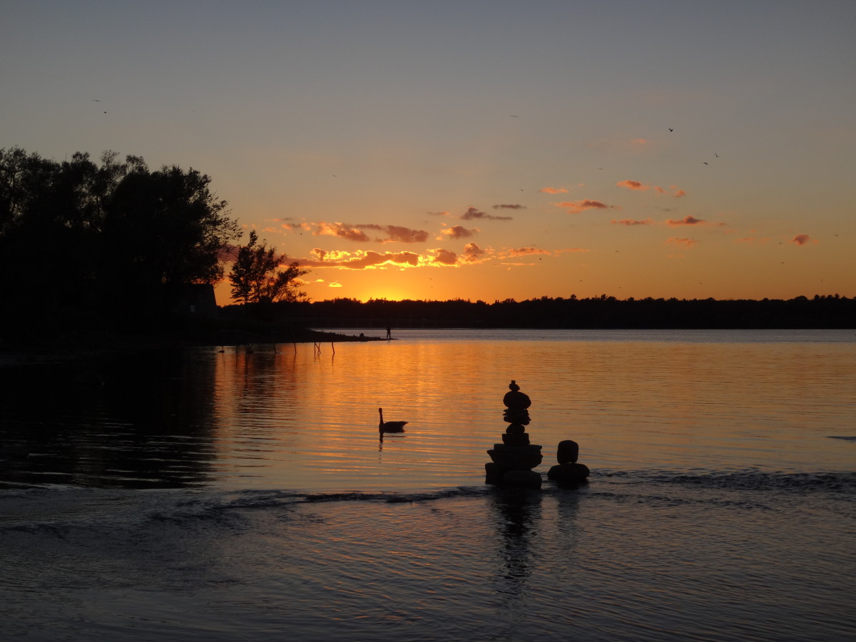
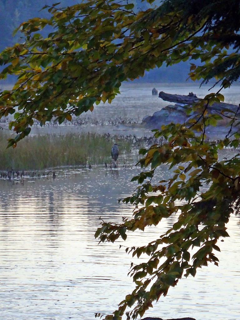
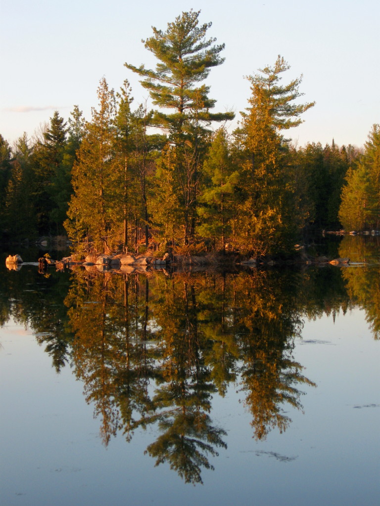
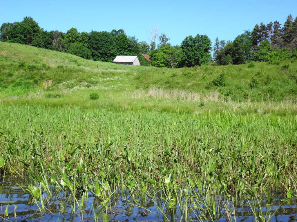
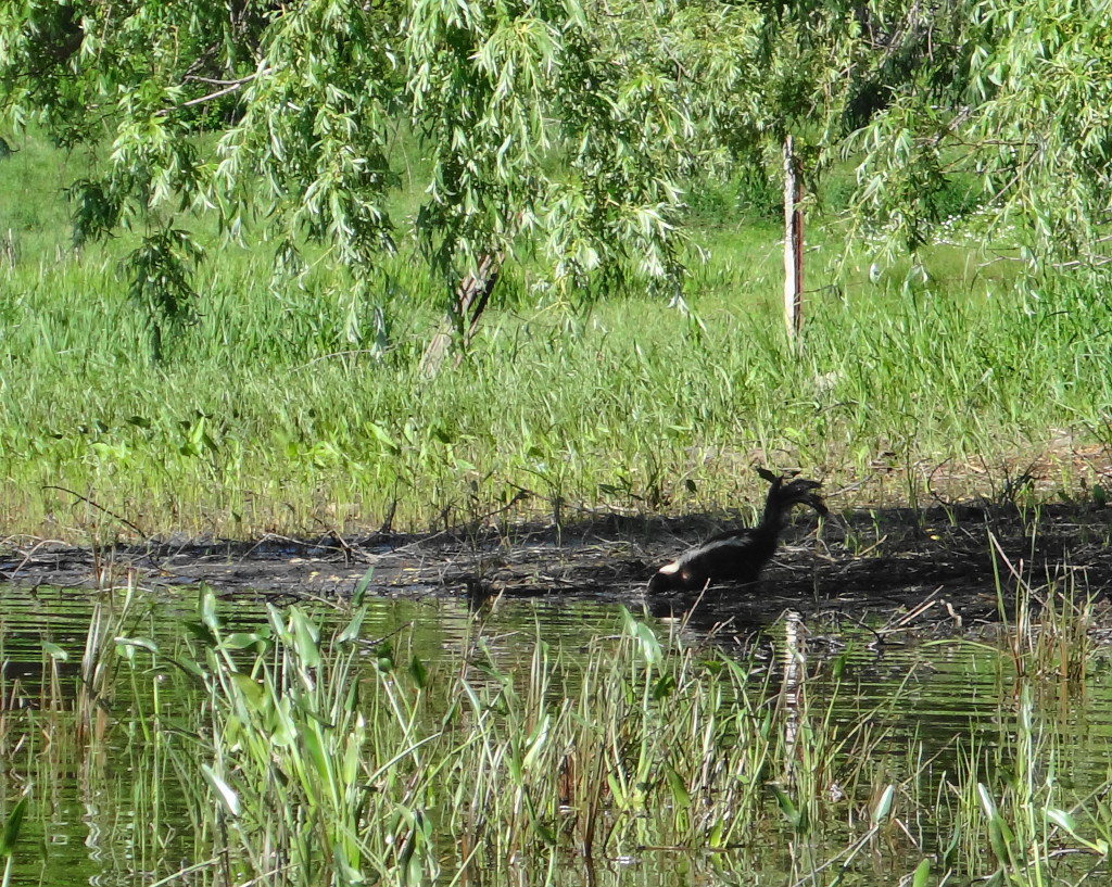
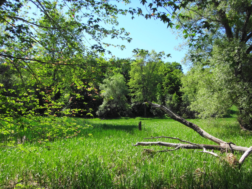
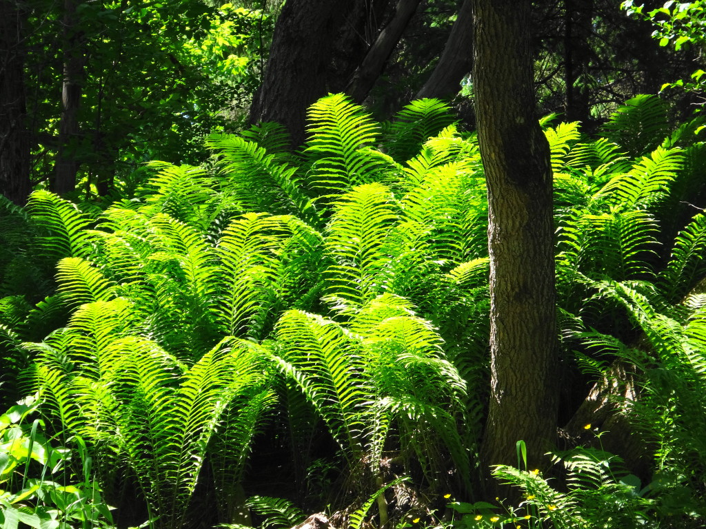
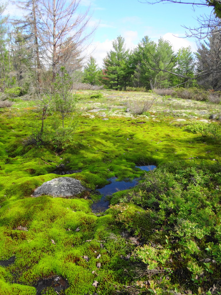
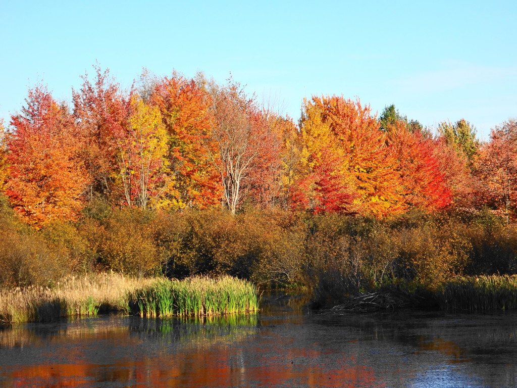
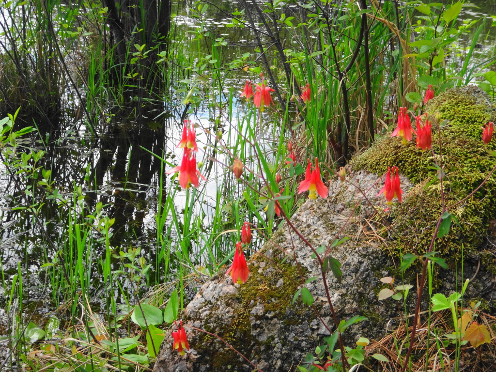
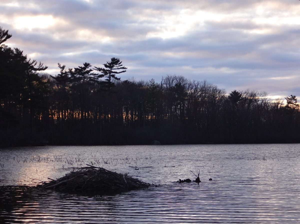
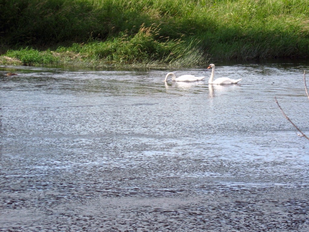
Constance Creek flows through a stunning swamp forest into Constance Bay.  Large, mature silver maples line the banks along the channel, while swamp bur oaks sit further back on slightly higher ground.  During the spring flood, one can sometimes paddle into the swamp itself, threading between standing and fallen trees.  Great blue herons stalk along the boundary of swamp and stream, while pileated woodpeckers cackle and hammer deeper in the recesses of the forest.  In the autumn, ducks and geese descend like leaves into the marshes around the creek mouth, and the sounds of shotguns echo distantly from further up the creek, where several duck clubs operate hunting blinds.

A stand of tall silver maple trees stand in sunlight along the low, floodplain of Constance Creek.
Silver Maple Swamp, Constance Creek
A stand of bur oak trees lines a sandy bank along Constance Creek.
Swamp Bur Oak, Constance Creek
A great blue heron hunts in the shallow water along the edge of Constance Creek.
Great Blue Heron, Constance Creek.

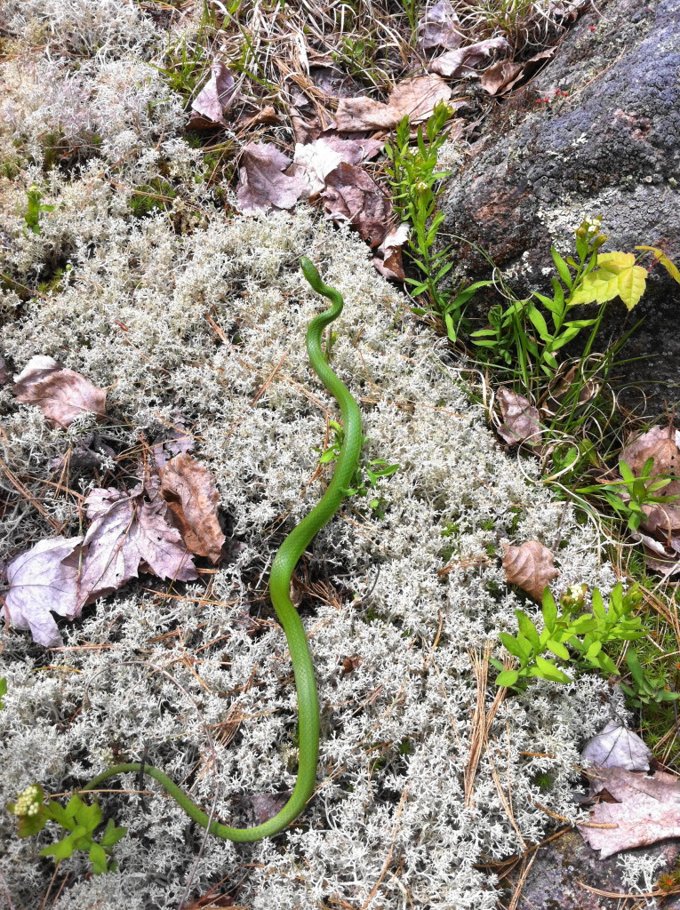
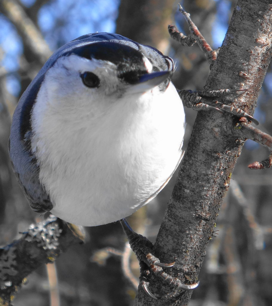
Not surprisingly, many of Ottawa’s most interesting animals and species at risk find a home along Constance Creek.  Five of Ottawa’s six at-risk turtle species have been recorded along the creek and at its mouth, including the extremely elusive (and possibly extirpated locally) spiny soft-shelled turtle.  Red-headed woodpeckers still nest locally.  Terns no longer nest in the area, but pass through during migration.  Ospreys can often be found hunting along the creek.  Bald eagles migrate along the creek and the Ottawa River shoreline, as do many other raptors, including peregrine falcons.  Lake sturgeons and American eels still inhabit the waters.

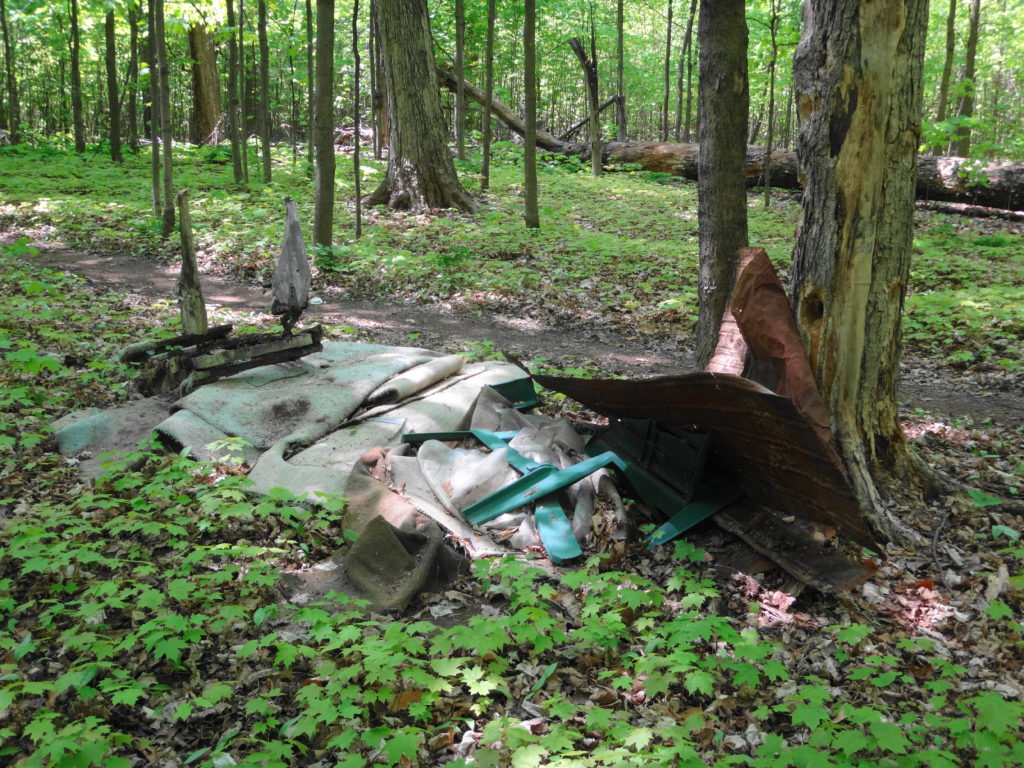
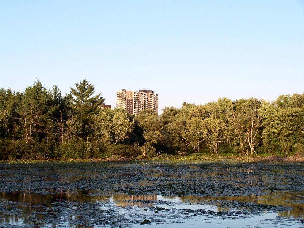
This richness of life is no doubt what attracted aboriginal peoples to the creek.  Archaeologists have documented at least one 2500 year-old camp and burial site at the mouth of Constance Creek, on its west shore (https://ottawarewind.com/2014/02/24/ancient-ottawa-lost-relics-from-500bc-found-at-constance-bay/).  More undocumented sites seem likely, perhaps in the large woodland on the east side of the creek mouth.  Unfortunately, that woodland remains at risk of future aggregate extraction.  Lying atop one of the largest, untouched sand and gravel deposits in the north end of the City, it currently enjoys protection by Provincial wetland policies and an unopened City road allowance.  These prevent the legal access required for an aggregate license.  Nonetheless, so long as the property remains privately-owned, the threat exists.

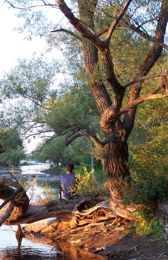
In the meantime, one can travel back 2500 years with just a canoe trip up the creek.  The present swirls behind from the blade of your paddle.  Lying quietly up in the swamp, daydreaming and staring serenely up at the translucent leaves, one can easily imagine that it has always appeared this way.  With a whisper of wings and ragged croak, Raven passes over the canopy.  Floating there, you surrender to thought and memory.

A great blue heron hunts in a shallow marsh on lower Constance Creek.
Great Blue Heron, Constance Creek
A panorama photograph shows a women sitting in the front of a canoe in a flooded silver maple swamp.
Swamp Panorama, Constance Creek

Chapman Mills and Heart’s Desire, South Nepean

When I visit the woodlots of South Nepean, I think of my years growing up in Esquimalt, Victoria, British Columbia.  I didn’t know, living in Esquimalt, that I was privileged to have one of Canada’s most endangered ecosystems in my backyard.  Highrock Park, or the “Cairn” as we knew it, was simply the place where we played after homework on a school night or rode our bikes on the weekend.  It rose above my neighborhood:  a rock bald, surrounded by a skirt of open woodland.

I didn’t know about Garry oak parkland and savannah.  No-one told me that I couldn’t play in the Cairn because it was special, or because I might damage myself.  Sure, I came back with skinned knees and bee stings.  And on warm summer evenings, when the local teens would sometimes gather in the twilight under the trees to consume beer or other elicit substances, my parents didn’t forbid me the adventure of the dark.  We climbed the twisted oak trees and played hide-and-seek in the thickets.

I think that I first learned my love of rock on the Cairn.  I couldn’t identify the hill as an exposed “pluton” of granite — a lump of igneous rock formed far down in the earth’s mantle 400 million years ago.  I didn’t know that the cataclysmic formation of western North America had thrust it to the surface.  I traced the long, parallel grooves on the smoothed rock without knowing about the pebbles that had gouged them under the weight of two kilometres of glacial ice.  I just loved the feeling of the hard stone under my hand, as I scrambled over the flanks of the hill or sat with my legs pulled up to my chest, looking out over my home.

Perhaps that’s why tree-forts and home-made mountain bike tracks usually don’t trouble me, even when I find them in some of Ottawa’s protected natural areas.  When I see bike trails, jumps and obstacles worn and carved into a place like the Chapman Mills East forest, I think of how much I would have enjoyed them as a kid.

A wide, dirt mountain bike track cuts through the middle of the Chapman Mills East Woodlot.
Mountain Bike Track, Chapman Mills East Woodlot

Most people driving past on Strandheard Road and Prince of Wales Drive likely give little more than a glance to the three adjacent patches of forest.  Few of them would suspect that these emerald gems contain some of Ottawa’s largest trees:  maples, beeches and oaks that rise like the pillars of a cathedral.  Under their boughs, a profusion of wildflowers bursts forth in spring:  trilliums, trout lilies, false solomon’s seal, violets, jack-in-the-pulpit.  Vireos sing high overhead.  With their windows rolled up and air conditioners running, few of the passing drivers will ever feel the coolness of the woods, or hear the susurration of the leaves as a breeze passes through the canopy.

The thick trunks of two maples and a beech rise from the forest floor.
Maple and Beech in Chapman Mills East
A blanket of white and painted trilliums bloom in Chapman Mills East
Trilliums in Chapman Mills East
A small patch of wood betony blooms is fleck of sunlight beside a stone in Heart's Desire.
Wood Betony in Heart’s Desire

The neighbours, I suspect, would prefer to keep it that way.  Walking through Chapman Mills East on a warm, weekday afternoon, I marvel at the lack of traffic.  I pass a few dogs and their owners sauntering the trails.  The occasional runner pads past me.  Most of the time, though, I have the woods to myself.  Apart from the distant sounds of traffic, I might be alone in the world.

Hopefully the evenings and weekends see more visitors.  Each of the South Nepean woodlots has its own charms and attractions.  Chapman Mills East, along Cresthaven Drive and Serena Way, is the easiest to love, with its towering maples, huge decaying logs, and dense mat of herbs and wildflowers.  Deep shade gives way to a patch of sunlight, where a snag has finally crumbled to the forest floor.  In the sunny gap, new growth reaches to the sky.  Bumblebees travel from flower to flower, then circle and drone off to a hollowed, old tree.  A pileated woodpecker hammers at a rotten white birch, while squirrels scold the intruder.  Old stone walls lie along the perimeter, marking the edges of old farm fields.

The massive trunk of a downed maple tree lies in a blanket of seedlings on the forest floor.
Rotting Log in Chapman Mills East
A path crosses a tumbled wall of old boulders, through a frame of trees, into the Chapman Mills Woodlot.
Entrance to Chapman Mills East from Serena Way

Chapman Mills West has a different character.  Lying astride Clearbrook Drive, it consists of two very different forest types.  In the southern, larger section, a dry cedar forest surrounds and hides a small, pretty, swamp.  Frogs croak along the marshy edges, while pairs of mallards raise chicks in the dense underbrush.  Just inside the south edge of the woodlot, the City’s Park Planners have cleverly threaded a fitness trail from Mancini Park.  Next door, where the School Board has allowed a small portion of the woodlot to remain in the yard, the worn earth under the cedars attests to affinity of children for trees.

A dense stand of cedar trees shades a dry, almost bare forest floor.
Cedar Forest in Chapman Mills West, South Section
Bright green leaves reflect in the water of a swamp in Chapman Mills West.
Reflections, Chapman Mills West Swamp
A pair of adult mallards and a chick sit on a log in the Chapman Mills West swamp.
Mallards, Chapman Mills West Swamp
A stonedust trail runs through large cedars, beside a bench and an inclined sit-up board.
Fitness Trail, Chapman Mills West, South Section
Two massive maples trees rise from the forest floor in the Chapman Mills West Woodlot.
Maples On the Fitness Trail, Mancini Park, Chapman Mills West

The smaller, north portion of Chapman Mills West appears younger, higher and drier.  Between scattered patches of cedar, an open forest of light-loving shrubs and trees creates a more pastoral feeling.  And, indeed, the woodlot may have provided pasture for cattle or horses before Chapman Mills was transformed from farmland to suburbia.  Over time, the forest canopy should fill in, especially now that the Ottawa Stewardship Council, with help from local schools and Ward Councillor Michael Qaqish, have taken an interest in managing and improving the woodlot.

A showy cherry tree blooms along the edge of the Chapman Mills West woodlot.
Cherry Tree, Chapman Mills West
Sunlight bathes an open forest of young trees in the north section of the Chapman Mills West Woodlot
Open Forest, Chapman Mills West
The perched roots of a birch tree still drape over the decayed stump on which it sprouted.
Life From Death, Chapman Mills West
Canada Mayflower grows near the roots of a tree. The plants have a single leaf each, typical of the non-flowering individuals.
Canada Mayflower, Chapman Mills West

Heart’s Desire, on the north bank of the Jock River, appears superficially like Chapman Mills East.  Here, though, massive oak trees dominate the forest.  And whereas blue cohosh seemed to blanket the floor of Chapman Mills East, false solomon’s seal carpets Heart’s Desire.  However, Heart’s Desire really gains its charm from the Jock River.  Spilling over a small weir and then flowing under Prince of Wales Drive, down to the Rideau River, this reach of the Jock runs along a stoney bed, with alternating riffles and pools that beg for a well-placed fly.  Through the summer months, large boulders provide tempting stepping stones to the other side.  The steep, wooded south bank provides an idyllic backdrop and creates a sense of wildness and privacy that belies the surrounding suburbs.

A massive red oak tree reaches to the canopy of Heart's Desire.
Red Oak, Heart’s Desire
A view of the Jock River through the foliage in Heart's Desire.
Jock River, Heart’s Desire
Boulders fill the bed of the Jock River, providing stepping stones to the far shore.
Stepping Stones, Heart’s Desire
White boulders lie on the south shoreline of the Jock River, against a emerald background of trees.
Across the River, Heart’s Desire

When I visualize South Nepean’s woodlots, I see children.  I see them racing bicycles along the paths, searching for frogs, and leaving damp footprints on white riverstones.  I hear unrestrained shouts and laughter under the trees.  Perhaps in my heart, I still feel myself with them.

I certainly feel torn.  When I look at the damage that already occurs to our woodlots — the trash, the yard waste, the bags of dog faeces — I wonder if the wildflowers and other delicate organisms in the forest floor can also withstand the trampling of young feet.  I think of myself as a boy, wriggling through the underbrush in Highrock Park and bouncing my bicycle off tree roots on dirt tracks.  Perhaps, along the way, I trampled something rare or special.  Perhaps the butterfly in my jar shouldn’t have been there.  But those experiences, and my other childhood explorations, taught me to love the natural world.  They set me on the path to where I am today.

A pile of grass clippings and other yard waste smothers the native plants in Champman Mills East.
Yard Waste, Chapman Mills East
A pile of trash lies along a path in Chapman Mills East
Trash, Chapman Mills East
Broad-leaved toothwort blooms on the forest floor in Chapman Mills East.
Broad-leaved Toothwort, Chapman Mills East
In this close-up of a jack-in-the-pulpit flower, the clublike spathe can be seen emerging from the hooded, tubular, green and red flower.
Jack-in-the-pulpit, Chapman Mills West
A cluster of false solomon's seal blossoms in Heart's Desire.
False Solomon’s Seal, Heart’s Desire

Yes, we need to protect our urban natural areas from careless and unnecessary damage.  We should educate our children to cherish and respect these marvelous places.  We can even try to direct their enthusiasm.  But we should never tell them that they can’t ride their bikes or build tree forts, imply that they don’t belong among the trees, or frown on their ebullience.  We need more children in our urban forests, not fewer.

Poole Creek, Stittsville

I’m crouched low, slowly creeping through young ferns and cedars toward a shaded pool, where my instincts tell me a brown trout should be resting.  Sunlight and reflections dapple the surface of the water.  In the shadow of the bank, the sandy, leaf-littered creek bottom looks bronze.  Freezing against a tree trunk, I concentrate on the patches of bronze, looking for movement.  After a few seconds, I can make out the shape, then the speckled, grey back and splash of gold on the sides, holding near the bottom.  Perhaps 14 inches long, and just over a pound.  I raise my camera, and try to slide surreptitiously into a better position.  With a quick flip of its tail, the fish is gone.

A cedar tree leans over the still surface of small creek pool.
Trout Pool, Upper Poole Creek

This isn’t Algonquin Park, the Madawaska Highlands, or Upper State New York.  This is Poole Creek, in the heart of Stittsville, one of Ottawa’s rapidly growing suburbs.

Like many people, I first visited Stittsville around 1980, on a Sunday family outing to the village’s famous flea market.  It was a small bedroom community clustered along its Main Street.  Since then, the village has merged with the City of Ottawa and grown into a busy suburb of 27,000 people, with more development and homes appearing every year.  As the village has grown, it has displaced much of the farmland, forest and wetland that once surrounded it.

Fortunately, throughout all of that growth, the community has had the wisdom to preserve Poole Creek — one of only two, truly cold-water creeks in the Ottawa area.  Poole Creek originates in the provincially-significant Goulbourn Wetland, about 1 km west of Stittsville along the Trans-Canada Trail.  An observation platform looks north over a large expanse of cattail marsh, while the creek begins its life flowing south under the trail through a steel culvert.  Barn swallows nest below the platform, and a careful observer might spot a well-camouflaged snipe probing the exposed mud flats with its long bill.  Common yellowthroats — pretty, masked warblers — call “witchitty, wichitty, witchitty” from the thickets.

A panorama view of large cattail marsh, the Goulbourn Wetland.
The Goulbourn Wetland
An observation platform at the side of a gravel trail overlooks the Goulbourn Wetland.
Observation Platform, Trans-Canada Trail

Local residents familar with the Goulbourn Wetland will have seen recent changes to it.  Water levels in the wetland have dropped since the City of Ottawa Drainage Unit and Roads Department replaced the collapsed culvert under the trail.  The culvert, and the beavers that habitually dammed it, had created a substantial pond extending into the marsh.  The replacement of the culvert and routine trapping of the beavers by the City has been controversial.  Whether justified or not, the resulting changes to the wetland need to be assessed in an historical context.  Aerial photography prior to the 1990s, when beavers recolonized the area, shows that much more of the wetland existed as swamp — suggesting that water levels were lower at that time.  In all likelihood, the wetland has probably gone through many changes since European settlement, as beavers were trapped out, the railroad built (the bed of the current trail), farms cleared and then abandoned.  The wetland will likely change again as it adjusts to the lowered water levels, perhaps seeing the conversion of marsh to swamp.  However, there’s little danger of the wetland vanishing, given the low topography of the area and size of the contributing catchment.

The Goulbourn Wetland and surrounding areas actually contribute very little to the flow of Poole Creek, except during the spring runoff and large storms.  Outside the wetland area, the thin, clay and till soils dry out quickly in the summer months.  Even before the culvert work and lowering of water levels in the wetland, Poole Creek west of Stittsville was classified as “seasonally intermittent”.  In dry summers, lengthy portions of the channel cease to flow, and minnows cluster in isolated pools as easy prey for birds and raccoons.

Yellow marsh marigolds bloom beside Upper Poole Creek.
Marsh Marigold Along Upper Poole Creek

Shortly after flowing under Westridge Drive into Stittsville, Poole Creek changes character.  The western side of Stittsville lies along a relict beach of the ancient Champlain Sea, which covered much of the Ottawa Valley following the retreat of the glaciers 10,000 years ago.  Rainfall infiltrates more easily into the sandy, beach soils than the clay and till soils that dominate most of the City.  Rather than running quickly along the surface, the water percolates slowly through the earth toward Poole Creek.  By the time that it seeps and wells up into the creek channel, the water has cooled to the temperature of the deeper soil.  Consequently, once it enters the village, Poole Creek quickly changes to a permanent, coldwater stream.

A small creek runs through an open, grassy channel, with several deeper pools.
Poole Creek at Westridge Drive

From Westridge to its mouth at the Carp River, five kilometres downstream, Poole Creek meanders through the village in a mostly natural corridor anywhere from 30 meter to 70 meters in width.  Immediately upstream and downstream of Stittsville Main Street, a healthy canopy of trees overhangs the creek.  Short riffles alternate with deeper pools.  Here, in the clear, cold water, local organizations introduced brown trout about twenty years ago, constructing “lunker boxes” for shelter and stabilizing the banks to improve the habitat.  The trout remain, virtually unknown to anyone but a few fly-fishers, who practice a careful catch-and-release to preserve the small population.

Cedar trees lean from right and left, creating a shady canopy over Poole Creek
Cedar Trees Along Upper Poole Creek
Poole Creek flows under the shade of cedar trees. Marsh Marigolds bloom beside the creek in the foreground.
Upper Poole Creek

Although the Trans-Canada Trail deviates from Poole Creek at Westridge Drive, another trail system picks up from it, following the creek in fits and starts for much of its length toward the Carp River.  However, any visit to Poole Creek would be incomplete without a detour to Quitters Coffee, where the Trans-Canada Trail crosses Stittsville Main Street.  Just a block or so south of Poole Creek, Quitters makes great pastries and sandwiches, while selling the best coffee in Stittsville.  You can sit in the spacious, bright cafe or relax outside on the patio.  With any luck, you might meet the owner, singer-songwriter Kathleen Edwards.

Just east of Main Street, Poole Creek turns north and dissappears into a large remnant of Stittsville’s once extensive wetlands.  Almost inaccessible, the wetland remains largely unsurveyed and uninventoried.  However, I suspect that an bioinventory would likely reveal several species at risk, especially Blanding’s turtle, which is known from the Goulbourn Wetland Complex and several isolated observations elsewhere in the village.  From the wetland, the Creek runs through the Amberwood Village Golf and Country Club, finally emerging back into the public realm at Springbrook Drive.  You can bypass the wetland and golfcourse by following the trail out on to Beechfern Drive (crossing a pretty little bridge on the way), and then taking every left turn until you arrive at Springbrook.  Along the way, you will follow a short, pretty trail between Hesse Crescent and Pine Bluff Trail, crossing a bridge over a small tributary.  The bridge provides a good place to pause and watch dragonflies, or listen to chickadees and common yellowthroats singing in the shrubs.

A woodend footbridge crosses Poole Creek.
Footbridge over Poole Creek

The trail picks up again on the north side of Poole Creek, where it crosses under Springbrook Drive.  This is a good place to see the impact of emerald ash borer on Ottawa’s urban canopy.  Where the trail once entered a shady grove, it now passes through a bright, open woodland, dotted with the stumps of ash trees.  Killed by the little, invasive green beetle, the dead trees posed a safety hazard to the children and other residents using the trail.  Although shocking at first glance, the clearing will soon be hidden by the growth of new shrubs and trees taking advantage of the abundance of light.

Children ride their bicycles along Poole Creek. The stumps of ash trees are visible in the foreground.
Children Riding Along Poole Creek

The stretch of Poole Creek between Springbrook Drive and Sweetnam Drive may be its prettiest section.  The creek burbles happily through the forest, then crosses under a footbridge into an open wetland.  On the south side of the creek, where the trail runs, some adjacent residents have taken it upon themselves to clear a small grassy area down to the creek bank.  Normally, the City frowns on such incursions into public natural areas.  In this case, though, the lawn provides views up and down the creek, allowing greater appreciation of the marshy floodplain.  In past years, beavers dammed the lower end of the reach, creating a pretty pond, which the City managed through use of a “beaver deceiver” to prevent flooding of the trail.  Although they have now abandoned the site, the beavers will no doubt return in the future.  In the meantime, the area still provides a wonderful place to observe birds, including the occasional great blue heron hunting frogs along the creek, or a Cooper’s hawk hunting unwary snakes.  A quiet, careful observer might even find painted turtles sunning themselves on the banks.

A wooden footbridge crosses Poole Creek over a stoney riffle. Sunlight sparkles on the water.
Footbridge Over Poole Creek

Past Sweetnam Drive, Poole Creek changes character again.  After a short run out of sight, it crosses under busy Hazeldean Road and enters one of the City’s newest neighbourhoods.  Where it once meandered through farmland, the creek nows winds between recent or still-developing subdivisions.  Deeper, clay soils have allowed the creek to carve a valley dense in places with Manitoba maple, crack willow and thorny thickets.  Following the creek becomes more difficult.  With construction still underway, the trail remains incomplete.  Good vantage points exist up and downstream of Huntmar Drive, beside one of the established subdivisions.

At first glance, the view in this area seems uninspiring.  With a few exceptions, the creek exhibits little of the primordial wildness of the upper reaches.  The nearby homes look down into the valley, which appears sadly exposed.

A pathway runs along the top of the Lower Poole Creek Valley, with homes clustured along the outside.
Lower Poole Creek Near Huntmar

Such a perspective ignores what the creek has been and what it will become.  In the past, when farmland lined the creek, the grassy valley provided pasture for farm animals, who would water in the creek, trampling and eroding the banks.  Animals would defecate in the creek.  Grazing maintained an open valley, exposing the creek to continuous sunlight and warming the water.  Although much of Ottawa’s agricultural community has embraced new, sustainable animal husbandry, such conditions still exist in some other creeks in Ottawa’s rural area.  We see the impacts as poor water quality, dismal aquatic habitat, and low native biodiversity.

Lower Poole Creek reminds me of the Don Valley, in North York, where I lived for year in 1975.  I recall the matted grasses along the riverbank in the spring, when the ice had finally melted.  I recall the dusty, dirt tracks on which we rode our bicycles, which turned to mud in the slightest rain.  When I visited that same site in summer 30 years later, I did not recognize it.  Where I’d known a wide, open, baking hot valley, I found a young forest and a cool, clear creek.

The same transformation will occur along lower Poole Creek.  Already, the local developers, the City and the Conservation Authority have planted hundreds of trees, which will stabilize and shade the creek banks as they grow.  They will plant more trees, and nature will play its own role, filling in the spaces.  By the time that the children in the neighbourhood have their own children, they will marvel at the changes.  A forest will fill the valley.  Spring mornings will sparkle with birdsong, and along secret ways, wildlife will follow the water.

Lower Poole Creek winds through a partially-wooded valley, with houses in the background.
Lower Poole Creek at Huntmar
Young trees and shrubs begin to colonize lower Poole Creek.
Lower Poole Creek: Early Transformations

Poole Creek demonstrates why my fellow environmental planners and I fight so hard to conserve and restore urban creek and stream corridors.  We often hear, “it’s just a ditch” or “it’s not worth protecting.”  In almost every case, we find ourselves having to justify the few metres required to protect these places.  We fight these battles not only because that’s our job, but because we see what these space will be in the future:  places of refuge for people and wildlife, where children can explore, lovers can embrace, and fish hide in shaded pools.

Lower Poole Creek meanders through a wooded valley.
Lower Poole Creek

Bilberry Creek Ravine, Orleans

The forest holds no more magical sound than the song of the hermit thrush at dusk.  In the calm of evening, when the breeze drops and the leaves hang still, it flutes through the trees:  a short, liquid, melancholy song.  You stand transfixed in the twilight of the trail, grasping for a lost memory or emotion.  Perhaps some ancestral memory of the primaevel forest.  Time pauses.

For anyone living in Orleans, in Ottawa’s east end, a short walk down the pathway into Bilberry Creek Ravine leaves behind the sounds of the City and carries one into the world of the wood thrush.  The steep, wooded slopes of the ravine create a quiet haven.  The chuckling of the creek rises from somewhere below.  The thick duff of the forest floor rustles with hidden growth and life.

A narrow footpath runs under the trees deep in the Bilberry Creek Ravine.
Footpath in Bilberry Creek Ravine

On an early, warm Spring morning, I stood quiet and still beside the trail in Bilberry Creek Ravine, hoping for a hermit thrush to come within photography range.  I had stopped at the fuss of chickadees and nuthatches in the pines ahead, thinking that an owl or hawk might be hidden in the dense boughs.  The hermit thrush foraged nearby on the forest floor, teasing.  It moved from shadow to shadow, clearly visible in my binoculars, but just beyond the reach of my pocket camera’s small lens.

As I waited patiently for the thrush to come closer, I caught another movement in the corner of my eye.  30 metres farther up the slope, almost screened by underbrush, a red fox climbed on to a rotting log, into a fleck of sunlight piercing the pine canopy.  Very slowly, I turned my head to watch it.  It sat upright in the rare patch of warmth, the light glowing in its fur.  As carefully as possible, I inched my binoculars back up to my eyes.  But not carefully enough.  The fox turned its head toward me, lowering itself warily to the log.  I froze.  For long seconds, we both stood still, our gazes locked on each other.  Then I moved slightly, just a shift of balance.  With a quick turn, the fox rose and vanished into the brush.  Thinking that the fox had prompted the chattering of the songbirds, I started again along the trail and jumped a small tributary brook.  Just at that moment, in the pine trees behind me, a barred owl began to call:  “who, who, who-calls-for-you”.

White pines soar along Bilberry Creek
Bilberry Creek White Pines

Once surrounded by development, most urban forests lose their wildest elements within a few months or years.  The noise and visual disturbance drive away the most sensitive animals.  Cats prowl along the wooded edges, hunting songbirds and small mammals with ruthless efficiency.  Neighbours dump lawn and garden waste into the forest, introducing exotic and invasive plants.  Returning fishermen dispose of unused, invasive nightcrawlers (earthworms), changing the soil and nutrient cycles.  Temperatures in the forest rise, light increases, and humidity drops.  The slow-growing trees that once prospered in the cool, damp woodland give way to faster-growing, sun and heat-loving species.

Such woodlands still have value to a community and a city.  Both the forest and the community find a new balance.  The chickadees that brighten the winter woodland will still delight children, as will the play of the squirrels in the summer.  The leaves will still rustle in the wind.  And if trilliums give way to bluets, will anyone but the most ardent naturalist notice or really mind?

A cluster of bright, yellow trout lilies bloom on the forest floor.
Trout Lilies Bloom in Bilberry Creek Ravine

But those urban forests with the capacity to resist such change deserve special reverance and protection.  Nestled in its ravine, Bilberry Creek is such a place.  The ravine retains humidity and cooler air, shields the forest from traffic noise and prying eyes, retains its secrets.  Although a graded, multi-use pathway cuts through the forest at one point, the steep clay slopes limit much of the ravine to rough, narrow nature trails.  Mature, “super-canopy” white pines and hemlocks thrust through the deciduous trees, harkening back to the ancient, pre-settlement, northern hardwood forest that once blanketed most of central Canada.  Tall, pockmarked snags provide nesting cavities for animals and birds.  Massive nurse logs lie decaying in undergrowth, returning their nutrients to the soil, holding moisture for insects and fungi, and sheltering amphibians, mice and voles.  The air is redolent with the rich odour of life.

Woodpecker holes and cavities pockmark the gnarled trunk of a white pine.
Woodpecker Holes in a White Pine
A large, collapsed log rots on the forest floor.
Woody Debris on the Forest Floor
A footbridge for a multi-use trail crosses Bilberry Creek.
Multi-use Trail Crossing Bilberry Creek
A nature trail leads up through conifers into sunlight.
Sunlit Path Through Conifers

Bilberry Creek, itself, appears surprisingly healthy for an urban watercourse.  On a spring morning, erosion and slope failures appear all along the creek, turning it grey with silt and clay  Woody debris litters and clogs the channel.  But did development cause these things, or do they result from the natural process of a young creek cutting into deep, clay soils?  Probably both.  Certainly the presence of old log crib walls along the creek suggests that the processes aren’t entirely new.  In any event, they don’t appear to have discouraged the local beaver.

Bilberry Creek cuts through the upper ravine.
Bilberry Creek
About 20 metres of the slope has slumped toward Bilberry Creek, carrying trees with it.
Slope Failure on Bilberry Creek
A slatted footbridge crosses Bilberry Creek.
Footbridge Over Bilberry Creek
A protective crib wall protects a small section of bank along Bilberry Creek.
Crib Wall on Bilberry Creek
A beaver has chewed through one trunk of a large, multi-stemmed tree, and cut most of the way through the other stem.
Beaver Work on Bilberry Creek

I would like to visit Bilberry Creek Ravine again in the winter.  I can imagine strapping on a pair of snowshoes and walking softly down the trail into the hush and swish of snow sifting through the pines.  Up ahead, perhaps, a pileated woodpecker would hammer on an old hemlock.  Perhaps the trail of a fox or fisher would cross the track.  After a while, I’d find a comfortable place to pause.  I’d pull a flask of coffee from my small pack, and a sandwich, and I’d stand there lost in the woods until the cold finally drove me onward or back.

Pine trees tower over Bilberry Creek.
Pine Trees Towering Beside Bilberry Creek
A trail leads through some trees down into the forest.
Down into the Forest

Morris Island and the Snye River

I wonder, sometimes, if some places should remain undiscovered.  If they remain unknown, then who will care to protect them?  But if they become too well known, how much attention can they withstand?  The Morris Island Conservation Area and the Snye River fall into that category.

Morris Island lies at the far west edge of Ottawa, on the Ottawa River just upstream of Des Chats Dam.  The Snye River, a shallow, rocky stream, separates the island from the mainland.  The Snye originates as a branch of the Mississippi River, which enters the Ottawa River at Marshall Bay, upstream of Morris Island.  About 500 m from the mouth of the Mississippi River, the Snye branches off 90 degrees from the main channel and winds its way northeast for several kilometres, rejoining the Ottawa River near Fitzroy Harbour.  I haven’t found any explanation for the origin of the Snye River.  However, the Ontario Geological Survey identifies the area as “confirmed karst”.  Karstic features appear in many places along the Snye, which leads me to think that it probably began as a cave feature, subsequently collapsing to create a surface stream.

Flooded sinkhole - Snye River
Flooded sinkhole – Snye River

Only one small bridge crosses the Snye, limiting development to less than 15% of Morris Island, clustered entirely on the west side.  Most of the island remains privately-owned.  Without another bridge, however, no further large development can occur, and the cost of such a bridge appears prohibitive.  Provincially significant wetland and habitat for species at risk also cover much of the island.  In the short term, therefore, the area appears likely to remain largely natural.  In the long term, it would benefit from greater public ownership.

A wooden fence stands beside the Snye River at the edge of an old field.
Old Fence – Snye River

Fortunately, the most scenic part of Morris Island already resides in public ownership.  The Morris Island Conservation Area — owned by the City of Ottawa and managed by the Mississippi Valley Conservation Authority — lies at the very end of the island’s road, on the south side of Lac Des Chats, in the backwater of Des Chats Dam.  The calm, stable waters of the lake lap along a rugged shoreline and archipelago of small islands.  Trails lead from the small parking lot.  One broad, accessible trail follows the route of an old railbed along the shore, while narrower nature trails venture into the forest and across boardwalks to the larger islands.

A pretty place at any time of year, Morris Island looks most beautiful in the autumn.  Along the shorelines of the islands, the gold, red and yellow foliage reflects in the still water.  Leaves carpet the pathways.  The rich odour of damp earth fills the air.  In the late afternoon, the low sunlight glows warm.  A cast lure lands in the gentle river with a quiet, “plop”.

Pine trees reflect perfectly in the still waters of Morris Island Conservation Area.
Morris Island Reflections
Silhouetted against the evening sky, trees and shoreline reflect in still water.
Evening at Morris Island Conservation Area
A teenage boy fishes from the shoreline, silhouetted against the river and sunset.
Evening Fishing at Morris Island Conservation Area

The Snye River, in contrast, deserves a morning paddle in the richness of full summer.  Sunlight penetrates deep into the clear water.  Longnose gar warm themselves in the shallows, and smallmouth bass lurk as dark shadows at the edge of boulders or beneath undercut banks.  Turtles glide below the surface.  The river cuts through bedrock, alternating between deep pools and short, shallow riffles.  In some of the longer, wider runs, enough sediment has built up to form small marshy areas and wet meadows.  It may be the most picturesque river in Ottawa.

A shallow riffle runs through a green canopy of trees.
Snye River Riffles
A small cluster of purple irises blooms on a marshy shoreline.
Iris versicolor Blooming on the Snye
A torpedo-like longnose gar basks just below the surface of the water.
Longnose Gar
A canoe rests on the edge of a sedge meadow beside the Snye River.
Sedge Meadow
A log, ferns and rocky shoreline reflect in the water of the Snye River.
Reflections along the Snye
A snapping turtle rests on the bottom of the river.
Snapping Turtle

Morris Island and the Snye River provide one of the best places in Ottawa to find and photograph wildlife.  The mix of forest types, the presence of wetlands, the confluence of two major rivers, and the close proximity of West Quebec’s enormous wilderness areas, give the area an amazing diversity of habitats and species.  Many of Ottawa’s species at risk enjoy relative protection and abundance in the area — a condition which deserves respect and sensitivity.  Visitors should heed the old Sierra Club motto:  “take nothing but a photograph; leave nothing but a footprint.”  If we treat the area gently, then it should remain a haven for future generations of wildlife and visitors.

A dot-tailed whiteface dragonfly rests on a lilypad.
Dot-tailed Whiteface
An eastern pondhawk dragonfly clings to a reed.
Eastern Pondhawk
A widow skimmer dragonfly clings to a reed.
Widow Skimmer
Two small, blue mushrooms grow on the forest floor.
Mushrooms in the Forest
A great blue heron takes flight from a marshy shoreline.
Taking Flight
A musk turtle hisses as it is held between a thumb and fingers.
Musk Turtle

The Ottawa River

A low angle view across the cobbled bed of stromatolites, with the river, shoreline and a sun flare in the background.
Ottawa River Stromatolites

In late summer, when water levels drop in the Ottawa River, a fascinating glimpse into ancient history emerges into view.  The Ottawa River stromatolites lie below the Quebec side of the Champlain Bridge.  460 million years ago, in a shallow, salty embayment of a tropical sea, colonies of blue-green algae cemented together sediments and calcium carbonate into low mounds of limestone (http://www.ottawagatineaugeoheritage.ca/subsites/4).  They survived the geological cataclysms of next half billion years to be scoured clean by the river and exposed on the pretty, wooded shoreline.  Perhaps nowhere else in the world can one leave a damp footprint on such tangible evidence of ancient life.

A close-up photograph of scarlet, Cardinal flower blossoms against an out of focus background of the Ottawa River and shoreline.
Cardinal Flower

No river figures so strongly in Canada’s history as the Ottawa.  For Aboriginal peoples, for early European explorers, for fur-traders and for pioneer loggers, the Ottawa River provided the most direct route into the heart of Canada.  The first Aboriginal sites along the Ottawa River date back 6000 years.  Samuel de Champlain’s Aboriginal guides led him up the Ottawa River in 1613.  The last timber raft floated under Parliament Hill in 1908, and log drives continued on the Ottawa River until 1990.  During the last half of the 19th Century and well into the 20th Century, power from the Chaudiere Falls supported thriving industries along the Gatineau and Ottawa shorelines.  The river gave birth to Canada’s atomic industry, at the Atomic Energy Commission Laboratories in Chalk River.  Hydro-electric dams continue to operate along the river, while the lakes behind them provide recreational boating and fishing that help to support thriving communities up the Ottawa Valley.  A paddle along the Ottawa River is literally a paddle through the history of the country.

On a breezy day, a regatta of sail boats tacks in the background, while a raft of Canada geese float in the foreground.
Regatta on Lac Deschenes, Ottawa River

Fortunately, almost all of the Ottawa River lies open to pedestrians, cyclists and paddlers.  Multi-use pathways line both shorelines through the urban core, with numerous lookouts and beaches providing access to the water.  Most of my favourite cycling routes begin beside the Ottawa River Locks, on the Rideau Canal, sandwiched between the Parliament Buildings and the Chateau Laurier hotel.  From there, a National Capital Commission cycling path travels beside the river, under the bluffs of Parliament Hill, below the Supreme Court of Canada and past the historical Aboriginal site of Victoria Island.  At the Portage Bridge, the trails begin to branch, some continuing along the Ontario shoreline upriver past the Chaudiere Falls and the Canadian War Museum, some crossing over the Portage and Chaudiere bridges to the Quebec shoreline.  The  National Capital Commission publishes a map of its trail system, showing the available destinations and routes (http://www.ncc-ccn.gc.ca/places-to-visit/parks-paths/things-to-do/cycling-capital-pathways).

My favourite ride makes a loop through Gatineau, on the Quebec side.  From the Chaudiere Bridge, it heads briefly upriver, then turns north into Gatineau Park, makes a quick detour to Pink Lake, heads east to the Gatineau River, goes back down through Lac Leamy Parc to the Ottawa River, and then crosses the Alexandra Bridge at the Canadian Museum of History.  It’s a challenging ride through beautiful scenery:  steep climbs and descents along forest trails and roads, winding pathways past wetlands, boardwalks and bridges over creeks and along shorelines.

Leafy branches frame a photograph of a marsh with a great blue heron standing in the reeds.
Gatineau Park Wetland

For a shorter, easier trip, I like to ride upriver along the Ontario shoreline to Mud Lake and Britannia Park.  Along the way, I sometimes stop at Lemiuex Island to view the colonies of gulls, cormorants and night herons on the adjacent, smaller islands.  I stop at Remic Rapids to admire the balanced rock sculptures in the shallows of the river.  Near Westboro Beach, I often take a detour into Westboro Village for coffee at Bridgehead, a browse through Mountain Equipment Co-op, or a meal at one of the cafes and restaurants.  Reaching Mud Lake, I may dismount for a walk through the natural area or carry on to Brittania Beach or Andrew Hayden Park.  I usually time my ride back home for the evening, when the sun sets behind the Quebec shoreline, sending its apricot glow across the river.

Under a beautiful, blue sky, balanced stone sculptures crowd the exposed shoreline rocks at Remic Rapids.
Remic Rapids
In the foreground, a balanced stone sculpture and a goose stand silhouetted against the glowing water of the river, while a fisherman stands in silhouette on a point in the distance.
Rock Balancing
Four wood and rock sculptures stand silhouetted against the blue and orange of the river at sunset.
River Sculptures
The Alexandra Bridge and Statue of Samuel de Champlain stand silhouetted against wispy blue clouds and glowing pink bands of the dusk sky.
Alexandra Bridge and Statue of Samuel de Champlain

On calm mornings, I will often load my canoe on to a Vrtucar (a local car-sharing business) and head off to one the river’s quieter areas.  Petrie Island, in the east end of the City, is a wonderful destination.  The provincially significant wetland inshore of the island provides sheltered canoeing, with opportunities to photograph the area’s many birds, turtles (including the threatened map turtle), and beautiful swamp forest.  Downstream of the island, the mouth of Cardinal Creek provides one of the river’s most important fish habitats.  A low squeeze under the Highway 174 bridge takes one into the lower reach of Cardinal Creek:  a marvellous, meandering paddle through a superb floodplain wetland entrenched in a deep valley.

A solitary map turtle basks on the tip of an old log in the middle of the Ottawa River at Petrie Island.
Map Turtle at Petrie Island

At the opposite end of the City lies Constance Bay, which deserves a full blog post of its own. Lying at the upper end of a relict, post-glacial flow channel paralleling the Ottawa River, Constance bay forms a wide, shallow, sandy-bottomed crescent at the mouth of Constance Creek.  Cottages and homes line the shore, but access to the Bay is possible from City road allowances at the end of Greenland Road on the east side of the bay and Lane Street on the west side of the bay in the Village of Constance Bay.  The shallow, sandy bay is delightful for wading, warm in the summer and easy on bare feet.  In the spring, just east of the creek mouth, longnose gar spawn and hunt in mere centimetres of water, “finning” in the shallows.  Pike lie in ambush in the reed beds.  Catfish wait in the channel of the creek, and walleye hunt along the dropoffs.  Waterfowl abound.  Herons hunt frogs.  Gulls and terns patrol the shallows, waiting to plunge onto schools of small minnows.  Within the mouth of creek, along the edge of the silver maple swamp, songbirds flit and sing.  It may be the prettiest spot on the river.

An aluminum boat floats in the shallows of Constance Bay at the end of Greenland Road, with sail boats and the Quebec shoreline in the distant background.
Constance Bay from Greenland Road
A young boy fishes from the bow of a canoe amidst the reeds in the marsh at Constance Bay.
Fishing at the Mouth of Constance Creek
The author of the blog sits in the stern of a canoe, holding a small pike that he has caught on a spinnerbait.
Small Pike on a Spinnerbait

The Ottawa River simply offers too many places to visit and things to do to describe in one short post.  Just within the boundaries of Ottawa and Gatineau, one can find places enough to fill a summer with exploration:  Morris Island Conservation Area, Fitzroy Harbour Provincial Park, The Quyon Ferry, Piney’s Point Historical Site, Sheila McKee Park, Shirley’s Bay, Andrew Hayden Park, Bate Island, Lemieux Island, Victoria Island, Rideau River Falls, Rockcliffe Park, Green’s Creek, Upper and Lower Duck Islands, Lac Leamy Park, Baie McLaurin, Baie Lafontaine.  Beyond Ottawa, even more opportunities abound, such as whitewater rafting in Beachburg, only 90 minutes north of the City, camping in Voyageur Provincial Park or Driftwood Provincial Park, an hour downriver and two and half hours upriver respectively, or houseboat cruising on the Upper Ottawa River.  Somewhere, there’s a deserted beach waiting.

For more information on enjoying and protecting the Ottawa River, please visit the Ottawa Riverkeeper website at:   http://www.ottawariverkeeper.ca/ 

A stand of pine trees, glowing in the early evening sun, reflect in the perfectly still water at Morris Island Conservation Area.
Morris Island Reflections
A boy fishes from a rocky shoreline in the twilight at Morris Island Conservation Area.
Evening Fishing
A group of people look out over the Ottawa River from the deck of the Quyon Car Ferry.
Quyon Ferry
A sailboat tacks into a stiff breeze off Sheila McKee Park, with the Quebec shoreline in the background.
View from Sheila McKee Park
Exhibitors in period costume stand before a reconstruction of a traditional river sailboat at Riverfest at Pinhey's Point Historical Site.
Riverfest at Pinhey’s Point Historical Site
A surfer and a kayaker Ride "The Wave" at Bate Island
Riding “The Wave” at Bate Island
A warmly dressed woman sits in the bow of a canoe as it glides up Green's Creek on a grey, Spring day.
Green’s Creek


Mississippi River and the Cody Creek Black Maple Swamp

The calm water of the Mississippi River reflects the clear, blue sky.  A pretty, shoreline marsh lies close on the right, while a wooded shoreline lies across the river on the left.
Mississippi River

The Village of Pakenham, just outside Ottawa, lies on the gentle Mississippi River.  Most visitors come to photograph the famous five-arch, stone bridge, or to eat ice cream at the Pakenham General Store, the oldest general store in Canada (open in the same location for 170 years).  A few dragonfly enthusiasts know it as one of the very few places to find the endangered Rapids Clubtail, a small colourful dragonfly that breeds in the shallow pools and rapids below the bridge.  I think of it as the perfect place to begin an excursion on the Mississippi River downstream to Cody Creek.

A view from the river across dense bed of pickerel weed to the shoreline of the Mississippi River, where a white barn stands in a pasture, with trees in the background.
Mississippi River Shoreline
A white canoe lies on the shoreline of a small creek where it empties into the MIssissippi River.  The shoreline is covered in dense grass, with trees in the background.
Exploring the Shoreline

The quiet backwater beside the Conservation Area at the bridge provides a good location to launch a canoe.  The river meanders gently through a rural landscape of wooded banks and farmland, a fringe of marsh along the sh0reline.  In places, old oxbows flank the main channel, hidden behind a screeen of willows.  Wildlife abounds along the banks, in the wetlands and the shallows.  Smallmouth bass, pike and walleye hunt the weedlines, the dropoffs and deeper pools.

A painted turtle basks on floating load, balancing precariously on the knot of an old branch.
Painted Turtle, Mississippi River
Through a frame of leafy branches and marsh vegetation, a striped skunk can be seen drinking on the shoreline.
Skunk Drinkng at the Shoreline

Not far downriver from Pakenham, perhaps a twenty minute paddle, Cody Creek joins the river from the east.  As one approaches the creek from upstream, the eastern shore becomes more hilly and heavily wooded.  Small, pretty wetlands lie behind the shoreline, draining to the river through small, muddy channels.  A wooded sandbar provides a place to pull out and stretch one’s legs.  Thick sedges and marsh grasses cover the banks, while beaver and muskrat tracks crisscross any patch of open ground.  Frogs scatter into the water at every step.  A narrow, greasy flood channel connects to a small beaver pond, overlooked by a large snag and stick nest.  A red-tailed hawk sounds a “keerrr” of protest.  The shade of a silver maple provides an idyllic location to sit, eat a snack, and watch a heron stalking in the shallows downstream.

A white canoe rests on the shoreline under the shade of a large silver maple tree.
Silver Maple, Mississippi River
A scenic view of a meadow marsh, framed by tree branches.
Mississippi River Wetland
A bullfrog hunkers down in a mudhole, with just his mouth and eyes protruding from the grey, silty water.
Bullfrog
Branches of a red maple tree silhouetted against a blue sky.
Red Maple

The marsh at the mouth of Cody Creek deserves appreciation for its diversity, beauty and productivity.  An artificial frog or a wooly bugger tossed along the weedline is likely to provoke an aggressive strike.  Dragonflies and damselflies cruise over the lilypads, coming to land on the side of the canoe, the end of a paddle, or the brim of a hat.  Mayflies cling to reeds.  A swirl in the water betrays a snapping turtle feeding on a dead carp in the murk of the bottom, while sun-loving painted turtles line up on logs.

A close-up photograph of a large, brown mayfly resting on the blade of a paddle.
Mayfly on a Paddle
A species of blue damselfly called an Eastern Forktail clings to the blade of reed in shallow water.
Eastern Forktail
A large, green and black dragonfly, called a Lilypad Clubtail, rests on the side of a canoe.
Lilypad Clubtail
A closeup of the face of the Lilypad Clubtail.
Closeup
Amidst a dense patch of pondweed, a shy painted turtle sticks its head out of the water for a look around.
Shy Painted Turtle
Another Painted Turtle basks on a log beside a bed of cattails.
Another Painted Turtle
The vague shape of a large snapping turtle can be seen under the water.
Snapping Turtle Feeding Underwater

Very few people know of Cody Creek.  From its headwaters in Long Swamp, it flows west, draining much of the southwest corner of Ottawa’s rural landscape.  It remains remarkably healthy, despite passing through some extensive agricultural lands.  By the time that it nears the Mississippi River, it has carved a steep-sided, overgrown valley.  In its last reaches, it meanders through a spectacular, black maple swamp.  This provincially significant Area of Natural and Scientific Interest is, so far as I know, unique in Ottawa.  The accomplished and well-known biologist, Dan Brunton, deserves much credit for documenting the outstanding natural value of the swamp and bringing it to the attention of the Province.

The swamp appears almost primaeval.  The brown water moves slowly, swirling slowly around large downed trees.  Animal prints crowd around dark holes in the slick, clay banks.  Tracks lead through sunlit ferns to the dark forest beyond.  I’ve come upon otters swimming in the shadows, as well as the ubiquitous muskrats and beavers.  Emerald and ebony jewelwings flit along shore.  Bright birdsong burbles in the underbrush and in the high canopy above, while the air below seems very still.

The dark waters of Cody Creek flow under overhanging trees, with the blue sky behind.
Cody Creek
A dense patch of Ostrick Fern glows in a beam of sunlight that has penetrated the dark swamp along Cody Creek.
Fern Garden

The creek can be paddled as far as the bridge at Hanson Side Road in low water, and a bit further in high water.  Log jams and fallen trees block the channel in some places.  The banks consist of slick clay, and it is probably easier and safer to climb on to the log jams and haul the canoe over than to try going around.  Access to the creek is also possible at the bridge, but there’s no easy put-in.

A hurried visitor can paddle the round-trip from Pakenham to Cody Creek in less than an hour.  But I wouldn’t take less than three hours, to allow time for sightseeing, photography and fishing.  A drifting canoe can float up to wildlife that a impatient paddler would never see.  And I’ve spent 45 minutes simply resting, bow into the weeds, with my head hung over the side of the canoe watching a microcosm of life play itself out in the water.  I suggest a morning trip, when birds and other animals are most active, and the air is a bit cooler.  Picnic by the stone bridge, then walk up the General Store for some ice cream and fresh-baked bread.

A view of the shoreline and river paddling back to Pakenham.
Paddling back to Pakenham

Carp Hills

The morning chorus of songbirds has quieted.  The spring sunshine has dried the dew and warmed the rocks.  Sprinkles of mica glint in the thin soil under your feet.  Green darners hunt over the beaverpond, while a swallowtail settles on to a bed of moss and lichen behind you.  Rufous-sided towhees sing from scattered pines, common yellowthroats and swamp sparrows flit through the willows along the shore, and a hummingbird buzzes by you on its way to a patch of columbine.  As you sit peacefully on 800 million year-old gneiss eating your sandwich, you watch a Blanding’s turtle crawl out warily on a beaver lodge to bask.  You have just fallen in love with the Carp Hills.

Lovers Pond
Lover’s Pond
Morning Dew
Morning Dew

The Carp Hills rise as a rocky ridge between the valleys of the Carp River and Constance Creek.  A mosaic of rock barrens, rocky, open woodlands, and dense mixed forest, I find them most inviting in mid-May, ahead of the swarms of blackflies, mosquitoes and deer flies that torture the summer visitor.  I like to arrive just before dawn, when the dew is still heavy enough to soak the hem of my pants.  Venus may still glitter over the turquoise horizon.  Birds begin to sing from every tree and shrub.  A beaver creases the mirrored surface of its pond, on the way back from its last foray of the night.  As the morning warms, the dragonflies and butterflies begin to stir.  Turtles and snakes come out to warm themselves in the sun.  Dewdrops cling like diamonds to cobwebs and spring flowers.  Before I realize it, I’ve spent two hours in wonder and barely moved 200 meters from the road.

Columbines
Columbines
Early Low Blueberry
Early Low Blueberry
Pale corydalis
Pale corydalis
Starflower
Starflower
Swallowtail
Swallowtail

The Carp Hills, along with the nearby South March Highlands, consist of Precambrian bedrock — an island of ancient metamorphic rock in the sea of younger, Paleozoic limestone that underlies most of Ottawa.  The large mineral crystals exposed in the rocky barrens attest to their formation and slow cooling almost a billion years ago, deep under a towering mountain chain created by the collision of continents.  Time and the inexorable force of water eroded the mountains, exposing their roots.

When subsequent upheavals in the earth’s crust created the great geological rift that we now call the Ottawa Valley, the Carp Hills remained elevated above the surrounding landscape.  Oceans came and went, laying down beds of limestone across the region.  More recently, Ice Age glaciers further scraped down the bedrock.  When the last glaciers receded 14,000 years ago, a shallow cold, silty sea followed behind them, depositing thick layers of clay over much of valley.  As the land rebounded from the weight of the glacial ice and the sea receded, massive rivers of glacial meltwater carved channels and dumped loads of sands and gravels.  Through it all, the Carp Hills remained islands of stone, facing and mirroring the Gatineau Hills to the east.

Rock Garden
Rock Garden

Despite their cataclysmic history, or perhaps because of it, the Carp Hills exhibit an exquisite sensitivity to disturbance.  The Precambrian rock provides few nutrients for plant growth, and much of it is sensitive to acid rain.  The thin soils have formed almost solely through weathering of the bedrock, the action of microbes, lichens and fungi, the sprinkling of atmospheric dust, and the painstaking accumulation of organic matter.  The wetlands, beaverponds and creeks that pocket the hills have adapted to the lack of nutrients, providing habitat for organisms that might not survive competition in more fertile environments.  Every living thing in the Carp Hills exists in a delicate and easily upset balance.

The Hills call for a gentle presence.  Even the old Sierra Club motto — “take nothing but a photograph, leave nothing but a footprint”  — does not suffice, particularly in the rock barrens.  A careless footstep on a delicate moss mat may undo 10,000 years of soil formation.  The track of a single mountain bike remains visible for weeks, while regular bike traffic leaves a coarse scar.  In such an exposed landscape, plants and animals rely upon every stone and every patch of vegetation for protection.  Snakes hide and hunt in the moss carpet.  Bats shelter from the sun under stones.  Many species at risk make their homes here.  Disturbance should be minimized.  Whenever possible, visitors should keep to the bare rock to protect the soil.  Stones should be left where they lie, and if turned over to look for wildlife, carefully replaced.

Even with such precautions, visitors will find more than enough to admire, photograph, or paint.  Wildlife and landscapes abound.  But, I particularly like to “get small” in the Carp Hills, to discover the world hidden at my feet.

Moss and Lichen Carpet
Big Brown Bat
Big Brown Bat Uncovered Under A Stone
Smooth Green Snake
Smooth Green Snake
Blanding's Turtle
Blanding’s Turtle Basking
Carp Hills Foliage
Autumn Foliage
Pink Ladyslipper
Pink Ladyslipper
Moss Blanket
Moss Blanket
Moss and Lichen Microcosm
Kidney-leaved Violet

The City of Ottawa owns significant portions of the Carp Hills, but much of it remains privately owned.  With City permission, the Friends of the Huntley Highlands (http://huntleyhighlands.com/) have created the Crazy Horse Trail off March Road, at the east end of the Carp Hills.  This low-impact walking and ski trail encompasses almost every habitat in the Hills, including forest, wetland and rock barrens.  A more informal, unmarked trail exists on City property off Thomas Dolan Parkway, in the heart of the rock barrens.  Parking is limited to the shoulder of the road, which can be very narrow, steep and soft in places.

As an old mountain biker — one who pre-dates the actual creation of the mountain bike — I understand the urge to ride the rock barrens of the Carp Hills.  But I ask mountain bikers to respect and protect the delicate nature of the landscape.  Even the most careful rider cannot help but cause long-term damage to the ecosystem.  Consider, instead, the nearby South March Highlands Conservation Forest, where the Ottawa Mountain Bike Association (http://ottawamba.org/cms/) maintains an outstanding trail system, with a range of technical difficulty to challenge the most avid rider.

The Carp Hills are predominantly wild.  A few black bears roam the area, especially in mid- to late summer when berries are ripe in the barrens.  In late autumn, deer hunting occurs in some areas.  From  mid-May until early September, blackflies, mosquitoes and deer flies occur in abundance.  Deer ticks, which can transmit Lyme Disease, may abound in some years.  There are no facilities and no safe drinking water (due to the presence of beavers).  In short, visitors to the Carp Hills should bring water, snacks and other essentials, consider insect repellent, wear long pants and sleeves, and be prepared to adapt as necessary.

Despite these few inconveniences, the Carp Hills are worth the effort.  They are a marvel of biodiversity, a window into the distant past, a living classroom, an artist’s inspiration.  They will remain in your eye and your mind long after you leave them, and you will return to them year after year.

Water's Edge
Water’s Edge

Mud Lake, Britannia

Mud Lake.  Such an unappealing, dull name for such a beautiful, diverse place.  It conveys nothing of the delightful chorus of migrating warblers in the surrounding forest and thickets on a early May morning.  It gives no hint of the late, summer sun setting aglow the surface of the Ottawa River and silhouetting a lone fly fisherman on the shoreline’s rocky ledges.  It fails to capture the spectacle of hundreds of cackling Canada geese sideslipping over paprika and apricot foliage to land in the lake late on an autumn afternoon.  It says nothing of the hush of snow sifting through the towering pines on a winter evening.

A quiet back bay of lilypads and shoreline trees at Mud Lake.
Back Bay at Mud Lake
A tall white pine stands silhouetted against a navy blue, evening sky.
Mud Lake Pine
The placid waters of the Ottawa River near Mud Lake reflect sunset's glow and shoreline trees.
Ottawa River at Mud Lake with Westboro in the Distance
A fishermen casts into the Ottawa River near Mud Lake at sunset.
Last Casts

Mud Lake sits on the shore of the Ottawa River in Britannia, within a semi-natural area of approximately 70 ha.  A low ridge, a quiet access road and the lawns of the Britannia Water Purification Plant separate it from the river.  A thin band of deciduous trees screens most of the lake.  Behind this screen, on the east side, lie young swamp forests, thickets and old fields.  An older, mixed forest lies on the west side of the lake, dominated by large white pines.  Across the access road, the shale ridge supports a thicket of stunted trees, staghorn sumac, and other scrubby brush, that merges with a fringe of crack willow along the river.

Dark trees and a silver sky reflect in the waters of Mud Lake.
Evening Reflections
Two large pines stand beside a walking path in the forest at Mud Lake.
Pines and Pathway
A single tower rises beyond Mud Lake and a line of trees.
Place of Refuge

The lake, itself, abounds with life.  Cattails, shrubs and sedges crowd the shore, while lilypads and other floating aquatic plants carpet the deeper sections.  Muskrats and beavers cruise the lake in the evenings.  Painted turtles glide under the surface, while a few Blanding’s turtles still survive in some of the quieter backwaters.  Bullheads gather in the shallows.  Dragonflies and damselflies dance everywhere, with 65 species reported.

A hand holds a baby snapping turtle.
Baby Snapping Turtle
A dense bed of ferns shines bright green in the sun.
Ferns
Moss on a grey stone emerges from snow.
Elements of Life
Peaceful Mud Lake lies under a blue, summer sky, with a yellow pond-lily in bloom in the foreground.
Yellow Pond-lily

But Mud Lake is best known as one of Ottawa’s great, urban birdwatching sites (a favourite of the Ottawa Valley Nature and Wildlife Photographers).  In the spring, the location, along with the diversity of vegetation and habitats, draws in birds of all shapes and sizes.  Warblers, flycatchers and hummingbirds flit through the trees and underbrush.  Thrashers and catbirds, sometimes even cuckoos and mockingbirds, chatter in the thickets.  Swallows and martins dart over the fields and the lake.  Great blue herons and black-crowned night herons stalk frogs along the shoreline.  Ducks, geese, gulls and shorebirds of all kinds visit or reside through the spring, summer and autumn months.  Sharp-shinned hawks, Cooper’s hawks, merlins and kestrels come to hunt.  Peregrines sometimes pass through, as do bald eagles and ospreys.  Screech owls haunt the woods in the summer, and and great horned owls have wintered in the woods.

A close-up photograph of a beady-eyed, white-breasted nuthatch clinging to a branch as it seeks a handout.
White-breasted Nuthatch Looking for a Handout

Mud Lake lies only a ten minute walk from Britannia Park, with its large, shady picnic area, sandy beach, and views of sailboats, kayaks and kiteboarders on the Ottawa River — an ideal place a family outing.  The Ottawa River bicycle path runs past it, connecting to kilometres of trails through the City and the 20,000 hectares of the National Capital Greenbelt (National Capital Greenbelt).  It’s the perfect place to listen to the wind in the pines, to find a quiet moment with nature, to watch a child laughing at a turtle, or to get that perfect photograph of a wood duck.

A boys sits on the reclining limb of a crack willow on the shoreline of the Ottawa River.
Idyllic Seat

The Rideau River

“Willows whiten, aspens quiver,
Little breezes dusk and shiver,
Through the waves that run for ever
By the island in the river
Flowing down to Camelot”
– Alfred Lord Tennyson, The Lady of Shallot


The Rideau River doesn’t flow down to Camelot, although the old City Hall, perched on its island just upstream of the Rideau Falls has its own, nostalgic mistique.  But my romance with the Rideau River has not waned in the twenty-odd years that I’ve lived in Ottawa.  In fact, it has deepened.

The bow of a canoe points along the shoreline of the Rideau River
Canoeing on the Rideau River

The Rideau River runs for almost 20 kilometres through urban Ottawa, although the section along which I spend most of my time is the 12 kilometre stretch from Carleton University to the Rideau Falls.  Several times a week, from late spring until mid-autumn, I ride my bicycle along the bordering pathways.  Once or twice a month I put my canoe in at Strathcona Park, and paddle up the river, with camera and binoculars beside me and a big fly trailing behind in the current in the vain hope of picking up a muskie.  Or I walk down with my rod and waders to a favourite ledge, where I cast to the big bass that lurk at the edge of a deep channel.

On any day, I never know what wildlife I will find at the river.  In the winter, mallards and goldeneyes congregate in the swift, open reaches.  In the spring and autumn, migratory waterfowl pass through:  buffleheads, loons, black ducks, common and hooded mergansers….  In the summer, the river and the woods teem with birds:  more mallards, wood ducks, great blue herons, mergansers, double-crested cormorants, spotted sandpipers, and songbirds of every kind.  More than once, I’ve lifted my head to the piping alarm of blackbirds to watch a Cooper’s Hawk fly swiftly across the river.  The Royal Swans, released from their winter captivity, glide along the shoreline.

A spectacular, multi-coloured male wood duck swims in the river.
Wood Duck
A pair of white swans swim along the grassy, far shore of the Rideau River, which ripples in a breeze.
Royal Swans on the Rideau River

Not just birds frequent the Rideau.  Bullfrogs groan in the shallows, and muskrats wind between lilypads and pickerelweed.  I’ve cruised my canoe up to somnolent snapping turtles, and cautiously edged toward wary painted turtles.  On an evening bicycle ride, I’ve exchanged curious stares with an otter.  In the dawn of another day, I’ve paddled quietly past a doe and fawn drinking at the water’s edge.  The Rideau River provides a natural refuge and a ribbon of life through the heart of Ottawa.

A pair of painted turtles bask on the shoreline of the river.
Painted Turtles
An enormous snapping turtle basks on a whitened log, her clawed, rear leg dangling toward the water.
Snapping Turtle

 The abundance and diversity of wildlife attests to the health of the Rideau River, especially considering the number of people that come to enjoy its offerings.  Some people come to fish.  Some come to cool their feet in the clean current — especially at the shallow, limestone ledge that spans the river at Strathcona.  Some come to feed the ducks.  Some come for exercise, to walk, run or ride along the pathways.  Some come merely to enjoy the views, to quiet their minds beside the water, or to hold hands with a sweetheart.

Balloons float over the Rideau River, while two wading fishermen cast lures into the stream.
Sights Along the Rideau
Two children and their mother play along the shoreline under the boughs of a tree.
Back to Nature
A young couple sit together on a log on the far, wooded shore of the river. Several towers loom in the distance.
A Quiet Refuge

I have lived in Victoria, Vancouver, Halifax, Edmonton, and Toronto.  I have visited most other Canadian cities at one time or another.  I don’t know any urban, natural space that exceeds the beauty of the Rideau River.  In another place — a New York, a London, or a Tokyo — it would be celebrated and promoted.  In books and movies, lovers would embrace and part on its shady banks.  Photographers would immortalize it.  Poets would write of it.  In modest Ottawa, though, it rolls on almost unheralded.  Perhaps we like it that way.  Perhaps that’s the secret of its charms.

Early on a misty, Spring morning, trees recede into fog along the shoreline.
Misty Spring River
A slightly out-of-focus swan floats on the river behind a screen of tall grass.
River Dreams
The sky reflects in the waters of the Rideau River.
Reflections