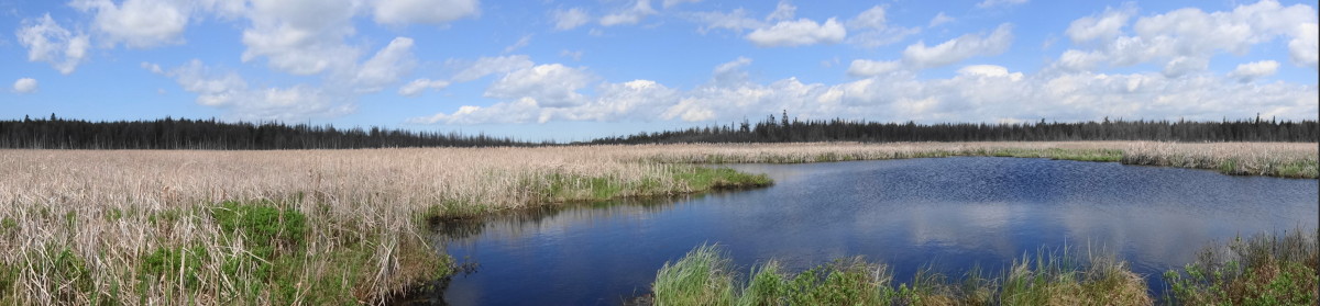
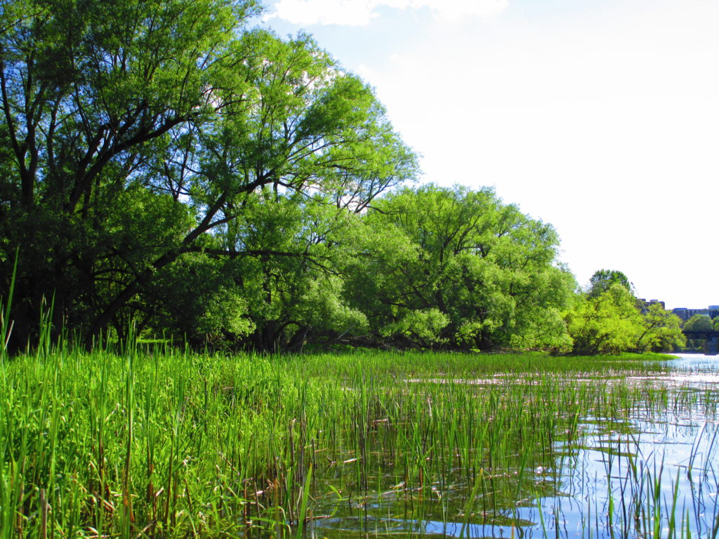
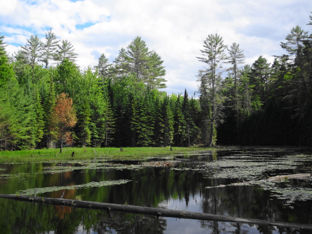
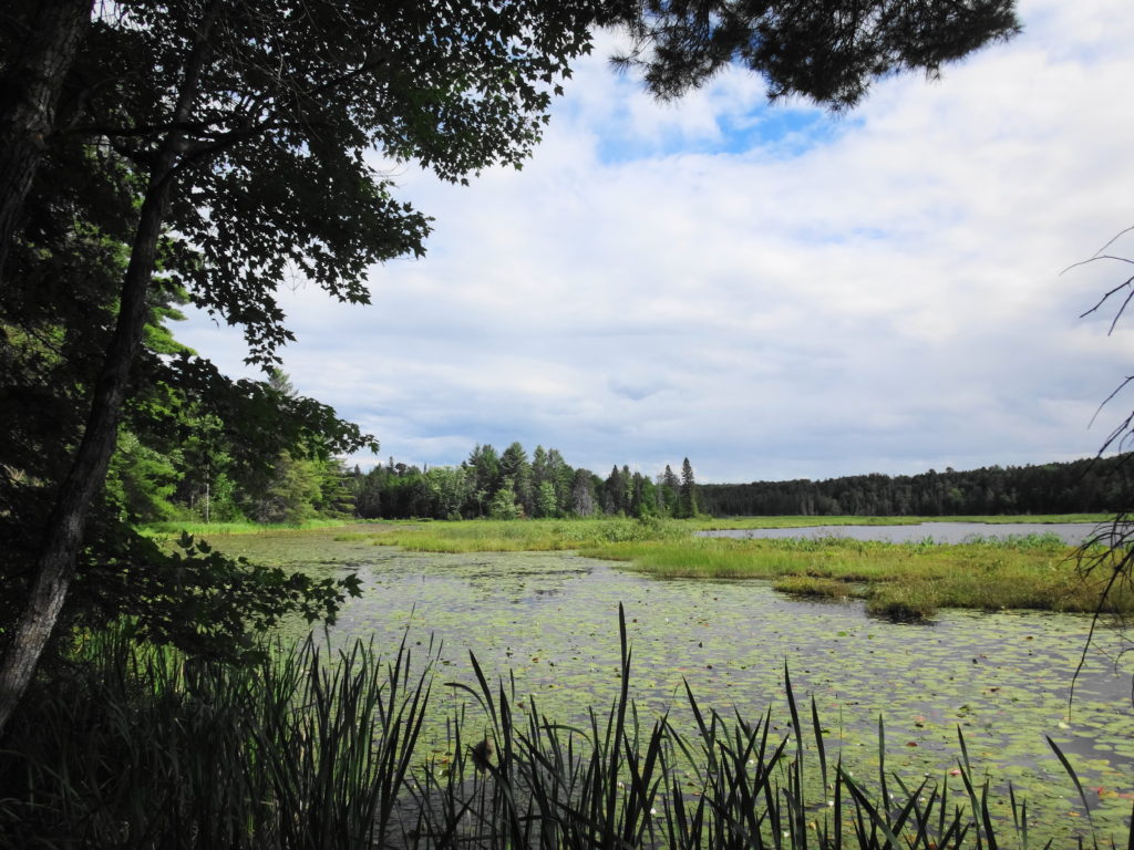
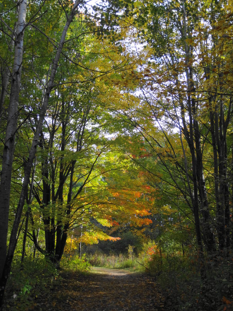
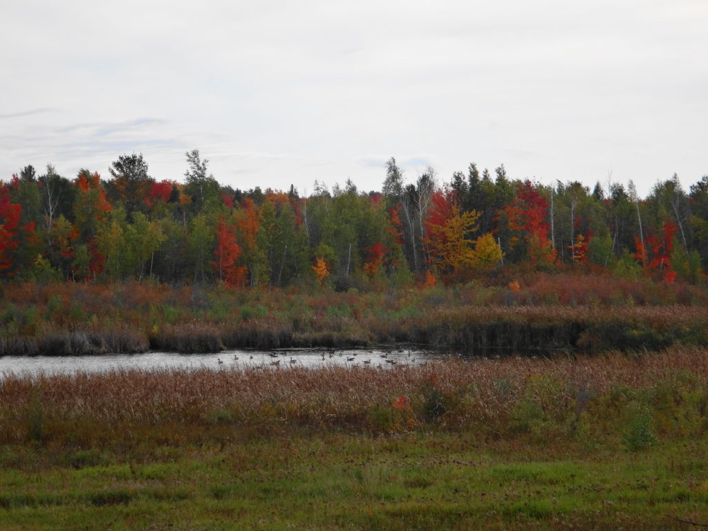
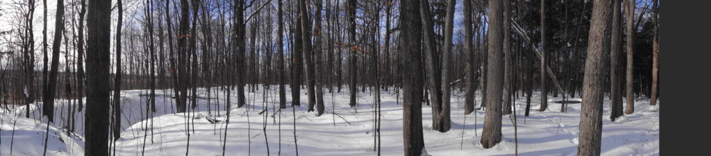
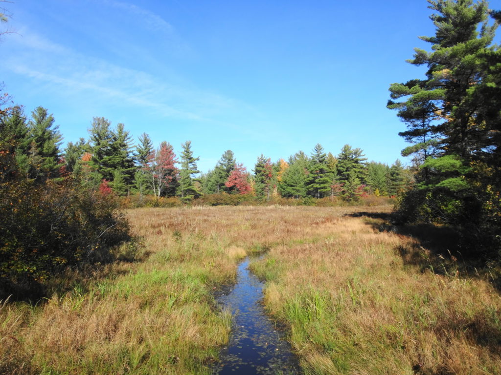
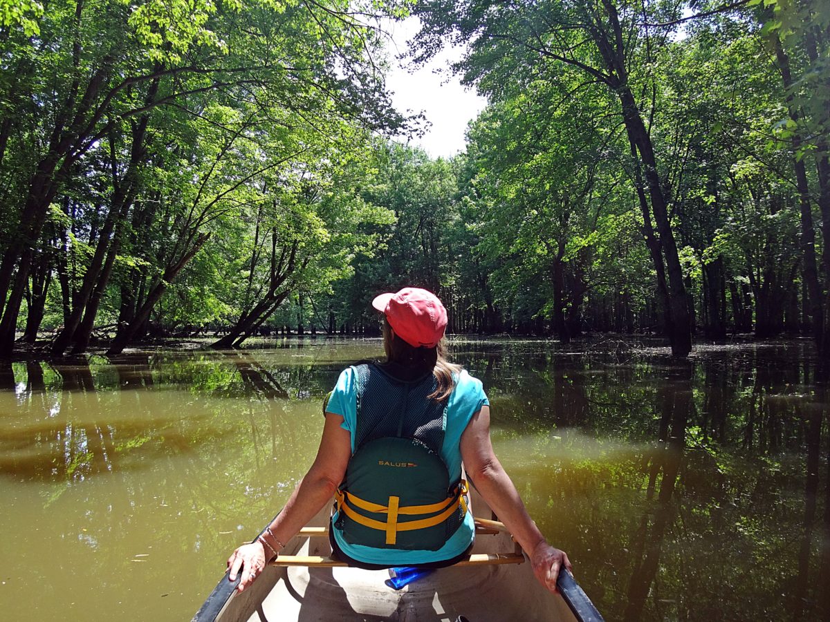
I never tire of paddling the Rideau River, especially the familiar section between Sandy Hill and Carleton University. I always find something to admire. I always reflect upon the human experience of the River, which still evolves, and which goes back at least 4000 years.
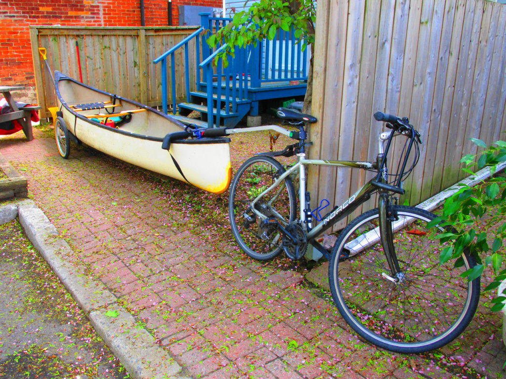
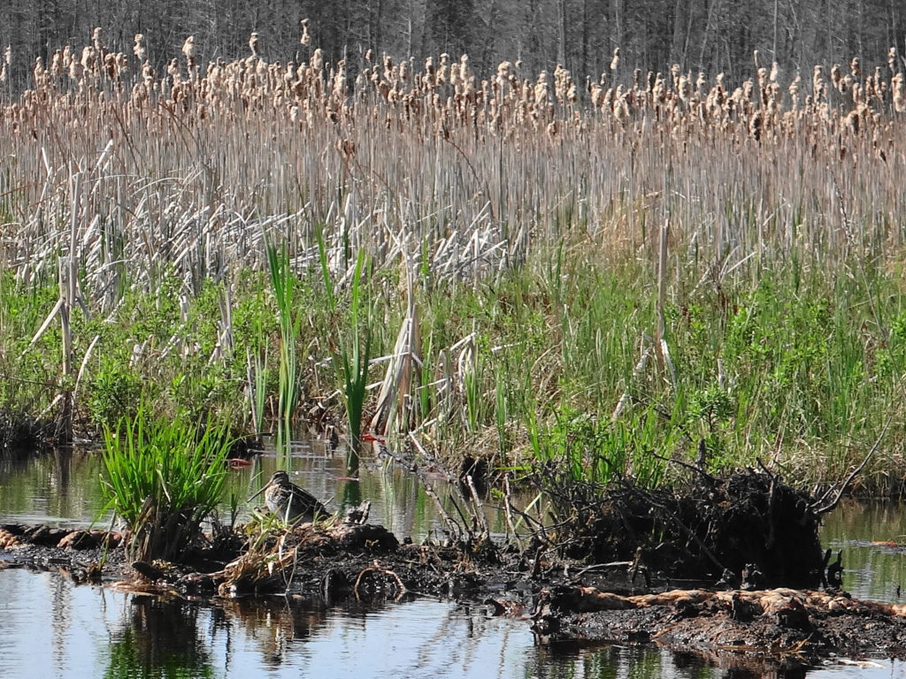
On a gorgeous Saturday afternoon, while many of my friends participated in the Ottawa Race Weekend, I launched my canoe for the season’s first paddle on the Rideau. I usually make this excursion earlier in the spring, but this year’s high flows kept me off the river. Loading my canoe on the bike trailer, I rode down to Robinson Park, launched from the beach, and turned upstream.
Wike Canoe Trailer
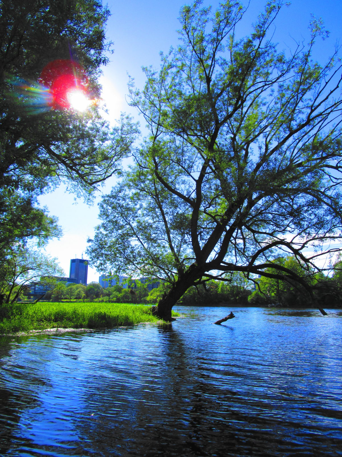
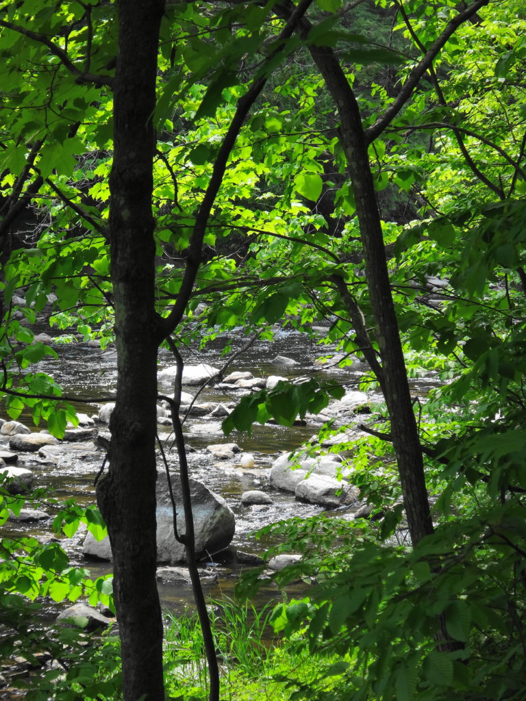
The paddling proved relatively easy, despite the strong current. I passed under the Queensway and the footbridge, skirting the shoreline and reeds in search of wildlife. My new cherrywood paddle (a birthday gift from Sue) felt good in my hands, and the tensions of the past work week eased out of my shoulders.
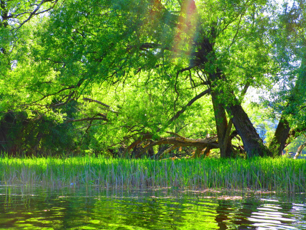
Rideau River Downstream of the Hurdman Bridge
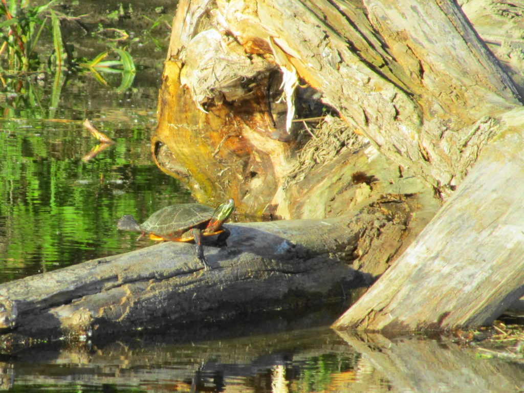
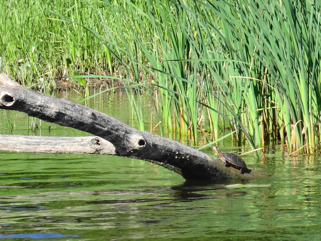
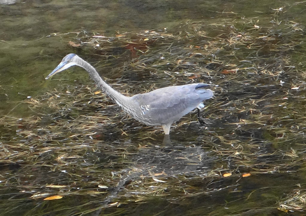
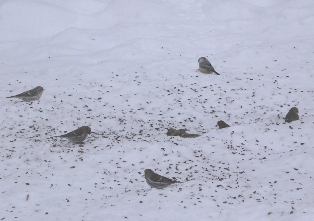
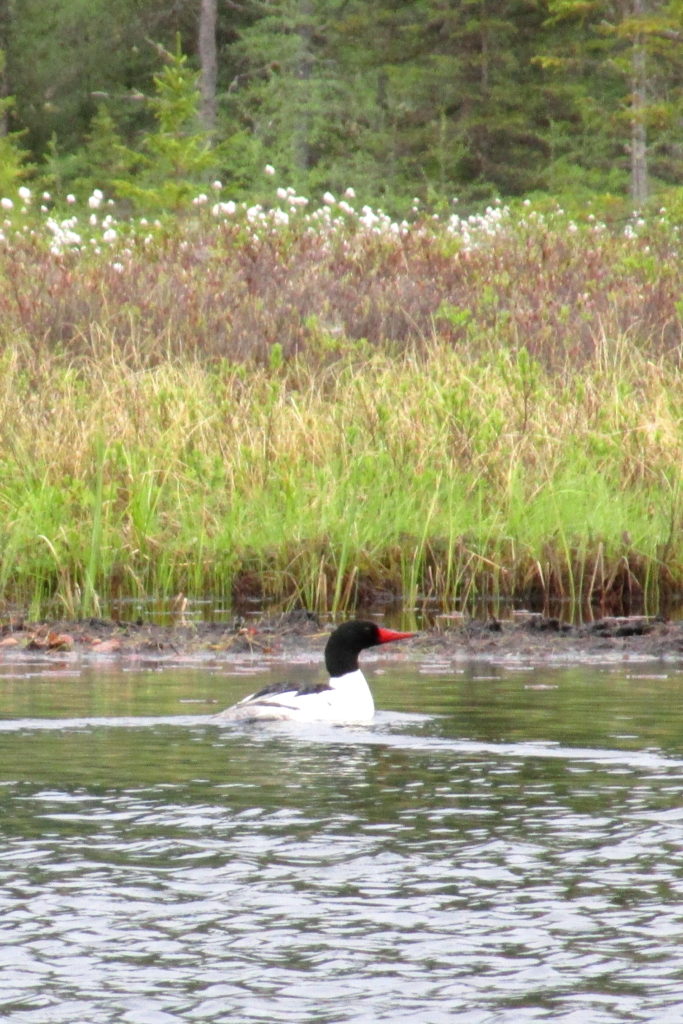
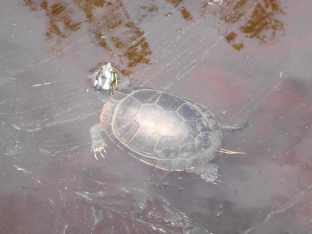
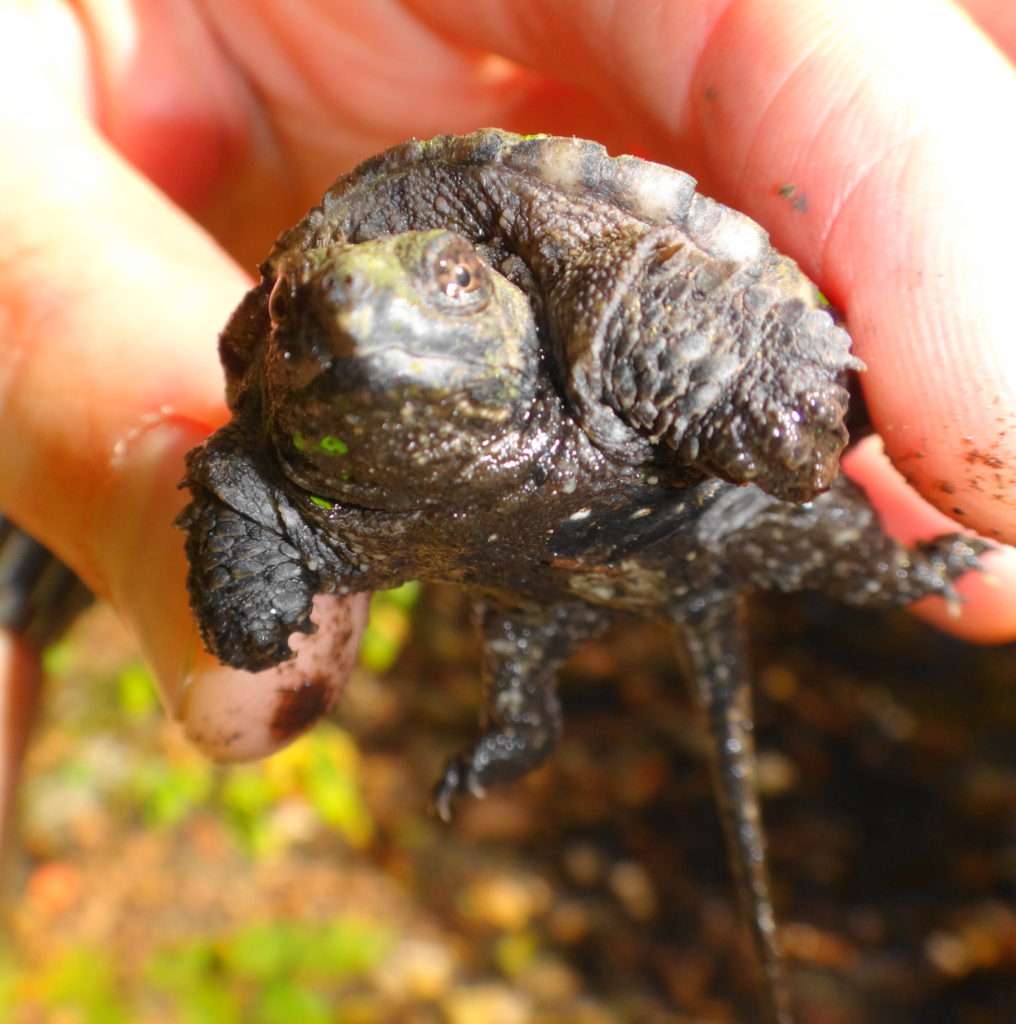
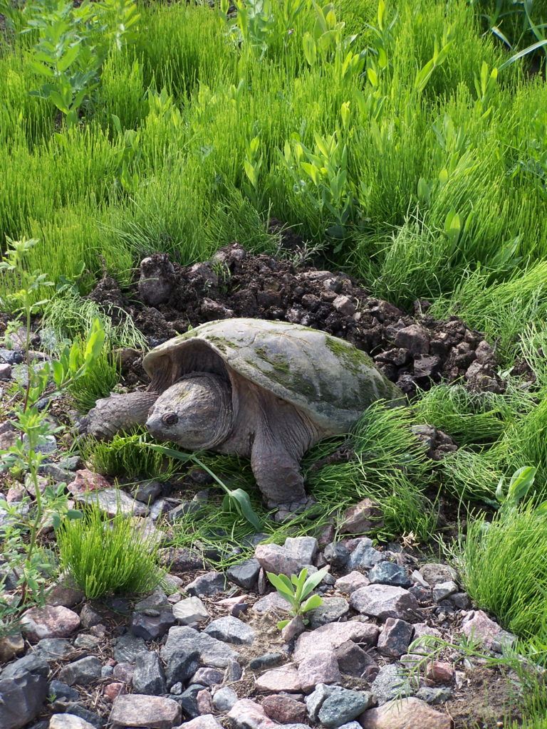
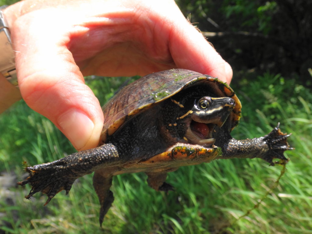
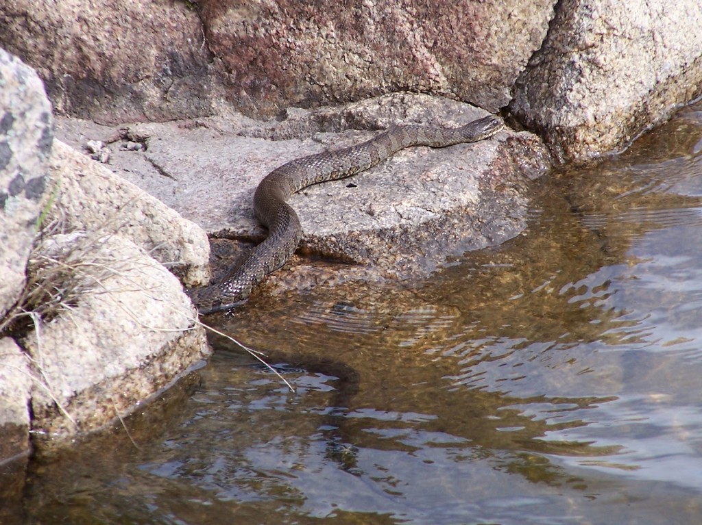
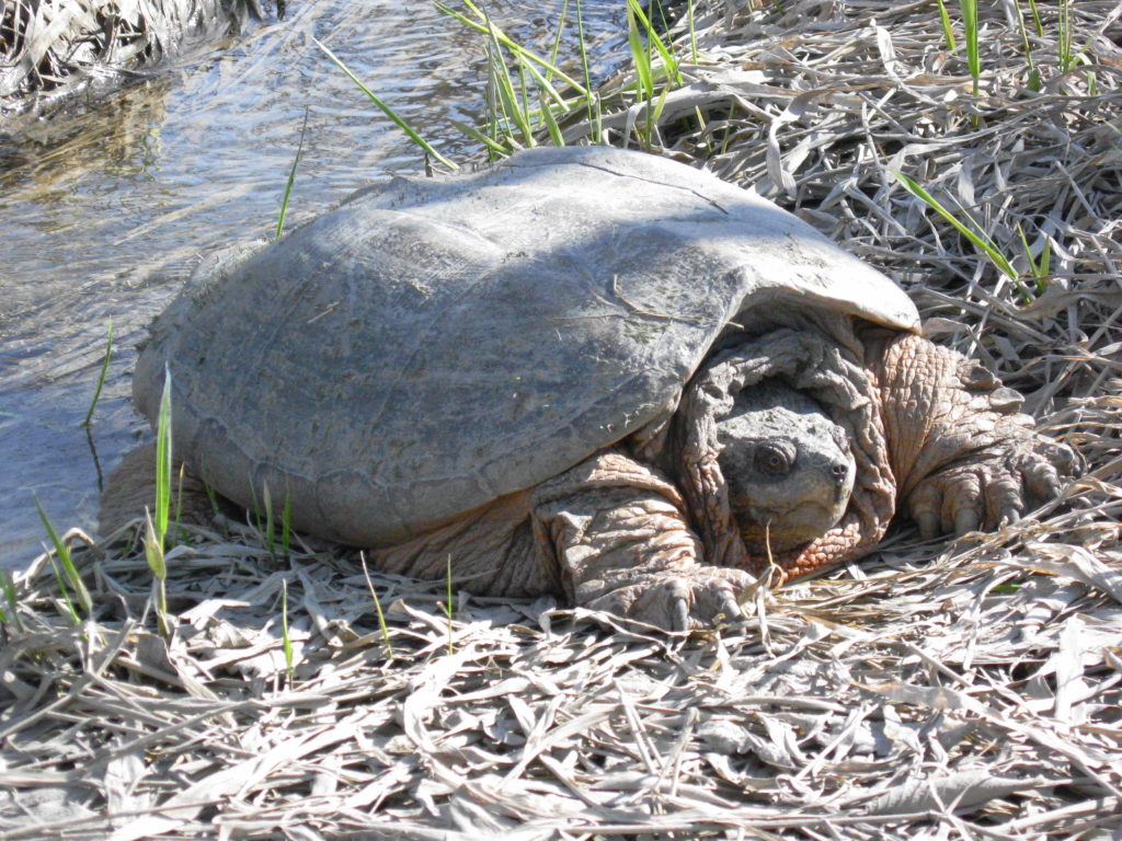
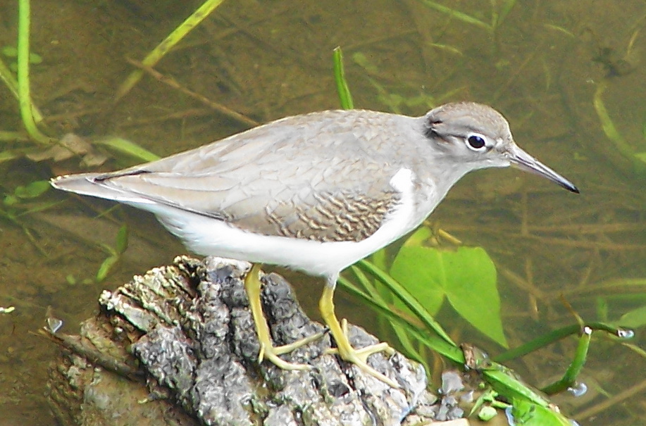
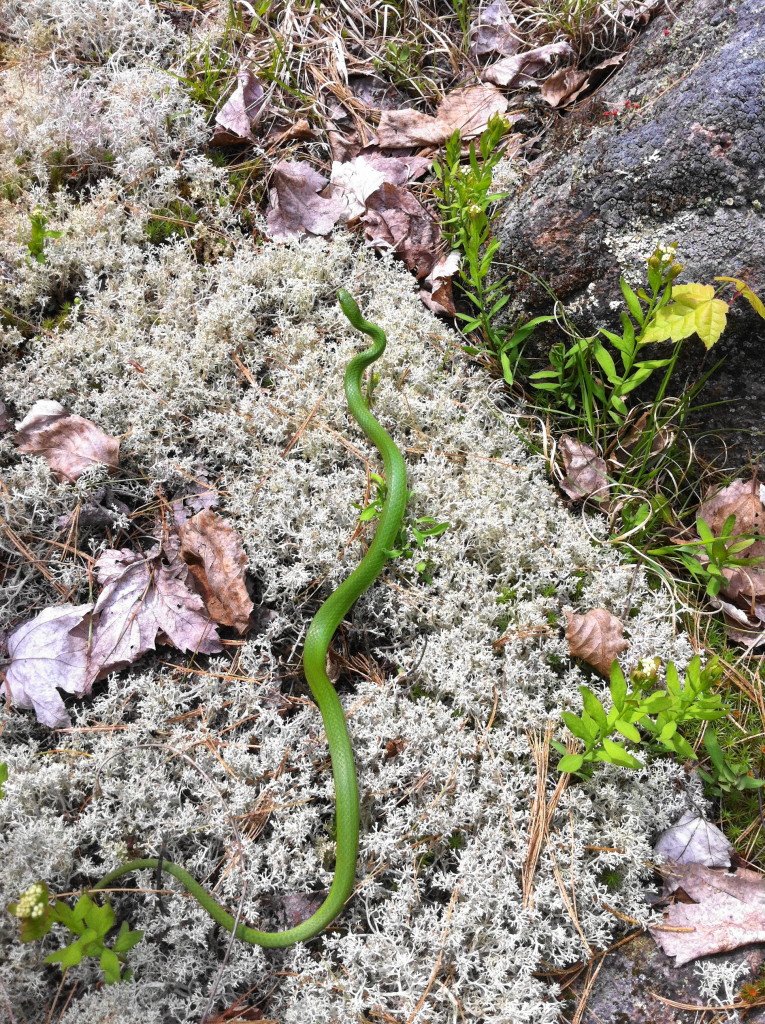
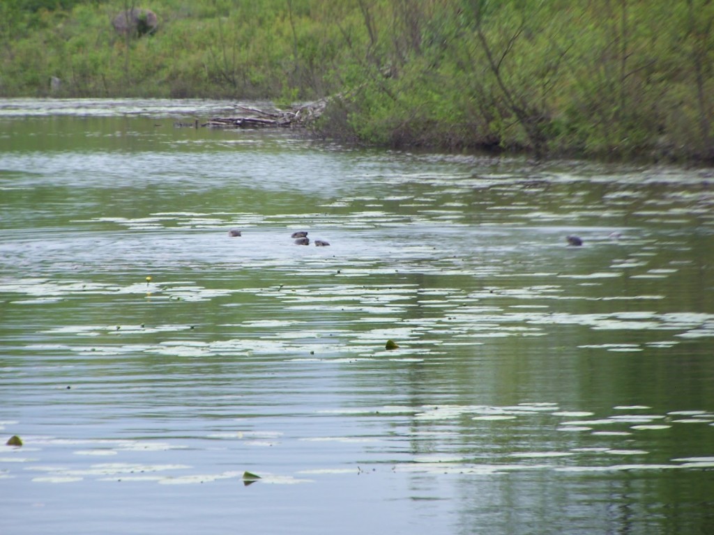
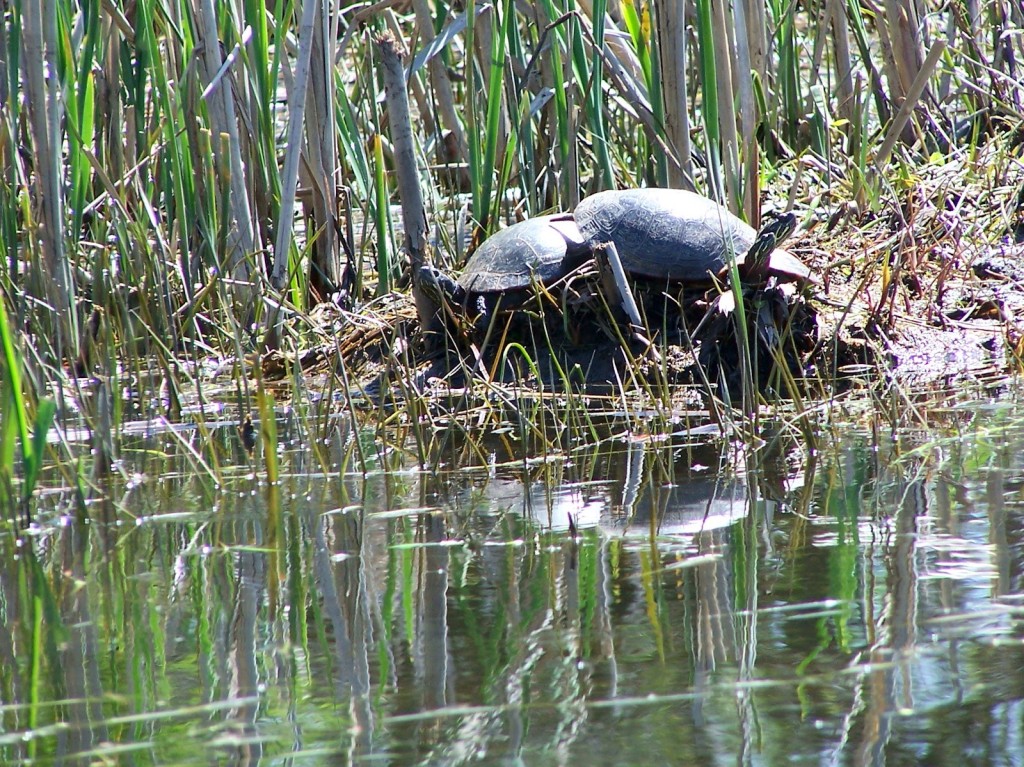
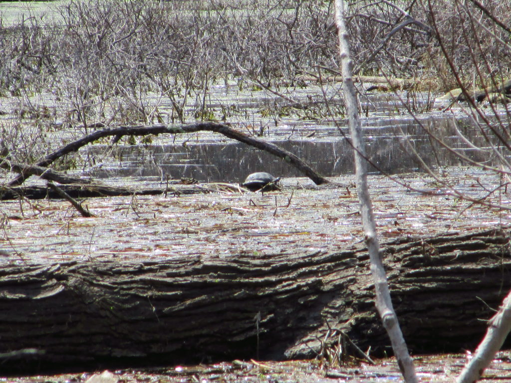
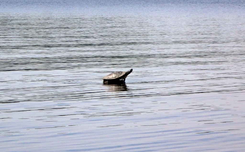
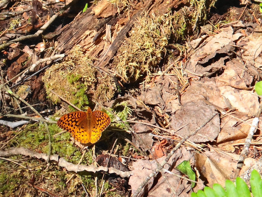
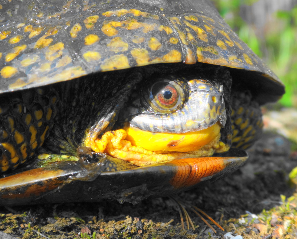
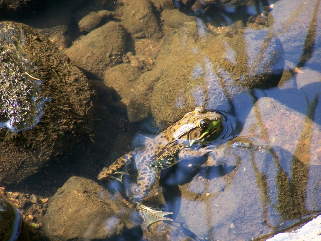
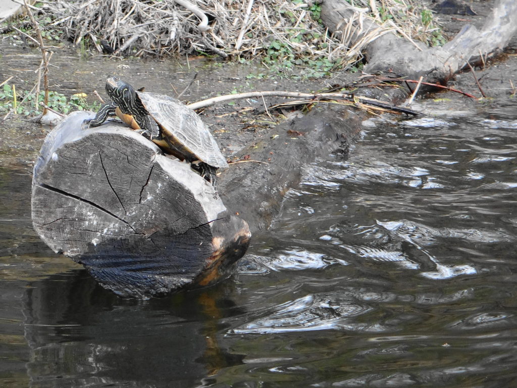
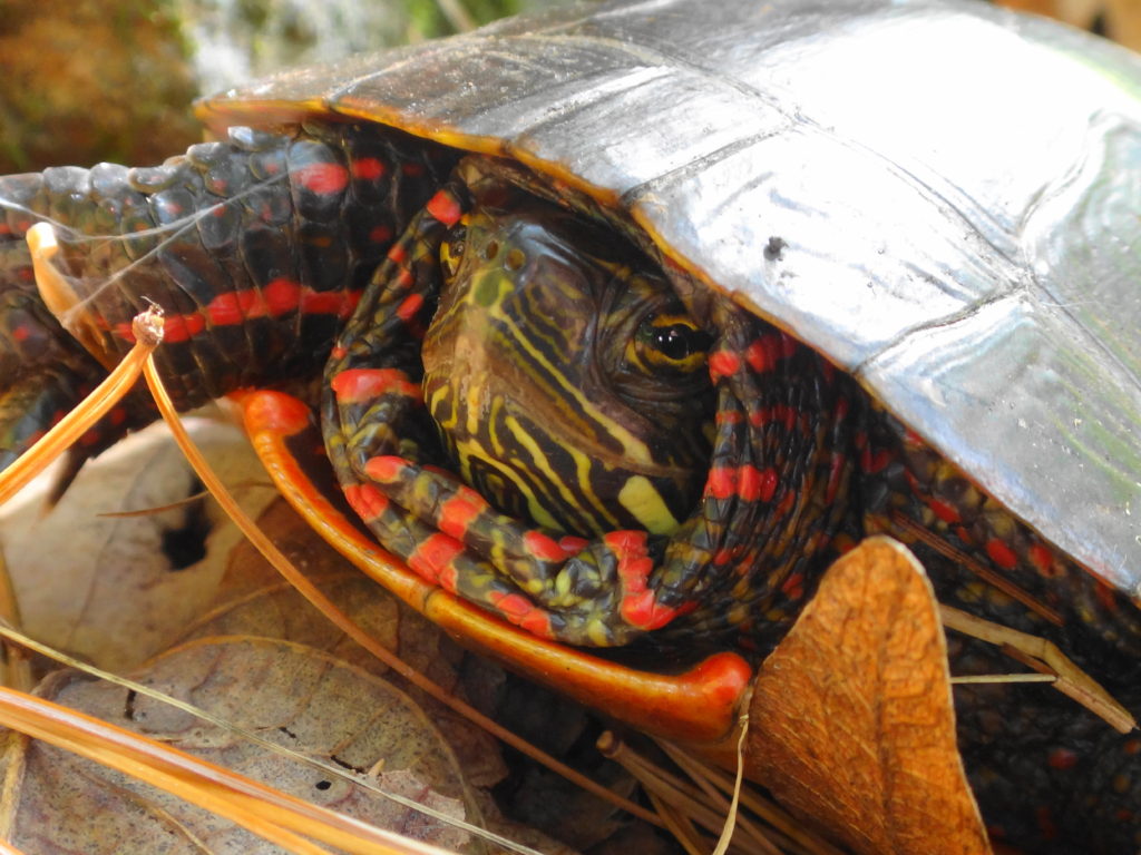
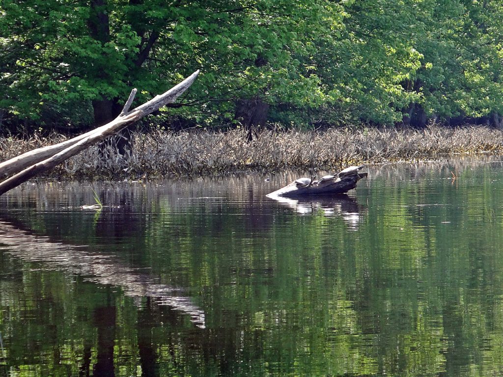
Given the warmth of the day, I expected to see a lot of basking turtles. In the past, I’ve spotted large numbers of painted turtles, plus large snappers and even map turtles along the shore. Surprisingly, in almost six hours on the river, I only found two painted turtles up on logs, along with three snappers idling in the shallows amidst the reeds. The Ministry of Natural Resources and Forestry has several old records of Blanding’s turtle along the river, and despite a decade of disappointment, I still live in hope of finding one sometime on this stretch.
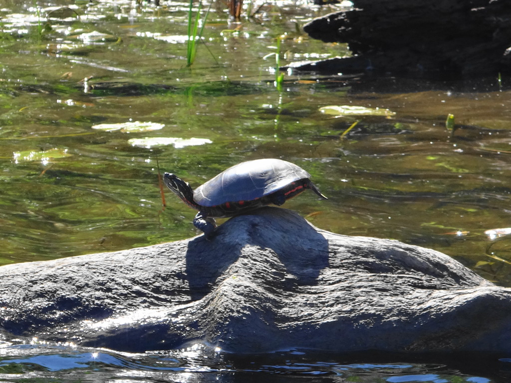
Painted Turtle, Rideau River
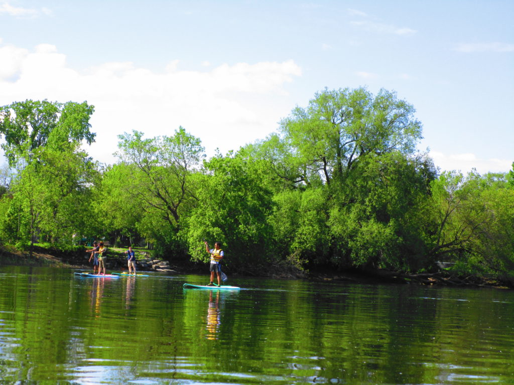
The hardest paddling of the day came at Billing’s Bridge, where the river flowed fast through the piers. Passing a small group of stand-up paddleboarders, I tried first for the central span, paddling hard in the eddy behind a pier and then shooting into the current. For a minute a two I held my own, but without making headway. Finally, I dropped back and moved to the next span south, where the current proved a little less challenging. One of the paddleboarders tried to follow me, but couldn’t muster enough speed. Just upstream of the bridge, several more stand-up paddleboarders practiced in the calmer pool. One of them, a very pretty young woman, struck yoga poses on her board, as her girlfriend snapped photographs.
Stand-up Paddleboarders, Rideau River
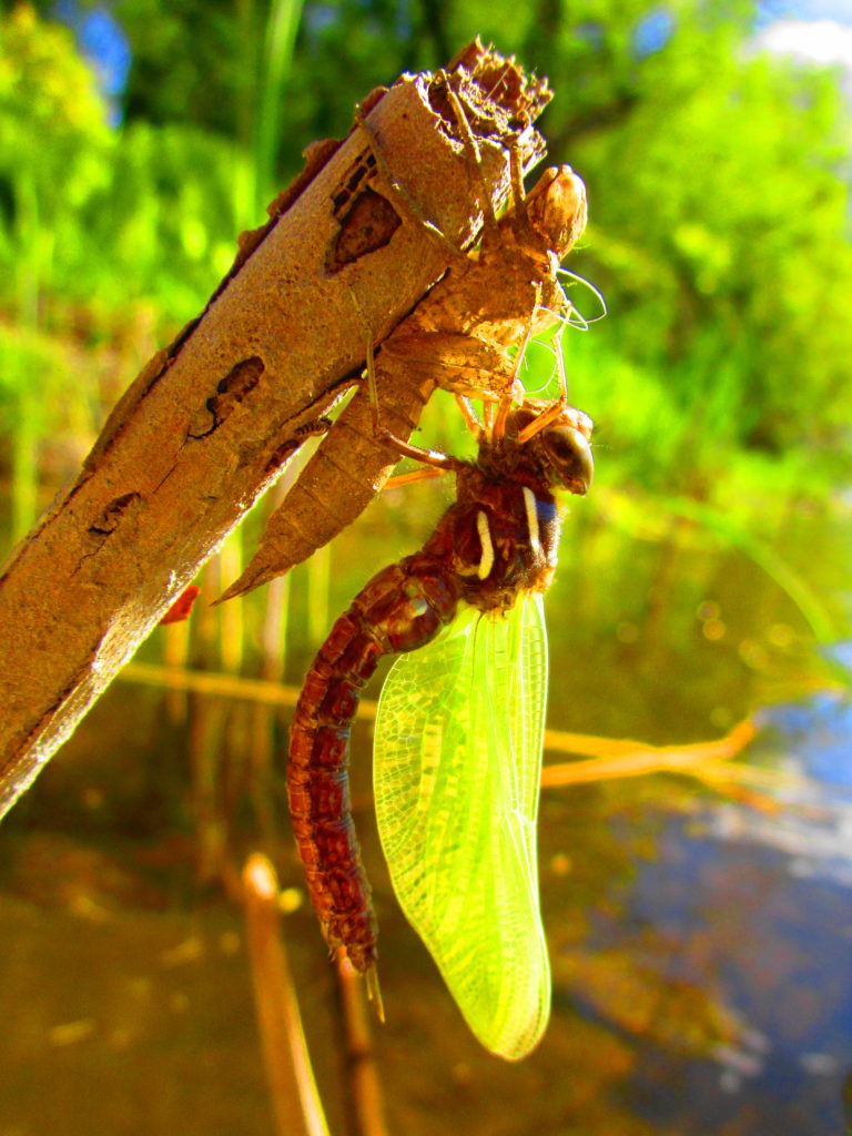
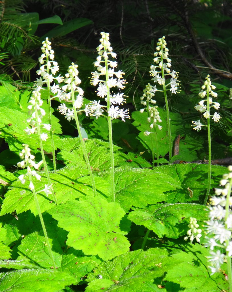
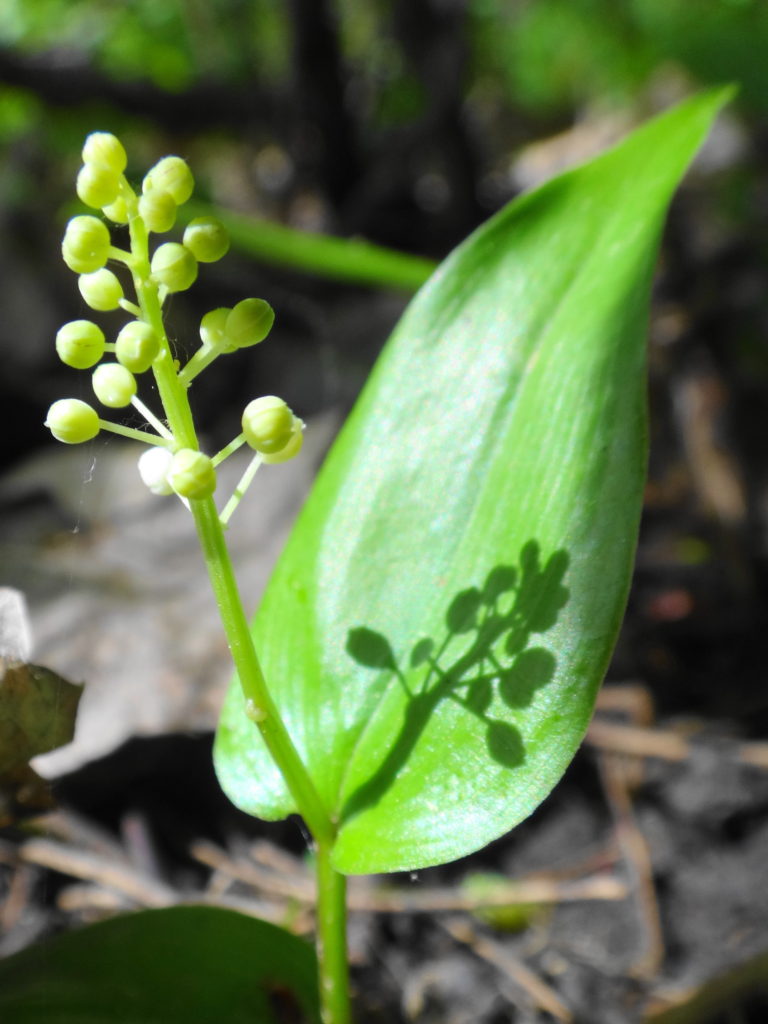
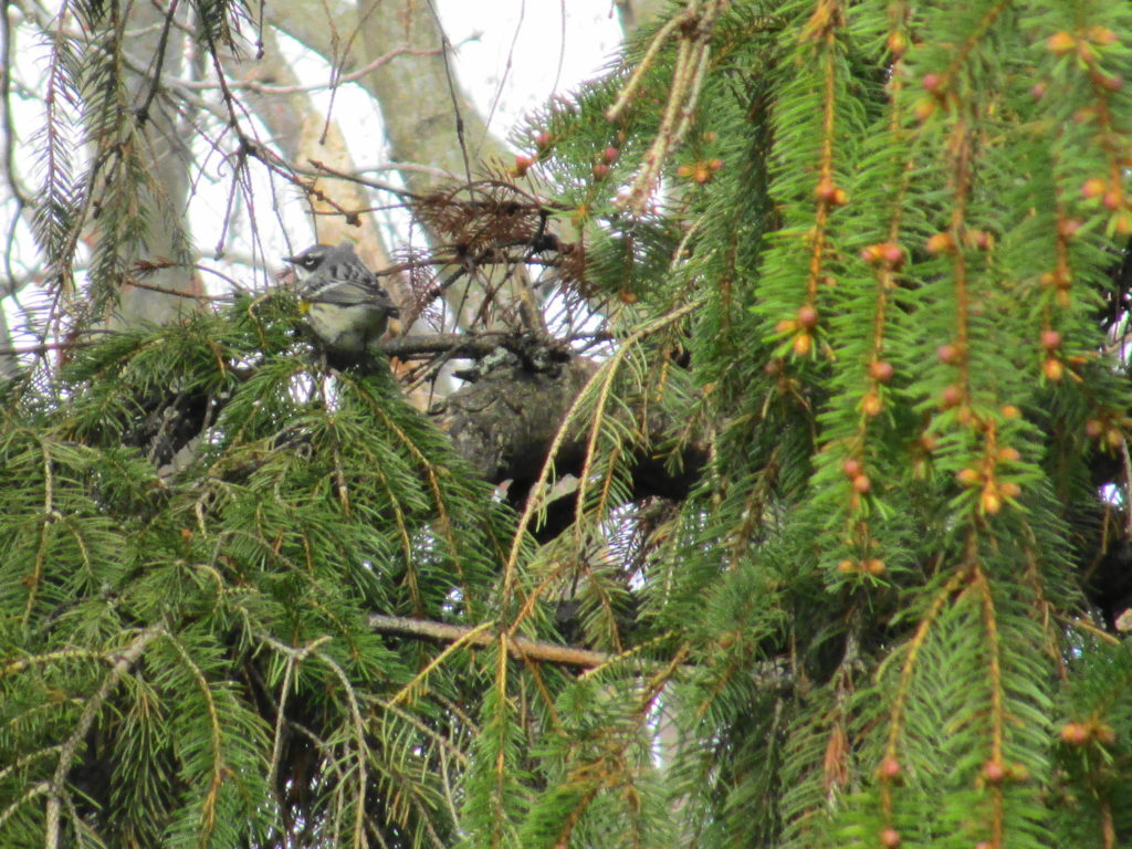
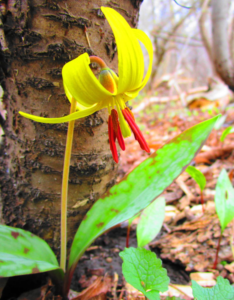
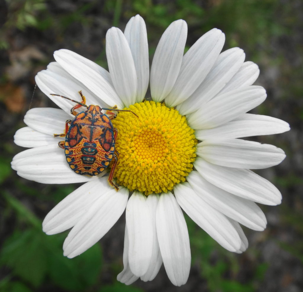
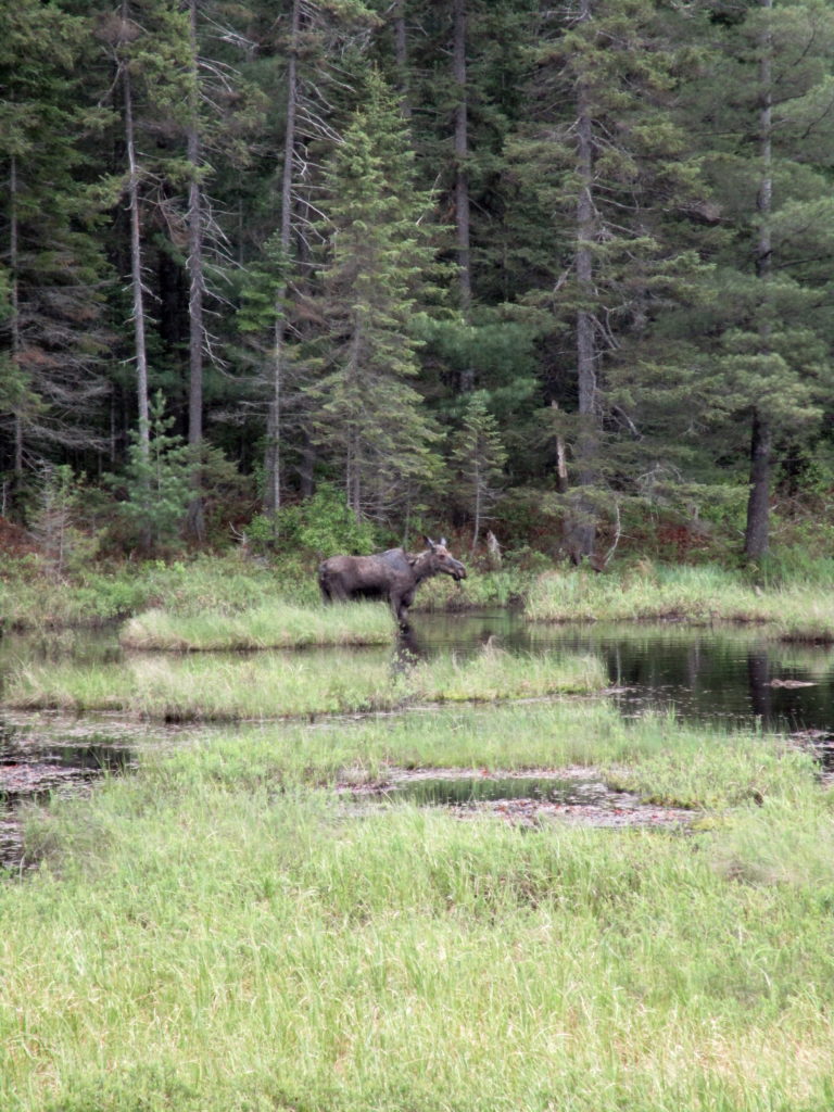
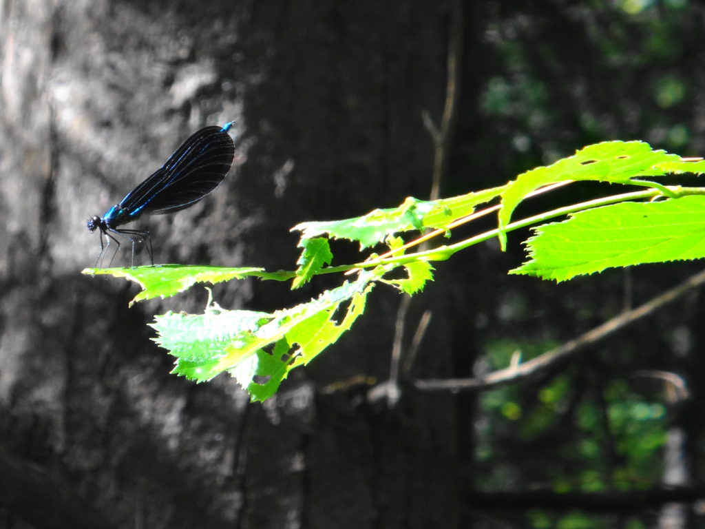
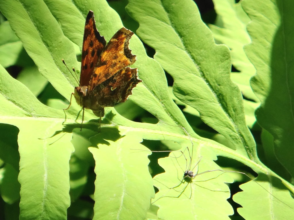
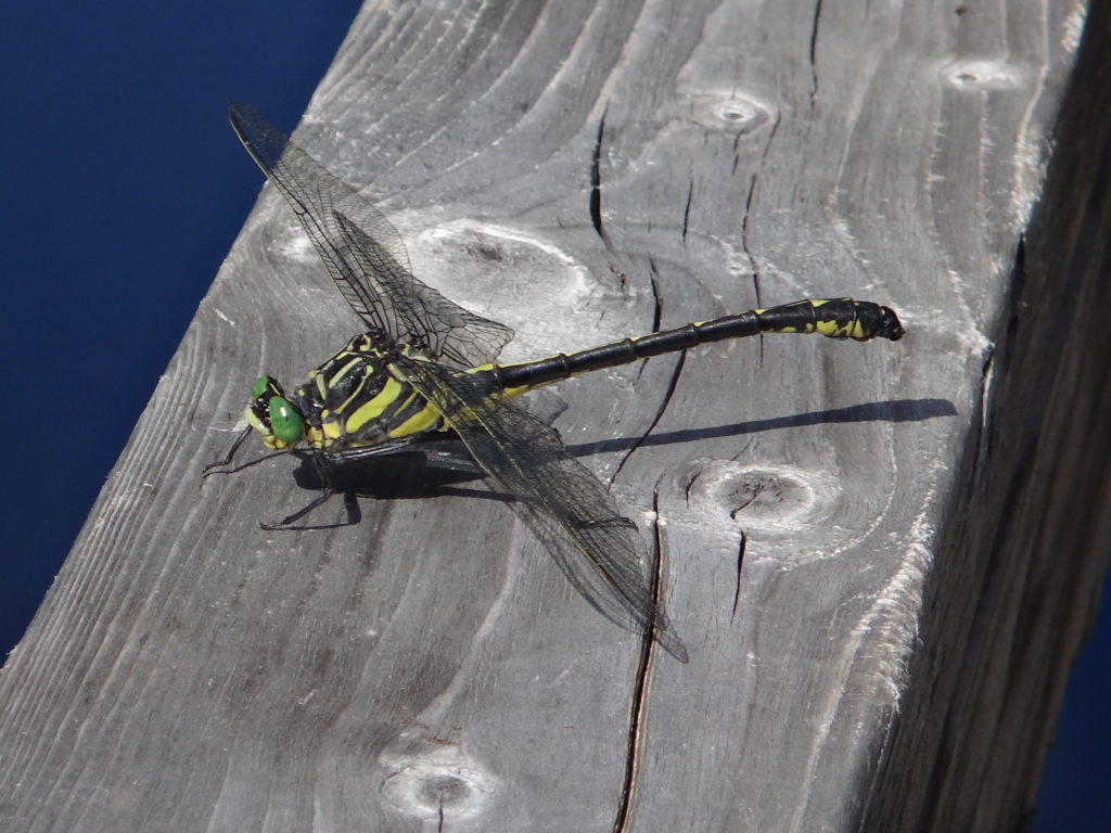
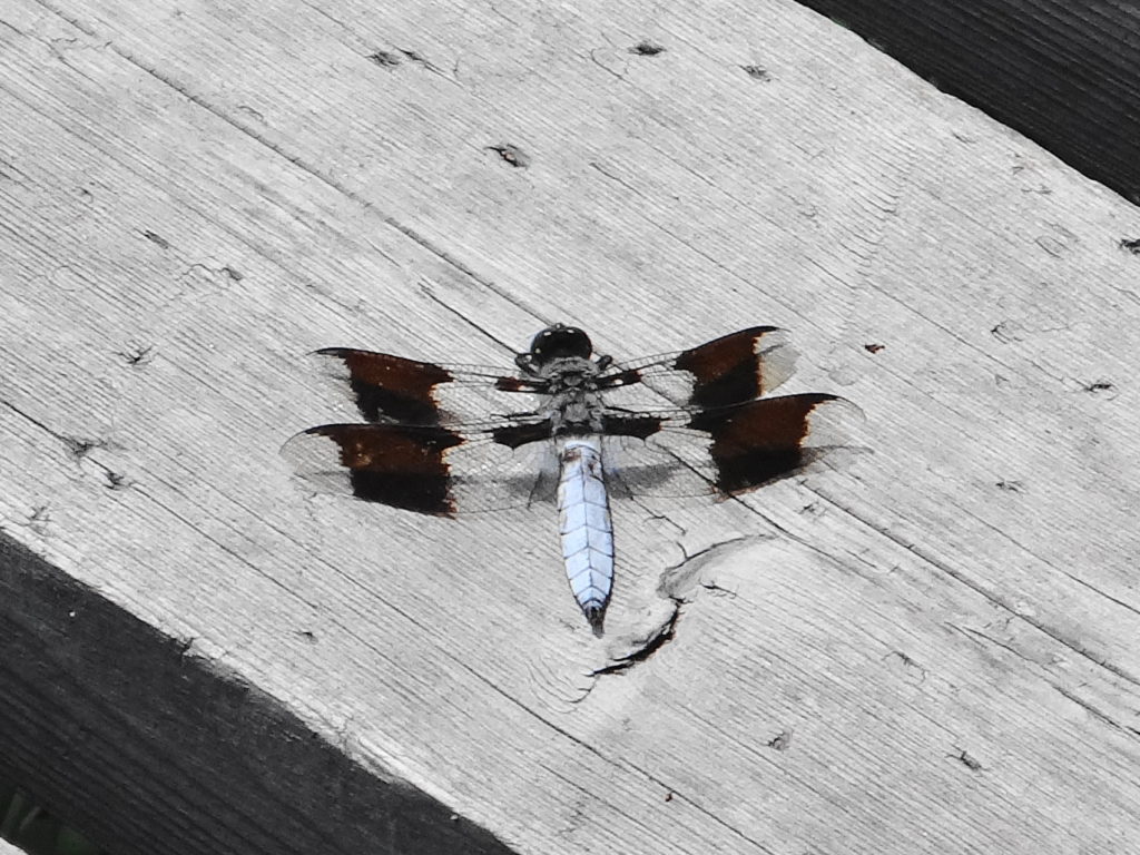
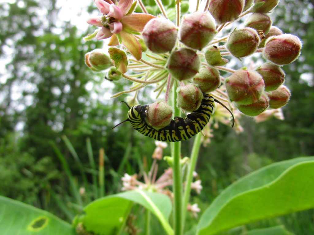
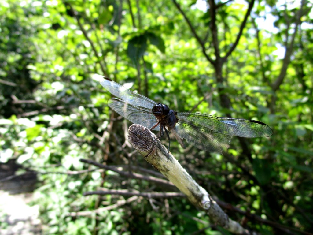
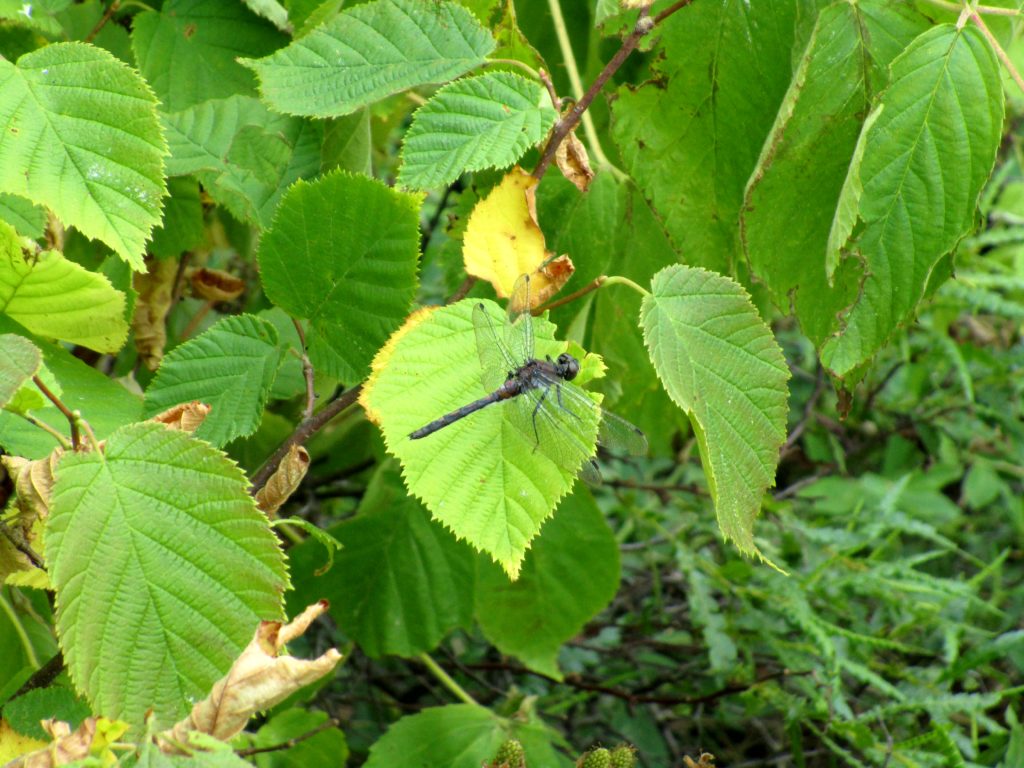
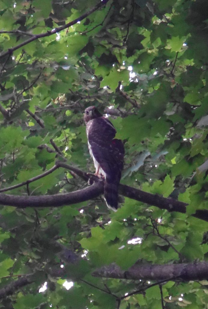
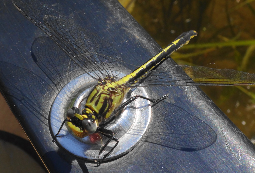
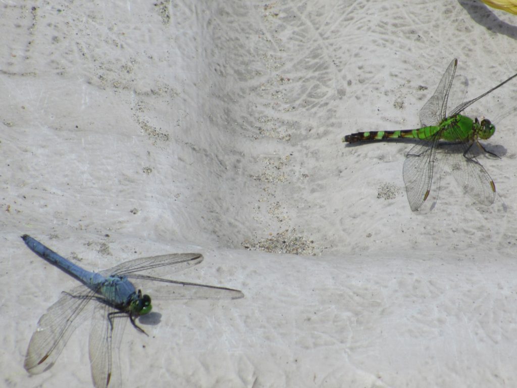
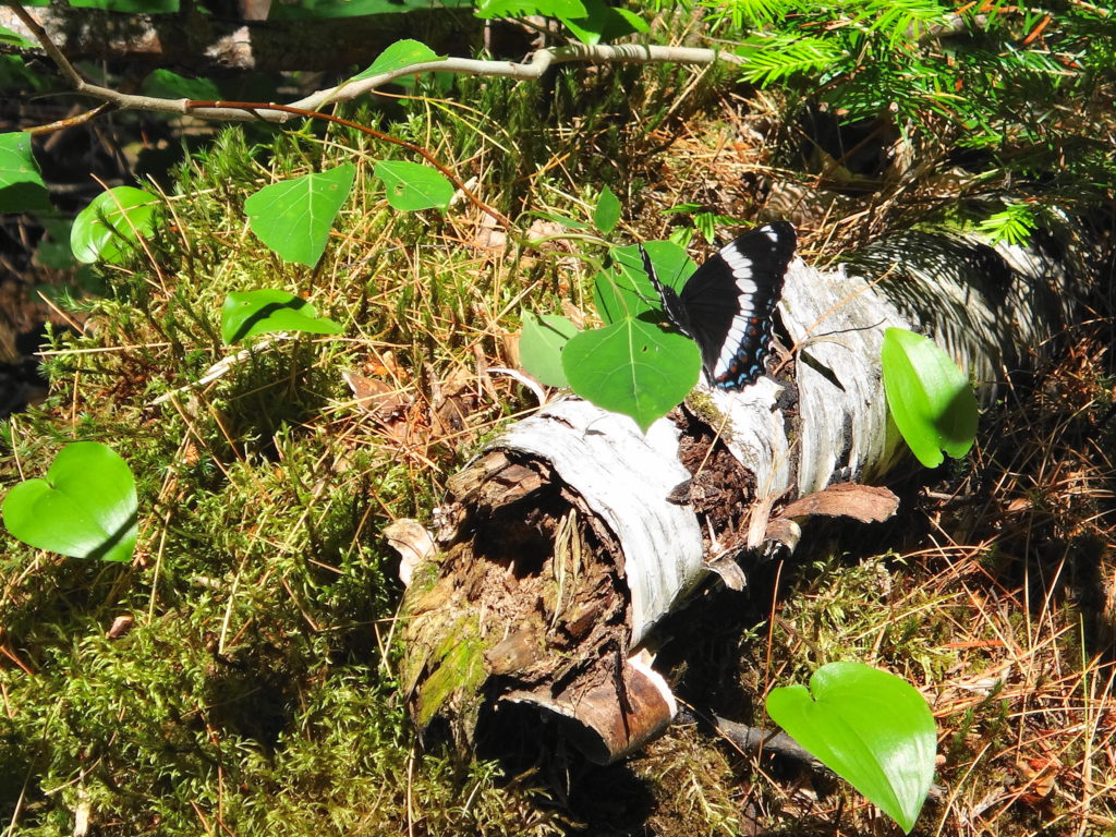
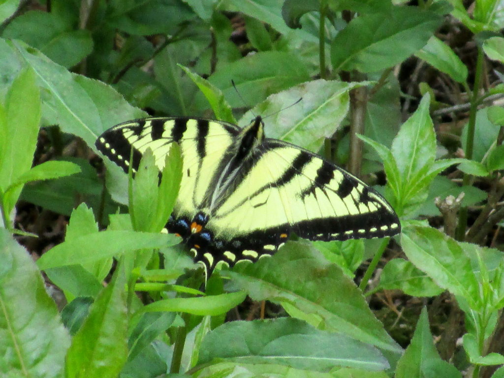
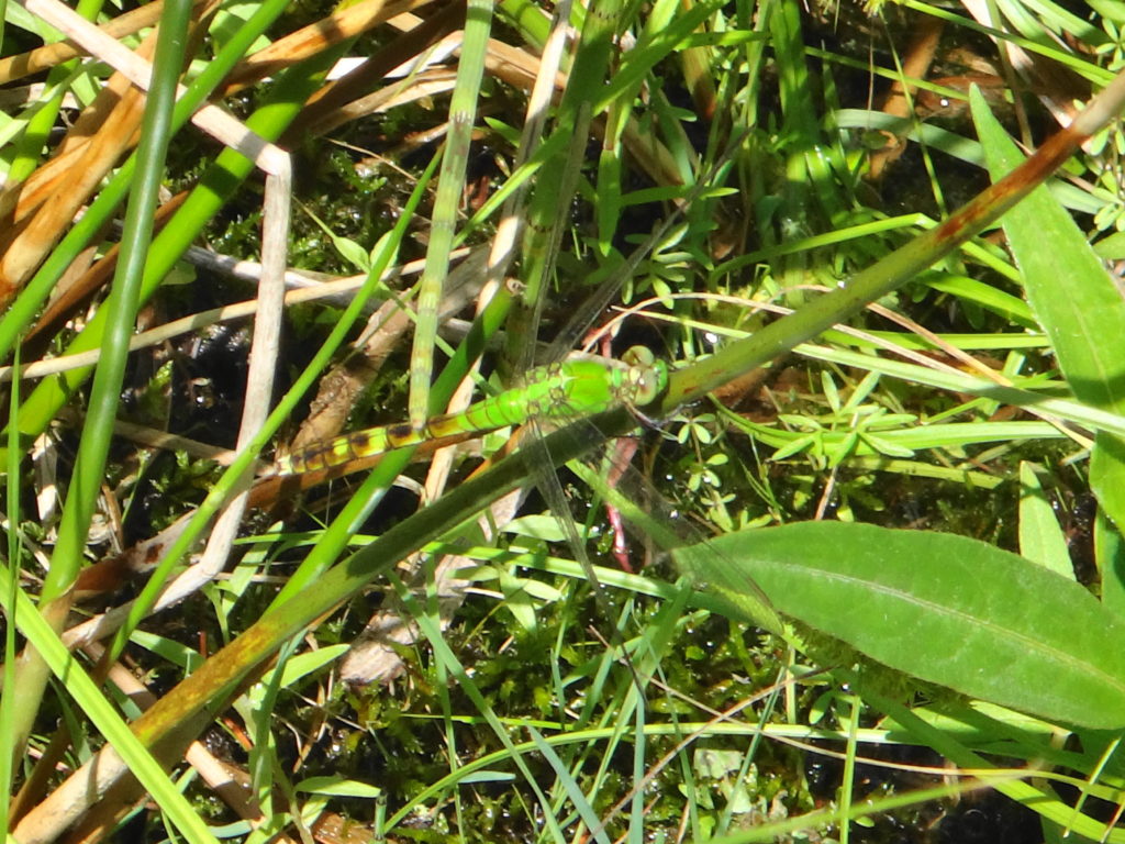
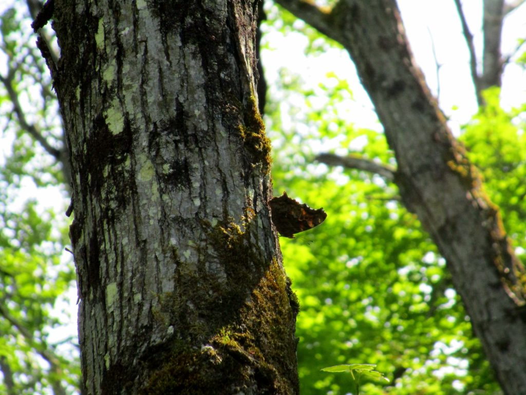
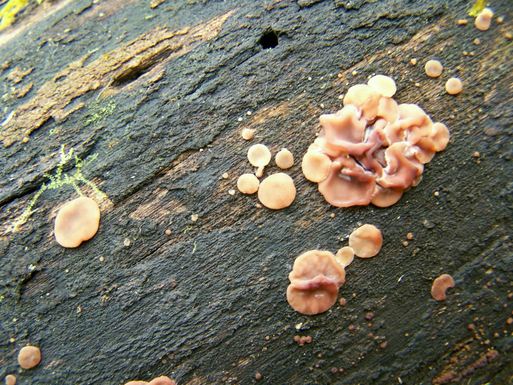
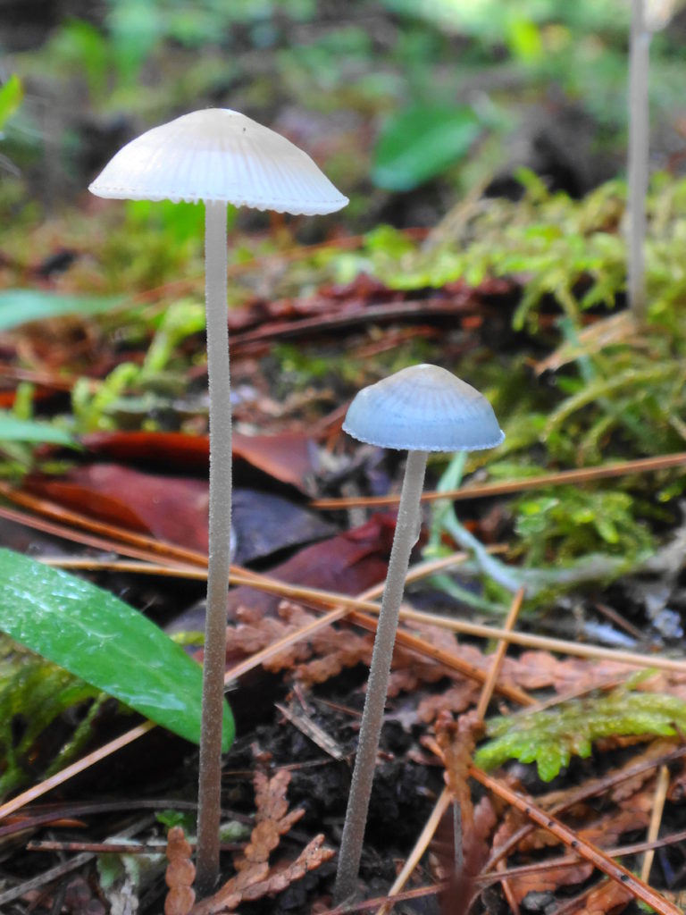
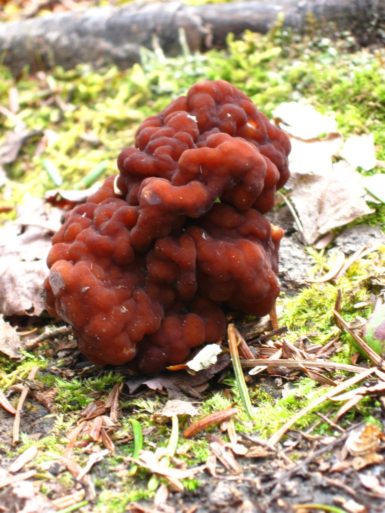
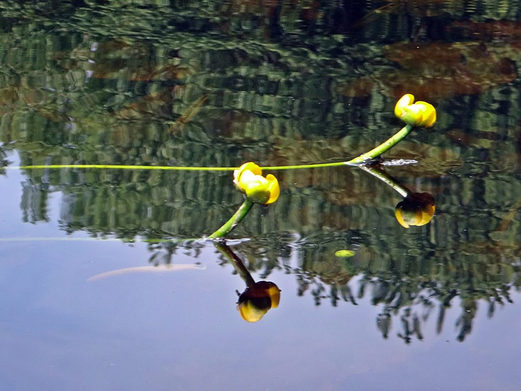
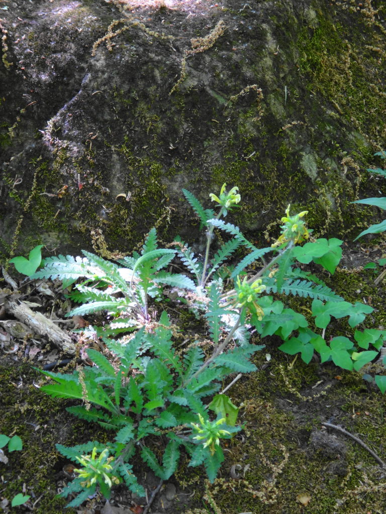
After working slowly through the riffles above Billings Bridge, I slid my canoe into the reeds at Clifford Allen Island, so that I could renew my sunscreen. As I slathered on the cream, with a pair of geese eyeing me warily, I noticed a newly molted dragonfly drying its wings at the tip of broken, brown reed, still hanging from its discarded nymph skin. It’s colors had not yet fully developed, but the stripes on the thorax suggested some kind of darner. I had seen pretty, green darners dancing over the reeds during my paddle upstream, but they lacked the thorax stripes.
Unknown Darner, Rideau River
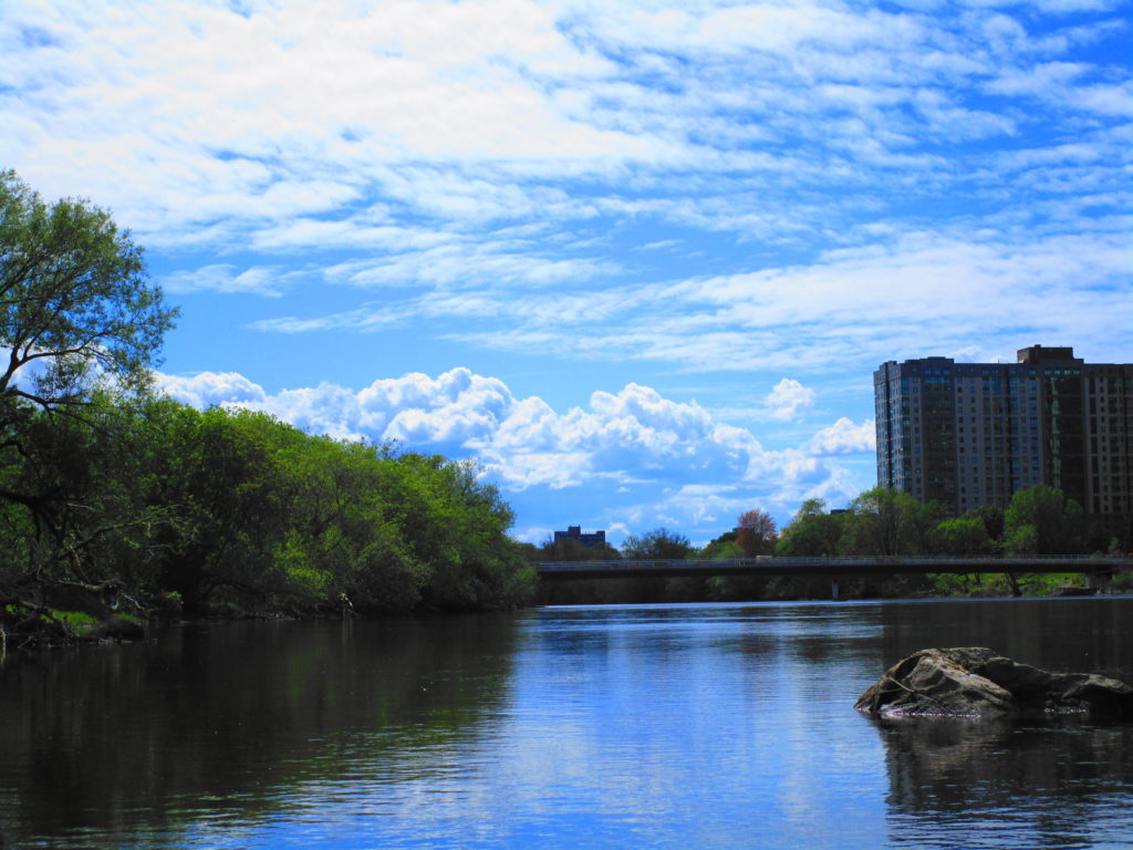
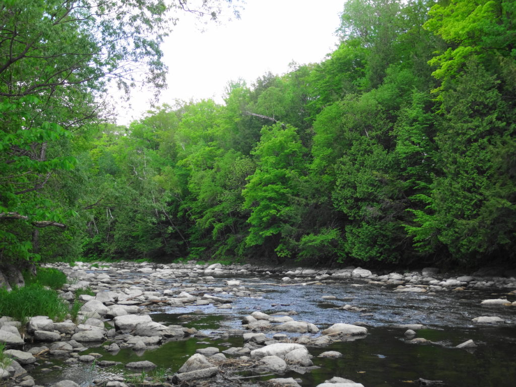
Carrying on from the island, I paddled past Brewer Park to the Dunbar Bridge. This part of the Rideau River hosts the most fascinating juxtaposition of culture in the City: literally 4000 years of history separated by barely 300 metres of river. On the north shore, nestled under the Dunbar Bridge, the House of PainT provides a venue for Ottawa’s hip-hop community, featuring its first legal graffiti wall and regular street dance festivals. Just upstream and across the river, on the south shore at Vincent Massey Park, lies a 4000 year-old, indigenous archaeology site. Excavated by the National Capital Commission over several years, the site marks the bottom end of an old portage around the Hogsback Falls. Paddling up the south shore in late afternoon, just below the rapids under the O-Train line, one can easily imagine those Early Woodland people pulling their canoes into shore to set camp for the night, perhaps casting their nets into the river, where fishermen cast their lines today. I suspect that they chose the spot as much for its beauty as for its convenience.
House of PainT, Dunbar Bridge, Rideau RiverEarly Woodland Archaeology Site, Rideau RiverShoreline, Vincent Massey Park, Rideau River
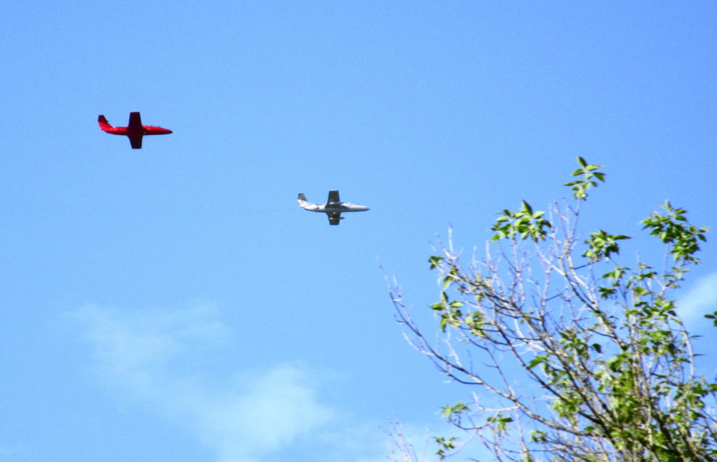
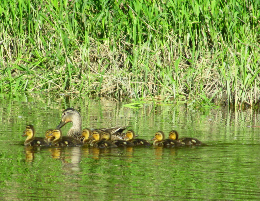
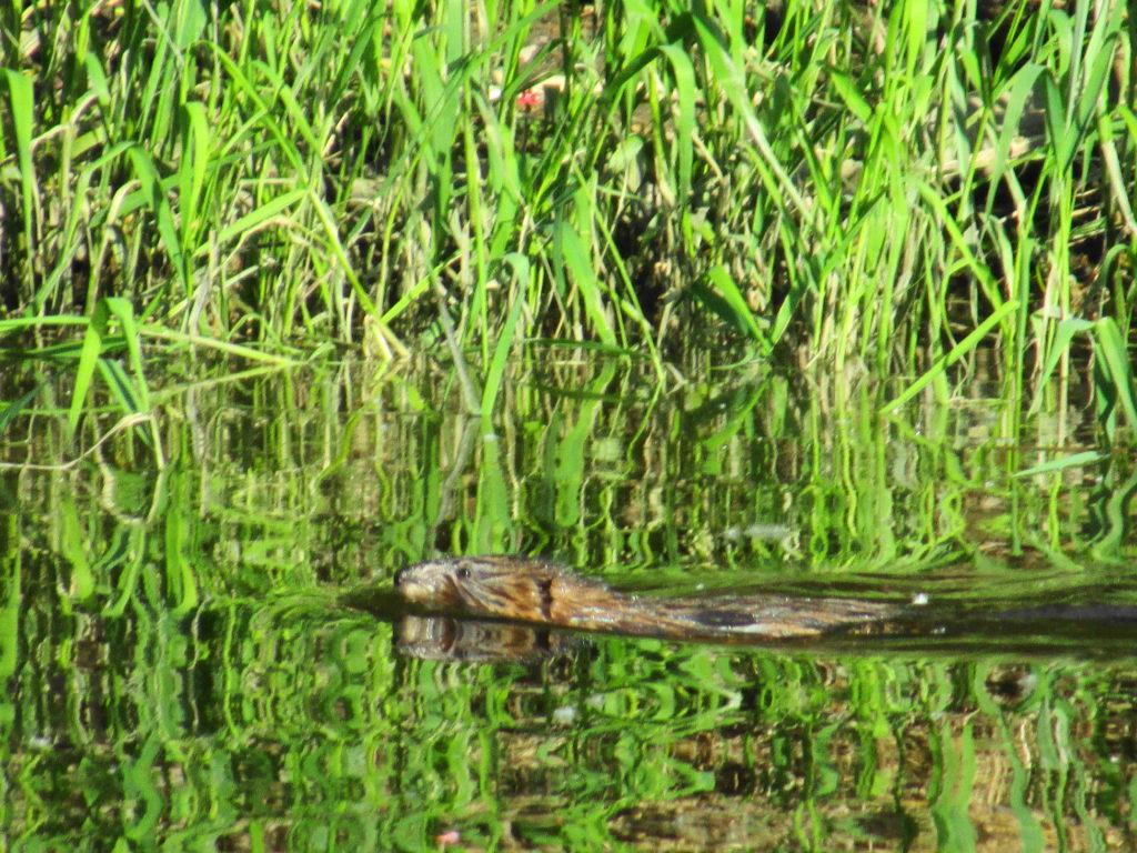
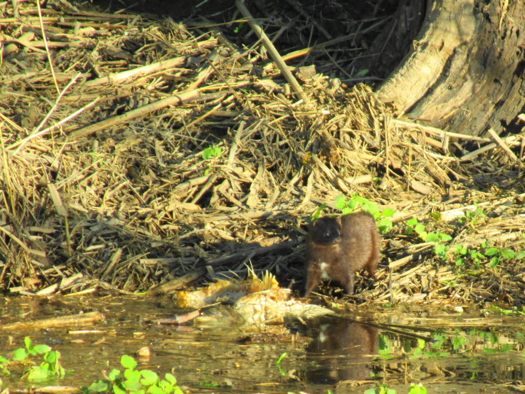
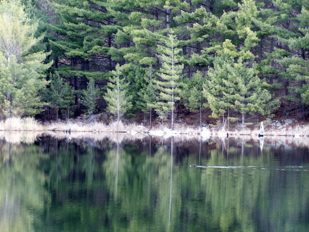
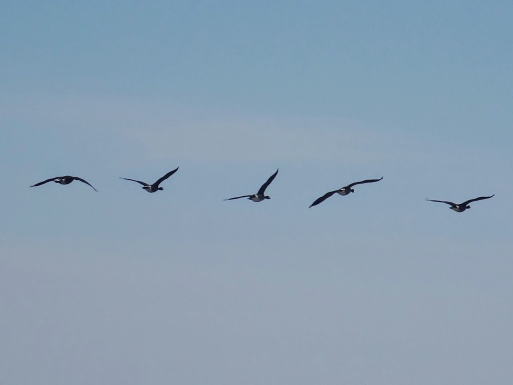
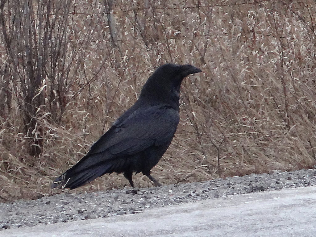
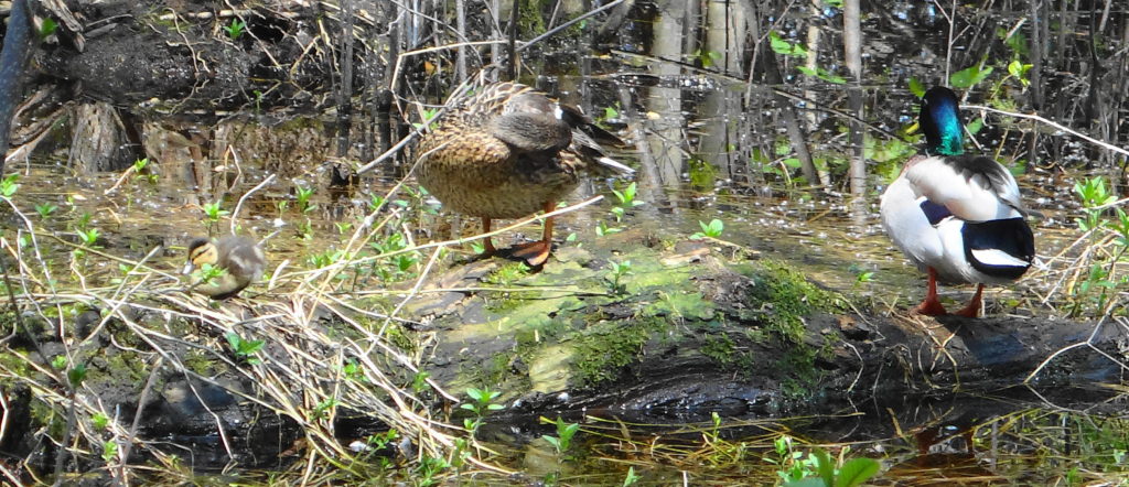
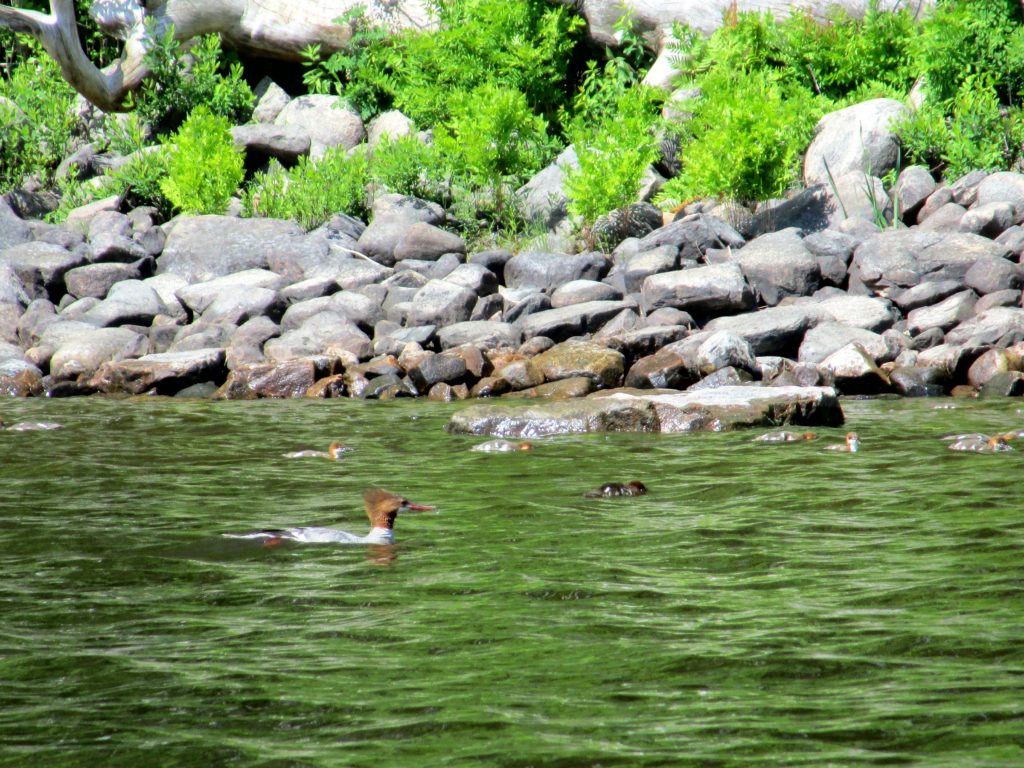
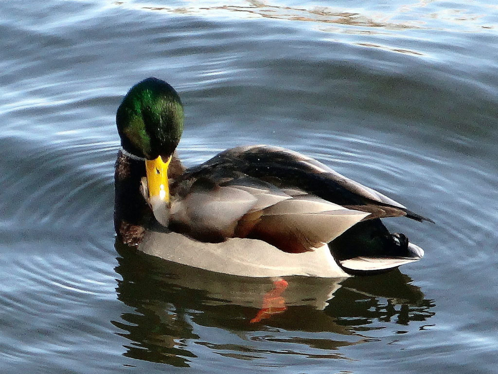
I turned back downstream in late afternoon, alternating drifting and paddling gently. For awhile, I watched two jets circling over the City in formation as part of the race weekend celebrations. Gradually, as the light mellowed, the wildlife became a bit more active. Just above Billings Bridge, a female mallard shepherded her large brood of ducklings. I could not help but think of the large muskellunge known from the area, and wonder how many ducklings would survive the summer. Further downstream, a muskrat plied the shoreline in the shadows of the trees. Finally, near the end of the paddle, I came upon a mink feeding on the carcass of a carp at the edge of the shore. I shot a few, quick photographs, then circled back to take a few more, only to see the mink slip back into the shadow of the trees.
L29 Delfins, AMC WarbirdsMallard and Ducklings, Rideau RiverMuskrat, Rideau RiverMink, Rideau River
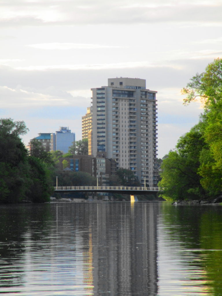
I pulled back into Robinson Park, just as the evening sun was dropping behind the City. I looked down the peaceful waterway to the Adawe Crossing at Strathcona Park. The serenity of the scene encapsulated the beautiful dichotomy of this wonderful urban river.
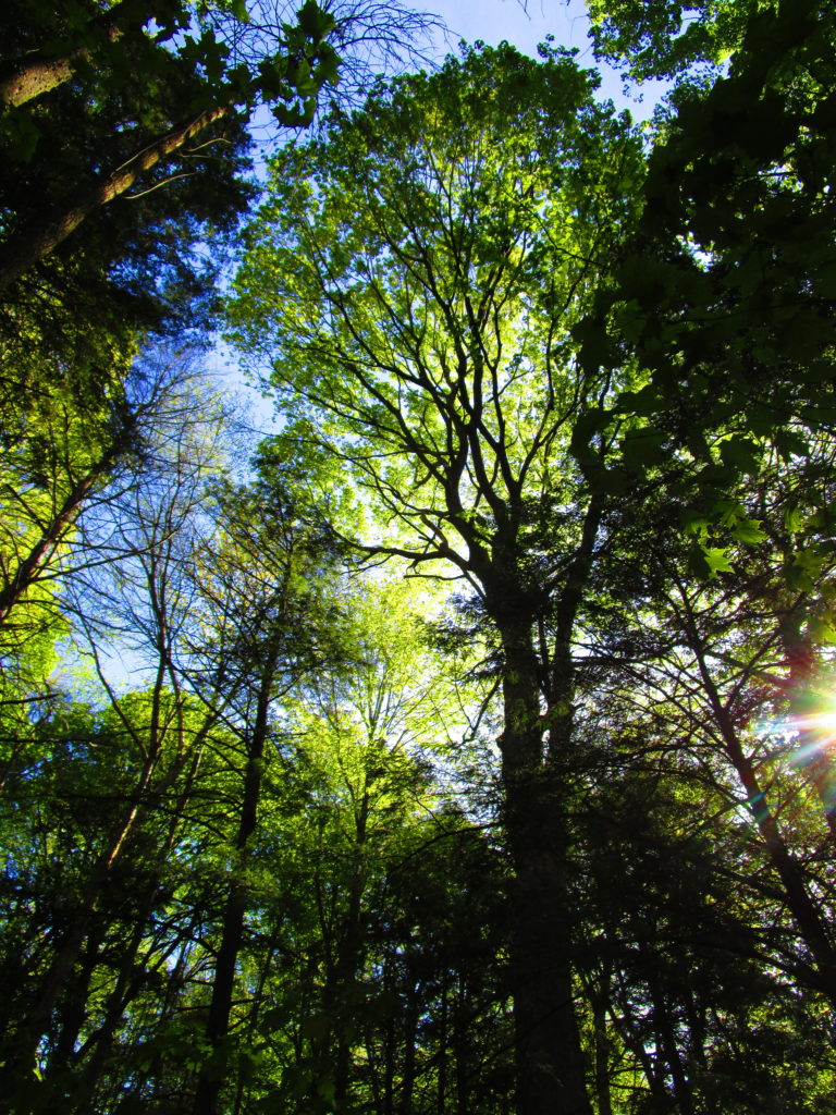
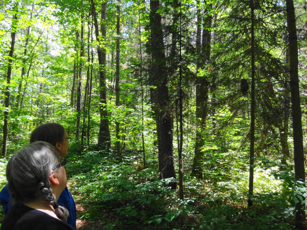
What makes a large urban forest special, and to whom? How do you plan it? How do you manage it?
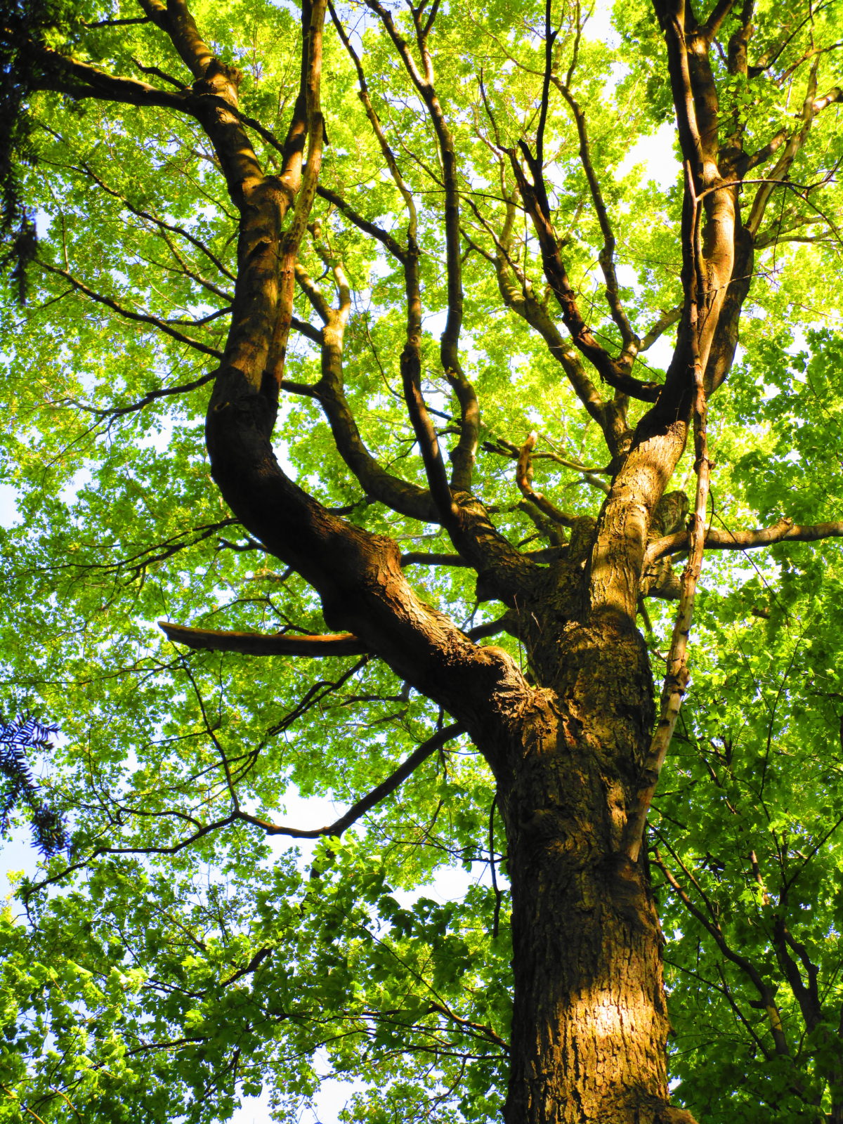
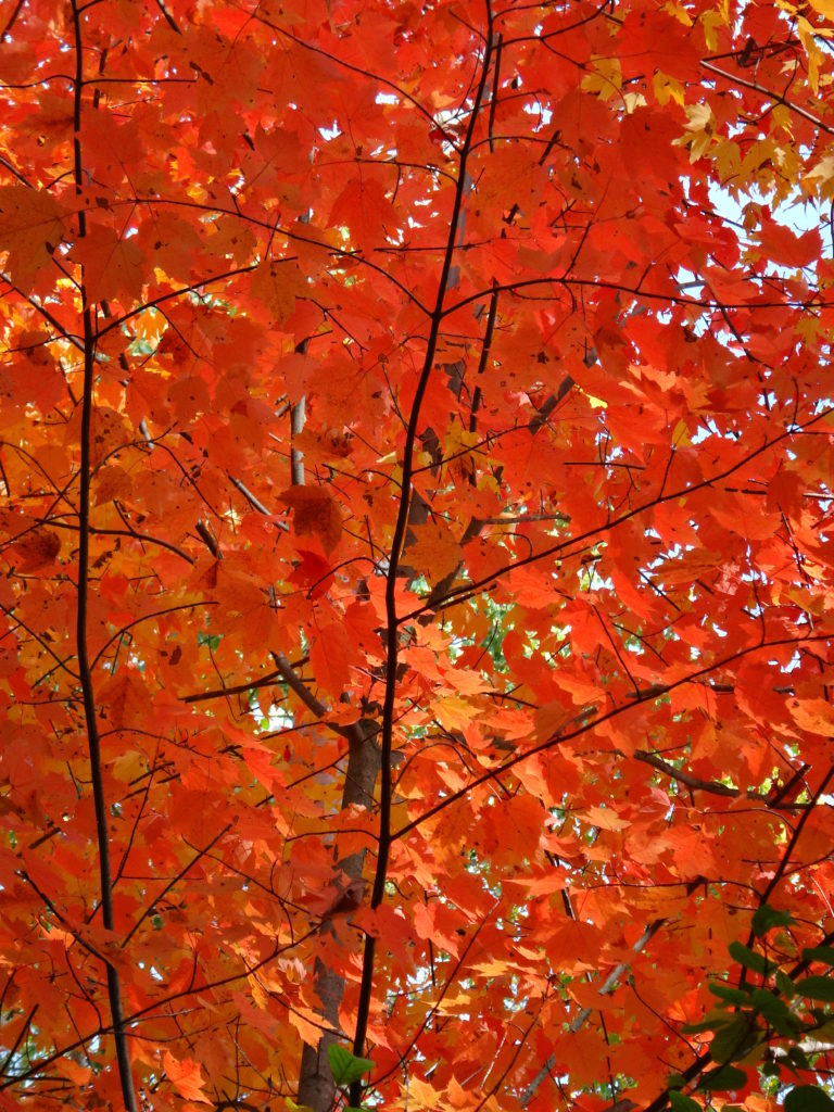
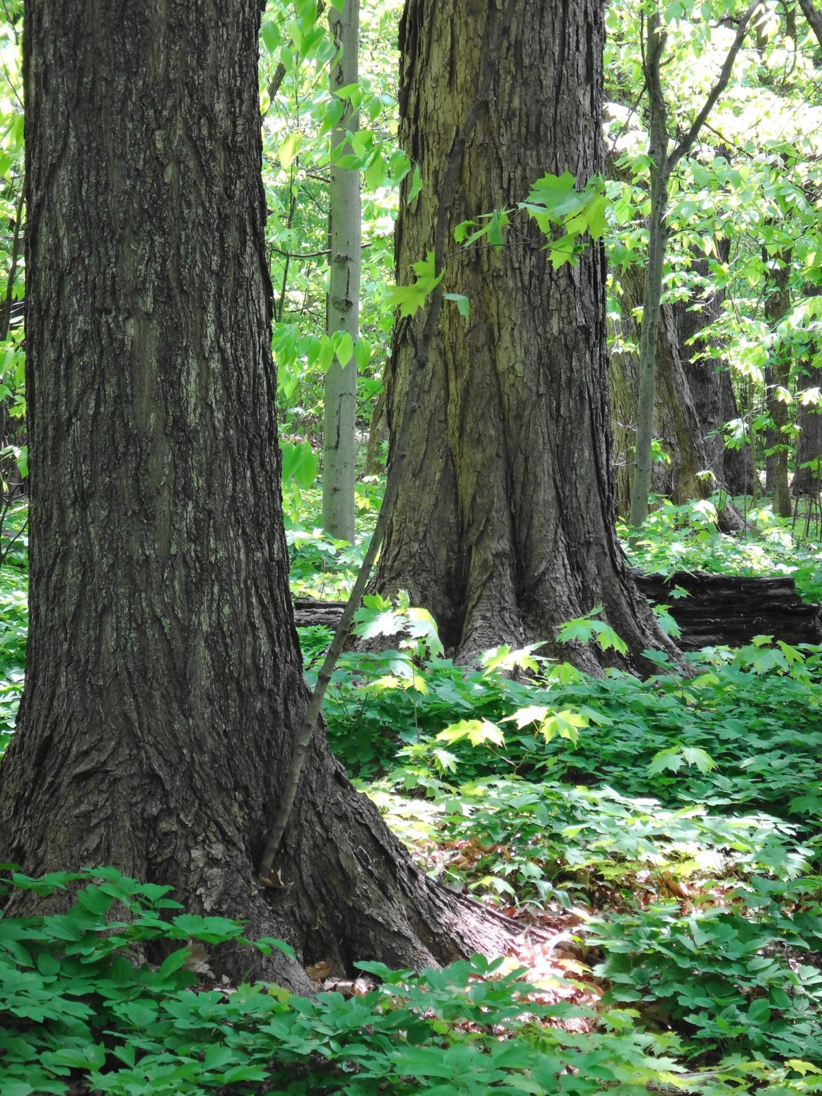
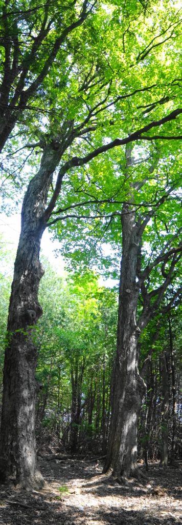
Maple Trees, Manotick Drumlin Forest
Not planning and managing it won’t do. “Just leave it alone,” the City often hears. That might work in the Marlborough Forest, or the Carp Hills. In an urban forest, though, we don’t have that choice. Whether the City plans it or not, people will use and change the forest. People will walk their dogs. Kids will ride their bikes, build forts, and climb trees. Homeowners will dump yard waste along the edges. Over time, a network of shortcuts and dusty, packed paths will develop. Soon the blanket of wildflowers will thin and fray into a scattered patchwork, while invasive periwinkle and buckthorn creep inward from the edges. Where massive maples and pines once aged and rotted, providing homes for woodpeckers and other wildlife, Forestry Services will remove any tree that could be a hazard to public safety. Skunks and raccoons, enjoying the bounty of adjacent yards and gardens, will proliferate. Where shaded forest pools once vibrated with the chorus of spring peepers and tree frogs, a silence will fall.
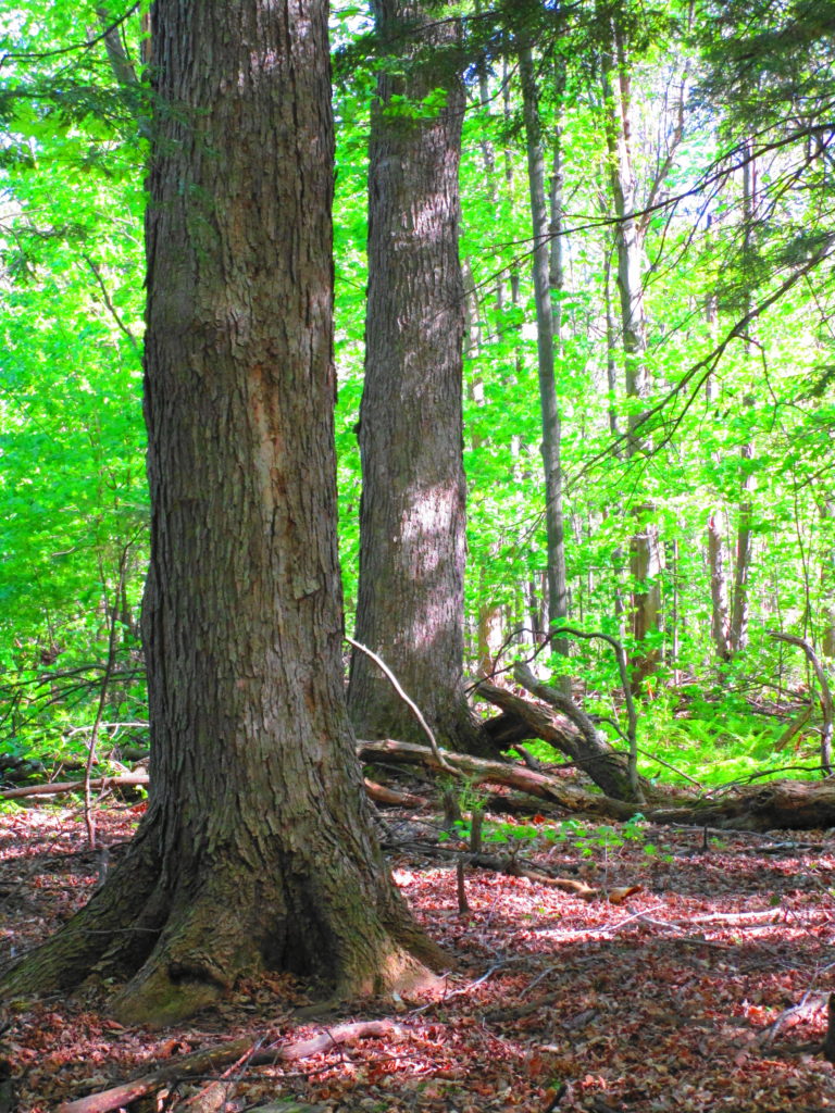
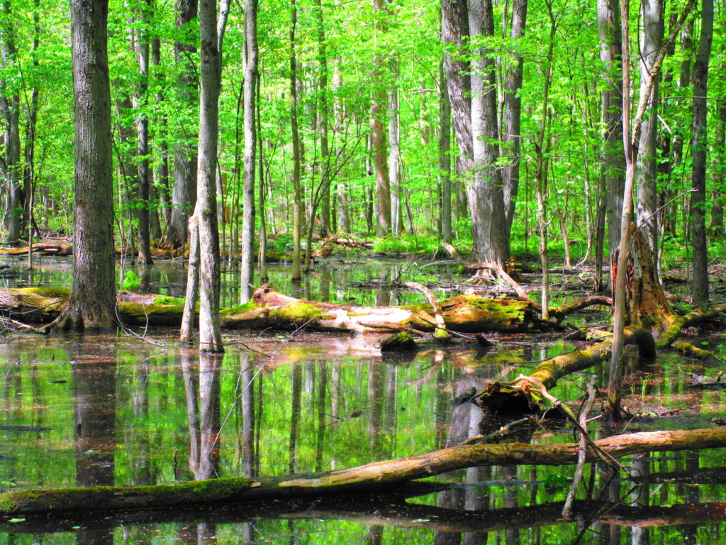
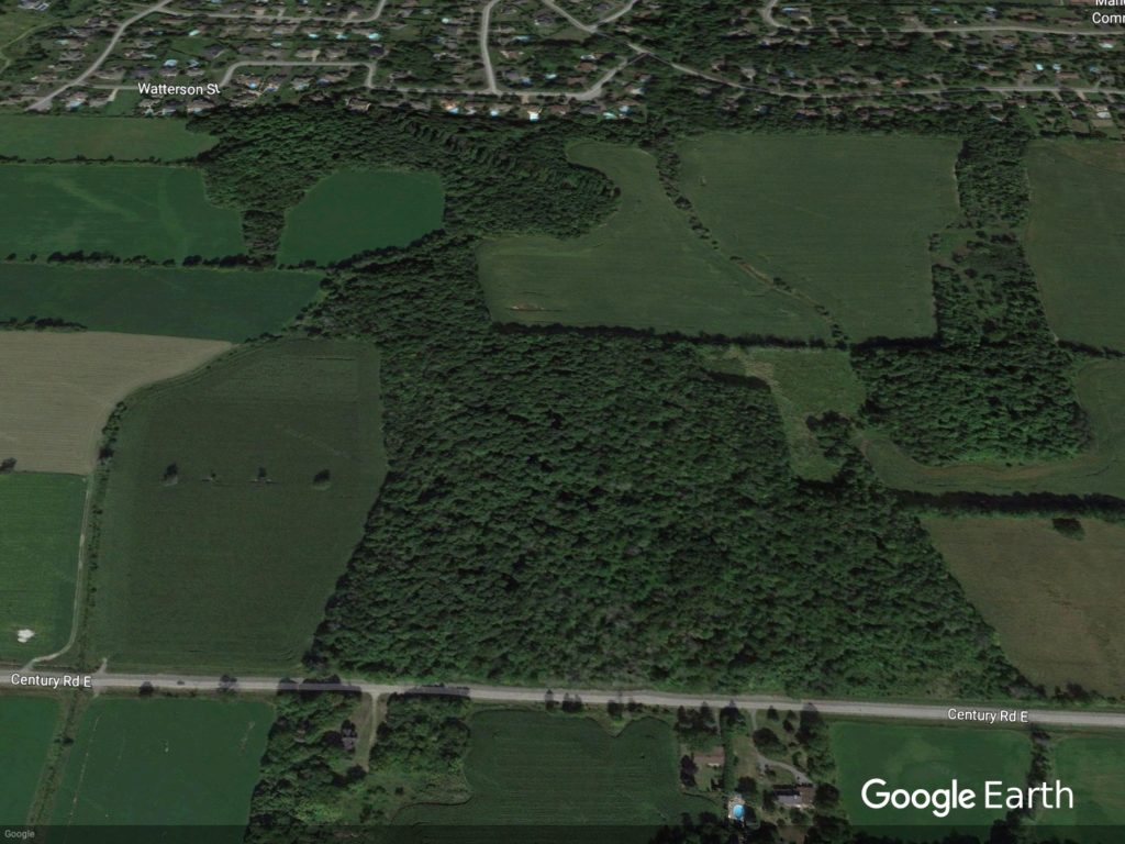
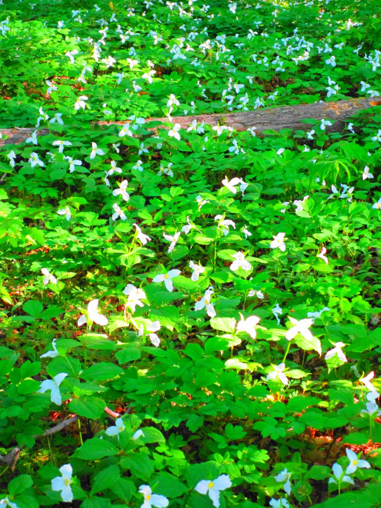
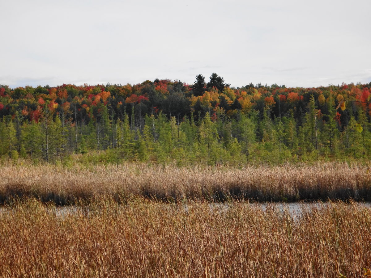
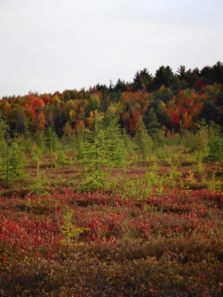
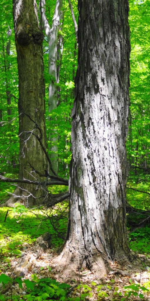
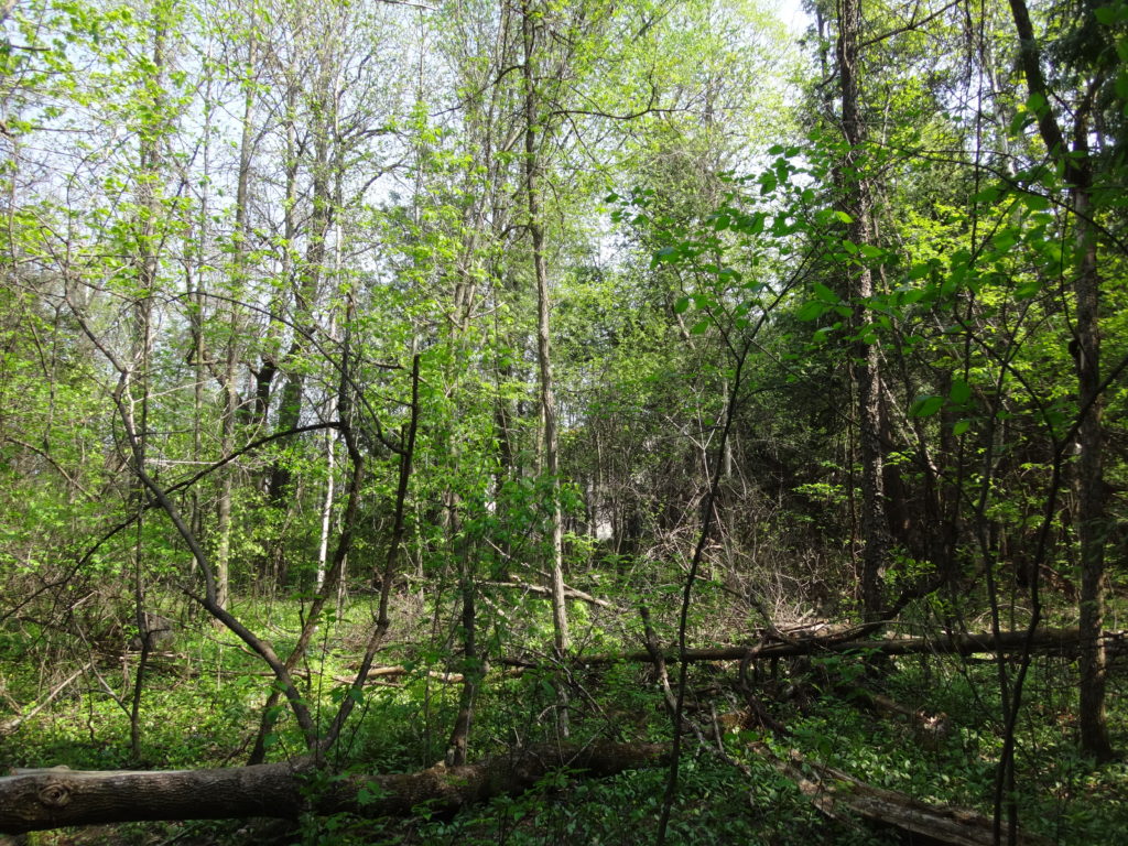
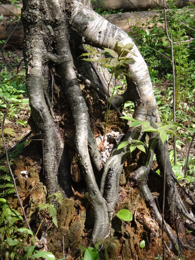
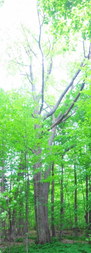
We would like to avoid that fate for the Manotick Drumlin Forest. Acquired by the City from Minto over the winter, the Manotick Drumlin Forest (also known as the Mahogany Forest) comes as close to an old-growth, northern hardwood forest as one can find in Ottawa. In his original evaluation of the forest, the renowned biologist, Dan Brunton, commented on its outstanding beauty, especially the proliferation of wildflowers. In a more recent evaluation, the biologists of Kilgour and Associates noted the remarkable diversity of the woodland. Within its relatively small area, the forest includes not only a mature stand of sugar maple, but also a healthy hemock grove, a red maple swamp, and large specimens of every other tree species commonly found in northern hardwood forests: white pine, beech, yellow birch, basswood, white ash (albeit infected with EAB), black cherry, red oak. Not surprisingly, the Ministry of Natural Resources and Forestry has long identified the forest as a candidate Area of Natural and Scientific Interest (ANSI). Together, the City of Ottawa and Minto have begun planning the preservation of these qualities, while enhancing the value of the woodlot to the surrounding community and the City as a whole.
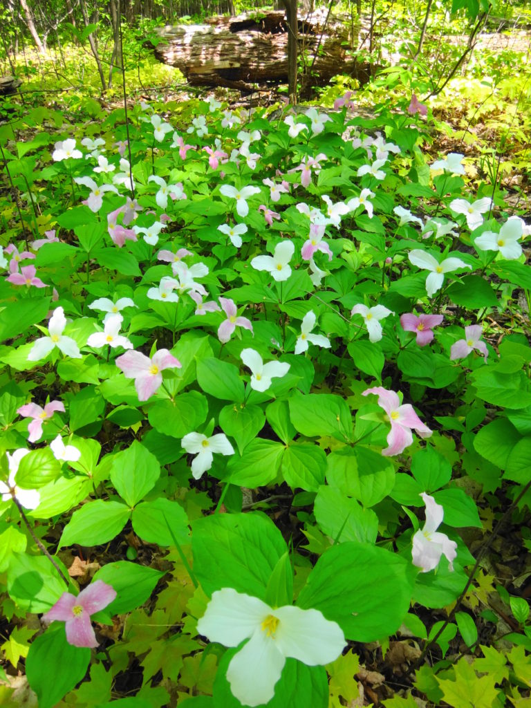
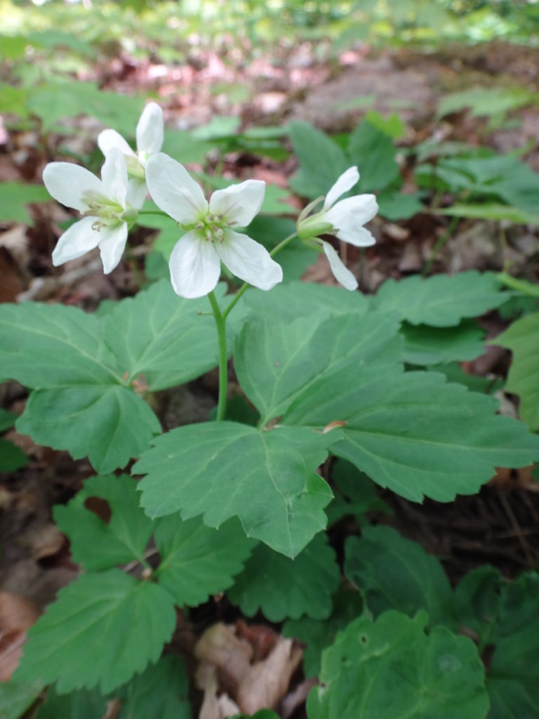
Manotick Drumlin Forest Looking North (excludes the woodland on the right)Trilliums, Manotick Drumlin ForestEnchanter’s Nightshade, Manotick Drumlin ForestDowny Yellow Violet, Manotick Drumlin Forest
Over the next ten years, a new subdivision will grow up on the east side of the forest, with thousands of new homes and residents. The City has a rare opportunity to work now with the land developer to decide how the forest and the new community will fit together. Where will trails go, and how will they look? How can we bring children into the forest and make it safe for them? Where can we allow dogs, and can they be off-leash? Can we turn the forest into a living classroom, and if so, how do we bring students to it? Where will people find quiet, cool shade for contemplation? And, most important, can we accomodate all of these uses while still protecting the trees, wildflowers, wetlands, and wildlife that make the forest unique?
Hemlock Grove, Manotick Drumlin Forest
Some answers already seem apparent. If we don’t plan and create trails, then future residents will create their own. By planning trails now, we can direct traffic away from the most sensitive places and leave space for natural forest processes to continue. By considering the viewscapes along streets and across open spaces, we can highlight the natural beauty of the forest as a centrepiece of the community. By working with the shape of the forest, we can create smaller, more intimate scenes for retreat and gentle appreciation. Most important, in my mind, we must also plan for kids, for the creation of spaces and zones along and within the boundary of the forest, where free play can occur. In doing so, however, we must consider the risk posed by Ottawa’s new status as a Lyme disease area. This emerging issue emphasizes the need for particular attention to “edge management” in the transition zone between the forest and adjacent landscaped areas, both for protection of residents from natural hazards, and for protection of the forest from residents.
Old “Field” Maple in Younger Second Growth Trees, Manotick Drumlin Forest, North SectionSunlit Canopy, Manotick Drumlin Forest
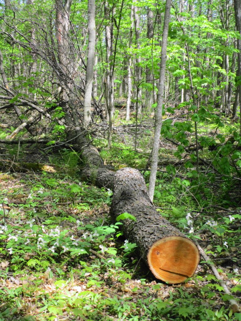
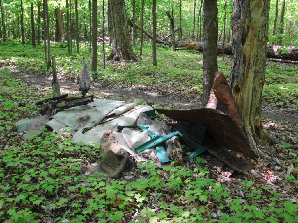
We know that no matter how carefully we plan, we cannot protect the woodlot from all impacts — whether intentional or incidental. Very sadly, unauthorized tree cutting and harvesting of wild plants has already caused substantial damage to the most sensitive portion of the forest. In the end, the fate of the forest will lie in the hands of the community. It will reflect the love and care that the community residents provide. If they value and respect the beauty and wonder of the woodlot, then they will preserve it. If not, then no amount of planning and City management will compensate. As the City and Minto move ahead with planning, we will seek community partners in stewardship and conservation.
Unauthorized Tree Cutting, Mature Black Cherry, Manotick Drumlin Forest
The Manotick Drumlin Forest preserves a glimpse into the forests of the past. Not a pristine glimpse — sadly the chestnuts, elms, and now white ash of old have fallen victim to imported pests and diseases — but one that conveys a strong sense of how the forest must have appeared to the Algonquins. Majestic in scale; intimate in sense; timeless in experience.
With a brief, sunny break in Ottawa’s wet spring weather, I headed out early on an April Saturday morning for a bird watching trip to the west end of the City. I set out just before dawn on my bike, crossed downtown along the Laurier bike lane, then cut down to the Ottawa River bike path by the War Museum. Almost immediately I stopped to watch several rough-winged swallows feeding over the channel by Albert Island, darting occasionally into the drainage holes in the concrete channel walls.
Carrying on, I quickly arrived at Lemieux Island, where I stopped to check out the colonies of ring-billed gulls on the smaller islands. A brown thrasher chattered in a copse of trees at the entrance of the causeway, and white-throated sparrows moved through the underbrush. Robins foraged in the grass. A cardinal sang in the sumac on the other side of the lane, and red-winged blackbirds piped all along the shoreline. Out at the lookout, I spotted a black-crowned night heron perched amidst the gulls, and the black spikes of cormorants on the furthest island. A large flock of tree swallows hunted over the swift, roiling river.
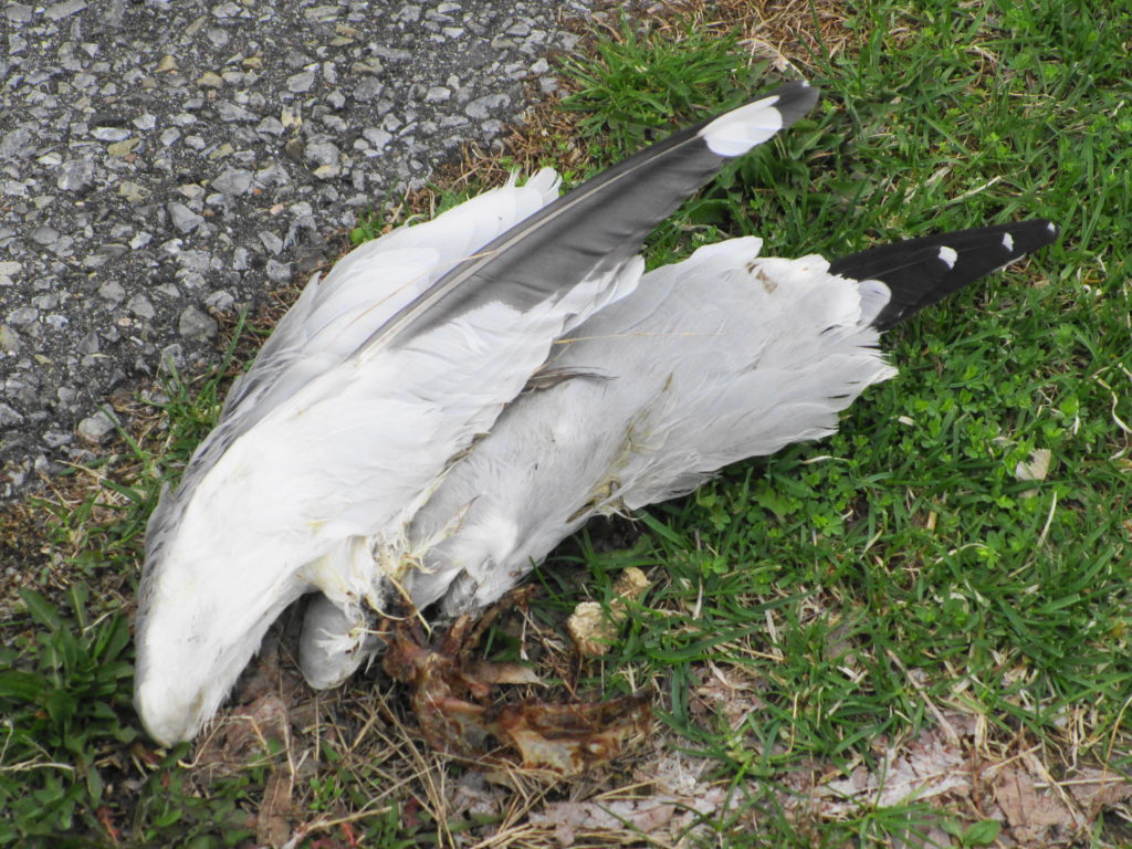
Leaving the island, I continued west along the river, checking off puddle ducks and diving ducks, until just before Mud Lake at Britannia, where a gull carcass caught my eye. Lying beside the path, all that remained of it were the two wings and a scraps of bones. I immediately thought of a description from J.A. Baker’s beautiful masterpiece of natural history, The Peregrine.
“A peregine kill can be easily recognized. The framework of a bird is left on its back, with the wings untouched and still attached to the body by the shoulder-girdles. The breastbone and all the main bones of the body may be quite fleshless. If the head has been left, the neck vertebrae will usually be fleshless also. The legs and back are frequently left untouched. If the breast-bone is still intact, small triangular pieces will have nipped out it by the peregrine’s bill.”
Peregrine Kill
Okay… not the most poetic extract of
Baker’s book, but based on this observation and others over the years, a pretty fair description.
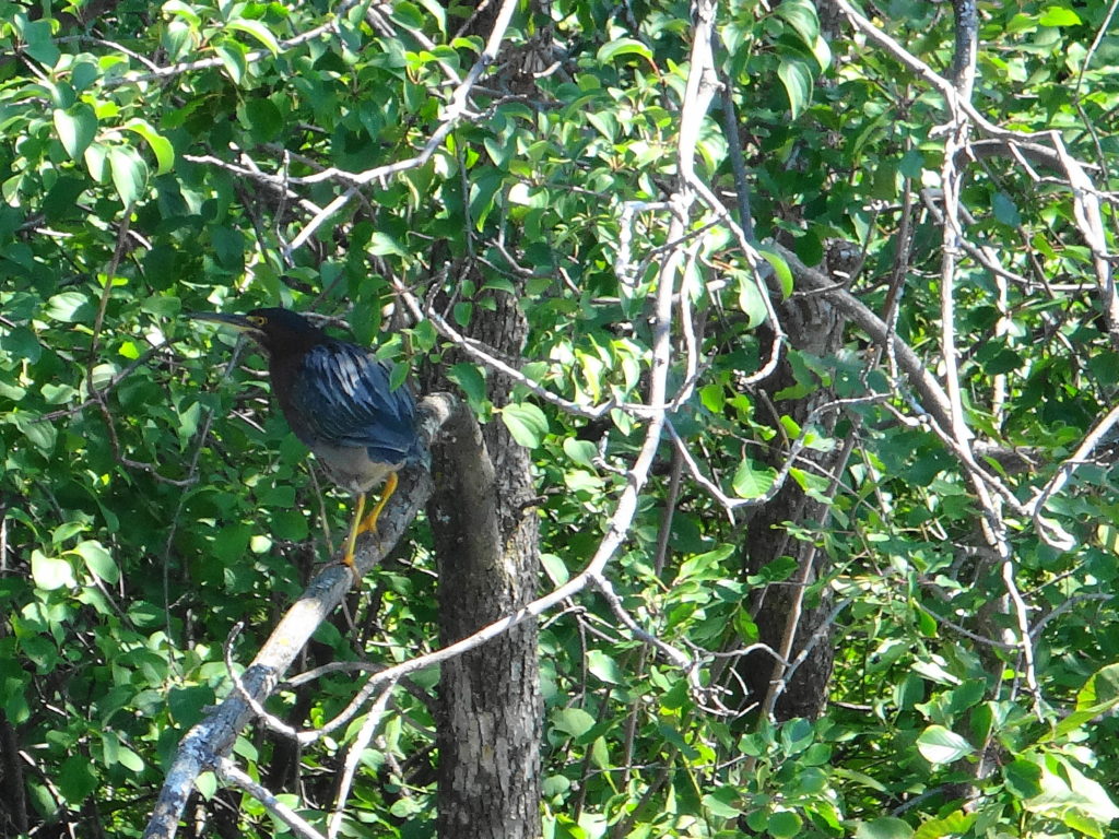
I arrived at Mud Lake early, while only a few keen wildlife photographers were prowling the paths. I went looking first for Blanding’s turtles in the well-screened east swamp, where I’d seen them basking in previous years. But the light was still too thin and the air too cold for basking. Pushing my bike along the path toward the boardwalk and the main pond, I spotted a pair of black-crowned night herons pass overhead. Chickadees flitted along beside me on the trail, until they realized that I had no sunflower seeds to feed to them. A pair of crows chased a raven.
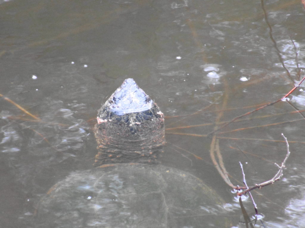
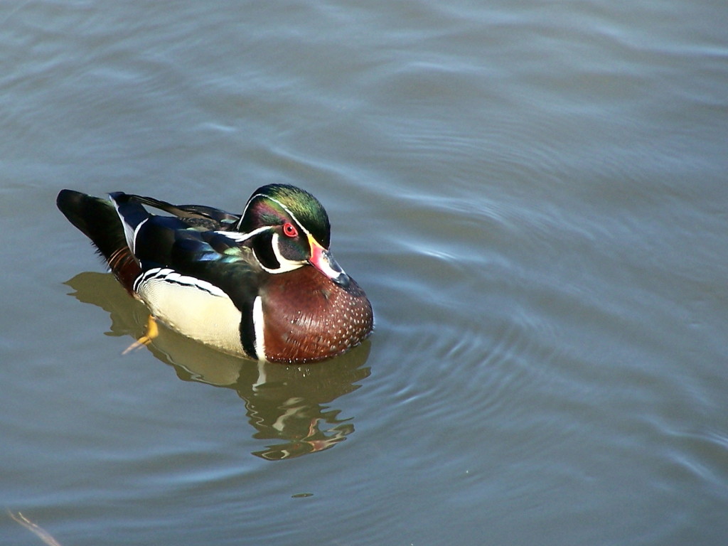
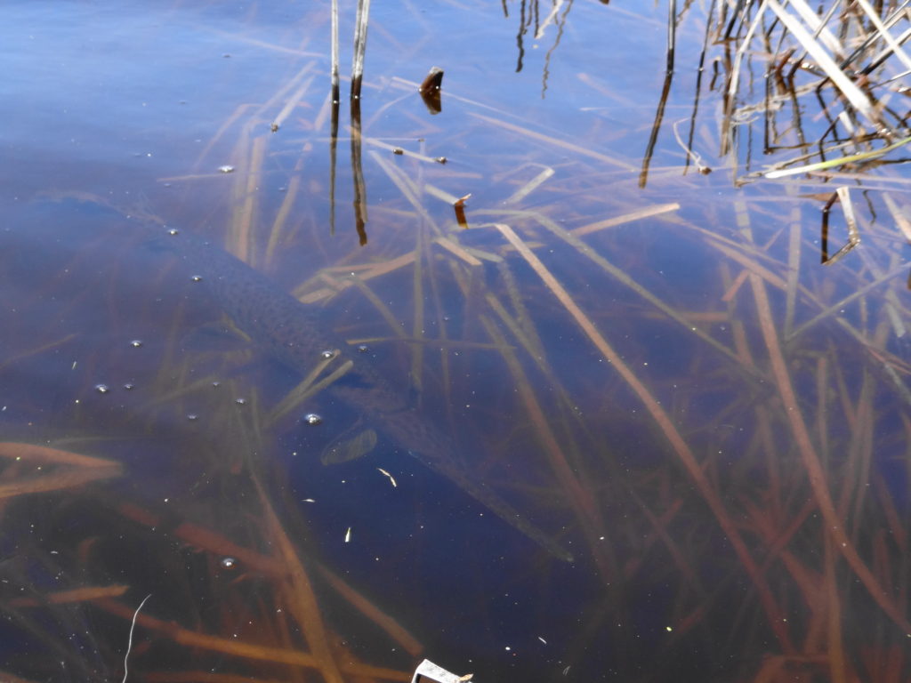
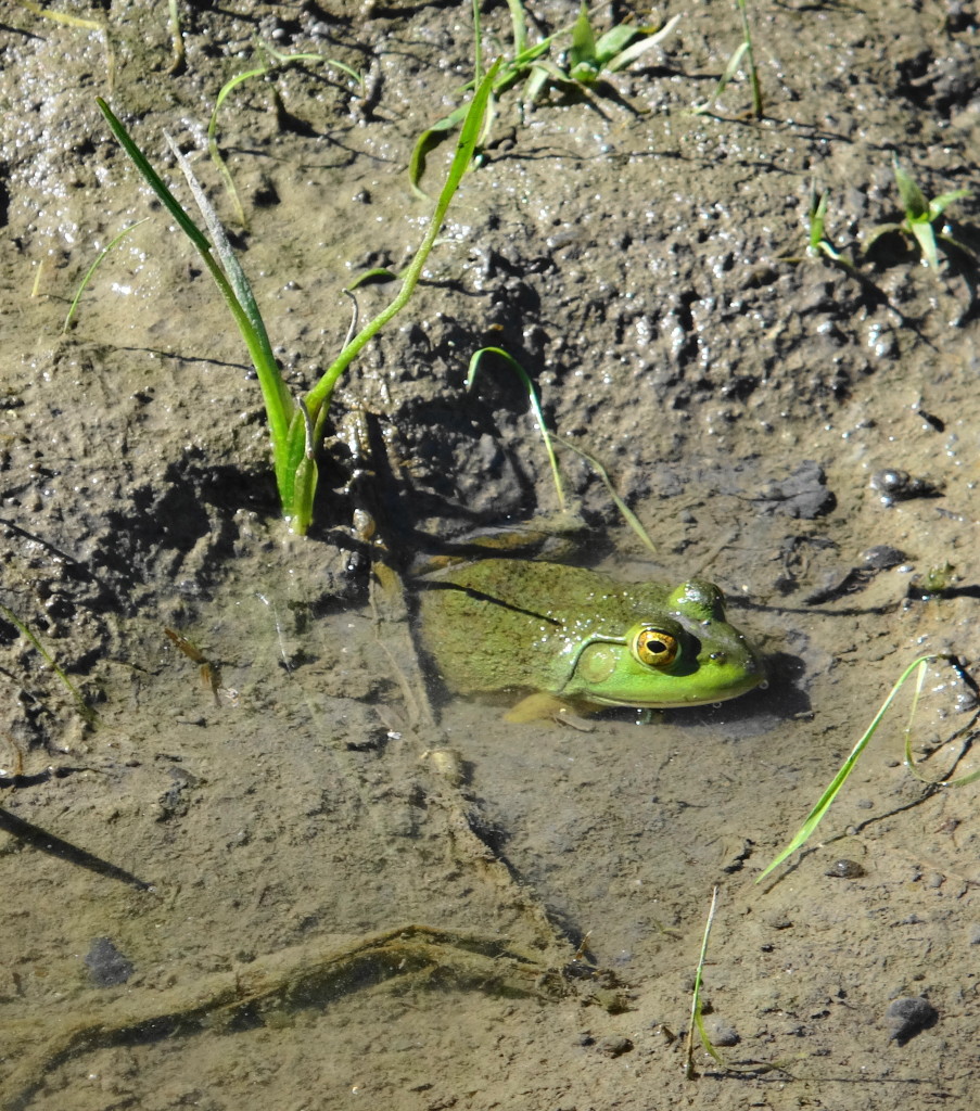
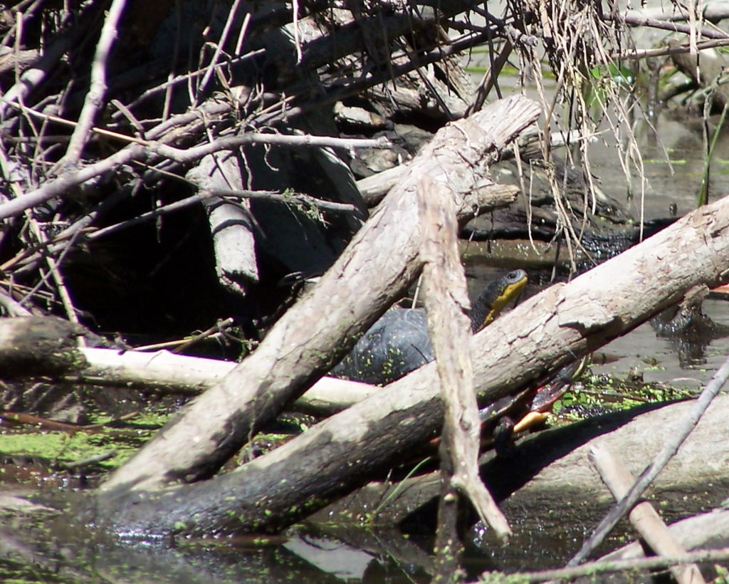
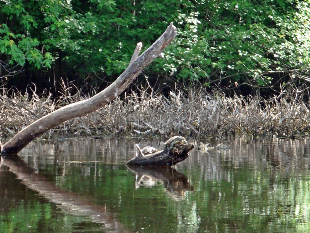
At the boardwalk, I hoped again to see some early basking turtles. But no luck. Several pairs of wood ducks swam amidst the maze of logs, broken branches and downed trees in the swamp on the inside of the boardwalk, while raucous geese squabbled over nesting sites along the shore of the pond. As I prepared to move on, a pair of northern flickers flew up to a snag beside the swamp, checking out the cavities. I had just resolved to leave them in peace, when I noticed a stir in the water and a tell-tale trail of bubbles. A few minutes of patient waiting was rewarded with the sight of large snapping turtle rising from the bottom of the pond for a breath.
Mud Lake Snapping Turtle
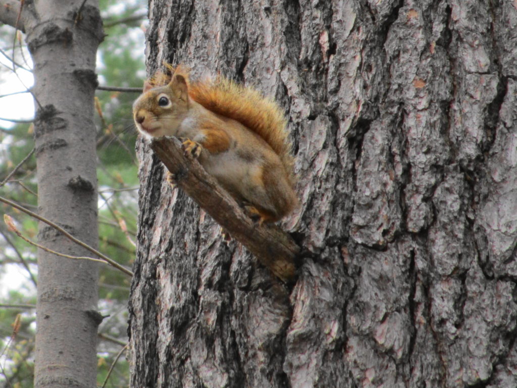
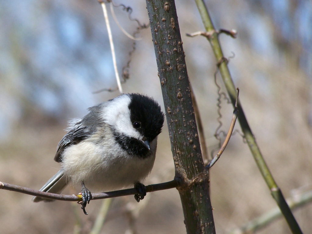
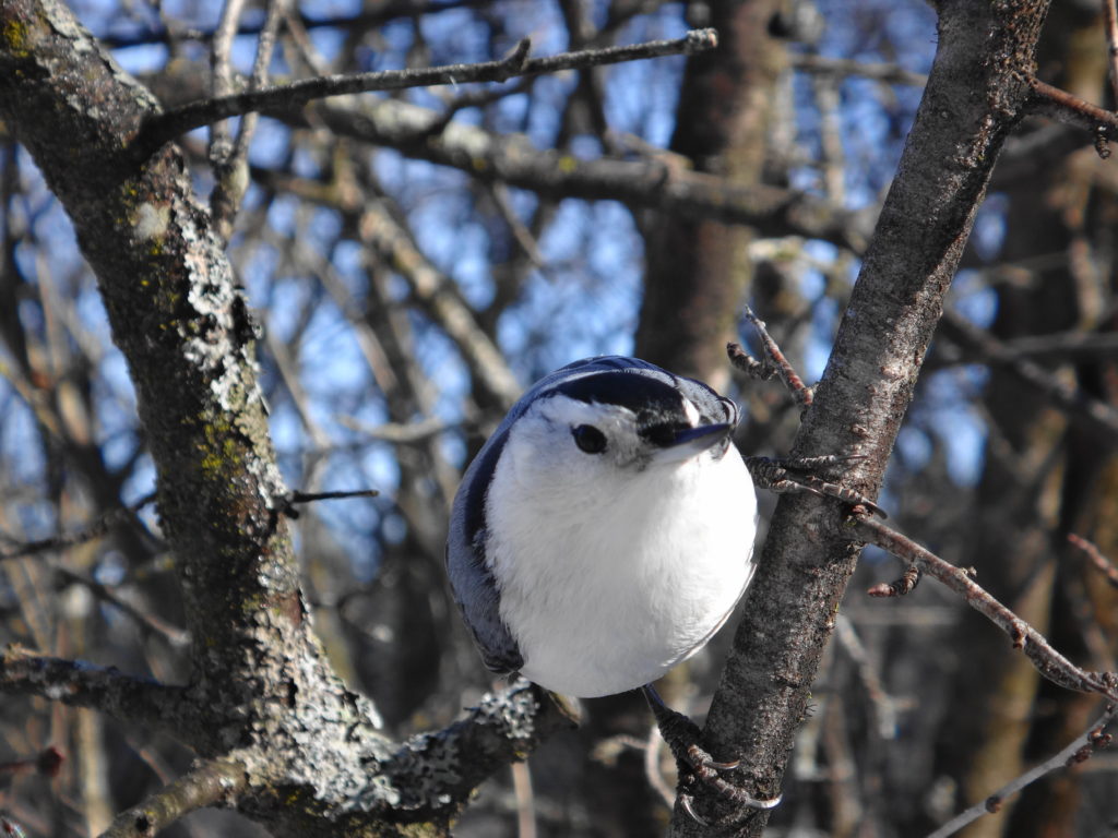
I slowly worked my way clockwise along the shore of Mud Lake, listening to the morning chorus. Goldfinches chittered overhead. A pine warbler buzzed in a tall pine. Yellow-rumped warblers flitted and sang in the high branches. Nuthatches and downy woodpeckers methodically moved from tree to tree, searching the trunk of each for insect morsels. To my disappointment, I found no trace of the screech owl that had made its home in the woods the past two years. Perhaps a little later in the spring?
Red Squirrel
Leaving my bike locked at the trailhead at Cassels Street, I walked the ridge along the river shoreline. From one of the lookouts, I could see across Deschenes Rapids to the large gull colony at the old mill site on the far shore. With my binoculars, I made out the larger, white silhouettes of several great egrets perched amidst the gulls. At the south end of the ridge, I spent almost half an hour lingering around the conifers in hopes of getting some good photographs of the enthusiastic yellow-rumped warblers feeding in their branches with a solitary palm warbler. While a small crowd of [other] grey-haired photographers fired off clusters of shots from a fortune of tripod-mounted, digital SLRs and long lenses, I waited for birds to come close enough for my pocket compact.
Yellow-rumped Warbler
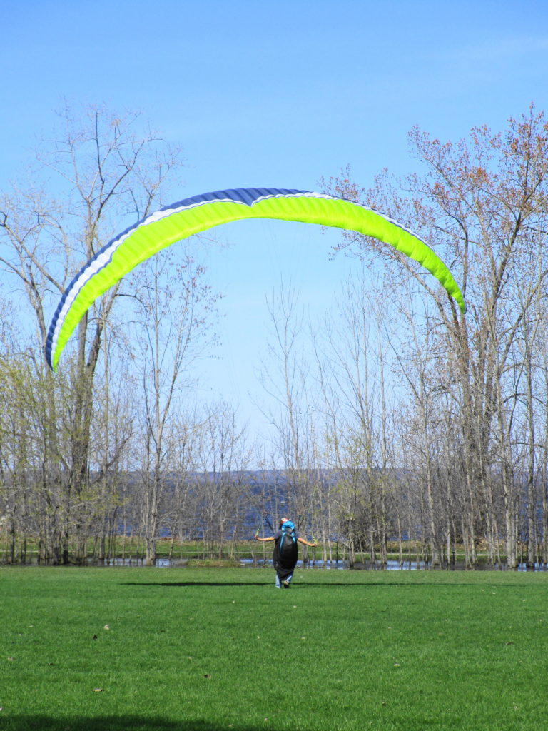
As usually happens, I’d lost track of time in the woods. Feeling hungry, I rode up to Richmond Road to grab some lunch, after which I returned to the Ottawa River trail and continued west. On one of the lawns at Britannia Park, someone was testing a parasail in the stiff wind. I passed Andrew Haydon Park and followed Watt’s Creek pathway to Moodie Drive, where I crossed into the National Capital Greenbelt. I continued following the Watt’s Creek pathway west to March Road, where I turned north to Herzberg Road and March Valley Road.
Parasail Practice at Britannia Park
When I first came to Ottawa, more than 25 years ago, March Valley Road provided some of the best bird-watching in Ottawa, especially for hawks and owls. It may be the last place in the City where I saw a short-eared owl, and I still catch glimpes of northern harriers over the Department of National Defence lands. Over the years, however, development has crept ever closer. Suburban subdivisions now lie only a few hundred meters distant, kept at bay only by the restrictions placed around the Department of National Defence firing range. However, it still offers a few good vistas across the fields of the base toward the silver maple swamps shielding Shirley’s Bay and the Ottawa Duck Club properties, including a distant view of Ottawa’s only active bald eagle nest. On this day, tree swallows filled the air above Shirley’s Brook, and the clean white head of an adult bald eagle rose above the rim of its nest.
Having ridden to within a few minutes of the South March Highlands and the Carp River Valley, I decided to mix pleasure with a bit of work. I headed up Terry Fox Drive, past Old Second Line Road, and then turned my bike on to the construction access road into the KNL development property to inspect some of the perimeter fencing.
Even having witnessed the transformation of the landscape on the KNL property during this winter’s cutting, I still find the view quite stark and shocking. Where a mature forest once stood, a expanse of stumps and scarred earth now remains. I find little consolation in the knowledge that the destruction of this forest was ordained more than twenty years ago, and that I played my role in protecting what remains. Perhaps when homes fill the landscape, families fill the homes, and neighborhood children ride the surrounding nature trails, I’ll feel better about the outcome.
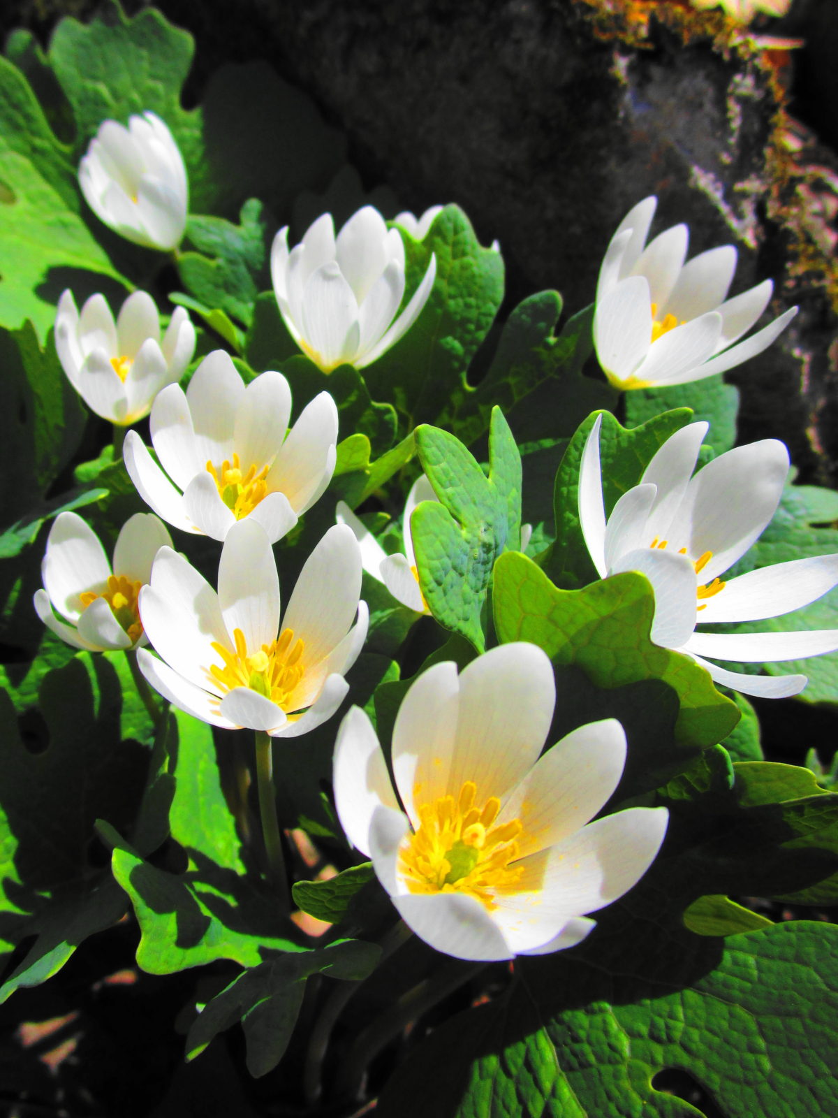
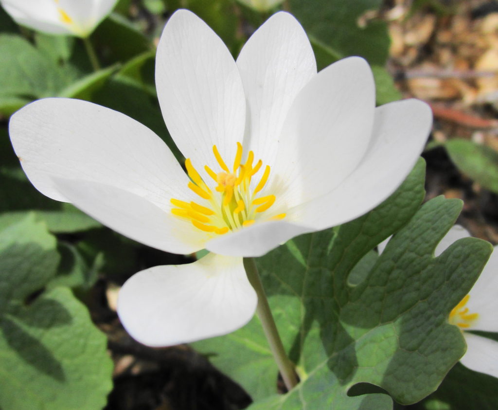
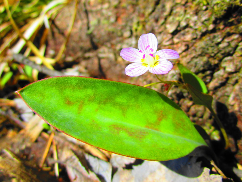
Retained Pond on KNL PropertyBloodroot in KNL Natural AreaTrout Lily in KNL Natural AreaSpring Beauty in KNL Natural Area
After checking out the fencing and scouting a retained pond for turtles (two painted, no Blanding’s), I continued along Terry Fox Drive to the Carp River Restoration Area. Like the KNL lands, the Carp River Restoration Area has a controversial development history. Notwithstanding its history, the restoration looks terrific. One of the pathways still needs completion, but the Carp has been returned to a more natural, sinuous form, and the new wetlands have been landscaped. With the spring flood only just having dropped (now returned!), the restoration area consisted mainly of bare, brown earth and mud. But in my mind’s eye, I could see it in the future, with the shrubs, cattails, and reeds in full growth and a cacophany of waterfowl side-slipping into the ponds.
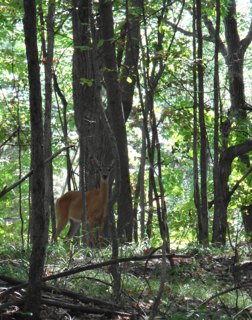
As I was contemplating this sight, I had my best moment of the day. While I looked out over one of the muddy ponds, a flock of six lesser yellow-legs flew across the water to land on shore at its edge. A instant later they scattered upward as a brown, blurred shape swept through, knocking one of them down. A peregine! The falcon whirled tightly back around, but its first strike had not been clean; the yellow-legs was back in the air. The peregine jinked quickly after it, but again the yellow-legs evaded, striking the water in the process. The prospect of a possible dunking seemed to deter the peregrine, which quickly gave up the chase, and climbed away to the west and out of sight. The whole encounter lasted only a few seconds. In my excitement, I hadn’t even thought of reaching for my camera — not that I could have captured anything at that range.
I waited awhile to see if either the yellow-legs or the peregrine would return. But apart from some mallards and geese, my only sighting of interest was a white-tailed deer in a thicket swamp on the far side of the river.
With the sun now sliding steadily downward, I reluctantly turned my bicycle back towards home. Heading along Campeau Drive, I detoured quickly into the Kanata Centre Woods, where a short pathway winds over a pretty rock knoll and past a lovely, hidden pond. The pond seemed very quiet in the late afternoon, made more so by the song of a solitary Cardinal in the trees across the water.
Kanata Centre Woods
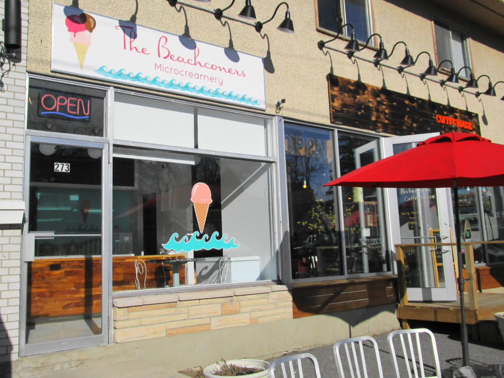
Reaching March Road, I cycled back to the Watts Creek pathway and retraced my route toward downtown. By the time that I reached Britannia, however, I was ready for a refreshment. I’d spotted the “Beachconers Microcremery” in the morning, beside the cycle path. Stopping now, with my muscles weary and my throat dry, I enjoyed what must be Ottawa’s best vanilla bean ice cream — or so it seemed at that moment.
Beachconers Microcremery
I arrived home just after sunset, wheeling up to the back door to see Sue through the window, sitting at the kitchen table. After a welcome supper, I then soothed my muscles and joints with a hot bath. Altogether, a very satisfying day.
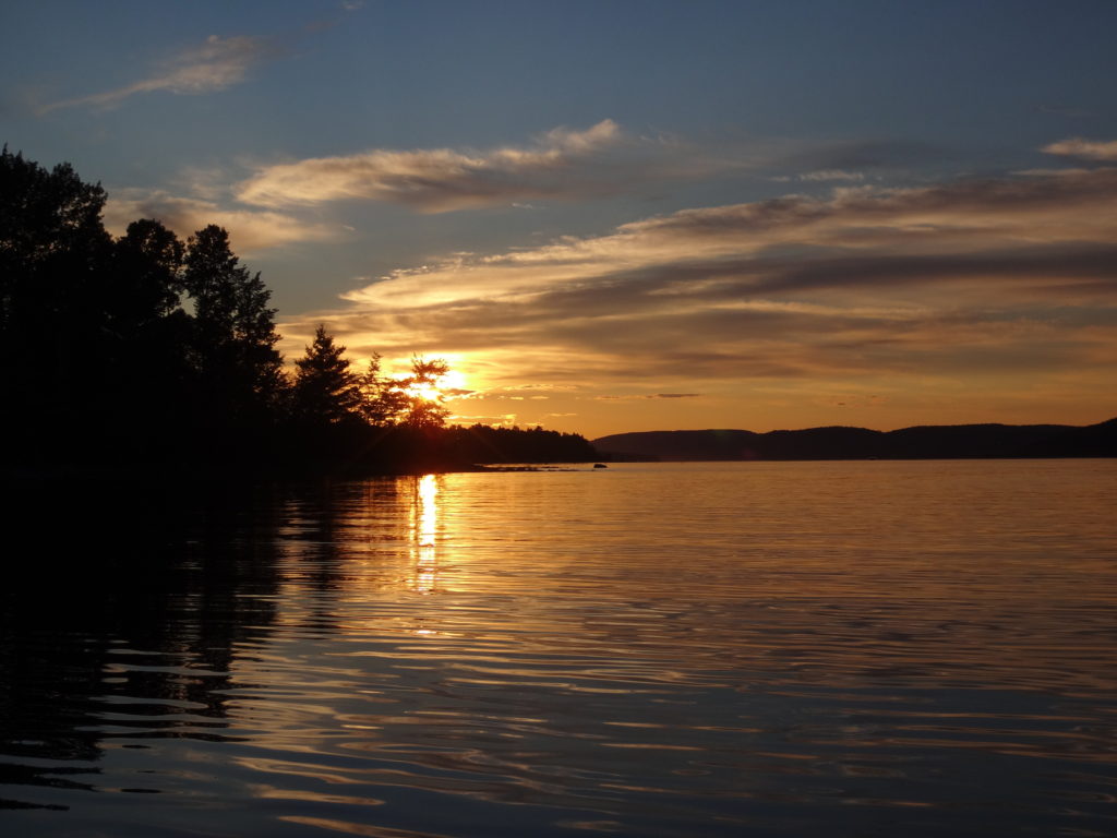
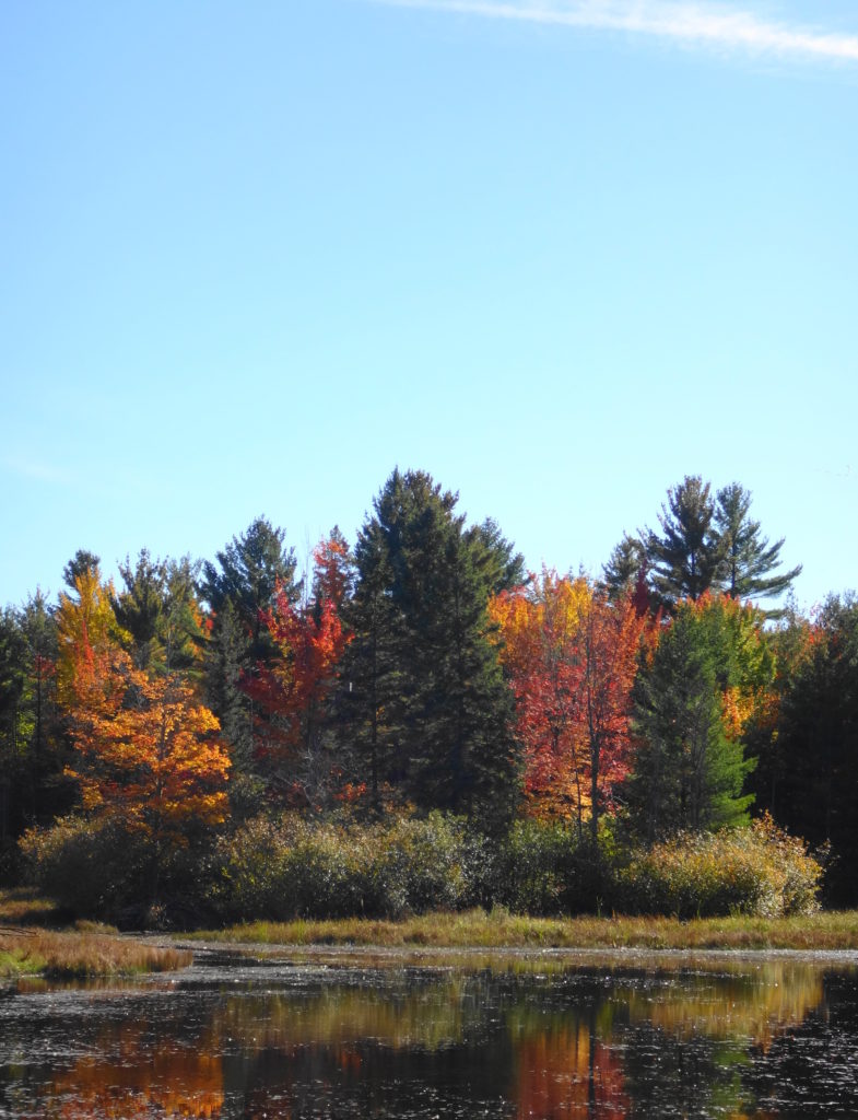
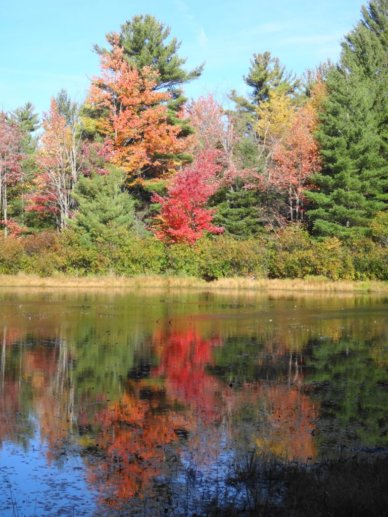
An evening calm has settled over the Ottawa River as I paddle into a burnished, copper sunset. I trail a fly behind the canoe, more from habit than hope. If I really wanted to catch fish, I would trail a spinnerbait for pike, or rig a artificial minnow for walleye. Mostly, I just enjoy the quiet, made more pronounced by the occasional powerboat thrumming in the distance. On the Quebec side, I see lights begin to glimmer on the houseboats beached at the point. Laughter carries across the water. Nearer, on my left, I see a whitetail deer come shyly down to the beach in the deepening dusk, as a wood thrush begins to flute in the woods. Abruptly, the sandy bottom rises below my canoe. I ship my paddle and quickly wind in my fly. Then I continue into the bay toward the boat launch, passing Lamure Beach and threading through the moored boats. I pull out the canoe and drag it up to the trees with the others. Then I stroll through the peaceful streets until I see home and the glow of warm, yellow light through the blinds of the large front window.
Sunset, Deep River
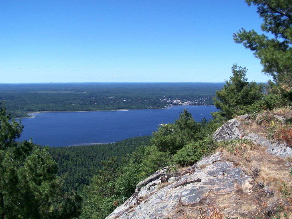
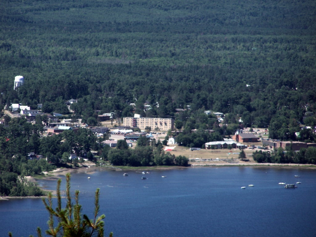
The town of Deep River lies an easy two hour drive northwest of Ottawa along Highway 17. Sandwiched between the highway and the Ottawa River, it trails along the shoreline for a couple of kilometers. The usual Tim Hortons, Canadian Tire, motel and small strip malls service the highway. A busy grocery store, post office, shops, cafes, school, and town office anchor the small, downtown core, which sits just behind the waterfront, overlooking the river. The marina and yacht club lie only a brisk two minute walk away. Tidy residential neighbourhoods lie either side of downtown — a mix of small, renovated, post-war bungalows and more modern, multi-story houses. The Deep River Regional Hospital marks the east side of town, while the Mount Martin Ski Club sits on the west side.
Deep River Viewed from Mount Martin, QuebecDeep River Waterfront
I spend at least two weeks every summer in Deep River with my wife and our sons. We make shorter visits throughout the year. I spend most of that time outside, exploring the local forests and wetlands, or paddling the shoreline of the Ottawa River. Deep River is a microcosm of whole Ottawa Valley, with almost every kind of ecosystem, habitat and wildlife species within easy reach.
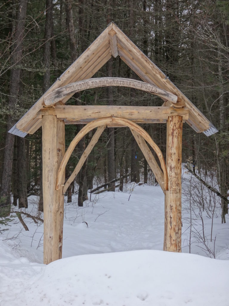
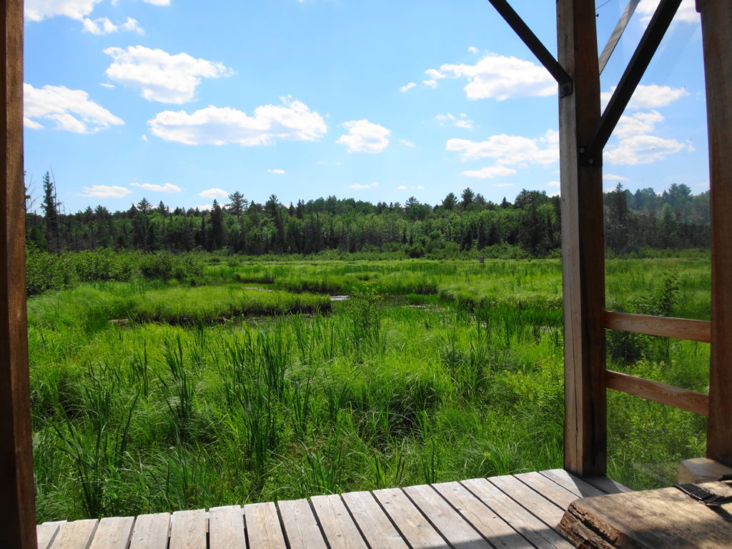
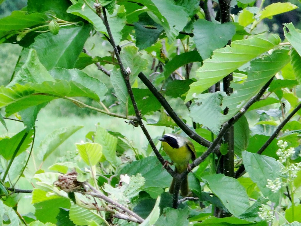
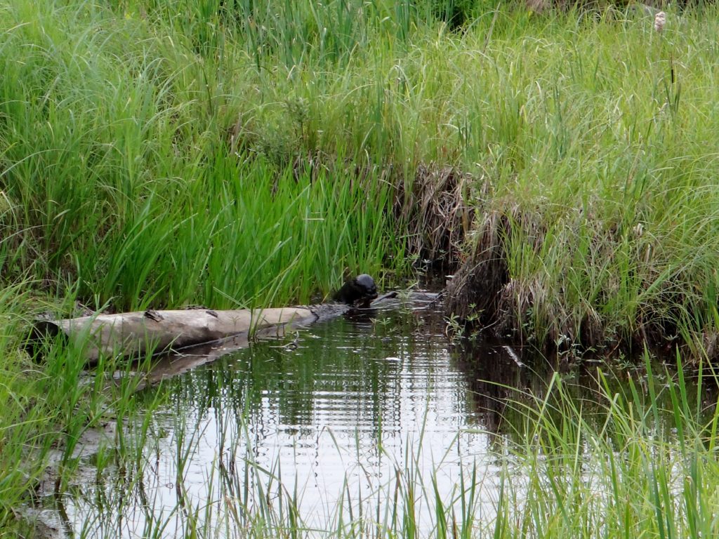
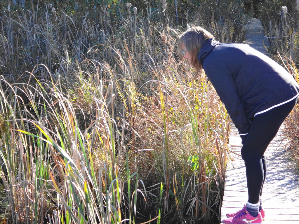
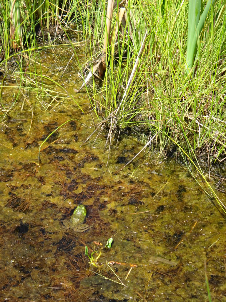
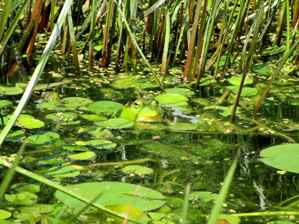
Most trips to Deep River begin and end at the Four Seasons Forest Sanctuary, on the southeast side of the town. This community-owned forest is part of an enormous, contiguous, protected natural area that includes the restricted lands surrounding the Canadian Nuclear Laboratories (formerly AECL) in Chalk River, the Petawawa Research Forest, the training areas of Canadian Forces Base Petawawa, and Algonquin Park. A short hiking loop begins across from the hospital and leads to a pretty, covered shelter overlooking a wetland. Even on the buggiest days, the squadrons of dragonflies hunting along the marsh edge succeed at keeping most mosquitoes at bay. Common yellowthroats sing in the thickets, while swamp sparrows skulk in the reeds. An American bittern grunts deep in the marsh. A blue heron fishes along the meandering stream on the other side. Turtles and frogs bask in the small pond by the shelter, where an occasional beaver, muskrat or otter makes an appearance. I’ll bring a lunch and meditate on the scene, read a book, or bring a guitar. Almost always, I’m on my own.
Four Seasons Forest Sanctuary EntranceMarsh Shelter, Four Seasons Conservation ForestCommon Yellowthroat, Four Seasons Conservation ForestOtter, Four Seasons Conservation Forest
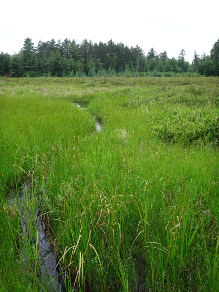
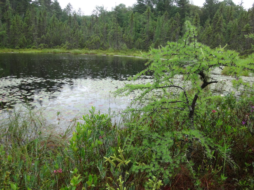
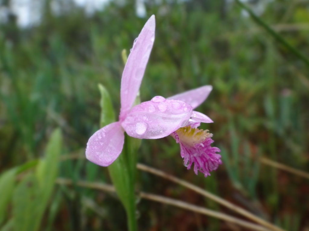
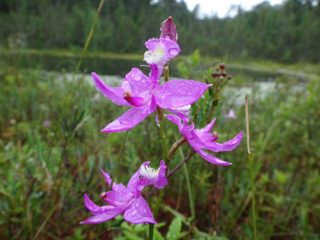
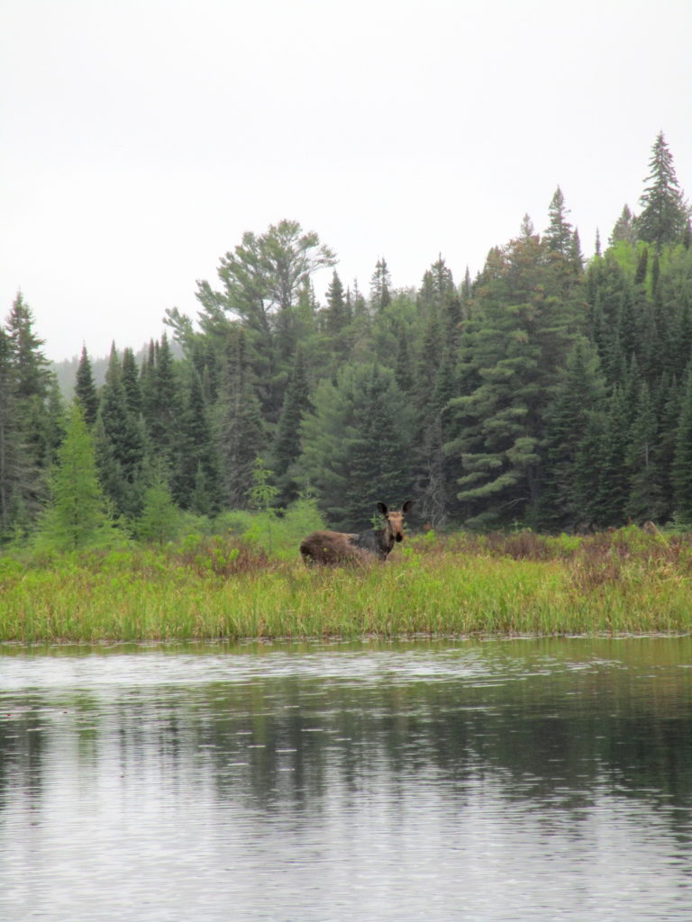
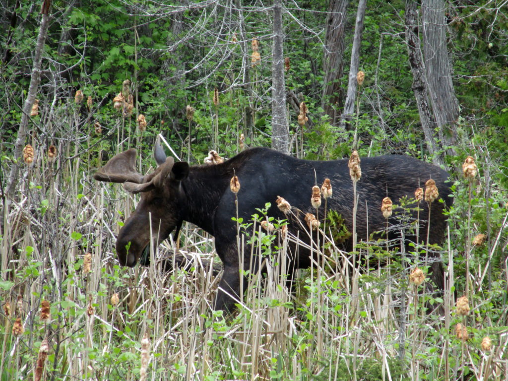
Longer trails lead deeper into the sanctuary, passing a variety of habitats: upland forests of white pine, maple and beech; darker forests of spruce and balsam fir; pretty riparian marshes, and dark forest pools; bright, grassy clearings, and shadowed fern gardens. One of my favourite destinations is Cranberry Lake, which stretches back into the AECL lands. At the end of a half hour hike, a small bench looks out over the lake and a pretty, floating fen mat. In late June and early July, white waterlilies carpet the water, and pink orchids (swamp pinks and rose pogonias) dot the fen. I often skip the bench and stretch out under the white pine that graces the shoreline, closing my eyes for a nap in midday sunshine. Occasionally I lift my head and look down the lake, hoping to see one of the moose that have found a haven on the AECL lands.
Cranberry Lake, Deep River
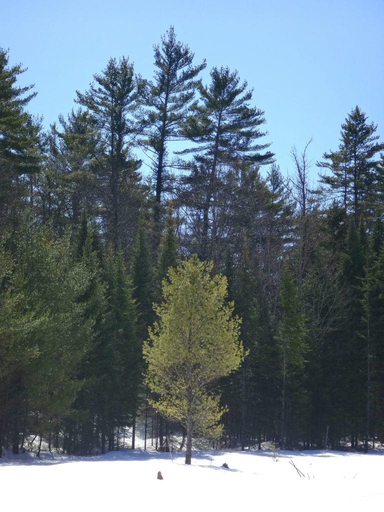
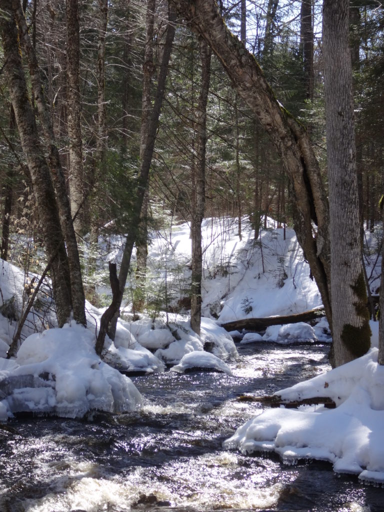
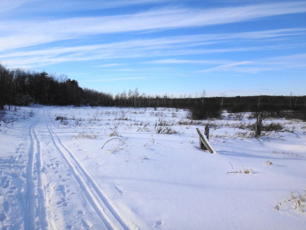
During the winter, the trails of the Forest Sanctuary become an active cross-country ski and snowshoe network. Trails are well marked and maintained by the Deep River Cross Country Ski Club, who put on an active recreational and social program through the winter. The forest and wetlands take on a different kind of beauty and quiet in the winter, always reminding me of the Robert Frost lines, “the only other sound’s the sweep, of easy wind and downy flake.”
Winter Beaverpond, Four Seasons Forest SanctuaryWinter Creek, Four Seasons Forest Sanctuary
The Petawawa Research Forest, just outside nearby Chalk River, also provides wonderful opportunities for exploration. The Research Forest Museum, now inactive and partly abandoned, still remains open to the public — albeit quickly deteriorating. An interpretive trail still loops from the museum through the forest, and an old boardwalk still offers a short, but pretty walk along the shore of the Chalk River. A maze of access and logging roads leads deep into the forest, past a myriad of different tree communities, streams and wetlands. In particular, the research forest includes a large number of well-developed fens and bogs, some of which are very accessible and yet still virtually unknown and pristine. They provide a unique opportunity for a careful, conscientious visitor to explore the flora and fauna of these marvelous ecosystems. Unfortunately, summer visitors can expect to be trailed by a cloud of deer flies, which swarm from the sandy roads and trails in numbers that are hard to comprehend. Once off the roads and into the forests and wetlands, however, the deer flies give way to the usual mosquitoes and blackflies, which respond much more readily to repellent. Of course, sensitive individuals can always choose to wear bug hats or bug shirts. Either way, the research forest is worth a visit.
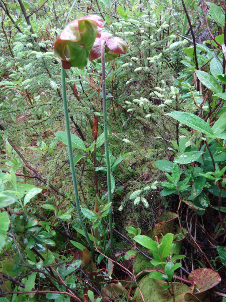
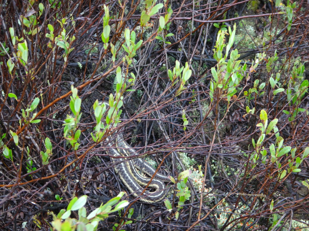
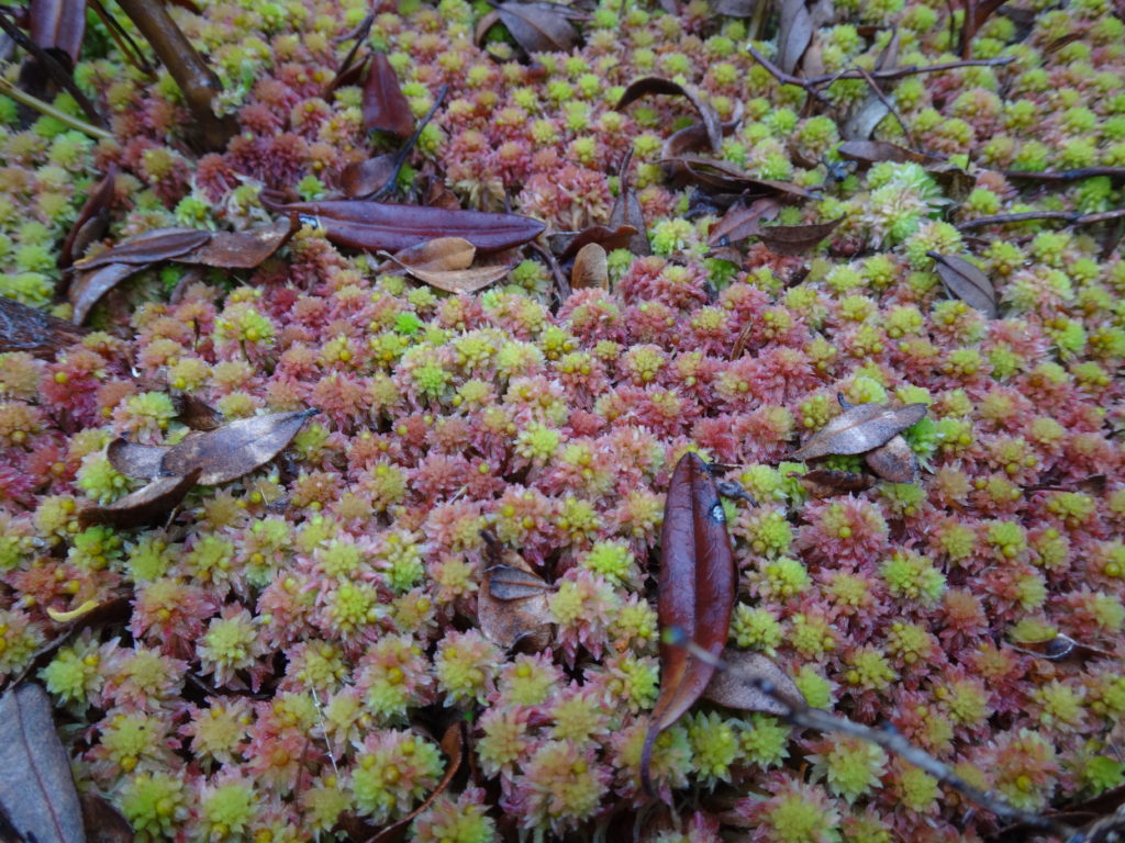
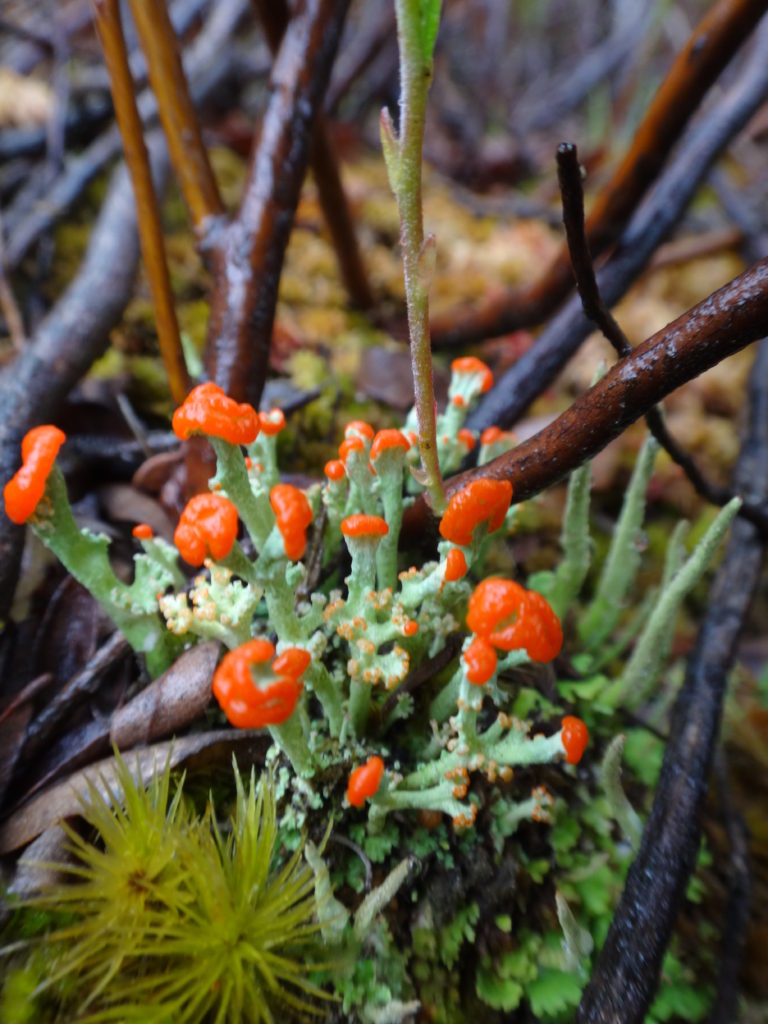
Raised Bog, Petawawa Research ForestSedge Meadow and Raised Bog, Petawawa Research ForestRich Fen, Petawawa Research ForestRose Pogonia, Petawawa Research ForestSwamp Pink, Petawawa Research ForestNorthern Pitcher Plant, Petawawa Research ForestGarter Snake on Bog Hummock, Petawawa Research ForestSphagnum Moss in a Bog, Petawawa Research ForestLichen in Bog, Petawawa Research Forest
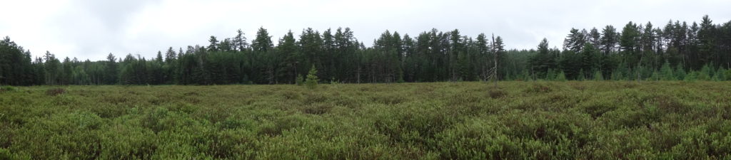
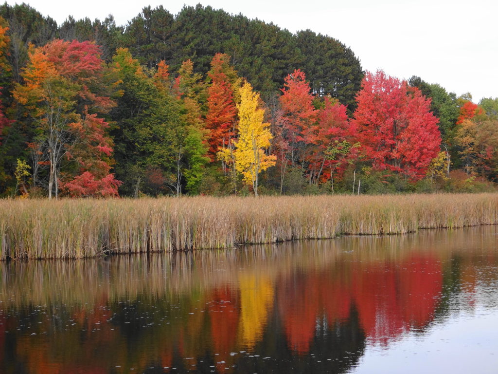
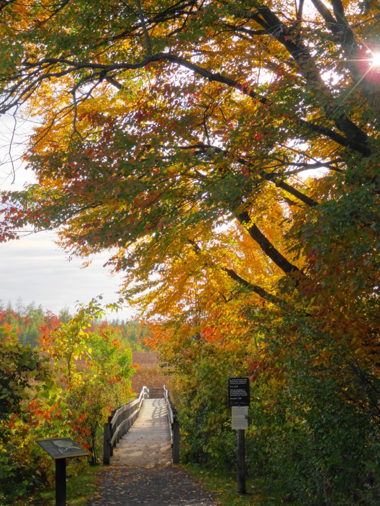
South of the Canadian Shield, Ontario has very few true bogs. The two largest occur in Eastern Ontario, anchoring both ends of a 60 km long, regionally-significant, natural landscape corridor known as the Bog-to-Bog Link. At the east end of this link lies the Alfred Bog — Southern Ontario’s largest. At the west end of the link lies Mer Bleue — Southern Ontario’s second largest and, arguably, most accessible and famous.
Mer Bleue Beaverpond
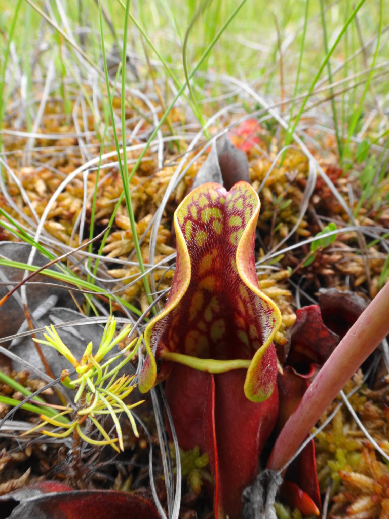
Mer Bleue occupies an old, post-glacial flow channel of the Ottawa River. Two forested ridges — immense, old river sandbars — thrust into the heart of the flat, peaty wetland. Cold, nutrient-poor groundwater seeping through the sandy ridges, along with the poor drainage of the old clay channel, creates the perfect conditions for the formation of peat, which lies almost 10 metres deep in places. Toward the centre of the wetland, the peat has built up into an almost imperceptible, low dome. Out of contact with the underlying water, most of few, hardy plant species growing in the centre of the raised peat must survive entirely on trace nutrients deposited by rain, snow and dust. One or two carnivorous species, like the pitcher plant, supplement that diet with captured insects. This reliance on aerial deposition of nutrients is what makes Mer Bleue a true bog.
Mer Bleue BogPitcher Plant
Mer Bleue welcomes visitors in any season. In the spring, the ridges attract migrating songbirds, while the watery moat along the edge of the peat mat (technically known as a “lagg”) attracts migrating waterfowl. Hawks hunt high over the ridges or low over the wetland. A dozen or so sandhill cranes stop in the area annually on their way north, with a few perhaps nesting somewhere deep within the bog. Beavers and muskrats ply the waters in the morning and evening to a chorus of frogs.
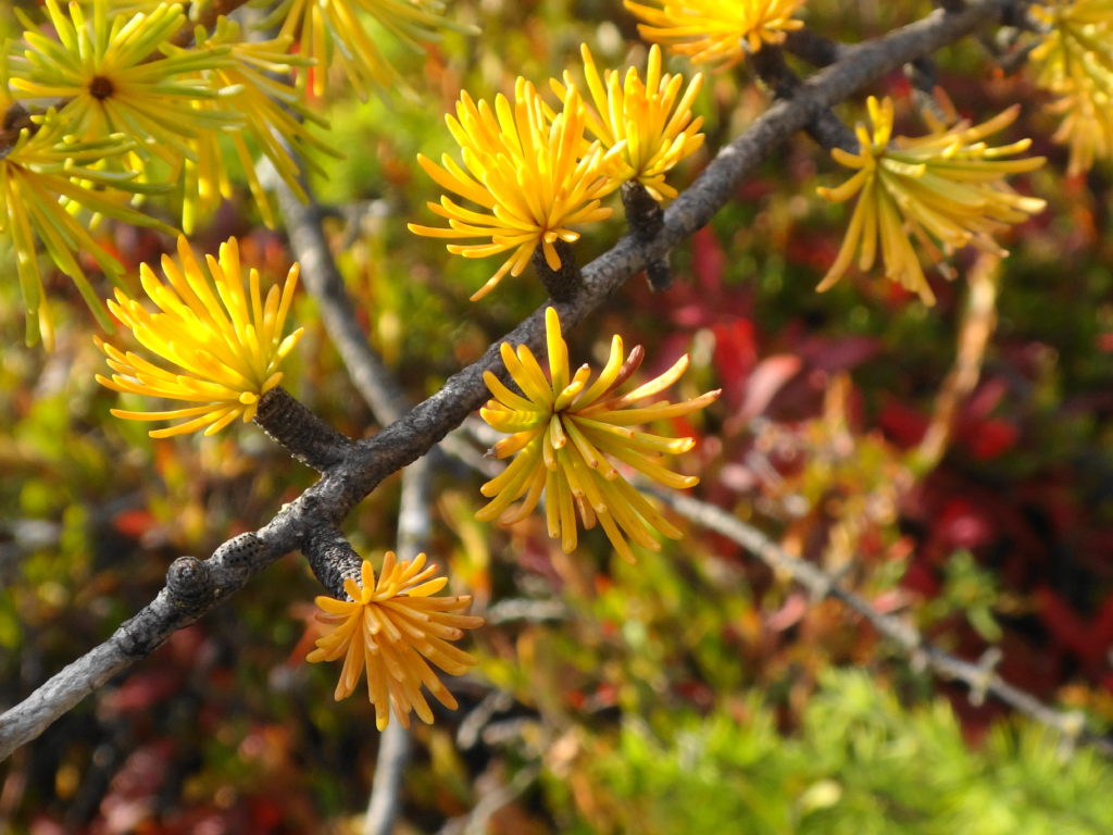
Through the summer, the shady, ridge trails provide a cool, relaxing hike. Vireos and pewees sing overhead. Ferns push up through the underbrush. Where a trail skirts the edge of a field, grey catbirds mew in a hedgerow, while a brown thrasher scolds from the treetops. Along the boardwalk, the heat of afternoon fills the air with the perfume of Labrador tea, bog rosemary, bog laurel, and leatherleaf. The scent of a few tamarack needles rubbed between the palms calls forth old memories.
Walking Trail, Mer BleueMature Forest, Mer BleueStart of the Mer Bleue BoardwalkTamarack Needles – Autumn
In autumn, the contrast of vegetation communities makes Mer Bleue one of the best places at which to enjoy the fall colours. The bog turns a deep red, accented by the paling tamarack. Red and gold maples line the edge of the ridges, brilliant against backgrounds of pine and spruce. Variegated thickets of young birch stems support an awning of yellow leaves. The forest floor rustles with life, as squirrels, thrushes, sparrows and other creatures prepare for the long winter. Flocks of blackbirds and starlings pass noisily overhead, while strings of geese call plaintively in the distance.
Canada GeeseRed MapleAfternoon Light on Maples
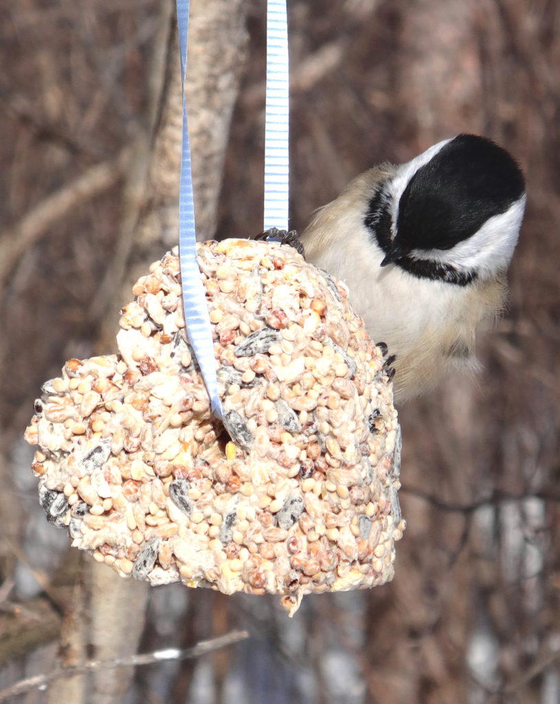
In winter, well-stocked bird feeders guarantee that the bright chatter of chickadees, nuthatches, woodpeckers and finches will greet visitors at every trailhead. Animal tracks criss-cross the trails: squirrels, snowshoe hares, mice and voles, coyotes, weasels, deer, and even moose. Those hoping to lay down their own tracks in fresh snow will need to rise early. Later in the day, when the parking lots begin to fill with visitors, the compacted trails provide an easy walk in the woods or out onto the boardwalk.
The NCC does not provide heated shelters or warm-up huts at Mer Bleue, so winter visitors should dress appropriately. The boardwalk, in particular, lies exposed to the wind, which blows unhindered across the bog. At those times, frostbite becomes a real risk. On calm days, however, particularly those brilliant blue days of January and February, when a frigid Arctic high sits over the City and the snow squeaks underfoot, the moisture rising from the peat will sometimes crystallize in a delicate, morning hoarfrost on the bog, sparkling in the sunlight. On those mornings, one hardly feels the cold.
Black-capped ChickadeeWinter Forest PanoramaNCC Trail 53 A, Mer Bleue
Mer Bleue lies only fifteen minutes from Parliament Hill and just five minutes off Highway 417 — the Trans-Canada Highway (http://www.ncc-ccn.gc.ca/places-to-visit/greenbelt/mer-bleue). Every trailhead has a small parking area, where visitors will find basic outhouses. There is no charge for parking or use of the area.
Visitors should remember that the international community has recognized Mer Bleue as a globally significant wetland under the Ramsar Convention (www.ramsar.org). Please stay on the trails and the boardwalk. The bog may look inviting, but it is both delicate and hazardous. A stray footstep can destroy decades of painstakingly slow plant growth or lead to a fatal plunge through the mat into the tannic waters below. Such a plunge would lead to an immortality of sorts, as the tannins of the bog preserved and slowly transformed the unwary soul into a leathery mummy. However, such immortality would be unappreciated both by the victim, the victim’s family, and posterity. Take a photograph instead.
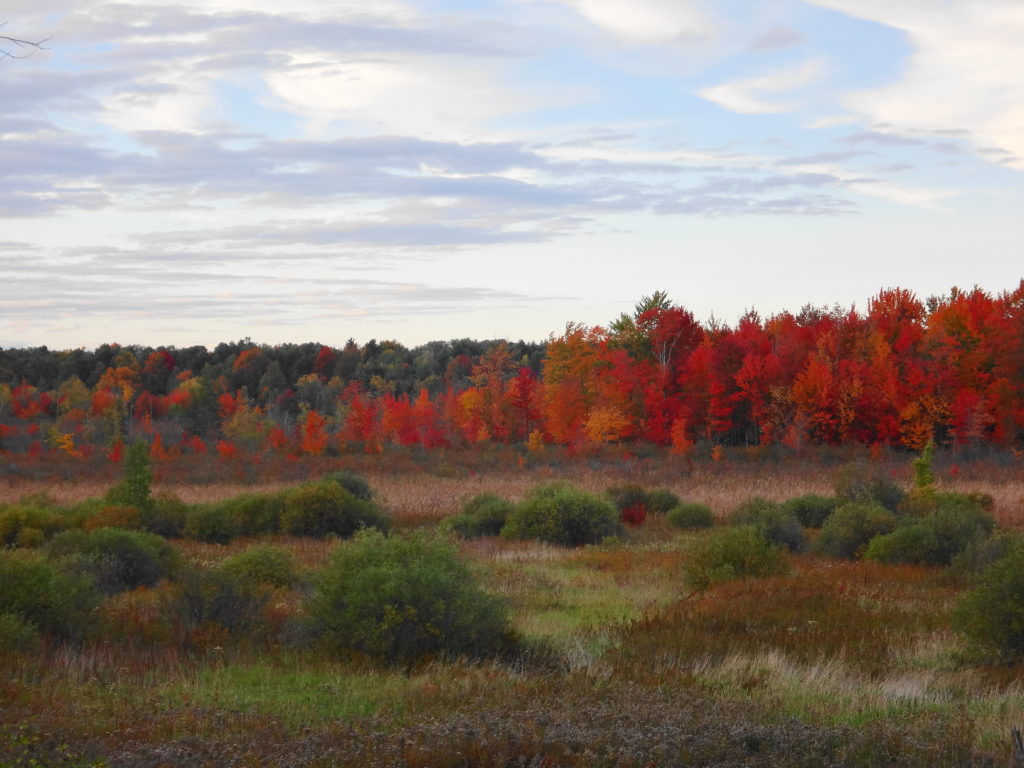
With a clear, blue sky, the autumn foliage at its peak, and rain forecast for the next few days, I decided to check out the work of the Friends of the Carp Hills on the Crazy Horse Trail. Parking my car at the trailhead on March Road, where it intersects Huntmar Drive, I tucked my pants into my socks (tick prevention) and strolled into the forest. The trees closed around me, and the sounds of traffic gradually faded.
The Precambrian bedrock of the Carp Hills rises from the clay-covered limestone of Ottawa’s west end. Historically, the thin soils and rock barrens resisted settlement, leaving the hills as one of Ottawa’s most beautiful natural areas. The City of Ottawa already owns and protects large portions of the Hills. Other landowners have protected additional areas through voluntary conservation easements. At the heart of these efforts, the Friends of the Carp Hills have committed themselves to seeing the area preserved for the enjoyment of current and future generations.
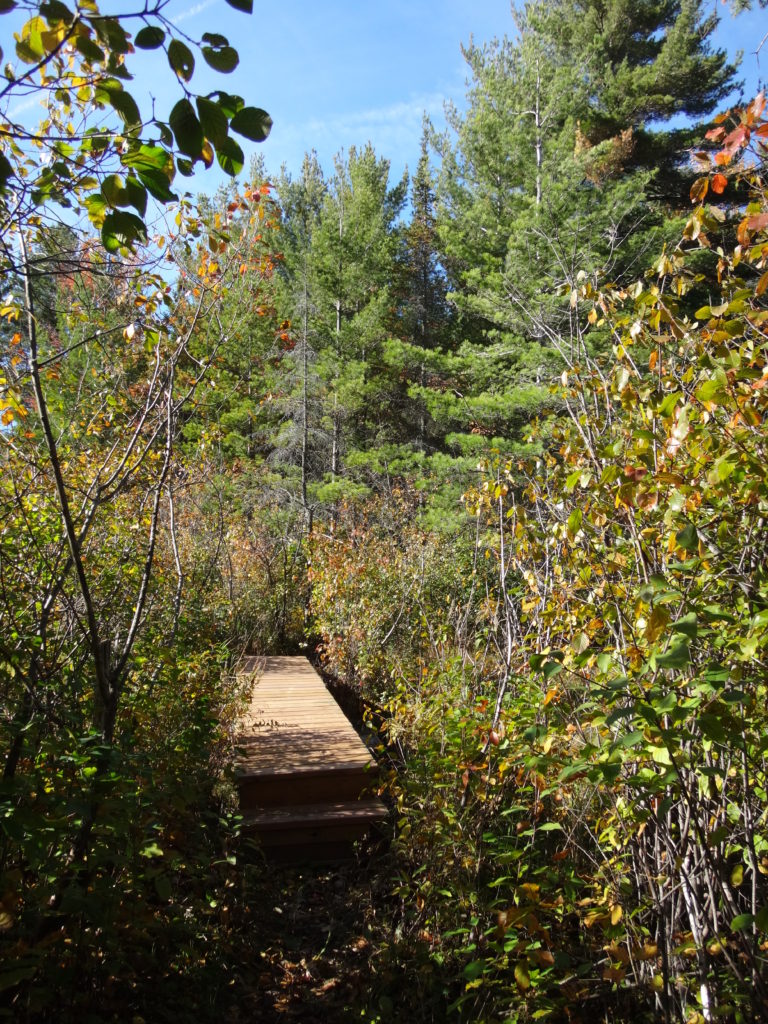
Crazy Horse Trail Boardwalk
Under the guidance of their Trail Foreman, Bernard, the Friends of the Carp Hills have created an 8 km long hiking trail on City-owned property. Much of the trail follows an informal network of cross-country ski trails. With the help of City staff from the Parks and Natural Systems branches, the Friends have blazed a route that visits shady forests, sunny glades, and luscious wetlands. While avoiding the most delicate and sensitive features, the trail winds past maples and pines, crosses beaver dams, and curls around boulders. Short spur trails lead to lookouts over wetlands and lichen-encrusted rock barrens. Where a short bridge spans a narrow watercourse, a rich fen lies to one side, gorgeously clad with sedges and other wetland plants. Markers guide hikers along the way, and the Friends provide a map on their website.
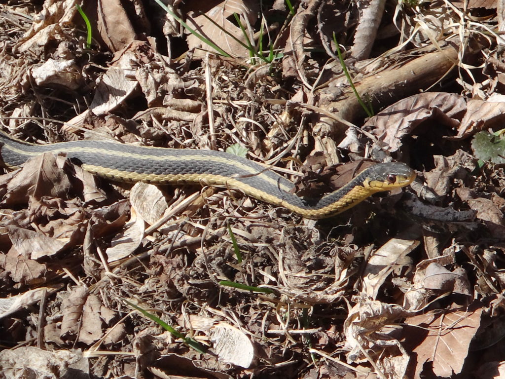
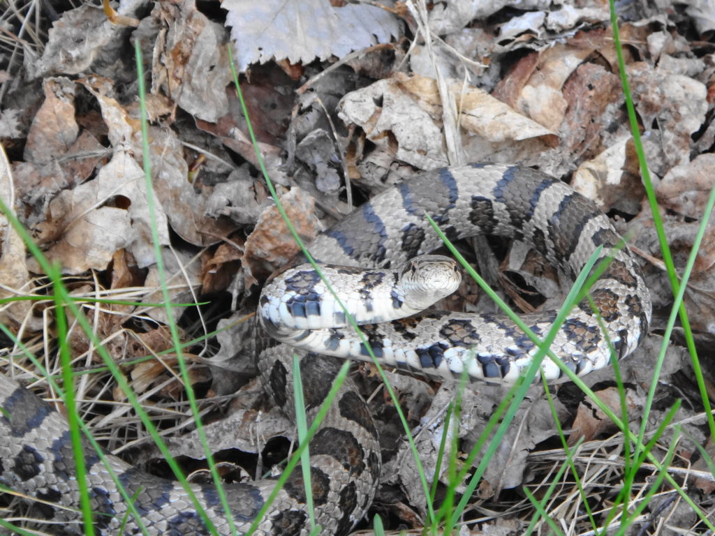
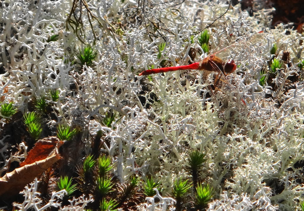
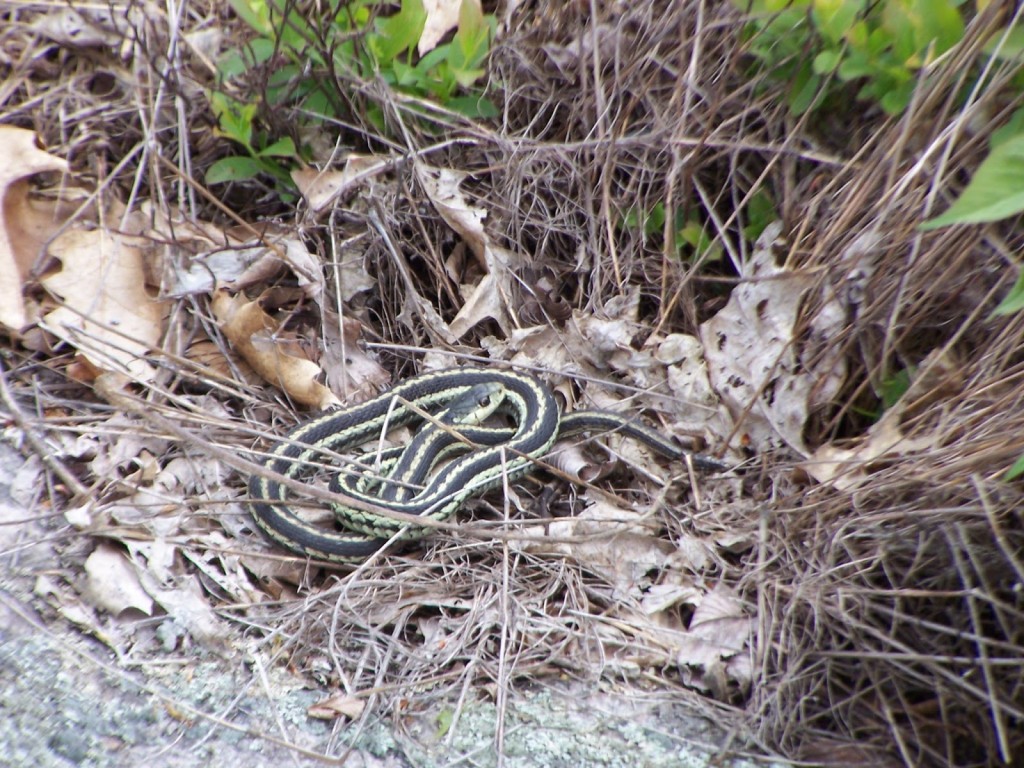
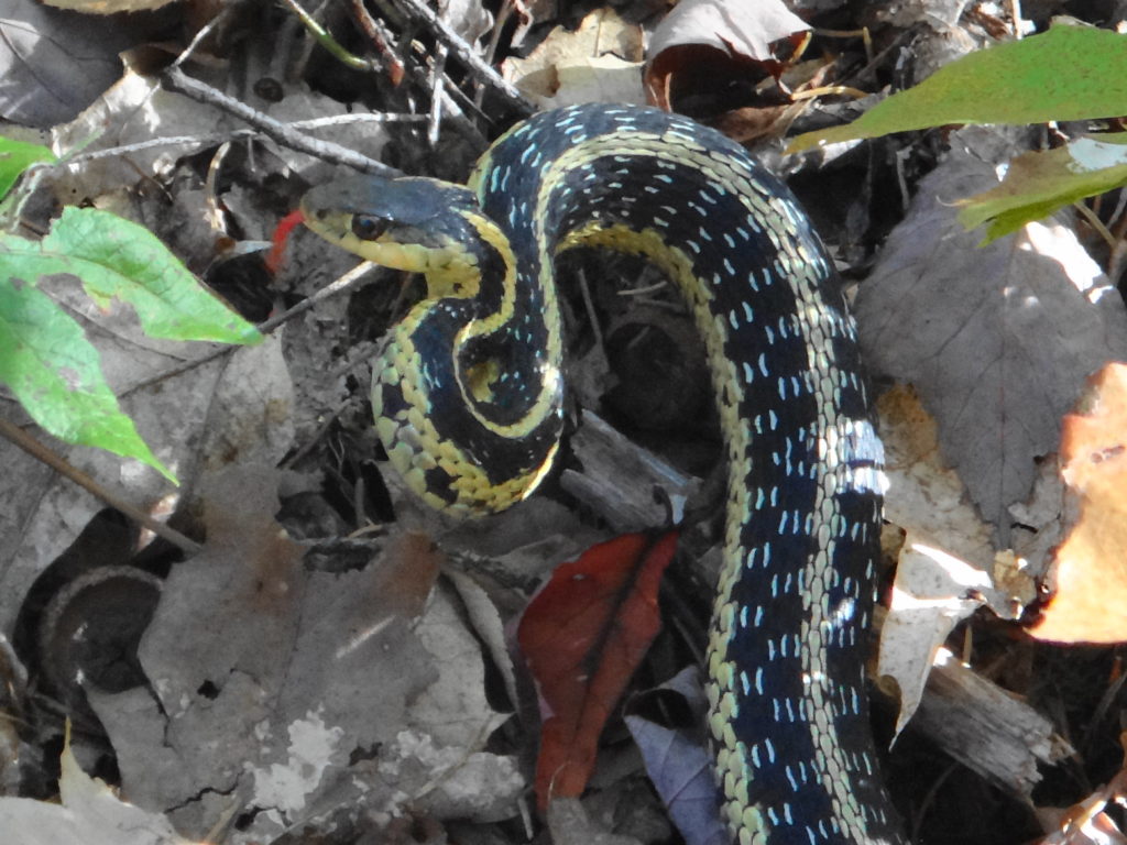
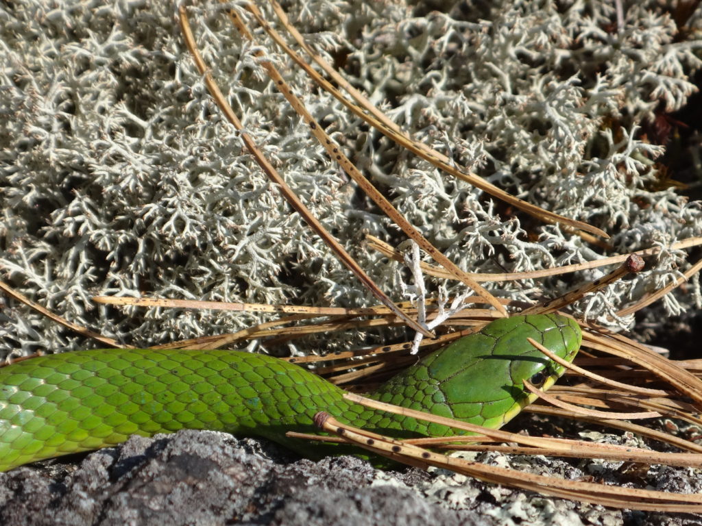
On this day, the woods seem quiet. Here and there a downy woodpecker taps on a tree, a blue jay rustles in the underbrush, and small, foraging flocks of chickadees and tardy kinglets pass through the forest. A few scarlet, autumn meadowhawks dart here and there over the barrens. A red squirrel scurries across the trail, carrying a mushroom almost as large as itself. A garter snake curls up in mock aggression as I pass. A small flock of geese honk on the Big Pond. Mostly, though, I wander alone along the trail, simply enjoying the beauty of the day.
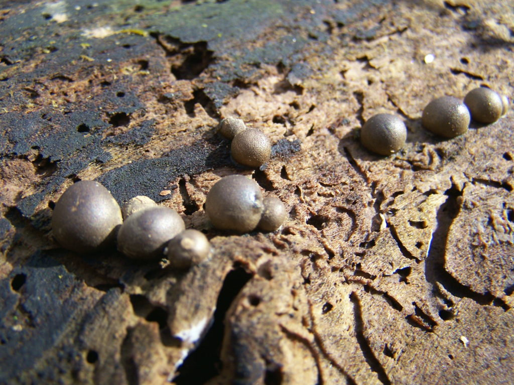
The largest living thing on earth lies within the floor of a forest in Oregon. A honey mushroom, Armillaria solidipes, it has spread over thousands of years through the soil and litter to parasitize the roots of trees over a four square mile area. Tests have showed that the entire mycelial network consists of a single, fungal colony — a single, almost immortal organism.
And it’s edible.
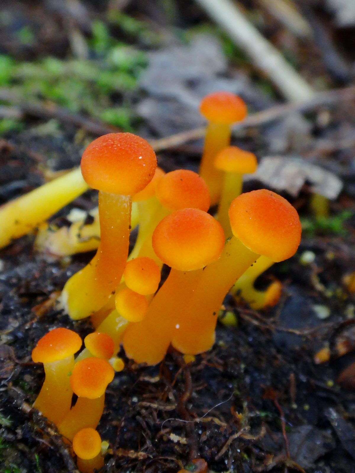
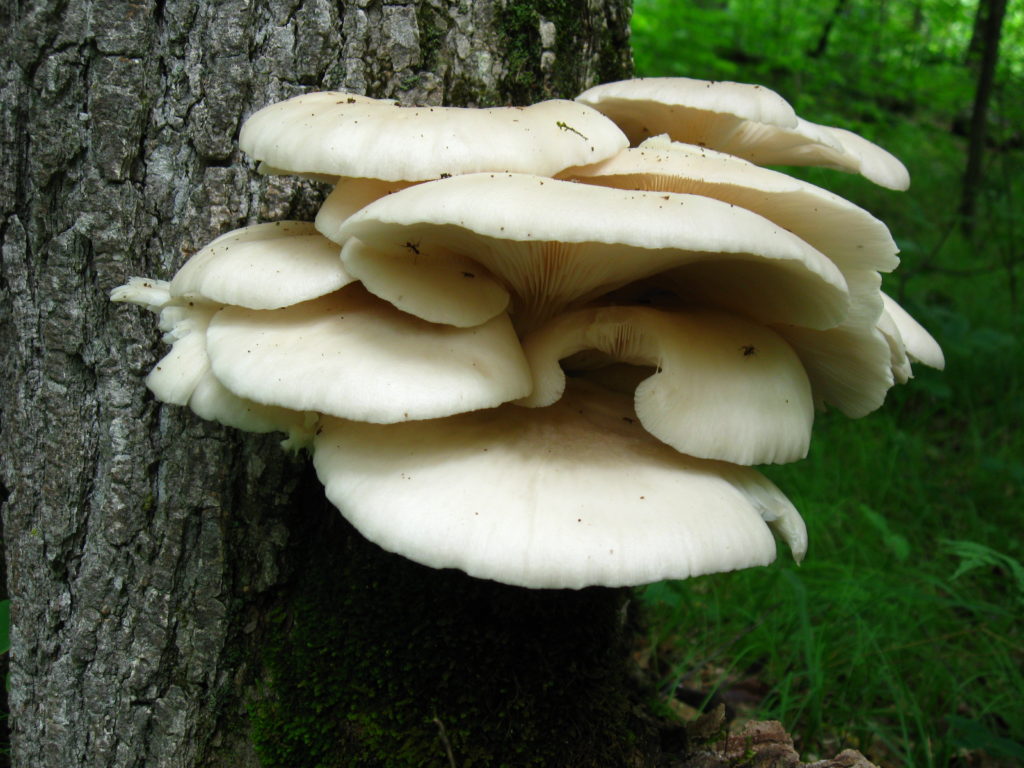
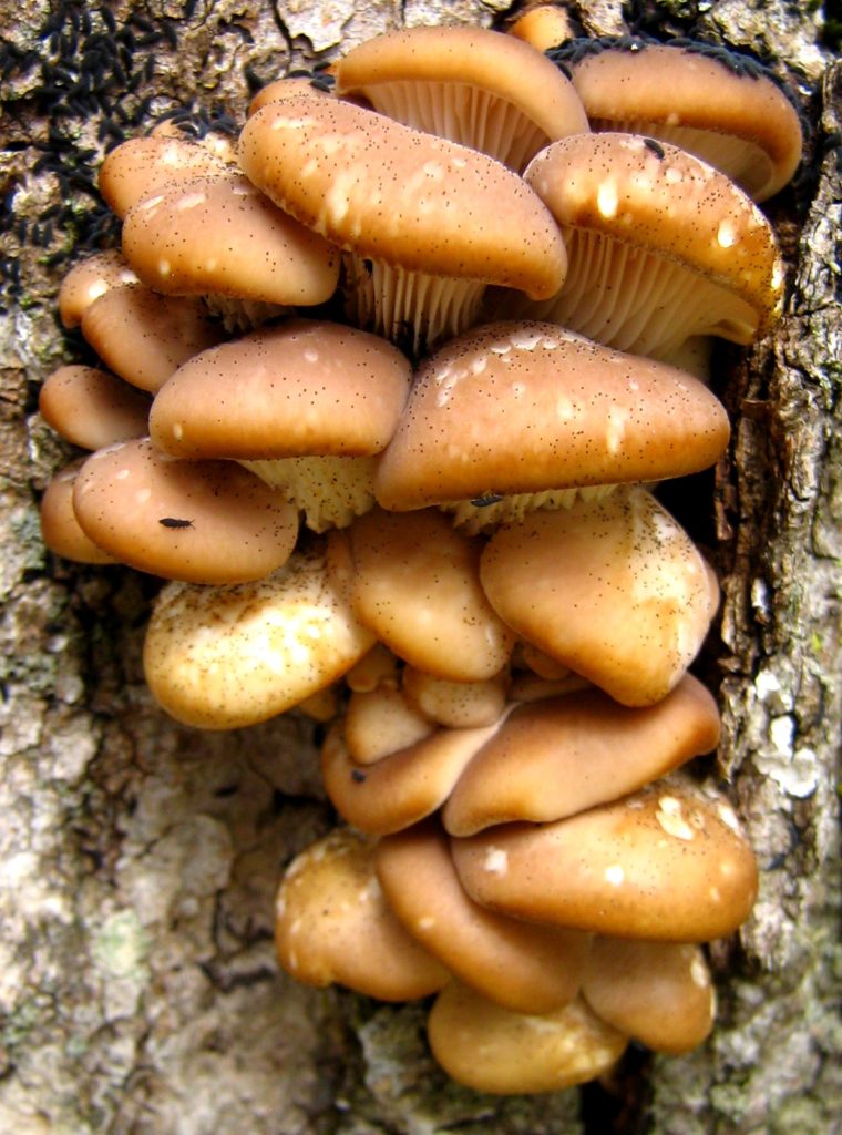
Oyster Mushrooms
I sometimes think about bringing brown paper bags with me into the forest. Unfortunately, that thought usually comes when I’m standing before a feast of oyster mushrooms sprouting from a log or tree, with no way to carry them home. By the time that I return, the slugs will have found them. Generally, however, I have little interest in picking mushrooms. My reluctance comes, in large part, from my lack of confidence in distinguishing edible mushrooms from the many inedible or poisonous species that grow side-by-side with them. It also comes from my appreciation of the beauty of mushrooms and the fascinating, critical role that they have played in life on Earth.
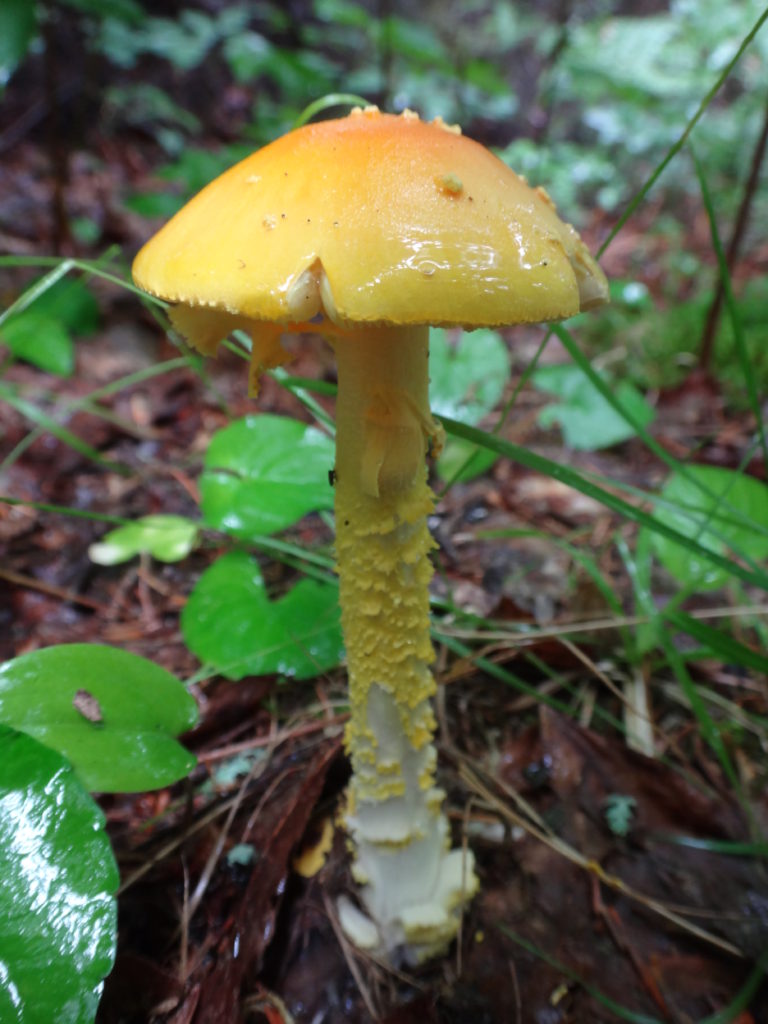
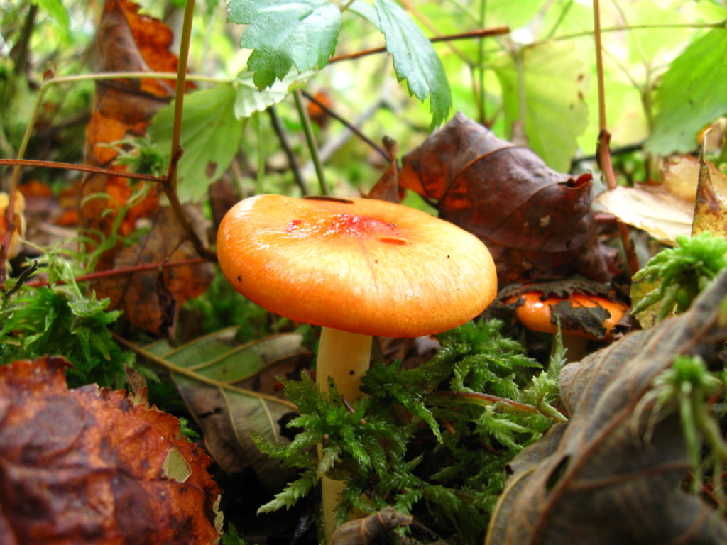
A beautiful but deadly Amanita frostiana, Frost’s Amanita.
By some estimates, almost 90% of the Earth’s plants form a symbiotic relationship with soil fungi. These mycorrhizae colonize plant roots, feeding on the sugars produced by the plants. In return, the fine mycelial threads of the fungi penetrate into soil pores and other spaces where plant roots cannot reach, giving the plants greater access to water and nutrients. They break down leaf litter and other detritus, improving the efficiency of nutrient cycling. They may even use organic acids and enzymes to dissolve rock, releasing phosphorous that would otherwise be unavailable to the plants. Not just individual species or plant families, but entire ecosystems like the northern boreal forest depend upon mycorrhizal fungi for their existence.
Hydrocybe acutoconica, Waxcap
Genetic studies suggest that the relationship between fungi and plants goes back to the very first colonization of dry land by plants. DNA analyses show that mycorrhizal fungi diverged from a group of parasitic aquatic fungi called “chytrids” approximately 700 million years ago — just about the time that the first land plants appear in the geological record. It seems very likely that these mycorrhizae not only accompanied plants on to the land, but that they actually made colonization of land possible through their superior ability to scavenge for water and nutrients in the barren landscape.
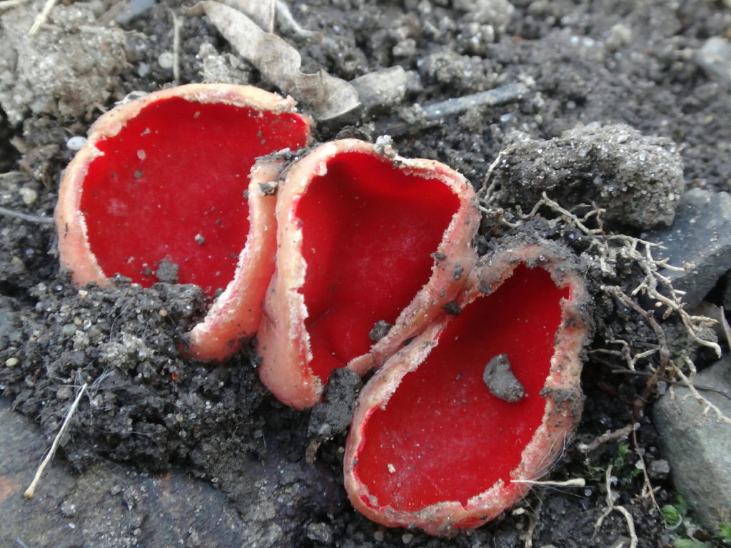
Ascocoryne cylichnium, a Sac or Cup FungusLasiosphaeria spermoides, a Sac or Cup FungusSarcoscypha austriaca, Scarlet Cups
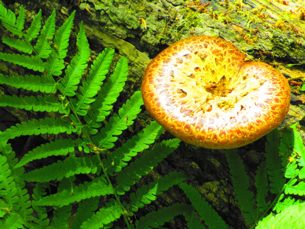
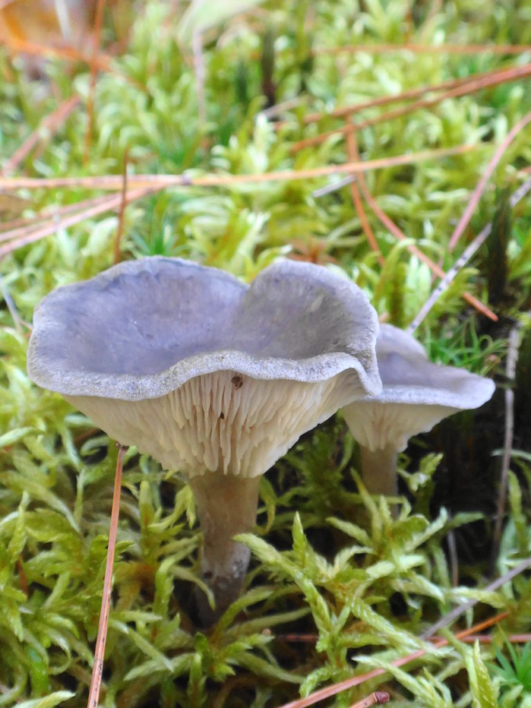
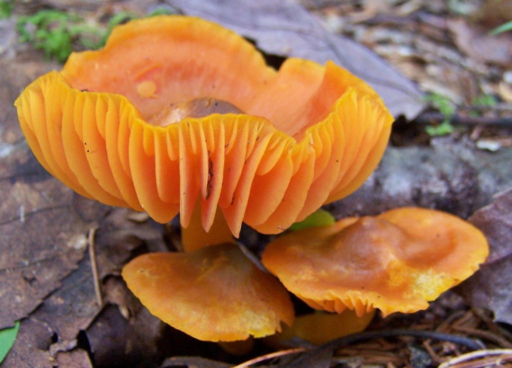
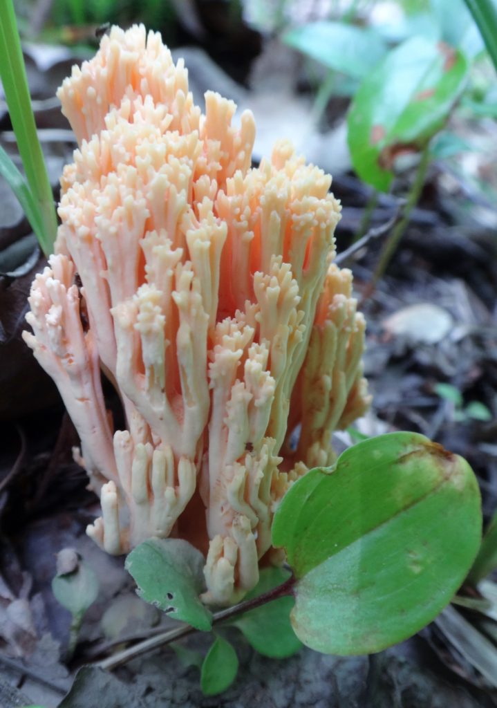
As a photographic subject, mushrooms seem sadly underappreciated. In the dog days of summer, when the spring chorus of birds has faded and the other forest animals hide from sight with their young, when the trees cast the forest floor in shade and the trilliums have withered and dropped, many of the most colourful mushrooms begin their slow eruption from the humus. Purest white, brilliant yellow, earthy browns and tans, luminescent orange, pale translucent blue… they turn dried leaves, moss and twigs into minature landscapes. One appreciates them most from close up, lying carefully amidst the ferns, tree seedlings, and forest litter: the different varieties and substrates, the forms and textures, the subtle details of cap and stem when viewed from the side or below. Other features of the forest floor also come into focus. Slugs enjoying a meal, tendrils of moss, skeletal scaffolds of decaying leaves. The first coral fungus that I ever examined held a red spotted salamander hidden amidst its spires. Sadly, on that day, I didn’t have a camera with me.
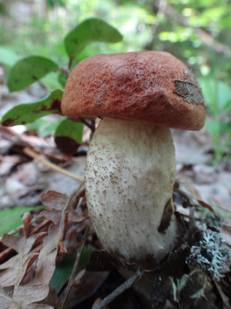
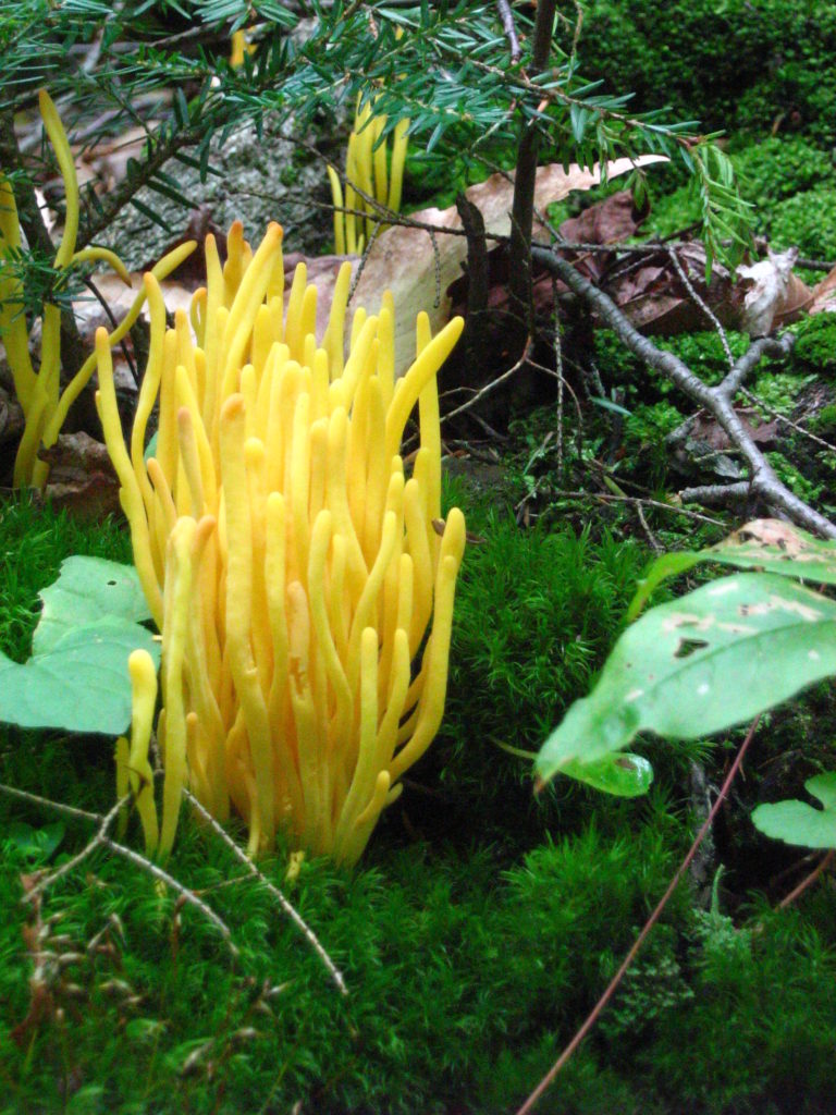
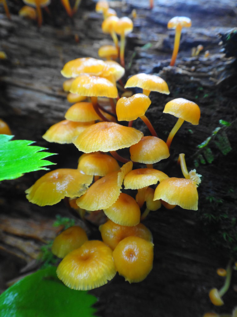
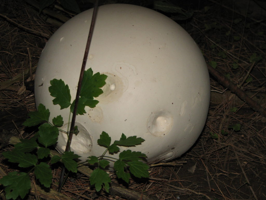
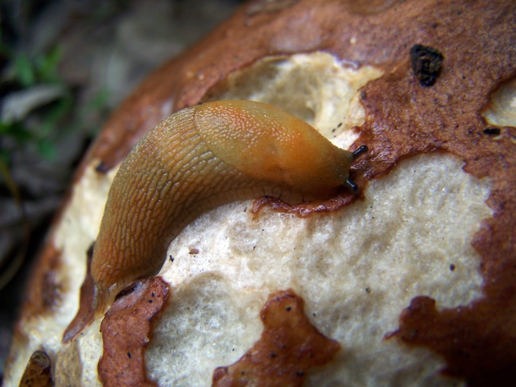
Leccinum aurantiacum, Orange BoleteClaculinopsis fusiformis, Spindle-shaped CoralXeromphalina campanellaCalvatia gigantea, Giant PuffballSlug Feeding on an Orange BoleteMycena subcaerulea
Every woodlot will have its share of mushrooms. My favourite places to search for them are the Four Seasons Forest Preserve in Deep River, where I spend two weeks each summer with my family, and Gatineau Park, where I often cycle and hike on weekends. Both areas offer a wide range of habitats, from dry pine and oak forests, through cool coves of maple and beech, to dank cedar swamps and wetlands. Please refrain from collecting mushrooms on protected lands and conservation areas: thousands of hectares of crown land lie available for collecting. And please refrain from collecting altogether unless you can confidently identify the edible varieties. Most mushroom guide books will list four or five unmistakable, “safe” species, such as oyster mushroom or black and yellow morels. Outside of those species, the chance of accidental poisoning or adverse effects increases dramatically for non-experts. Picking mushrooms for their hallucinogenic properties is especially risky, not just because the hallucinogenic species are almost indistinguishable from more poisonous species, but also because the reaction to such mushrooms can vary greatly between individuals. It simply isn’t worth the risk.
Omphalotus olearius, Jack O’Lantern. Deadly poisonous.
Do, however, get down on your stomach to admire and photograph mushrooms. And while you are there, in contact with the living forest floor, think about how the life in the forest is linked and interwoven. How the trees around you are connected by the hidden network below you; how the living and the dead are connected in the circle of life, and how the miracle of evolution has produced the wonder of it all.
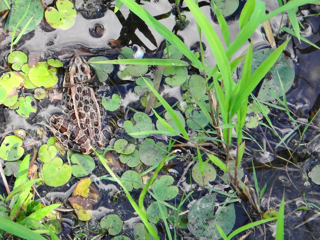
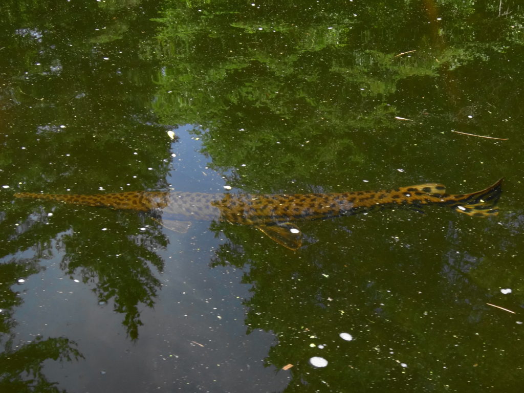
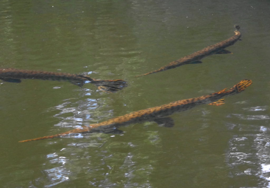
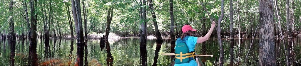
We glide on dirty, brown water under a green, sunlit canopy of silver maple trees. Spring run-off on the Ottawa River has pushed nutrient-rich floodwaters back into the forests along lower Constance Creek. Warblers sing brightly in the tree-tops and multi-hued wood ducks peek shyly from the shady depths of the swamp. The nighttime chorus of spring peepers and tree frogs has dwindled in the warming day to a few desultory chirps and clucks. We pass between the spreading, fluted tree trunks in quiet awe, like visitors to some southern, bald cypress bayou. But instead of alligators basking along the channel, map turtles and painted turtles crawl on to logs to sun themselves, while pike and gar lie up in the shallow reed beds.
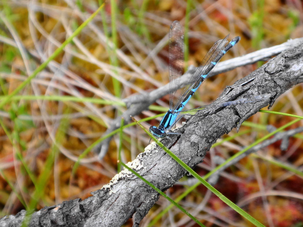
When biologists speak of the diversity and productivity of wetlands, they have places like Constance Creek in mind, where life overspills its banks. Scoop the creek water into your cupped hands, and you hold a galaxy of microscopic, living things. Look up to the trees to see life thrust by the laws of thermodynamics toward its origin in the dust and energy of stars. Energy flows through a tangled web of matter, seeking stability, building in complexity, expressed in a fractal lattice in which dragonflies hang like jewels. A wetland brings together the elements of life like no other place. Perhaps in no other place does a biologist feel more like a priest.
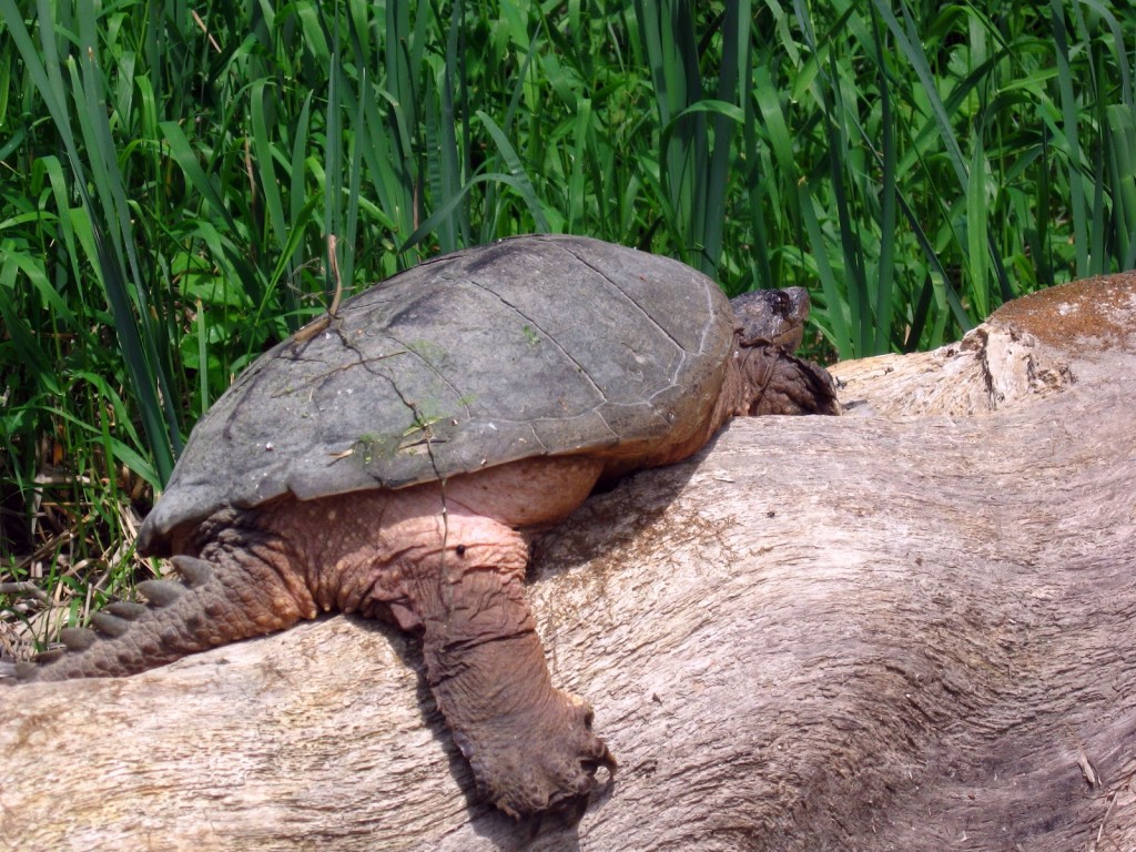
Turtle Basking on Constance Creek
A confluence of fortuitous circumstances has preserved Constance Creek as a uniquely healthy riverine wetland. About 10,000 years ago, when meltwaters of the retreating glaciers swelled the Ottawa River, part of it flowed along a side channel from Constance Bay in the north to Shirley’s Bay in the south. Along the banks of this channel, it deposited large sandbars over the flat clays left by the retreating Champlain Sea. Over time, as the Ottawa River shrank to its current size, flows along the channel reversed direction, draining the adjacent Carp Ridge and Dunrobin Ridge north through a meadering stream and wide, swampy floodplain. Annual flooding limited farming and permanent settlement along the creek, while the deep, sandy soils supported the growth of a rich riparian forest to further screen and protect the creek. Some unauthorized filling of the Constance Creek wetland occurred in 1989 with the construction of the Eagle Creek Golf Club. Sand pits have also opened at places along the creek, although they remain hidden from the main channel. For the most part, though, the creek remains well buffered from surrounding land uses.
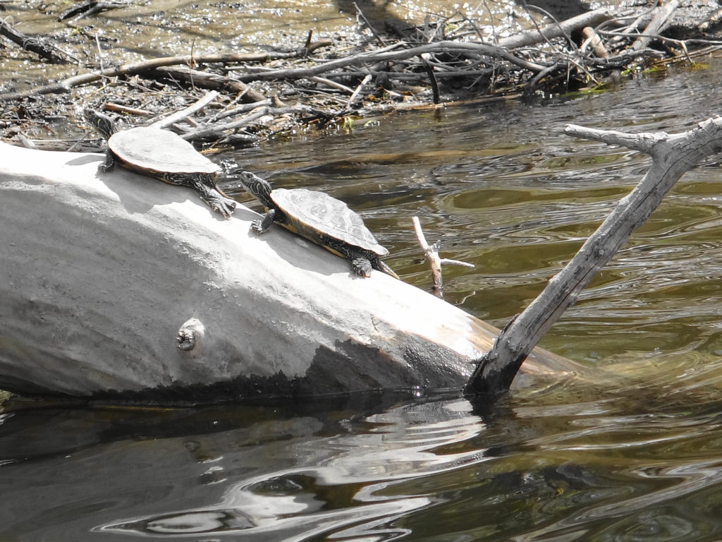
Several locations give access to the creek, but thick cattails often limit paddling. At the upper end, an alm0st impenetrable marsh blocks access from Constance Lake. The reach downstream of the bridge at Thomas Dolan Parkway provides a short, easy paddle through a lovely riverine marsh. Painted turtles, snapping turtles and Blanding’s turtles bask along the channel in the midday sun, and a colony of black-crowned night herons hides back in the reeds. Damselflies and dragonflies hunt over the water. The bridge at Vance’s Side Road provides a pretty view over marsh and swamp, but the channel quickly chokes off both upstream and downstream. In contrast, the mouth of the creek on Constance Bay offers one of the most beautiful, flat water paddles in Ottawa.
Yellow Pond Lilies
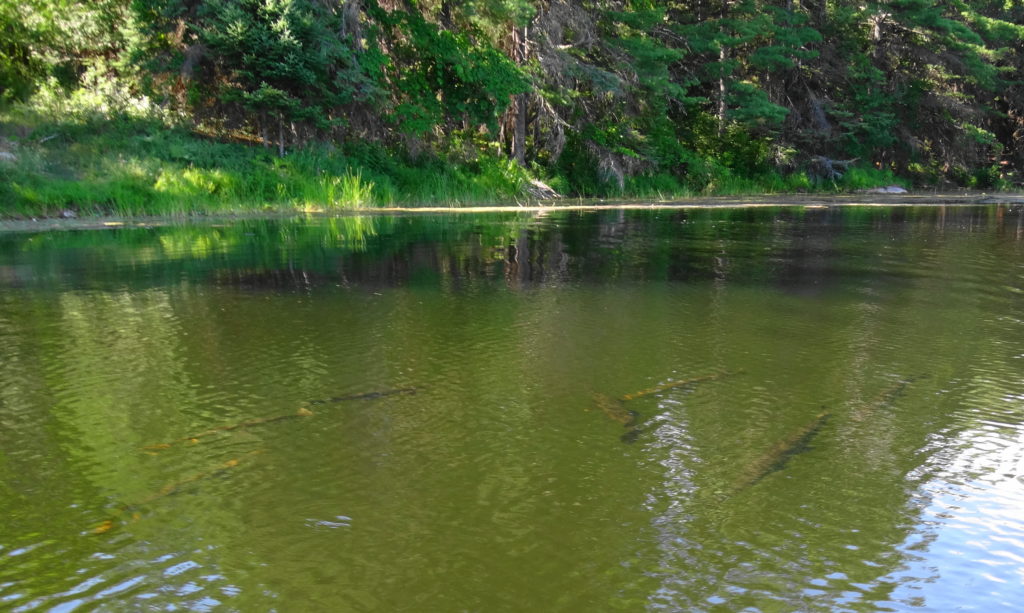
I like to start my trips up Constance Creek at the far, north end of Greenland Road, where the City-owned road allowance runs up to the water at tiny Horseshoe Bay. I paddle through the sandy shallows, tracked by freshwater clams and mussels, into the wider expanse of Constance Bay. I don’t recommend it for breezy days, when the wind driving across the wide river can raise substantial waves. But on calm days, the glassy water parts smoothy to either side of the bow, as I round the point to the west. Sometimes I paddle straight across Constance Bay to the mouth of the creek. More often, though, I skirt the shoreline, looking for turtles and scanning the flats for longnose gar finning in the shallow water.
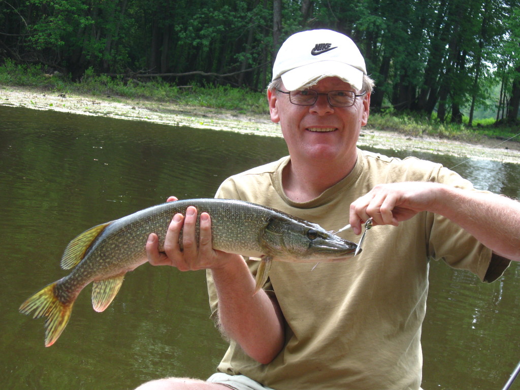
Constance Bay provides some of the best fishing along the Ottawa River shoreline. The clean, Ottawa River, the shallow reed and weed beds, and the steady influx of nutrients from Constance Creek create a perfect mix of spawning, nursery and adult habitats. Although I haven’t yet tried flyfishing for longnose gar, I’ve heard that they rival bonefish for fun. The technique seems roughly the same, and one can find lots of instruction online. Usually, however, I troll a streamer fly or a spinnerbait behind the canoe and pick up some of the pike for which Constance Bay is famous. Musky also lurk in the weeds, although for the sake of my light tackle (and their health), I don’t try for them. Closer to the mouth of the creek, though, I’ve caught catfish and bass. Walleye forage in deeper water, along the outer edge of the bay. At times, in fact, fish have struck so frequently as I’ve paddled across the bay, that I’ve had to bring in my line to make any real progress toward the creek.
Small Pike on a Spinnerbait
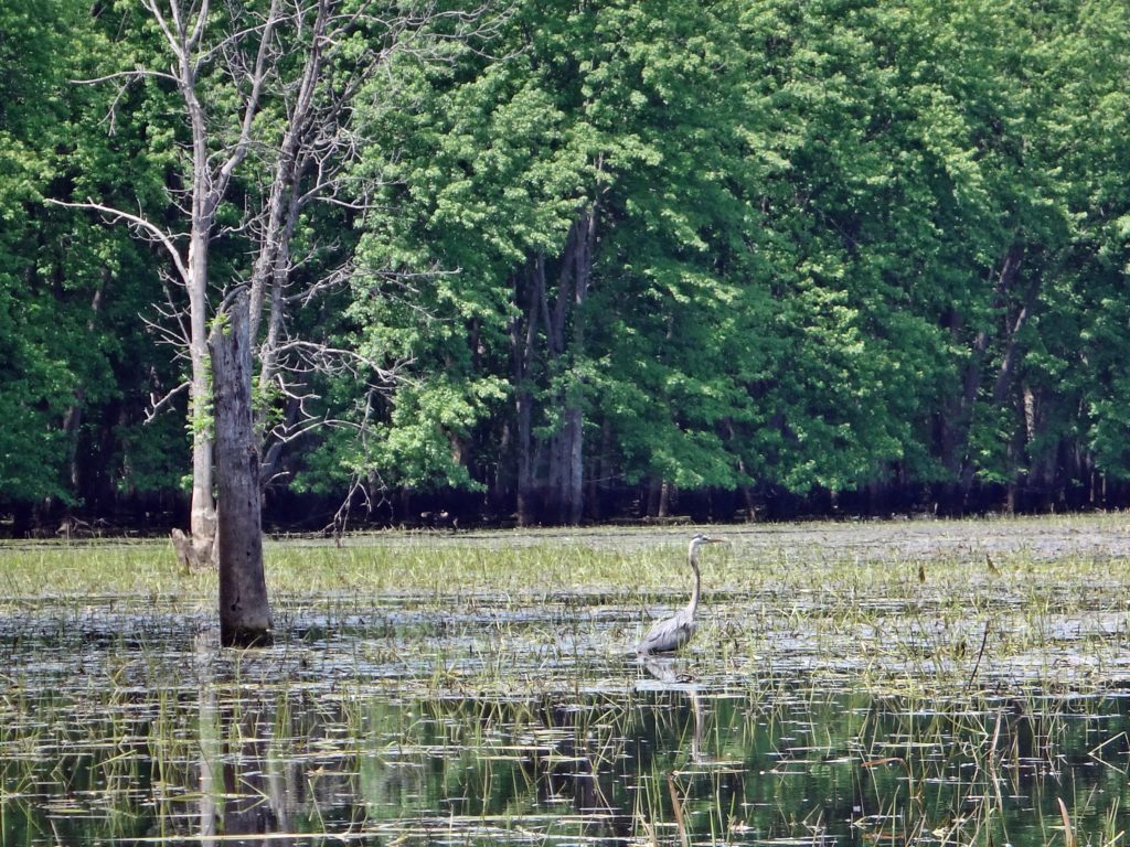
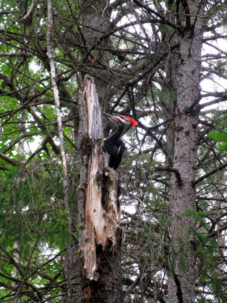
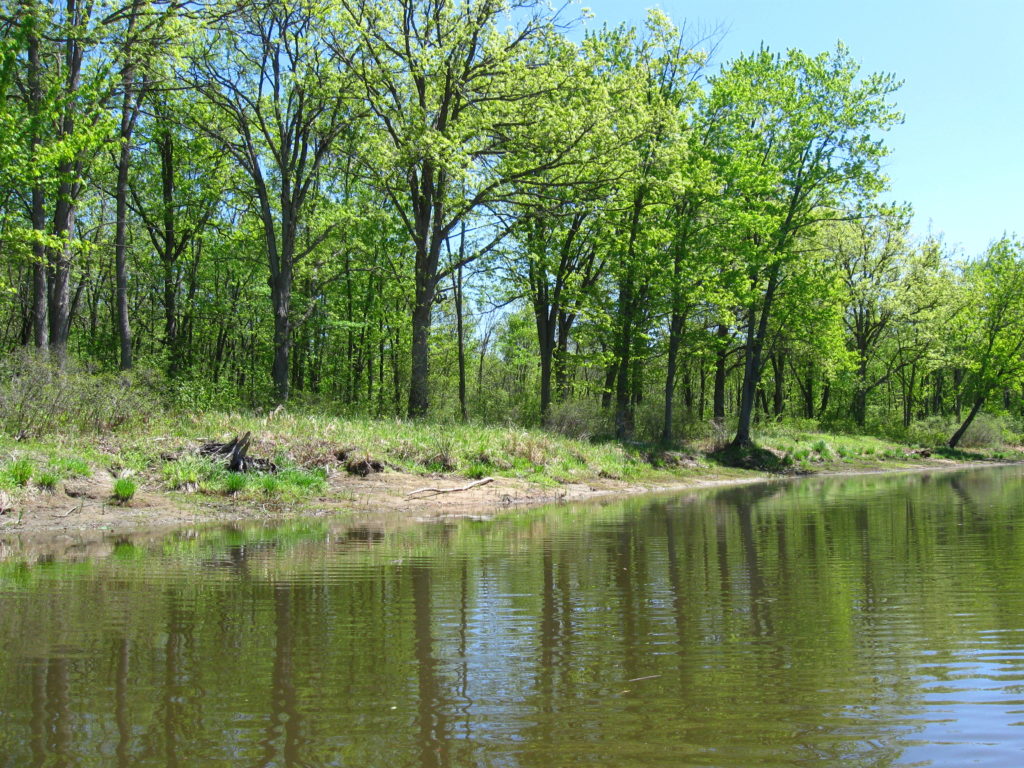
Constance Creek flows through a stunning swamp forest into Constance Bay. Large, mature silver maples line the banks along the channel, while swamp bur oaks sit further back on slightly higher ground. During the spring flood, one can sometimes paddle into the swamp itself, threading between standing and fallen trees. Great blue herons stalk along the boundary of swamp and stream, while pileated woodpeckers cackle and hammer deeper in the recesses of the forest. In the autumn, ducks and geese descend like leaves into the marshes around the creek mouth, and the sounds of shotguns echo distantly from further up the creek, where several duck clubs operate hunting blinds.
Silver Maple Swamp, Constance CreekSwamp Bur Oak, Constance CreekGreat Blue Heron, Constance Creek.
Not surprisingly, many of Ottawa’s most interesting animals and species at risk find a home along Constance Creek. Five of Ottawa’s six at-risk turtle species have been recorded along the creek and at its mouth, including the extremely elusive (and possibly extirpated locally) spiny soft-shelled turtle. Red-headed woodpeckers still nest locally. Terns no longer nest in the area, but pass through during migration. Ospreys can often be found hunting along the creek. Bald eagles migrate along the creek and the Ottawa River shoreline, as do many other raptors, including peregrine falcons. Lake sturgeons and American eels still inhabit the waters.
This richness of life is no doubt what attracted aboriginal peoples to the creek. Archaeologists have documented at least one 2500 year-old camp and burial site at the mouth of Constance Creek, on its west shore (https://ottawarewind.com/2014/02/24/ancient-ottawa-lost-relics-from-500bc-found-at-constance-bay/). More undocumented sites seem likely, perhaps in the large woodland on the east side of the creek mouth. Unfortunately, that woodland remains at risk of future aggregate extraction. Lying atop one of the largest, untouched sand and gravel deposits in the north end of the City, it currently enjoys protection by Provincial wetland policies and an unopened City road allowance. These prevent the legal access required for an aggregate license. Nonetheless, so long as the property remains privately-owned, the threat exists.
In the meantime, one can travel back 2500 years with just a canoe trip up the creek. The present swirls behind from the blade of your paddle. Lying quietly up in the swamp, daydreaming and staring serenely up at the translucent leaves, one can easily imagine that it has always appeared this way. With a whisper of wings and ragged croak, Raven passes over the canopy. Floating there, you surrender to thought and memory.
Great Blue Heron, Constance CreekSwamp Panorama, Constance Creek
When I visit the woodlots of South Nepean, I think of my years growing up in Esquimalt, Victoria, British Columbia. I didn’t know, living in Esquimalt, that I was privileged to have one of Canada’s most endangered ecosystems in my backyard. Highrock Park, or the “Cairn” as we knew it, was simply the place where we played after homework on a school night or rode our bikes on the weekend. It rose above my neighborhood: a rock bald, surrounded by a skirt of open woodland.
I didn’t know about Garry oak parkland and savannah. No-one told me that I couldn’t play in the Cairn because it was special, or because I might damage myself. Sure, I came back with skinned knees and bee stings. And on warm summer evenings, when the local teens would sometimes gather in the twilight under the trees to consume beer or other elicit substances, my parents didn’t forbid me the adventure of the dark. We climbed the twisted oak trees and played hide-and-seek in the thickets.
I think that I first learned my love of rock on the Cairn. I couldn’t identify the hill as an exposed “pluton” of granite — a lump of igneous rock formed far down in the earth’s mantle 400 million years ago. I didn’t know that the cataclysmic formation of western North America had thrust it to the surface. I traced the long, parallel grooves on the smoothed rock without knowing about the pebbles that had gouged them under the weight of two kilometres of glacial ice. I just loved the feeling of the hard stone under my hand, as I scrambled over the flanks of the hill or sat with my legs pulled up to my chest, looking out over my home.
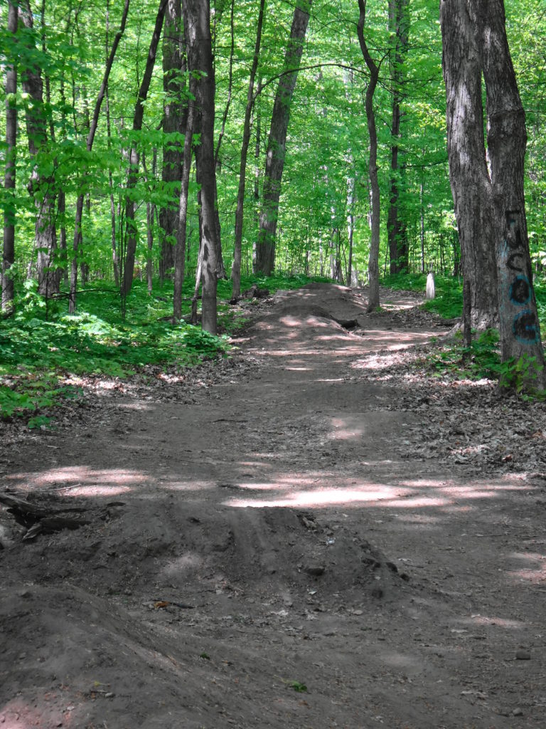
Perhaps that’s why tree-forts and home-made mountain bike tracks usually don’t trouble me, even when I find them in some of Ottawa’s protected natural areas. When I see bike trails, jumps and obstacles worn and carved into a place like the Chapman Mills East forest, I think of how much I would have enjoyed them as a kid.
Mountain Bike Track, Chapman Mills East Woodlot
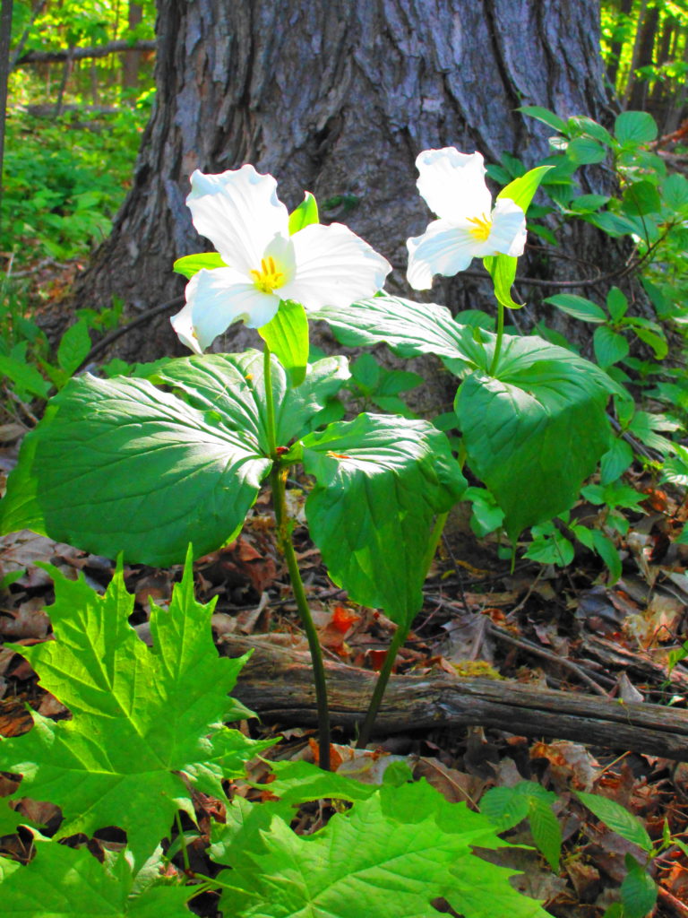
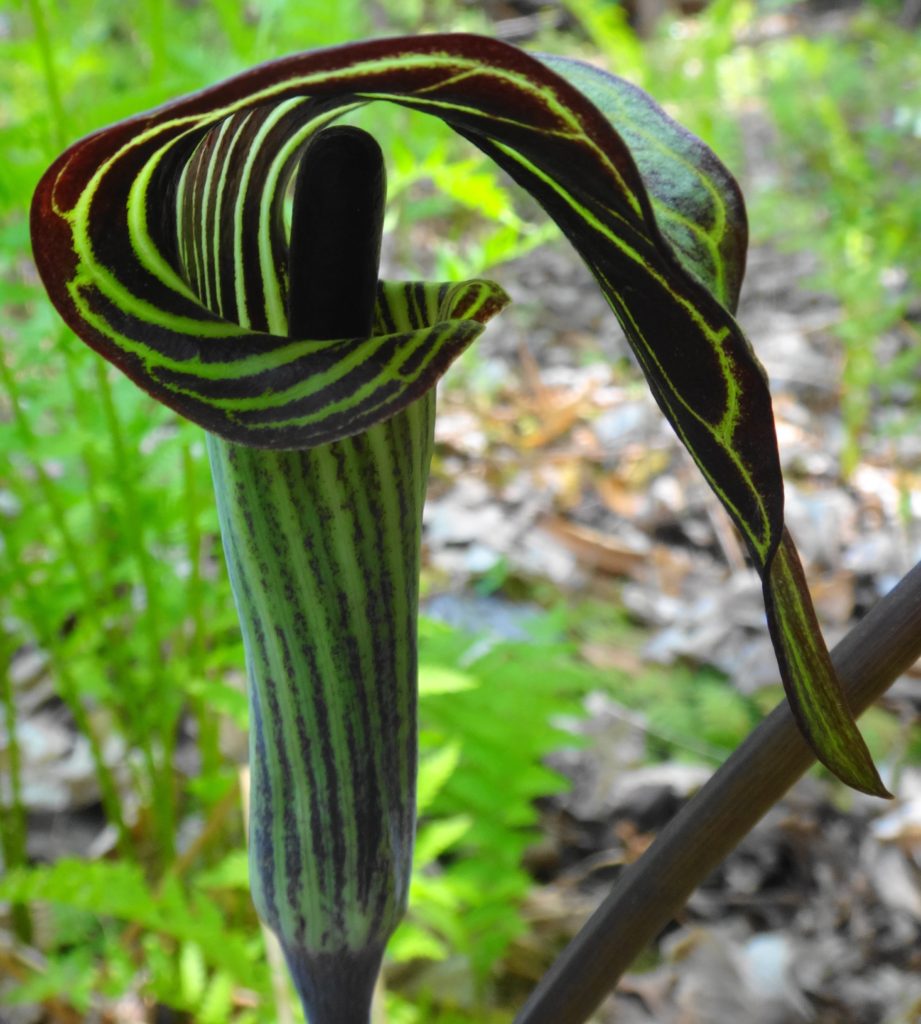
Most people driving past on Strandheard Road and Prince of Wales Drive likely give little more than a glance to the three adjacent patches of forest. Few of them would suspect that these emerald gems contain some of Ottawa’s largest trees: maples, beeches and oaks that rise like the pillars of a cathedral. Under their boughs, a profusion of wildflowers bursts forth in spring: trilliums, trout lilies, false solomon’s seal, violets, jack-in-the-pulpit. Vireos sing high overhead. With their windows rolled up and air conditioners running, few of the passing drivers will ever feel the coolness of the woods, or hear the susurration of the leaves as a breeze passes through the canopy.
Maple and Beech in Chapman Mills EastTrilliums in Chapman Mills EastWood Betony in Heart’s Desire
The neighbours, I suspect, would prefer to keep it that way. Walking through Chapman Mills East on a warm, weekday afternoon, I marvel at the lack of traffic. I pass a few dogs and their owners sauntering the trails. The occasional runner pads past me. Most of the time, though, I have the woods to myself. Apart from the distant sounds of traffic, I might be alone in the world.
Hopefully the evenings and weekends see more visitors. Each of the South Nepean woodlots has its own charms and attractions. Chapman Mills East, along Cresthaven Drive and Serena Way, is the easiest to love, with its towering maples, huge decaying logs, and dense mat of herbs and wildflowers. Deep shade gives way to a patch of sunlight, where a snag has finally crumbled to the forest floor. In the sunny gap, new growth reaches to the sky. Bumblebees travel from flower to flower, then circle and drone off to a hollowed, old tree. A pileated woodpecker hammers at a rotten white birch, while squirrels scold the intruder. Old stone walls lie along the perimeter, marking the edges of old farm fields.
Rotting Log in Chapman Mills EastEntrance to Chapman Mills East from Serena Way
Chapman Mills West has a different character. Lying astride Clearbrook Drive, it consists of two very different forest types. In the southern, larger section, a dry cedar forest surrounds and hides a small, pretty, swamp. Frogs croak along the marshy edges, while pairs of mallards raise chicks in the dense underbrush. Just inside the south edge of the woodlot, the City’s Park Planners have cleverly threaded a fitness trail from Mancini Park. Next door, where the School Board has allowed a small portion of the woodlot to remain in the yard, the worn earth under the cedars attests to affinity of children for trees.
Cedar Forest in Chapman Mills West, South SectionReflections, Chapman Mills West SwampMallards, Chapman Mills West SwampFitness Trail, Chapman Mills West, South SectionMaples On the Fitness Trail, Mancini Park, Chapman Mills West
The smaller, north portion of Chapman Mills West appears younger, higher and drier. Between scattered patches of cedar, an open forest of light-loving shrubs and trees creates a more pastoral feeling. And, indeed, the woodlot may have provided pasture for cattle or horses before Chapman Mills was transformed from farmland to suburbia. Over time, the forest canopy should fill in, especially now that the Ottawa Stewardship Council, with help from local schools and Ward Councillor Michael Qaqish, have taken an interest in managing and improving the woodlot.
Cherry Tree, Chapman Mills WestOpen Forest, Chapman Mills WestLife From Death, Chapman Mills WestCanada Mayflower, Chapman Mills West
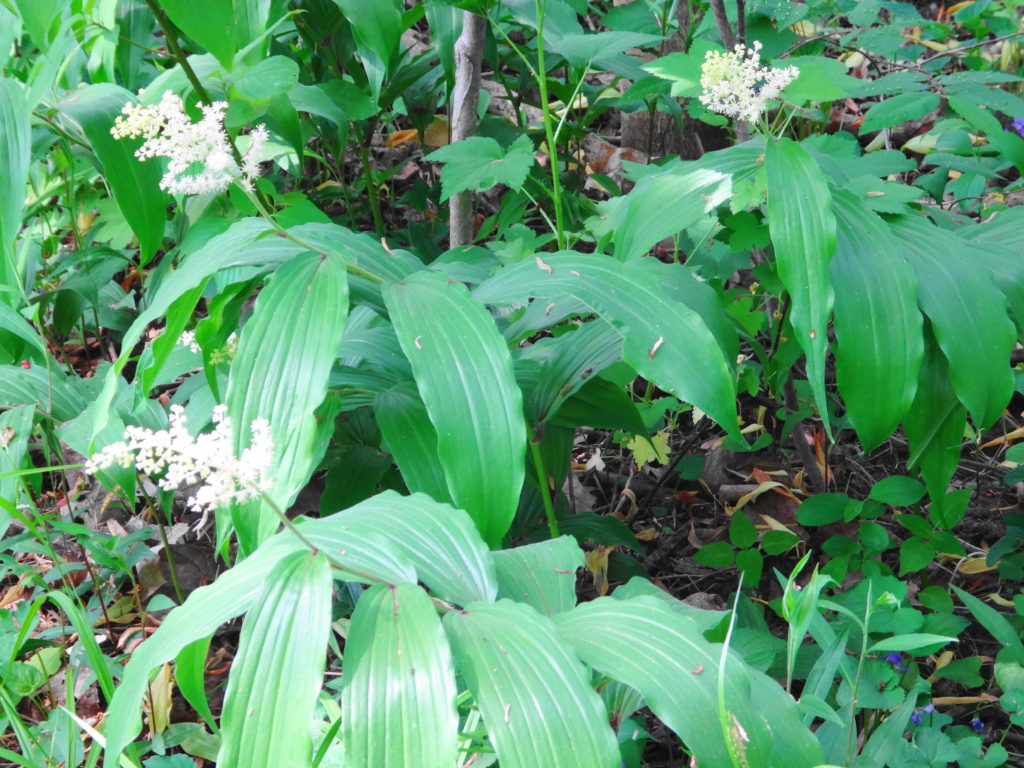
Heart’s Desire, on the north bank of the Jock River, appears superficially like Chapman Mills East. Here, though, massive oak trees dominate the forest. And whereas blue cohosh seemed to blanket the floor of Chapman Mills East, false solomon’s seal carpets Heart’s Desire. However, Heart’s Desire really gains its charm from the Jock River. Spilling over a small weir and then flowing under Prince of Wales Drive, down to the Rideau River, this reach of the Jock runs along a stoney bed, with alternating riffles and pools that beg for a well-placed fly. Through the summer months, large boulders provide tempting stepping stones to the other side. The steep, wooded south bank provides an idyllic backdrop and creates a sense of wildness and privacy that belies the surrounding suburbs.
Red Oak, Heart’s DesireJock River, Heart’s DesireStepping Stones, Heart’s DesireAcross the River, Heart’s Desire
When I visualize South Nepean’s woodlots, I see children. I see them racing bicycles along the paths, searching for frogs, and leaving damp footprints on white riverstones. I hear unrestrained shouts and laughter under the trees. Perhaps in my heart, I still feel myself with them.
I certainly feel torn. When I look at the damage that already occurs to our woodlots — the trash, the yard waste, the bags of dog faeces — I wonder if the wildflowers and other delicate organisms in the forest floor can also withstand the trampling of young feet. I think of myself as a boy, wriggling through the underbrush in Highrock Park and bouncing my bicycle off tree roots on dirt tracks. Perhaps, along the way, I trampled something rare or special. Perhaps the butterfly in my jar shouldn’t have been there. But those experiences, and my other childhood explorations, taught me to love the natural world. They set me on the path to where I am today.
Yes, we need to protect our urban natural areas from careless and unnecessary damage. We should educate our children to cherish and respect these marvelous places. We can even try to direct their enthusiasm. But we should never tell them that they can’t ride their bikes or build tree forts, imply that they don’t belong among the trees, or frown on their ebullience. We need more children in our urban forests, not fewer.